Farmonaut’s Q2 2023 Highlights: Pioneering Sustainable Agriculture and Geospatial Advancements
As we reflect on the second quarter of 2023, we at Farmonaut are thrilled to share our remarkable achievements and milestones. Our journey in revolutionizing agriculture through cutting-edge technology continues to gain momentum, and we’re excited to present the highlights of our recent accomplishments.
1. Fashion for Biodiversity Project: A Triumph in Crop Estimation
One of our most significant achievements this quarter was the successful completion of a major project for our esteemed client, Fashion for Biodiversity, in Germany. This project showcased our expertise in crop estimations and our commitment to supporting sustainable agricultural practices.
Diverse Crop Estimation
Our team utilized advanced satellite imagery and AI algorithms to estimate the areas of various crops, including:
- Saffron
- Arjun Trees
- Aswatha Trees
- Mulberry Plantation
This project not only demonstrated our technical capabilities but also highlighted the critical role of precision agriculture in promoting biodiversity and sustainable farming practices.
Impact on Sustainable Fashion
By providing accurate crop estimations, we’ve enabled Fashion for Biodiversity to make informed decisions about sourcing sustainable materials for the fashion industry. This collaboration marks a significant step towards creating a more environmentally conscious fashion ecosystem.
2. Expanding Our Reach: Collaboration with Fair Climate Fund
We’re proud to announce our collaboration with the Fair Climate Fund, Netherlands, to scale out our satellite services for carbon management in Rwanda and Kenya. This partnership represents a major leap in our mission to promote sustainable agriculture on a global scale.
Accuracy in Carbon Data
Our carbon management services have demonstrated an impressive accuracy rate of 90-95%, as verified by the Fair Climate Fund’s ground-truthing efforts. This high level of precision is crucial for:
- Accurate carbon credit calculations
- Effective climate change mitigation strategies
- Promoting sustainable farming practices
Expanding Our Footprint in Africa
This collaboration allows us to extend our services to farmers in Rwanda and Kenya, contributing to:
- Improved agricultural practices
- Enhanced carbon sequestration
- Increased farmer income through carbon credits
By providing reliable satellite services for carbon management, we’re empowering farmers to participate in global climate change mitigation efforts while improving their livelihoods.
3. G20 Conference: Shaping the Future of Agriculture
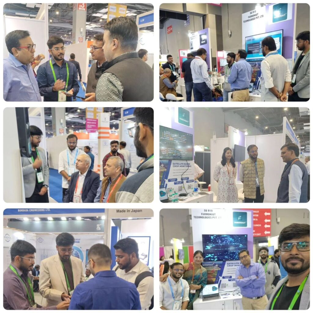
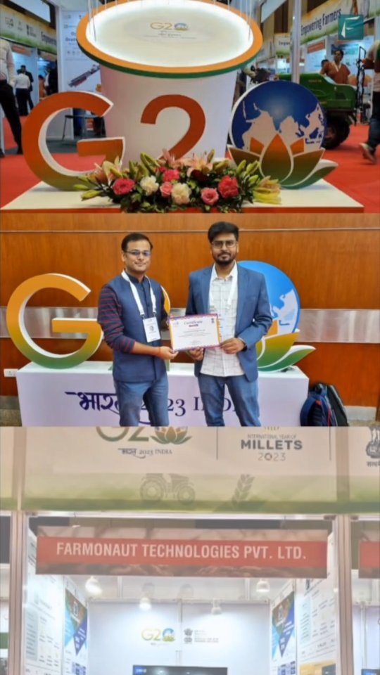
Our team had an incredible experience at the G20 Conference in Hyderabad, where we had the opportunity to interact with global Agriculture Ministers, Experts, and Model Farmers. This event provided a platform for us to showcase our innovative solutions and contribute to discussions on creating a sustainable agricultural ecosystem.
Key Takeaways from the Conference
- Shared vision for sustainable agriculture
- Importance of technology in addressing global food security
- Collaborative approaches to tackle climate change in agriculture
Our participation in the G20 Conference reinforced our commitment to driving positive change in the agricultural sector through innovative technology and data-driven solutions.
4. Validating Egypt’s Wheat Cultivation Expansion
One of our most significant achievements this quarter was the validation of Egypt’s wheat cultivation expansion through our satellite-based crop estimations. This project demonstrated the power and accuracy of our technology in providing crucial agricultural insights.
Surpassing Ground Reports
Our satellite data projected a higher cultivation area than the initial ground reports, a finding that was later confirmed by government officials. This validation marks a significant victory for Farmonaut® and underscores the reliability of our satellite-based crop monitoring system.
Implications for Food Security
Accurate crop estimation is crucial for:
- National food security planning
- Optimizing resource allocation
- Informing agricultural policy decisions
By providing precise data on wheat cultivation areas, we’re contributing to Egypt’s efforts to enhance its food security and agricultural productivity.
5. Recognition in GIS Resources Magazine
We’re honored to be highlighted in the latest issue of GIS Resources Magazine for our contributions to geospatial advancements. This recognition underscores our commitment to pushing the boundaries of what’s possible in agricultural technology.
Pioneering Geospatial Solutions
Our feature in the magazine focused on our innovative use of satellite technology and AI in agriculture, including:
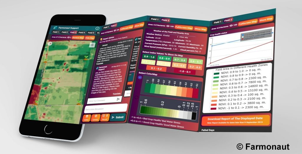
- Advanced crop monitoring techniques
- Precision agriculture solutions
- Integration of geospatial data in farm management
This recognition not only validates our efforts but also helps raise awareness about the potential of geospatial technology in transforming agriculture.
The Farmonaut® Advantage: Satellite vs. Drone and IoT Monitoring
As we continue to innovate in the field of agricultural technology, it’s important to understand the advantages of our satellite-based system compared to other farm monitoring methods. Here’s a comparison of Farmonaut’s Satellite System with drone and IoT-based farm monitoring:
| Feature | Farmonaut Satellite System | Drone-based Monitoring | IoT-based Monitoring |
|---|---|---|---|
| Coverage Area | Large scale (thousands of hectares) | Limited (few hundred hectares) | Very limited (few hectares) |
| Frequency of Data Collection | Daily to weekly | On-demand (weather dependent) | Continuous |
| Initial Setup Cost | Low | High | Medium to High |
| Maintenance | Minimal | Regular (hardware maintenance) | Regular (sensor maintenance) |
| Data Processing | Automated (AI-driven) | Semi-automated | Automated |
| Scalability | Highly scalable | Limited scalability | Moderate scalability |
| Weather Independence | High (can penetrate clouds) | Low (affected by weather) | Moderate (some sensors affected) |
| Global Accessibility | Yes | Limited by regulations | Limited by infrastructure |
As evident from the comparison, Farmonaut’s Satellite System offers unparalleled advantages in terms of coverage, scalability, and cost-effectiveness, making it the ideal choice for modern, data-driven agriculture.
Looking Ahead: Our Commitment to Sustainable Agriculture
As we move forward, we remain dedicated to our mission of creating a more sustainable and efficient agricultural ecosystem. Our achievements in Q2 2023 have set the stage for even greater innovations and collaborations in the future.
Key Focus Areas for the Future
- Expanding our satellite services for carbon management to more regions globally
- Enhancing our AI algorithms for more precise crop estimations
- Developing new partnerships to promote sustainable farming practices
- Continuing our research and development in geospatial advancements for agriculture
- Educating farmers and stakeholders about the benefits of precision agriculture
We invite you to join us on this exciting journey towards a more sustainable and productive agricultural future. Explore our services and see how Farmonaut can transform your farming practices:
- Try our mobile app: Android | iOS
- Integrate our API into your systems: Farmonaut API
- Learn more about our weather API: Weather API Documentation
FAQ: Farmonaut’s Q2 2023 Achievements
To provide more clarity on our recent accomplishments and services, we’ve compiled a list of frequently asked questions:
Q1: What was the significance of the Fashion for Biodiversity project?
A1: The Fashion for Biodiversity project in Germany showcased our ability to accurately estimate diverse crop areas, including saffron, Arjun trees, Aswatha trees, and mulberry plantations. This project highlighted the intersection of sustainable agriculture and fashion, demonstrating how precise crop estimations can support environmentally conscious industries.
Q2: How accurate is Farmonaut’s carbon management data?
A2: Our carbon management data has demonstrated an impressive accuracy rate of 90-95%, as verified by the Fair Climate Fund’s ground truthing efforts. This high level of precision is crucial for accurate carbon credit calculations and effective climate change mitigation strategies.
Q3: What was Farmonaut’s role at the G20 Conference in Hyderabad?
A3: At the G20 Conference, we had the opportunity to interact with global Agriculture Ministers, Experts, and Model Farmers. We shared our vision for creating a sustainable agricultural ecosystem and discussed the role of technology in addressing global food security challenges.
Q4: How did Farmonaut validate Egypt’s wheat cultivation expansion?
A4: Our satellite-based crop estimations projected a higher wheat cultivation area in Egypt than initial ground reports. This finding was later confirmed by government officials, validating the accuracy and reliability of our satellite monitoring system.
Q5: What geospatial advancements has Farmonaut contributed to?
A5: Farmonaut has been recognized for its innovative use of satellite technology and AI in agriculture. Our advancements include advanced crop monitoring techniques, precision agriculture solutions, and the integration of geospatial data in farm management.
Q6: How does Farmonaut’s satellite system compare to drone and IoT-based monitoring?
A6: Farmonaut’s satellite system offers several advantages over drone and IoT-based monitoring, including larger coverage area, higher frequency of data collection, lower initial setup costs, minimal maintenance, and greater scalability. Our system is also weather-independent and globally accessible.
Q7: How can farmers access Farmonaut’s services?
A7: Farmers can access our services through our mobile app available on both Android and iOS platforms. For more advanced integrations, we offer API access for developers and businesses. You can find links to these resources in the blog post above.
Q8: What are Farmonaut’s plans for expanding its services?
A8: We plan to expand our satellite services for carbon management to more regions globally, enhance our AI algorithms for more precise crop estimations, develop new partnerships to promote sustainable farming practices, and continue our research in geospatial advancements for agriculture.
As we conclude this comprehensive overview of Farmonaut’s Q2 2023 highlights, we’re filled with gratitude for the trust our clients and partners have placed in us. Our journey in revolutionizing agriculture through technology is far from over, and we’re excited about the possibilities that lie ahead.
From our groundbreaking work in crop estimations for Fashion for Biodiversity to our expanding role in carbon management across Africa, every project reinforces our commitment to creating a more sustainable and productive agricultural ecosystem. Our recognition in the GIS Resources Magazine and our impactful presence at the G20 Conference further validate our efforts and inspire us to push the boundaries of what’s possible in agritech.
As we look to the future, we remain dedicated to our mission of making precision agriculture accessible to farmers worldwide. We’ll continue to innovate, collaborate, and educate, always with the goal of empowering farmers and promoting sustainable practices.
We invite you to join us on this exciting journey. Whether you’re a farmer looking to optimize your crops, a business seeking to integrate advanced agricultural data into your operations, or an individual passionate about sustainable farming, Farmonaut has something to offer you.
Explore our services, try our app, or reach out to learn more about how we can help you be part of the agricultural revolution. Together, we can create a more sustainable, productive, and resilient future for agriculture.
Thank you for your continued support and trust in Farmonaut. Here’s to many more milestones and achievements in the quarters to come!
For more information or to get started with Farmonaut, visit our website or contact our team directly. Let’s grow together towards a more sustainable future!


