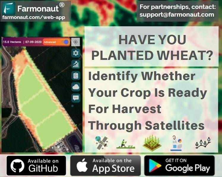
Maximizing Wheat Yield: Leveraging Satellite Technology for Optimal Harvest Timing
As we approach the final weeks of wheat maturity, farmers across the globe are gearing up for one of the most crucial phases in the agricultural calendar: the harvest. At Farmonaut, we understand the significance of this period and the impact it has on overall yield and quality. That’s why we’re excited to share how our cutting-edge satellite technology is revolutionizing the way farmers determine the perfect moment to harvest their wheat crops.
The Importance of Precise Harvest Timing
Harvesting wheat at the right time is a delicate balance that can significantly influence both the quantity and quality of your yield. Harvest too early, and you risk reduced grain weight and lower overall yield. Wait too long, and you may face issues such as grain shattering, lodging, or exposure to adverse weather conditions. This is where precision agriculture, powered by satellite technology, comes into play.
Farmonaut: Your Partner in Precision Agriculture
At Farmonaut, we’ve harnessed the power of satellite data to provide farmers with unparalleled insights into their crops’ health and maturity. Our platform offers real-time monitoring and analysis, allowing you to make informed decisions about when to begin your wheat harvest. Here’s how our technology can help you achieve maximum yield:
- Real-time Crop Monitoring: Our satellites continuously capture high-resolution images of your fields, providing up-to-date information on crop health and maturity.
- Advanced Analytics: Our AI-powered algorithms analyze satellite data to assess various parameters such as chlorophyll content, moisture levels, and overall plant vigor.
- Customized Insights: We provide tailored recommendations based on your specific wheat variety, local climate conditions, and historical data.
- User-Friendly Interface: Access all this information through our intuitive mobile and web applications, available on Android, iOS, and web browsers.
Understanding Wheat Maturity Stages
To fully appreciate the value of precise harvest timing, it’s essential to understand the stages of wheat maturity. Wheat typically goes through several distinct phases as it approaches harvest readiness:
- Milk Stage: The kernels contain a milky fluid and are beginning to fill.
- Dough Stage: The kernels have a doughy consistency and are nearing full size.
- Hard Dough Stage: The kernels are firm but can still be dented with a thumbnail.
- Ripening Stage: The kernels are fully developed and begin to dry down.
Each of these stages presents different moisture content levels in the grain, which is crucial for determining the optimal harvest time. With Farmonaut’s satellite technology, we can help you track these stages with unprecedented accuracy.
How Farmonaut’s Satellite Technology Works
Our satellite-based crop monitoring system utilizes a combination of multispectral imagery and advanced algorithms to provide you with actionable insights. Here’s a breakdown of the process:
- Data Acquisition: High-resolution satellite images are captured regularly over your wheat fields.
- Multispectral Analysis: We analyze various spectral bands to assess crop health, chlorophyll content, and moisture levels.
- Vegetation Indices Calculation: We compute indices such as NDVI (Normalized Difference Vegetation Index) to quantify crop vigor and maturity.
- Machine Learning Algorithms: Our AI models interpret this data, considering factors like weather patterns and historical yield data.
- Customized Recommendations: Based on all these inputs, we provide you with specific recommendations for harvest timing.
The Advantages of Satellite-Based Monitoring
While there are various methods for monitoring crop health and maturity, satellite-based systems offer several unique advantages:
| Feature | Farmonaut Satellite System | Drone-based Monitoring | IoT-based Monitoring |
|---|---|---|---|
| Coverage Area | Large-scale (Entire farms) | Limited by flight time and regulations | Limited by sensor placement |
| Frequency of Data Collection | Regular (Every few days) | As needed, but labor-intensive | Continuous, but limited to sensor locations |
| Initial Setup Cost | Low | High (Drone purchase and training) | High (Sensors and network setup) |
| Maintenance | Minimal (Cloud-based system) | Regular (Drone maintenance and repairs) | Regular (Sensor calibration and replacement) |
| Data Processing | Automated and cloud-based | Often requires manual processing | Automated but limited to sensor data |
| Scalability | Highly scalable | Limited by equipment and personnel | Requires additional sensor installation |
Maximizing Your Wheat Yield with Farmonaut
Now that we’ve explored the technology behind our system, let’s dive into how you can use Farmonaut to maximize your wheat yield:
1. Regular Monitoring Throughout the Growing Season
While harvest timing is crucial, the path to a successful yield begins much earlier. With Farmonaut, you can monitor your wheat crop from planting to harvest, allowing you to:
- Detect and address issues such as nutrient deficiencies or pest infestations early on.
- Optimize irrigation by monitoring soil moisture levels.
- Track crop development stages to ensure timely application of inputs.
2. Precise Harvest Timing
As your wheat crop enters the final stages of maturity, Farmonaut provides you with detailed insights to determine the optimal harvest window:
- Track changes in chlorophyll content, which indicate the transition from the milk stage to the dough stage.
- Monitor moisture levels in the grain to ensure it’s within the ideal range for harvesting (typically between 20-30% moisture content for most wheat varieties).
- Receive alerts when your crop reaches the hard dough stage, signaling the approaching harvest window.
3. Field-Specific Recommendations
Every field is unique, and variations in soil type, topography, and microclimate can lead to uneven crop maturity across your farm. Farmonaut’s satellite technology allows you to:
- Identify areas of your field that are maturing faster or slower than others.
- Plan a staged harvest approach if necessary, targeting areas that reach optimal maturity first.
- Adjust your harvesting strategy based on real-time data, ensuring you capture the maximum yield from each section of your field.
4. Weather Integration for Informed Decision-Making
Weather conditions play a crucial role in determining the best time to harvest. Farmonaut integrates local weather forecasts with crop maturity data to help you:
- Plan your harvest around favorable weather conditions.
- Avoid potential losses due to unexpected rain or adverse weather events.
- Optimize your harvesting schedule to ensure maximum efficiency and yield.
Beyond Wheat: Farmonaut’s Versatility in Crop Monitoring
While we’ve focused on wheat in this discussion, it’s important to note that Farmonaut’s technology is applicable to a wide range of crops. Our satellite-based monitoring system can provide valuable insights for various agricultural products, including:
- Rice (Paddy): Monitor flood levels, assess plant vigor, and determine optimal harvest times for rice crops.
- Corn (Maize): Track growth stages, detect stress factors, and optimize inputs for maximum yield.
- Soybeans: Monitor crop health, predict yields, and identify pest or disease outbreaks early.
- Cotton: Assess plant development, optimize irrigation, and determine the best time for defoliation and harvest.
- Fruits and Vegetables: Monitor crop health, predict yields, and optimize harvest timing for various horticultural crops.
Understanding Yield Calculation in Agriculture
While Farmonaut provides valuable insights for optimizing your harvest, understanding how to calculate yield is crucial for assessing your farm’s performance. Here’s a brief overview of how to calculate yield in agriculture:
Basic Yield Calculation Formula
The basic formula for calculating crop yield is:
Yield = Total Crop Production / Area Harvested
For wheat, yield is typically measured in bushels per acre or tonnes per hectare. Here’s how you can calculate it:
- Measure the total weight of harvested grain (in pounds or kilograms).
- Convert the weight to bushels or tonnes (1 bushel of wheat = approximately 60 pounds).
- Divide the total bushels or tonnes by the number of acres or hectares harvested.
For example, if you harvested 6,000 bushels of wheat from a 100-acre field, your yield would be 60 bushels per acre.
Factors Affecting Yield Calculation
Several factors can impact your yield calculation and should be considered for accurate results:
- Moisture Content: Grain weight should be adjusted to a standard moisture content (usually 13.5% for wheat) for accurate comparison.
- Test Weight: This measures the density of the grain and can affect the bushel weight.
- Field Losses: Account for any grain left in the field due to shattering or incomplete harvesting.
- Sample Accuracy: Ensure your samples are representative of the entire field for accurate calculations.
How Farmonaut Enhances Yield Calculation
While the basic yield calculation provides valuable information, Farmonaut’s satellite technology can enhance this process in several ways:
- Pre-harvest Yield Estimation: Our advanced algorithms can predict yield based on crop health data, allowing for better planning and resource allocation.
- Field Variability Mapping: Identify areas of high and low productivity within your fields, enabling targeted management strategies.
- Historical Yield Comparison: Compare current yield estimates with historical data to track improvements and identify trends.
- Input Efficiency Analysis: Correlate yield data with input usage to optimize resource allocation and improve overall farm efficiency.
Accessing Satellite Imagery for Your Farm
One of the most common questions we receive at Farmonaut is, “How can I get satellite imagery for my farm?” With our user-friendly platform, accessing high-resolution satellite imagery of your fields is easier than ever. Here’s a step-by-step guide on how to get started:
- Sign Up for Farmonaut: Visit our website or download our mobile app from the Google Play Store or Apple App Store.
- Create Your Farm Profile: Enter basic information about your farm, including its location and the crops you’re growing.
- Define Your Field Boundaries: Use our intuitive mapping tool to outline your fields. You can do this manually or import existing boundary files.
- Select Your Monitoring Package: Choose the monitoring frequency and resolution that best suits your needs.
- Access Your Imagery: Once set up, you’ll start receiving regular satellite imagery of your fields, typically within 24-48 hours of each satellite pass.
For developers and businesses looking to integrate satellite imagery into their own applications, we offer a robust API. You can find detailed documentation on our Farmonaut Satellite Weather API Developer Docs page.
Understanding Cloud Coverage in Satellite Imagery
When working with satellite imagery, it’s important to understand the impact of cloud coverage on image quality and data interpretation. Here’s what you need to know about checking cloud coverage in your satellite images:
Why Cloud Coverage Matters
Clouds can obstruct the view of the Earth’s surface, potentially limiting the usability of satellite imagery for crop monitoring. Understanding cloud coverage helps you:
- Assess the reliability of the data for a given date.
- Plan for alternative monitoring strategies during periods of high cloud coverage.
- Interpret any gaps or inconsistencies in your crop health data.
How Farmonaut Handles Cloud Coverage
At Farmonaut, we’ve implemented several strategies to mitigate the impact of cloud coverage on our satellite monitoring services:
- Cloud Detection Algorithms: Our system automatically detects and filters out cloud-covered areas in satellite images.
- Multi-temporal Analysis: We combine data from multiple dates to fill in gaps caused by cloud coverage.
- Alternative Data Sources: In cases of persistent cloud coverage, we supplement satellite data with other sources, such as weather station data and crop models.
Checking Cloud Coverage in Your Farmonaut Account
To check the cloud coverage for your satellite images in Farmonaut:
- Log in to your Farmonaut account.
- Navigate to the “Imagery” or “Field Monitoring” section.
- Select the date range you’re interested in.
- Look for the cloud coverage percentage displayed alongside each image.
- Use the cloud-free image toggle to view only images with minimal cloud coverage.
The Future of Precision Agriculture with Farmonaut
As we continue to innovate and expand our services, we’re excited about the future of precision agriculture. Here are some of the developments we’re working on:
- Hyperspectral Imaging: Incorporating even more detailed spectral data for enhanced crop health analysis.
- Machine Learning Advancements: Refining our AI models to provide even more accurate yield predictions and recommendations.
- Integration with IoT Devices: Combining satellite data with ground-based sensors for a comprehensive view of your farm.
- Climate Change Adaptation Tools: Developing features to help farmers adapt to changing climate patterns and extreme weather events.
Getting Started with Farmonaut
Ready to take your wheat farming to the next level? Here’s how you can get started with Farmonaut:
- Visit our website at https://farmonaut.com/app_redirect to sign up for an account.
- Download our mobile app from the Google Play Store or Apple App Store.
- Explore our features and set up your farm profile.
- Start monitoring your wheat crops and receive personalized recommendations for optimal harvest timing.
For those interested in integrating our satellite data into their own applications, check out our API documentation at https://sat.farmonaut.com/api.
Frequently Asked Questions (FAQ)
Q: How often are satellite images updated in Farmonaut?
A: The frequency of updates depends on your chosen plan, but typically ranges from daily to weekly updates. Cloud coverage and satellite orbits may affect the exact timing of updates.
Q: Can Farmonaut help me monitor crops other than wheat?
A: Yes, our platform is designed to monitor a wide range of crops, including rice, corn, soybeans, cotton, and various fruits and vegetables.
Q: Is Farmonaut suitable for small-scale farmers?
A: Absolutely! We offer plans tailored to farms of all sizes, making precision agriculture accessible to small-scale farmers as well as large agribusinesses.
Q: How accurate are Farmonaut’s yield predictions?
A: Our yield predictions typically have an accuracy rate of 85-90%, depending on factors such as crop type, weather conditions, and the availability of historical data.
Q: Can I integrate Farmonaut data with my existing farm management software?
A: Yes, we offer API access that allows for integration with many popular farm management systems. Check our developer documentation for more details.
Q: How does Farmonaut handle data privacy and security?
A: We take data privacy very seriously. All farm data is encrypted and stored securely, and we never share individual farm data without explicit permission.
Conclusion
As we’ve explored throughout this article, precise timing of wheat harvest is crucial for maximizing yield and quality. With Farmonaut’s advanced satellite technology, you have a powerful tool at your fingertips to make informed decisions about when to harvest your wheat crop. By leveraging real-time data, customized insights, and user-friendly applications, you can take your farming practices to the next level.
We invite you to join the growing community of farmers who are harnessing the power of satellite technology to improve their yields and streamline their operations. With Farmonaut, you’re not just investing in a tool; you’re investing in the future of your farm.
Ready to revolutionize your wheat farming? Sign up for Farmonaut today and experience the difference that precision agriculture can make. Visit https://farmonaut.com/app_redirect to get started.
Happy farming, and here’s to a bountiful harvest!
