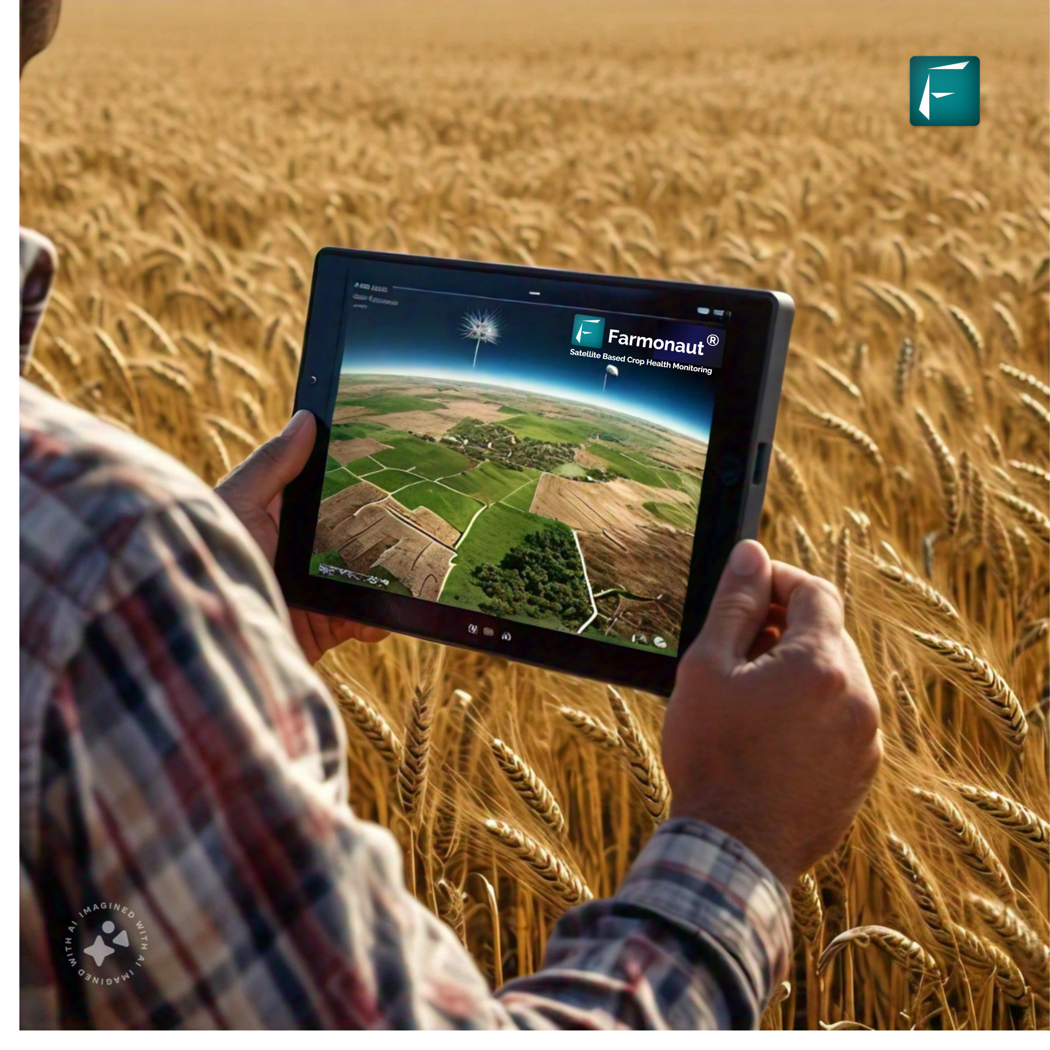
In the ever-evolving landscape of modern agriculture, a groundbreaking innovation is transforming the way farmers manage their crops and maximize yields. Satellite data for agriculture has emerged as a game-changing tool, offering unprecedented insights and real-time monitoring capabilities. This technological marvel is not just changing farming practices; it’s revolutionizing the entire agricultural sector.
🌱 The Power of Satellite-Based Monitoring in Agriculture
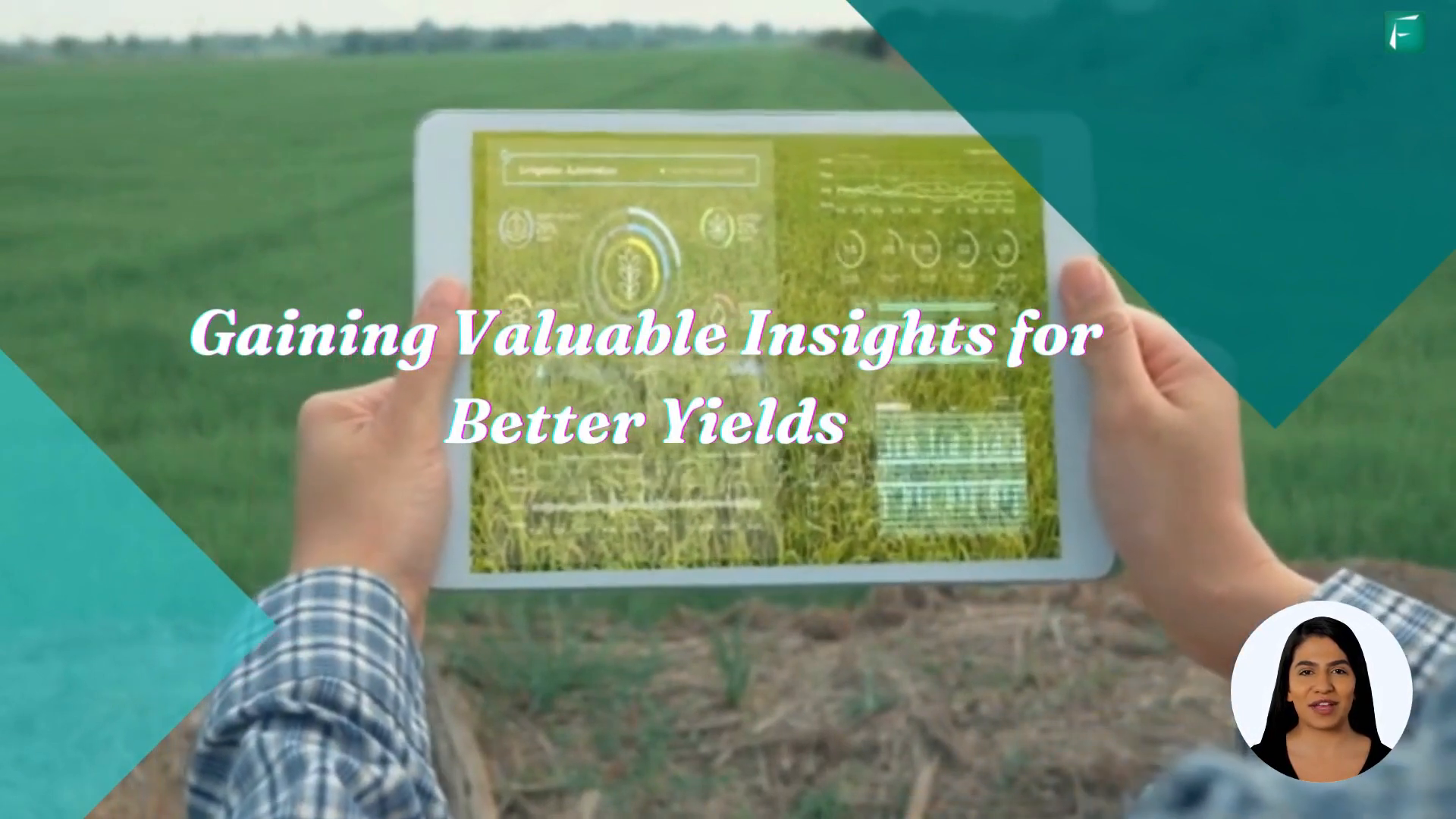
Satellite-based monitoring has become a cornerstone of precision agriculture, providing farmers with a bird’s-eye view of their fields and invaluable data to make informed decisions. This technology offers several advantages over traditional methods and even drone-based solutions.
Drone vs Satellite Imagery: A Comparative Analysis
While drones have gained popularity in agricultural monitoring, satellite imagery offers distinct advantages. Satellites can cover vast areas quickly and consistently, providing a broader perspective that drones simply can’t match. Additionally, satellite data is less affected by local regulations and doesn’t require on-site operation, making it a more scalable solution for large-scale farming operations.
| Feature | Drone Imagery | Satellite Imagery |
|---|---|---|
| Coverage Area | Limited | Extensive |
| Frequency | On-demand | Regular intervals |
| Resolution | Very High | High |
| Operational Complexity | High | Low |
| Weather Dependency | High | Moderate |
The agro satellite revolution is enabling farmers to access critical information about their crops without the need for expensive equipment or specialized training. This democratization of technology is leveling the playing field for farmers of all sizes.
🌾 Monitoring Crop Health: A Key to Sustainable Agriculture
One of the most significant applications of satellite data in agriculture is monitoring crop health. This capability allows farmers to detect issues early, optimize resource allocation, and ultimately improve yields.
The Importance of Real-Time Crop Monitoring
Agriculture real-time monitoring systems powered by satellite data provide farmers with up-to-date information on crop conditions, soil moisture levels, and potential threats. This timely information enables quick decision-making and proactive management of fields.
- Early detection of pest infestations
- Identification of nutrient deficiencies
- Optimization of irrigation schedules
- Prediction of harvest times
By leveraging these insights, farmers can address issues before they become significant problems, leading to healthier crops and increased productivity.

🚜 Satellite Advisory: Bringing Expert Insights to Your Fingertips
The concept of a satellite advisory service takes crop monitoring to the next level by providing expert analysis and recommendations based on satellite data. This personalized guidance helps farmers make data-driven decisions without the need for extensive technical knowledge.
Farmonaut’s WhatsApp-Based Satellite Advisory
A prime example of this innovative approach is Farmonaut’s satellite-based WhatsApp advisory service. This groundbreaking solution delivers vital crop health and irrigation guidance directly to farmers’ smartphones, making advanced agricultural technology accessible to all.
- 92% engagement rate
- Over 20,000 messages exchanged
- Updates every 4-5 days
- User-friendly interface
This service exemplifies how satellite data for agriculture can be transformed into actionable insights, delivered in a format that’s easy for farmers to understand and implement.

🌿 The Impact of Satellite-Based Monitoring on Agricultural Practices
The adoption of satellite-based monitoring systems is having a profound impact on agricultural practices worldwide. From small-scale farmers to large agricultural corporations, the benefits of this technology are being realized across the board.
Precision Agriculture and Resource Optimization
Satellite data enables precision agriculture, allowing farmers to apply resources such as water, fertilizers, and pesticides with pinpoint accuracy. This not only reduces waste but also minimizes environmental impact, promoting sustainable farming practices.
Crop Yield Prediction and Market Planning
Farmonaut: Revolutionizing Crop Monitoring and Yield Prediction
Effective crop monitoring and yield prediction are crucial for optimizing agricultural decision-making at every stage of growth. Farmonaut’s innovative platform leverages cutting-edge remote sensing technology to provide farmers with a powerful, scientific, and scalable solution that addresses these critical needs.
Traditional Methods vs. Farmonaut’s Approach:
- Field Scouting (Naked Eye):
- Limited by human error and subjectivity
- Time-consuming and labor-intensive
- Difficult to scale across large areas
- Digital Images:
- Lack comprehensive details
- Limited in scope and scale
- Challenges in expert interpretation
- IoT Devices:
- High implementation costs
- Limited coverage area
- Maintenance challenges
Farmonaut’s Remote Sensing Advantage:
- Covers vast areas from farm to country level
- Scientifically rigorous and data-driven
- Addresses a wide range of agricultural challenges
- Cost-effective and scalable
- Provides actionable insights for targeted interventions
Key Benefits of Farmonaut’s Platform:
- Comprehensive Crop Monitoring:
- Real-time assessment of crop health
- Early detection of pest and disease outbreaks
- Identification of nutrient deficiencies
- Monitoring of water stress and irrigation needs
- Accurate Yield Prediction:
- Advanced algorithms analyze multiple factors:
- Crop type and variety
- Climatic conditions
- Soil properties
- Phenological stages
- Enables precise yield forecasting across diverse agricultural landscapes
- Advanced algorithms analyze multiple factors:
- Market Planning and Supply Chain Optimization:
- Informed decision-making for harvest timing
- Optimized resource allocation
- Improved supply chain management
- Enhanced food security planning
- Cost Savings and Sustainability:
- Targeted application of inputs (fertilizers, pesticides, water)
- Reduction of environmental impact
- Improved resource efficiency
- Global Accessibility:
- Support for over 50 languages
- Democratizing access to advanced agricultural technology
- Empowering farmers worldwide to improve practices and yields
Farmonaut’s remote sensing platform represents a paradigm shift in crop monitoring and yield prediction. By providing farmers and agricultural stakeholders with accurate, timely, and actionable insights, Farmonaut is driving the future of precision agriculture. This innovative approach not only enhances individual farm productivity but also contributes to global food security, sustainable farming practices, and more resilient agricultural systems.
As agriculture faces increasing challenges from climate change, population growth, and resource constraints, Farmonaut’s technology offers a powerful tool for adaptation and optimization. By embracing this advanced remote sensing solution, farmers can make data-driven decisions that lead to increased yields, reduced costs, and more sustainable
🔬 The Role of Automated Pest Monitoring Systems in Agriculture
An exciting development in the field of satellite-based agriculture is the emergence of automated pest monitoring systems. These systems use a combination of satellite data, ground sensors, and artificial intelligence to detect and predict pest outbreaks.
The Growing Automated Pest Monitoring System Market
The automated pest monitoring system market for the agriculture sector is experiencing rapid growth. According to recent market research, this segment is expected to expand at a CAGR of over 15% in the coming years, driven by the increasing need for sustainable pest management solutions.
- Early warning systems for pest outbreaks
- Reduced reliance on chemical pesticides
- Integration with precision spraying technologies
- Data-driven pest management strategies
These advanced systems are helping farmers combat pest issues more effectively while minimizing environmental impact and reducing costs associated with pest control.

🌍 Global Impact: Satellite Data Transforming Agriculture Worldwide
The impact of satellite data on agriculture extends far beyond individual farms. It’s transforming the global agricultural landscape, addressing critical challenges such as food security, climate change adaptation, and sustainable resource management.
Case Studies: Success Stories from Around the World
From smallholder farmers in Africa to large-scale operations in the Americas, satellite-based agricultural solutions are making a difference. For instance, in India, the use of satellite data has helped increase crop yields by up to 30% in some regions, while in Brazil, it has contributed to more sustainable management of the Amazon rainforest alongside agricultural expansion.
🔮 The Future of Satellite Data in Agriculture
As technology continues to advance, the potential applications of satellite data in agriculture are expanding. From AI-powered analysis to integration with IoT devices, the future of farming looks increasingly high-tech and data-driven.
Emerging Trends and Technologies
- Hyperspectral imaging for detailed crop analysis
- Integration with blockchain for supply chain transparency
- Machine learning algorithms for predictive agriculture
- Satellite-guided autonomous farming equipment
These innovations promise to further revolutionize the agricultural sector, making it more efficient, sustainable, and resilient in the face of global challenges.

❓ Frequently Asked Questions
What is satellite-based monitoring in agriculture?
Satellite-based monitoring in agriculture uses imagery and data collected by satellites to provide farmers with information about their crops, soil conditions, and overall field health. This technology allows for large-scale observation and analysis of agricultural lands without the need for on-site inspections.
How does satellite data improve crop yields?
Satellite data improves crop yields by providing farmers with timely information about crop health, soil moisture, and potential issues such as pest infestations or nutrient deficiencies. This allows for early intervention and optimized resource allocation, leading to healthier crops and higher yields.
Is satellite-based monitoring cost-effective for small farmers?
Yes, satellite-based monitoring can be cost-effective for small farmers, especially when delivered through accessible platforms like WhatsApp. Services like Farmonaut’s advisory make this technology affordable and user-friendly for farmers of all scales.
How often is satellite data updated for agricultural purposes?
The frequency of satellite data updates can vary depending on the service provider and the satellites used. Many services, like Farmonaut, offer updates every 4-5 days, providing farmers with regular, timely information about their crops.
Can satellite data help with sustainable farming practices?
Absolutely. Satellite data supports sustainable farming by enabling precision agriculture, which reduces resource waste and environmental impact. It also helps in monitoring deforestation, tracking carbon sequestration, and promoting conservation agriculture practices.
As we’ve explored throughout this article, satellite data for agriculture is not just a technological novelty—it’s a transformative force that’s reshaping the future of farming. From monitoring crop health to providing real-time advisories, this technology is empowering farmers with the knowledge and tools they need to thrive in an increasingly challenging agricultural landscape. As we look to the future, it’s clear that satellite-based solutions will play a crucial role in ensuring food security, promoting sustainable practices, and supporting the livelihood of farmers around the world. The agricultural revolution is here, and it’s powered by eyes in the sky.
To learn more about how you can leverage satellite data for your farming operations, explore Farmonaut’s WhatsApp Based Satellite Advisory service. Take the first step towards precision agriculture and join the thousands of farmers already benefiting from this game-changing technology.
In the ever-evolving landscape of modern agriculture, a groundbreaking innovation is transforming the way farmers manage their crops and maximize yields. Satellite data for agriculture has emerged as a game-changing tool, offering unprecedented insights and real-time monitoring capabilities. This technological marvel is not just changing farming practices; it’s revolutionizing the entire agricultural sector.
🌱 The Power of Satellite-Based Monitoring in Agriculture
Satellite-based monitoring has become a cornerstone of precision agriculture, providing farmers with a bird’s-eye view of their fields and invaluable data to make informed decisions. This technology offers several advantages over traditional methods and even drone-based solutions.
Drone vs Satellite Imagery: A Comparative Analysis
While drones have gained popularity in agricultural monitoring, satellite imagery offers distinct advantages. Satellites can cover vast areas quickly and consistently, providing a broader perspective that drones simply can’t match. Additionally, satellite data is less affected by local regulations and doesn’t require on-site operation, making it a more scalable solution for large-scale farming operations.
| Feature | Drone Imagery | Satellite Imagery |
|---|---|---|
| Coverage Area | Limited | Extensive |
| Frequency | On-demand | Regular intervals |
| Resolution | Very High | High |
| Operational Complexity | High | Low |
| Weather Dependency | High | Moderate |
The agro satellite revolution is enabling farmers to access critical information about their crops without the need for expensive equipment or specialized training. This democratization of technology is leveling the playing field for farmers of all sizes.
🌾 Monitoring Crop Health: A Key to Sustainable Agriculture
One of the most significant applications of satellite data in agriculture is monitoring crop health. This capability allows farmers to detect issues early, optimize resource allocation, and ultimately improve yields.
The Importance of Real-Time Crop Monitoring
Agriculture real-time monitoring systems powered by satellite data provide farmers with up-to-date information on crop conditions, soil moisture levels, and potential threats. This timely information enables quick decision-making and proactive management of fields.
- Early detection of pest infestations
- Identification of nutrient deficiencies
- Optimization of irrigation schedules
- Prediction of harvest times
By leveraging these insights, farmers can address issues before they become significant problems, leading to healthier crops and increased productivity.
🚜 Satellite Advisory: Bringing Expert Insights to Your Fingertips
The concept of a satellite advisory service takes crop monitoring to the next level by providing expert analysis and recommendations based on satellite data. This personalized guidance helps farmers make data-driven decisions without the need for extensive technical knowledge.
Farmonaut’s WhatsApp-Based Satellite Advisory
A prime example of this innovative approach is Farmonaut’s satellite-based WhatsApp advisory service. This groundbreaking solution delivers vital crop health and irrigation guidance directly to farmers’ smartphones, making advanced agricultural technology accessible to all.
- 92% engagement rate
- Over 20,000 messages exchanged
- Updates every 4-5 days
- User-friendly interface
This service exemplifies how satellite data for agriculture can be transformed into actionable insights, delivered in a format that’s easy for farmers to understand and implement.
🌿 The Impact of Satellite-Based Monitoring on Agricultural Practices
The adoption of satellite-based monitoring systems is having a profound impact on agricultural practices worldwide. From small-scale farmers to large agricultural corporations, the benefits of this technology are being realized across the board.
Precision Agriculture and Resource Optimization
Satellite data enables precision agriculture, allowing farmers to apply resources such as water, fertilizers, and pesticides with pinpoint accuracy. This not only reduces waste but also minimizes environmental impact, promoting sustainable farming practices.
Crop Yield Prediction and Market Planning
Farmonaut: Revolutionizing Crop Monitoring and Yield Prediction
Effective crop monitoring and yield prediction are crucial for optimizing agricultural decision-making at every stage of growth. Farmonaut’s innovative platform leverages cutting-edge remote sensing technology to provide farmers with a powerful, scientific, and scalable solution that addresses these critical needs.
Traditional Methods vs. Farmonaut’s Approach:
- Field Scouting (Naked Eye):
- Limited by human error and subjectivity
- Time-consuming and labor-intensive
- Difficult to scale across large areas
- Digital Images:
- Lack comprehensive details
- Limited in scope and scale
- Challenges in expert interpretation
- IoT Devices:
- High implementation costs
- Limited coverage area
- Maintenance challenges
Farmonaut’s Remote Sensing Advantage:
- Covers vast areas from farm to country level
- Scientifically rigorous and data-driven
- Addresses a wide range of agricultural challenges
- Cost-effective and scalable
- Provides actionable insights for targeted interventions
Key Benefits of Farmonaut’s Platform:
- Comprehensive Crop Monitoring:
- Real-time assessment of crop health
- Early detection of pest and disease outbreaks
- Identification of nutrient deficiencies
- Monitoring of water stress and irrigation needs
- Accurate Yield Prediction:
- Advanced algorithms analyze multiple factors:
- Crop type and variety
- Climatic conditions
- Soil properties
- Phenological stages
- Enables precise yield forecasting across diverse agricultural landscapes
- Advanced algorithms analyze multiple factors:
- Market Planning and Supply Chain Optimization:
- Informed decision-making for harvest timing
- Optimized resource allocation
- Improved supply chain management
- Enhanced food security planning
- Cost Savings and Sustainability:
- Targeted application of inputs (fertilizers, pesticides, water)
- Reduction of environmental impact
- Improved resource efficiency
- Global Accessibility:
- Support for over 50 languages
- Democratizing access to advanced agricultural technology
- Empowering farmers worldwide to improve practices and yields
Farmonaut’s remote sensing platform represents a paradigm shift in crop monitoring and yield prediction. By providing farmers and agricultural stakeholders with accurate, timely, and actionable insights, Farmonaut is driving the future of precision agriculture. This innovative approach not only enhances individual farm productivity but also contributes to global food security, sustainable farming practices, and more resilient agricultural systems.
As agriculture faces increasing challenges from climate change, population growth, and resource constraints, Farmonaut’s technology offers a powerful tool for adaptation and optimization. By embracing this advanced remote sensing solution, farmers can make data-driven decisions that lead to increased yields, reduced costs, and more sustainable
🔬 The Role of Automated Pest Monitoring Systems in Agriculture
An exciting development in the field of satellite-based agriculture is the emergence of automated pest monitoring systems. These systems use a combination of satellite data, ground sensors, and artificial intelligence to detect and predict pest outbreaks.
The Growing Automated Pest Monitoring System Market
The automated pest monitoring system market for the agriculture sector is experiencing rapid growth. According to recent market research, this segment is expected to expand at a CAGR of over 15% in the coming years, driven by the increasing need for sustainable pest management solutions.
- Early warning systems for pest outbreaks
- Reduced reliance on chemical pesticides
- Integration with precision spraying technologies
- Data-driven pest management strategies
These advanced systems are helping farmers combat pest issues more effectively while minimizing environmental impact and reducing costs associated with pest control.
🌍 Global Impact: Satellite Data Transforming Agriculture Worldwide
The impact of satellite data on agriculture extends far beyond individual farms. It’s transforming the global agricultural landscape, addressing critical challenges such as food security, climate change adaptation, and sustainable resource management.
Case Studies: Success Stories from Around the World
From smallholder farmers in Africa to large-scale operations in the Americas, satellite-based agricultural solutions are making a difference. For instance, in India, the use of satellite data has helped increase crop yields by up to 30% in some regions, while in Brazil, it has contributed to more sustainable management of the Amazon rainforest alongside agricultural expansion.
🔮 The Future of Satellite Data in Agriculture
As technology continues to advance, the potential applications of satellite data in agriculture are expanding. From AI-powered analysis to integration with IoT devices, the future of farming looks increasingly high-tech and data-driven.
Emerging Trends and Technologies
- Hyperspectral imaging for detailed crop analysis
- Integration with blockchain for supply chain transparency
- Machine learning algorithms for predictive agriculture
- Satellite-guided autonomous farming equipment
These innovations promise to further revolutionize the agricultural sector, making it more efficient, sustainable, and resilient in the face of global challenges.
❓ Frequently Asked Questions
What is satellite-based monitoring in agriculture?
Satellite-based monitoring in agriculture uses imagery and data collected by satellites to provide farmers with information about their crops, soil conditions, and overall field health. This technology allows for large-scale observation and analysis of agricultural lands without the need for on-site inspections.
How does satellite data improve crop yields?
Satellite data improves crop yields by providing farmers with timely information about crop health, soil moisture, and potential issues such as pest infestations or nutrient deficiencies. This allows for early intervention and optimized resource allocation, leading to healthier crops and higher yields.
Is satellite-based monitoring cost-effective for small farmers?
Yes, satellite-based monitoring can be cost-effective for small farmers, especially when delivered through accessible platforms like WhatsApp. Services like Farmonaut’s advisory make this technology affordable and user-friendly for farmers of all scales.
How often is satellite data updated for agricultural purposes?
The frequency of satellite data updates can vary depending on the service provider and the satellites used. Many services, like Farmonaut, offer updates every 4-5 days, providing farmers with regular, timely information about their crops.
Can satellite data help with sustainable farming practices?
Absolutely. Satellite data supports sustainable farming by enabling precision agriculture, which reduces resource waste and environmental impact. It also helps in monitoring deforestation, tracking carbon sequestration, and promoting conservation agriculture practices.
As we’ve explored throughout this article, satellite data for agriculture is not just a technological novelty—it’s a transformative force that’s reshaping the future of farming. From monitoring crop health to providing real-time advisories, this technology is empowering farmers with the knowledge and tools they need to thrive in an increasingly challenging agricultural landscape. As we look to the future, it’s clear that satellite-based solutions will play a crucial role in ensuring food security, promoting sustainable practices, and supporting the livelihood of farmers around the world. The agricultural revolution is here, and it’s powered by eyes in the sky.
To learn more about how you can leverage satellite data for your farming operations, explore Farmonaut’s WhatsApp Based Satellite Advisory service. Take the first step towards precision agriculture and join the thousands of farmers already benefiting from this game-changing technology.
