Here’s a comprehensive blog post on land classification in Tamil Nadu, incorporating the requested elements:

Comprehensive Guide to Land Classification in Tamil Nadu: Understanding Soil Types and Agricultural Potential
Welcome to our in-depth exploration of land classification in Tamil Nadu. As experts in agricultural technology and remote sensing, we at Farmonaut understand the critical importance of proper land classification for sustainable agriculture and efficient resource management. In this comprehensive guide, we’ll delve into the intricacies of land classification in Tamil Nadu, exploring its significance, methodologies, and impact on the state’s agricultural landscape.
Table of Contents
- Introduction to Land Classification
- The Importance of Land Classification in Tamil Nadu
- Major Soil Types in Tamil Nadu
- Land Classification Methodologies
- Agricultural Zones in Tamil Nadu
- Impact of Land Classification on Agriculture
- Challenges in Land Classification
- Farmonaut’s Role in Enhancing Land Classification
- Future of Land Classification in Tamil Nadu
- FAQs
1. Introduction to Land Classification
Land classification is a systematic categorization of land based on its physical, chemical, and biological characteristics. It serves as a fundamental tool for understanding the potential and limitations of different land areas for various uses, particularly in agriculture. In Tamil Nadu, a state known for its diverse geography and rich agricultural heritage, land classification plays a crucial role in guiding agricultural practices, urban planning, and environmental conservation efforts.
2. The Importance of Land Classification in Tamil Nadu
Tamil Nadu, with its varied topography ranging from coastal plains to hilly regions, presents a complex landscape for agriculture. The land classification in Tamil Nadu is essential for several reasons:
- Optimizing Agricultural Production: By understanding soil types and land capabilities, farmers can make informed decisions about crop selection and farming practices.
- Resource Management: Proper classification helps in efficient allocation of water resources and other inputs.
- Environmental Conservation: It aids in identifying areas prone to erosion or degradation, enabling targeted conservation efforts.
- Urban Planning: Land classification guides urban development by identifying areas suitable for construction and those that should be preserved for agriculture or ecological purposes.
- Policy Formulation: It provides a scientific basis for agricultural and environmental policies at the state level.
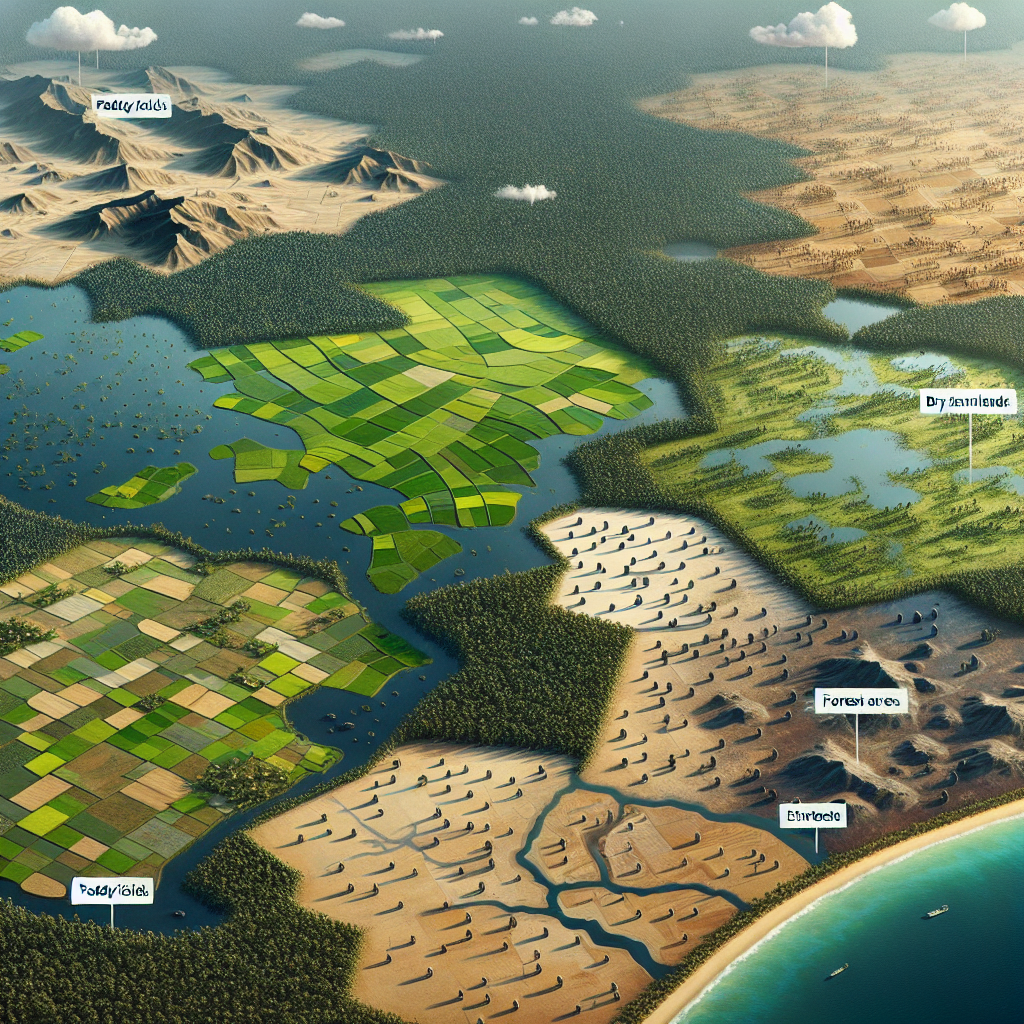
3. Major Soil Types in Tamil Nadu
Tamil Nadu boasts a diverse range of soil types, each with its unique characteristics and agricultural potential. Understanding these soil types is crucial for effective land classification in Tamil Nadu. Let’s explore the major soil types found in the state:
3.1 Red Soils
Red soils are predominant in Tamil Nadu, covering about 45% of the state’s area. These soils are characterized by their reddish color due to the presence of iron oxides. They are generally:
- Light-textured and well-drained
- Low in nitrogen, phosphorus, and organic matter
- Suitable for crops like millets, groundnuts, and pulses
3.2 Black Soils
Black soils, also known as regur or cotton soils, are found in parts of central Tamil Nadu. These soils are:
- Rich in clay content and have high moisture retention capacity
- Well-suited for cotton cultivation, hence the name ‘cotton soils’
- Also suitable for crops like sorghum, millets, and oilseeds
3.3 Alluvial Soils
Alluvial soils are found along the river valleys and coastal plains of Tamil Nadu. These soils are:
- Highly fertile due to regular deposition of silt by rivers
- Ideal for a wide range of crops, including rice, sugarcane, and vegetables
- Vary in texture from sandy loam to clay
3.4 Laterite Soils
Laterite soils are found in some hilly regions of Tamil Nadu. These soils are:
- Rich in iron and aluminum oxides
- Generally acidic and less fertile
- Suitable for plantation crops like tea, coffee, and rubber
3.5 Saline Soils
Saline soils are found in coastal areas and some inland regions of Tamil Nadu. These soils:
- Have high salt content, which affects plant growth
- Require special management practices for agriculture
- Are suitable for salt-tolerant crops and mangrove vegetation
4. Land Classification Methodologies
The process of land classification in Tamil Nadu involves various methodologies that combine traditional knowledge with modern technologies. Here’s an overview of the key approaches used:
4.1 Soil Survey and Mapping
This traditional method involves:
- Field surveys to collect soil samples
- Laboratory analysis of soil properties
- Creation of detailed soil maps
4.2 Remote Sensing and GIS
Modern land classification heavily relies on:
- Satellite imagery analysis
- Geographic Information Systems (GIS) for spatial data management
- Integration of multiple data layers for comprehensive land assessment
4.3 Land Capability Classification
This system categorizes land based on its capability to support various uses:
- Classes I to VIII, with Class I being the most suitable for agriculture
- Considers factors like soil depth, slope, erosion risk, and drainage
4.4 Agro-Ecological Zoning
This approach:
- Divides land into zones based on climate, soil, and topography
- Helps in identifying suitable crops for different regions
5. Agricultural Zones in Tamil Nadu
Based on the land classification in Tamil Nadu, the state is divided into several agricultural zones, each with its unique characteristics and crop suitability. Let’s explore these zones:
5.1 Cauvery Delta Zone
- Characterized by alluvial soils
- Major crops: Rice, sugarcane, coconut
- Intensive agriculture with well-developed irrigation systems
5.2 Southern Zone
- Predominant red and black soils
- Major crops: Cotton, millets, oilseeds
- Rainfed agriculture with some irrigation from tanks and wells
5.3 Western Zone
- Hilly terrain with laterite and forest soils
- Major crops: Tea, coffee, spices
- Plantation agriculture and horticultural crops
5.4 North Western Zone
- Mix of red and black soils
- Major crops: Sorghum, pulses, oilseeds
- Predominantly rainfed agriculture
5.5 North Eastern Zone
- Red sandy soils and coastal alluvium
- Major crops: Rice, groundnut, vegetables
- Mix of irrigated and rainfed agriculture
6. Impact of Land Classification on Agriculture
The land classification in Tamil Nadu has a profound impact on the state’s agricultural practices and productivity. Here’s how it influences various aspects of agriculture:
6.1 Crop Selection
- Guides farmers in choosing crops suitable for their soil type and local climate
- Helps in diversifying agriculture based on land capabilities
- Promotes optimal use of land resources
6.2 Water Management
- Identifies areas suitable for different irrigation methods
- Helps in planning water conservation strategies
- Guides the development of watershed management projects
6.3 Soil Conservation
- Identifies areas prone to erosion or degradation
- Helps in implementing targeted soil conservation measures
- Promotes sustainable land use practices
6.4 Agricultural Planning
- Aids in formulating region-specific agricultural development plans
- Guides agricultural research and extension activities
- Helps in allocating resources for agricultural development
7. Challenges in Land Classification
Despite its importance, land classification in Tamil Nadu faces several challenges:
7.1 Rapid Land Use Changes
- Urbanization and industrialization leading to loss of agricultural land
- Difficulty in keeping land classification data up-to-date
7.2 Climate Change Impact
- Changing rainfall patterns affecting soil characteristics
- Need for frequent reassessment of land capabilities
7.3 Data Integration Issues
- Challenges in integrating data from various sources
- Need for standardization of data collection and classification methods
7.4 Resource Constraints
- Limited resources for comprehensive and frequent land surveys
- Need for more trained personnel in advanced land classification techniques
8. Farmonaut’s Role in Enhancing Land Classification
At Farmonaut, we leverage cutting-edge satellite technology and artificial intelligence to enhance land classification and agricultural management. Our solutions offer several advantages over traditional methods:
| Feature | Farmonaut Satellite System | Drone-based Monitoring | IoT-based Monitoring |
|---|---|---|---|
| Coverage Area | Large scale (State-wide) | Limited (Farm-level) | Very Limited (Sensor locations) |
| Frequency of Data | Regular (Every 3-5 days) | On-demand | Continuous |
| Cost-effectiveness | High | Medium | Low |
| Data Integration | Easy with GIS systems | Requires processing | Limited to sensor data |
| Scalability | Highly scalable | Limited by operational constraints | Limited by infrastructure needs |
Our satellite-based solutions offer:
- Regular updates on land use and crop health
- AI-driven analysis for precise land classification
- Integration with weather data for comprehensive agricultural insights
- Easy-to-use mobile and web applications for farmers and policymakers
To explore how Farmonaut can revolutionize your approach to land management and agriculture, visit our application page or check out our API services.
9. Future of Land Classification in Tamil Nadu
The future of land classification in Tamil Nadu is poised for significant advancements:
- Increased use of high-resolution satellite imagery and AI for real-time land monitoring
- Integration of big data analytics for more accurate and dynamic land classification
- Development of predictive models for land use changes and agricultural planning
- Enhanced collaboration between government agencies, research institutions, and agritech companies like Farmonaut
10. FAQs
Q1: What is the primary purpose of land classification in Tamil Nadu?
A1: The primary purpose is to categorize land based on its characteristics and potential uses, particularly for agricultural planning, resource management, and environmental conservation.
Q2: How often is land classification data updated in Tamil Nadu?
A2: Traditionally, comprehensive land surveys were conducted every few decades. However, with modern satellite technology, updates can be more frequent, potentially on an annual basis.
Q3: Can land classification help in improving crop yields?
A3: Yes, proper land classification helps farmers choose the most suitable crops for their land, leading to optimized resource use and potentially higher yields.
Q4: How does climate change impact land classification?
A4: Climate change can alter soil characteristics, rainfall patterns, and crop suitability, necessitating regular reassessment and updating of land classification data.
Q5: Are there any mobile apps available for farmers to access land classification data?
A5: Yes, Farmonaut offers mobile applications that provide farmers with easy access to land and crop data. You can download our app from the Google Play Store or the Apple App Store.
For developers interested in integrating our satellite and weather data into their applications, we offer comprehensive API documentation. Check out our API documentation for more details.
Conclusion
Land classification in Tamil Nadu is a crucial tool for sustainable agricultural development and effective resource management. As we’ve explored in this comprehensive guide, it encompasses a wide range of methodologies and has far-reaching implications for the state’s agricultural landscape. With the advent of advanced technologies like satellite imaging and AI-driven analysis, the future of land classification looks promising, offering more accurate, timely, and actionable insights.
At Farmonaut, we’re committed to leveraging these technologies to support farmers, policymakers, and researchers in making informed decisions about land use and agricultural practices. By combining traditional knowledge with cutting-edge technology, we can work towards a more sustainable and productive agricultural future for Tamil Nadu and beyond.
To learn more about how Farmonaut can help you leverage satellite technology for agriculture and land management, subscribe to our services:
Join us in revolutionizing agriculture through technology and data-driven insights!
