Empowering Agricultural Research: Farmonaut’s Initiative for Student Access to Cutting-Edge Satellite Data
At Farmonaut, we believe in the power of education and innovation to revolutionize agriculture. That’s why we’re excited to announce our new initiative aimed at supporting the next generation of agricultural researchers and scientists. We are offering full access to our advanced satellite data and remote sensing tools to students who want to conduct their research studies. This program is designed to bridge the gap between theoretical knowledge and practical application in the field of precision agriculture.
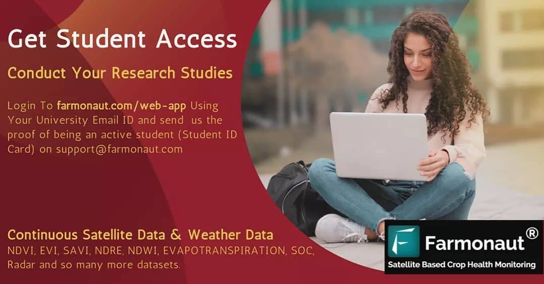
How Students Can Access Farmonaut’s Resources
Getting started with Farmonaut’s student access program is simple:
- Login to Our Web-App: Visit farmonaut.com/web-app and log in using your university email ID.
- Verify Your Student Status: Send us proof of being an active student (Student ID Card) to [email protected].
- Gain Full Access: Once verified, you’ll have comprehensive access to our satellite data and analytical tools.
What Students Gain Access To
Our platform offers a wealth of continuous satellite data and weather information, including but not limited to:
- NDVI (Normalized Difference Vegetation Index)
- EVI (Enhanced Vegetation Index)
- SAVI (Soil-Adjusted Vegetation Index)
- NDRE (Normalized Difference Red Edge)
- NDWI (Normalized Difference Water Index)
- Evapotranspiration data
- SOC (Soil Organic Carbon) estimates
- Radar data
- And many more datasets crucial for agricultural research
The Power of Satellite Data in Agricultural Research
Satellite data has revolutionized the way we approach agricultural research and practice. At Farmonaut, we harness the power of remote sensing to provide invaluable insights into crop health, soil conditions, and environmental factors that influence agriculture. Here’s why satellite data is crucial for modern agricultural research:
1. Wide-Scale Monitoring
Satellite imagery allows researchers to monitor vast areas of farmland simultaneously. This bird’s-eye view is invaluable for understanding large-scale patterns in crop growth, disease spread, and environmental changes.
2. Temporal Analysis
With regular satellite passes, we can collect data over time, enabling researchers to study seasonal changes, crop cycles, and long-term trends in agricultural landscapes.
3. Non-Invasive Observations
Unlike ground-based methods, satellite remote sensing doesn’t disturb the crops or soil, allowing for continuous, non-invasive monitoring of agricultural areas.
4. Multispectral Insights
Satellites equipped with multispectral sensors can capture data across various wavelengths of light. This allows researchers to derive indices like NDVI, which provide detailed information about vegetation health and density.
5. Cost-Effective Research
Compared to traditional field surveys, satellite data can significantly reduce the cost and time required for large-scale agricultural research projects.
Farmonaut’s Satellite System vs. Drone and IoT-based Farm Monitoring
| Feature | Farmonaut Satellite System | Drone-based Monitoring | IoT-based Monitoring |
|---|---|---|---|
| Coverage Area | Large scale (Global) | Limited (Local) | Very Limited (Field-specific) |
| Data Frequency | Regular (Based on satellite pass) | On-demand (Requires manual flight) | Continuous (Real-time) |
| Initial Setup Cost | Low | High | Medium to High |
| Maintenance | Minimal | Regular (Equipment upkeep) | Regular (Sensor maintenance) |
| Data Processing | Automated and scalable | Requires specialized software | Automated but limited in scope |
| Regulatory Constraints | Minimal | Significant (Flight regulations) | Moderate (Depends on sensor type) |
| Weather Dependency | Moderate (Cloud cover can affect) | High (Cannot fly in bad weather) | Low (Operates in most conditions) |
| Scalability | Highly scalable | Limited by equipment and manpower | Scalable but costly for large areas |
Potential Research Areas Using Farmonaut’s Data
With access to our comprehensive satellite data and analytical tools, students can explore a wide range of research topics. Here are some potential areas of study:
1. Crop Yield Prediction Models
Utilize our historical NDVI data along with weather information to develop accurate crop yield prediction models. This research can help in food security planning and agricultural policy-making.
2. Climate Change Impact on Agriculture
Analyze long-term trends in vegetation indices and weather patterns to understand how climate change is affecting crop growth and agricultural productivity in different regions.
3. Precision Agriculture Techniques
Develop new methodologies for precision agriculture using our high-resolution satellite imagery. This could include creating zone-specific management plans for irrigation, fertilization, and pest control.
4. Soil Health Assessment
Use our SOC estimates and other soil-related indices to study soil health across different agricultural landscapes. This research can contribute to sustainable land management practices.
5. Water Resource Management in Agriculture
Leverage our NDWI and evapotranspiration data to study water stress in crops and develop efficient irrigation strategies.
6. Crop Disease Detection
Explore the use of multispectral satellite data for early detection of crop diseases. This research could lead to the development of automated disease warning systems.
7. Land Use Change and Its Impact on Agriculture
Study how changes in land use patterns affect agricultural productivity using our historical satellite imagery.
8. Effectiveness of Conservation Agriculture Practices
Assess the impact of conservation agriculture practices on soil health and crop productivity using our time-series satellite data.
How Farmonaut’s Data Can Enhance Your Research
Our satellite data and analytical tools offer several advantages for agricultural research:
- Comprehensive Coverage: Access data for vast agricultural areas, enabling large-scale studies.
- Historical Data: Analyze trends and patterns over time with our extensive historical dataset.
- Multispectral Analysis: Utilize various spectral bands to derive multiple vegetation indices.
- Integration with Weather Data: Correlate satellite observations with weather patterns for more robust analysis.
- API Access: For advanced users, our API allows direct data integration into your research workflows.
- Mobile App Support: Use our mobile apps (Android, iOS) for field verification and ground-truthing.
Getting Started with Your Research
Once you’ve gained access to our platform, here are some steps to kickstart your research:
- Define Your Research Question: Clearly outline what you aim to investigate using our satellite data.
- Familiarize Yourself with the Platform: Explore our web app and available datasets. Our developer documentation can be a valuable resource.
- Data Collection: Identify the specific datasets and time periods relevant to your research.
- Analysis: Utilize our built-in analytical tools or export data for use with your preferred statistical software.
- Validation: Consider using our mobile app for field validation of your satellite-based observations.
- Seek Support: Don’t hesitate to reach out to our support team if you need guidance or have questions about using our data.
Supporting Your Research Journey
At Farmonaut, we’re committed to supporting your research endeavors. Here’s how we can assist:
- Technical Support: Our team is available to help with any technical questions about using our platform or interpreting the data.
- Research Guidance: If you have an idea but are unsure how to proceed, email us, and we’ll be happy to help you develop your research proposal.
- Collaborative Opportunities: We’re open to collaborations that align with our mission of advancing agricultural technology.
- Publication Support: We encourage you to publish your findings and can provide necessary information about our data and methodologies for your papers.
The Importance of Student Research in Agriculture
We at Farmonaut firmly believe in the power of student research to drive innovation in agriculture. Here’s why we think student contributions are crucial:
- Fresh Perspectives: Students often bring new ideas and approaches to longstanding agricultural challenges.
- Interdisciplinary Insights: Many students combine knowledge from various fields, leading to innovative cross-disciplinary solutions.
- Future Leaders: Today’s student researchers are tomorrow’s agricultural leaders and policymakers.
- Technology Adoption: Students are often at the forefront of adopting and adapting new technologies for agricultural use.
- Sustainable Focus: Many young researchers are passionate about sustainable agriculture, driving research in this critical area.
Future of Agriculture: The Role of Satellite Data and Remote Sensing
As we look to the future of agriculture, satellite data and remote sensing will play an increasingly crucial role. Here’s how we see this technology shaping the future:
- Precision Agriculture at Scale: Satellite data will enable precision agriculture techniques to be applied across vast areas, optimizing resource use and increasing productivity.
- Climate-Smart Agriculture: With better predictive models based on satellite data, farmers will be able to adapt more effectively to changing climate conditions.
- Sustainable Resource Management: Improved monitoring of soil health and water resources will lead to more sustainable agricultural practices.
- Food Security: Accurate crop yield predictions and early warning systems for crop failures will help in better food security planning at national and global levels.
- Ecosystem Services: Satellite data will help in quantifying and monitoring ecosystem services provided by agricultural lands, potentially leading to new revenue streams for farmers.
Join the Agricultural Revolution with Farmonaut
By participating in our student access program, you’re not just conducting research – you’re joining a movement to revolutionize agriculture. Your work could contribute to solving some of the most pressing challenges in food production and environmental sustainability.
We encourage you to take full advantage of this opportunity. Explore our data, push the boundaries of what’s possible with satellite remote sensing, and don’t hesitate to think big. The future of agriculture is in your hands, and we’re here to support you every step of the way.
Ready to Start Your Research Journey?
If you’re ready to begin your research with Farmonaut’s satellite data, here’s what you need to do:
- Visit our web app and create an account using your university email.
- Send your student ID to [email protected] for verification.
- Once verified, explore our datasets and start planning your research.
- Reach out to us if you need any assistance or have questions about using our platform.
We can’t wait to see the innovative research you’ll produce using our satellite data and remote sensing tools. Together, we can drive the future of sustainable and productive agriculture.
Frequently Asked Questions (FAQ)
Q1: Who is eligible for Farmonaut’s student access program?
A: Any active student enrolled in a recognized university or college is eligible. This includes undergraduate, graduate, and doctoral students.
Q2: Is there a cost associated with the student access program?
A: No, the program is completely free for eligible students.
Q3: How long does student access last?
A: Access is typically granted for the duration of your academic year or research project. You may need to revalidate your student status annually.
Q4: Can I use Farmonaut’s data for my thesis or dissertation?
A: Absolutely! We encourage students to use our data for academic research, including theses and dissertations.
Q5: Is technical support available for students?
A: Yes, our technical support team is available to assist students with using the platform and interpreting data.
Q6: Can I publish research based on Farmonaut’s data?
A: Yes, we encourage publication of research using our data. We just ask that you acknowledge Farmonaut as the data source in your publications.
Q7: What types of satellite data are available through Farmonaut?
A: We offer a wide range of satellite data, including various vegetation indices (NDVI, EVI, SAVI, etc.), weather data, soil moisture information, and more.
Q8: How frequently is the satellite data updated?
A: Data update frequency varies depending on the satellite and the specific dataset, but most of our data is updated every few days.
Q9: Can I integrate Farmonaut’s data with other datasets or software?
A: Yes, we offer API access for advanced users who wish to integrate our data into their own systems or software.
Q10: Is training available on how to use Farmonaut’s platform?
A: We provide comprehensive documentation and tutorials. For specific research needs, we can offer additional guidance and support.
Join Farmonaut Today
Ready to take your agricultural research to the next level? Join Farmonaut today and gain access to cutting-edge satellite data and remote sensing tools. Whether you’re studying crop yields, developing new precision agriculture techniques, or exploring the impacts of climate change on farming, our platform has the data and tools you need to succeed.
Don’t miss this opportunity to be at the forefront of agricultural innovation. Sign up now and start your journey towards groundbreaking research in agriculture!
Join us in shaping the future of agriculture. Together, we can create a more sustainable, productive, and resilient agricultural sector. Start your research journey with Farmonaut today!
