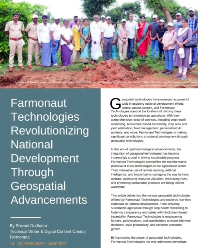
Revolutionizing National Development Through Geospatial Advancements: Farmonaut’s Game-Changing Contributions
In the ever-evolving landscape of agricultural technology, Farmonaut® has emerged as a trailblazer, making significant waves in revolutionizing national development through cutting-edge geospatial advancements. As highlighted in the latest issue of GIS Resources Magazine (Issue 2 | June 2023), our comprehensive range of services is reshaping the agricultural sector and beyond, driving progress across various industries.
At Farmonaut, we’re proud to be at the forefront of utilizing geospatial technologies to address some of the most pressing challenges in agriculture and national development. Our innovative solutions are not just transforming farming practices; they’re paving the way for a more sustainable, efficient, and productive future.
The Farmonaut Revolution: A Comprehensive Overview
Farmonaut’s suite of services is designed to tackle the multifaceted challenges faced by modern agriculture. Let’s delve into the key components that make our platform a game-changer in the industry:
1. Crop Health Monitoring
Our advanced crop health monitoring system is at the heart of Farmonaut’s offerings. Utilizing state-of-the-art satellite imagery and sophisticated algorithms, we provide farmers with real-time insights into the health of their crops. This technology allows for:
- Early detection of pest infestations and diseases
- Identification of nutrient deficiencies
- Optimization of irrigation schedules
- Targeted application of fertilizers and pesticides
By leveraging multispectral satellite images, we can analyze various vegetation indices, including the Normalized Difference Vegetation Index (NDVI), to provide a comprehensive view of crop health across vast areas. This level of monitoring was previously unattainable or prohibitively expensive for many farmers.
2. Blockchain-Based Traceability
In an era where consumers are increasingly concerned about the origin and journey of their food, our blockchain-based traceability solution offers unprecedented transparency in the agricultural supply chain. This innovative system:
- Tracks products from farm to table
- Ensures food safety and quality
- Reduces fraud and enhances consumer trust
- Facilitates easier compliance with regulatory requirements
By integrating blockchain technology into the agricultural supply chain, we’re not just improving traceability; we’re revolutionizing the way consumers interact with and trust their food sources.
3. Crop Area and Yield Estimation
Accurate crop area and yield estimation is crucial for agricultural planning, food security, and economic forecasting. Our advanced geospatial technologies enable:
- Precise measurement of cultivated areas
- Early yield predictions based on historical data and current crop health
- Informed decision-making for farmers and policymakers
- Optimized resource allocation and market planning
By providing reliable estimates well before harvest time, we’re empowering stakeholders across the agricultural sector to make data-driven decisions that can significantly impact productivity and profitability.
4. Fleet Management
Efficient fleet management is essential for large-scale agricultural operations. Our fleet management solution offers:
- Real-time tracking of agricultural vehicles and equipment
- Optimization of routes and resource utilization
- Predictive maintenance alerts
- Fuel consumption monitoring and optimization
By streamlining fleet operations, we’re helping agribusinesses reduce costs, improve efficiency, and minimize their environmental impact.
5. Personalized AI Advisory
Our personalized AI advisory system is a game-changer for farmers of all scales. This intelligent system:
- Provides tailored recommendations based on crop type, local conditions, and historical data
- Offers real-time advice on pest management, fertilization, and irrigation
- Helps farmers make informed decisions to optimize yields and reduce resource waste
- Continuously learns and improves its recommendations based on feedback and results
By putting the power of artificial intelligence in the hands of farmers, we’re democratizing access to expert agricultural knowledge and enabling more sustainable and productive farming practices.
The Impact of Farmonaut’s Geospatial Advancements
The integration of these advanced geospatial technologies into agriculture and related sectors is having a profound impact on national development. Here’s how:
Enhancing Food Security
By improving crop yields, reducing losses, and optimizing resource use, our technologies are directly contributing to enhanced food security at both local and national levels. The ability to accurately estimate crop yields and monitor crop health in real-time allows for better planning and distribution of food resources.
Boosting Economic Growth
The increased efficiency and productivity in agriculture translate to economic benefits for farmers, agribusinesses, and the national economy as a whole. Our solutions help reduce costs, increase profits, and create new job opportunities in the agtech sector.
Promoting Sustainable Agriculture
Our technologies enable more precise and efficient use of resources such as water, fertilizers, and pesticides. This not only reduces the environmental impact of agriculture but also ensures long-term sustainability of farming practices.
Empowering Small-Scale Farmers
By making advanced agricultural technologies accessible and affordable, we’re leveling the playing field for small-scale farmers. This democratization of technology contributes to rural development and helps reduce income disparities.
Facilitating Evidence-Based Policymaking
The wealth of data generated by our geospatial technologies provides policymakers with valuable insights for crafting informed agricultural policies, subsidy distributions, and development strategies.
Farmonaut vs. Traditional Monitoring Methods
To truly appreciate the revolutionary nature of Farmonaut’s satellite-based system, it’s essential to compare it with traditional farm monitoring methods like drones and IoT devices. Here’s a comparative table highlighting the advantages of our approach:
| Feature | Farmonaut Satellite System | Drone-based Monitoring | IoT-based Monitoring |
|---|---|---|---|
| Coverage Area | Vast (Global) | Limited (Local) | Very Limited (Point-based) |
| Frequency of Data Collection | Daily to Weekly | As needed (Manual flights) | Continuous (for installed sensors) |
| Initial Setup Cost | Low | High | Medium to High |
| Operational Complexity | Low (Cloud-based) | High (Requires skilled operators) | Medium (Requires maintenance) |
| Weather Dependency | Low | High | Medium |
| Scalability | Highly Scalable | Limited Scalability | Moderately Scalable |
| Data Processing | Automated (AI/ML) | Semi-automated | Automated for specific parameters |
| Regulatory Compliance | Easy | Complex (Aviation regulations) | Moderate |
As evident from the comparison, Farmonaut’s satellite-based system offers unparalleled advantages in terms of coverage, cost-effectiveness, and ease of use, making it the superior choice for comprehensive farm monitoring and management.
The Future of Agriculture with Farmonaut
As we continue to innovate and expand our services, the future of agriculture with Farmonaut looks incredibly promising. Here are some of the developments we’re excited about:
Integration with Emerging Technologies
We’re constantly exploring ways to integrate our geospatial technologies with other emerging technologies such as 5G, edge computing, and advanced IoT sensors. This convergence will enable even more precise and real-time agricultural insights.
Expansion of AI Capabilities
Our AI advisory system is continuously learning and improving. In the future, we anticipate it will be able to provide even more sophisticated and accurate recommendations, potentially even automating certain aspects of farm management.
Enhanced Climate Resilience
As climate change continues to pose challenges to agriculture, our technologies will play a crucial role in developing climate-resilient farming practices. By providing accurate climate data and predictions, we’ll help farmers adapt to changing conditions more effectively.
Broader Applications in Environmental Conservation
While our current focus is primarily on agriculture, the potential applications of our geospatial technologies in environmental conservation are vast. From monitoring deforestation to tracking wildlife populations, we see numerous opportunities to contribute to global conservation efforts.
How to Get Started with Farmonaut
Ready to revolutionize your farming practices with Farmonaut? Here’s how you can get started:
- Visit our website: Farmonaut App
- Explore our API documentation: Farmonaut API
- Download our mobile app:
- Android: Google Play Store
- iOS: Apple App Store
- For developers, check out our detailed API documentation: Farmonaut API Docs
Subscribe to Farmonaut
Ready to take your farming to the next level? Subscribe to Farmonaut today and unlock the full potential of your agricultural operations:
Frequently Asked Questions (FAQ)
To help you better understand Farmonaut and our services, we’ve compiled a list of frequently asked questions:
Q: What is Farmonaut?
A: Farmonaut is a pioneering agricultural technology company that offers advanced, satellite-based farm management solutions. We use geospatial technologies, AI, and blockchain to provide services such as crop health monitoring, yield estimation, and personalized advisory.
Q: How does Farmonaut’s crop health monitoring work?
A: Our crop health monitoring system uses multispectral satellite imagery to analyze various vegetation indices, including NDVI. This allows us to assess crop health, detect stress, and identify potential issues early on.
Q: Is Farmonaut suitable for small-scale farmers?
A: Absolutely! We’ve designed our solutions to be accessible and affordable for farmers of all scales. Our tiered pricing model ensures that small-scale farmers can benefit from our advanced technologies without breaking the bank.
Q: How accurate is Farmonaut’s yield estimation?
A: Our yield estimation is highly accurate, thanks to our advanced algorithms that consider multiple factors including historical data, current crop health, and environmental conditions. However, the exact accuracy can vary depending on the crop type and specific conditions.
Q: Can Farmonaut integrate with my existing farm management software?
A: Yes, we offer API access that allows for integration with various farm management software. Our team can work with you to ensure smooth integration with your existing systems.
Q: How often is satellite data updated?
A: The frequency of satellite data updates can vary depending on your subscription tier and location. Generally, we offer updates ranging from daily to weekly, ensuring you always have access to recent data.
Q: Is my data secure with Farmonaut?
A: Absolutely. We take data security very seriously and employ industry-standard encryption and security measures to protect your information. Our blockchain-based systems also ensure the integrity and immutability of data where applicable.
Q: Does Farmonaut work in all countries?
A: Farmonaut’s satellite-based system has global coverage. However, the availability of certain features may vary depending on local regulations and satellite coverage in specific regions. Contact us to learn about service availability in your area.
Q: How can I learn more about using Farmonaut effectively?
A: We offer comprehensive documentation, video tutorials, and customer support to help you make the most of our platform. Additionally, we regularly conduct webinars and training sessions for our users.
Q: What sets Farmonaut apart from other agtech solutions?
A: Farmonaut stands out due to our comprehensive approach that combines satellite technology, AI, and blockchain. Our focus on affordability, scalability, and user-friendliness makes advanced agtech accessible to a wide range of users, from small-scale farmers to large agribusinesses.
Conclusion
As we continue to push the boundaries of what’s possible with geospatial technologies in agriculture, Farmonaut remains committed to our mission of making precision agriculture accessible and affordable for farmers worldwide. Our contributions to national development through these advancements are just the beginning of a broader transformation in how we approach agriculture, resource management, and sustainable development.
We invite you to join us on this exciting journey towards a more efficient, productive, and sustainable agricultural future. Whether you’re a farmer looking to optimize your operations, an agribusiness seeking to improve your supply chain, or a policymaker interested in leveraging data for better decision-making, Farmonaut has the tools and expertise to help you succeed.
Together, we can revolutionize agriculture and drive meaningful progress in national development. The future of farming is here, and it’s powered by Farmonaut.
