Revolutionizing Agriculture: Monitoring Rabi Crops, Tracking Cyclones, and Rapid Field Mapping with Satellite Technology
In today’s rapidly evolving agricultural landscape, staying ahead of the curve is crucial for farmers and agribusinesses alike. At Farmonaut, we’re at the forefront of this revolution, harnessing the power of satellite technology to transform the way we monitor crops, track weather patterns, and manage farmlands. Our innovative solutions are designed to help farmers world monitor their fields with unprecedented precision and efficiency.
The Power of Satellite Technology in Modern Agriculture
Satellite technology has emerged as a game-changer in the agricultural sector, offering a bird’s-eye view of vast farmlands and providing invaluable data that was previously unattainable. With our advanced satellite-based solutions, we’re enabling farmers to:
- Monitor crop health in real-time
- Track weather patterns and potential natural disasters
- Map and analyze fields quickly and accurately
- Make data-driven decisions to optimize yield and reduce waste
Let’s delve deeper into how our satellite technology is revolutionizing various aspects of agriculture, from crop monitoring to disaster preparedness.
Monitoring Rabi Crops with Precision
Rabi crops, sown in winter and harvested in spring, are a crucial part of India’s agricultural cycle. Our satellite-based monitoring system provides farmers with a powerful tool to keep a close eye on these important crops throughout their growth cycle.
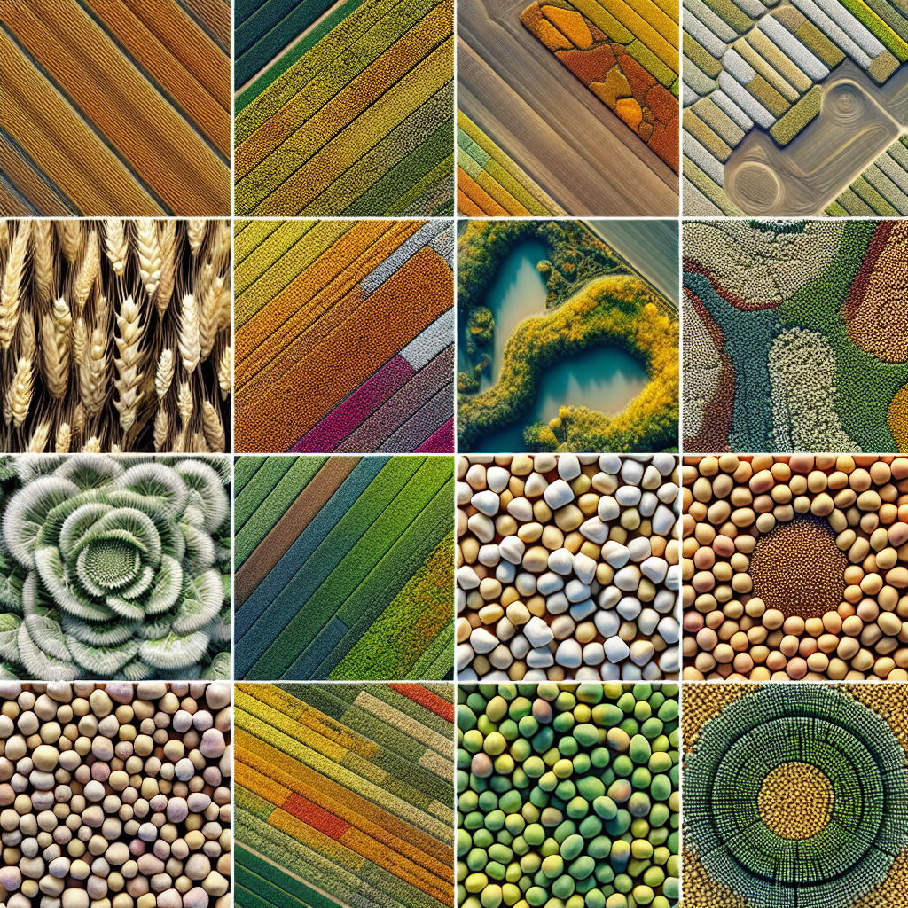
Rabi Crops Images with Names: A Visual Guide
Our platform offers high-resolution satellite imagery of rabi crops, allowing farmers to visually assess crop health and progress. Here’s a brief overview of some common rabi crops and how they appear in satellite imagery:
- Wheat: Appears as a uniform green carpet in early stages, transitioning to golden as it matures.
- Mustard: Distinctive bright yellow flowers are visible during the flowering stage.
- Chickpeas: Show up as a light green to bluish-green color, with a more compact growth pattern.
- Barley: Similar to wheat but with a slightly lighter green hue.
- Peas: Appear as a bright green, often with a more irregular field pattern due to their climbing nature.
By providing clear, named images of these crops at various growth stages, we help farmers quickly identify and monitor their specific rabi crops, enabling them to make informed decisions about irrigation, fertilization, and pest control.
Benefits of Satellite-Based Rabi Crop Monitoring
- Early detection of crop stress or disease outbreaks
- Optimization of water and fertilizer use
- Accurate yield prediction
- Timely intervention for pest and weed control
- Improved planning for harvest and post-harvest activities
Our advanced algorithms analyze multispectral satellite data to provide insights into crop health, soil moisture levels, and potential issues, allowing farmers to take proactive measures to protect and nurture their rabi crops.
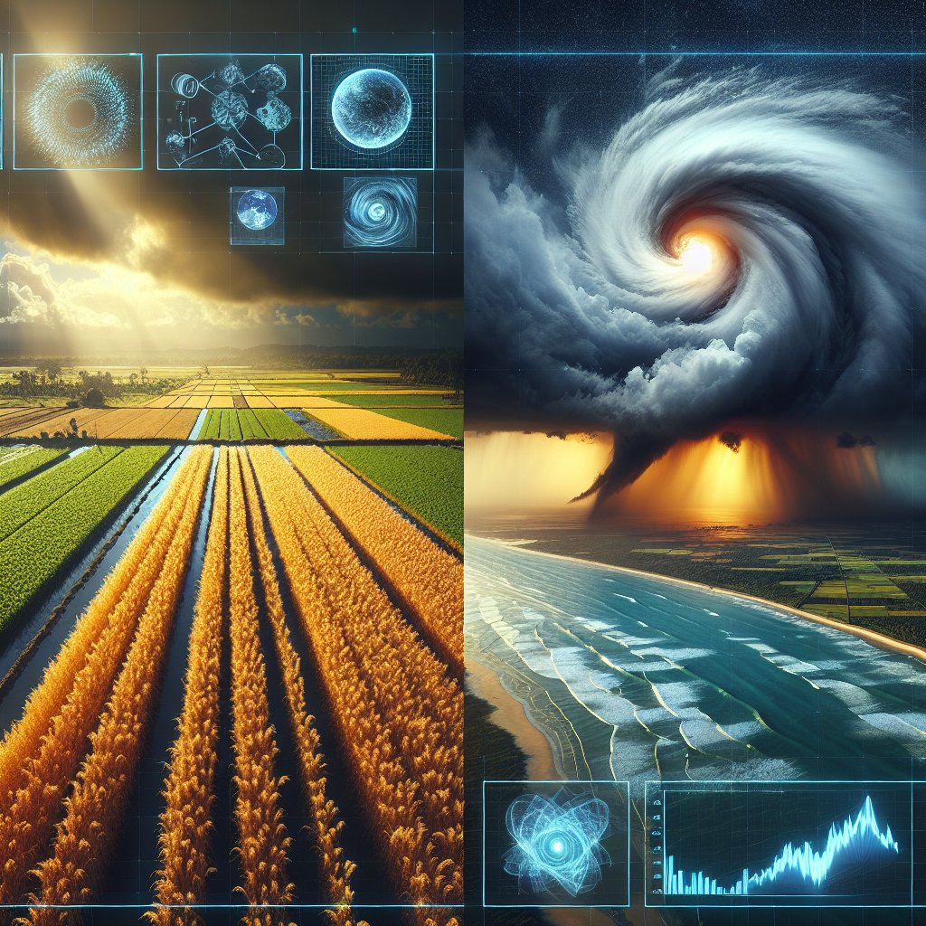
Tracking Cyclones and Extreme Weather Events
In coastal regions and areas prone to extreme weather, the ability to track and prepare for cyclones and other severe weather events is crucial for agricultural success. Our platform integrates data from various sources, including INSAT images of cyclones, to provide farmers with up-to-date information on approaching storms and their potential impact on crops.
Utilizing INSAT Images for Cyclone Tracking
The Indian National Satellite (INSAT) system plays a vital role in weather monitoring and cyclone tracking. We incorporate INSAT images of cyclones into our platform, offering farmers:
- Real-time updates on cyclone formation and movement
- Predictive models for cyclone paths and intensity
- Early warning systems for potentially affected areas
- Recommendations for crop protection measures
By leveraging these INSAT images, we help farmers prepare for and mitigate the impact of cyclones on their crops, potentially saving millions in agricultural losses.
Beyond Cyclones: Comprehensive Weather Monitoring
Our weather monitoring capabilities extend beyond cyclone tracking. We provide farmers with a comprehensive suite of weather data, including:
- Precipitation forecasts
- Temperature trends
- Wind patterns
- Humidity levels
- Extreme weather alerts (heatwaves, frost, etc.)
This wealth of weather information enables farmers to make informed decisions about planting, irrigation, and harvesting, optimizing their crop management strategies in the face of changing climate conditions.
Rapid Field Mapping and Monitoring
One of the most significant advantages of our satellite-based technology is the ability to map and monitor crops quickly and efficiently. Traditional field surveying methods are time-consuming and labor-intensive, but with our advanced satellite imagery and AI-powered analysis, farmers can gain insights into their fields in a matter of minutes.
How We Map and Monitor Crops Quickly
- High-Frequency Satellite Imagery: We utilize a network of satellites to capture frequent, high-resolution images of agricultural areas.
- AI-Powered Analysis: Our advanced algorithms process these images, identifying crop types, assessing health, and detecting anomalies.
- User-Friendly Interface: Farmers can access detailed field maps and reports through our intuitive web and mobile applications.
- Real-Time Updates: Our system continuously updates field data, providing farmers with the most current information available.
- Custom Alerts: Users can set up personalized alerts for specific conditions or changes in their fields.
This rapid mapping and monitoring capability allows farmers to:
- Identify areas of crop stress or damage quickly
- Monitor crop growth stages across large areas
- Detect pest infestations or disease outbreaks early
- Assess the impact of weather events on specific field sections
- Plan and optimize field operations more effectively
By providing this level of detailed, up-to-date information, we empower farmers to make swift, data-driven decisions that can significantly impact their crop yields and overall farm productivity.
Farmonaut: Your Partner in Precision Agriculture
At Farmonaut, we’re committed to making precision agriculture accessible and affordable for farmers worldwide. Our comprehensive platform offers a range of tools and services designed to optimize every aspect of farm management:
- Satellite-based crop health monitoring
- AI-powered advisory system (Jeevn AI)
- Blockchain-based product traceability
- Fleet and resource management tools
- Carbon footprint tracking
By integrating these advanced technologies, we provide a holistic solution that addresses the diverse needs of modern agriculture.
Why Choose Farmonaut?
| Feature | Farmonaut Satellite System | Drone-based Monitoring | IoT-based Monitoring |
|---|---|---|---|
| Coverage Area | Large scale (Global) | Limited (Local) | Limited (Field-specific) |
| Data Frequency | Daily to weekly | On-demand (weather dependent) | Continuous (limited by sensor battery life) |
| Initial Setup Cost | Low | High (drone purchase) | Medium to High (sensor deployment) |
| Operational Complexity | Low (cloud-based) | High (requires trained pilots) | Medium (requires maintenance) |
| Data Analysis | Advanced AI-powered analysis | Manual or semi-automated | Automated, but limited to sensor data |
| Scalability | Highly scalable | Limited by drone fleet size | Limited by sensor deployment |
| Weather Independence | High (cloud penetration capabilities) | Low (affected by wind, rain) | Medium (some sensors weather-sensitive) |
As you can see, our satellite-based system offers numerous advantages over traditional monitoring methods, providing a more comprehensive, scalable, and cost-effective solution for modern farmers.
Getting Started with Farmonaut
Ready to revolutionize your farming practices? Getting started with Farmonaut is easy:
- Visit our web application or download our mobile app for Android or iOS.
- Create an account and select your subscription plan.
- Input your field boundaries or import existing field data.
- Start receiving insights and recommendations tailored to your farm!
For developers and businesses looking to integrate our powerful satellite and weather data into their own systems, we offer comprehensive API access. Check out our API documentation to learn more about how you can leverage Farmonaut’s technology in your applications.
Subscription Plans
Choose the plan that best fits your needs and start optimizing your farm management today:
Conclusion: Embracing the Future of Agriculture
As we face the challenges of feeding a growing global population in an era of climate change and resource scarcity, innovative solutions like Farmonaut are more critical than ever. By harnessing the power of satellite technology, AI, and blockchain, we’re empowering farmers to:
- Increase crop yields
- Reduce resource waste
- Mitigate the impact of extreme weather events
- Make data-driven decisions for sustainable farming
Join us in revolutionizing agriculture and building a more sustainable, productive future for farming worldwide. With Farmonaut, the power to monitor, analyze, and optimize your farm is at your fingertips.
Frequently Asked Questions (FAQ)
- Q: How often are satellite images updated on the Farmonaut platform?
A: Image frequency varies depending on the subscription plan, ranging from daily to weekly updates. Premium plans offer more frequent imagery. - Q: Can Farmonaut’s technology work for small farms?
A: Absolutely! Our solutions are scalable and designed to benefit farms of all sizes, from small holdings to large commercial operations. - Q: Is internet connectivity required to use Farmonaut?
A: Internet connectivity is needed to access real-time data and updates. However, some features of our mobile app can work offline with previously downloaded data. - Q: How accurate is the weather forecasting for cyclone tracking?
A: Our weather forecasts, including cyclone tracking, are highly accurate as they integrate data from multiple sources, including INSAT images and international meteorological agencies. - Q: Can Farmonaut help with crop insurance claims?
A: Yes, our detailed satellite imagery and crop health data can provide valuable evidence for crop insurance claims, helping to streamline the process and ensure fair assessments. - Q: Is training provided on how to use the Farmonaut platform?
A: Yes, we offer comprehensive training resources, including video tutorials, user guides, and customer support to help you make the most of our platform. - Q: How does Farmonaut ensure data privacy and security?
A: We take data privacy seriously, employing industry-standard encryption and security protocols to protect your farm data. Our blockchain technology also ensures the integrity and traceability of data. - Q: Can Farmonaut’s system detect specific crop diseases?
A: While our system can detect anomalies and signs of stress in crops, specific disease identification often requires additional on-ground verification. However, our AI models are continuously improving in disease detection capabilities. - Q: Is Farmonaut available worldwide?
A: Yes, our satellite-based technology allows us to offer services globally. However, some features may vary depending on the region due to differences in satellite coverage and local regulations. - Q: How does Farmonaut compare to traditional field scouting methods?
A: Farmonaut complements traditional scouting by providing a comprehensive, bird’s-eye view of entire fields quickly. This allows for more targeted and efficient on-ground scouting, saving time and resources.
Have more questions? Don’t hesitate to reach out to our support team. We’re here to help you make the most of our revolutionary agricultural technology!