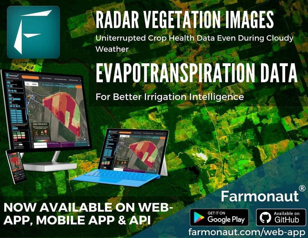
Revolutionizing Crop Health Monitoring: Farmonaut Introduces Radar Vegetation Images and Evapotranspiration Data
At Farmonaut, we’re constantly striving to push the boundaries of agricultural technology and provide farmers with the most advanced tools for crop management. Today, we’re thrilled to announce a significant enhancement to our satellite-based crop health monitoring offerings. We’re introducing two new types of satellite data that will revolutionize the way farmers monitor and manage their crops: Radar Vegetation Images and Evapotranspiration Data.
Expanding Our Satellite-Based Crop Health Monitoring Suite
Our commitment to providing state-of-the-art technologies to farmers has led us to integrate these new data types into our existing platform. From now on, all users of the Farmonaut Platform – including web users, smartphone app users, and API users – will have access to these advanced features alongside our already comprehensive suite of satellite images.
Let’s dive deeper into why these new data types are game-changers for precision agriculture and how they can benefit farmers around the world.
Synthetic Aperture Radar (SAR) Images: Seeing Through the Clouds
One of the most significant challenges in satellite-based crop monitoring has been the interference of cloud cover, especially during rainy seasons. Cloudy weather can interrupt the capture of crucial crop health metrics, leaving farmers in the dark about the state of their fields. This is where Synthetic Aperture Radar (SAR) technology comes to the rescue.
Why SAR Images are Revolutionary
- Cloud Penetration: SAR can penetrate clouds, ensuring a consistent supply of reliable data throughout the year, regardless of weather conditions.
- All-Weather Capability: SAR images can be captured day or night, in any weather condition, providing uninterrupted monitoring of crop health.
- Enhanced Information: SAR data can provide additional insights such as:
- Phenological stage of cropland
- Growth dynamics
- Crop-type differentiation
The introduction of SAR images to our platform marks a significant leap forward in our crop health monitoring capabilities. Farmers can now rely on consistent, accurate data even during periods of extended cloud cover, ensuring they never miss critical information about their crops’ health and development.
Evapotranspiration Data: Understanding Water Dynamics
Evapotranspiration (ET) is a crucial component of the soil water balance and plays a major role in determining potential yields in agriculture. By incorporating ET data into our platform, we’re providing farmers with invaluable insights into their crops’ water usage and needs.
The Importance of Evapotranspiration in Agriculture
Evapotranspiration is a key variable in numerous agricultural disciplines, including:
- Irrigation management
- Crop growth monitoring
- Hydrologic cycle analysis
- Plant physiology studies
- Soil-plant-water-atmosphere relationship understanding
- Microclimate and surface interactions
- Drainage studies
By providing accurate ET data, we’re empowering farmers to make more informed decisions about water management, potentially leading to significant improvements in water use efficiency and crop yields.
The Power of Integrated Data
The addition of Radar Vegetation Images and Evapotranspiration Data to our existing suite of satellite imagery creates a powerful, comprehensive toolkit for farmers. This integrated approach to crop health monitoring allows for a more nuanced understanding of field conditions and crop needs.
Benefits of Our Enhanced Platform
- Uninterrupted Monitoring: SAR images ensure continuous monitoring, even in cloudy conditions.
- Improved Water Management: ET data helps optimize irrigation strategies and water use efficiency.
- Enhanced Crop Health Insights: The combination of multiple data types provides a more complete picture of crop health and field conditions.
- Better Decision Making: With more comprehensive data, farmers can make more informed decisions about crop management practices.
- Increased Yields: By optimizing resource use and responding quickly to potential issues, farmers can potentially increase their yields.
Farmonaut’s Commitment to Innovation
At Farmonaut, we believe in constantly adapting and improving our offerings to meet the evolving needs of farmers. The introduction of Radar Vegetation Images and Evapotranspiration Data is just the latest step in our ongoing quest to provide cutting-edge technologies to the agricultural community.
We understand that the future of farming lies in precision agriculture, and we’re committed to making these advanced technologies accessible and affordable to farmers of all sizes. Our platform is designed to be user-friendly, allowing farmers to easily integrate these new data types into their existing workflows.
How Farmonaut’s Satellite System Compares to Drone and IoT-based Farm Monitoring
| Feature | Farmonaut Satellite System | Drone-based Monitoring | IoT-based Monitoring |
|---|---|---|---|
| Coverage Area | Large scale (entire farms) | Limited by flight time and regulations | Limited by sensor placement |
| Frequency of Data Collection | Regular intervals (as frequent as daily) | Dependent on manual flights | Continuous but localized |
| Weather Dependency | Low (with SAR technology) | High | Low |
| Initial Setup Cost | Low | High | Medium to High |
| Maintenance Required | Minimal | Regular (drone maintenance) | Regular (sensor maintenance) |
| Data Processing | Automated | Often requires manual processing | Automated |
| Scalability | Highly scalable | Limited scalability | Moderately scalable |
Getting Started with Farmonaut’s Enhanced Platform
We’re excited to offer these new features to all our users, and we’ve made it easy to get started:
- Web App Users: Simply log in to your account at https://farmonaut.com/app_redirect to access the new data types.
- Mobile App Users: Update your Farmonaut app to the latest version on Google Play Store or Apple App Store.
- API Users: Check out our updated API documentation at https://farmonaut.com/farmonaut-satellite-weather-api-developer-docs/ to learn how to integrate the new data types into your systems.
The Future of Precision Agriculture with Farmonaut
As we continue to push the boundaries of what’s possible in agricultural technology, we remain committed to our core mission: making precision agriculture accessible and affordable for farmers worldwide. The introduction of Radar Vegetation Images and Evapotranspiration Data is a significant step towards this goal, but it’s far from the last innovation you can expect from us.
We’re constantly researching and developing new ways to leverage satellite technology, artificial intelligence, and data analytics to provide even more valuable insights to farmers. Some areas we’re exploring include:
- Advanced crop yield prediction models
- Integration of machine learning for pest and disease detection
- Enhanced weather forecasting for localized micro-climates
- Further improvements in remote sensing technologies
Our commitment to innovation is driven by our belief in the power of technology to transform agriculture. By providing farmers with the tools they need to make data-driven decisions, we’re not just improving individual farm productivity – we’re contributing to global food security and sustainable agricultural practices.
Join the Farmonaut Community
We invite you to join the growing community of farmers, agronomists, and agricultural professionals who are leveraging Farmonaut’s cutting-edge technology to revolutionize their farming practices. Whether you’re managing a small family farm or overseeing large-scale agricultural operations, our platform is designed to meet your needs and help you achieve your goals.
To get started with Farmonaut and experience the benefits of our enhanced crop health monitoring system, including the new Radar Vegetation Images and Evapotranspiration Data. Join us on this journey,
Conclusion: Embracing the Future of Agriculture
The introduction of Radar Vegetation Images and Evapotranspiration Data to the Farmonaut platform marks a significant milestone in our journey to revolutionize agriculture through technology. These new data types, combined with our existing suite of satellite-based monitoring tools, provide farmers with unprecedented insights into their crops and fields.
As we continue to innovate and expand our offerings, we remain committed to our core values of accessibility, affordability, and sustainability. We believe that by empowering farmers with advanced technologies and data-driven insights, we can help create a more resilient and productive agricultural sector that’s capable of meeting the challenges of the 21st century.
We’re excited about the future of agriculture and the role that Farmonaut will play in shaping it. Join us on this journey, and let’s work together to cultivate a smarter, more sustainable future for farming.
Frequently Asked Questions (FAQ)
- Q: What is the Radar Vegetation Index (RVI)?
A: The Radar Vegetation Index (RVI) is a measure derived from Synthetic Aperture Radar (SAR) data that provides information about vegetation structure and biomass. Unlike optical indices, RVI can be obtained regardless of cloud cover or time of day, making it a valuable tool for continuous crop monitoring. - Q: How does evapotranspiration data help in farm management?
A: Evapotranspiration data helps farmers understand the water requirements of their crops more accurately. This information is crucial for optimizing irrigation schedules, improving water use efficiency, and ultimately enhancing crop yields while conserving water resources. - Q: Can Farmonaut’s satellite-based monitoring replace ground-level observations?
A: While Farmonaut’s satellite-based monitoring provides valuable insights, it’s designed to complement rather than replace ground-level observations. The combination of satellite data and on-the-ground assessments offers the most comprehensive understanding of crop health and field conditions. - Q: How often is the satellite data updated?
A: The frequency of data updates depends on the specific satellite and the type of data. Generally, we provide updates every few days, but with the addition of SAR technology, we can now offer more consistent data even in cloudy conditions. - Q: Is Farmonaut’s platform suitable for small-scale farmers?
A: Yes, Farmonaut’s platform is designed to be accessible and affordable for farmers of all scales, including small-scale farmers. We offer flexible pricing options to ensure that our technology is within reach for a wide range of users. - Q: How does Farmonaut ensure the accuracy of its satellite data?
A: We use a combination of high-resolution satellite imagery, advanced algorithms, and ground-truthing techniques to ensure the accuracy of our data. Our team of experts continually refines our methods to provide the most reliable information possible. - Q: Can Farmonaut’s platform integrate with other farm management software?
A: Yes, Farmonaut offers API access that allows for integration with other farm management software. This enables farmers to incorporate our satellite data and insights into their existing workflows and systems. - Q: What support does Farmonaut offer to help users understand and utilize the new data types?
A: We provide comprehensive documentation, video tutorials, and customer support to help users make the most of our platform, including the new Radar Vegetation Images and Evapotranspiration Data. We also offer webinars and training sessions for those who want to dive deeper into the technology. - Q: How does Farmonaut’s satellite monitoring compare to drone-based solutions?
A: While drones can provide high-resolution imagery, Farmonaut’s satellite-based monitoring offers several advantages, including broader coverage, more frequent updates, and the ability to monitor crops regardless of weather conditions or flight restrictions. Our solution is also more scalable and cost-effective for monitoring large areas. - Q: Is Farmonaut’s platform available worldwide?
A: Yes, Farmonaut’s satellite-based monitoring services are available globally. Our platform can be used by farmers and agricultural professionals in any country, providing valuable insights for a wide range of crops and climates.
We hope this FAQ section has addressed some of your questions about Farmonaut’s enhanced crop health monitoring platform. If you have any further questions or need additional information, please don’t hesitate to reach out to our support team. We’re here to help you make the most of our advanced agricultural technology solutions.
