Unveiling Cloud Patterns: A Comprehensive Guide to Satellite Cloud Coverage Images Over India

In the ever-evolving field of meteorology and remote sensing, satellite cloud coverage plays a crucial role in understanding weather patterns, climate change, and atmospheric dynamics. At Farmonaut, we recognize the importance of these cloud images from satellite sources in various applications, including agriculture, disaster management, and environmental monitoring. In this comprehensive guide, we’ll delve deep into the world of satellite image cloud cover, with a special focus on satellite images of clouds over India.
Understanding Cloud Satellites: The Basics
Before we dive into the intricacies of cloud coverage analysis, let’s address a fundamental question: What is a cloud satellite? A cloud satellite is a specialized Earth observation satellite designed to capture images and data related to cloud formations, atmospheric conditions, and weather patterns. These satellites are equipped with advanced sensors and imaging systems that allow them to provide valuable information about the Earth’s atmosphere from space.
Types of Cloud Satellites
- Geostationary satellites
- Polar-orbiting satellites
- Low Earth orbit (LEO) satellites
Each type of satellite offers unique advantages in terms of coverage, resolution, and data frequency. At Farmonaut, we utilize a combination of these satellite types to provide comprehensive cloud coverage data for agricultural applications.
The Importance of Satellite Cloud Coverage Images
Cloud images from satellites are invaluable for a variety of reasons:
- Weather forecasting and prediction
- Climate change monitoring
- Agricultural planning and management
- Disaster preparedness and response
- Aviation safety
In the context of agriculture, which is our primary focus at Farmonaut, satellite view cloud cover data helps farmers and agribusinesses make informed decisions about planting, irrigation, and crop management.
Analyzing Satellite Images of Clouds Over India
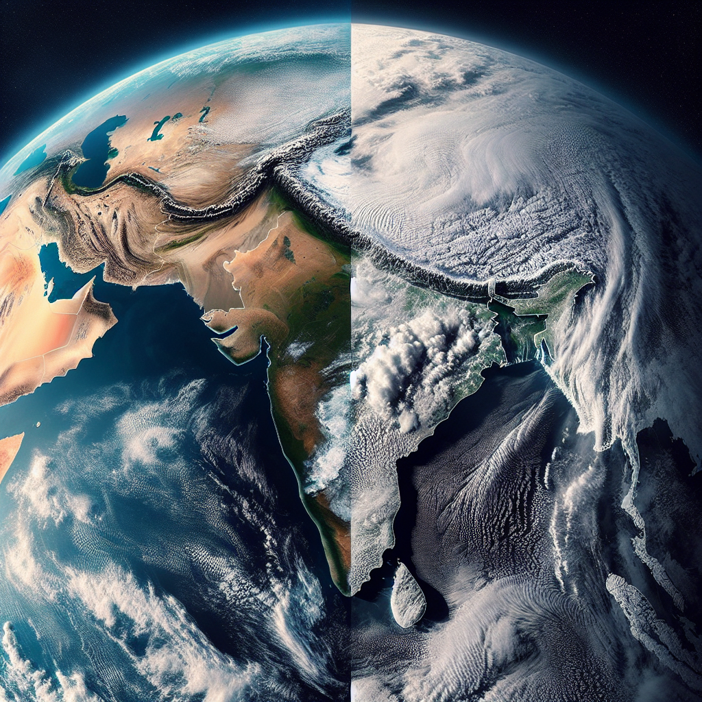
India’s diverse geography and climate make it a fascinating subject for cloud coverage analysis. From the monsoon patterns in the south to the Himalayan cloud formations in the north, satellite images of clouds over India reveal a complex and dynamic atmospheric landscape.
Key Features of Cloud Coverage Over India
- Monsoon cloud patterns
- Western Disturbances
- Cyclonic formations in the Bay of Bengal and Arabian Sea
- Orographic clouds over the Western Ghats and Himalayas
At Farmonaut, we analyze these patterns to provide precise agricultural insights for farmers across India. Our satellite-based crop health monitoring system takes into account cloud coverage to deliver accurate vegetation health assessments and irrigation recommendations.
The Technology Behind Satellite Cloud Imagery
The process of capturing and analyzing cloud images from satellites involves sophisticated technology and data processing techniques. Here’s an overview of the key components:
1. Satellite Sensors
Modern cloud satellites use a variety of sensors to capture detailed information about cloud formations:
- Visible light sensors
- Infrared sensors
- Microwave radiometers
- Spectroradiometers
These sensors work in concert to provide a comprehensive view of cloud structures, density, and altitude.
2. Data Transmission and Processing
Once the satellite image cloud cover data is captured, it’s transmitted to ground stations for processing. This involves:
- Signal reception and decoding
- Data calibration and correction
- Image reconstruction and enhancement
- Cloud detection and classification algorithms
At Farmonaut, we’ve developed advanced algorithms that integrate this cloud coverage data with other meteorological and agricultural parameters to provide actionable insights for farmers.
3. Cloud Analysis Techniques
Analyzing cloud images from satellites involves several sophisticated techniques:
- Spectral analysis
- Texture analysis
- Pattern recognition
- Machine learning and AI-based classification
These techniques allow us to extract valuable information about cloud types, precipitation potential, and atmospheric conditions.
Applications of Satellite Cloud Coverage Data in Agriculture
At Farmonaut, we leverage satellite view cloud cover data to provide a range of services for the agricultural sector:
1. Crop Health Monitoring
By analyzing cloud patterns and their impact on sunlight availability, we can provide more accurate assessments of crop health and growth stages.
2. Irrigation Management
Cloud coverage data helps in predicting precipitation and evapotranspiration rates, allowing for more efficient irrigation planning.
3. Pest and Disease Forecasting
Certain cloud patterns and atmospheric conditions can indicate increased risk of pest infestations or disease outbreaks. Our system uses this data to provide early warnings to farmers.
4. Yield Prediction
By integrating cloud coverage data with other parameters, we can provide more accurate yield predictions, helping farmers and agribusinesses in their planning and decision-making processes.
Farmonaut’s Approach to Satellite-Based Farm Monitoring
While drones and IoT devices have their place in precision agriculture, satellite-based monitoring offers unique advantages. Here’s how Farmonaut’s satellite system compares to drone and IoT-based farm monitoring:
| Feature | Farmonaut Satellite System | Drone-based Monitoring | IoT-based Monitoring |
|---|---|---|---|
| Coverage Area | Large scale (hundreds to thousands of hectares) | Limited (few hectares per flight) | Limited to sensor placement |
| Frequency of Data | Daily to weekly updates | On-demand, limited by flight regulations | Real-time, but localized |
| Cost-effectiveness | High (no on-site equipment needed) | Moderate (equipment and operator costs) | Variable (depends on sensor density) |
| Weather Independence | High (can penetrate clouds with radar) | Low (affected by wind and rain) | Moderate (some sensors weather-dependent) |
| Data Integration | Seamless integration with global datasets | Limited to local data | Limited to sensor network |
Our satellite-based system offers a comprehensive, cost-effective solution for large-scale farm monitoring, complementing on-ground technologies for a holistic approach to precision agriculture.
The Future of Satellite Cloud Coverage Analysis
As technology advances, we anticipate several exciting developments in the field of satellite image cloud cover analysis:
- Higher resolution imagery
- Improved data processing speeds
- Integration with AI and machine learning for more accurate predictions
- Enhanced 3D modeling of cloud structures
- Real-time cloud tracking and analysis
At Farmonaut, we’re committed to staying at the forefront of these technological advancements, continually improving our services to provide the best possible insights for our agricultural clients.
Conclusion
The world of satellite cloud coverage imagery is vast and complex, offering invaluable insights for various sectors, particularly agriculture. As we’ve explored in this guide, cloud images from satellites play a crucial role in understanding weather patterns, predicting crop health, and managing agricultural resources efficiently.
At Farmonaut, we’re proud to be at the forefront of this technology, leveraging advanced satellite data to provide cutting-edge solutions for farmers and agribusinesses. Our commitment to innovation and precision agriculture drives us to continually improve our services, making the most of every satellite image of clouds over India and beyond.
To experience the power of satellite-based farm management firsthand, we invite you to try our services. Visit our app or explore our API for developers. You can also download our mobile apps for Android and iOS.
For those interested in integrating our satellite and weather data into their own systems, check out our API documentation.
Subscribe to Farmonaut
FAQs
Q: What is the difference between geostationary and polar-orbiting satellites for cloud coverage?
A: Geostationary satellites remain fixed over a specific point on Earth, providing continuous coverage of the same area. Polar-orbiting satellites circle the Earth from pole to pole, offering global coverage but with less frequent revisits to the same location.
Q: How often are satellite cloud images updated?
A: The frequency of updates depends on the satellite type. Geostationary satellites can provide images as frequently as every 5-15 minutes, while polar-orbiting satellites typically offer daily or twice-daily coverage of a specific area.
Q: Can satellite cloud images see through clouds?
A: While visible light sensors cannot penetrate clouds, certain types of satellites equipped with microwave or infrared sensors can provide information about cloud thickness, altitude, and even some data about conditions beneath the clouds.
Q: How does Farmonaut use satellite cloud coverage data for agriculture?
A: We integrate cloud coverage data with other satellite and ground-based information to provide insights on crop health, irrigation needs, potential weather risks, and yield predictions. This helps farmers make informed decisions about their agricultural practices.
Q: Are satellite-based farm monitoring systems more cost-effective than drones or IoT devices?
A: In many cases, yes. Satellite-based systems like Farmonaut’s can cover large areas without the need for on-site equipment or personnel, making them highly cost-effective for large-scale monitoring. However, the best solution often involves a combination of technologies tailored to specific farm needs.
Q: How accurate are cloud coverage predictions based on satellite data?
A: Modern satellite-based cloud coverage predictions are highly accurate, especially when combined with advanced weather models. However, accuracy can vary depending on factors such as the type of clouds, atmospheric conditions, and the specific prediction timeframe.
Q: Can individual farmers access and use satellite cloud coverage data?
A: Yes, through services like Farmonaut, individual farmers can access interpreted satellite data, including cloud coverage information, to help with their agricultural decision-making. Our user-friendly apps and interfaces make this complex data accessible and actionable for farmers of all scales.
We hope this comprehensive guide has provided valuable insights into the world of satellite cloud coverage imagery and its applications in agriculture. As we continue to innovate and improve our services at Farmonaut, we remain committed to empowering farmers with the latest in satellite technology and data-driven insights.
