Unveiling Earth’s Atmosphere: Exploring Satellite Images, Maps, and Views of Cloud Formations
In the vast expanse of our planet’s atmosphere, clouds play a crucial role in shaping weather patterns, regulating temperature, and influencing the Earth’s climate system. At Farmonaut, we recognize the immense value of understanding cloud formations and their impacts on agriculture. In this comprehensive blog post, we’ll delve into the fascinating world of satellite image clouds, satellite map clouds, and satellite view of clouds, exploring how these technological marvels are revolutionizing our understanding of atmospheric processes and benefiting various industries, including agriculture.
Table of Contents
- Introduction to Satellite Cloud Imaging
- The Science Behind Satellite Cloud Observations
- Types of Satellite Imagery for Cloud Monitoring
- Applications of Satellite Cloud Data in Agriculture
- Farmonaut’s Approach to Satellite-Based Farm Management
- The Future of Satellite Cloud Imaging
- FAQs
1. Introduction to Satellite Cloud Imaging
Satellite cloud imaging has revolutionized our ability to observe and understand atmospheric phenomena on a global scale. These advanced technologies provide us with unprecedented views of cloud formations, weather patterns, and atmospheric conditions that were once impossible to capture comprehensively.
The Evolution of Satellite Cloud Imaging
The journey of satellite cloud imaging began in the 1960s with the launch of the first weather satellites. Since then, we’ve witnessed remarkable advancements in satellite technology, data processing capabilities, and imaging techniques. Today, a network of sophisticated satellites orbits our planet, constantly capturing and transmitting valuable data about cloud formations and atmospheric conditions.
Why Satellite Cloud Imaging Matters
Satellite cloud imaging is crucial for various reasons:
- Weather Forecasting: It provides meteorologists with real-time data to improve weather predictions.
- Climate Research: Long-term satellite observations help scientists study climate patterns and changes.
- Agricultural Planning: Farmers can use cloud data to make informed decisions about irrigation and crop management.
- Disaster Management: Satellite images help track and predict severe weather events like hurricanes and storms.
- Aviation Safety: Cloud data is essential for safe air travel and efficient route planning.
2. The Science Behind Satellite Cloud Observations
To truly appreciate the power of satellite image clouds, it’s essential to understand the scientific principles that make these observations possible.
Electromagnetic Spectrum and Cloud Detection
Satellites use various parts of the electromagnetic spectrum to detect and image clouds:
- Visible Light: Captures clouds as we see them with our eyes.
- Infrared: Detects cloud temperature and height.
- Microwave: Penetrates clouds to measure water content and precipitation.
Types of Satellites Used for Cloud Imaging
Several types of satellites contribute to our understanding of cloud formations:
- Geostationary Satellites: Remain fixed over a specific area, providing continuous coverage.
- Polar-Orbiting Satellites: Circle the Earth from pole to pole, offering global coverage.
- Weather Satellites: Specifically designed for atmospheric and meteorological observations.
- Earth Observation Satellites: Capture high-resolution images of Earth’s surface and atmosphere.
3. Types of Satellite Imagery for Cloud Monitoring
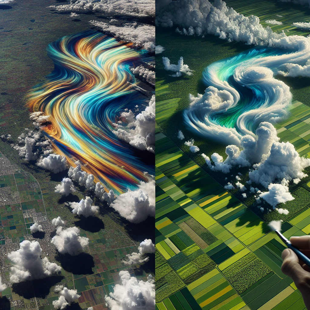
When we talk about satellite map clouds and satellite view of clouds, we’re referring to various types of imagery that provide different perspectives on cloud formations.
Visible Light Imagery
Visible light images show clouds as we would see them from space with our naked eye. These images are invaluable for:
- Identifying cloud types and patterns
- Tracking storm systems
- Monitoring cloud cover over specific regions
Infrared Imagery
Infrared satellite images reveal cloud temperatures and heights. This type of imagery is particularly useful for:
- Distinguishing between low, middle, and high-level clouds
- Identifying potential areas of severe weather
- Monitoring cloud development over time
Water Vapor Imagery
These images show the distribution of water vapor in the upper atmosphere, helping meteorologists:
- Track atmospheric moisture
- Identify jet streams and areas of potential storm development
- Understand large-scale atmospheric circulation patterns
Multispectral Imagery
Combining data from multiple parts of the electromagnetic spectrum, multispectral imagery provides a comprehensive view of cloud properties, including:
- Cloud thickness
- Particle size
- Phase (liquid or ice)
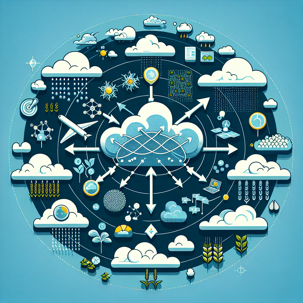
4. Applications of Satellite Cloud Data in Agriculture
At Farmonaut, we recognize the immense potential of satellite cloud data in revolutionizing agricultural practices. Let’s explore how this technology benefits farmers and the agricultural industry as a whole.
Weather Forecasting for Farm Management
Accurate weather forecasts are crucial for farmers to plan their activities effectively. Satellite cloud data contributes to improved weather predictions by:
- Providing real-time information on approaching weather systems
- Helping meteorologists track the development and movement of storms
- Enabling more accurate long-term climate forecasts
Irrigation Planning
Satellite-derived cloud cover information helps farmers optimize their irrigation strategies:
- By predicting rainfall patterns, farmers can adjust their irrigation schedules
- Cloud cover data can indicate potential evapotranspiration rates, informing water management decisions
- Long-term cloud pattern analysis aids in seasonal water resource planning
Crop Health Monitoring
Cloud cover affects the amount of sunlight reaching crops, which in turn impacts plant growth and health. Satellite cloud data helps farmers:
- Estimate potential photosynthetic activity based on cloud cover
- Identify areas that may be prone to fungal diseases due to prolonged cloud cover
- Adjust planting schedules based on expected cloud patterns
Yield Prediction
By incorporating satellite cloud data into crop models, we can improve yield predictions:
- Cloud cover information helps estimate solar radiation reaching crops
- This data, combined with other factors, enhances the accuracy of yield forecasts
- Improved predictions help farmers and agribusinesses make informed decisions about harvest timing and market strategies
5. Farmonaut’s Approach to Satellite-Based Farm Management
At Farmonaut, we’ve developed a comprehensive satellite-based farm management system that leverages cloud data along with other crucial information to provide farmers with actionable insights.
Our Satellite-Based Crop Health Monitoring
Our advanced system uses multispectral satellite images to monitor crop health, providing farmers with:
- Vegetation health indices (NDVI)
- Soil moisture level estimates
- Crop stress detection
By integrating cloud cover data with these observations, we offer a more comprehensive understanding of crop conditions and potential risks.
Jeevn AI Advisory System
Our AI-driven farm advisory tool, Jeevn AI, incorporates satellite cloud data to deliver:
- Personalized crop management strategies
- Real-time weather insights
- Irrigation recommendations based on cloud cover and precipitation forecasts
How Farmonaut’s System Compares to Other Farm Monitoring Methods
| Feature | Farmonaut Satellite System | Drone-based Monitoring | IoT-based Monitoring |
|---|---|---|---|
| Coverage Area | Large scale (regional to global) | Limited (local) | Limited (field-specific) |
| Frequency of Data Collection | Daily to weekly | On-demand (requires manual operation) | Continuous (real-time) |
| Initial Setup Cost | Low | High (drone purchase, training) | Medium to High (sensors, network setup) |
| Maintenance Requirements | Minimal | Regular (battery, repairs) | Regular (sensor calibration, replacements) |
| Data Processing | Automated (cloud-based) | Requires specialized software and expertise | Automated (local or cloud-based) |
| Weather Dependency | Moderate (can see through some clouds) | High (cannot operate in bad weather) | Low (operates in all weather conditions) |
| Scalability | Highly scalable | Limited by operational constraints | Scalable but requires additional hardware |
As you can see, our satellite-based system offers unique advantages in terms of coverage, cost-effectiveness, and scalability, making it an ideal choice for farmers of all sizes.
6. The Future of Satellite Cloud Imaging
The field of satellite cloud imaging is continually evolving, with exciting developments on the horizon. Here are some trends we’re watching closely at Farmonaut:
Improved Resolution and Frequency
Future satellites will offer even higher resolution satellite image clouds and more frequent updates, providing:
- More detailed cloud structure information
- Near real-time monitoring of rapidly changing weather systems
- Better data for short-term weather forecasting
Advanced AI and Machine Learning Integration
Artificial intelligence and machine learning algorithms will revolutionize how we process and interpret satellite cloud data:
- Automated detection of severe weather patterns
- Improved long-term climate predictions
- More accurate crop yield forecasts based on historical cloud patterns
Integration with Other Data Sources
Future systems will seamlessly integrate satellite cloud data with other information sources:
- Ground-based weather stations
- IoT sensors in agricultural fields
- Social media reports for ground-truth verification
Enhanced 3D Visualization
Advancements in 3D modeling will provide more intuitive ways to visualize and understand cloud formations:
- Immersive virtual reality experiences of weather systems
- Better understanding of cloud dynamics and interactions
- Improved educational tools for meteorology and atmospheric science
7. FAQs
Q: What is the difference between a satellite image of clouds and a satellite map of clouds?
A: A satellite image of clouds typically refers to a visual representation of cloud formations as captured by satellite sensors. This could be a single-band image (like visible light) or a composite of multiple spectral bands. On the other hand, a satellite map of clouds often involves additional processing and may include overlays of geographic information, weather data, or color-coding to represent different cloud types or heights.
Q: How often are satellite cloud images updated?
A: The frequency of updates depends on the type of satellite and its orbit. Geostationary satellites can provide updates as frequently as every 5-15 minutes for a specific region. Polar-orbiting satellites typically provide global coverage once or twice a day. At Farmonaut, we process and integrate the most recent available data to provide timely insights to our users.
Q: Can satellites see through clouds?
A: While visible light cannot penetrate thick clouds, some satellite sensors use other parts of the electromagnetic spectrum, such as microwave or radar, which can “see” through clouds to some extent. This allows for observations of surface conditions or lower atmospheric layers even in cloudy conditions.
Q: How does Farmonaut use satellite cloud data to benefit farmers?
A: We integrate satellite cloud data into our comprehensive farm management platform to provide:
- Accurate weather forecasts for better planning
- Irrigation recommendations based on expected cloud cover and precipitation
- Crop health assessments that take into account the effects of cloud cover on plant growth
- Long-term climate trend analysis for strategic farm planning
Q: Are satellite cloud images available to the public?
A: Yes, many meteorological agencies and space organizations provide public access to satellite cloud images. However, the most valuable insights come from combining this data with other information and using advanced analysis techniques, which is what we specialize in at Farmonaut.
Conclusion
The world of satellite image clouds, satellite map clouds, and satellite view of clouds is a fascinating and rapidly evolving field. At Farmonaut, we’re committed to harnessing the power of this technology to provide farmers with the most accurate, timely, and actionable insights possible. By combining satellite cloud data with our advanced AI algorithms and comprehensive farm management tools, we’re helping to usher in a new era of precision agriculture.
We invite you to explore how Farmonaut can transform your farming practices:
- Try our mobile app: Android | iOS
- Explore our API services for developers
- Learn more about our Satellite Weather API
Ready to take your farm management to the next level? Subscribe to Farmonaut today:
Join us in revolutionizing agriculture through the power of satellite technology and data-driven insights. Together, we can build a more sustainable and productive future for farming.