- Introduction: GIS in Sustainable Farming
- Trivia: GIS-Driven Yield Gains
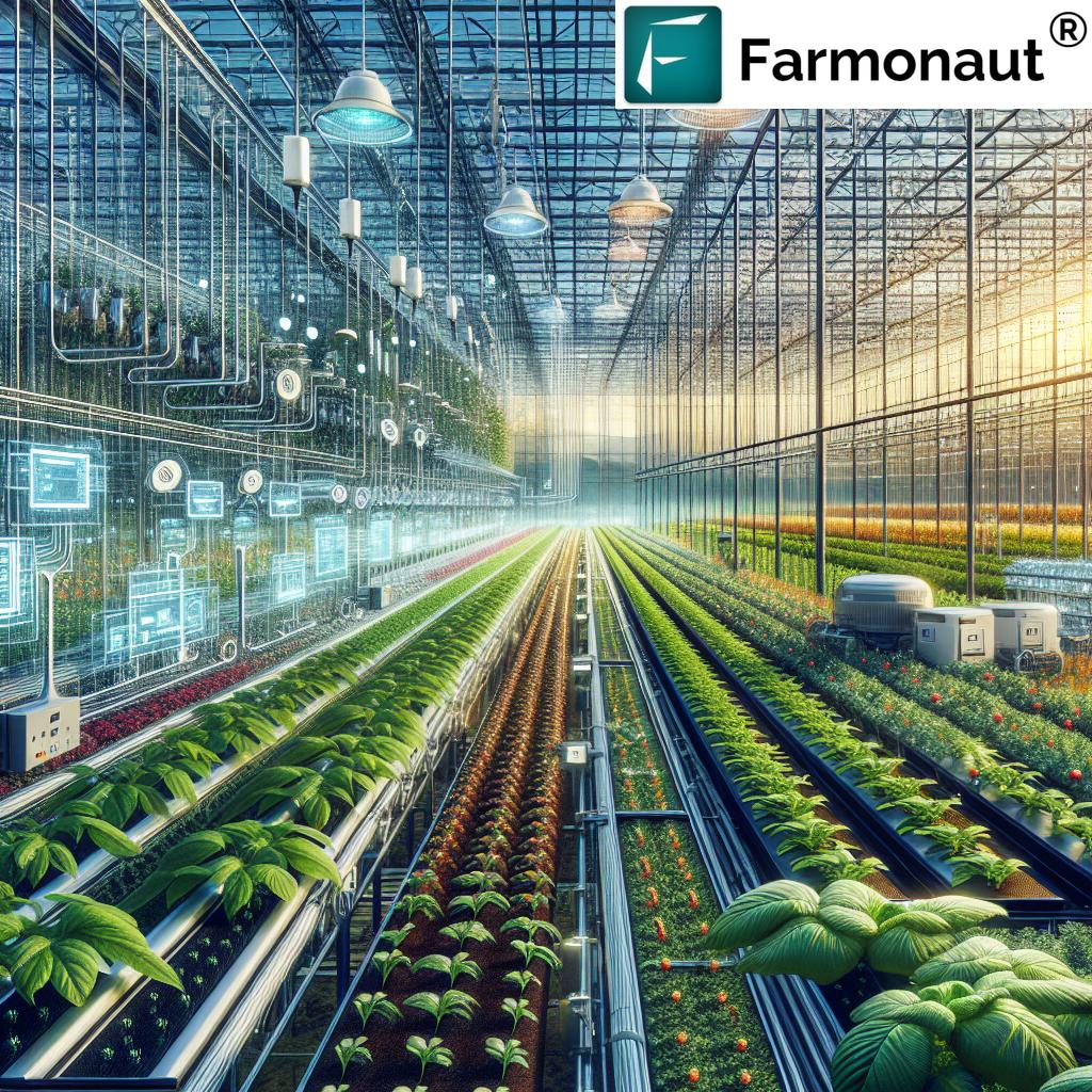
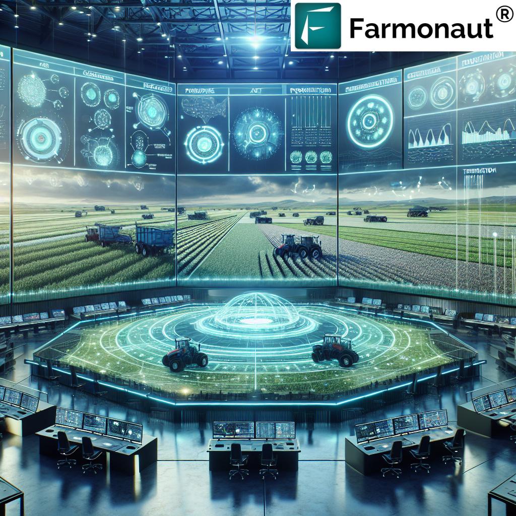
- GIS Solutions in Precision Agriculture
- How GIS Enhances Crop Health Monitoring
- Soil and Water Management with GIS
- GIS in Livestock Monitoring and Management
- Pest and Disease Management Using GIS
- Efficient Irrigation Management via GIS
- Agricultural Land Use Planning with GIS
- Forest Management with GIS
- Climate Change Adaptation in Agriculture
- Environmental Monitoring in Farming
- Integrating Data for Informed Decisions
- Comparison: Traditional vs. GIS-Driven Precision Agriculture
- Farmonaut’s Role in Precision Agriculture
- Farmonaut Platforms, Apps, and API Access
- Farmonaut Subscriptions
- FAQs about GIS in Agriculture
- Conclusion: GIS Transforms Farming for Sustainability
GIS Solutions: Transform Sustainable Farming Fast!
Geographic Information Systems (GIS) have fundamentally reshaped agriculture, farming, and forestry. As we enter a new era of digital transformation, GIS in agriculture stands out as an innovative approach to boosting sustainability, resource efficiency, and food security. By integrating spatial data and advanced analytical capabilities, stakeholders—including farmers, agribusinesses, and policymakers—can optimize operations, monitor environmental conditions, and implement precision agriculture solutions that drive real, sustainable results.
In this comprehensive guide, we’ll explore the key GIS solutions and their impact on sustainable farming practices, crop health monitoring, soil and water management, environmental monitoring in farming, and more. We’ll also highlight how platforms like Farmonaut bring these technologies to life, making advanced precision agriculture accessible to every farmer.
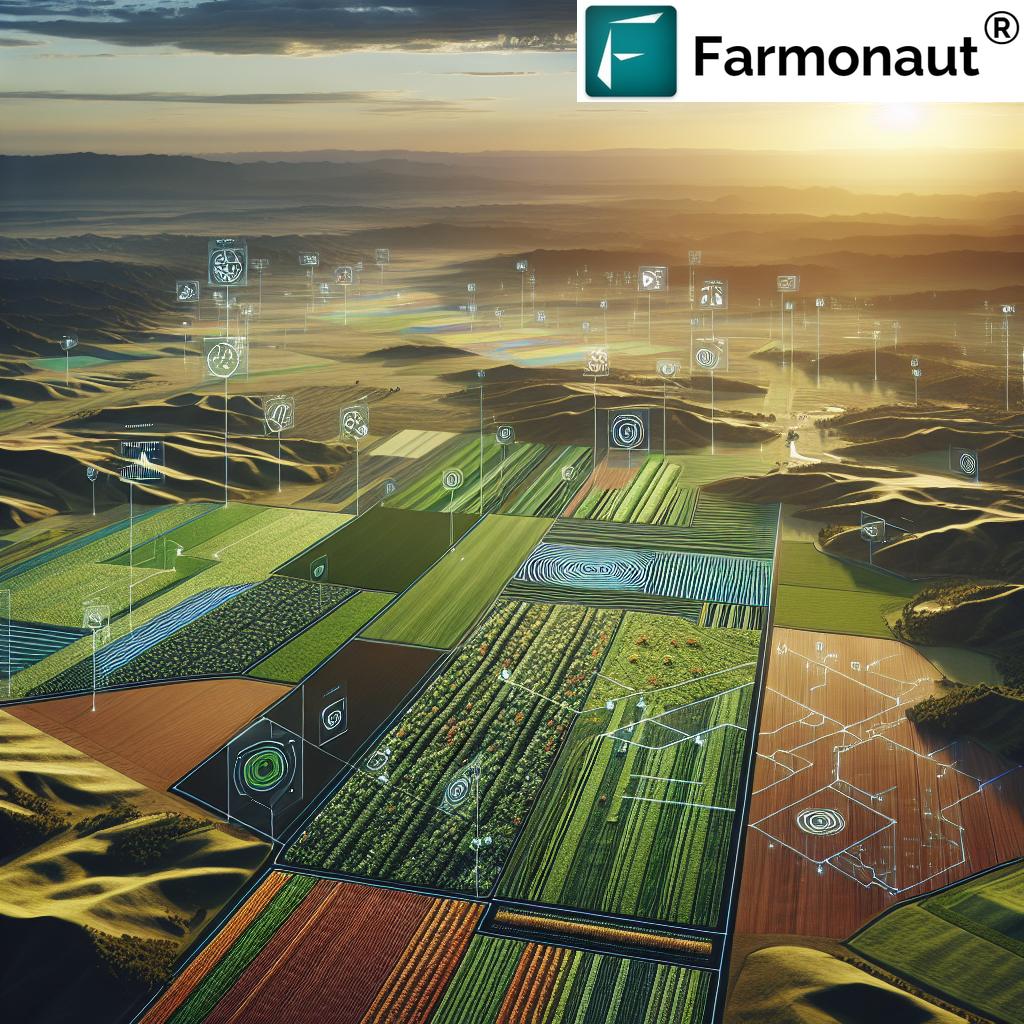
GIS Solutions in Precision Agriculture
Precision agriculture solutions represent a technological revolution powered by GIS. By analyzing spatial variability within fields, we can implement tailored interventions that address specific crop and soil needs.
Key Features of Precision Agriculture with GIS
- Data-Driven Mapping: GIS enables us to create detailed maps of soil properties, moisture levels, and nutrient content for each field.
- Variable-Rate Applications: Armed with spatial data, we can apply fertilizers, pesticides, and water only where needed—minimizing waste and reducing costs.
- Optimizing Inputs: By identifying nutrient deficiencies and soil health status, we ensure resources are used efficiently, boosting crop yields.
- Resource Allocation: Farm managers allocate resources more judiciously, improving productivity and environmental stewardship.
This innovative approach not only enhances agricultural productivity but also supports the core tenets of sustainable farming practices.
Explore Farmonaut’s Large Scale Farm Management tools—empowering agribusinesses to efficiently monitor, plan, and optimize plantation operations by leveraging real-time satellite data, AI-driven insights, and intuitive analytics.
Focus Keyword: GIS in Agriculture
- Primary use: GIS in Agriculture equips us with field-specific knowledge, allowing for precision, reduced waste, and most importantly—higher, more sustainable yields.
- Farmonaut advantage: Unlike traditional systems requiring expensive field equipment, Farmonaut’s platform brings cost-effective, satellite-based precision solutions to any scale farm via smartphone, desktop, or API.
Remote Sensing for Crop Monitoring
Through remote sensing—satellite imagery and drone data—GIS allows us to identify micro-variability in fields, unlocking the full potential of precision agriculture. This leads to:
- Rapid early detection of diseases, pests, and stressors
- Targeted intervention zones for minimal resource use
- Year-over-year analysis of crop growth patterns
How GIS Enhances Crop Health Monitoring
Maintaining healthy crops is the cornerstone of sustainable agriculture. GIS-powered crop health monitoring empowers us to detect issues early and take targeted actions, minimizing loss and maximizing gains. By integrating remote sensing (e.g., satellite and drone imagery), GIS platforms—like Farmonaut—enrich field-level analyses for every farm.
Tools and Techniques
- Vegetation Indices: The Normalized Difference Vegetation Index (NDVI) maps vegetation health with high accuracy—pinpointing stressed zones, drought impact, and overall vigor.
- Thermal Imaging: GIS integrates temperature mapping to identify crop dehydration, heat stress, or localized disease outbreaks.
- Temporal Analysis: By monitoring progression patterns over time, we assess the effectiveness of interventions and crop response.
These GIS-based capabilities enable farmers to monitor conditions at scale, resulting in timely decisions that optimize yields and resource use.
Use Farmonaut’s Crop Health Monitoring—harness NDVI, soil moisture, and AI-powered recommendations for smarter crop care, optimized input use, and greater productivity for every field.
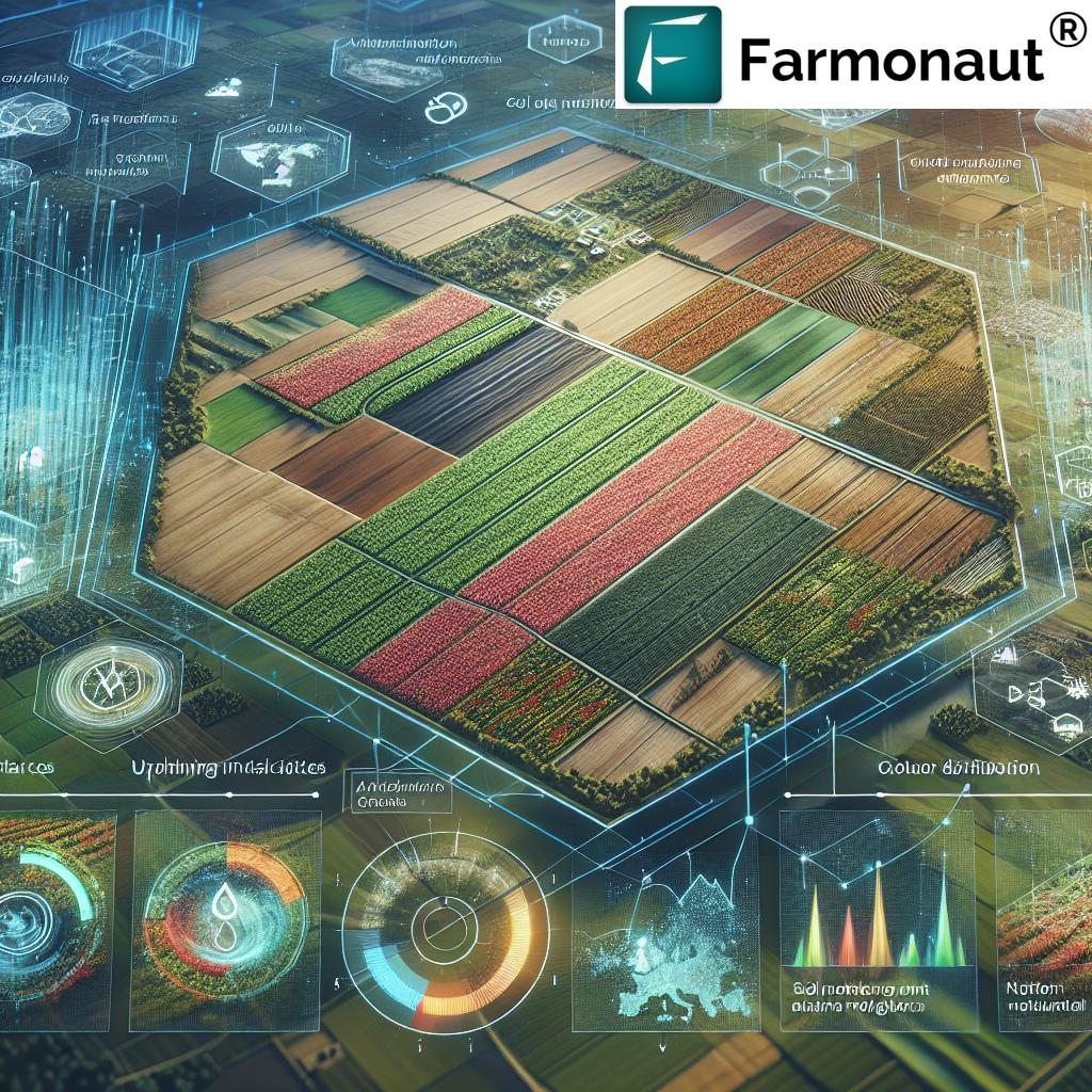
Soil and Water Management with GIS
Preserving soil health and efficient water management are the bedrock of sustainable farming. GIS tools offer us a comprehensive way to analyze soil properties, assess moisture levels, and monitor erosion risks to build resilient agricultural systems.
Optimizing Soil & Water Utilization
- Soil Mapping: Detailed mapping identifies texture, pH, organic matter, and nutrient availability, enabling customized fertilizer and amendment applications.
- Water Stress Mapping: With satellite-derived moisture data, we pinpoint drought-prone or waterlogged areas within fields, guiding irrigation plans and conservation measures.
- Guided Conservation: GIS helps implement contour farming, buffer zones, and terracing by analyzing topography and erosion hotspots.
Using these spatial data insights, farmers can implement precise interventions that improve resource efficiency, cut costs, and reduce environmental impact.
Track and reduce your environmental impact! Explore Farmonaut’s Carbon Footprinting tools—monitor real-time emissions, comply with sustainability regulations, and enhance your farm’s environmental credentials.
GIS Mapping for Conservation and Erosion Control
- Identify fields prone to soil erosion, saline deposits, or compaction
- Guide cover crop selection and soil improvement practices
- Enable efficient irrigation scheduling—conserving resources and improving yields
GIS in Sustainable Farming Practices
By integrating soil and water data, we foster resilient, climate-smart agriculture that supports long-term sustainability.
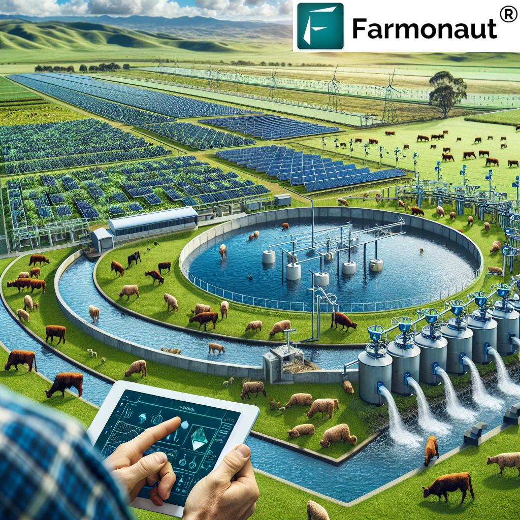
GIS in Livestock Monitoring and Management
GIS technology’s benefits extend to livestock management. By combining GPS-enabled collars, spatial tracking, and health monitoring, we enable farmers to analyze grazing patterns, prevent overgrazing, and detect animal health issues early.
- Real-Time Location Tracking: Ensures livestock safety and optimizes pasture usage.
- Health Analytics: Data-driven alerts for abnormal movement, suggesting illness or injury.
- Resource Management: Ensures carrying capacity isn’t exceeded, securing animal welfare and productivity.
Fleet Management and Resource Optimization
For large-scale operations, farm machinery fleet management is crucial. Farmonaut’s Fleet Management equips agribusinesses to track vehicles, optimize logistics, and improve safety—driving efficiency across agricultural systems.
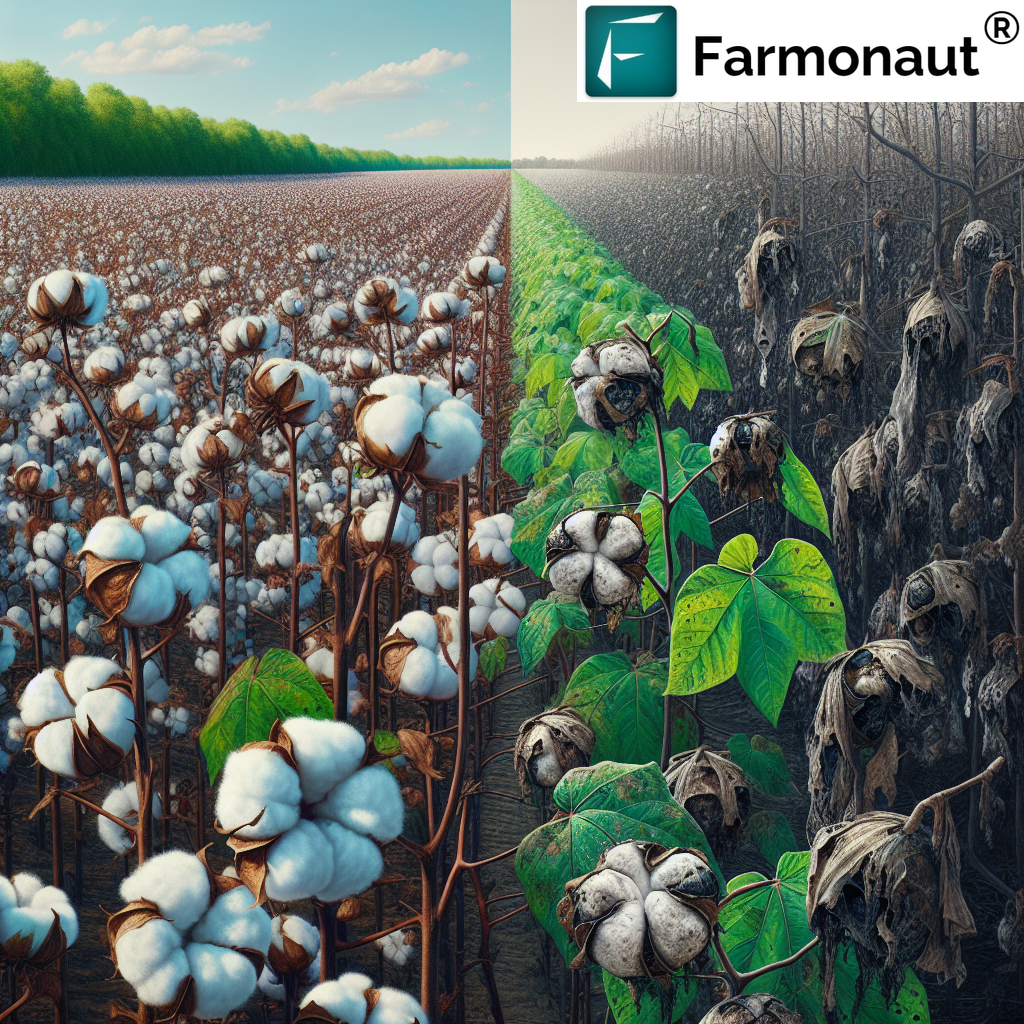
Pest and Disease Management Using GIS
Control of pests and diseases requires data-driven intelligence. GIS tools help us map infestation zones, predict spread patterns, and target interventions for maximum impact—and minimum chemical use.
- Disease Detection: Early warning by analyzing anomalies in vegetation indices and climate data.
- Pest Movement Modeling: Knowing migration or outbreak hotspots allows targeted, localized application of pesticides.
- Effectiveness Assessment: GIS-based monitoring aids in evaluating intervention performance and adapting strategies.
Improve transparency and trust with Farmonaut’s Blockchain-Based Product Traceability—track every stage of your produce’s journey from the field to the end-consumer, ensuring authenticity and sustainable practices.
Efficient Irrigation Management via GIS
The challenge of water scarcity demands advanced irrigation management tools. By analyzing soil moisture, local weather patterns, and crop requirements, GIS-enabled irrigation scheduling guarantees every drop counts.
- Precision Irrigation: Satellites and in-situ sensors combine to design optimal irrigation schedules—preventing drought stress and waterlogging.
- Resource Conservation: Efficient management reduces water waste and improves yields.
- Real-Time Monitoring: Systems like Farmonaut allow for immediate reaction to adverse field conditions as they develop.
Unlock access to affordable credit: Verify your farm with satellite-based Crop Loan and Insurance solutions from Farmonaut, reducing fraud and accelerating approvals for reliable financing.
Agricultural Land Use Planning with GIS
Making the most of each hectare is the goal of agricultural land use planning with GIS. By overlaying data on soil type, climate, topography, and historical productivity, we can identify optimal planting zones—ensuring high-value crops are grown in the right place at the right time.
- Land Suitability Analysis: Pinpoints which fields are appropriate for specific crops
- Environmental Risk Avoidance: Maps areas vulnerable to flooding, drought, or erosion, guiding safe and sustainable production
Forest Management with GIS
Beyond fields and farms, GIS in forestry allows us to map forest cover, biodiversity, and harvesting plans for sustained ecological health.
- Monitor deforestation and reforestation efforts in near real-time
- Assess species distribution, density, and health
- Plan sustainable extraction, balancing yields with conservation
Steer your agroforestry or reforestation projects with Farmonaut’s Crop Plantation & Forest Advisory modules—harnessing GIS and satellite insights for optimal forest management, conservation, and productivity.
Climate Change Adaptation in Agriculture
As the world faces greater climate variability, adaptation is vital for resilience. GIS solutions offer a scientific framework to analyze climate risks, map vulnerable regions, and develop adaptive strategies.
- Climate Data Integration: Incorporates temperature, rainfall, drought, and extreme event mapping
- Drought and Flood Risk Analysis: Identifies at-risk areas to inform planting schedules, crop variety selection, and risk mitigation
- Climate-Smart Policies: Guides policymakers and stakeholders in designing evidence-based, region-specific adaptation measures
With platforms such as Farmonaut, farmers and agribusinesses can develop targeted adaptation plans powered by comprehensive geographic information—for sustainable yields, even in uncertain times.
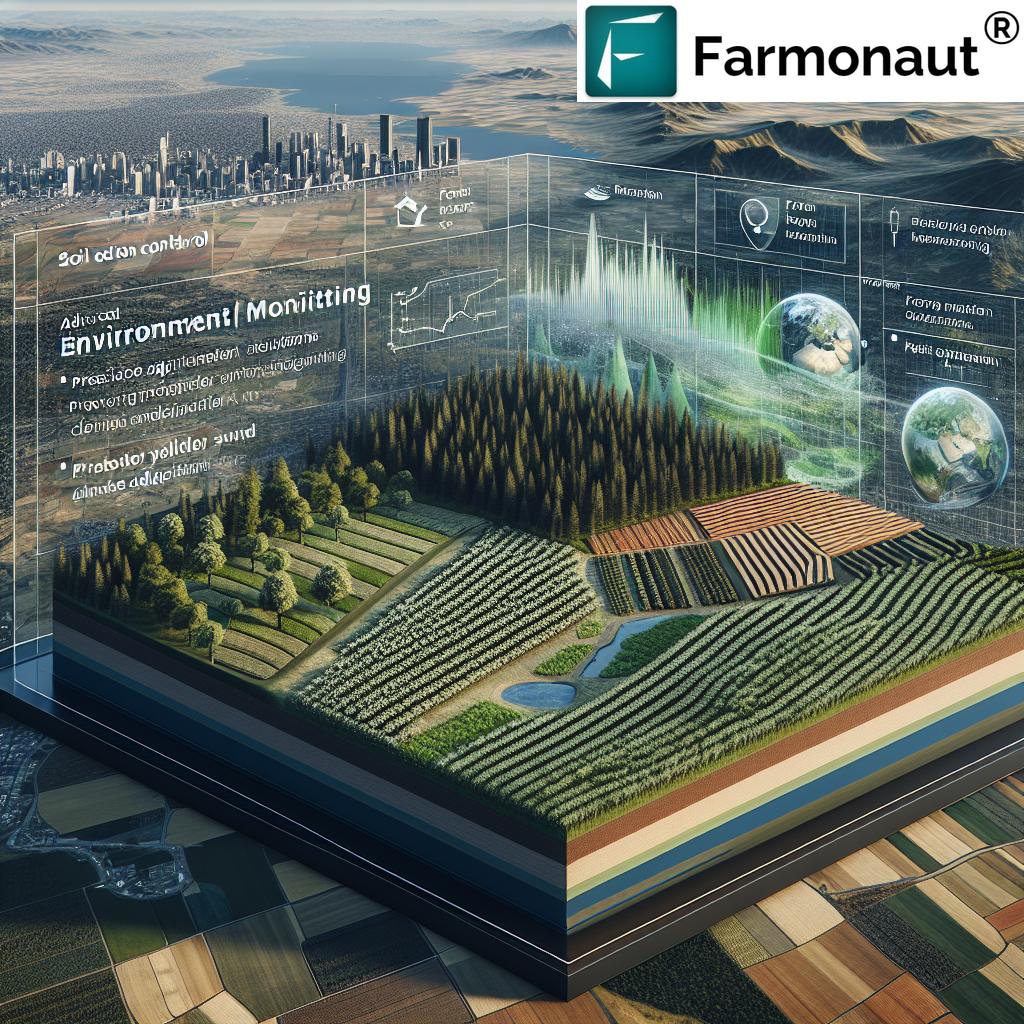
Environmental Monitoring in Farming and Sustainable Practices
Environmental stewardship is at the core of sustainable farming practices. GIS-enabled environmental monitoring in farming brings together biodiversity measurements, soil and water quality analytics, and land use mapping for a holistic approach to farm management.
- Biodiversity Tracking: GIS maps changes in field and forest biodiversity, supporting conservation initiatives
- Impact Assessment: Farmers can analyze the impact of their activities on the environment and adjust practices for positive outcomes
- Conservation Planning: Pinpoints buffer zones, sensitive habitats, and areas needing restoration or protection
Platforms like Farmonaut make extensive use of satellite imagery and AI to help farmers, governments, NGOs, and corporates implement, monitor, and refine sustainable agriculture projects.
Are you building your own agri data platform or need automated satellite analysis? Take advantage of Farmonaut’s robust satellite and weather Data APIs for easy integration into your systems! Don’t forget to review the official API developer documentation here.
Integrating Data for Informed Decisions
The power of GIS is amplified through the integration of various data streams—satellite imagery, in-field sensors, weather stations, and more. Comprehensive geographic information enables agricultural stakeholders to make informed decisions that optimize resource allocation, risk management, and efficiency.
- Decision Support Systems: Platforms like Farmonaut consolidate multi-source data, providing actionable recommendations and visual analytics.
- AI-Based Farm Advisory: Systems such as Jeevn AI on Farmonaut deliver personalized, real-time insights directly to farmers’ mobile devices, combining remote sensing and machine learning with practical farm guidance.
- Traceability and Compliance: Blockchain integration ensures product provenance, enhances transparency, and supports food safety and regulatory compliance.
By leveraging layered, integrated data, the agricultural sector unlocks unprecedented efficiency, resilience, and sustainability.


Comparison Table: Traditional vs. GIS-Driven Precision Agriculture Practices
| Farming Aspect | Traditional Method (Estimated Results) | GIS Solution (Estimated Results) | Sustainability Impact |
|---|---|---|---|
| Crop Health Monitoring | Visual observation; delayed detection; reactive only (Yields improve 5-8%) | Remote sensing & NDVI maps; early detection; proactive (Yields improve 15-20%) | Reduces loss and input waste, increases resilience |
| Soil Analysis | Periodic manual sampling (Input/Cost reduction up to 8%) | Continuous spatial mapping, targeted interventions (Input/Cost reduction up to 22%) | Enhances soil health, minimizes fertilizer runoff |
| Water/Irrigation Management | Scheduled irrigation; uniform rates (Water savings up to 10%) | Data-driven variable-rate, moisture-based scheduling (Water savings up to 30%) | Conserves water, reduces stress, improves drought resilience |
| Pest & Disease Management | Blanket pesticide application (Up to 5% input reduction) | GIS-targeted spraying, predictive modeling (Up to 35% input reduction) | Minimizes chemical use, protects biodiversity |
| Land Use Efficiency | General field mapping (Land-use optimization up to 8%) | Multi-layered suitability analysis (Land-use optimization up to 21%) | Reduces environmental impact, maximizes productivity |
| Environmental Monitoring | Minimal, rarely landscape scale | Continuous, spatially-explicit monitoring with AI support | Proactive conservation, carbon reduction, ecosystem health |
Farmonaut’s Role in Precision Agriculture: Making Technology Affordable and Accessible
At Farmonaut, we’re dedicated to empowering every stakeholder in the agricultural ecosystem—including individual farmers, agribusinesses, governments, NGOs, and corporate clients—by democratizing access to precision agriculture and GIS-powered data.
Technologies for the Future of Sustainable Farming
- Satellite-Based Crop Health Monitoring: Farmonaut delivers field-scale NDVI, soil moisture maps, and crop growth analytics using multispectral satellite imagery.
- AI-Powered Farm Advisory: Personalized, real-time insights with our Jeevn AI system.
- Blockchain-Enabled Traceability: Secures product chains with verifiable, fraud-resistant provenance.
- Fleet & Resource Management: Monitor and optimize agri machinery and logistics for enhanced efficiency.
- Carbon Footprinting & Environmental Monitoring: Real-time carbon emission tracking for compliance and sustainability goals.
Key Benefits:
- Cost-Effective Precision: No expensive field hardware required—just your phone, tablet, or computer.
- Increased Productivity: Make data-driven decisions for higher yields, lower losses, and optimal input use.
- Sustainability At Scale: Easily track, measure, and improve your farm’s environmental impact.
- Seamless Access to Credit: Leverage satellite-verified data for crop loans and insurance, streamlining approvals and protecting against fraud.
- Scalability: From one field to nationwide programs, Farmonaut’s modular solutions grow with your needs.
Farmonaut Platforms, Apps & API Access
We support the next generation of precision agriculture with solutions available across:
- Android and iOS Apps: Real-time field monitoring and advice in your pocket.
- Web/Browsers: Easily analyze, plan, and act from any device with browser access.
- Developer API: Plug GIS, weather, and satellite data feeds into your own farm management, research, or governmental platforms.
Farmonaut Subscriptions
Frequently Asked Questions: GIS Solutions in Agriculture
A: GIS (Geographic Information System) is a framework for capturing, managing, and analyzing spatial and geographic data. In agriculture, GIS helps monitor crop health, optimize resource use (soil, water, fertilizer), plan land use, facilitate early disease/pest detection, and inform sustainable practices.
Q2: Are GIS solutions only for large agribusinesses?
A: No. Thanks to affordable platforms like Farmonaut, even individual and smallholder farmers can access precision agriculture and GIS-based solutions via their smartphones or computers.
Q3: How does GIS support sustainable farming practices?
A: GIS enables sustainability by guiding resource-efficient planning, promoting conservation, monitoring environmental impact, and enabling adaptive measures in response to climate change and soil/water stress.
Q4: How does satellite imagery improve crop yield and health monitoring?
A: Satellite imagery, combined with GIS analytics, detects crop stress, disease, pest outbreaks, and moisture deficiency early—enabling fast, targeted interventions that minimize loss and enhance productivity.
Q5: Can I use Farmonaut’s API for custom solutions?
A: Absolutely! You can access Farmonaut’s API for integrating field-level satellite, weather, and crop data into proprietary software, apps, or research tools. Learn more in the API Developer Docs.
Q6: Does Farmonaut sell farm inputs or machinery?
A: No. Farmonaut is not a seller/manufacturer of inputs or machinery—it provides data-driven GIS and farm management tools.
Conclusion: GIS Solutions Transform Sustainable Farming—Fast!
GIS technology has fundamentally altered how we approach crop health monitoring, soil and water management, sustainable farming practices, land use planning, and environmental monitoring in farming. Through precision and data-driven interventions, we now have the power to boost yields, reduce resource waste, mitigate risks, and ensure a resilient, sustainable future for global agriculture.
Farmonaut stands at the forefront, making advanced precision agriculture solutions affordable, scalable, and accessible to all. By integrating satellite, AI, blockchain, and multi-source data, we collectively transition toward more efficient, environmentally friendly, and sustainable farming systems.
Let’s harness the power of GIS and smart agricultural management—ensuring food security, climate resilience, and profitability for present and future generations!