
Utilize Farmonaut Engine to Monitor Levees Efficiently: The Future of Flood Risk Detection & Infrastructure Resilience
“Farmonaut Engine analyzes over 1,000 levee kilometers daily using advanced remote sensing for early flood risk detection.”
Why Levee Monitoring Is Essential for Flood Control and Community Safety
Levees are critical structures that play a pivotal role in flood control systems across the globe. By safeguarding agricultural lands, vital infrastructure, and communities from the devastating effects of flooding, levees serve as the backbone of many urban and rural landscapes. However, the true value of these protective barriers is only as strong as our ability to maintain their structural integrity and detect emerging issues before they escalate into failures.
Regular, thorough levee monitoring is essential for preventing catastrophic damage that could lead to significant economic, environmental, and societal consequences. Inadequate inspections or the failure to detect internal or subtle anomalies—like seepage, erosion, or structural weaknesses—can turn small unseen problems into full-blown disasters that threaten entire regions.
- Levee failures can inundate thousands of hectares of farmland, destroy infrastructure, and displace communities.
- The effects of uncontrolled flooding extend to long-term environmental degradation and loss of livelihoods.
- Early detection of levee issues is key to reducing risk, enabling rapid corrective action and enhancing infrastructure resilience.
Reviewing Traditional Levee Inspection Methods
For decades, levee inspection methods have relied on hands-on, manual techniques. These typically include:
- Visual surveys: Trained inspectors walk or drive alongside levees, visually assessing surface anomalies like erosion, vegetation overgrowth, or cracks (surface-level assessment).
- Piezometers: Devices installed within levees to measure the height of the water column, indicating pore water pressure and helping to detect seepage or changes in water movement.
- Seepage pressure gauges: Instruments focused on monitoring internal pore water pressure within the structure of the levee, which are essential for indicating stability and vulnerability to failures.
Advantages of Traditional Methods:
- Relatively low upfront costs for basic tools and labor.
- Easy to deploy for small-scale, low-tech levee systems.
Key Limitations:
- Labor-intensive and Time-consuming: Manual inspections require significant human effort and resources, making them less feasible for covering large or remote infrastructure.
- Limited Data Depth: Surface-level assessments and periodic readings may miss internal or developing issues deep within the levee’s core.
- Susceptibility to Human Error or Damage: Sensors such as piezometers and pressure gauges can be vulnerable to damage, clogging, and calibration drift, reducing the accuracy and reliability of long-term data collection.
- No Real-time or Continuous Insights: Most methods require periodic measurement or observation, leaving substantial windows of time when emerging problems remain undetected.
As the complexity and scale of flood defense infrastructure grow, so does the need to advance levee monitoring with more innovative, automated, and comprehensive technologies.


Access real-time levee and crop health monitoring from anywhere using the Farmonaut Web App.
Emerging Technologies in Levee Monitoring: From Remote Sensing to Real-Time Analytics
With the limitations of traditional monitoring apparent, the evolution of levee monitoring technologies brings unparalleled opportunities for early detection, accuracy, and infrastructure resilience. The new generation of advanced monitoring includes:
- Remote Sensing for Levees (satellite imagery, aerial photography, radar, and more) for broad, detailed, and regular observation of levee conditions without on-site human presence.
- Unmanned Aerial Systems (UAS), or drones, capable of capturing high-resolution images and topographical data that highlight surface anomalies like erosion, vegetation encroachment, and deformations much faster than ground crews.
- Distributed Fiber-Optic Sensing (DFOS) applying continuous monitoring for changes in strain, temperature, and acoustic signals embedded within levee structures.
- AI and Analytics for automating the detection of anomalies, integrating multi-source data, and providing actionable insights for maintenance or emergency response.
These innovative technologies represent the future of effective structural health monitoring. Let us explore these game-changing advances in detail.
“Unmanned aerial systems with Farmonaut monitor levee changes 50% faster than traditional ground-based inspections.”
Remote Sensing for Levees: Intelligence from a Distance
Remote sensing constitutes one of the most advanced and scalable methods for levee monitoring and flood control systems worldwide. Using satellites and aerial platforms, we can gather continuous, unimpeded streams of data over vast and inaccessible areas, rapidly identifying changes or threats to levee integrity.
Satellite Imagery for Flood Prevention & Levee Assessment
- Multispectral and radar satellites (like Sentinel and Landsat) provide detailed imagery to monitor surface changes, vegetation patterns, and topographical deformations.
- Interferometric Synthetic Aperture Radar (InSAR) detects vertical and horizontal ground displacement, which is crucial for identifying subsidence, settlement, or slow movements in levee structures.
- High-frequency revisit times enable us to spot anomalies early, facilitating timely maintenance and repairs.
Example Application: InSAR has been utilized in urban delta regions (e.g., New Orleans in the United States) to monitor minute levee settlement and subsidence that may not be visible through ground-based assessments.


Distributed Fiber-Optic Sensing for Infrastructure Health
Distributed Fiber-Optic Sensing (DFOS) is a revolution in internal structural health monitoring for critical infrastructure like levees and dams. By embedding fiber-optic cables along levee structures, DFOS continuously detects changes in strain, temperature, acoustic signals, and water pressure—offering real-time levee data straight from the heart of the barrier.
- Continuous performance monitoring allows us to spot changes caused by seepage, erosion, and structural weaknesses before they lead to visible surface issues.
- Unlike point sensors, DFOS enables detailed assessments along the entire length of the levee, providing spatial resolution that is vital for identifying anomalies anywhere in the structure.
- Helps diagnose hard-to-detect events, like internal movement, pore water build-up, or acoustic signals from failing material.
Benefits: Enhanced sensitivity, high stability, and the ability to detect undetected or potential failures in levee structures make DFOS a cornerstone in modern flood risk management.
Unmanned Aerial Systems for Levee Inspection
Unmanned Aerial Systems (UAS)—drones equipped with a suite of smart sensors—represent one of the most versatile and efficient levee inspection methods now available. UAS for levee monitoring enables us to reach, scan, and assess vast or difficult-to-access stretches of levee with speed, safety, and accuracy.
- Optical cameras and LiDAR technology deliver high-resolution imagery and topographical data, capturing surface anomalies, erosion patterns, vegetation encroachment, and deformations.
- Provide routine aerial surveys and rapid post-storm assessments.
- UAS platforms facilitate frequent, in-depth inspections while minimizing operational disruptions and human risks compared to foot or vehicle patrols.
Advantage: Farmonaut’s engine integrates UAS data for a 360-degree view of levee conditions, allowing early detection and proactive intervention.

Farmonaut Platform: Powerful Monitoring for Modern Levees
At Farmonaut, we drive the technology & innovation theme in agriculture and critical infrastructure by making advanced levee monitoring affordable, accessible, and actionable. Our platform’s core is a robust engine harnessing satellite imagery, artificial intelligence, and API-based integration for real-time observation and analysis of levee conditions—anywhere in the world.
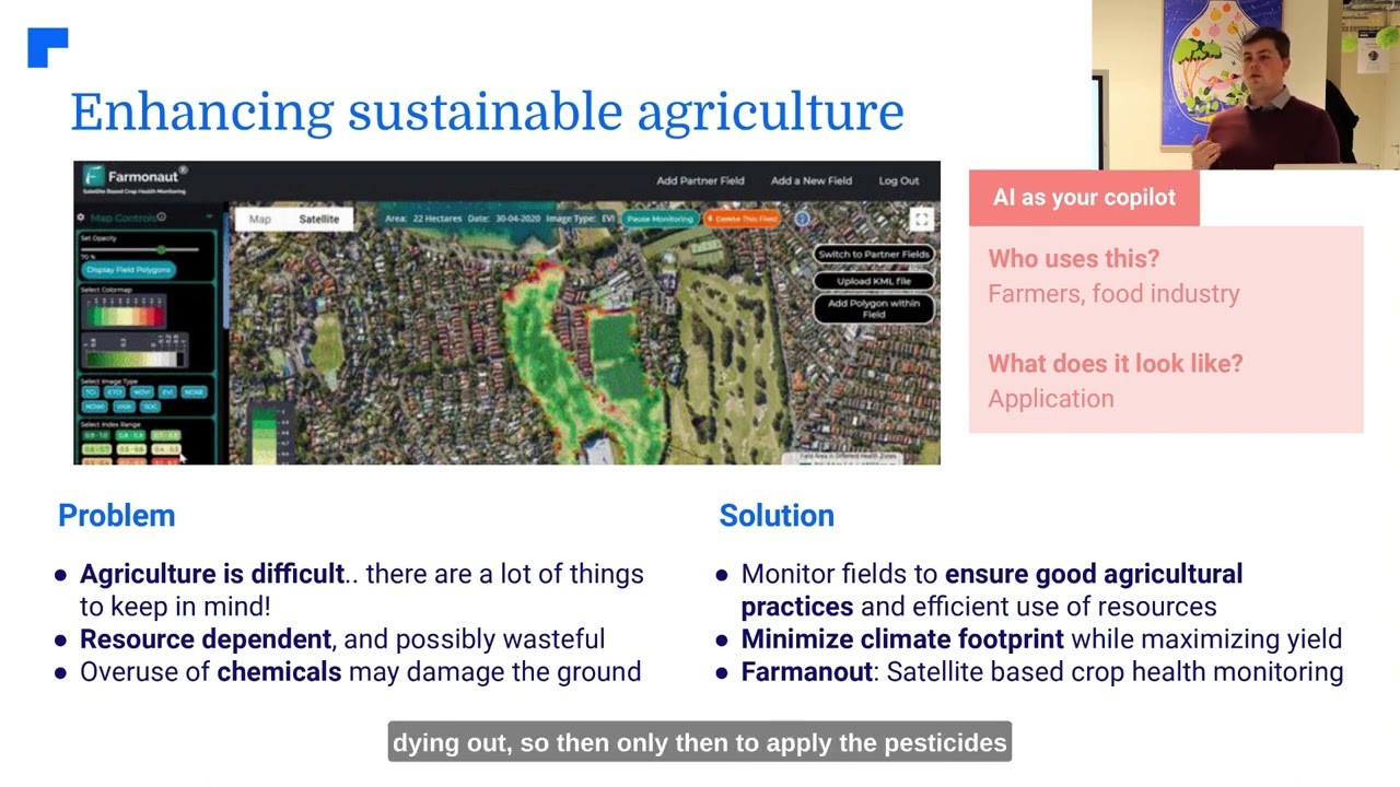
- Satellite-Based Monitoring: Farmonaut analyzes multispectral satellite data to monitor not only agricultural fields but also adjacent levee structures and flood control systems, identifying even minor variations and emerging threats in surface conditions.
- AI-Powered Insights: Our algorithms detect anomalies, erosion, seepage indicators, and vegetation patterns that may signal internal problems within a levee, all with high accuracy and at scale.
- API and App-Based Access: Easily integrate our levee monitoring data into your systems through Farmonaut’s API and detailed developer docs, or use our cross-platform mobile and web apps for instant access.
Why Farmonaut?
- Brings real-time levee data to decision-makers, maintenance crews, and disaster response teams.
- Enables customized alerts when anomalies are detected, reducing response times and ensuring the safety of at-risk areas.
- Scales from small community levees to vast regional flood defense systems.
Where can Farmonaut be impactful? Any region where levees safeguard agricultural lands, urban centers, and infrastructure is a candidate for scalable remote levee monitoring. Our solutions excel in river regions, coastal deltas, dam floodplains, and anywhere robust early warning of potential levee failures is paramount.
Explore our Large Scale Farm Management Platform—manage levee-adjacent lands while monitoring flood risks seamlessly.

Implementing Farmonaut Engine for Levee Monitoring: Step-by-Step
Farmonaut integrates the most recent advancements in remote sensing for levees and structural health monitoring, making early detection and mitigation of flood risks practical for large-scale infrastructure and community protection.
How Our Monitoring System Works
- Satellite Imagery Acquisition — The Farmonaut platform automatically collects high-resolution satellite images across stretches of levees and adjacent agricultural fields.
- Data Integration & Visualization — Our algorithms process and visualize satellite, aerial, and sensor data to identify surface anomalies, displacement, and subsidence, as well as emergent vegetation or changes in the landscape that could indicate seepage or internal issues.
- AI-Driven Analysis — Using our precision analytics, the system flags patterns associated with early-stage levee failures (e.g., increased pore water pressure, unexpected erosion, or growth anomalies).
- Integration with UAS Data — Drones equipped with optical and LiDAR sensors supplement satellite observations, capturing fine details, surface deformations, or vegetation encroachment missed by other methods.
- Actionable Alerts & Reports — Customize reports and receive alerts instantly through email, SMS, dashboard notifications, or API endpoints, allowing rapid dispatch of crews for inspection or repair.
The Farmonaut Engine allows for truly comprehensive assessment—from the sky, ground, and inside the levee itself.

Comparing Advanced Levee Monitoring Technologies: A Data-Driven Table
Summary: Farmonaut delivers the highest combination of speed, accuracy, scalability, and minimal disruption—enabling proactive levee monitoring for agencies, farmers, engineers, and community managers.
Benefits of Using Farmonaut for Levee Monitoring
- Early Detection of Levee Issues: Continuous, automated surveillance means we catch problems—such as seepage, internal displacement, micropores, or evolving vegetation—much earlier than manual methods.
- Cost-Effectiveness: The need for fewer on-site inspections, streamlined operations, and multi-tech integration mean substantial savings over traditional approaches.
- Real-Time Levee Data & Analytics: Decision-makers can view current conditions, receive AI-powered suggestions, and customize alerts directly from Farmonaut’s mobile/web platform.
- Scalability and Flexibility: Farmonaut’s modular architecture allows monitoring from localized levees to massive regional systems.
- Regulatory Compliance & Reporting: Oversight bodies or insurance agencies can receive robust, quantitative reports that enhance transparency and liability management. Learn more about verifying levee and field maintenance for insurance in Farmonaut’s Crop Loan & Insurance Verification solutions.
- Sustainability & Carbon Monitoring: By minimizing unnecessary inspections and consolidating resources, Farmonaut’s platform also supports carbon footprint tracking and sustainable maintenance strategies for critical infrastructure.
- Blockchain Traceability: Our product traceability tools ensure that work performed on levees and flood control structures is accurately recorded, supporting compliance and public assurance.
Paired with Fleet & Resource Management, Farmonaut ensures not only accurate detection and reporting, but also optimized dispatch of vehicles and personnel for effective, timely levee maintenance.
Key Challenges in Advanced Levee Monitoring
While technologies like those offered by Farmonaut are groundbreaking, integration and implementation come with their own set of challenges:
- Data Integration: Combining diverse sources—satellite, UAS, DFOS, and legacy ground sensors—requires robust data engineering and automated analytics pipelines.
- Regulatory Compliance: Drone (UAS) usage for levee inspection is subject to national and international aviation rules, privacy laws, and occasionally environmental standards.
- Infrastructure Requirements: Remote areas may need initial setup (e.g. data relay points, sensor maintenance hubs), though Farmonaut’s system is designed to minimize on-site dependency.
- Calibration & Sensor Health: To maintain accuracy, all input sensors and data sources must undergo regular calibration and health checks, particularly for ground-based and DFOS technologies.
- Data Security & Access Management: Safeguarding real-time levee data against unauthorized access or tampering is crucial in critical infrastructure applications.
By proactively addressing these challenges, we ensure the long-term resilience of flood control systems and maximally effective deployment of cutting-edge monitoring solutions.
Farmonaut Tools, Apps, and API Access
Whether you oversee levee safety for government agencies, agribusinesses, cooperatives, or local communities, Farmonaut offers multi-platform, real-time access to critical levee and flood control data:
- Web & Mobile App: Simple dashboards, customizable alerts, and visual status of levee health, crop areas, and risk zones.
- Farmonaut API: Programmatic data retrieval and integration for third-party platforms, disaster management systems, and custom analytics projects. Full documentation can be found at Farmonaut API Developer Docs.
- Android App and iOS App: On-the-go levee and crop monitoring for field staff, operation leads, and engineering teams.
Specialized Solutions: For plantation, forest, or large-scale advisory services in sensitive floodplain and riparian zones, consider Farmonaut’s Crop Plantation & Forest Advisory tools.
Farmonaut Subscription Pricing
We offer a variety of subscription plans to match every scale—from smallholder operations inspecting adjacent rural levees to regional authorities managing extensive flood control infrastructure.
All plans include access to remote sensing for levees, AI-powered analytics, mobile/web access, and real-time alert features.
FAQ: Levee Monitoring with Farmonaut
1. How does Farmonaut improve early detection of levee issues?
Farmonaut’s platform analyzes high-resolution satellite imagery, UAS data, and ground-based sensors using AI. This integration enables identification of subtle surface and internal anomalies—such as seepage, displacement, and vegetation growth—long before they become serious issues, allowing preventive maintenance and reduced risk of failures.
2. Can Farmonaut data be integrated with our existing flood control systems?
Absolutely. Our API and web/mobile dashboards support data export and integration with popular third-party tools, GIS systems, and custom applications.
3. What makes Farmonaut’s system more effective than manual levee inspections?
Key advantages include real-time levee data, greater coverage, reduced operational overhead, higher accuracy (through AI absence of human error), and earlier warning of potential problems. Manual methods cannot match the scope and speed of cloud-based analytics and automated data collection.
4. How do regulatory requirements affect UAS-based levee monitoring?
Use of UAS for levee inspection is subject to local and international aviation regulations and, occasionally, privacy legislation. It’s important to comply with all applicable government rules for flight permissions, altitude, and data capture. Farmonaut’s system is designed to operate flexibly under common regulatory frameworks.
5. Can levee and crop data be monitored from anywhere?
Yes, Farmonaut’s platform is accessible globally via web and mobile apps, making on-demand levee or farm monitoring possible for distributed teams.
6. Is there a solution for tracking environmental impact of levee maintenance?
Yes. Our carbon footprinting feature enables users to monitor the environmental impact associated with inspection visits, machinery usage, and levee maintenance—supporting sustainability and compliance initiatives.
Conclusion: Levee Monitoring & Technology Innovation with Farmonaut
As climate change and urban expansion increase flood risks globally, the need for robust, proactive levee monitoring systems becomes more critical. Traditional methods—while historically significant—cannot scale to today’s challenges nor deliver the data granularity or speed required for effective early warning systems.
Farmonaut stands at the forefront of this transformation. By integrating remote sensing for levees, distributed fiber-optic sensing, satellite and UAS imagery analysis, and AI-driven anomaly detection, we empower stakeholders to take decisive, data-backed actions for flood prevention, agricultural land safety, and community resilience.
- Leverage precision analytics, real-time insights, and scalable monitoring with Farmonaut’s comprehensive platform.
- Protect agricultural lands, communities, and infrastructure from the devastating impacts of flooding.
- Facilitate regulatory compliance, sustainability, and long-term risk reduction with next-generation technology.
As the world’s levee and flood control infrastructure ages and climate threats increase, partnering with advanced technology like Farmonaut Engine is not merely an upgrade—it’s an essential evolution for future safety and prosperity.
Ready to revolutionize your levee monitoring?
Try our platform today via web and mobile apps, or streamline your infrastructure data integration with the Farmonaut API.


