Extreme Fire Danger: Northwest Arkansas Battles Wildfires Amid Red Flag Warnings and Burn Bans
“Two wildland fires in Rogers County, Northwest Arkansas, consumed over 180 acres amid extreme fire danger conditions.”
As we delve into the critical issue of wildland fire safety in Northwest Arkansas, we find ourselves at the forefront of an environmental challenge that demands our immediate attention. The recent surge in extreme fire danger has placed our region on high alert, with red flag fire warnings and burn ban counties highlighting the urgent need for vigilance and proactive measures.
In this comprehensive blog post, we will explore the current situation, analyze the factors contributing to the heightened fire risk, and provide essential information on how to protect your property and community. We’ll also discuss the collaborative efforts of fire services, meteorologists, and public safety officials in addressing these pressing environmental challenges.
The Current Fire Situation in Northwest Arkansas
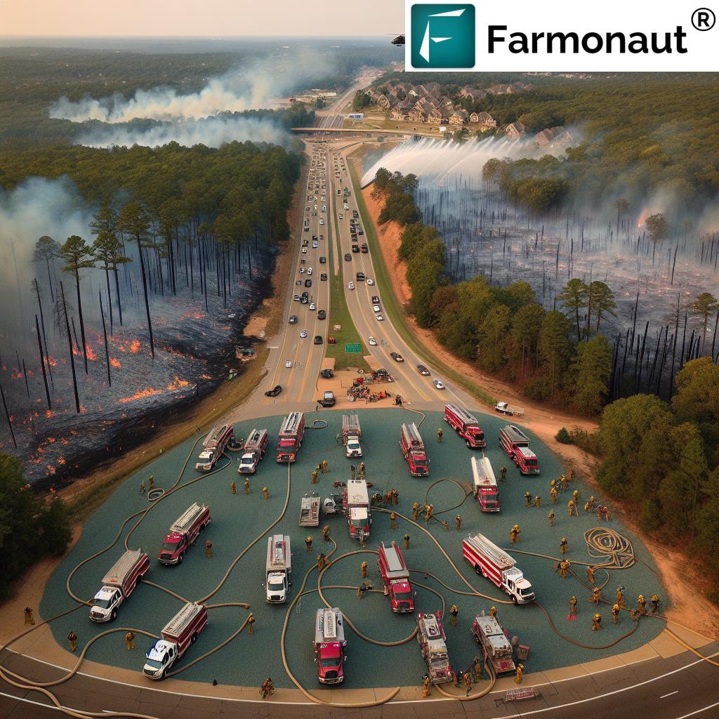
The recent events in Rogers County serve as a stark reminder of the volatile fire conditions plaguing our region. Two significant wildland fires have consumed over 180 acres, presenting formidable challenges to our local fire departments and necessitating mutual aid from neighboring jurisdictions.
- The Pine Creek Hollow Road fire affected approximately 141 acres
- The Railroad Cut Road fire impacted about 43 acres
These fires, exacerbated by low humidity and high winds, have showcased the region’s vulnerability to rapid fire spread. The Piney Point Fire Department, along with several mutual aid departments, worked tirelessly to contain these blazes, facing extreme challenges due to the adverse weather conditions.
Weather Conditions and Red Flag Warnings
The National Weather Service in Tulsa has been instrumental in alerting the public to the dangerous fire conditions. Multiple red flag warnings have been issued for Northwest Arkansas and parts of northeast Oklahoma, signaling a perilous combination of factors favoring wildfire growth:
- Stronger winds
- Lower humidity levels
- Warmer temperatures
- Dry vegetation
These red flag warnings are not to be taken lightly. They indicate that within 24 hours, conditions will be ideal for the rapid spread of wildfires, making containment efforts extremely challenging.
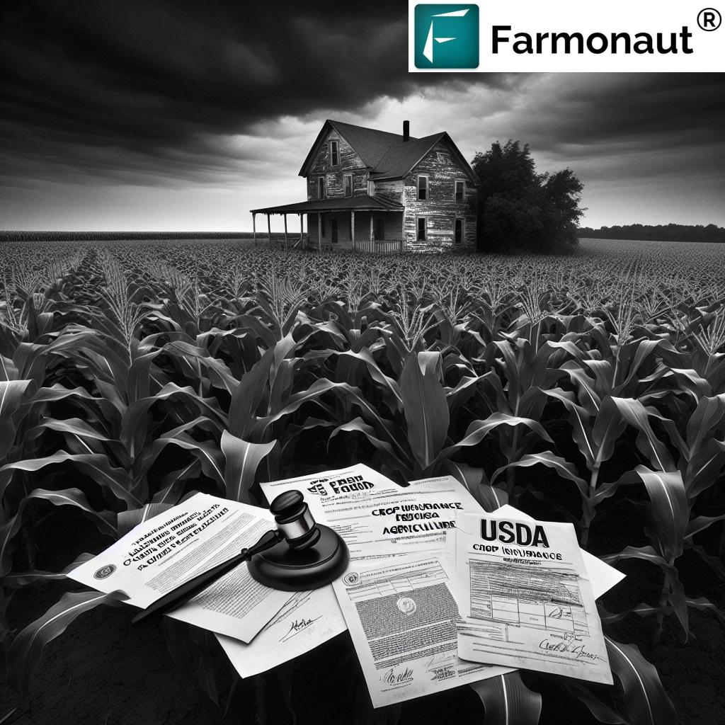
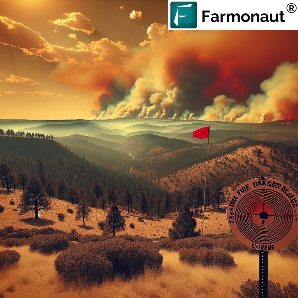
Burn Bans and Fire Danger Scale
In response to the elevated fire risk, local authorities have implemented outdoor burning restrictions across numerous counties. Benton County, for instance, has issued 24-hour bans on outdoor open burning for several consecutive days. These decisions are not made lightly and are based on a careful assessment of various factors:
- Information from the National Weather Service
- Consultation with the Department of Agriculture Forestry Division
- Wind speeds
- Humidity levels
- Overall dryness in the weather forecast
The fire danger scale, a color-coded system ranging from green (least severe) to red (most severe), has been a crucial tool in assessing and communicating the level of fire risk to the public. Many counties in Northwest Arkansas have been placed at the red level, indicating extreme fire danger.
Northwest Arkansas Fire Danger Assessment
| County Name | Fire Danger Level | Burn Ban Status | Recent Wildfire Activity | Precautionary Measures |
|---|---|---|---|---|
| Benton | Extreme | Yes | Significant | Avoid all outdoor burning, clear debris from property |
| Washington | Extreme | Yes | Minor | Keep flammable materials away from structures |
| Carroll | Extreme | Yes | None | Maintain defensible space around homes |
| Madison | Extreme | Yes | Minor | Have an evacuation plan ready |
| Crawford | Extreme | Yes | None | Stay informed about local fire conditions |
This table provides a snapshot of the current fire danger situation across key counties in Northwest Arkansas. As we can see, the situation is critical, with all listed counties facing extreme fire danger and active burn bans. Residents in these areas must remain vigilant and adhere to the precautionary measures outlined.
The Role of the Arkansas Forestry Division
The Arkansas Forestry Division has been at the forefront of monitoring and reporting on the fire danger across the state. Their assessments have been crucial in informing local authorities and the public about the evolving situation. As of our latest update, the division has reported extreme fire danger across multiple counties in Northwest Arkansas, including:
- Benton
- Washington
- Carroll
- Boone
- Madison
- Newton
- Crawford
- Franklin
- Johnson
- Sebastian
Additionally, 17 other Arkansas counties outside the immediate Northwest region were under burn bans as of the latest report. This widespread implementation of burn bans underscores the severity of the current fire risk and the need for statewide vigilance.
“Multiple counties in Northwest Arkansas faced red flag warnings and burn bans due to low humidity and high winds.”
Understanding the Factors Contributing to Extreme Fire Danger
To fully grasp the severity of the current situation, it’s essential to understand the various factors that contribute to extreme fire danger. These elements work in concert to create conditions that are highly conducive to the rapid spread of wildfires:
- Low Humidity: When the air is dry, it quickly absorbs moisture from vegetation, making it more susceptible to ignition.
- High Winds: Strong winds can rapidly spread fires, carry embers to new locations, and make containment efforts extremely challenging.
- Warm Temperatures: Higher temperatures accelerate the drying of vegetation and increase the likelihood of ignition.
- Dry Vegetation: Prolonged periods without significant rainfall can leave plants and trees in a highly flammable state.
- Topography: The hilly terrain of Northwest Arkansas can contribute to faster fire spread, especially uphill.
The combination of these factors creates a perfect storm for wildfire development and propagation, necessitating heightened awareness and precautionary measures from all residents.
The Impact of Recent Wildfires
The recent wildfires in Rogers County have had significant impacts on the local community and environment. While the swift response of fire departments and mutual aid partners prevented loss of life, the fires did result in property damage:
- One structure suffered heavy damage
- A second structure received minimal damage
- Over 180 acres of land were affected
These incidents serve as a stark reminder of the potential for rapid fire spread under current conditions and highlight the critical importance of fire prevention and preparedness measures.
Collaborative Efforts in Fire Response and Prevention
The battle against these wildfires and the ongoing efforts to prevent future incidents involve a wide range of stakeholders working in close collaboration:
- Fire Departments: Local fire services, including the Piney Point Fire Department, have been at the forefront of fire response efforts.
- Mutual Aid Partners: Neighboring fire departments have provided crucial support in combating large-scale fires.
- National Weather Service: Meteorologists play a vital role in predicting and communicating fire danger conditions.
- Arkansas Forestry Division: This agency provides critical assessments of fire danger and coordinates statewide fire prevention efforts.
- County Officials: Local authorities are responsible for implementing burn bans and coordinating public safety measures.
- Public Safety Departments: These organizations work to ensure community safety and coordinate emergency responses.
This multi-agency approach is essential for effectively managing the complex challenges posed by extreme fire danger conditions.
Wildfire Prevention Tips for Northwest Arkansas Residents
In light of the current extreme fire danger, it’s crucial for all residents of Northwest Arkansas to take proactive steps to prevent wildfires and protect their properties. Here are some essential wildfire prevention tips:
- Obey Burn Bans: Strictly adhere to all local burn bans and fire restrictions.
- Create Defensible Space: Maintain a 30-foot buffer zone around your home free of flammable vegetation and materials.
- Proper Disposal of Cigarettes: Never throw cigarette butts out of car windows or onto the ground.
- Maintain Equipment: Ensure all outdoor equipment is in good working order to prevent sparks.
- Be Cautious with Vehicles: Avoid driving or parking on dry grass, as hot exhaust systems can ignite vegetation.
- Report Suspicious Activity: If you see signs of a potential fire starting, report it immediately to local authorities.
- Stay Informed: Keep up-to-date with local weather forecasts and fire danger reports.
By following these guidelines, residents can significantly reduce the risk of accidental fire starts and contribute to the overall safety of their communities.
Leveraging Technology for Fire Prevention and Management
In today’s digital age, technology plays a crucial role in fire prevention and management efforts. Advanced tools and platforms can provide valuable insights and aid in decision-making processes. For instance, satellite-based monitoring systems can offer real-time data on vegetation health and moisture levels, which are critical factors in assessing fire risk.
Farmonaut, a leading agricultural technology company, offers satellite-based farm management solutions that can be valuable in this context. While primarily focused on precision agriculture, their platform’s capabilities in monitoring vegetation health (NDVI) and soil moisture levels can be potentially useful for fire risk assessment in agricultural and forested areas.

For those interested in exploring these technological solutions, Farmonaut offers various access points to their services:
- Web App: Access detailed satellite imagery and analytics through their browser-based platform.
- Mobile Apps: Stay informed on-the-go with their Android and iOS applications.
- API Access: For developers and organizations looking to integrate satellite data into their own systems, Farmonaut provides API access. You can find more information in their API Developer Docs.


While these tools are primarily designed for agricultural purposes, the underlying technology and data could potentially be adapted or integrated into fire prevention strategies, especially in rural and agricultural areas that are at high risk for wildfires.
Community Engagement and Education
Effective wildfire prevention and management require active community engagement and ongoing education. Local fire departments, forestry agencies, and community organizations play a crucial role in disseminating information and raising awareness about fire safety. Some key aspects of community engagement include:
- Public workshops on fire safety and prevention
- Distribution of educational materials on creating defensible spaces
- Community-wide fire drills and evacuation practices
- Youth education programs in schools
- Volunteer programs for community fire watch during high-risk periods
By fostering a culture of fire awareness and preparedness, communities can significantly reduce their vulnerability to wildfires and improve their resilience in the face of extreme fire danger.
The Role of Sustainable Land Management in Fire Prevention
Sustainable land management practices play a significant role in mitigating fire risks, especially in regions prone to extreme fire danger. By implementing these practices, landowners and farmers can contribute to overall fire prevention efforts:
- Proper Vegetation Management: Regular thinning and removal of excess vegetation can reduce fuel loads and slow fire spread.
- Controlled Burns: When conditions permit and under expert supervision, controlled burns can help manage vegetation and create fire breaks.
- Crop Rotation: Implementing diverse crop rotations can help maintain soil moisture and reduce the risk of large, continuous areas of dry vegetation.
- Water Management: Efficient irrigation systems and water conservation practices can help maintain higher moisture levels in vegetation, reducing fire risk.
- Buffer Zones: Creating and maintaining fire-resistant buffer zones between agricultural lands and forested areas can help prevent fire spread.
These practices not only contribute to fire prevention but also promote overall environmental health and agricultural sustainability. Farmers and landowners can leverage technologies like satellite-based monitoring to assess vegetation health and implement targeted management strategies.
Earn With Farmonaut: Earn 20% recurring commission with Farmonaut’s affiliate program by sharing your promo code and helping farmers save 10%. Onboard 10 Elite farmers monthly to earn a minimum of $148,000 annually—start now and grow your income!
The Economic Impact of Wildfires
The threat of wildfires extends beyond immediate safety concerns, posing significant economic challenges to affected regions. Understanding these impacts is crucial for policymakers and community leaders in developing comprehensive fire management strategies:
- Property Damage: Direct losses from structure and property damage can be substantial.
- Agricultural Losses: Crops and livestock can be severely affected, leading to significant financial losses for farmers.
- Tourism Impact: Areas known for outdoor recreation may see a decline in visitors during high fire risk periods.
- Increased Insurance Costs: Properties in high-risk areas may face higher insurance premiums.
- Firefighting Costs: The resources required for fire suppression can strain local and state budgets.
- Long-term Environmental Costs: Ecosystem damage can have lasting effects on local economies dependent on natural resources.
By considering these economic factors, communities can better justify investments in fire prevention and management strategies, potentially saving significant costs in the long run.
Climate Change and Its Impact on Fire Risk
The increasing frequency and severity of extreme fire danger conditions in regions like Northwest Arkansas can be partly attributed to broader climate change trends. Understanding this connection is crucial for developing long-term strategies to mitigate fire risks:
- Extended Dry Seasons: Climate change can lead to longer periods of dry weather, increasing the risk of wildfires.
- Higher Temperatures: Warmer average temperatures contribute to drier conditions and more readily combustible vegetation.
- Changing Precipitation Patterns: Irregular rainfall can lead to periods of vegetation growth followed by rapid drying, creating ideal conditions for fires.
- Increased Wind Events: Some regions may experience more frequent or severe wind events, which can exacerbate fire spread.
Addressing these climate-related factors requires a combination of local adaptation strategies and broader efforts to mitigate climate change impacts. Technologies that provide accurate weather forecasting and vegetation monitoring, such as those offered by platforms like Farmonaut, can play a crucial role in adapting to these changing conditions.
Future Outlook and Long-term Strategies
As we look to the future, it’s clear that addressing the challenges of extreme fire danger in Northwest Arkansas and similar regions will require a multifaceted, long-term approach. Key strategies may include:
- Advanced Early Warning Systems: Investing in more sophisticated fire detection and prediction technologies.
- Sustainable Urban Planning: Designing communities with fire resistance in mind, including strategic placement of fire breaks and water sources.
- Ecosystem-based Management: Implementing land management practices that promote natural fire resistance in local ecosystems.
- Community Resilience Programs: Developing comprehensive programs to enhance community preparedness and response capabilities.
- Integration of Technology: Leveraging advanced tools like satellite monitoring, AI-driven predictive models, and drone technology for better fire management.
By adopting these forward-thinking strategies and continuing to prioritize fire safety and prevention, communities in Northwest Arkansas can work towards a future where the threat of extreme fire danger is significantly reduced.
Conclusion
The current situation of extreme fire danger in Northwest Arkansas serves as a stark reminder of the critical importance of wildland fire safety and prevention. As we’ve explored in this comprehensive overview, the challenges posed by low humidity, high winds, and dry vegetation require a coordinated response from fire services, meteorologists, public safety officials, and the community at large.
By staying informed about current conditions, adhering to burn bans and fire safety guidelines, and leveraging advanced technologies for monitoring and prevention, we can all play a part in protecting our communities from the threat of wildfires. Remember, fire safety is a shared responsibility, and every action, no matter how small, contributes to the overall resilience of our region in the face of extreme fire danger.
FAQ Section
Q: What causes red flag warnings to be issued?
A: Red flag warnings are issued when a combination of strong winds, low relative humidity, and warm temperatures create ideal conditions for wildfire spread.
Q: How can I stay updated on the current fire danger in my area?
A: Monitor local news, weather services, and official social media channels of your local fire department and forestry division for the most up-to-date information.
Q: What should I do if a wildfire is approaching my property?
A: Follow evacuation orders immediately if issued. Have an emergency kit prepared and a plan for where to go. If time allows, close all windows and doors, and remove flammable items from around your home.
Q: Are campfires allowed during burn bans?
A: Generally, all outdoor burning, including campfires, is prohibited during a burn ban. Always check with local authorities for specific restrictions.
Q: How can technology help in preventing wildfires?
A: Advanced technologies like satellite monitoring, weather forecasting systems, and AI-driven predictive models can help detect fire risks early and assist in prevention and management efforts.