Revolutionizing American Agriculture: How Geospatial Analytics and AI Are Powering Smart Farming Solutions
“The geospatial analytics market in agriculture is projected to reach USD 55.75 billion by 2029, revolutionizing farm management.”
In the heart of America’s vast agricultural landscape, a quiet revolution is taking place. As we stand on the cusp of a new era in farming, geospatial analytics and artificial intelligence (AI) are emerging as the cornerstones of smart agriculture. This technological renaissance is not just changing how we farm; it’s redefining our relationship with the land, promising a future where efficiency, sustainability, and productivity go hand in hand.
At Farmonaut, we’re at the forefront of this agricultural transformation, harnessing the power of satellite technology and AI to bring precision farming to fields across the nation. But before we delve into the specifics of how these technologies are reshaping American agriculture, let’s take a broader look at the geospatial analytics market and its profound impact on the farming sector.
The Rising Tide of Geospatial Analytics in Agriculture
The geospatial analytics market is experiencing unprecedented growth, with projections indicating a surge from USD 32.97 billion in 2023 to an impressive USD 55.75 billion by 2029. This remarkable expansion, marked by a compound annual growth rate (CAGR) of 11.1%, is reshaping industries across the board, with agriculture standing out as a prime beneficiary.
Several key factors are driving this growth:
- The proliferation of smart cities
- Integration of AI and IoT with geospatial data
- Increasing demand for real-time data visualization
- Growing need for effective disaster management and urban planning systems
As these technologies converge, they’re creating a perfect storm of innovation in the agricultural sector, particularly in the realm of precision farming and smart agriculture solutions.
Precision Farming Technologies: The New Frontier
Precision farming technologies are at the heart of this agricultural revolution. By leveraging geospatial analytics, farmers can now make data-driven decisions that optimize every aspect of their operations. Here’s how these technologies are transforming farm management:
- Crop Monitoring with GIS: Geographic Information Systems (GIS) allow farmers to map and analyze their fields with unprecedented accuracy. By integrating satellite imagery with on-ground data, GIS provides a comprehensive view of crop health, soil conditions, and potential problem areas.
- AI-Powered Farm Management: Artificial intelligence algorithms process vast amounts of data from various sources, including satellite imagery, weather forecasts, and historical yield data. These AI systems can predict crop yields, detect early signs of disease, and recommend optimal planting and harvesting times.
- IoT in Agriculture: The Internet of Things (IoT) has brought a new level of connectivity to the farm. Smart sensors placed throughout fields collect real-time data on soil moisture, temperature, and nutrient levels, allowing for precise irrigation and fertilization strategies.

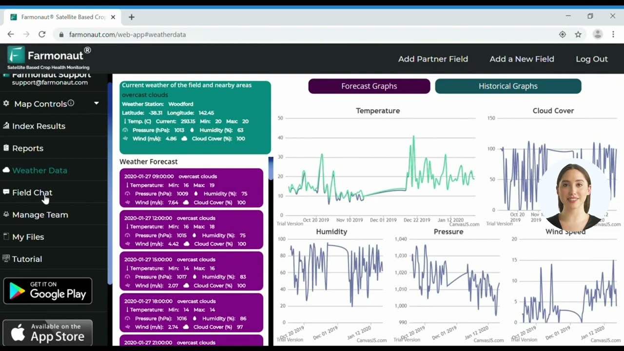
At Farmonaut, we’re proud to offer cutting-edge solutions that bring these technologies to farmers across America. Our web app and mobile applications for Android and iOS provide easy access to satellite-based crop monitoring, empowering farmers with the insights they need to make informed decisions.
The Power of Satellite Crop Monitoring
Satellite crop monitoring has revolutionized the way we observe and manage agricultural lands. This technology offers several key advantages:
- Wide-area coverage, allowing for the monitoring of vast tracts of land
- Frequent revisit times, providing up-to-date information on crop conditions
- Multi-spectral imaging capabilities that can detect issues invisible to the naked eye
- Cost-effective solution compared to traditional field surveys
Farmonaut’s satellite-based crop monitoring service leverages these advantages to provide farmers with detailed insights into their fields. Our system uses advanced algorithms to analyze satellite imagery, generating actionable intelligence on crop health, growth stages, and potential issues.
AI-Powered Predictive Analytics: The Future of Farming
“AI-powered systems leveraging geotemporal data provide predictive analytics for farming, optimizing crop yields across millions of acres.”
Predictive analytics in agriculture is perhaps one of the most exciting developments in recent years. By combining historical data with real-time information and advanced AI algorithms, we can now forecast crop yields, predict disease outbreaks, and optimize resource allocation with remarkable accuracy.
Here’s how AI-powered predictive analytics is transforming farming:
- Yield Prediction: AI models can analyze factors such as weather patterns, soil conditions, and historical yield data to predict crop yields with increasing accuracy. This allows farmers to make informed decisions about planting strategies and market planning.
- Disease and Pest Forecasting: By analyzing environmental conditions and historical pest data, AI systems can predict the likelihood of disease outbreaks or pest infestations, allowing for proactive treatment and prevention.
- Resource Optimization: Predictive models help farmers optimize the use of water, fertilizers, and other inputs by recommending precise application timing and quantities based on crop needs and environmental conditions.

At Farmonaut, our AI-powered advisory system, Jeevn AI, is designed to deliver personalized recommendations to farmers based on their specific field conditions and crop types. This system integrates seamlessly with our satellite monitoring capabilities, providing a comprehensive solution for modern farm management.
The Role of Geotemporal Data in Agriculture
Geotemporal data, which combines spatial information with time-based data, is proving to be a game-changer in agriculture. This type of data allows farmers to track changes in their fields over time, providing invaluable insights into crop development, soil health trends, and the effectiveness of various management practices.
Key applications of geotemporal data in agriculture include:
- Monitoring crop growth stages and identifying potential issues early
- Tracking the spread of diseases or pests across regions over time
- Analyzing the long-term impacts of climate change on local agricultural conditions
- Optimizing crop rotation strategies based on historical field performance
Farmonaut’s platform is built to harness the power of geotemporal data, providing farmers with time-lapse visualizations of their fields that reveal patterns and trends that might otherwise go unnoticed.
Agricultural Data Visualization: Making Insights Accessible
The power of geospatial analytics and AI in agriculture would be significantly diminished without effective data visualization tools. These tools transform complex data sets into easily understandable visual formats, allowing farmers to quickly grasp important insights and make timely decisions.
Effective agricultural data visualization offers several benefits:
- Improved Decision-Making: Visual representations of data make it easier for farmers to identify trends, anomalies, and opportunities for improvement.
- Enhanced Communication: Visualizations help in communicating complex information to stakeholders, from farm workers to investors.
- Simplified Compliance: Visual reports can streamline the process of demonstrating compliance with environmental regulations and sustainability standards.
Farmonaut’s platform includes a range of visualization tools, from color-coded NDVI maps to interactive time-lapse features, all designed to make complex agricultural data accessible and actionable for farmers of all technological backgrounds.
The Integration of IoT in Agriculture
The Internet of Things (IoT) is creating a network of interconnected devices that is transforming agriculture into a high-tech enterprise. These smart devices generate real-time data that, when combined with geospatial analytics and AI, create a powerful system for precision farming.
Key applications of IoT in agriculture include:
- Smart irrigation systems that adjust water usage based on real-time soil moisture data
- Automated climate control in greenhouses
- Livestock monitoring systems that track animal health and behavior
- Autonomous farm equipment that can perform tasks with minimal human intervention
While Farmonaut’s core services focus on satellite-based monitoring, our platform is designed to integrate seamlessly with IoT devices, allowing farmers to combine aerial insights with ground-level data for a comprehensive view of their operations.
The Future of Geospatial Analytics in Agriculture
As we look to the future, the role of geospatial analytics in agriculture is set to expand even further. Emerging technologies and trends that we’re watching closely include:
- Hyper-Spectral Imaging: Advanced satellite sensors that can detect an even wider range of spectral bands, providing more detailed information about crop health and soil conditions.
- Edge Computing: Processing data closer to the source (i.e., on farm equipment or local servers) to reduce latency and improve real-time decision-making capabilities.
- Blockchain Integration: Using blockchain technology to enhance traceability in the agricultural supply chain, from farm to table.
- Advanced Drone Technology: Integrating drone-captured imagery with satellite data for even more precise field analysis.
At Farmonaut, we’re committed to staying at the forefront of these technological advancements, continuously improving our services to meet the evolving needs of American farmers.
The Growth of Geospatial Analytics in Agriculture
| Year | Market Size (USD Billion) | Key Technologies Driving Growth |
|---|---|---|
| 2023 | 32.97 | Satellite imagery, Basic AI applications |
| 2024 | 36.63 | Advanced AI algorithms, IoT integration |
| 2025 | 40.69 | Cloud-based services, Edge computing |
| 2026 | 45.21 | 5G connectivity, Blockchain integration |
| 2027 | 50.23 | Quantum computing applications, Advanced robotics |
| 2028 | 55.75 | Hyper-spectral imaging, AI-powered predictive analytics |
| 2029 | 61.88 | Autonomous systems, Integrated smart farming platforms |
Farmonaut: Empowering American Farmers with Cutting-Edge Technology
As we’ve explored the transformative power of geospatial analytics and AI in agriculture, it’s clear that these technologies are not just the future of farming – they’re the present. At Farmonaut, we’re proud to be at the forefront of this agricultural revolution, offering American farmers the tools they need to thrive in an increasingly complex and challenging environment.
Our suite of services, accessible through our web app, Android app, and iOS app, brings the power of satellite-based crop monitoring, AI-driven insights, and advanced data visualization to farms of all sizes. We’re committed to making precision agriculture accessible and affordable, helping farmers increase yields, reduce costs, and farm more sustainably.
For those looking to integrate our services into their own applications or systems, we offer a robust API with comprehensive developer documentation.
Conclusion: The Dawn of a New Agricultural Era
As we stand at the intersection of agriculture and technology, the future has never looked brighter for American farming. Geospatial analytics and AI are not just improving farm management – they’re revolutionizing it, ushering in an era of precision, efficiency, and sustainability.
From the vast cornfields of the Midwest to the vineyards of California, smart farming solutions are helping American farmers meet the challenges of feeding a growing global population while conserving resources and protecting the environment. As these technologies continue to evolve and integrate, we can look forward to a future where farming is not just a practice, but a precise science, driven by data and powered by innovation.
At Farmonaut, we’re excited to be part of this journey, working hand in hand with American farmers to build a more sustainable and productive agricultural future. Together, we’re not just embracing new technologies – we’re cultivating a smarter, more resilient future for American agriculture.
FAQ Section
- Q: What is geospatial analytics in agriculture?
A: Geospatial analytics in agriculture involves using satellite imagery, GPS data, and other location-based information to analyze and optimize various aspects of farming, from crop health monitoring to resource management. - Q: How does AI contribute to smart farming?
A: AI in smart farming processes vast amounts of data to provide insights and predictions, such as crop yield forecasts, disease detection, and optimal resource allocation recommendations. - Q: What benefits does satellite crop monitoring offer?
A: Satellite crop monitoring provides wide-area coverage, frequent updates, and the ability to detect issues invisible to the naked eye, all at a lower cost compared to traditional field surveys. - Q: How does IoT integrate with geospatial analytics in agriculture?
A: IoT devices collect real-time data from the field, which can be combined with geospatial data to provide a comprehensive view of farm conditions and inform precise management decisions. - Q: What is the role of predictive analytics in farming?
A: Predictive analytics in farming uses historical and real-time data to forecast future outcomes, such as crop yields, disease outbreaks, and optimal planting times, helping farmers make proactive decisions.


