
What Is NDWI? 7 Powerful Ways to Boost Water Management
“NDWI can detect water stress in crops with up to 90% accuracy using satellite remote sensing data.”
Table of Contents
- Introduction: The Power of NDWI in Agriculture & Forestry
- Understanding NDWI: How the Normalized Difference Water Index Works
- 7 Powerful Ways NDWI Enhances Water Management
- How Farmonaut Makes NDWI-Based Water Management Easy
- Comparative Table: NDWI Applications and Benefits
- Remote Sensing Technology: NDWI Bands, Satellite Imagery & Data Insights
- Limitations & Considerations of NDWI in Real-World Scenarios
- Getting Started: Access NDWI and Advanced Water Management Tools
- Frequently Asked Questions About NDWI & Water Management
- Conclusion: The Future of Water Management with NDWI & Innovation

Introduction: The Power of NDWI in Agriculture & Forestry
In today’s fast-evolving world, water management stands as a central challenge for the agriculture and forestry sectors. Water scarcity, climate change, and resource depletion demand more innovative tools than ever before. In this context, the Normalized Difference Water Index (NDWI) emerges as a leading-edge solution that empowers us to assess, monitor, and optimize water resources with unprecedented precision.
Across the globe, farmers, foresters, and sustainable land managers are turning to NDWI as a trusted remote sensing metric for drought monitoring, irrigation efficiency assessment, and monitoring crop water stress. By integrating advanced ndwi remote sensing into our decision-making, we unlock a deep well of data-driven insights—driving improved yields, resource conservation, and environmental stewardship.

“Over 70% of global drought monitoring programs now utilize NDWI for real-time water resource assessment.”
Understanding NDWI: How the Normalized Difference Water Index Works
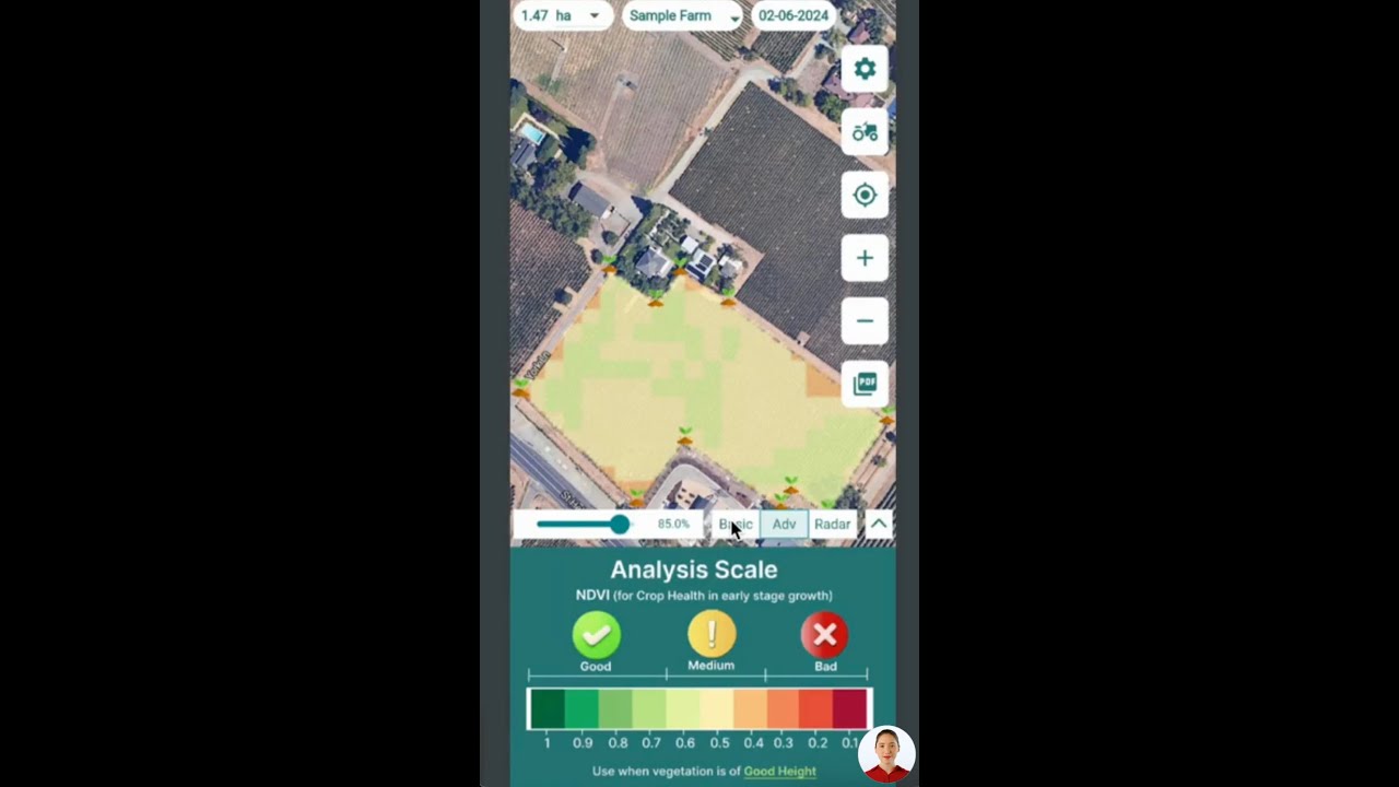
The Normalized Difference Water Index (NDWI) is a powerful spectral index for agriculture and forestry that helps us quantify the water content in vegetation and identify water bodies. Designed for ndwi remote sensing applications, NDWI utilizes certain wavelengths captured by satellite sensors and applies a mathematical formula to reveal real-time environmental insights.
The NDWI Formula
NDWI leverages the unique reflectance characteristics of water in the near-infrared (NIR) and shortwave-infrared (SWIR) regions. The index is calculated as:
NDWI = (NIR - SWIR) / (NIR + SWIR)
- NIR (Near-Infrared band) – captures the vitality and water status of plant tissue
- SWIR (Shortwave-Infrared band) – highly sensitive to the presence or absence of water
NDWI values range between -1 and +1. Higher values indicate a greater water content in vegetation, while lower values signal water stress or a lack of water in foliage. Typical NDWI thresholds in monitoring crop water stress are:
- NDWI > 0.4 – healthy, well-irrigated crops
- NDWI < 0.3 – potential water deficit or drought-affected crops
Why Use NDWI Over Other Vegetation Indices?
While indices like NDVI (Normalized Difference Vegetation Index) are effective at assessing general vegetation health, NDWI is uniquely sensitive to water availability and water stress in crops. By specifically analyzing NIR and SWIR bands, NDWI delivers precise insights for irrigation management, drought response, and water resource planning.

7 Powerful Ways NDWI Enhances Water Management
Let’s explore the seven core ways the normalized difference water index boosts land and water management across agriculture and forestry:
-
Monitoring Crop Health & Water Stress
Farmers can monitor crop water stress by regularly analyzing NDWI values in different field areas. A sudden drop in NDWI often signals early water stress in crops, enabling us to adjust irrigation schedules proactively. This not only improves yields but also conserves water resources and prevents plant stress from escalating.
NDWI’s real-time monitoring reduces the guesswork in detecting plant water stress, guiding targeted irrigation interventions for optimal plant growth.
-
Irrigation Efficiency Assessment
By comparing NDWI values across irrigation zones, we can quickly identify areas with inadequate or excessive water distribution. Using NDWI as a water management tool allows for targeted irrigation efficiency assessment, leading to cost savings, water conservation, and uniform crop growth.
-
Drought Monitoring in Agriculture
A continuous decline in NDWI across large land areas acts as an early drought warning signal. This metric is now used in over 70% of global drought programs for real-time water resource assessment, helping us deploy timely mitigation strategies to safeguard crops and forests in drought-prone regions.
-
Forest Fire Risk Assessment
In forestry, NDWI is instrumental in forest fire risk assessment. Low NDWI readings in forested areas pinpoint dry, fire-prone zones, so we can carry out preventive interventions, allocate resources, and reduce fire hazards.
-
Land and Water Management Tools
NDWI assists in mapping water bodies and their boundaries for accurate land classification. Reliable water body delineation provides insight for managing wetlands, irrigation reservoirs, habitats, and pollution monitoring, improving sustainable land use planning.
-
Wetland and Flood Risk Assessment
NDWI’s ability to distinguish between land areas and open water bodies makes it ideal for wetland mapping and flood monitoring. Accurately mapped wetlands help maintain ecosystem balance, track water quality, and inform conservation or emergency response strategies.
-
Water Resource Allocation & Planning
Regional authorities and farm managers use NDWI data as a foundation for allocating water resources efficiently and designing infrastructure for sustainable farming, forest management, and urban planning. Better visibility leads to smarter policies, resource resilience, and adaptation.
How Farmonaut Makes NDWI-Based Water Management Easy
Farmonaut empowers users worldwide with cost-effective, advanced NDWI tools for monitoring crop health, optimizing irrigation, and precision resource management. By leveraging powerful technologies such as satellite-based crop health monitoring, AI-driven advisory, and blockchain traceability, we make data-driven agriculture a reality for every farmer, business, and land manager.
- Crop Health & Water Stress Monitoring: Our platform uses satellite-derived NDWI imagery to give farmers real-time visibility on crop vitality, plant water status, and drought risk.
-
Fleet & Resource Management: Efficient NDWI-based operations let agribusinesses manage their machinery, logistics, and field teams—directly minimizing operational waste and maximizing productivity.
More on Farmonaut Fleet Management →
-
Advanced Plantation, Crop, and Forest Monitoring: Plantation owners, large farms, and forestry managers harness NDWI analytics to make targeted interventions for healthier, more resilient landscapes.
Farmonaut Large-Scale Plantation & Forest Management
-
Product Traceability: Blockchain-backed tracking enhances transparency of your produce’s entire journey—with environmental metrics such as NDWI for sustainability certifications.
Explore Farmonaut Traceability Solutions
-
Carbon Footprinting: Monitor and reduce your carbon impact with real-time emissions and resource use tracking.
Farmonaut Carbon Footprint Tools
Unlock full NDWI water management with Farmonaut’s Apps or direct API integration.

Comparative Table: NDWI Applications and Benefits
| NDWI Application | Estimated Impact (Quantitative Example) | Technological Integration | Benefits for Agriculture/Forestry |
|---|---|---|---|
| Monitoring crop water stress | Up to 20% increase in yield by timely water stress mitigation | Satellite-based NDWI analysis, farm monitoring apps | Optimized irrigation, early interventions, proactive management |
| Irrigation efficiency assessment | 10–25% water savings across irrigated fields | NDWI mapping in field sections, AI advisory systems | Uniform crop growth, cost reduction, water conservation |
| Drought monitoring in agriculture | Detection of drought onset 2–3 weeks earlier than traditional methods | Real-time NDWI monitoring, alert systems | Early warning, strategic resource allocation, crop protection |
| Forest fire risk assessment | Accurate detection of up to 90% fire-prone zones | NDWI-based fuel moisture analytics, satellite imagery | Fire prevention, improved resource deployment, risk reduction |
| Water body delineation | 98%+ accuracy in mapping water/land boundaries | NDWI spectral analysis, GIS integration | Resource planning, wetland conservation, land management |
| Wetland mapping & flood risk assessment | 50% time savings in wetland classification | NDWI time-series, mapping software | Faster emergency response, ecosystem management |
| Water resource allocation | Up to 30% improvement in distribution strategies | Regional NDWI monitoring, resource management tools | Sustainable water use, resilience against scarcity |
Remote Sensing Technology: NDWI Bands, Satellite Imagery & Data Insights
Harnessing ndwi remote sensing requires modern satellite-based technologies capable of capturing data in the NIR and SWIR spectral bands. Platforms like Farmonaut deliver these multispectral images and make advanced NDWI analytics accessible to users worldwide through:
- Satellite Imagery Providers: Satellites such as Sentinel-2, Landsat 8, and others offer free and commercial imagery with the requisite NIR and SWIR bands for precise water body and plant water content assessment.
- Data Processing Algorithms: Automated pipelines process large-scale images, apply the NDWI formula, and output actionable maps and alerts in user-friendly apps.
- Farmonaut Apps & APIs: Whether through the intuitive web and mobile apps or API endpoints, users can integrate NDWI directly with their farm or forest operations.
- AI & Machine Learning: Combining NDWI with other indices and AI-driven models further enhances accuracy for crop health diagnostics, drought forecasting, and fire risk prediction.
Key Terms: NDWI, NIR, SWIR, and Spectral Index
- NDWI (Normalized Difference Water Index): A spectral index calculated from satellite imagery for monitoring water content in vegetation and water bodies.
- NIR (Near-Infrared): Light in the 0.8–1.1 µm wavelength, sensitive to plant cell structure and water in leaves.
- SWIR (Shortwave Infrared): Light between 1.1–3.0 µm, highly affected by water presence and absorbed by water-rich structures.
- Spectral Index: A mathematical combination of bands to extract physical or biological information (NDWI, NDVI, etc.).
Farmonaut democratizes water management: no expensive hardware, just direct access to high-quality NDWI data for actionable insights in monitoring crop water stress, irrigation efficiency assessment, forest fire risk assessment, and more.
Limitations & Considerations of NDWI in Real-World Scenarios
While NDWI advances water management in agriculture and forestry, it’s essential to understand its limitations for accurate management decisions:
- Sensitivity to Built Structures: Urban areas with reflective surfaces such as concrete or rooftops can cause NDWI to overestimate water bodies, resulting in false positives. Always interpret NDWI maps in the context of actual land use.
- Dependence on Atmospheric Conditions: Atmospheric variables—cloud cover, water vapor, and humidity—can interfere with spectral reflectance, reducing NDWI accuracy. Data filtering and multi-temporal analysis help mitigate this.
- Spectral Band Availability: Not all satellite sensors offer both NIR and SWIR bands. Effective NDWI calculation depends on access to multispectral data.
- Surface Water vs. Soil Moisture: NDWI primarily detects water content in vegetation and open water—not direct soil moisture. It’s best used alongside other indices for comprehensive insights.
- Temporal Frequency: Satellite revisit times can limit how frequently NDWI maps are updated; cloudy periods can create gaps in observations.
Careful interpretation, multi-index analysis, and validation with ground truth observations ensure NDWI’s reliable use in real-world water management.
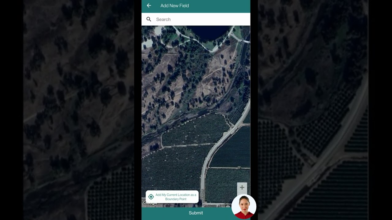
Getting Started: Access NDWI and Advanced Water Management Tools
Ready to harness NDWI for your farming, irrigation, drought management, or forest monitoring needs? Get started in three easy ways:
-
1. Farmonaut Web App: Access detailed NDWI, NDVI, and crop health maps in an intuitive dashboard for fields, plantations, or entire agro-forestry regions.
Launch Web App
- 2. Mobile Apps (Android & iOS): Monitor your crops anytime, anywhere—get insights, alerts, and AI-driven recommendations straight from your phone.
- 3. Farmonaut API: Integrate NDWI and other satellite analytics into your farm management software, advisories, or agri-research platforms. Find full docs: Developer Documentation.
Plantation, crop, and forest managers—track vast estates and optimize resources using dedicated large-scale management tools.
Traceability and transparency—monitor sustainable water and land practices with blockchain-based supply chain solutions.
For insurance and loan verification requirements, Farmonaut offers satellite-based crop validation that incorporates NDWI trends into risk models.


Frequently Asked Questions About NDWI & Water Management
What is NDWI?
NDWI stands for Normalized Difference Water Index. It is a remote sensing metric calculated from satellite imagery using near-infrared (NIR) and shortwave-infrared (SWIR) spectral bands to monitor the water content in vegetation and to map water bodies.
How is NDWI different from NDVI?
NDVI measures general vegetation vigor and greenness, while NDWI focuses specifically on detecting water content in plants and surface water detection. NDWI uses the NIR and SWIR bands for higher sensitivity to water.
How can NDWI improve irrigation practices?
By highlighting areas within a field that are under- or over-watered, NDWI enables irrigation efficiency assessment. Adjustments can be made to optimize water usage and ensure healthy crop growth.
Can NDWI help with drought monitoring?
Yes, NDWI is a reliable indicator for drought monitoring in agriculture. Drops in NDWI over time signal emerging water deficits, allowing for timely interventions to mitigate drought impacts.
Does NDWI require special equipment?
No hardware is required! All NDWI calculations are performed with satellite imagery and can be accessed via web or mobile apps and APIs like those offered by Farmonaut.
Is NDWI available worldwide?
As a remote sensing index, NDWI can be calculated for any region covered by satellites with NIR and SWIR sensors, making it accessible globally for various geographical locations.
What limitations should I be aware of?
NDWI accuracy may be affected by urban structures, atmospheric conditions like clouds and humidity, and the presence or absence of the required spectral bands in satellite data.
How do I access NDWI data for my farm?
Sign up for Farmonaut’s platform—choose between web, Android, iOS, or API access for NDWI-based monitoring, advisory, and management tools tailored to your needs.
Conclusion: The Future of Water Management with NDWI & Innovation
The Normalized Difference Water Index (NDWI) is reshaping the way we manage water, agriculture, forestry, and land resources. By providing actionable, spectral insights into plant water content, drought conditions, irrigation efficiency, and fire risk, NDWI empowers us to achieve higher productivity, resilience, and sustainability.
Integrated into advanced platforms like Farmonaut, NDWI makes precision agriculture not just attainable, but affordable for farmers, businesses, governments, and NGOs around the world. Whether our goal is to optimize resource usage, conserve water, protect crops and forests, or track environmental impact, NDWI stands as a vital tool in our modern toolkit—bolstered by the speed, scalability, and intelligence of remote sensing innovation.
Start your journey with NDWI and Farmonaut—bring the next level of water management to your fields and forests today!


