Unlocking the Power of Historical Weather Data for Precision Agriculture
At Farmonaut, we’re committed to revolutionizing agriculture through cutting-edge technology and data-driven insights. Today, we’re excited to share a powerful feature that can significantly enhance your farming practices: the ability to download your field’s historical weather data in an Excel sheet format. This invaluable tool offers a wealth of information to help you make informed decisions and optimize your crop management strategies.
The Importance of Historical Weather Data in Agriculture
Weather plays a crucial role in agriculture, influencing everything from planting dates to crop yields. By having access to detailed historical weather data, farmers can:
- Identify weather patterns and trends
- Make more accurate crop selection decisions
- Optimize irrigation schedules
- Predict pest and disease outbreaks
- Plan harvesting activities more effectively
Our commitment to providing comprehensive weather information sets us apart in the agricultural technology sector. Let’s explore how Farmonaut’s satellite-based system compares to other farm monitoring methods:
| Feature | Farmonaut Satellite System | Drone-based Monitoring | IoT-based Monitoring |
|---|---|---|---|
| Coverage Area | Large scale (global) | Limited (local) | Limited (local) |
| Cost-effectiveness | High | Medium | Low |
| Data Frequency | Regular (3-5 days) | On-demand | Continuous |
| Infrastructure Required | Minimal | Moderate | Extensive |
| Historical Data Availability | Extensive | Limited | Varies |
Farmonaut’s Weather Data Collection Process
At Farmonaut, we believe in providing our users with comprehensive and accurate weather information. Our sophisticated system begins recording various weather details from the moment a field is submitted for satellite monitoring. This ensures that you have access to a wealth of historical data that can inform your agricultural decisions.
The weather parameters we track include:
- Temperature (minimum and maximum)
- Atmospheric pressure
- Humidity levels
- Cloud cover
- Precipitation
Let’s delve deeper into each of these parameters and understand their significance in agriculture.
Temperature (Minimum and Maximum)
Temperature plays a crucial role in plant growth and development. Different crops have specific temperature requirements for optimal growth. For instance, the temperature required for cotton is typically between 21°C to 30°C (70°F to 86°F) for optimal growth. Our system records both minimum and maximum temperatures, allowing you to:
- Determine the best planting times for your crops
- Predict potential frost or heat stress events
- Adjust irrigation schedules based on temperature trends
- Plan for crop protection measures during extreme temperature events
Atmospheric Pressure
While not directly impacting plant growth, atmospheric pressure is a key indicator of weather changes. By tracking pressure patterns, we can help you:
- Anticipate incoming weather systems
- Prepare for potential storms or clear weather
- Make informed decisions about field operations
Humidity Levels
Humidity affects plant transpiration rates and can influence the spread of certain diseases. Our humidity data enables you to:
- Assess the risk of fungal diseases
- Optimize irrigation practices
- Plan for crop protection measures in high-humidity conditions
Cloud Cover
Cloud cover impacts the amount of sunlight reaching your crops, which in turn affects photosynthesis and overall plant growth. Our cloud cover US data (and for other regions) helps you:
- Estimate potential impacts on crop growth and yield
- Adjust irrigation schedules based on expected evapotranspiration rates
- Plan for supplemental lighting in greenhouse operations
Precipitation
Precipitation is a critical factor in agriculture, directly impacting soil moisture levels and crop water availability. Our detailed precipitation data allows you to:
- Optimize irrigation schedules
- Assess the risk of water stress or waterlogging
- Plan for potential erosion control measures
- Make informed decisions about planting and harvesting times
Leveraging Historical Weather Data for Improved Farm Management
Now that we’ve explored the various weather parameters we track, let’s discuss how you can leverage this historical weather data to enhance your farm management practices:
1. Crop Selection and Planning
By analyzing historical temperature and precipitation patterns, you can make more informed decisions about which crops are best suited for your specific location. This data can help you:
- Identify optimal planting windows for different crops
- Select varieties that are well-adapted to your local climate
- Plan crop rotations based on seasonal weather patterns
2. Irrigation Management
Historical precipitation and temperature data can greatly improve your irrigation strategies:
- Develop more accurate water budgets for your crops
- Identify periods of likely water stress
- Optimize irrigation schedules to conserve water and improve crop health
3. Pest and Disease Management
Many pests and diseases are influenced by weather conditions. By analyzing historical weather data, you can:
- Predict potential outbreaks based on temperature and humidity trends
- Plan preventative measures during high-risk periods
- Optimize the timing of pesticide applications
4. Yield Forecasting
Historical weather data, combined with crop growth models, can help you make more accurate yield predictions:
- Identify correlations between weather patterns and past yields
- Adjust yield expectations based on current season weather trends
- Plan harvesting and storage logistics more effectively
5. Climate Change Adaptation
Long-term weather data is invaluable for understanding and adapting to climate change:
- Identify shifting weather patterns in your region
- Plan for potential changes in crop suitability
- Develop strategies to mitigate climate-related risks
Accessing Your Field’s Historical Weather Data
At Farmonaut, we’ve made it easy for our users to access and utilize their field’s historical weather data. Here’s how you can download this valuable information:
- Log in to your Farmonaut account at https://farmonaut.com/app_redirect
- Navigate to the field for which you want to download weather data
- Look for the “Download Historical Weather Data” option
- Select the date range for which you want to retrieve data
- Click “Download” to receive an Excel sheet with your field’s historical weather information
This easy-to-use format allows you to analyze the data using your preferred spreadsheet software, enabling you to create custom charts, graphs, and analyses tailored to your specific needs.
Integrating Weather Data with Other Farmonaut Features
While historical weather data is incredibly valuable on its own, its power is amplified when combined with other Farmonaut features. Here’s how you can leverage this data in conjunction with our other tools:
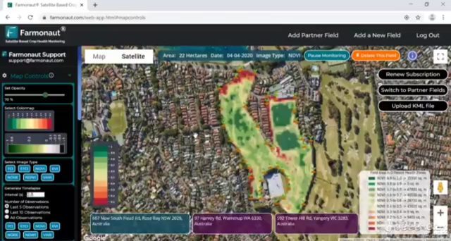
1. Satellite-Based Crop Health Monitoring
Our satellite imagery provides real-time insights into crop health through vegetation indices like NDVI (Normalized Difference Vegetation Index). By correlating this data with historical weather patterns, you can:
- Identify potential causes of crop stress
- Predict areas that may be more susceptible to weather-related issues
- Optimize resource allocation based on both current and historical conditions
2. Jeevn AI Advisory System
Our AI-powered advisory system becomes even more powerful when it has access to detailed historical weather data. This integration allows Jeevn AI to:
- Provide more accurate and personalized recommendations
- Offer insights into potential weather-related risks
- Suggest optimal timing for various farm operations based on weather patterns
3. Carbon Footprint Tracking
Historical weather data can inform our carbon footprint tracking feature by:
- Helping to estimate emissions based on weather-dependent farm activities
- Identifying opportunities for more sustainable practices based on local climate patterns
- Assisting in the development of climate-smart agriculture strategies
The Power of APIs: Extending Farmonaut’s Weather Data Capabilities
For developers and businesses looking to integrate Farmonaut’s powerful weather data into their own systems, we offer robust API solutions. Our weather radar data API and other weather-related APIs provide programmatic access to a wealth of meteorological information.
To explore our API offerings and documentation, visit:
These APIs enable you to:
- Integrate real-time and historical weather data into your own applications
- Develop custom farm management tools leveraging Farmonaut’s extensive weather database
- Create innovative solutions that combine weather data with other agricultural insights
The Future of Weather Data in Agriculture
As we continue to face the challenges of climate change and the need for sustainable agriculture, the role of accurate and comprehensive weather data becomes increasingly crucial. At Farmonaut, we’re committed to staying at the forefront of this technology, continually improving our data collection and analysis capabilities.
Some exciting developments on the horizon include:
- Integration of machine learning algorithms to provide more accurate long-term weather forecasts
- Enhanced micro-climate modeling for even more localized weather insights
- Improved integration with IoT devices for real-time weather data validation and calibration
- Development of crop-specific weather risk models to provide tailored recommendations
Getting Started with Farmonaut
Ready to harness the power of historical weather data and our suite of advanced agricultural tools? Getting started with Farmonaut is easy:
- Visit our website at https://farmonaut.com
- Sign up for an account and choose a subscription plan that fits your needs
- Download our mobile app for on-the-go access:
- Android: Farmonaut on Google Play
- iOS: Farmonaut on the App Store
- Start monitoring your fields and accessing valuable weather insights
Subscription Plans
Choose the Farmonaut plan that best suits your needs:
Frequently Asked Questions (FAQ)
Here are some common questions about Farmonaut’s historical weather data feature:
Q: How far back does the historical weather data go?
A: Our historical weather data starts from the day your field was submitted for satellite monitoring on Farmonaut. The longer you use our service, the more extensive your historical data will become.
Q: How accurate is the weather data provided by Farmonaut?
A: We use advanced satellite technology and data analysis techniques to provide highly accurate weather information. However, local micro-climates can sometimes cause slight variations. We continuously work on improving our accuracy through machine learning and data validation processes.
Q: Can I integrate Farmonaut’s weather data with my own farm management software?
A: Yes, we offer API access that allows you to integrate our weather data into your own systems. Check our API documentation for more details.
Q: How often is the weather data updated?
A: We update our weather data daily, ensuring you have access to the most recent information for your decision-making processes.
Q: Is the historical weather data feature available on all Farmonaut subscription plans?
A: The availability of historical weather data may vary depending on your subscription plan. Please check our pricing page or contact our support team for specific details about your plan.
Q: Can I request weather data for a specific date range?
A: Yes, when downloading your historical weather data, you can specify the date range for which you want to retrieve information.
Q: How does Farmonaut’s weather data compare to data from local weather stations?
A: While local weather stations provide point-specific data, our satellite-based system offers broader coverage and can capture variations across larger areas. In many cases, our data complements local weather station information, providing a more comprehensive view of weather patterns affecting your fields.
Conclusion
At Farmonaut, we’re committed to empowering farmers with the tools and data they need to make informed decisions and optimize their agricultural practices. Our historical weather data feature is just one of the many ways we’re working to revolutionize farming through technology.
By providing easy access to comprehensive weather information, we’re helping farmers around the world improve their crop yields, reduce resource usage, and adapt to changing climate conditions. Whether you’re a small-scale farmer or managing large agricultural operations, Farmonaut’s suite of tools, including our powerful weather data capabilities, can help you take your farming to the next level.
We invite you to explore the full potential of Farmonaut’s agricultural technology solutions. Sign up today and experience the power of data-driven farming for yourself. Together, we can build a more sustainable and productive future for agriculture.
Happy Farming!
#farmer #farming #satellite #naturalfarming #vegetation #lowcost #gis #organicfarming #crops #urbanfarming #fieldscouting #remotesensing #greentech #smartfarming #precisionagriculture #agro #farm #agritech #vegetables #agriculture #foodsecurity #technology
