
Drones in Mining Surveys: Boosting Safety & Efficiency (2025 Guide)
“Drones can survey up to 100 hectares of mining land in a single flight, capturing thousands of data points per minute.”
- Introduction: Drones in Mining Surveys Revolution
- Technological Advances Driving Drone Adoption
- Key Applications of Drones in Mining Surveys
- Traditional vs. Drone-Based Mining Surveys: Side-by-Side Comparison
- How Drones Boost Mining Safety & Efficiency
- Integrating UAV Surveys & Satellite Tech: A Gamechanger
- Challenges & The Future of Drones in Mining (2025 and Beyond)
- FAQs: Drones in Mining Surveys
- Conclusion: The Road Ahead
Introduction: Drones in Mining Surveys Revolution
Drones in Mining Surveys represent one of the most transformative technological advancements in the mining industry, particularly as we approach 2025. In recent years, the integration of drone technology into mining operations and surveys has evolved from an operational advantage to being essential for improved efficiency, safety, and data accuracy. The realm of mining surveys has been revolutionized by unmanned aerial vehicles (UAVs), offering unprecedented aerial data collection, faster volume calculations, precise 3D mapping, and advanced risk detection—all with minimal human involvement.
Why has this shift become so critical? Traditionally, mining surveyors relied on manual methods, such as ground-based total stations or GPS units. These approaches were often risky, slow, labor-intensive, and expensive, especially in hazardous or inaccessible terrain. Enter the era of drones in mining surveys: they enable rapid, high-resolution aerial data acquisition and drastically reduce risks for those working within mines.

In this comprehensive article, we explore the transformative role of drones within mining surveys—from technological advancements to practical applications, challenges, and the future prospects of mining survey technologies.
Whether you’re an industry decision-maker, engineer, analyst, or technology enthusiast, understanding the current and future state of drones in mining is essential for navigating the next phase of industry evolution.
Technological Advances Driving Drone Adoption in Mining Surveys
The adoption of drones in mining surveys has accelerated due to rapid technological advances. Today’s modern drones are powerful data-gathering tools, equipped with an array of advanced features:
- LiDAR (Light Detection and Ranging): Enables precise 3D mapping and terrain modeling, even in dusty, low-light, or forested environments. LiDAR-equipped UAVs can penetrate complex terrain or foliage, capturing millions of data points for accurate surveys and slope detection.
- Multispectral & Hyperspectral Cameras: Provide detailed spectral signatures for mineral detection and environmental monitoring, revealing information invisible to the human eye.
- Photogrammetry Tools: Enable the creation of high-resolution 3D site models, orthomosaic maps, and digital elevation models by stitching together multiple images.
- Artificial Intelligence (AI) & Machine Learning (ML) Algorithms: Modern drone platforms leverage AI for autonomous flight path planning, image detection and classification, rapid data processing, and automated anomaly detection (such as slope instability or equipment defects).
- Cloud Integration & Real-time Data Sharing: Survey data can be uploaded instantly to the cloud, where remote teams analyze results collaboratively and make timely decisions—crucial for operational efficiency in large-scale mining.
These advancements collectively drive higher-quality surveys, allowing drones to collect accurate information in a fraction of the time taken by traditional methods. The result is better-informed site management, accelerated project planning, and enhanced compliance with regulatory and environmental requirements.

A Closer Look at Advanced Survey Technologies
- LiDAR Drones: Using light pulses, LiDAR drones scan terrain, logging millions of data points for modeling even when the ground is obscured by dust, vegetation, or debris. This is invaluable for uncovering geotechnical risks, resource estimation, and slope stability monitoring.
- Multispectral & Hyperspectral Survey UAVs: These technologies allow mining companies to detect subtle changes in surface composition, mineral types, and even pollution, assisting in both exploration and ongoing environmental monitoring.
- AI-Powered Data Processing: The rise of AI-based resource and fleet management solutions enables companies to automatically classify terrain, identify hazardous zones, and optimize routes for equipment movement, reducing safety risks and costs.
Key Applications of Drones in Mining Surveys
Let’s dive deeper into the most transformative applications for drones in mining survey operations:
-
Resource Estimation and Volume Calculations
Drones excel at volumetric calculations of stockpiles, material dumps, and excavation sites, delivering more accurate resource data and improving management as well as financial forecasting. Automated drone flights capture up-to-date imagery, processed via advanced modeling algorithms for precise workflows. -
Topographic Mapping and Site Modeling
Aerial photogrammetry and LiDAR mapping generate detailed 3D models of the mining environment. Engineers and planners use this data for infrastructure placement, water drainage planning, pit design, and monitoring the impact of ongoing activities on the terrain. -
Safety and Risk Management
By deploying drones in hazardous zones—like unstable slopes, tailings dams, or blasting areas—mining companies reduce risks to personnel. Real-time aerial surveillance helps in early anomaly detection, such as cracks or unplanned subsidence, supporting faster reactions and fewer injuries. -
Regulatory Compliance and Environmental Monitoring
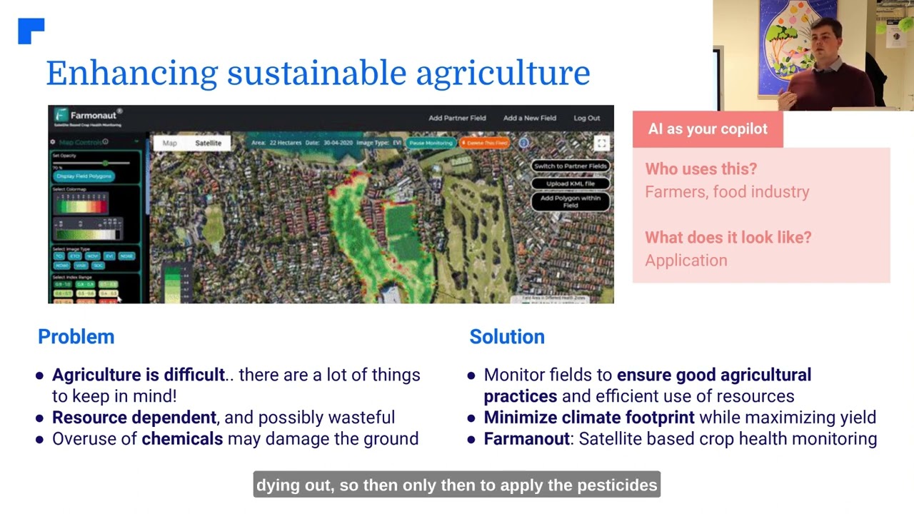
Frequent airborne surveys make it easy to document compliance with regulatory limits, track land reclamation, and spot illegal encroachment or dumping. With integrated multispectral sensors, drones can detect changes in vegetation health, soil conditions, and water bodies. For example, Farmonaut’s carbon footprinting tools help monitor emissions, supporting sustainable practices and regulatory compliance. -
Operational Efficiency
Compared to conventional surveys, drones execute missions in less time, with lower costs, and minimal disruption to daily mining activities. With automated flight plans and data uploads, teams can access actionable maps and models in hours instead of days—crucial for high-paced, modern mining.

“3D drone mapping in mining achieves accuracy within 2-5 centimeters, far surpassing traditional ground-based survey methods.”
Additional Applications and Emerging Use Cases
- Land Reclamation Progress Monitoring: Automated surveys document post-mining restoration, allowing for transparent reporting and improved traceability for stakeholders and regulators.
- Initial Exploration: UAVs are deployed at the earliest stages to identify mineral deposits with help from multispectral/hyperspectral sensors, reducing up-front costs and environmental impact.
- Disaster Assessment: After landslides or floods, drones provide rapid situation awareness, supporting faster recovery and safer mobilization of repair crews.
- Ongoing Monitoring: High-frequency surveys allow for near-continuous advisory and monitoring for mine management, operations optimization, and regulatory compliance.

Traditional vs. Drone-Based Mining Surveys: Side-by-Side Comparison
To fully appreciate the transformative impact of drone technology in mining surveys, let’s compare traditional ground-based methods to UAV-powered surveys:
| Survey Method | Estimated Time Required | Accuracy Level | Number of Personnel Needed | Safety Incidents (per 100 surveys, est.) | Operational Cost (USD, est.) | Data Output Type |
|---|---|---|---|---|---|---|
| Traditional Ground Surveys | 3-7 Days per 100 ha | 10-30 cm (2D, Limited 3D) | 4-8 Surveyors | 2-5 (due to exposure to hazardous terrain) | USD 10,000–15,000 (per large site) | 2D Topographic Maps, Basic 3D Models |
| Drone-Based Surveys | 1-3 Hours per 100 ha | 2-5 cm (Accurate 3D Models) | 1-2 Operators | <0.1 (Minimal risk to personnel) | USD 2,000–5,000 (per large site) | High-Res 2D/3D Maps, Point Clouds, Orthomosaics |

How Drones in Mining Surveys Boost Safety and Efficiency
The greatest draw of drones in mining surveys is their ability to deliver dramatic improvements across safety, efficiency, and accuracy in every stage of mining:
Enhancing Safety on Mining Sites
- Minimized Human Exposure: Drones survey hazardous or unstable ground (such as active pits or tailings dams) remotely, keeping surveyors out of harm’s way.
- Early Hazard Detection: Automated workflows powered by AI detect slope movement, cracks, or hazardous changes in topography from repeated drone surveys. Early warnings allow for timely interventions.
- Emergency Response: In the event of a collapse or accident, UAVs provide instant aerial views, guiding first responders safely through hazardous terrain.
Supercharging Survey Efficiency and Productivity
- Speed: With the ability to cover up to 100 hectares per flight, drones reduce weeks-long surveys to a matter of hours.
- Data Processing Automation: Onboard AI and cloud servers process millions of points rapidly, eliminating tedious manual calculations.
- Up-to-date Mapping: High-frequency ongoing monitoring supports agile, informed decision-making for fast-moving operations.
Increasing Accuracy Across the Mining Value Chain
- Centimeter-level Precision: Modern drones using LiDAR or RTK-GPS achieve mapping accuracy of 2-5 cm, essential for optimal resource allocation and risk management.
- Rich Data Output: UAVs generate detailed 3D point clouds, surface models, and orthophotos that far exceed what ground crews can deliver.

Integrating UAV Surveys & Satellite Tech: A Gamechanger for 2025 and Beyond
Combining drone-based mining surveys with advanced satellite monitoring platforms like Farmonaut multiplies the value of both technologies. This hybrid approach enables:
- Scalable Monitoring: Satellite imagery handles wide-area monitoring, identifying trends and informing where high-resolution drone flights should be deployed for targeted assessments.
- Layered Data Insights: Combining aerial drone data with satellite-based multispectral imaging (as provided by Farmonaut) creates a powerful, multi-scale dataset for planning, resource optimization, and environmental management.
- AI-Driven Advisory: Farmonaut’s Jeevn AI Advisory System merges satellite and drone analytics for real-time strategy development, ongoing monitoring, and operational improvements across mining sites worldwide.
- Carbon Tracking & Traceability: The synergy between Farmonaut’s carbon monitoring solutions and aerial UAV surveys empowers mining companies to measure environmental impact, ensure regulatory compliance, and improve stakeholder transparency.
- Fleet and Resource Optimization: With satellite-based fleet management integrated into mining drone operations, logistics can be optimized while reducing operational costs and improving safety for vehicles and teams.
Farmonaut’s API integrations (API and API Developer Docs) let mining organizations incorporate real-time remote sensing, traceability, and advisory features into their own platforms, unlocking powerful solutions for resource management and operational efficiency as the mining industry approaches 2025.


Farmonaut’s Unique Value for Mining Surveys
At Farmonaut, we believe that accessible, cost-effective satellite technology accelerates widespread digital transformation across mining. Our solutions enable:
- Real-time, actionable insights on land use, resource extraction, and ongoing site management.
- Blockchain-based traceability for improved transparency and compliance with increasingly strict regulatory frameworks. Learn about blockchain traceability in mining.
- Sustainable, data-driven fleet and resource planning—from field crews to heavy vehicles—supported by satellite and drone analytics (see Fleet Management).
- Environmental stewardship with carbon footprint monitoring, supporting responsible mining and positive community relations.

Challenges & The Future of Drones in Mining (2025 and Beyond)
While drones have revolutionized mining surveys, several challenges must be navigated as we move toward 2025 and beyond:
- Regulatory Complexity: Drone flights are governed by different aviation and privacy regulations around the world. Some regions require special permissions for flights near infrastructure, urban zones, or air traffic corridors.
- Weather Dependence: High winds, dust storms, rain, or snow can restrict UAV operations, especially in harsh mining environments.
- Skill & Training Requirements: Operating advanced drones and interpreting complex geospatial datasets requires ongoing workforce training and certification.
- Data Security & Privacy: As survey data grows in value, security practices and privacy considerations become paramount.
What Does the Future Hold?
- Swarm UAV Technology: The development of coordinated drone fleets will allow for simultaneous, rapid surveying of vast mine sites, further driving efficiency.
- Battery Technology & Hydrogen Fuel: Advancements will boost flight times, allowing longer-range or continuous data collection for remote or very large mining territories.
- Augmented & Virtual Reality (AR/VR) Integration: Detailed 3D site maps and real-time drone feeds will allow remote operators to virtually “walk” mine sites for planning, hazard training, or incident response.
- Automated ML & AI Analytics: Ongoing enhancement will enable real-time decisions—from risk detection to resource allocation—directly informed by streaming survey data.
FAQs: Drones in Mining Surveys
Drones offer rapid, high-precision aerial data collection, lower operational risks, reduced costs, improved regulatory compliance, and powerful 3D mapping for both ongoing monitoring and resource calculations. As technology advances, traditional surveys will be inadequate for the pace and complexity of modern mining.
Q2: How do drones improve safety in mining surveys?
Drones survey hazardous areas (unstable slopes, pits, tailings dams) remotely, minimizing human exposure to risks. Built-in sensors and AI-powered analytics detect hazards early, supporting proactive safety measures.
Q3: What types of sensors or technologies are most used on mining drones?
LiDAR for 3D mapping, multispectral/hyperspectral cameras for mineral/vegetation diagnostics, photogrammetry tools for terrain modeling, and AI-enabled data processors for flight planning and anomaly detection.
Q4: How do drone surveys support regulatory and environmental compliance?
High-frequency, geo-referenced drone imaging makes it easy to document regulatory adherence, track carbon impact, monitor land reclamation, and submit transparent reports to authorities.
Q5: Can drones and satellite data be used together?
Absolutely. Merging satellite-based monitoring (as provided by Farmonaut) with UAV data enables layered insights—from large-scale trend detection to precise, local mapping—unlocking greater value from digital mining operations.
Conclusion: The Road Ahead for Drone-Based Mining Surveys
As we approach 2025, drones in mining surveys are reshaping the industry standard for accuracy, safety, and efficiency. The fusion of advanced UAVs with satellite remote sensing platforms (like those offered by Farmonaut) unleashes new potential for resource estimation, risk management, environmental stewardship, and operational optimization.
Mining companies that embrace these technological advancements will enjoy a clear competitive advantage, gaining faster and more precise decision-making, reduced environmental and safety risks, and lower costs. Meanwhile, the ongoing evolution of regulatory environments, swarm drone use, AI/ML processing, and AR/VR integration points to a future where autonomous, rapid, and highly detailed mining surveys are the norm.
The next era of mining is digital, sustainable, and data-driven. Drones—empowered by platforms like Farmonaut—are at the heart of this revolution.
Explore More:
- API Access: Interested in integrating precise mining survey and monitoring data? Learn more about our API here and view our developer docs.
- Traceability: Ensure transparency across mining supply chains with Farmonaut Traceability solutions.
- Carbon Footprinting for Mining: Track your site’s environmental impact with satellite-powered carbon measurement.
- Fleet Management: Optimize machinery use, vehicle routing, and resource allocation via satellite mapping and drone insights.
- Large-Scale Management: Learn about our Agro Admin App for whole-operation oversight & satellite management of mines or large sites.
Ready to revolutionize your mining operations? Explore Farmonaut’s affordable subscription packages and ensure your team is future-ready for the digital mining era.


