Table of Contents
- Introduction: Autonomous Drones Military & Agriculture Transformation
- 1. Precision Agriculture Solutions: Empowering Smart Farming
- 2. Environmentally Friendly Crop Spraying & Targeted Fertilization
- 3. Livestock Drone Monitoring: Smarter Herd Management
- 4. Land Surveying & Agricultural Drone Mapping Technologies
- 5. Drone Monitoring in Forestry: Sustainable Forest Management
- 6. Drone Swarm Technology: The Rise of Collaborative AI in Farming and Forestry
- 7. Challenges, Security, and Considerations in Drone Integration
- Comparative Impact Table: 7 Ways Drones Transform Agriculture
- Farmonaut: Making Precision Agriculture Accessible
- Future Outlook: Sustainable, Productive, and Efficient Operations
- Frequently Asked Questions (FAQ)
Autonomous Drones Military: 7 Ways Transforming Agriculture


The integration of autonomous drones in agriculture and forestry sectors is fundamentally reshaping how we approach modern farming, food production, and sustainable forestry management. By utilizing advanced drone sensors, artificial intelligence, and real-time data gathering, drones are able to monitor, manage, and optimize agricultural and forest operations on a scale never seen before.
Autonomous drones serve as highly adaptive tools—capable of precision crop spraying, early pest and disease detection, targeted application of inputs, soil analysis, large-scale agricultural drone mapping, and data-driven livestock herd management. With these capabilities, the push toward environmentally friendly, efficient, and highly productive farming and forest management is well underway.
In this comprehensive guide, we will explore the seven most transformative applications of autonomous drones across agriculture and forestry. We’ll show how these solutions address environmental challenges, improve productivity, and empower both large-scale agribusinesses and smallholder farmers to thrive in a new age of precision agriculture.
1. Precision Agriculture Solutions: Empowering Smart Farming
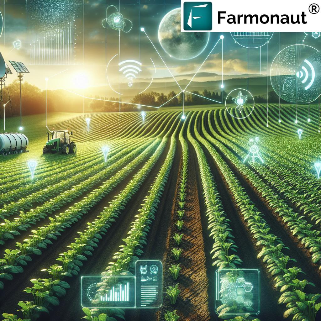
Precision agriculture leverages data-driven monitoring and management to optimize every aspect of farming—from soil analysis and seed selection to crop health and resource allocation. The introduction of autonomous drones in agriculture has been a game changer, making precision agriculture accessible and impactful, even for smallholder farmers.
Equipped with advanced drone sensors for farming—including high-resolution cameras, multispectral sensors, and LiDAR—drones can capture detailed images and analyse vast fields far more efficiently than traditional scouting methods. This data is then used to:
- Monitor crop development and health, detecting diseases and pest infestations early
- Identify areas suffering from under- or over-irrigation
- Assess soil variability for targeted fertilization and planting
- Reduce input costs and minimize environmental impact by applying resources only where needed
By combining multispectral imaging with AI-driven analytics, drones enable early pest detection and health monitoring at the field or even plant level. This not only reduces the reliance on broad-spectrum pesticides, but also supports environmentally friendly crop spraying and resource-efficient operations.


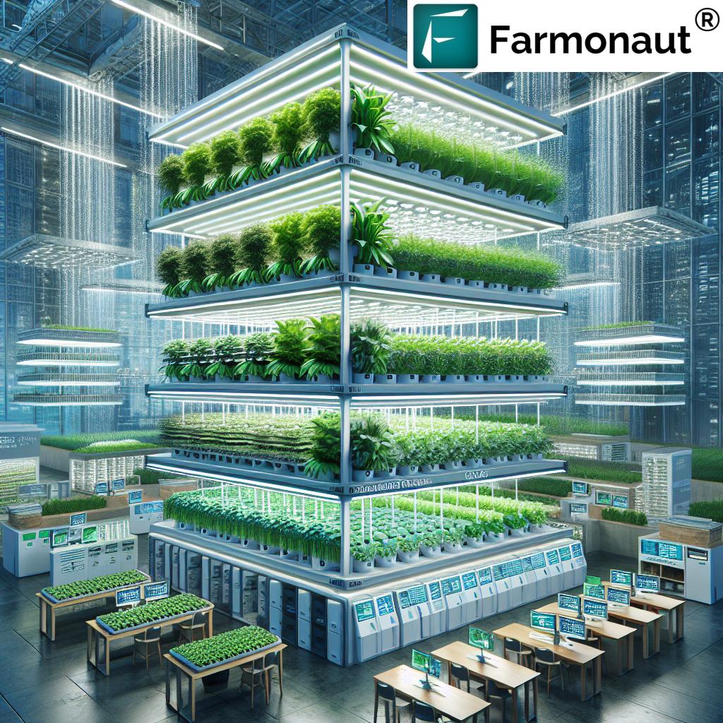
On our Large Scale Farm Management platform, users get access to AI-powered crop health monitoring, weed and pest detection, and water stress mapping, all via easy-to-use apps and an API. This optimization leads to maximized yields and minimized inputs—a core principle of precision agriculture solutions.
Example of Impact: According to UAVCoach, drones can reduce scouting time by up to 80%, improve detection accuracy of diseases and pests, and help farmers respond proactively to environmental challenges before they escalate.
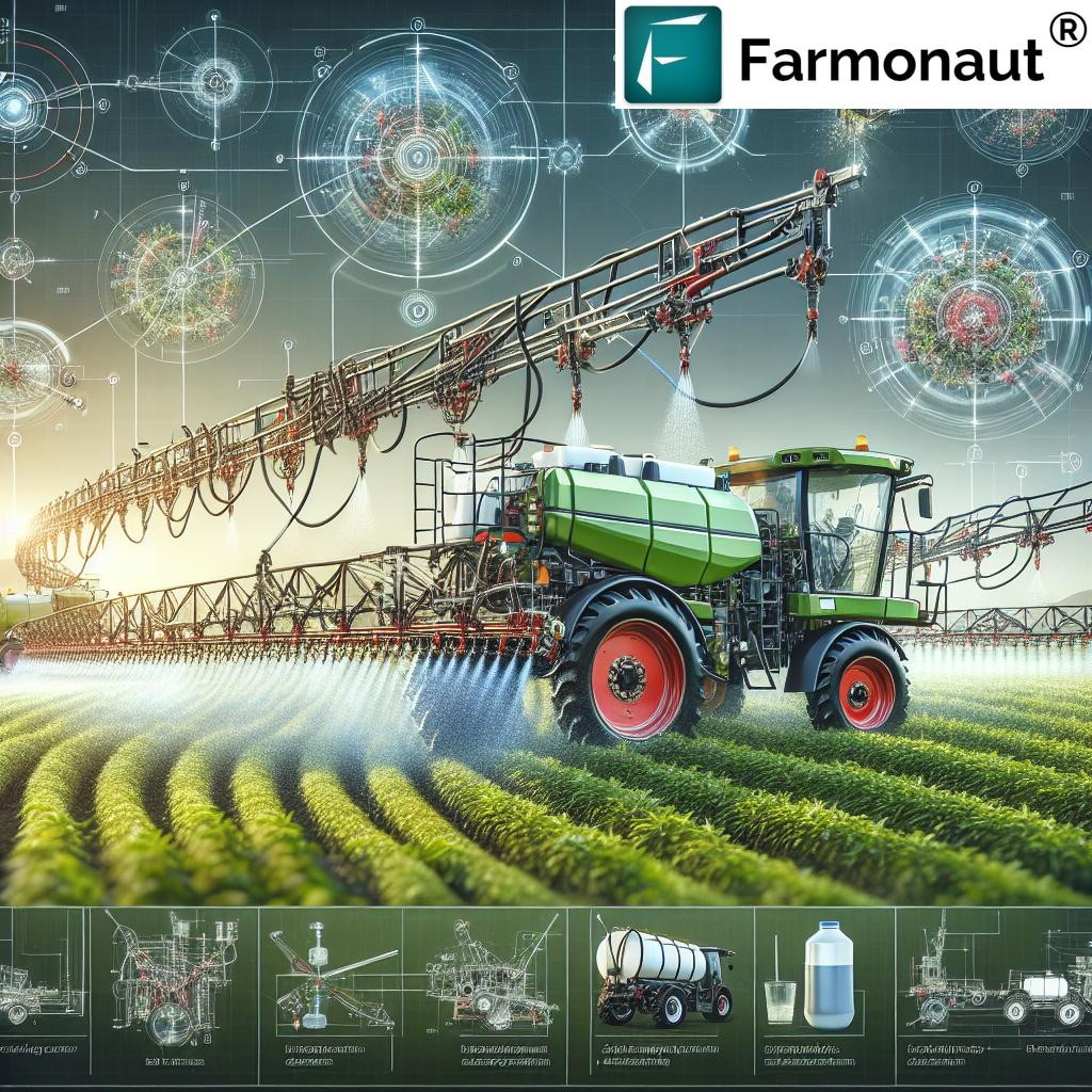
2. Environmentally Friendly Crop Spraying & Targeted Fertilization
Traditional methods of pesticide and fertilizer application often involve uniform spraying across entire fields, leading to overuse, wastage, and increased environmental risks. Autonomous drones have revolutionized spraying and fertilization by enabling:
- Targeted spot spraying: Applying chemicals only to infested or problem areas, not the entire field
- Reduced input costs and environmental impact through minimized chemical usage
- Real-time adjustment of spraying based on real crop health data
- Fast, precise application across challenging terrains—all without human entry into hazardous or inaccessible zones
One prominent development is the introduction of large-capacity, electric vertical take-off and landing (eVTOL) aircraft, such as the SC1 by Guardian Agriculture. It can carry up to 200 pounds of fertilizer or pesticides, covering 60 acres per hour with pinpoint accuracy. This shift empowers environmentally friendly crop spraying at both industrial and local scales, drastically reducing unintended chemical runoff.
Key benefits:
- Significant decrease in labor while increasing operational efficiency
- Able to perform large-scale spraying in tight windows dictated by weather
- The use of precise, AI-guided systems ensures regulatory compliance and maximizes crop health
As a result, more and more stakeholders in agriculture are adopting advanced drone spraying to increase yields while reducing environmental impact and operating costs.
3. Livestock Drone Monitoring: Smarter Herd Management
Livestock drone monitoring is transforming animal husbandry by providing farmers and ranchers with tools to remotely monitor herd locations, estimate herd sizes, and identify missing or isolated animals. Autonomous drones equipped with thermal imagers and advanced tracking algorithms can perform regular counts, assess pasture resource allocation, and facilitate efficient movement planning.
- Ensure the wellbeing of animals by quickly identifying and responding to health issues or disappearances
- Assist in pasture and water supply planning across large or rugged terrains
- Improve safety and speed of livestock drives, reducing human labor and risk
These advancements in livestock drone monitoring not only enhance operational efficiency but also contribute to animal welfare, regulatory compliance, and resource conservation. Furthermore, integrating these insights within farm management apps—such as our own Fleet Management system—enables large-scale agribusinesses to streamline their livestock logistics even further.
“Autonomous drones can scan up to 1,000 acres of forest in a single day for data-driven management.”
4. Land Surveying & Agricultural Drone Mapping Technologies
Accurate land surveying is essential for:
- Infrastructure planning (e.g., irrigation ditches, drainage, farm roads, and water management)
- Regulatory compliance
- Optimizing investments into machinery and resources
- Long-term farm expansion and environmental conservation
Autonomous drones, when equipped with advanced imaging, photogrammetry, and LiDAR, can rapidly perform detailed agricultural drone mapping across vast areas.
Advantages include:
- High-resolution 2D and 3D models for precise infrastructure placement
- Flood risk and waterway planning
- Efficient identification of soil erosion, resource wastage, or underutilized areas
- Cost savings by reducing manual survey crew time and risk
This data can be seamlessly integrated into farm management solutions, such as Farmonaut’s Large Scale Farm Management App, for smarter, real-time decision making.
5. Drone Monitoring in Forestry: Sustainable Forest Management
Forests are vital for biodiversity, carbon sequestration, and maintaining ecological balance. Drone monitoring in forestry has rapidly gained adoption because it enables:
- Monitoring forest health: Early detection of diseases, pest infestations, and areas under environmental stress using multispectral and thermal sensors
- Mapping forest resources: Quick and accurate measurement of tree cover, biomass, and species distribution
- Supporting conservation efforts: Identifying illegal logging, encroachments, or habitat loss in real time
- Wildfire detection and suppression: Early warning via AI, rapid assessment, and strategic response, even in hazardous conditions
With the ability to scan up to 1,000 acres of forest per day, autonomous drones provide an unprecedented level of operational intelligence for sustainable forestry management.
By integrating data-driven drone operations into forest conservation and wildfire management, stakeholders not only protect natural resources but also maximize the value of forests for future generations.
For those interested in combining forest data with agricultural production intelligence, our Crop Plantation & Forest Advisory module supports resource planning, health tracking, and actionable alerts for sustainable forestry initiatives.
Learn more: Drones in Wildfire Management
6. Drone Swarm Technology: The Rise of Collaborative AI in Farming and Forestry
Drone swarm technology is at the forefront of the next agricultural revolution, enabling:
- Simultaneous deployment of dozens or even hundreds of drones in coordinated actions
- Efficient large-scale planting, spraying, harvesting, or wildfire suppression operations
- Greater data collection density across huge tracts of land—enabling more robust analytics and faster responses
- Improved resilience and redundancy: if one drone experiences a fault, the swarm can quickly compensate
Powered by AI, these swarms can make decisions in real time, optimize their tasking, and collaboratively map, monitor, and protect both farmed and forested areas. Companies are already testing ultra-heavy-lift drone swarms for critical tasks like wildfire suppression and mass tree reseeding.
The application of drone swarms heralds a future of fully automated, highly productive, and environmentally conscious agricultural and forestry sectors.
Interested in detailed, automated field planning? Our Farmonaut Satellite API and Developer Documentation make integrating real‑time mapping, weather, and advisory tools into your own agricultural software easy and scalable.
7. Challenges, Security, and Considerations in Drone Integration
While autonomous drones in agriculture and forestry are transformative, several challenges and considerations must be addressed for widespread, sustainable adoption:
- Regulatory barriers: Airspace control, certification, and compliance vary significantly across regions, often limiting autonomous operations
- Initial investment and training: High upfront costs of drones and required education for operators may slow adoption, especially in developing contexts
- Data privacy and security: As these systems collect increasingly sensitive agricultural and environmental data, ensuring secure transmission, storage, and usage is paramount
- Integration complexity: New drone-based solutions must sync smoothly with existing farm management systems and established workflows to maximize efficiency
- Weather and technical limitations: Severe weather can restrict drone operability, and technical failures can cause operational delays
For these reasons, we recommend a phased integration strategy: start with select high-value tasks, focus on data interoperability, and invest in operator training as part of any large-scale deployment.
Solutions such as our Satellite-Based Crop Loan & Insurance Verification product can bolster operational integrity and support secure, data-driven lending, helping more organizations and farmers manage risk in an increasingly complex world.
In addition, our Carbon Footprinting tool helps organizations monitor and reduce their environmental impact, making large-scale autonomous drone operations more sustainable and regulation-friendly.
Comparative Impact Table: 7 Ways Drones Transform Agriculture
| Application Area | Description | Estimated Efficiency Gain (%) | Sustainability Impact |
|---|---|---|---|
| Precision Agriculture | Use of advanced multispectral drones and sensors for crop health monitoring, soil analysis, and resource optimization. | 30-55% | Reduces overuse of inputs and environmental harm, increases yield |
| Crop Spraying & Fertilization | Spot and area-specific application of pesticides, herbicides, and fertilizers using AI-guided autonomous drones. | 40-60% | Minimizes chemical runoff and input waste for a more sustainable approach |
| Livestock Monitoring | Remote herd tracking, missing animal identification, and pasture resource planning with autonomous surveillance. | 15-30% | Reduces livestock losses and labor needs, improves animal wellbeing |
| Land Surveying & Modeling | Rapid, high-resolution mapping of farms using photogrammetry and LiDAR for water and infrastructure planning. | 60-80% | Optimizes land and water resource usage; enhances conservation |
| Forestry Monitoring | Drone monitoring in forestry for health assessment, mapping, biodiversity, and conservation planning. | 35-50% | Supports sustainable forestry management and preserves ecosystems |
| Drone Swarm Technology | AI-enabled, coordinated swarms for mass planting, monitoring, and wildfire suppression. | 50-70% | Maximizes coverage, speed, and resilience in agricultural and forest operations |
| Wildfire Suppression & Response | Early fire detection, tactical mapping, and targeted response in hazardous zones. | 45-65% | Mitigates loss of resources, reduces carbon emissions, improves safety |
Farmonaut: Making Precision Agriculture Accessible and Sustainable for All
As precision agriculture solutions become increasingly critical to future food security and environmental stewardship, we at Farmonaut are committed to powering this transformation. Our satellite-based farm management platform delivers affordable, AI-driven, and highly scalable support for farmers, cooperatives, agribusinesses, and government agencies.
- Real-time Crop Health Monitoring: Our system analyzes satellite multispectral imagery to provide insights into vegetation health, early pest and disease risk, and resource management recommendations.
- Jeevn AI Advisory: Personalized, AI-guided recommendations keep users informed about best practices and provide actionable, data-driven alerts.
- Traceability & Blockchain: With blockchain-enabled traceability, our clients ensure the integrity, transparency, and security of their agricultural supply chains.
- Fleet Management: Fleet management tools on our platform help organizations oversee logistics and field operations efficiently, optimize vehicle use, and reduce costs.
- Carbon Footprinting: Carbon monitoring features allow for precise measurement and reduction of agricultural emissions—key for sustainable certifications and environmental compliance.
With a user-focused, subscription-based approach, our services make precision farming and resource optimization attainable for any size operation—no fleet of expensive UAVs required. From individual farmers to industry leaders, everyone can benefit from smarter, greener, and scalable farm and forestry management.
Future Outlook: Sustainable, Productive, and Efficient Agriculture & Forestry Operations
The trajectory for autonomous drones in agriculture and forestry is rapidly upward. As artificial intelligence matures, sensor hardware becomes more affordable, and regulatory frameworks adapt, these advanced technology solutions will become the new norm in productive, sustainable farming.
Key emerging trends to watch:
- Greater Integration: Drones will be further merged with IoT and satellite-driven farm management systems, allowing for truly seamless, data-driven agriculture.
- Smarter Swarms: Drone swarm algorithms will tackle increasingly complex, large-scale forestry and farming tasks collaboratively.
- Environmental Monitoring: Integration of drones into traceability and carbon accounting workflows will help stakeholders substantiate their sustainability claims and achieve global compliance goals.
- Accessible Platforms: Subscription-based apps and APIs will make these tools practical—even for those unable to invest in their own UAV fleet.
Looking ahead, these technologies will play a pivotal role in addressing food security, environmental conservation, and climate change mitigation. Whether through early pest detection with drones, precision irrigation management, or sustainable forestry management backed by real-time data, the world’s agri-food systems are poised for smarter, greener, and more resilient growth.
Frequently Asked Questions (FAQ): Autonomous Drones in Agriculture and Forestry
What are the main uses of autonomous drones in agriculture?
The main uses include crop health monitoring, early pest and disease detection, irrigation and soil analysis, targeted spraying and fertilization, agricultural drone mapping, livestock monitoring, and large-scale data analysis for optimized farm management.
How do autonomous drones enhance efficiency in farming?
Autonomous drones enable real-time, data-driven decision making, drastically reduce scouting and application time, provide highly targeted resource use, and allow for rapid scaling of operations across vast areas—all while minimizing labor and cost.
What is drone monitoring in forestry used for?
Drone monitoring in forestry is used for environmental monitoring, forest health assessment, biodiversity surveying, illegal logging detection, and wildfire suppression. These solutions aid in more sustainable and efficient management of natural resources.
What is the biggest challenge to adopting drone technology in agriculture?
The biggest challenges are regulatory hurdles, high initial investment and training requirements, ensuring data security, and the need for seamless integration with existing agricultural management systems.
Do I need a fleet of drones to benefit from precision agriculture?
No! Platforms like Farmonaut provide satellite-driven crop and field intelligence, making advanced decision support and monitoring accessible without needing your own UAV fleet.
How do autonomous drone swarms work?
Swarm technology deploys multiple drones that coordinate via AI algorithms, allowing them to collectively perform complex tasks such as mass planting, large-area crop monitoring, and wildfire fighting.
What apps or platforms can I use for autonomous drone and precision agriculture management?
Farmonaut offers a variety of web, iOS, and Android applications as well as APIs to enable precision agriculture, real-time monitoring, traceability, and advanced field analytics—all accessible from any device.
Ready to join the sustainable farming revolution? Get started with Farmonaut today and unlock affordable, data-driven solutions for your farm or forestry operation.
Autonomous drones military and precision agriculture solutions are redefining what’s possible in agriculture and forestry. By leveraging advanced sensors, real-time data, and AI, we are building productive, efficient, and environmentally friendly operations for a more secure and sustainable future.