What Makes Mississippi Vulnerable to Floods in 2025? Soil, Climate, and Sustainable Agricultural Solutions
Meta Description: Mississippi’s flood vulnerability in 2025 stems from its soil types, extensive rivers with poor drainage, and climate impacts. Explore agriculture risks, sustainable solutions, and how to safeguard farmlands.
“Over 60% of Mississippi’s soil is highly flood-prone, putting thousands of fertile acres at continual risk each year.”
Introduction: Mississippi’s Flood Challenge
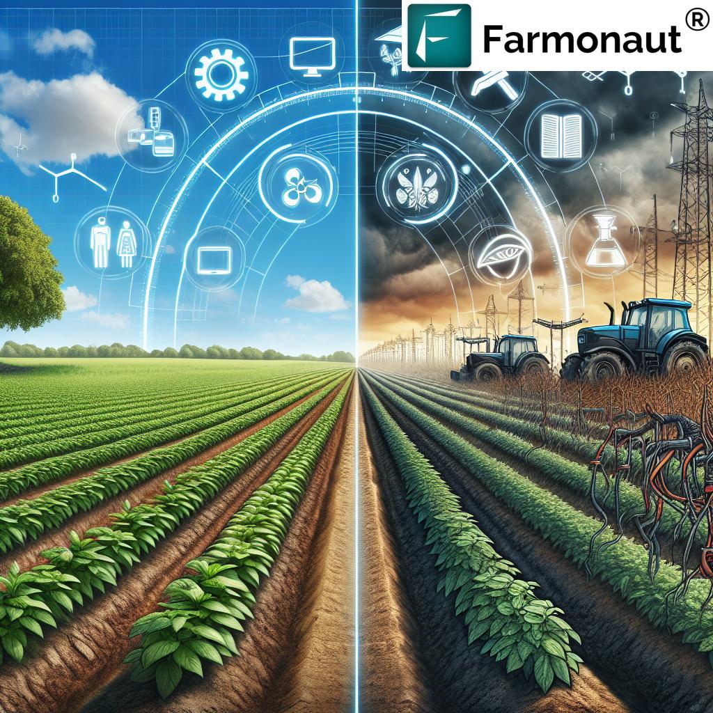
Mississippi, located in the heart of the American South, is a state synonymous with fertile farmland, productive agriculture, and iconic river landscapes. Yet, beneath these agricultural advantages lies growing vulnerability. In 2025 and beyond, the state’s exposure to major flood events is an urgent concern, threatening the backbone of its economy and the security of food systems far beyond its borders.
What makes Mississippi vulnerable to floods? Its soil types and rich farmland, its abundance of rivers with poor drainage, distinct climate patterns, and evolving challenges from climate change are all key factors. This blog explores these vulnerabilities, their impact across agriculture, and, crucially, the sustainable solutions that can help safeguard Mississippi’s farmlands for current and future generations.
We’ll uncover how the composition of soil, the behavior of rivers, weather patterns, and both traditional and modern farming practices intertwine—shaping not only risk but also the opportunities for resilience. Let’s delve into agriculture and its types in the Mississippi Delta, the flood risk, and what lessons we can take to ensure food security across the eastern United States.


What Makes Mississippi Vulnerable to Floods? Key Factors in 2025
Mississippi’s flood vulnerability in 2025 arises from a unique combination of factors:
- Abundant Rivers with Poor Drainage: The Mississippi, Yazoo, and Big Black Rivers intersect the state, creating extensive basins and floodplains. Their natural drainage is often inadequate, especially during heavy rainfall seasons or snowmelt upstream.
- Soil Types and Rich Farmland: Alluvial and clay-rich soils, though fertile, limit infiltration and increase runoff, amplifying flood risk.
- Flat Topography: The Mississippi Delta is distinctly flat, causing floodwaters to accumulate and disperse slowly, especially in poorly drained lands.
- Climatic Conditions: The region experiences heavy seasonal rains, with storms becoming more intense due to climate change.
- Inadequate Flood Infrastructure: Levees, drainage systems, and buffers are often outdated or insufficient, failing to cope with increasingly severe weather events.
Regarding what makes Mississippi vulnerable to floods? Its soil types and rich farmland, its hot climate with little precipitation, its coastal location and large lakes, its abundance of rivers with poor drainage—the abundance of slow-draining rivers, rich yet flood-sensitive soils, and dynamic weather patterns are the most significant contributors.
Mississippi’s Soil Types & Flood Vulnerability
Mississippi’s soil composition plays a pivotal role in its susceptibility to floods. The state features a variety of soil types, each with unique physical properties that directly influence drainage, runoff, and crop suitability.
The most prominent soil types in Mississippi’s floodplains are:
-
Alluvial Soils:
- Located across the Mississippi Delta and river basins.
- Formed by periodic flooding depositing mineral-rich silt and clay.
- Extremely fertile, supporting crop types like cotton, soybeans, rice, and corn.
- However, fine texture and compaction often lead to reduced permeability, increasing surface water runoff and flood vulnerability.
-
Loess Soils:
- Found on the bluffs east of the Delta (Loess Hills region).
- Fine-grained, wind-deposited silt that is rich but highly susceptible to erosion during heavy rains.
-
Clay Soils:
- Prevalent in the central and southern state.
- Expansive; retain water quickly but drain poorly, often swelling and cracking, which threatens root systems and soil health.
-
Sandy Soils:
- Occur mainly near the Gulf Coast and in certain upland areas.
- High drainage rates but low nutrient retention. While less prone to surface flooding, can become drought-prone in hot weather.
Each of these soil types presents a distinct set of opportunities and challenges for agriculture and its types. For instance, alluvial soils offer high productivity yet heightened risk in wet periods, while clays may suffer from persistent saturation and associated root stress.
Flood Vulnerability & Soil Type Comparison Table
To understand where the most critical flood risks intersect with agriculture in Mississippi, we’ve assembled a comparative table. This resource highlights the flood vulnerability and probable yield impact by soil type, alongside suggested sustainable solutions for 2025 and beyond:
| Soil Type | Estimated Flood Vulnerability (2025) | Main Affected Crops | Climate Change Influence | Suggested Sustainability Strategies |
|---|---|---|---|---|
| Alluvial | High (Nearly 70% of Delta region) | Cotton, Soybeans, Rice, Corn |
|
|
| Loess | Medium–High (Prone to rapid erosion) | Wheat, Corn, Hay |
|
|
| Clay | High (Poor drainage, ponding risk) | Rice, Soybeans, Some Corn |
|
|
| Sandy | Low for flooding; high drought risk | Vegetables, Peanuts, some Corn |
|
|
Estimated flood vulnerability and yield loss values are based on regional projections for 2025 given increased precipitation patterns and land use trends.
It is clear that soil type, water management, and sustainable practices are all intricately linked with flood vulnerability and agricultural productivity in Mississippi. Understanding these factors is essential for developing and targeting the right solutions.
“Mississippi’s annual precipitation has risen by nearly 10% since 1980, increasing flood threats to its valuable farmland.”
Mississippi’s Climate Patterns: Impact on Floods and Agriculture
Climatic conditions strongly influence Mississippi’s flood risk. Traditionally, the state experiences a humid subtropical climate with ample rainfall—but climate data shows a marked uptrend in both frequency and intensity of extreme weather events:
- Longer Rainy Seasons: Spring and early summer see the most significant precipitation, overlapping with key planting and crop establishment periods across the Delta.
- Heavier Downpours: Rain now arrives in intense bursts, leading to greater surface runoff and more frequent instances of flash-flooding.
- Erratic Seasons: “Stuck” weather patterns (persistent wet or dry spells) bring unpredictability for farmers making planting and harvesting decisions.
- Rising Temperatures: Hotter summers can both intensify evaporation (leading to drought in sandy soils) and cause faster snowmelt upstream in the larger river basins, heightening the risk of Mississippi River overflow.
The implications of these changes are profound. Not only do they raise the stakes for flood infrastructure and farm practices, but they also demand new solutions and flexible strategies.
How River Systems and Poor Drainage Shape Flood Risk in Mississippi
The Mississippi River—North America’s mightiest—is just the centerpiece of an expansive network of rivers and tributaries lacing the state. Along with the Yazoo and Big Black Rivers, these waterways historically support irrigation, transport, and trade, but they also pose critical flood threats due to:
- Low Gradient, Flat Topography: Makes it easy for floodwaters to spread across large areas, with slow drainage out of croplands.
- Natural and Artificial Levee Weak Points: Many levees are old or insufficient for 2025’s increasingly powerful storms.
- Marshes and Poorly Drained Basins: Designed by nature to flood, these can be quickly overwhelmed, disrupting agricultural operations for weeks.
- Backwater Flooding: When the main river rises, tributaries back up, causing prolonged inundation where farms depend on timely planting and harvesting schedules.
During periods of heavy rainfall or rapid snowmelt, the capacious yet flat basins of northern Mississippi, especially the Delta, are particularly at risk—compounding stress for local growers and communities.
What Makes the United States East of the Mississippi River a Good Region for Agriculture?
The eastern United States, especially the land east of the Mississippi River, is widely considered one of the world’s most productive agricultural regions. The question, “What makes the United States east of the Mississippi river a good region for agriculture?,” is answered by several factors:
- Rich Loamy and Alluvial Soils: Soil fertility is consistently high thanks to centuries of riverine sedimentation, supporting diverse crops like corn, soybeans, wheat, as well as fruits and vegetables.
- Ample Rainfall: Unlike arid western states, the east enjoys moderate to abundant precipitation—crucial for raising yield potential without the need for excessive irrigation.
- Long Growing Season: Mild winters and lengthy warm seasons allow for multiple cropping cycles and a wider range of agricultural types.
- Access to Waterways and Transportation: The river network supports low-cost distribution, while the navigability of rivers like the Mississippi fuels the movement of goods across the United States and beyond.
- Diverse Microclimates: Create countless local opportunities for specialty crops.
These strengths make the region a key pillar of U.S. food security and export power, though—importantly—they also heighten flooding risks when weather patterns shift or river systems overflow.
Flood Implications: Mississippi’s Agriculture Sector in 2025
Flooding in Mississippi carries critical implications for agriculture and its types:
- Crop Losses: Sudden or sustained floods destroy planted crops (cotton, soybeans, rice, corn) at all growth stages, reducing yields and undermining farmer incomes.
- Soil Erosion: Water runoff strips vital topsoil—directly impacting food security by reducing future productivity.
- Nutrient Runoff: Fertilizers and soil nutrients are lost to streams, both harming water quality and raising input costs for subsequent seasons.
- Delayed Planting and Harvesting: Persistent waterlogging makes it impossible to use heavy machinery or access fields for critical cropping windows.
- Disease and Pest Pressure: Wet soil promotes the spread of fungal diseases and pests, compounding crop losses.
For farmers and rural communities, these risks are not just economic but threaten the social fabric—driving the need for sustainable, adaptive solutions that enhance resilience and ensure food security across the region.
Impact of Climate Change on Agriculture Production and Its Sustainable Solutions
The impact of climate change on agriculture production and its sustainable solutions is perhaps the defining challenge for Mississippi—and global agriculture—in 2025 and the years ahead. Key impacts include:
- Increased Rainfall and Flood Frequency: Rising annual precipitation means that minor flood events are more common, punctuated by catastrophic floods causing multi-million dollar losses across the sector.
- More Erratic Weather Patterns: Unpredictable wet–dry cycles cause both flooding and increased drought episodes, straining cropping systems and traditional risk management tactics.
- Soil Health Decline: Repeated flooding leads to compaction, poor aeration, and loss of soil structure—all detrimental to productive agriculture.
- Food System Disruption: National food supply chains, already vulnerable to labor or infrastructure breakdowns, are increasingly affected by localized climate-induced production shocks.
The growing realization is clear: Farming systems must evolve to be more resilient, diversified, and sustainability-focused to ensure both economic and ecological stability.
Sustainable Agricultural Solutions to Safeguard Farmlands
Confronting Mississippi’s flood vulnerability and ensuring long-term food security in the face of climate risks requires a holistic, cross-cutting strategy. Key sustainable solutions for 2025 and beyond include:
1. Improved Water Management Infrastructure
- Invest in levee upgrades, new drainage canals, and retention basins capable of handling heavier rainfall and more violent flood events.
- Modernize irrigation systems using tools such as satellite-based carbon footprinting to maximize efficiency and environmental outcomes, ensuring water use is smart even during drought periods.
- Expand fleet management solutions for agricultural machinery to increase deployment effectiveness during highly weather-dependent planting and harvest windows.
2. Soil Conservation Practices
- Encourage cover cropping, no-till farming, and contour plowing to reduce erosion, improve infiltration, and foster soil health.
- Establish riparian buffers along streams and ditches to trap runoff and filter sediment before it enters waterways.
- Increase adoption of blockchain-based traceability systems for responsible fertilizer and input management, reducing nutrient runoff and environmental impacts.
3. Agroforestry and Diversified Cropping Systems
- Mix trees, perennials, and multi-species pastures into farm landscapes, which act as natural water moderators and prevent topsoil loss during intense rainfall.
- Promote diversified cropping systems (e.g., intercropping corn and soybeans) to spread climate and market risks across species.
- Leverage large-scale farm management platforms to coordinate and monitor complex diversified farming operations at scale.
4. Climate-Smart Agriculture
- Implement drought- and flood-resistant crop varieties that tolerate water stress and rebound quickly after severe events.
- Adopt precision agriculture technologies, like satellite and AI monitoring, for site-specific decision-making (e.g., optimized planting schedules or targeted input use).
- Utilize climate forecasting and AI-based insurance assessments to reduce unmanageable risks and ensure farm financial viability.
5. Policy and Community Engagement
- Encourage integrated land use planning that accounts for flood risk, food security, and environmental protection.
- Support financial incentives for conservation farming practices that reduce disaster risk and build long-term resilience across Mississippi’s agricultural sector.
- Promote widespread access to open agricultural APIs and developer resources for effective data-driven infrastructure planning.
Farmonaut: Empowering Data-Driven, Sustainable Agriculture
Modern threats require modern solutions. At Farmonaut, we are committed to supporting Mississippi farmers, businesses, and local governments in building climate-smart, resilient agricultural systems using state-of-the-art technology:
- Satellite-Based Monitoring: Our multi-spectral imagery helps users monitor crop health, soil moisture, and structural integrity across farmlands, identifying early warning signs of flooding or drought stress.
- AI-Driven Insights: Jeevn AI provides tailored advisory—delivering weather forecasts, risk assessments, and optimal action points for farmers in real time.
- Blockchain-Based Traceability: Users can ensure transparent, reliable tracking of products and environmental impact throughout the supply chain.
- Resource & Fleet Management: Farmonaut tools help optimize agricultural logistics and resource allocation, minimizing waste and cost in dynamic weather conditions.
- Environmental Impact Tools: Our platform supports carbon and water footprinting, empowering users to comply with regulations and achieve sustainability targets for Mississippi’s agricultural sector.
Our subscription-based model, web and mobile applications, and developer API allow for scalable, accessible implementation—from small independent growers to large agribusinesses and public agencies.
Ready to strengthen your farm’s resilience with data? Get started with Farmonaut’s crop monitoring today!
You can also try our API and view comprehensive developer guidance in our API Developer Docs.
FAQs: Mississippi Flood Vulnerability & Sustainable Agriculture
Q: What makes Mississippi vulnerable to floods in 2025?
A: Mississippi’s vulnerability stems from its abundance of rivers with poor drainage (including the Mississippi, Yazoo, and Big Black Rivers), flat topography, rich but impermeable soil types, and rising rainfall caused by climate change. Outdated infrastructure and frequent heavy rain patterns further exacerbate flood risk.
Q: How does soil type affect Mississippi’s flood risk?
A: Fine-textured alluvial and clay soils common in the Delta region have low permeability, causing water to accumulate and resulting in higher surface runoff and greater risk of saturated, flood-prone fields.
Q: What sustainable agricultural solutions are recommended?
A: Solutions include water management infrastructure upgrades, conservation practices (cover cropping, no-till farming), diversified cropping and agroforestry, adoption of climate-smart crops and technologies, and coordination with community and policy stakeholders for flood-resilient land use planning.
Q: Why is the eastern United States east of the Mississippi River favorable for agriculture?
A: This region has fertile soils, abundant rainfall, a long growing season, and access to rivers and transportation networks, allowing for high productivity of staple crops and specialty produce alike.
Q: How can technology help mitigate flood vulnerability?
A: Satellite and AI solutions like those offered by Farmonaut enable real-time crop and soil monitoring, predictive weather and risk analytics, traceability, and efficient resource management—empowering farmers and officials to act proactively in response to climatic variability.
Conclusion: A Sustainable Future for Mississippi Farmland
Mississippi’s flood risk in 2025 is deeply rooted in its abundant rivers with poor drainage, its fertile but flood-sensitive soil types, and an ever-more unpredictable climate. Flooding and agricultural vulnerability may be longstanding challenges, but they also underscore the critical importance of resilience, sustainability, and innovation.
Practical solutions are at hand: from modernized infrastructure and nature-based soil conservation to the adoption of precision and climate-smart farming practices. The move toward real-time monitoring, AI-driven advice, and transparent supply chains—as facilitated by technologies like those Farmonaut provides—will be vital to safeguard valuable farmlands, protect communities, and ensure continued food security for the United States and beyond.
In the face of mounting flood risks and changing weather, collective action with evidence-led solutions offers hope. As Mississippi and the Delta region rise to meet these challenges, the seeds sown for sustainable agriculture today will yield more secure, climate-resilient harvests in the seasons ahead.