Climate Mapping for Resilience: 7 PH Agriculture Tech
“Over 7 advanced climate mapping technologies are being deployed to boost climate resilience in Philippine agriculture.”
Table of Contents
- Introduction: Why Climate Mapping Matters for the Philippines
- Climate Mapping for Resilience and Adaptation: Foundations and Benefits
- 7 Innovative Climate Mapping Technologies Powering Climate-Resilient Agriculture in the Philippines
- Comparative Benefits Table: PH Climate Mapping Technologies
- Essential Tools and Platforms for Enhancing Resilience
- Farmonaut: Satellite-Driven Insights and Advisory for PH Agriculture
- Strategies for Climate Adaptation and Resilience Building
- Challenges, Opportunities, and The Road Ahead (2025 & Beyond)
- Frequently Asked Questions
- Conclusion
Introduction: Why Climate Mapping Matters for the Philippines
The Philippines stands as one of the world’s most climate-vulnerable countries, experiencing increasingly frequent extreme weather events, rising temperatures, and shifting rainfall patterns. As climate change intensifies, the impacts on local communities and the agricultural sector – a vital contributor to the nation’s economy and food security – are becoming increasingly evident. For Filipino farmers, these changing patterns pose significant threats to crop yields, rural livelihoods, and the overall resilience of the nation’s food systems.
How can the nation adapt? The answer lies in advancing climate mapping for resilience and adaptation, coupled with climate resilient technologies—empowering farmers, policymakers, and local communities to build proactive adaptation strategies. These innovative tools help identify vulnerable zones, optimize planting decisions, and implement targeted interventions based on real-time data and spatial intelligence.
This blog explores the transformative role of climate mapping for resilience and adaptation in shaping the future of climate resilient agriculture in the Philippines—spotlighting 7 innovative technologies and practical approaches for building a sustainable, food-secure future.
Enhance your agriculture monitoring and resilience planning with Farmonaut’s Web App, Android App, iOS App, or explore our API Developer Docs to integrate satellite-driven climate intelligence directly into your custom platforms.
Climate Mapping for Resilience and Adaptation: Foundations and Benefits
Climate mapping for resilience and adaptation is a foundational tool that combines geographic information systems (GIS), remote sensing, and climate modeling to visualize, analyze, and anticipate climate risks at multiple spatial and temporal scales. In the Philippines, these maps are revolutionizing agricultural decision-making by providing detailed, spatially explicit data on:
- Climatic variables (e.g., temperature, precipitation patterns, event probabilities)
- Soil types and soil health
- Zones affected by droughts, floods, or typhoons
- Cropping calendars and projected impacts on key crops
- Local vulnerabilities and community assets
By overlaying projections of changing climatic trends with soil data and historical event patterns, climate mapping can pinpoint which regions may face prolonged dry spells, increased risk of flooding, or higher pest and disease pressures. This spatial intelligence enables:
- Targeted interventions – e.g., prioritizing drought-tolerant rice varieties in drought-prone provinces like Isabela, Cagayan, or Nueva Ecija
- Optimizing cropping patterns based on future scenarios
- Facilitating informed, data-driven decisions by farmers, local government, and the agricultural sector
Watch: Farmonaut Web System Tutorial: Monitor Crops via Satellite & AI shows how satellite analysis translates to actionable farm-level decisions in the Philippines.
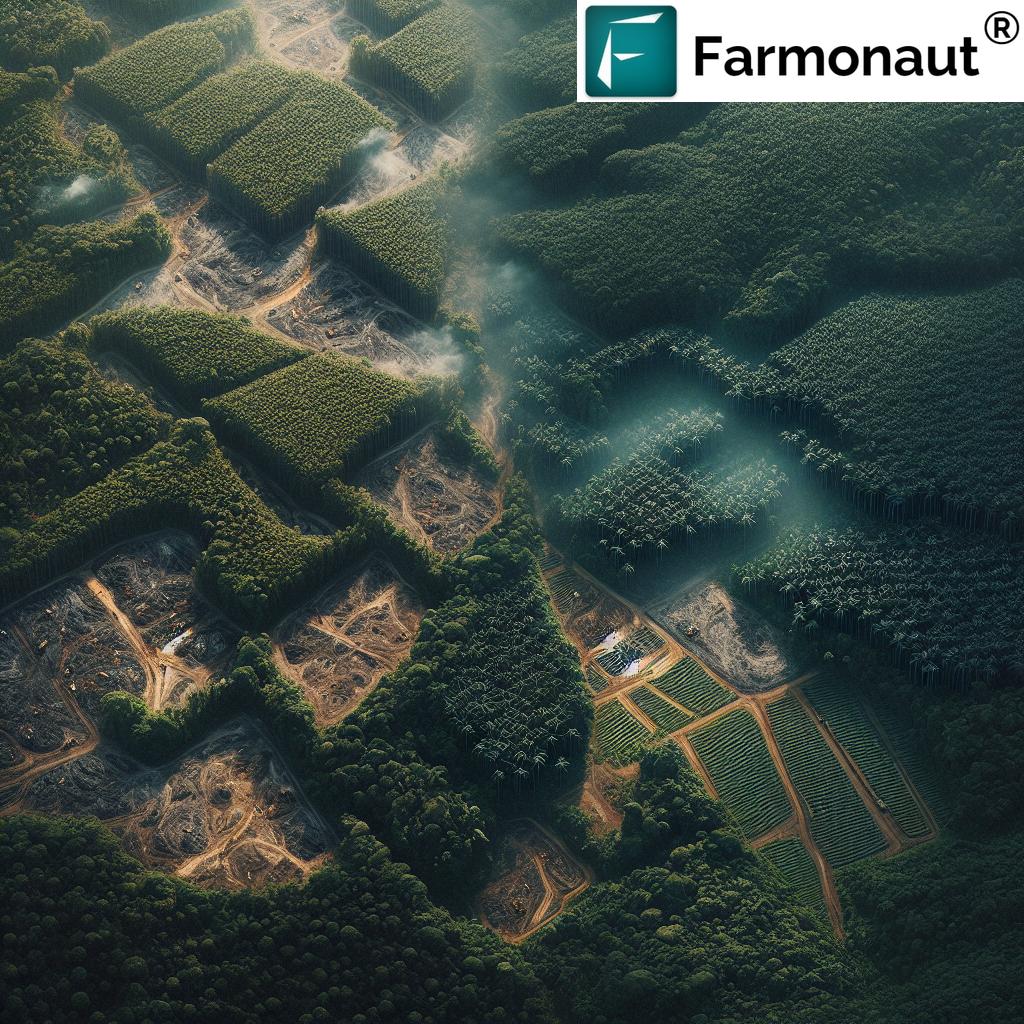
7 Innovative Climate Mapping Technologies Powering Climate-Resilient Agriculture in the Philippines
As 2025 approaches, a new era of climate resilient technologies and mapping systems is driving transformative change across the Philippine agriculture sector. Below we profile 7 leading-edge technologies empowering farmers and policy-makers to adapt, thrive, and reduce climate-related crop losses:
“Philippine farms using climate resilience tech saw up to 30% reduction in climate-related crop losses since 2022.”
-
1. Advanced Satellite-Based Crop & Climate Mapping
Utilizing modern remote sensing, GIS, and AI-powered satellite analytics, this approach provides real-time, spatially explicit data on vegetation health, soil moisture, drought stress, and weather event probabilities for every corner of the archipelago. Farmers gain visibility over localized climate trends, vulnerable zones, and crop stress patterns—essential for timely adaptation in both irrigated lowlands and rain-fed uplands.
- Improves early warning for typhoons, floods, dry spells
- Directs interventions to projected hot spots
- Supports climate-resilient crop selection and calendar planning
Watch: Farmonaut – Revolutionizing Farming with Satellite-Based Crop Health Monitoring
-
2. Automated Weather Stations & Local Sensing Networks
Distributed networks of automated weather stations provide granular, real-time climatic data—including temperature, humidity, rainfall, and wind speed. Integration with climate mapping platforms creates valuable datasets for modeling future event probabilities, while crowdsourced weather data further improves local adaptation strategies.
- Enables microclimate monitoring for precision agriculture
- Alerts farmers and government to increasingly evident weather changes
- Boosts community engagement in data-driven decision-making
Watch: JEEVN AI: Smart Farming with Satellite & AI Insights – See how AI advisory systems leverage weather and satellite data for adaptive farm advice.
-
3. Digital Agro-Advisory Platforms & Mobile Apps
Mobile-based farming advisory platforms now directly connect smallholder Filipino farmers to localized weather forecasts, climate adaptation tips, and pest alerts. Platforms such as Farmonaut support field-level decisions, optimal planting dates (to avoid extreme events), and tailored crop management strategies in remote areas.
- Reduces information asymmetry between urban and rural sectors
- Ensures timely recommendations aligned to changing patterns
- Improves food security and farmer welfare
Try Farmonaut Web & Mobile App – Real-Time Monitoring & Climate Advice
-
4. Precision Irrigation and Water Management Tools
Water scarcity and increasingly variable rainfall make precision irrigation systems critical. Leveraging satellite imaging (NDWI), soil moisture mapping, and remote monitoring, these tools optimize water usage—maximizing crop health and yields despite shifting rainfall and climate risks.
- Pinpoints areas needing irrigation or drainage enhancement
- Supports drought adaptation and mitigates flood risks
- Conserves national water resources for food security
Watch: How Satellites and AI Revolutionize Water Management in Farming | Precision Agriculture with NDWI
-
5. Climate-Resilient Crop Breeding and Seed Varieties
Combining climate mapping data with advanced genomics and breeding programs, researchers now develop crops with traits like heat tolerance, pest resistance, and salinity tolerance. Targeted deployment based on vulnerability assessment ensures rice, corn, and vegetable farmers in regions like Bicol or Ilocos Norte are better protected against projected change impacts.
- Aligns breeding targets with foundational mapping data
- Boosts crop survival rates despite changes
- Expands farmer choice in future scenarios
-
6. Participatory Community Mapping & Indigenous Knowledge Integration
Involving local communities in mapping exercises enables richer, context-driven climate adaptation. By marrying scientific maps with indigenous knowledge (traditional weather signs, historical flood zones), risk assessments become more accurate—guiding community-led interventions.
- Empowers local adaptation and resilience planning
- Enhances accuracy of official climate maps
- Builds trust between government and communities
-
7. AI-Driven Pest & Disease Predictive Systems
As temperatures rise and rainfall patterns shift, pest outbreaks and plant disease threats increase. AI-enabled models utilize weather, crop, and satellite data to predict and alert farmers across Luzon, Visayas, and Mindanao to upcoming pest risks, minimizing losses and supporting timely interventions.
- Enables proactive crop protection and safeguards food security
- Integrates historical event databases for more accurate forecasting
- Deploys via digital platforms and local extension services
Watch: Farmonaut Web app | Satellite Based Crop monitoring – See how digital decision tools provide targeted alerts and crop health insights.
Watch: Regenerative Agriculture 2025 ? Carbon Farming, Soil Health & Climate-Smart Solutions | Farmonaut – Discover the next wave in sustainable, climate-resilient agricultural practices for the Philippines.
Comparative Benefits Table: PH Climate Mapping Technologies
| Technology Name | Key Features | Estimated Resilience Impact (% improvement in crop survival) | Coverage Area (hectares, estimated) | Example Application (Philippine Region or Crop) | Innovation Level |
|---|---|---|---|---|---|
| Advanced Satellite-Based Crop & Climate Mapping | NDVI/NDWI imaging, AI-driven GIS analysis, real-time monitoring | 25–30% | 1,200,000+ | Rice fields in Central Luzon; corn in Mindanao | Very High |
| Automated Weather Stations & Local Sensing | Microclimate measurement, real-time alerts, API data feeds | 20–25% | 400,000+ | Banana plantations, Davao region | High |
| Digital Agro-Advisory Platforms & Apps | SMS push, crop advisory, pest and weather alerts, app integration | 18–22% | 500,000+ | Vegetable/fruit smallholders—Visayas islands | High |
| Precision Irrigation & Water Management | Soil moisture sensors, NDWI mapping, automated irrigation, analytics | 28–35% | 250,000+ | Sugarcane—Negros Occidental | Very High |
| Climate-Resilient Crop Breeding | Genomics, simulation of climate scenarios, targeted trait development | 23–28% | 700,000+ | Flood-tolerant rice in Bicol; heat-tolerant corn in Ilocos region | High |
| Participatory Mapping & Indigenous Knowledge | Community mapping sessions, crowdsourcing, data validation | 10–15% | 120,000+ | Typhoon mitigation—Eastern Visayas | Moderate |
| AI-Driven Pest & Disease Prediction | Machine learning, pest risk maps, real-time farmer notifications | 16–20% | 300,000+ | Rice blast monitoring—Pampanga, Bulacan | High |
This table summarizes how the deployment of diverse technologies—powered by spatial data and intelligent mapping—boosts resilience, coverage, and climate risk reduction for Philippine agriculture.
Essential Tools and Platforms for Enhancing Climate Resilience in Philippine Agriculture
Smart tools, platforms, and data systems are the backbone of effective climate mapping for resilience and adaptation in the Philippines. Here are key categories and leading digital resources:
-
Satellite Imagery & AI Analytics Platforms
- Provide field-level data on weather, crop stress, and soil variability across remote areas
- Farmonaut Large-Scale Farm Management: Optimize monitoring, fleet management, and satellite-based mapping for large farms and agri-businesses
-
API and Integration Services
-
Integrate real-time satellite data, blockchain traceability, and AI forecasts into custom web and mobile solutions.
Farmonaut API enables seamless integration with agri-tech systems, insurance, logistics and traceability platforms. - Product Traceability ensures transparency in the food supply chain.
-
Integrate real-time satellite data, blockchain traceability, and AI forecasts into custom web and mobile solutions.
-
Automated Advisory & Decision Support Tools
- Customizable AI-driven advisory solutions (e.g., Farmonaut Jeevn AI) for weather, irrigation, and crop health recommendations
-
Environment & Carbon Tracking Solutions
- Monitor carbon footprints for compliance and sustainable farming via advanced satellite analytics.
- Read more: Carbon Footprinting for Philippine Farms
-
Climate-Linked Insurance and Financing Tech
-
Leverage satellite-based verification for crop loan and insurance to protect against climate-related losses while providing easier access to financial support.
Farmonaut Crop Loan & Insurance
-
Leverage satellite-based verification for crop loan and insurance to protect against climate-related losses while providing easier access to financial support.
By integrating these tools and services, Filipino farmers and agri-businesses are far better positioned to forecast risks, minimize losses, and ensure food security in 2025 and beyond.
Watch: Farmonaut Large Scale Field Mapping & Satellite Based Farm Monitoring | How To Get Started
Farmonaut: Satellite-Driven Insights and Advisory for Climate-Resilient Agriculture in the Philippines
As a pioneering satellite technology company, we at Farmonaut are committed to providing Filipino farmers, agribusinesses, and governments with affordable, accessible, and data-driven climate mapping for resilience and adaptation solutions.
- Satellite-Based Monitoring: We use multispectral imaging to provide crop health indices (NDVI, NDWI), soil condition analysis, and resource management insights—supporting climate-resilient agriculture in the Philippines.
- Jeevn AI Advisory System: Our AI analyzes satellite data to deliver tailored strategies on crop choice, irrigation, weather adaptation, and fertilization – driving efficient climate adaptation at both the farm and policy levels.
- Blockchain-Based Traceability: We ensure secure tracking of agricultural products through every supply chain stage—vital for transparency in food security, government oversight, and export markets.
- Fleet & Resource Management: Our fleet management tools optimize agricultural logistics, reducing operating costs while ensuring timely interventions during climate events.
- Environmental Impact Monitoring: We facilitate carbon footprinting and emissions analysis for sustainability compliance and reporting.
Watch: Unlocking Soil Organic Carbon: The Secret to Sustainable Farming with Farmonaut
Whether you’re a smallholder in Ilocos, an agri-business in Mindanao, or part of a government agency—our platform accelerates data-driven, climate-resilient decisions for every scale and setting.
Why Choose Farmonaut for Climate Mapping in the Philippines?
- Affordability – Bringing advanced satellite data and AI down to earth, with no expensive hardware or specialized staff required.
- Real-Time Actionability – Receive instant notifications for weather, crop stress, and recommended farm actions.
- Scalability – Modular platform, designed for individuals, co-operatives, large agro-industries, and the public sector.
- Sustainability & Transparency – Empowering compliance, reporting, and traceability for Philippine food exports.
- Remote Accessibility – Manage even the most remote or difficult-to-access fields in Luzon, Visayas, or Mindanao from any connected device.
Explore our apps and subscription plans to drive your farm’s climate resilience in 2025.
Watch: Farmonaut Web System Tutorial: Monitor Crops via Satellite & AI
Strategies for Climate Adaptation and Resilience Building
For climate resilient agriculture in the Philippines, a portfolio of strategies and best practices utilizing climate mapping for resilience and adaptation is essential:
-
Data-Driven Crop Zone Planning: Use maps to match future climate projections to soil types and crop varieties best suited for changing scenarios.
- Example: Flood-tolerant rice for Eastern Visayas lowlands; drought-resistant corn for Central Luzon.
- Early Weather and Pest Warning Systems: Automated alerts (via SMS, apps, or extension services) for impending extreme events and pest outbreaks, increasing the resilience of Filipino farmers.
- Community-Led Mapping and Monitoring: Integrate indigenous knowledge to refine risk assessments and improve participatory adaptation planning.
- Climate-Linked Crop Insurance and Financial Services: Reduce risks, encourage investment, and buffer against climate shocks.
- Sustainable Resource Management: Leverage carbon tracking, water monitoring, and traceability platforms to support environmentally responsible agricultural growth.
Challenges, Opportunities, and The Road Ahead (2025 & Beyond)
The transition to climate resilient agriculture in the Philippines is not without challenges:
- Data Gaps and Digital Divide: Remote areas face limited connectivity and a lack of historical weather data for granular modeling.
- Capacity Building: Continuous training and extension efforts are needed to ensure adoption of advanced technologies at grassroots level.
- Infrastructure and Policy Support: Sustained investment and coordinated government programs are essential to scale up successful models nationwide.
- Inclusivity in Technology Design: Ensuring platforms and services are accessible to women, youth, and marginalized communities.
Opportunities abound: Evolving satellite and sensor cost structures, better open-source mapping platforms, and government-led open data initiatives will continue to lower barriers, allowing even smallholders in the most vulnerable zones to benefit from climate mapping for resilience. Private sector innovation—like that from us at Farmonaut—will further democratize access and drive resilience for every Filipino farmer.
What Does 2025 Hold for Philippine Agri-Tech?
- Universal App & Platform Adoption – Mobile phones and low-bandwidth web apps to ensure climate risk alerts reach every barangay (village).
- Simplified, Actionable Dashboards – Visual maps and AI summaries customizable for any organization or farmer profile.
- Integration with Insurance & Financing – Direct link between climate data and access to risk protection or climate-linked lending.
- Enhanced Carbon & Sustainability Monitoring – Widespread adoption of carbon footprint tracking and blockchain traceability for food exports.
Philippine agriculture’s path to resilience lies directly through climate mapping, innovation, and inclusive technology deployment.
Frequently Asked Questions (FAQ)
Q1: What is climate mapping, and why is it crucial for resilience and adaptation?
Climate mapping for resilience and adaptation involves producing detailed, spatially explicit maps that visualize weather variables, event probabilities, and vulnerabilities at the farm, barangay, or provincial level. It helps decision-makers and farmers plan adaptation strategies, optimize agricultural practices, and reduce risks from extreme climate events.
Q2: Which areas in the Philippines benefit most from climate mapping?
Vulnerable zones such as Central Luzon, Bicol, Eastern Visayas, and Mindanao (particularly lowland rice and upland corn farming areas) benefit greatly, thanks to enhanced crop planning, disaster preparedness, and resource allocation.
Q3: How can Filipino farmers use climate mapping and digital platforms?
Filipino farmers use mobile or web apps (like Farmonaut) to access localized weather forecasts, crop health maps, water advisory, and get real-time pest, flood, or drought alerts—optimizing their planting and resource use, and ensuring greater resilience despite climate change impacts.
Q4: What are climate resilient technologies, and what makes them effective?
Climate resilient technologies refer to systems, tools, and innovations—such as satellite monitoring, AI-based advisory, improved seed varieties, and automated irrigation—that help Philippine agriculture withstand, adapt to, and recover from extreme climate events.
Q5: How does Farmonaut support climate resilient agriculture in the Philippines?
We provide satellite-driven monitoring, AI-based recommendations, blockchain traceability, and carbon tracking, accessible on any web or mobile device. Filipino farms, organizations, and governments can leverage our modular solutions for climate mapping, risk reduction, and sustainable resource management.
Conclusion
The trajectory for climate resilient agriculture in the Philippines hinges on continually advancing climate mapping for resilience and adaptation. Innovative technologies—from AI-powered satellite analytics and digital advisory platforms, to participatory mapping and sustainable resource management solutions—form the foundation of resilient agriculture in a nation increasingly threatened by climate change.
As of 2025 and beyond, combining scientific tools with community engagement enables the Philippines to ensure food security, agricultural productivity, and rural prosperity for all. By utilizing data-driven maps, climate-resilient crop varieties, and digital platforms, the country embarks on a path to sustainable, climate-smart farming.
Explore Farmonaut’s web, Android, and iOS platforms, or integrate our APIs to get started with climate mapping, environmental tracking, and precision advisory for your agricultural operations.


Climate mapping for resilience and adaptation—empowering Filipino farmers to face tomorrow’s climate challenges with innovation, intelligence, and action.