GPS Technology for Agriculture & IoT in India 2025: Revolutionizing Farming with Precision, Efficiency & Sustainability
“By 2025, over 60% of Indian farms are projected to adopt GPS-enabled precision agriculture tools.”
Table of Contents
- Introduction
- India Agriculture Technology: 2025 Landscape
- Understanding GPS Technology for Agriculture
- The Impact of IoT Technology in Agriculture
- Precision Farming: The Convergence of GPS & IoT in Indian Fields
- Key Applications of GPS and IoT in Indian Agriculture
- How Satellite-Driven Tools Empower Agriculture (Farmonaut)
- Comparative Feature & Impact Table
- Challenges & Adoption Roadmap for 2025
- Industry Trends and Future Outlook
- Farmonaut Subscription Plans
- Frequently Asked Questions
- Conclusion
Introduction: The Digital Transformation of Indian Agriculture
Agriculture stands as the backbone of India, employing over half the country’s population. Yet, the traditional ways of farming are now merging with powerful digital advances. As we approach 2025, agriculture GPS technology and IoT technology in agriculture aren’t just buzzwords—they are revolutionizing the agrarian landscape, empowering Indian farmers with precision, efficiency, and sustainable solutions.
This blog explores the pivotal role of GPS technology for agriculture and the Internet of Things (IoT) in India agriculture technology by 2025. Learn how these tools are addressing challenges like resource optimization, food security, sustainable practices, and resilience against unpredictable climate changes, ultimately enhancing productivity and livelihoods in one of the world’s most populous and agriculturally intensive countries.
India Agriculture Technology: Setting the Stage for 2025
Over the recent years, the integration of advanced technologies has revolutionized Indian farming. Tools initially developed for navigation, like GPS, are now enabling real-time field mapping, soil condition assessment, and highly accurate farm operations. Equally, the rise of IoT technology in agriculture—with sensors, weather stations, and smart irrigation controllers—has given Indian farmers the ability to make informed and timely decisions, optimizing every aspect of agriculture.
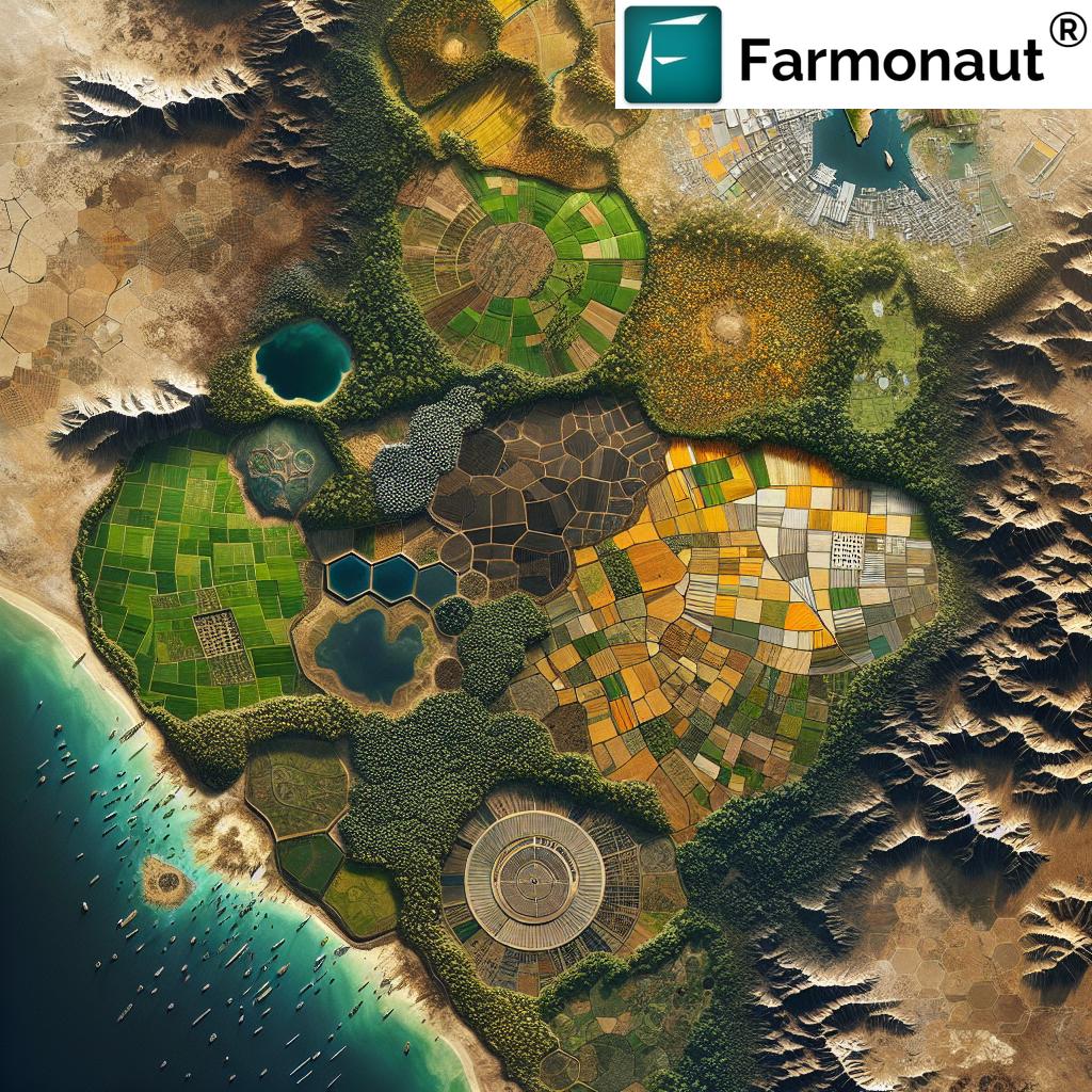
India’s agrarian landscape is highly diverse. There are smallholder farms in Punjab, rice paddies in Tamil Nadu, and drought-prone regions in Maharashtra and Rajasthan. This diversity makes the use of technology in agriculture even more critical—farming practices must adapt to soil variability, changing weather, and limited resource inputs.
Key drivers of this digital transformation include:
- Government initiatives and investment in agricultural technologies
- Private sector development of data-driven farm management tools
- Increasing adoption of GPS and IoT-enabled devices by small and large farms
- Satellite-based platforms and affordable mobile applications empowering even marginal farmers
By 2025, India is on pace to lead globally in precision and data-driven farming—driven by GPS, IoT, and satellite imagery.
 Install on Android – Monitor Your Farm

What is GPS Technology for Agriculture?
The Global Positioning System (GPS) was originally developed for military and navigation applications, but its profound impact on agricultural practices is now evident across the Indian landscape. By leveraging GPS, farmers accurately map their fields, track farm machinery, and micromanage the application of inputs like seeds, fertilizers, and water.
Key Features and Functions of Agriculture GPS Technology
- Field Mapping: Create precise maps of plots to identify variability and plan operations.
- Soil Sampling: Pinpoint soil patches with different nutrients or properties and collect targeted samples.
- Guidance Systems: Use GPS auto-steering on tractors and combines for straight, non-overlapping rows during planting, spraying, and harvesting.
- Resource Optimization: Optimize the application of seeds, fertilizers, and water by only covering the exact areas needed, thereby reducing wastage and overuse.
- Time and Cost Savings: Minimize overlaps, missed spots, and labor hours, reducing input costs and maximizing productivity.
For example, if a maize field in Uttar Pradesh shows uneven crop growth, GPS field mapping can help the farmer locate soil variability and direct fertilizer application only where required. This approach enhances efficiency, boosts yields, and supports long-term soil health—preventing overuse and degradation of valuable resources.

Available on iOS – Monitor Crops Anywhere
Benefits of GPS in Indian Farms
- Reduces Input Wastage: Saves on expensive seeds, pesticides, and fertilizers.
- Ensures Precision Farming: Crops receive exact nutrients, at the right time, in the right place.
- Minimizes Environmental Impact: Prevents contamination or degradation of soil and water bodies from over-application.
- Improves Timeliness: Enables quick responses to weather events or pest outbreaks.
By 2025, such agriculture GPS technology will form the core of modern farming in India, making resource optimization and data-driven practices mainstream—even for smallholder farmers.

IoT Technology in Agriculture: Transforming India’s Farming with Data
The Internet of Things (IoT) is rapidly transforming Indian agriculture by connecting sensors, stations, and machinery to digital networks. India’s Iot technology in agriculture progress has exploded, providing farmers with actionable, real-time data about everything from soil moisture to weather updates, crop health, and even the precise movement of livestock.
“IoT devices in Indian agriculture are expected to surpass 8 million units by 2025, enhancing data-driven farming.”
Core Elements of IoT Agriculture Solutions
- Soil Moisture Sensors: Continuously monitor moisture levels, alerting farmers when irrigation is required—with minimal guesswork and water wastage, thereby conserving water in drought-prone regions.
- Weather Stations: Predict weather conditions, optimal planting and harvesting windows, and potential climate threats.
- Smart Irrigation Controllers: Automatically adjust watering based on sensor data, reducing labor and ensuring ideal crop growth conditions.
- Livestock Monitoring: IoT tags track animal health and location, improving herd management and food security.
- Supply Chain Tracking: GPS+IoT tags maintain produce traceability and freshness as crops move to markets.
IoT networks send device data to a cloud platform or mobile apps, where farmers can instantly analyze information and make informed decisions about inputs, pests, irrigation needs, and harvest schedules.
How IoT Improves Efficiency and Sustainability
The convergence of IoT with GPS technology for agriculture spurs highly relevant practices across diverse ecological zones in India:
- Minimizing Water Wastage: Only areas with dry soil receive irrigation, instead of blanket watering.
- Pest & Disease Monitoring: Rapid sensor-based detection limits crop losses and input overuse.
- Input Optimization: Data on moisture, temperature, and plant needs guides fertilizer and pesticide application.
- Climate Resilience: Automated crop management systems can rapidly adapt to unpredictable weather changes.
- Supply Chain Transparency: Real-time location tagging allows for blockchain-based traceability of produce, critical for food safety and consumer confidence.
IoT-based systems ensure that inputs, time, and natural resources are optimized, making Indian farming highly sustainable and productive.
IoT adoption is made easier with affordable devices, user-friendly apps, and platforms such as Farmonaut, which integrate satellite, AI, and blockchain for holistic management. Try our [Farmonaut Web App](https://farmonaut.com/app_redirect) to instantly access satellite-powered crop monitoring.

Precision Farming: The Convergence of GPS and IoT in Indian Agriculture
Precision agriculture, also known as satellite or data-driven farming, arises from the powerful integration of GPS technology and IoT technology in agriculture. This convergence is highly suited to India’s diverse ecological zones and smallholder farm structures—both of which present unique challenges related to resource management, crop variability, and unpredictable climate conditions.
Core Advantages of Precision Agriculture GPS & IoT Technology
- Targeted Application of Resources: Fertilizers, water, and seeds are placed down to the square meter, enhancing productivity and reducing environmental footprint.
- Real-Time Crop Health Monitoring: Uses satellite or sensor data to detect stress, disease, or pests—making prevention and intervention swift and effective.
- Yield Forecasting: Data-driven prediction of crop yield helps plan harvesting, reduce losses, and improve food security.
- Risk Reduction: Early alerts for drought, pest invasion, or nutrient deficiency empower farmers to safeguard yields and profits.
- Cost Efficiency: Precision reduces input costs, labor, and post-harvest losses—critical for India’s small and medium landholders.
Platforms like Farmonaut Large Scale Farm Management are designed to make mapping, satellite monitoring, and resource allocation seamless and scalable for any farm size—supporting organizations and individual growers alike.
GPS & IoT-Driven Practices: Adapting to Different Indian Regions
- Punjab/Haryana Wheat Belts: GPS-guided seeders and combines save massive amounts of diesel and reduce wastage.
- Maharashtra, Rajasthan Drylands: IoT moisture sensors optimize every drop of irrigation water, conserving this critical resource in drought-prone zones.
- Telangana, Tamil Nadu: Weather-linked farming calendars and real-time crop monitoring minimize climatic risk and untimely losses.
- Smallholder Farms: Mobile apps and low-cost sensors guide resource application and prompt interventions, empowering even marginal farmers.
Precision practices mean higher yields, reduced unpredictability, and improved resilience to climate change for farms across India.
Key Applications of GPS & IoT in Indian Agriculture
The adoption of India agriculture technology based on GPS and IoT has led to innovative, practical applications that are already transforming farms in every state. Below are some of the most impactful examples:
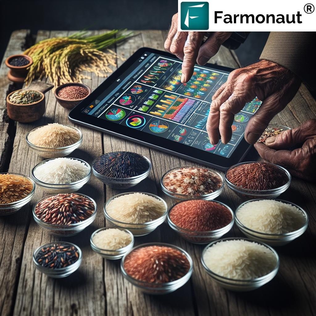
1. Soil Health and Moisture Monitoring
- Satellite and Ground Sensors: Deliver continuous data to apps, providing real-time updates on soil conditions, fertility, and moisture.
- Automated Alerts: Notify the farmer of irrigation needs, minimizing water wastage and optimizing fertilizer application.
This approach not only sustains soil health but also prevents overuse of inputs and long-term degradation—traceability supported by blockchain ensures every input and activity is recorded and verifiable for full transparency.
2. Smart Irrigation Management
- IoT controllers adjust irrigation in real-time to weather and soil moisture conditions.
- Prevents over-irrigation and under-watering, saving millions of litres of water.
To learn how satellite-based environmental impact tracking can further boost water and resource conservation, discover Farmonaut Carbon Footprinting.
3. Field Mapping, Sampling, and Variable Rate Application
- GPS technology enables creation of highly accurate field maps, supporting variable rate technology (VRT) for seeds, fertilizers, and pesticides.
- Dynamic mapping of crop growth enables spot treatment, minimizing chemical wastage and input cost.
4. Crop Health, Disease, and Pest Monitoring
- Drone and satellite imagery with GPS tracks plant health (NDVI/NDWI indices) and facilitates early pest/disease detection.
- AI prediction tools can recommend interventions to limit spread and reduce yield losses.
Our Jeevn AI Advisory System and crop monitoring apps enable farmers to identify and address problems faster—try Jeevn AI now.
5. Fleet and Resource Management
- GPS and IoT fleet trackers optimize usage of tractors, harvesters, and logistics vehicles.
- Ensures timely maintenance, reduces fuel consumption, and integrates supply chain logistics from farm to market gates.
Leverage Farmonaut Fleet Management Solutions for remote tracking and cost savings.
6. Supply Chain Traceability and Loan/Insurance Validation
- Maintain end-to-end tracking with blockchain and GPS for higher consumer confidence and export competitiveness.
- Satellite-backed loan and insurance validation dramatically speeds up financial access for Indian farmers—test our Crop Loan & Insurance Services now.

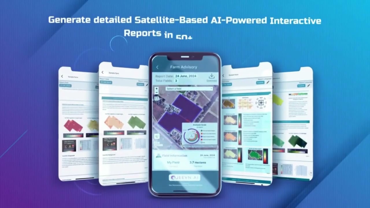
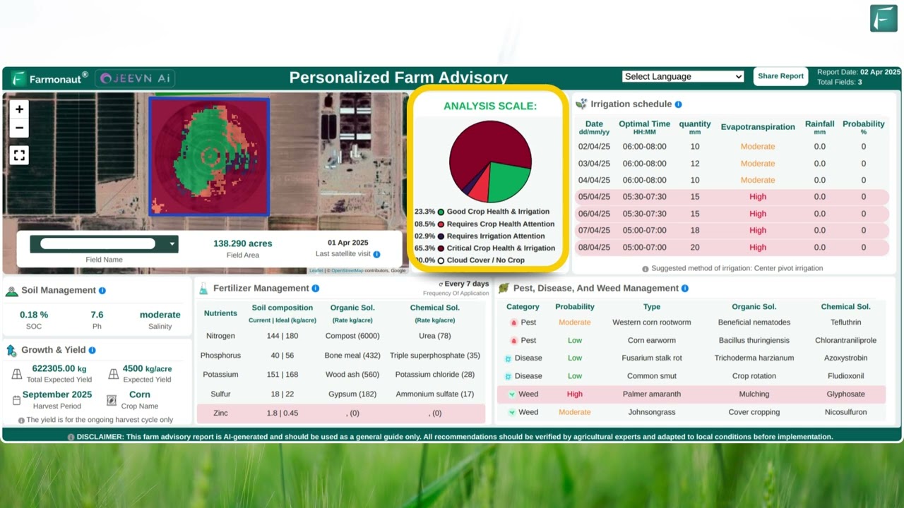
How Farmonaut’s Satellite-Driven Tools Empower GPS & IoT Agriculture
At Farmonaut, we make satellite-powered agriculture GPS technology and IoT integration accessible and economical for every Indian farmer, business, or institution. Our platform provides:
- Real-time Monitoring: Multispectral satellite imagery delivers consistent updates on crop health (NDVI), soil status, and resource usage.
- AI-Based Advisory Systems: Jeevn AI provides personalized strategies and weather forecasts, improving productivity and operational resilience.
- Blockchain Traceability: Ensure full transparency from farm to fork, raising consumer confidence and global market access.
- Fleet & Resource Management: Reduce logistics costs and coordinate all farm machinery or vehicles remotely.
- Environmental Impact Measurement: Track carbon footprint, water conservation, and sustainability for any farm size.
Our solutions enable informed decisions, boost efficiency, and help address challenges that come with farming in an eco- and climate-sensitive India.
Get started today with our Farmonaut Satellite & Weather API and Developer Docs—easily integrate field-level data analytics into your own apps or farm management systems.
Comparative Feature & Impact Table: Traditional Farming vs GPS and IoT Agriculture in India (2025)
| Agricultural Activity | Traditional Practice | GPS & IoT-Enabled Practice | Estimated Efficiency Gain (%) | Estimated Sustainability Impact |
|---|---|---|---|---|
| Soil Monitoring | Manual soil sampling at random spots, rough estimates of fertility/moisture | Automated, GPS-guided variable sampling; IoT soil sensors relay real-time data | +45% | Saves 30-50% water and fertilizer per acre; protects soil health |
| Precision Seeding & Fertilizing | Uniform seeding and blanket fertilizer application, high wastage | GPS auto-guidance and VRT-enabled implements; inputs delivered precisely | +35% | Reduces fertilizer use by 20-30%; minimizes leaching & pollution |
| Irrigation Management | Fixed irrigation schedules, often leading to overwatering | IoT moisture sensors; smart irrigation actuators adapt to weather, soil | +50% | Up to 60% water saved in dry regions |
| Crop Yield Estimation | Visual assessment, unreliable forecasts | AI/satellite-based yield prediction using NDVI & crop health trends | +30% | Reduces food losses, aligns harvest with market demand |
| Pest & Disease Monitoring | Spot checks, often after damage is done | Drone/Aerial GPS surveys, IoT detection, early AI alerts | +50% | Reduces chemical use by 30%; less environmental impact |
| Logistics & Fleet Management | Manual fleet logs, delays in transport/maintenance | GPS/IoT-enabled real-time vehicle tracking, optimized routes | +40% | 10-20% fuel savings, timely delivery reduces post-harvest losses |
| Supply Chain Traceability | Paper tracking, prone to errors and fraud | GPS+Blockchain RFID for supply chain end-to-end transparency | +60% | Increases trust, opens export markets, reduces spoilage |
Overcoming Challenges: Adoption & Skills for 2025
While the benefits are substantial, the transition to GPS technology for agriculture and IoT technology in agriculture in India faces hurdles:
- Initial Investment: Devices and sensors, although falling in cost, are still not affordable for every smallholder.
- Technical Skills: Many farmers are unfamiliar with digital platforms, requiring ongoing education and support.
- Connectivity: Rural/interior regions may lack robust mobile and internet infrastructure.
- Data Security: Increasing need for data protection, especially when blockchain and third-party platforms are involved.
- Fragmented Landholdings: Adaptation and scaling must address India’s unique land size and fragmentation challenges.
Government and private sector initiatives are increasingly promoting these technologies with training programs, subsidized hardware, and support services—building an ecosystem where digital agriculture can become the new normal by 2025.
Industry Trends: The Future of Indian Agritech by 2025 and Beyond
The future belongs to precision and data-driven agriculture:
- Aerial Drones and UAVs: GPS-enabled drones make large-scale field mapping, health monitoring, and fertilizer/pesticide spraying ultra-precise and affordable.
- Artificial Intelligence: Machine Learning and AI-driven advisory (Jeevn AI) automate recommendations based on millions of real-world datasets.
- Blockchain Traceability: Every stage of the supply chain, from input to delivery, can be verified for authenticity and quality (Farmonaut Traceability).
- Financial Access: Affordable loans and risk mitigation products based on satellite data (Crop Loan & Insurance) are opening up capital for the next generation of Indian farmers.
- Fleet Automation: GPS-tracked fleets could be fully autonomous within a decade (Fleet Management for today).
- Environmental and Resource Accountability: Indian agriculture is going green with carbon, water, and ecological impact monitoring (Farmonaut Carbon Footprinting).
In 2025 and beyond, the mainstream Indian farm will harness satellites, IoT, GPS, and AI as naturally as it wields physical tools today. This technology stack is enabling sustainable development—maximizing productivity, minimizing waste, and safeguarding food security for generations.
Get Started: Farmonaut Subscription Plans
Explore flexible subscription options that put satellite, AI, and traceability tools in your hands, at any scale—from single-farm users to enterprises and government agencies.
Frequently Asked Questions: Agriculture GPS Technology & IoT in India 2025
What is GPS technology for agriculture and why is it important for India?
GPS technology for agriculture provides accurate field mapping, navigation, and resource application through satellites. In India’s highly variable landscapes, it enables precision, reduces wastage of inputs, and directly boosts efficiency and sustainability.
How does IoT technology in agriculture benefit Indian farmers?
IoT technology in agriculture allows for real-time monitoring of soil, weather, irrigation, and equipment status. This enables farmers to make informed, timely decisions— maximizing yield, conserving resources (especially water), and reducing costs.
Can smallholder farmers afford GPS and IoT systems in 2025?
Yes! The cost of GPS and IoT devices is decreasing. Solutions like the Farmonaut Satellite App are affordable, subscription-based, and offer scalable options even for small farms.
Is GPS & IoT technology only for large agribusinesses?
No. Mobile platforms, affordable sensors, and satellite-based services mean even marginal landholders in India can access these innovations and benefit from data-driven farming.
What are some examples of precision farming practices enabled by GPS and IoT?
- Variable rate seeding and fertilization
- Automated and precise irrigation
- Drone and satellite-based crop health scouting
- Fleet management and produce traceability
How does Farmonaut support GPS and IoT agriculture in India?
We enable farmers, agribusinesses, governments, and institutions to leverage affordable satellite imagery, AI-based advisory, and blockchain traceability, integrating GPS and IoT data into actionable insights for smarter decision making.
How is climate change addressed through these technologies?
By optimizing use of water, fertilizer, seeds, and pesticides, these technologies reduce waste, emissions, and environmental impact, while increasing yields and resilience to unpredictable Indian climatic conditions.
Where can I download farm management and satellite apps for GPS and IoT farming?
Download the Farmonaut Web App, Android App, or iOS App for handheld digital crop monitoring and management.
Conclusion: Empowering Indian Agriculture’s Digital Future
By 2025, the integration of GPS technology for agriculture and IoT technology in agriculture promises to bring unprecedented efficiency, precision, and sustainability to Indian fields. From the Punjab wheat belt to the Tamil Nadu rice fields and the arid Maharashtra plains, these advanced technologies are the drivers of a new era—a future where data, not just intuition, guides every agricultural decision.
Our mission at Farmonaut is to make these satellite and sensor advances accessible for anyone: enabling farmers, agribusinesses, and government agencies to adopt resource optimization, boost food security, and navigate climate challenges with confidence. By leveraging our affordable subscription-based platform, users gain access to real-time monitoring, AI-driven advisory, blockchain traceability, and impactful environmental tools—empowering every farm, business, or agency to thrive in India’s rapidly transforming agricultural landscape.
The next decade belongs to technology-enabled famers. And the journey—into precision, sustainability, and data-driven growth—has only just begun.
Explore the power of satellite, GPS, and IoT for your farm:
Farmonaut Carbon Footprinting |
Traceability |
Crop Loan & Insurance |
Fleet Management |
Large Scale Farm Management |
Crop Plantation & Forest Advisory
© 2024 Farmonaut. All Rights Reserved.