Best GPS for Agriculture: 7 Ways GPS Transforms Farming
GPS Technology in Modern Agriculture: Revolutionizing Farming and Forestry in 2025
“*Modern GPS systems can reduce fertilizer use in agriculture by up to 15%, enhancing both efficiency and sustainability.*”
In recent years, agriculture and forestry have been dramatically transformed by advanced technologies. Among these, the Global Positioning System (GPS) stands as the cornerstone for precision agriculture and **forest management**. As we enter 2025 and look toward the future, GPS for agriculture has become essential for maximizing **precision, efficiency, and sustainability** across farms and large-scale operations globally. This blog explores how GPS use in agriculture improves productivity, highlights the best GPS for agriculture, and forecasts the far-reaching impacts of this technology in the coming years.
The Role of GPS in Agriculture and Forestry
Leveraging a network of satellites that transmit real-time data to receivers on the ground, GPS enables users to pinpoint their exact location anywhere on the planet. This **precision positioning** technology is now at the heart of modern agricultural and forestry systems. Let’s examine the core advantages:
- Field Mapping and Land Management: GPS-equipped devices allow for the precise mapping of fields, tracking soil health, and monitoring crop performance. In forestry, detailed mapping aids boundary identification and **inventory management**.
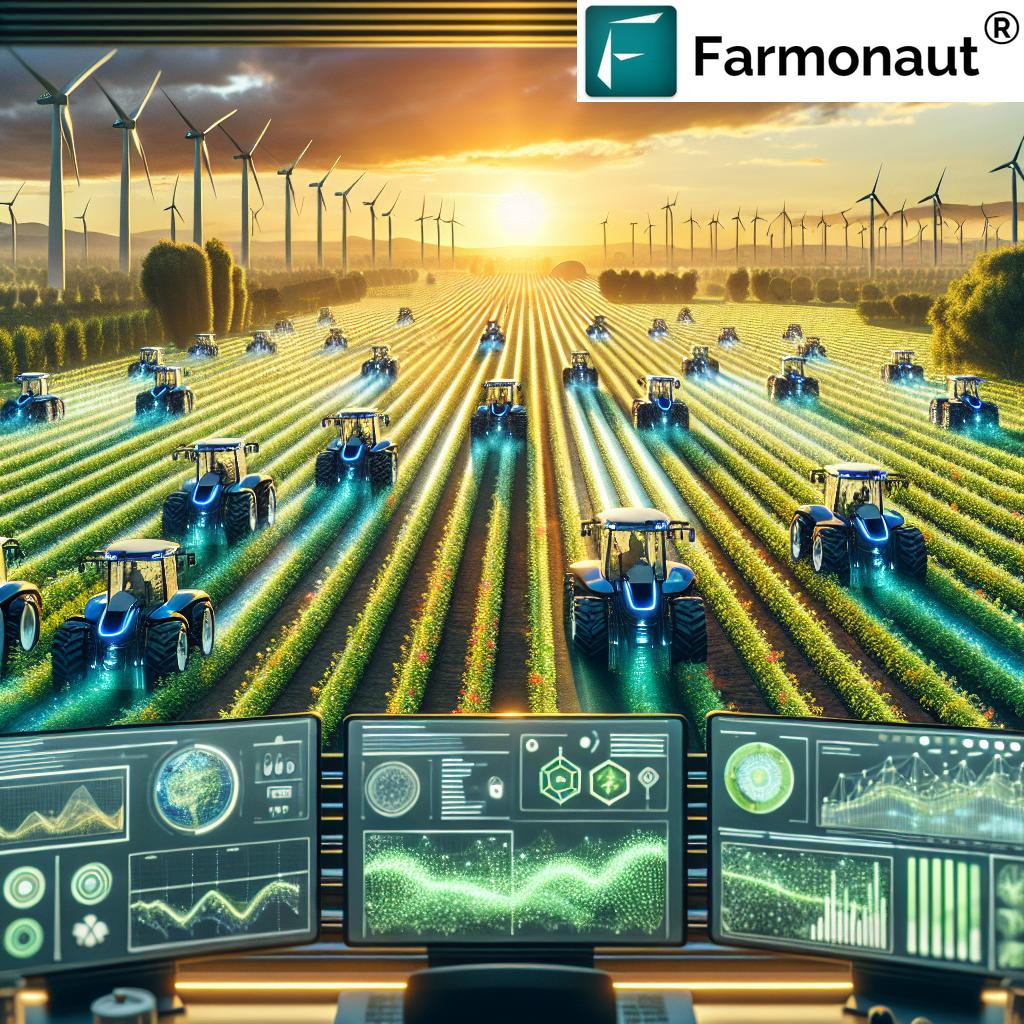
- Automated Machinery Guidance: Tractors, sprayers, and harvesters with GPS-guided auto-steering systems minimize overlap and operator fatigue—vital for large-scale farms, especially during planting and harvesting seasons.
- Yield Monitoring and Data Collection: Combined with sensors and data-driven software, GPS enables real-time **spatial yield monitoring**, supporting smarter input application and future crop planning.
- Resource Optimization: By optimizing routes and tracking machinery, GPS reduces fuel consumption, cuts costs, and decreases environmental impacts.
- Precision Input Application: Variable Rate Technology (VRT) with GPS allows for **site-specific input application**—increasing yields, minimizing waste, and supporting sustainability.
“*Over 70% of large-scale farms in developed countries now use GPS-guided machinery for planting and harvesting.*”
7 Ways GPS for Agriculture Transforms Farming
Let’s break down the seven transformative ways in which GPS for agriculture empowers farmers and land managers for better operations, productivity, and sustainability in 2025 and beyond:
-
Ultra-Accurate Field Mapping & Soil Analysis
GPS enables ultra-precise mapping of fields and boundaries, allowing farmers to understand soil variability, drainage issues, and crop health trends. Mapping becomes invaluable for planning rotations, improving soil quality, and making data-informed decisions.
-
Precision Input Application with VRT
With GPS-guided Variable Rate Technology (VRT), farmers can apply seeds, fertilizers, and pesticides exactly where needed. This minimizes excess use, improves yields, and reduces environmental impacts, meeting the demands of the modern sustainable agricultural system.
-
GPS-Guided Machinery & Autonomous Operations
Automated guidance allows tractors, sprayers, and even drones to follow the optimal route with “hands-free” navigation, maximizing efficiency while minimizing overlaps and fuel waste. The rise of autonomous equipment, enabled by GPS, is shaping the farms of the future.
-
Yield Monitoring & Site-Specific Management
By combining sensors with GPS receivers, real-time data is captured on yield and crop performance across every part of the field. This mapping informs tailored management—pinpointing high and low productivity zones for further improvement.
-
Fleet & Equipment Tracking
GPS technology provides real-time tracking of farm equipment and fleet management, supporting efficient routes, improving logistics, lowering costs, and helping avoid unauthorized use.
Explore advanced Fleet Management solutions
for farms and agribusinesses that optimize equipment usage and route planning.
-
Enhanced Sustainability & Resource Management
GPS-enabled systems reduce fertilizer, water, and pesticide usage by targeting only the areas that need treatment. This not only shields environmental health but also strengthens farm economics and carbon footprint management.
Click here to learn about carbon footprinting tools that track and reduce your farm’s environmental impact.
-
Seamless Integration with Smart Farm Platforms & Data Analytics
Modern GPS data integrates with AI-powered farm management software and IoT devices. This provides real-time insights for smarter planning, monitoring, reporting, and enables API access for custom analytics.
Expand your digital farm: Access satellite and weather data via Farmonaut API
Read the Developer Docs for Farmonaut API
Best GPS Systems for Agriculture in 2025
Selecting the best GPS for agriculture depends on farm size, required accuracy, features, and integration needs. Hardware ranges from console-based receivers for tractors and harvesters to handheld GPS units for field scouting.
The global market now offers a wide array of specialized GPS products—from leading brands to emerging innovators—designed to maximize farm management and yield optimization. Let’s review the top systems dominating GPS for agriculture in 2025:
1. Trimble Agriculture GPS Systems
- About: Trimble is a pioneer and leader in precision agriculture.
- Key Products: GFX-350 display + NAV-900 receiver
- Benefits: Offers sub-inch accuracy for seed planting and crop spraying, robust software integration, and reliable auto-steering.
- Core Use: Suitable for both crop and nutrient management, integrates with leading farm management and guidance systems.
2. John Deere StarFire GPS
- About: John Deere‘s StarFire Receivers remain renowned for reliability and integration with Deere machinery.
- Key Products: SF3 & SF4 Receivers
- Benefits: Provide sub-meter to decimeter accuracy; seamlessly connect with John Deere tractors, planters, and harvesters for full guidance and variable rate control.
- Core Use: Ideal for both row crop and large cereal operations.
3. Garmin GPSMAP Series
- About: Garmin is an industry mainstay, offering versatile GPS units for smaller farms and forestry professionals.
- Key Products: GPSMAP 66i, 64st Handheld Units
- Benefits: Portable, rugged, affordable; useful for field scouting, forest mapping, and property boundary location.
- Core Use: Quick-deployment GPS, great for precision mapping and asset tracking.
4. Ag Leader GPS & Guidance Solutions
- About: Ag Leader excels in user-friendly, interoperable, and affordable GPS devices.
- Key Products: InCommand Display + GPS 6500 Receiver
- Benefits: Intuitive touch interface, real-time data streaming, robust compatibility with various implements.
- Core Use: Broadacre farms, specialty operations, mixed crop-livestock enterprises.
5. NovAtel SMART6-L GPS Receiver
- About: NovAtel delivers precision positioning critical for autonomous tractors/drones and future-ready farms.
- Key Products: SMART6-L Multi-constellation Receiver
- Benefits: Advanced compatibility, automation-ready, sub-decimeter accuracy.
- Core Use: Robotics, drone-based monitoring, and self-guided vehicles.
Agricultural GPS Systems Comparison Table
Compare the top GPS for agriculture options below to find the system that fits your farm’s needs for 2025 and beyond. Criteria include precision, features, price, compatibility, support, and environmental impact.
| GPS System Name | Precision Level (cm/in accuracy) | Core Features | Estimated Price Range | Compatibility | Ease of Use (1–5) | Support & Updates | Sustainability Impact |
|---|---|---|---|---|---|---|---|
| Trimble GFX-350 + NAV-900 | 1–2.5 cm (sub-inch) | Auto-steering, VRT, yield monitoring, field mapping | $3,000–$10,000 | Tractor/Harvester/Drones | 5 | Excellent | Up to 15% less fuel & chemical use |
| John Deere StarFire SF3/SF4 | 2–4 cm to 10 cm | Auto-steer, section control, data logging | $3,500–$9,000 | Deere Tractors/Harvesters | 5 | Premium | 15% fuel savings, 12% less pesticide |
| Garmin GPSMAP 66i/64st | 1–3 m (handheld) | Handheld mapping, asset tracking | $350–$600 | Handheld, Field Scouting | 4 | Good | Saves chemical/fuel via precise scouting |
| Ag Leader InCommand + GPS 6500 | 2–8 cm | Maps, VRT, live data, compatibility | $2,500–$11,000 | Tractors/Implements | 5 | Excellent | 10%–18% input reduction |
| NovAtel SMART6-L Receiver | 2–10 cm | Automation-ready, drone support, multi-band | $1,900–$7,500 | Robots/Drones/Fleet | 4 | Good | Key for autonomous, energy-saving ops |
Manage Your Farm Remotely—Anytime, Anywhere
Monitor your fields, crop health, inputs, and logistics from your device using our Farmonaut App:


Where to Find Agriculture GPS for Sale
Given the surge in gps for agriculture demand, there are now multiple reputable sources for purchasing top-tier GPS units, receivers, and systems:
- Authorized Dealers: Brands such as John Deere and Trimble offer professional installation, support, and software training through official dealer networks—key for farmers seeking reliability.
- Ag Technology Retailers: Specialized stores focus on agricultural GPS products, mapping displays, and accessories.
- Online Marketplaces: E-commerce platforms like Amazon, eBay, and dedicated ag technology websites offer a wide selection with competitive prices and customer reviews guiding buyers.
- Manufacturers’ Websites: Direct orders often grant access to the latest firmware, exclusive bundles, and custom solutions for large-scale or specialty farming.
- Second-Hand Markets: Used and refurbished agricultural GPS for sale can be sourced at auctions or classified ads, but conditions, warranties, and calibrations should be verified.
Choosing the Right Agricultural GPS for Sale: Key Considerations
- Coverage & Correction: Is sub-inch or decimeter accuracy required for your crops?
- Integration: Must it connect seamlessly with existing tractors, harvesters, sensors, and farm management systems?
- Interoperability: Can the system share data across platforms or with your preferred software?
- Future-Proofing: Is the system upgradable or easily compatible with AI, IoT, or autonomous equipment for your future needs?
GPS Use in Agriculture: Trends and Innovations for 2025+
The year 2025 is just the beginning—the integration of GPS in agriculture is accelerating as systems grow sophisticated and smarter.
Key Trends
- AI and IoT Integration: The combination of GPS, artificial intelligence, and connected sensors delivers advanced analytics for crop health monitoring, pest detection, and weather prediction.
- Autonomous Farm Machinery: Robots and drones equipped with high-precision GPS now plant, monitor, and harvest with minimal human intervention—pushing agricultura toward full automation.
- GIS & Remote Sensing Synergies: Geographic Information Systems (GIS) use spatial data fed by GPS to layer maps for soil, terrain, vegetation, and microclimate analysis. This deepens possibilities for planning, resource allocation, and risk management.
Explore large-scale farm & forest management tools harnessing satellite, AI, and mapping technology for field, estate, or plantation managers.
- Precision Forestry: In forestry, GPS supports selective logging, wildfire mapping, and sustainable reforestation with pinpoint accuracy.
Need crop intelligence for plantations or forest advisory? See Farmonaut’s remote monitoring solutions.
- Blockchain for Traceability: GPS location data can now be paired with blockchain for complete crop, timber, and resource traceability.
Learn more about blockchain-powered product traceability—track your agri-supply chain “from field to market.”
- Financing & Insurance: GPS and satellite data are being used by banks and insurers for efficient crop loan approvals and risk assessment.
Read more about crop loan and insurance solutions powered by field-verified, real-time data.
Farmonaut: Making Precision Agriculture Accessible & Sustainable
At Farmonaut, we are committed to empowering every farmer and agribusiness with the latest digital tools for precision agriculture. Our platform combines satellite-based remote monitoring, AI-driven advisories, and blockchain traceability—making scalable, affordable, and precise farm management a reality in over 40 countries.
- Satellite-Based Crop Health Monitoring: We use multispectral imaging to track NDVI, soil moisture, and vegetation anomalies, supporting timely input application and boosting yields while minimizing waste.
- AI-Powered Jeevn Advisory System: Our personalized advisories, weather updates, and expert recommendations help farmers optimize every field operation. (Watch the video above to see Jeevn in action!)
- Blockchain Traceability & Carbon Footprinting: We enable farmers and agri-corporates to build trust with transparent supply chains, meet regulatory standards, and monitor their sustainability efforts.
- Fleet and Equipment Management: Efficient route planning and equipment tracking lower costs and improve field productivity.
- API and App Access: Our web, Android, and iOS apps deliver real-time, actionable data wherever you are—no expensive in-field hardware required.
GPS En Agriculture: Un Impacto Global
El GPS en agricultura ya es una realidad global. Desde América Latina hasta Europa y el norte de África, miles de pequeñas y grandes explotaciones están integrando tecnología GPS para lograr una mayor eficiencia, controlar el uso de insumos y proteger el medio ambiente.
- El uso de GPS en la agricultura permite una gestión de datos exacta: localización de parcelas, control de maquinaria, tracking del estado del cultivo y manejo sostenible del suelo (la gestion du sol).
- En la silvicultura (forestry), ayuda a implementar planes de gestión ambiental, optimizar las rutas de extracción de madera, y restaurar áreas degradadas—mejorando la trazabilidad y la sostenibilidad.
- La integración de VRT, IoT y AI con el GPS digitaliza la agricultura tradicional, reduciendo el desperdicio y aumentando la productividad.
FAQ: Best GPS for Agriculture, Use, and Systems
What is the most accurate GPS for agriculture in 2025?
The Trimble GFX-350/NAV-900 and John Deere StarFire SF3/SF4 systems lead the market with sub-inch accuracy and powerful integration features.
How does GPS use in agriculture improve sustainability?
By enabling variable rate application, optimized routes, and minimizing fertilizer and chemical waste, GPS systems reduce environmental impact and encourage sustainable practices.
Can GPS technology help small and medium farms?
Yes, handheld options like Garmin GPSMAP and affordable solutions support precision mapping and resource tracking—empowering even smallholder farmers to access precision agriculture.
What is VRT (Variable Rate Technology) in GPS?
VRT uses field data and GPS positioning to **apply seeds, fertilizers, or chemicals at variable rates**, boosting efficiency and improving yields.
How do I integrate GPS data with AI and remote sensing?
Use digital platforms and APIs such as (Farmonaut API) to combine field-level GPS data with AI-based insights for full-spectrum crop health, weather alerts, and predictive analytics.
What are the key benefits of using GPS in forestry?
GPS solutions for forestry help with inventory management, sustainable logging, wildfire mDo field mapping with minimal intrusion, and monitor reforestation progress efficiently.
Conclusion: Revolutionizing Agriculture & Forestry with GPS in 2025
The landscape of gps for agriculture is evolving at an unprecedented pace. As we embrace 2025 and beyond, GPS-enabled systems are more accessible, powerful, and essential than ever. The best GPS for agriculture offers not only **positioning accuracy** but also seamless integration with AI, remote sensing, and data-driven farm management systems.
By reducing inputs, improving yields, and minimizing environmental impact, GPS technology supports the sustainable transformation of both farming and forestry. For farmers, land managers, and agribusinesses worldwide, leveraging the right GPS solutions—paired with digital platforms like Farmonaut—ensures resilience and profitability in the face of climate change, rising input costs, and global food demand.
The future of agriculture and forestry management will be increasingly data-driven, automated, and sustainable—thanks to innovation in GPS, AI, and satellite technology. Now is the time to adopt these tools, optimize every hectare, and join the revolution shaping global food and resource systems for generations to come.