

Reviewed September 2026 against USDA Economic Research Service and Deloitte Insights data.
Try it: Run your own numbers →
Table of Contents
- What Technical Farming Means, in Numbers
- Defining Technical Farming
- Who Actually Uses This: USDA Adoption Data by Farm Size
- Technical Farming Products: What They Cost and What They Do
- Comparison Table: Technical Farming Products by Cost and Adoption
- Calculator: Precision Irrigation Payback for Your Field
- Technical Rotation in Forestry
- The Technical Skills Farmers Are Actually Training For
- Tech in Farming: How the Pieces Connect
- Where Farmonaut Fits
- Apps, APIs, and Resources
- Frequently Asked Questions
- Conclusion
- Try it: Run your own numbers
What Technical Farming Means, in Numbers
Technical farming is the use of satellites, sensors, GPS guidance, and data analytics to run planting, irrigation, and harvest decisions off measurements instead of habit. It is not a future promise: the USDA Economic Research Service found that 68% of large-scale U.S. crop farms (those with more than $1 million in gross income) were already using precision agriculture technology as of the 2023 Agricultural Resource Management Survey, against 27% of all U.S. farms combined — a gap that tells you adoption tracks farm size and capital, not enthusiasm. Source: USDA ERS, Chart of Note 110550.
This page answers the searches people actually run: what “technical farming” is, what a “technical farming website” or “technical farming products” actually sell, what a “technical farm” looks like on the ground, and what “farming technology” and a “farmer tech offering” cost to adopt. Rather than repeating projections nobody can check, every figure below carries a source and a date, and every section tells you where to pull a fresher number when this one ages out.
Defining Technical Farming
Technical farming is the application of measurable, repeatable technology — satellite imagery, GPS guidance, IoT sensors, variable-rate machinery, and AI-based analytics — to specific farm decisions: where to plant, how much to irrigate, when to spray, when to harvest. It replaces blanket treatment of a field with treatment calibrated to what a sensor or image says that part of the field actually needs. Five things distinguish it from conventional practice:
- Data-driven decisions: real-time inputs from sensors, satellites, and weather feeds inform planting, irrigation, and harvest timing instead of a fixed calendar.
- Precision input management: water, fertilizer, and pesticide are applied to zones within a field based on measured need, not a flat per-acre rate.
- Integrated smart hardware: IoT nodes, drones, GPS-guided equipment, and AI models work as one monitoring and response system rather than standalone gadgets.
- Continuous monitoring: crop, soil, and — where livestock are involved — herd condition are tracked on an ongoing basis, not spot-checked at planting and harvest.
- Advanced genetics: seed varieties bred or engineered for drought tolerance and input efficiency are matched to field-specific conditions via decision-support tools.
How a Technical Farm Differs from a Conventional One
- Conventional: uniform input rates across a field, decisions made on a calendar or by visual inspection, resource use set by rule of thumb.
- Technical: input rates vary by zone based on sensor or imagery data, decisions are triggered by measured thresholds, and every pass is logged for the next season’s plan.

Real-time satellite and AI monitoring, demonstrated above, is the entry point most technical farms start from.
Who Actually Uses This: USDA Adoption Data by Farm Size
The clearest answer to “is technical farming actually being used” is the USDA’s own adoption tracking, and it breaks sharply by farm size and by technology type. GPS guidance autosteering — the single most widely adopted precision technology — was in use on 70% of large-scale U.S. crop farms versus 52% of mid-size farms as of 2023, per USDA ERS. Source: USDA ERS, Chart of Note 105914.
Below that top tier, adoption drops off by technology: yield monitors, yield maps, and soil maps were used on 68% of large crop farms in 2023 (same USDA ERS source above), variable-rate technology (VRT) for fertilizer or chemical application reached 45% of U.S. farms, and drone technology — still the newest category tracked — sat at just 12% of U.S. farms in 2023. Source: USDA ERS Publication 105893.
Controlled environment agriculture (CEA) — greenhouses and other enclosed, sensor-managed growing systems — is a smaller but fast-documented slice of technical farming. USDA NASS counted 2,994 CEA operations in the United States in 2019, producing 7.86 million hundredweight of crops that year. Source: USDA ERS, Chart of Note 109422. That is the most recent NASS count publicly charted at the time of writing; USDA NASS refreshes precision agriculture and irrigation adoption data annually through the Agricultural Resource Management Survey and the Farm and Ranch Irrigation Survey, both posted at nass.usda.gov/Charts_and_Maps — check there for a CEA count or adoption rate newer than the one cited here.
Money follows the same size-skew. Deloitte Insights put the U.S. farm technology market at $18–21 billion for 2025, with venture capital into U.S. AgTech startups totaling $10.6 billion in 2022. Source: Deloitte Insights, Agricultural Technology Predictions. Two figures the USDA and industry trackers have not yet published: a quantified yield gain attributable to precision agriculture adoption at the farm level, and adoption rates specifically for AI/machine-learning applications in U.S. farming — both are listed as open gaps in current USDA reporting, so treat any percentage yield-gain claim you see elsewhere as unverified until NASS or a land-grant extension study publishes one with a method attached.
Technical Farming Products: What They Cost and What They Do
“Technical farming products” is a search people run when they want to know what’s actually for sale, not a definition. Here is what sits in each category, tied to the adoption figures above.
GPS Guidance and Autosteer
- What it is: GPS-guided steering that keeps planting, spraying, and harvest passes on precise, non-overlapping lines.
- Adoption: 70% of large U.S. crop farms, 52% of mid-size farms (USDA ERS, 2023, cited above) — the highest-adoption category in precision agriculture, likely because it pays back through reduced input overlap on the very first season.
Smart Irrigation Systems
- Description: Drip or sprinkler systems linked to soil moisture sensors and weather forecasts, applying water to measured deficit rather than a fixed schedule.
- Benefit: reduces water applied per acre by matching output to sensor-read soil moisture instead of calendar-based scheduling.

Soil moisture monitoring, shown above, is the sensor layer that smart irrigation scheduling runs on.
Yield Monitors, Yield Maps, and Soil Maps
- What it is: in-combine sensors and mapping software that record yield variation across a field at harvest, building the zone map that next season’s variable-rate application uses.
- Adoption: 68% of large U.S. crop farms in 2023 (USDA ERS, cited above).
Variable-Rate Technology (VRT)
- What it is: equipment that varies seed, fertilizer, or chemical application rate in real time based on a prescription map.
- Adoption: 45% of U.S. farms in 2023 (USDA ERS Publication 105893, cited above).
IoT and Smart Sensors
- Description: ground-based sensors, weather stations, and asset trackers feeding continuous data on soil, crop, and microclimate conditions to a cloud dashboard.
- Benefit: early detection of pest or disease pressure and moisture stress, ahead of visible symptoms.
Drone and Satellite Remote Sensing
- Description: UAV and satellite imagery covering a field faster and more consistently than a ground survey, used for stress detection, stand counts, and yield estimation.
- Adoption: 12% of U.S. farms used drone technology in 2023 (USDA ERS Publication 105893) — the least-adopted precision category tracked, consistent with it being the newest to reach commercial cost parity.
AI-Based Disease Detection and Blockchain Traceability
- Description: AI models scan field imagery from drones, satellites, or phone cameras to flag early disease, nutrient deficiency, or pest signatures; blockchain layers then record that data immutably for supply-chain verification.
- Benefit: earlier intervention and a verifiable record for buyers or certifiers.
See Farmonaut’s blockchain-based traceability solutions for how that record-keeping layer works in practice.
Genetically Enhanced Seed and Decision Support
- Description: seed bred or engineered for drought tolerance, input-use efficiency, and pest resistance, paired with software that recommends which hybrid to plant where based on field-specific conditions.

JEEVN AI, shown above, layers advisory output on top of the satellite and sensor data described in this section.
Comparison Table: Technical Farming Products by Cost and Adoption
| Product Category | Function | US Adoption Rate | Adoption Period | Source |
|---|---|---|---|---|
| GPS Guidance / Autosteer | Precision steering for planting, spraying, harvest passes | 70% large farms / 52% mid-size farms | 2023 | USDA ERS 105914 |
| Yield / Soil Mapping | Records yield variation, builds prescription zone maps | 68% large crop farms | 2023 | USDA ERS 110550 |
| Variable-Rate Technology | Adjusts seed/fertilizer/chemical rate by zone | 45% of US farms | 2023 | USDA ERS 105893 |
| Drone Remote Sensing | Aerial imagery for stress detection, stand counts | 12% of US farms | 2023 | USDA ERS 105893 |
| Precision Ag, All Types (large farms) | Combined precision technology adoption | 68% of farms >$1M gross income | 2023 | USDA ERS 110550 |
| Precision Ag, All Types (all US farms) | Combined precision technology adoption | 27% of all US farms | 2023 | USDA/ProAg summary |
Read this table as a size gradient, not a single national number: GPS autosteer, the cheapest-to-retrofit category, has the highest adoption at every farm size; drone sensing, the newest and most capital-intensive, has the lowest. NASS refreshes these figures roughly annually through the Agricultural Resource Management Survey — check nass.usda.gov/Charts_and_Maps before quoting last year’s percentage as current.

Drone-based field scouting, covered above, sits in the 12%-adoption category from the table — still the newest precision technology to reach working farms at scale.
Calculator: Precision Irrigation Payback for Your Field
Enter your field size and current water cost to see how a soil-moisture-triggered irrigation schedule compares to a fixed calendar schedule, based on the water-savings mechanism described above.
Run your own numbers
Assumptions: uses your own water cost and field size; the reduction percentage is an editable estimate, not a guaranteed figure — USDA has not published a standardized water-savings percentage for sensor-scheduled irrigation (see the gap noted above), so use your own farm's historical water use or a local extension trial as the basis for that input. Excludes sensor hardware maintenance, installation labor, and financing costs.
Technical Rotation in Forestry: Data-Driven Land Management
Forestry applies the same measurement-over-habit logic to rotation planning — the interval between planting and harvest. Instead of a fixed-year cycle applied uniformly across a stand, technical rotation plans harvest timing per-stand using measured growth rate, soil condition, and canopy data.
- Remote Monitoring: satellite and drone imagery track forest health, regrowth rate, and canopy density across large areas without ground survey crews.
- Technical Rotation Planning: AI and GIS tools identify harvest-ready stands based on measured growth data rather than a calendar interval, timing harvest to actual maturity.
- Resource Conservation: monitoring of moisture, carbon sequestration proxies, and pest risk supports management cycles that avoid over-harvesting adjacent stands.
- Sustainability: data-driven rotation reduces clear-cutting of stands that haven't reached measured maturity, preserving biodiversity corridors under sustained harvest pressure.

Carbon farming and soil health monitoring, covered above, feed the same land-management data that technical rotation planning uses.
Timber production sits downstream of these same rotation decisions — see how forestry economics interact with land-management policy in this analysis of global timber production. For advisory tools that apply to plantation and forest management specifically, see Farmonaut's crop plantation & forest advisory platform.
The Technical Skills Farmers Are Actually Training For
Hardware adoption is only half the picture — the USDA adoption figures above assume someone on the farm can operate, interpret, and troubleshoot the system. That's the "farmer tech offering" side of the search: what training or support actually comes bundled with the product, not just the product itself. Five skill areas show up consistently in what technical farms report needing:
- Digital Literacy: reading and acting on data from cloud dashboards, satellite feeds, and IoT sensor networks as part of daily operations, not a monthly report.
- Remote Sensing Interpretation: reading NDVI (vegetation index) imagery and soil health indices, and translating an AI-generated advisory into a field action.
- Operating Automated Machinery: running and troubleshooting GPS-guided autosteer systems, drones, and variable-rate applicators — the mechanical and software layer behind the 70%/52%/45% adoption figures cited earlier.
- Resource and Fleet Management: using software platforms — such as Farmonaut's fleet management tools — to schedule and track vehicles, equipment, and labor across multiple fields or a plantation.
- Financial and Compliance Skills: maintaining the digital records that crop insurance, carbon-credit programs, and traceability requirements increasingly demand as a condition of payout or certification.

Satellite-based crop health monitoring, demonstrated above, is the skill most technical-farming training now starts with.
U.S. land-grant extension programs — Cooperative Extension offices attached to each state's land-grant university — remain the most consistent free source of hands-on precision agriculture training; a grower evaluating a new sensor or GPS system can typically get an equipment demonstration or interpretation walkthrough through their state's extension office before committing to a purchase.
Tech in Farming: How the Pieces Connect
The defining feature of tech in farming isn't any single product — it's how IoT sensors, AI models, autonomous machinery, and satellite monitoring interlock into one system that keeps updating itself as field conditions change.
Key Elements of a Connected Farming System
- IoT Integration: soil moisture, weather, and climate stations feeding live data into a shared cloud system.
- AI-Driven Decision Support: models processing sensor and imagery data into specific actions — harvest date, fertilizer plan, irrigation trigger.
- Autonomous Operations: GPS-guided tractors, robotic harvesters, and sensor-triggered irrigation running from the same data advisories that inform human decisions.
- Remote Monitoring via Satellite: large farms and institutional operations using satellite-based platforms — like Farmonaut's large-scale farm management platform — for oversight across many fields at once.
- Blockchain Traceability: connecting producers, processors, and buyers with a tamper-evident record — see Farmonaut's traceability solution.
- Environmental Monitoring: carbon footprint and resource-use metrics informing management decisions, as offered through Farmonaut's carbon footprinting tools.
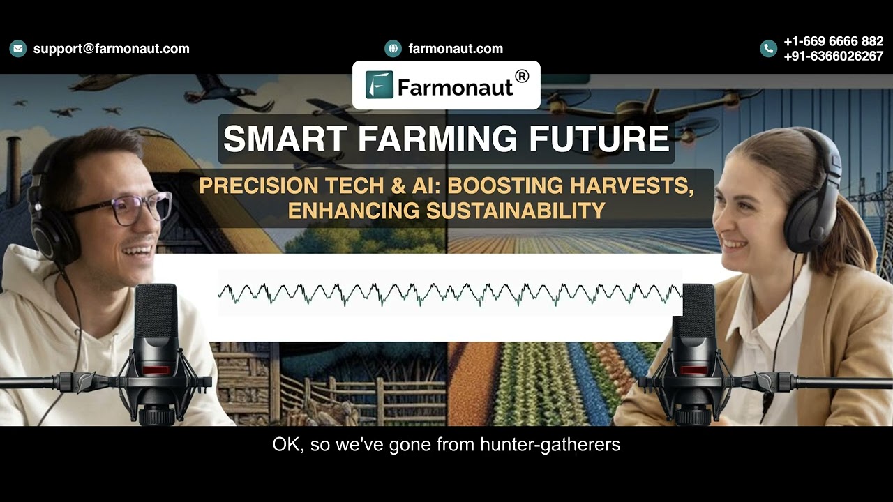
Precision tech and AI working as one ecosystem, shown above, is what separates a "technical farm" from a farm that owns a few gadgets.
Weather Risk and Insurance Verification
Weather volatility is where a connected system earns its cost fastest: satellite-backed advisories and automated alerts let a technical farm act on a forecast before a conventional operation would notice the risk. Crop insurance increasingly depends on the same kind of unbiased, timely field data — Farmonaut's satellite-backed crop loan and insurance solutions give lenders and insurers real-time field verification instead of a post-loss inspection.
The equipment and telematics market covered above sits inside the same $18–21 billion U.S. farm technology market Deloitte projected for 2025 (cited earlier) — see how equipment efficiency and crop yield connect for the mechanics.
Where Farmonaut Fits
Farmonaut's role in this landscape is making satellite-driven monitoring and advisory tools accessible at a subscription price point, rather than requiring the farm-level capital investment that GPS-guided machinery or in-field sensor networks demand.
What Farmonaut Provides
- Satellite-Based Monitoring: multispectral imagery for tracking NDVI (vegetation health), soil moisture, and vegetation stress, supporting the same kind of measurement-based decisions the USDA adoption data above describes.
- Jeevn AI Advisory System: combines weather data, field imagery, and satellite analytics into an AI-generated advisory for planning and action, delivered on mobile and web.
- Blockchain-Based Traceability: a tamper-evident record for crop or livestock batches from field to market (explore traceability).
- Fleet & Resource Management: tracking and optimizing tractor, truck, and irrigation equipment utilization (see more).
- Environmental Impact Monitoring: carbon footprinting and compliance tracking modules (learn about carbon footprinting).
Satellite-based soil monitoring, shown above, is the data layer Farmonaut's advisory tools are built on.
Subscriptions and Availability
Farmonaut is available on Android, iOS, web app, and Open API, scaling from individual fields to large agribusiness estates.
Start with the mobile/web apps:



API integration for developers and agribusinesses:
API platform
Developer documentation
Farmonaut Subscriptions – Affordable satellite-powered insight for every farm
Essential Technical Farming Resources
- Farmonaut Apps (Web, Android, iOS): satellite monitoring and AI-powered advisories — get started.
- API Integrations: access satellite, weather, or resource data programmatically — sign up for API access or view the developer documentation.
- Sustainable Carbon Monitoring: calculate and monitor carbon footprint — discover carbon solutions.
- Blockchain Traceability: tamper-proof supply chain tracking — learn about traceability.
- Crop Loan and Insurance: satellite-verified insurance and loan approval — find out how.
- Large-Scale Farm & Plantation Monitoring: for institutions and plantation managers — manage expansive lands.
- Fleet Management: track and optimize farm machinery and equipment — optimize your fleet.
Frequently Asked Questions
What is technical farming?
Technical farming is the use of GPS guidance, satellite imagery, IoT sensors, and AI analytics to manage crop, soil, and livestock decisions based on measured data rather than a fixed schedule or uniform treatment.
What is a technical farming product?
It's a specific hardware or software tool — GPS autosteer, variable-rate applicators, soil moisture sensors, yield mapping software, or satellite monitoring platforms — that applies technical farming's data-driven approach to one operation. USDA ERS tracked adoption of these categories at between 12% (drones) and 70% (GPS autosteer, large farms) of U.S. farms in 2023.
What does a technical farming website actually offer?
Look for adoption data with a named source and date, a specific product list with cost ranges, and a way to try the tool (app, demo, or API) rather than a generic technology overview — that's the difference between a working "farmer tech offering" and a marketing page.
What is technical rotation in forestry?
Technical rotation uses satellite and drone imagery plus GIS analysis to plan tree harvest timing based on measured stand growth and soil condition, rather than a fixed-year cycle applied uniformly.
Which technical skills matter most for farmers right now?
Interpreting sensor and satellite data, operating GPS-guided and autonomous machinery, using fleet and resource management software, and maintaining the digital records that crop insurance and carbon-credit programs increasingly require.
How does Farmonaut support technical farming?
Through multispectral satellite monitoring, AI-based advisories (Jeevn AI), blockchain traceability, and fleet/carbon management tools delivered via subscription on web, Android, iOS, and API — without requiring the farm to buy GPS-guided machinery or install its own sensor network.
Is technical farming affordable for a small operation?
Subscription-based satellite and advisory tools lower the entry cost compared to owning GPS-guided machinery outright — USDA data shows 27% of all U.S. farms had adopted some precision technology by 2023 versus 68% of farms over $1 million in gross income, so smaller operations remain the segment with the most room to adopt lower-capital tools like satellite subscriptions and mobile advisories.
How do I start using technical farming tools?
Download the app for Android or iOS, or use the web platform, set up field boundaries for monitoring, and begin working from the AI-driven advisories on crop, soil, and resource condition.
Conclusion
Technical farming is not a single product but a size-dependent adoption curve: USDA data puts large U.S. crop farms at 68% precision-technology adoption against 27% for all farms combined, with GPS autosteer the most widely adopted single technology (70% of large farms) and drones the least (12% of all U.S. farms), both as of the 2023 ARMS survey. That gradient is the real story behind every "technical farming products," "farming technology," and "farmer tech offering" search — cost and capital requirement, not usefulness, is what's holding back the lower end of that curve.
To track whether that gradient is closing, the durable method is simple: check USDA NASS's Charts and Maps page annually for updated ARMS and Farm and Ranch Irrigation Survey figures, compare the new adoption percentages against the 2023 baselines cited throughout this article, and treat any yield-gain or ROI percentage you encounter elsewhere — for precision agriculture broadly or AI-specific tools — as unverified until USDA or a land-grant extension study publishes one with a stated method, since neither exists in published USDA data as of this review.
Whether the entry point is a $500 soil moisture sensor or a satellite monitoring subscription, the products, skills, and the underlying data connect the same way — measurement replacing habit, one field zone at a time.

 Anaxee Digital Runners
 Patrick America
 Red Dog Management
 Liquify Digital
 CU Foods
 BeyondTech Global
 Rouge VC
 AgroGreen Dynamics
 AgroRisk
 Oath Inc
 Reddane Farming
 Esri North East Africa
 Cresol
 MDCV UK
 Zerella Group
 Etech Consulting Madagascar
 Vestlandsforsking
 Delicio
 WB Dev
 Sama Premium
 Prochecker
