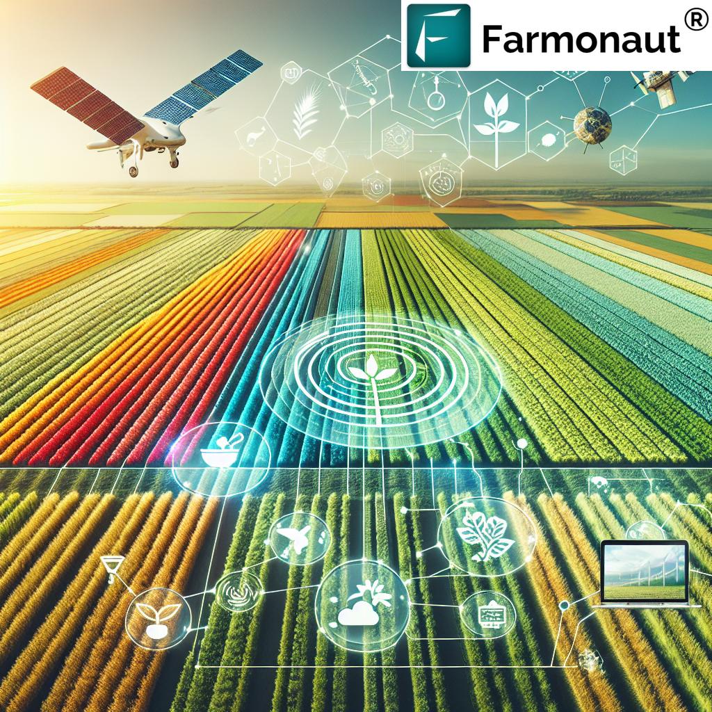
Jeera and Banana Farm Mapping: Advancing Precision Agriculture in India
At Farmonaut, we’re excited to share our latest project involving the mapping of Jeera (Cumin) and Banana farms in Rajasthan and West Bengal, respectively. This initiative is a significant step forward in our mission to revolutionize agriculture through advanced technology and data-driven insights. In this comprehensive blog post, we’ll delve into the intricacies of this project, its implications for precision agriculture, and how it contributes to the broader goals of sustainable farming and food security in India.
Understanding the Importance of Jeera and Banana Cultivation
Before we dive into the specifics of our mapping project, let’s take a moment to appreciate the significance of Jeera and Banana cultivation in India:
Jeera (Cumin) in Rajasthan
Jeera, or cumin, is a crucial spice crop in India, with Rajasthan being one of the leading producers. The arid climate and sandy soils of Rajasthan provide ideal conditions for cumin cultivation. Some key points about Jeera cultivation in Rajasthan include:
- Rajasthan accounts for over 70% of India’s cumin production
- Cumin is a major export crop, contributing significantly to agricultural GDP
- The crop is known for its drought tolerance, making it suitable for Rajasthan’s climate
- Accurate jeera area estimation is crucial for predicting yield and managing market supply
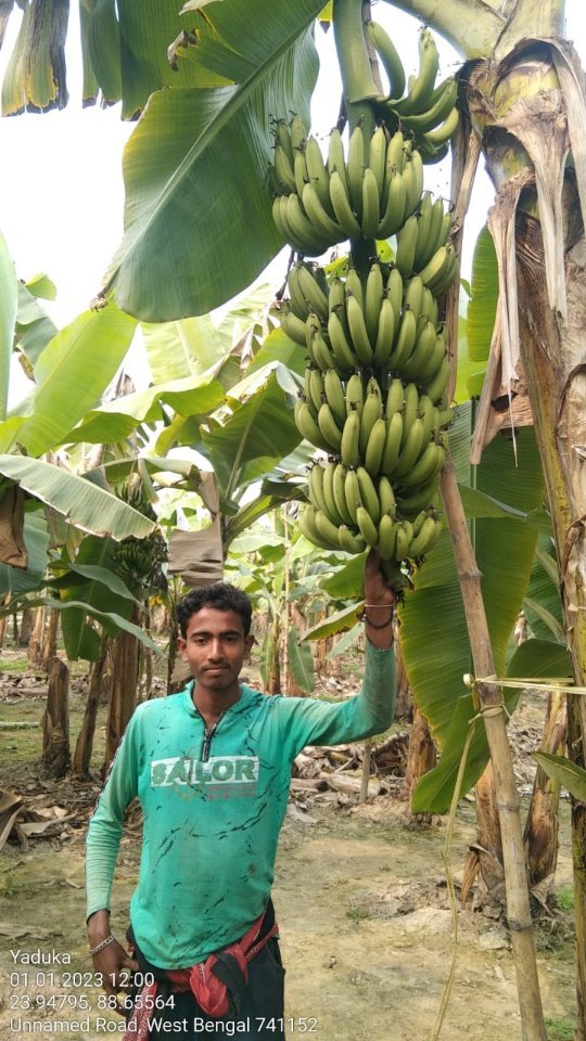
Banana in West Bengal
Banana cultivation in West Bengal is an essential part of the state’s agricultural landscape. The humid subtropical climate of West Bengal is conducive to banana growth. Here are some important aspects of banana farming in the region:
- West Bengal is one of the top banana-producing states in India
- Bananas are a staple food crop and a significant source of income for many farmers
- The crop is known for its nutritional value and versatility in culinary applications
- Precise banana area estimation helps in forecasting production and planning distribution
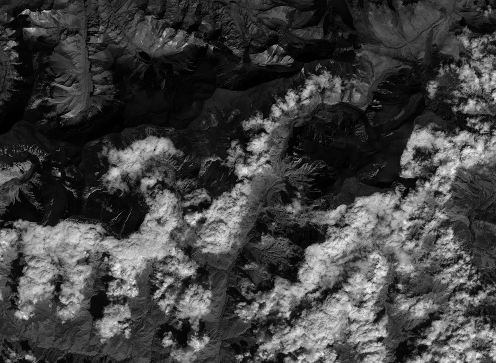
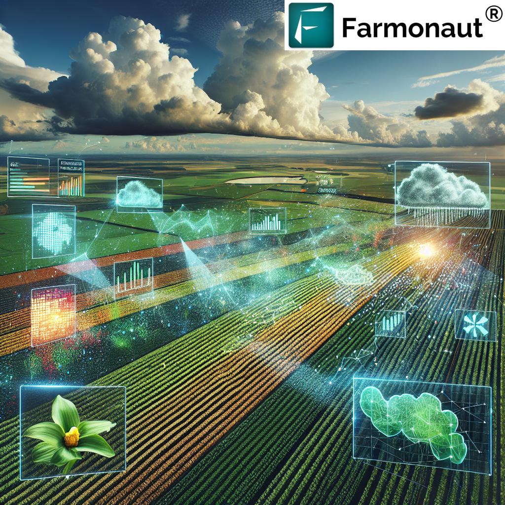
The Role of Remote Sensing in Modern Agriculture
Remote sensing technology has revolutionized the way we approach agriculture. At Farmonaut, we leverage advanced satellite imagery and data analysis techniques to provide valuable insights to farmers and agricultural stakeholders. Here’s how remote sensing contributes to modern farming practices:
- Crop Health Monitoring: Satellite imagery allows us to assess crop health over large areas, identifying potential issues before they become visible to the naked eye.
- Resource Optimization: By analyzing vegetation indices, we can help farmers optimize their use of water, fertilizers, and other inputs.
- Yield Prediction: Advanced algorithms can estimate crop yields based on historical data and current growth patterns.
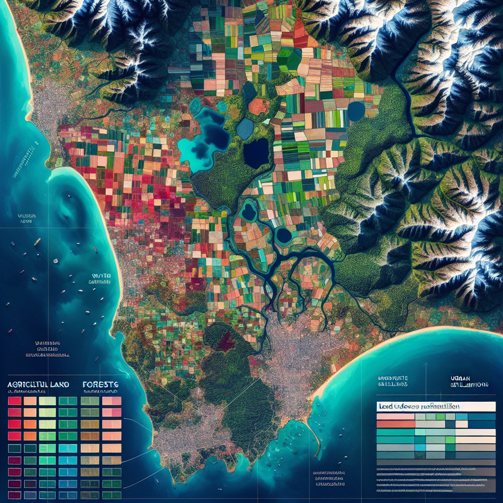
- Land Use Classification: Remote sensing enables accurate mapping of different crop types and land use patterns.
- Climate Change Adaptation: Long-term satellite data helps in understanding and adapting to changing climate patterns.
Our Jeera and Banana Mapping Project
Now, let’s focus on the specifics of our ongoing mapping project in Rajasthan and West Bengal:
Project Objectives
- Accurate jeera area estimation in Rajasthan
- Precise banana area estimation in West Bengal
- Development of robust crop classification algorithms
- Creation of detailed crop maps for better resource management
- Provision of data-driven insights to farmers and policymakers
Methodology
Our approach combines cutting-edge satellite technology with ground-truthing data collection:
- Satellite Imagery Acquisition: We utilize high-resolution multispectral satellite imagery to capture detailed views of the agricultural landscapes in Rajasthan and West Bengal.
- Ground Truthing: Our team conducts extensive field visits to collect accurate on-ground data, which is crucial for validating and calibrating our satellite-based observations.
- Data Analysis: Using advanced machine learning algorithms, we process the satellite imagery and ground-truthing data to classify land use and estimate crop areas.
- Validation and Refinement: We continuously refine our models based on feedback and additional data to ensure the highest levels of accuracy.
Technologies Employed
At Farmonaut, we leverage a suite of advanced technologies to ensure the success of our mapping projects:
- Satellite Imagery: We use multispectral imagery from various satellite platforms, including Sentinel-2 and Landsat-8, to capture detailed information about crop health and land use.
- Machine Learning: Our proprietary algorithms employ deep learning techniques to classify crops and estimate areas with high precision.
- GIS Software: We utilize advanced Geographic Information System (GIS) tools for spatial analysis and map creation.
- Mobile Apps: Our field teams use custom-built mobile applications for efficient ground-truthing data collection.
- Cloud Computing: To process vast amounts of data quickly, we leverage cloud computing platforms for scalable and efficient analysis.
The Importance of Ground Truthing
Ground truthing is a critical component of our mapping project. It involves collecting real-world data to validate and calibrate our satellite-based observations. Here’s why ground truthing is so important:
- Accuracy Validation: It allows us to verify the accuracy of our satellite-based crop classifications.
- Model Calibration: Ground data helps us fine-tune our machine-learning models for better performance.
- Local Knowledge Integration: Interacting with local farmers provides valuable insights into regional farming practices and challenges.
- Identification of Edge Cases: Ground truthing helps identify unusual or complex situations that satellite imagery alone might miss.
- Building Trust: By demonstrating our commitment to on-ground verification, we build trust with farmers and stakeholders.
Applications of Jeera and Banana Area Estimation
The accurate estimation of jeera and banana cultivation areas has numerous applications and benefits:
For Farmers:
- Better crop planning and resource allocation
- Improved understanding of local and regional crop distribution
- Access to data-driven insights for yield optimization
- Enhanced ability to predict and mitigate risks
For Policymakers:
- Accurate data for agricultural policy formulation
- Improved food security planning
- Better allocation of subsidies and support programs
- Enhanced ability to monitor and respond to climate change impacts
For Agribusinesses:
- More accurate supply chain planning
- Better understanding of market dynamics
- Opportunities for targeted product development and marketing
- Improved risk assessment for agricultural investments
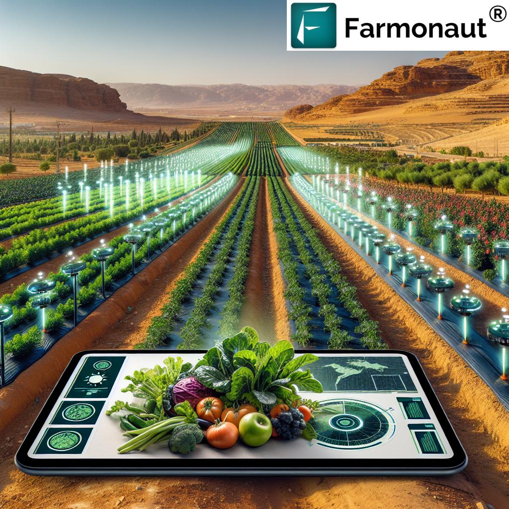
Precision Agriculture: The Future of Farming
Our jeera and banana mapping project is just one aspect of the broader field of precision agriculture. At Farmonaut, we’re committed to advancing precision farming techniques to create a more sustainable and productive agricultural sector. Here’s how precision agriculture is transforming farming:
Key Components of Precision Agriculture:
- Crop Sensing: Using satellite imagery to monitor crop health and growth patterns.
- Variable Rate Technology: Applying inputs like water and fertilizers at variable rates based on specific field conditions.
- Yield Monitoring: Collecting detailed data on crop yields to inform future decisions.
- Soil Sampling: Conducting detailed soil analyses to optimize nutrient management.
Benefits of Precision Agriculture:
- Increased crop yields
- Reduced input costs
- Minimized environmental impact
- Improved farm profitability
- Enhanced food quality and safety
Farmonaut’s Role in Advancing Precision Agriculture
At Farmonaut, we’re at the forefront of the precision agriculture revolution. Our satellite-based farm management solutions are designed to make advanced agricultural techniques accessible and affordable for farmers of all scales. Here’s how we’re contributing to the advancement of precision farming:
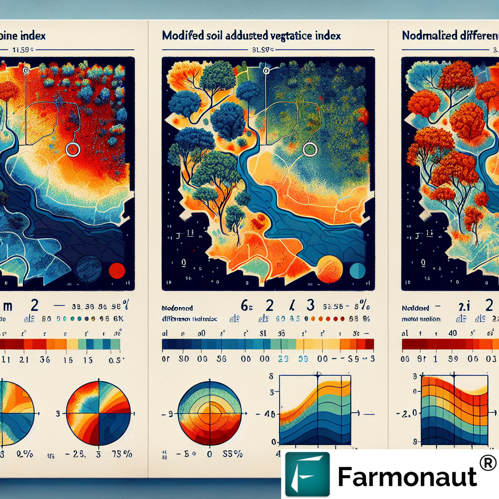
1. Satellite-Based Crop Monitoring
Our platform provides real-time insights into crop health, allowing farmers to detect issues early and take prompt action. By leveraging multispectral satellite imagery, we offer:
- Vegetation health indices (e.g., NDVI)
- Soil moisture analysis
- Crop stress detection
- Growth stage monitoring
2. AI-Powered Advisory System
Our Jeevn AI system analyzes satellite data, weather forecasts, and historical information to provide personalized farming advice, including:
- Optimal planting dates
- Irrigation scheduling
- Pest and disease alerts
- Fertilizer application recommendations
3. Blockchain-Based Traceability
We’re implementing blockchain technology to enhance supply chain transparency, offering:
- End-to-end product traceability
- Verification of organic and sustainable practices
- Enhanced food safety measures
- Improved consumer trust
4. Resource Management Tools
Our platform includes features to help farmers optimize their resource usage:
- Water management systems
- Fleet and machinery tracking
- Labor allocation tools
- Input inventory management
Comparing Farmonaut’s Satellite System with Drone and IoT-Based Monitoring
While drones and IoT devices have their place in modern agriculture, Farmonaut’s satellite-based system offers unique advantages. Here’s a comparison:
| Feature |
Farmonaut Satellite System |
Drone-Based Monitoring |
IoT-Based Monitoring |
| Coverage Area |
Large scale (thousands of hectares) |
Medium scale (hundreds of hectares) |
Small scale (individual fields) |
| Frequency of Data Collection |
Regular (every few days) |
On-demand (requires manual operation) |
Continuous (real-time data) |
| Initial Investment |
Low (subscription-based) |
High (equipment purchase) |
Medium (sensor installation) |
| Operational Complexity |
Low (cloud-based platform) |
High (requires skilled operators) |
Medium (requires maintenance) |
| Data Analysis Capabilities |
Advanced (AI and machine learning) |
Moderate (depends on software) |
Basic (focused on specific parameters) |
| Scalability |
Highly scalable |
Limited by equipment and operators |
Requires additional sensor deployment |
The Future of Jeera and Banana Farming in India
As we continue our mapping project and expand our precision agriculture services, we envision a bright future for jeera and banana farming in India. Here are some of the developments we anticipate:
For Jeera Cultivation in Rajasthan:
- Increased adoption of drought-resistant varieties
- Implementation of advanced water conservation techniques
- Development of value-added products to boost farmer incomes
- Enhanced global market presence through improved quality control
For Banana Cultivation in West Bengal:
- Introduction of disease-resistant banana varieties
- Expansion of organic banana farming practices
- Development of efficient post-harvest technologies to reduce losses
- Increased focus on banana-based processed products
How Farmonaut is Shaping the Future of Agriculture
Our commitment to advancing precision agriculture goes beyond individual projects. We’re working tirelessly to create a more sustainable, efficient, and productive agricultural sector. Here’s how we’re shaping the future of farming:
1. Democratizing Access to Technology
We believe that advanced agricultural technologies should be accessible to all farmers, regardless of the size of their operations. Our affordable, user-friendly platform is designed to bridge the technology gap in agriculture.
2. Promoting Sustainable Practices
By providing detailed insights into resource usage and environmental impact, we’re helping farmers adopt more sustainable farming practices. This not only benefits the environment but also improves long-term farm viability.
3. Enhancing Food Security
Through improved crop monitoring and yield prediction, we’re contributing to better food security planning at both local and national levels. This is crucial in the face of growing populations and climate change challenges.
4. Fostering Innovation
We’re constantly pushing the boundaries of what’s possible in agricultural technology. By integrating cutting-edge technologies like AI, blockchain, and advanced remote sensing, we’re creating new possibilities for the future of farming.
5. Building a Global Agricultural Network
Our platform is designed to connect farmers, researchers, policymakers, and agribusinesses. By facilitating the exchange of knowledge and data, we’re creating a more collaborative and innovative agricultural ecosystem.
Get Involved with Farmonaut
Are you ready to join the precision agriculture revolution? Here’s how you can get involved with Farmonaut:
- Try Our Platform: Experience the power of satellite-based farm management by signing up for our service.
- Explore Our API: Developers can integrate our powerful satellite and weather data into their own applications. Check out our API documentation.
- Download Our Mobile Apps: Get instant access to farm insights on the go with our mobile apps for Android and iOS.
- Stay Informed: Follow our blog and social media channels for the latest updates on precision agriculture and our ongoing projects.
Frequently Asked Questions (FAQ)
Q: What is the purpose of the jeera and banana mapping project?
A: The project aims to accurately estimate the cultivation areas of jeera in Rajasthan and bananas in West Bengal using satellite imagery and ground-truthing data. This information is crucial for crop yield prediction, resource management, and policy planning.
Q: How does Farmonaut’s satellite-based system differ from traditional farming methods?
A: Farmonaut’s system provides real-time, data-driven insights into crop health, soil conditions, and weather patterns. This allows for more precise decision-making compared to traditional methods, leading to optimized resource use and improved yields.
Q: Can small-scale farmers benefit from Farmonaut’s technology?
A: Absolutely! Our platform is designed to be accessible and affordable for farmers of all scales. Small-scale farmers can benefit from improved crop management, reduced input costs, and better yield predictions.
Q: How accurate is the crop area estimation using satellite imagery?
A: When combined with ground-truthing data, our satellite-based crop area estimation can achieve accuracy levels of over 90%. The exact accuracy may vary depending on factors such as crop type and local conditions.
Q: Does Farmonaut provide services for crops other than jeera and bananas?
A: Yes, our platform is capable of monitoring and analyzing a wide range of crops. While this project focuses on jeera and bananas, we provide services for numerous other crops across different regions.
Q: How often is the satellite data updated?
A: The frequency of satellite data updates depends on the specific satellite platform and the subscription plan. Typically, we provide updates every 3-5 days, but more frequent updates are available for certain applications.
Q: Is Farmonaut’s technology applicable in regions outside of India?
A: Absolutely! While this project focuses on regions in India, our technology is globally applicable. We’re actively expanding our services to support agriculture in various countries around the world.
Q: How does Farmonaut ensure data privacy and security?
A: We take data privacy and security very seriously. All user data is encrypted and stored securely in compliance with international data protection standards. We never share individual farm data without explicit consent.
Q: Can Farmonaut’s technology help in adapting to climate change?
A: Yes, our platform provides valuable insights into changing weather patterns and their impact on crops. This information helps farmers adapt their practices to evolving climate conditions, improving resilience and sustainability.
Q: How can I learn more about using Farmonaut’s platform?
A: We offer comprehensive documentation, video tutorials, and customer support to help users get the most out of our platform. You can also explore our
developer documentation for more technical details.
Conclusion
Our jeera and banana mapping project in Rajasthan and West Bengal is just the beginning of a broader transformation in Indian agriculture. At Farmonaut, we’re committed to leveraging cutting-edge technology to empower farmers, enhance food security, and promote sustainable agricultural practices.
By combining satellite imagery, ground-truthing data, and advanced analytics, we’re providing unprecedented insights into crop health, land use patterns, and agricultural productivity. This not only benefits individual farmers but also contributes to more informed policy-making and efficient resource allocation at a national level.
As we continue to refine our technologies and expand our services, we invite farmers, researchers, policymakers, and agricultural enthusiasts to join us on this exciting journey. Together, we can create a more productive, sustainable, and resilient agricultural sector that’s ready to meet the challenges of the 21st century.
Stay tuned for more updates on our jeera and banana mapping project, and explore how Farmonaut can transform your approach to farming. The future of agriculture is here, and it’s more precise, data-driven, and sustainable than ever before.
Happy Farming!