Aquifer Characteristics & Map Illinois: 2025 Guide
Summary: Aquifer Characteristics and the Importance of Aquifer Mapping in Illinois: A 2025 Perspective
Water is the lifeblood for Illinois—sustaining agriculture, infrastructure, and the environment. As groundwater demand intensifies in 2025, a robust understanding of aquifer characteristics, and access to a highly accurate aquifer map illinois, has never been more critical. The state sits atop a complex network of aquifers with varying depth, composition, and recharge rates. Implementing modern mapping and satellite-driven data tools is revolutionizing sustainable water management, providing crucial insights for agriculture, forestry, and infrastructure development. This article explores Illinois’s unique aquifer features, the tools empowering efficient resource use, and the path toward environmental sustainability.
Introduction: Illinois Aquifers and Sustainable Water Management in 2025
Water continues to play a critical role across many industries in Illinois, particularly agriculture, municipal supply, and infrastructure. As climate variability increases and demand intensifies, understanding our underground aquifers’ characteristics is essential to secure a sustainable future. In 2025, data-driven decision-making, powered by advanced mapping and monitoring, is central to informed management of precious groundwater resources.
This article explores the nature, significance, and evolving implications of aquifer characteristics, aquifer map illinois—paving the way for sustainable agriculture and responsible stewardship.
Aquifer Characteristics in Illinois: Understanding Depth, Recharge, and Availability
Illinois Aquifers: An Intricate Network Beneath Our Feet
The state of Illinois is largely underlain by an intricate network of aquifers that vary significantly in depth, composition, thickness, and properties. These aquifer systems are not uniform: their characteristics—such as recharge rates, contamination vulnerability, and water quality—are shaped by geology, human activities, and evolving climate pressures.
Primary Illinois Aquifer Systems in 2025
- Shallow sand and gravel aquifers:
Found above bedrock, these aquifers are highly productive, widely used by rural towns and for agricultural irrigation. Their proximity to the surface makes them susceptible to contamination from surface activities. - Deeper bedrock aquifers:
These distinct systems, including the Silurian-Devonian and Cambrian-Ordovician Aquifers, are composed mainly of limestone and dolomite. Water here is stored in fractures and porous rock formations. While they provide large volumes of water necessary for urban supply and industrial use, recharge rates are typically slower.
Recharge Rates: The Dynamic Engine of Aquifer Health
The recharge rate is the measure of how quickly an aquifer replenishes. Factors influencing recharge variability include:
- Precipitation patterns and climate variability: Changing seasonal rainfall—with increases in frequency of droughts—directly impact recharge.
- Soil permeability and vegetation cover: Looser sandy soils and healthy vegetation facilitate quicker recharge.
- Land cover and human activities: Urban development or intensive agriculture can reduce recharge potential and increase contamination risks.
In 2025, Illinois aquifers face greater recharge variability than ever, highlighting the need for continuous monitoring and adaptive management strategies.
Comparing Shallow Versus Deep Aquifers in Illinois
- Shallow sand and gravel aquifers: Fast recharge, but high susceptibility to contamination (nitrates, pesticides, road salt useful examples).
- Deep bedrock aquifers: Slow recharge, better protected from surface contamination, but may face over-extraction and water quality issues like high TDS (total dissolved solids).
Because aquifer properties can vary significantly within Illinois, accurate, detailed maps and continuous monitoring are crucially important for sustainable water management in 2025.
Comparative Aquifer Overview Table: Illinois 2025
The table below provides a concise comparison of the most important aquifer systems in Illinois. It highlights quantity (coverage, depth, recharge rate) and quality (TDS, use, environmental challenges) to empower sustainable planning for agriculture, infrastructure, and resource management.
| Aquifer Name | Geographic Coverage (sq. miles, est.) | Depth Range (feet) | Water Quality (TDS mg/L, est.) | Primary Use | Recharge Rate (inches/year, est.) | Notable Environmental Challenges |
|---|---|---|---|---|---|---|
| Mahomet Aquifer | ~4,000 | 100–200 | 400–800 | Drinking, Irrigation | 12–15 | Nitrate/chemical contamination, over-extraction |
| Cambrian-Ordovician (Sandstone) Aquifer | >15,000 | 500–1,700 | 500–1,500 | Municipal, Industrial | 0.5–2 | Slow recharge, saline intrusion, overdraw |
| Silurian-Devonian Aquifer | ~10,000 | 100–400 | 200–700 | Municipal, Irrigation | 3–6 | Hardness, contamination near urban centers |
| Shallow Sand & Gravel Aquifers | Statewide, patchy | 20–100 | Varies, 200–800 | Rural Drinking, Agriculture | 15–20 | Nitrate/pesticide contamination |
| St. Peter Sandstone Aquifer | Central/Northern IL | 500–1,200 | 500–1,200 | Industrial, Municipal | ~2 | Salinity, slow recharge |
*Values are for general guidance and subject to change with new geological survey data updates in 2025.
Aquifer Mapping in Illinois: The Significance, Tools, and 2025 Advances
Why Aquifer Mapping Is Essential for Illinois
Accurate mapping of aquifers—especially with a focus on Illinois’s diverse geology—is the foundation of responsible groundwater management in 2025. Aquifer maps do much more than show location: they reveal depth, thickness, water-bearing properties, recharge zones, and vulnerability.
- Identify productive groundwater zones: Help target optimal irrigation/water supply strategies.
- Inform infrastructure projects: Avoid developing in vulnerable recharge or contamination-prone zones.
- Estimate sustainable withdrawal limits: Prevent over-extraction and support environmental health.
- Guide conservation planning: Map recharge areas and protect them to maintain aquifer health.
Major Mapping Tools Used in Illinois (2025):
- Illinois State Geological Survey (ISGS) and U.S. Geological Survey (USGS) – leading the way in producing state-of-the-art aquifer maps using drilling records, geophysical data, and hydrogeological modeling.
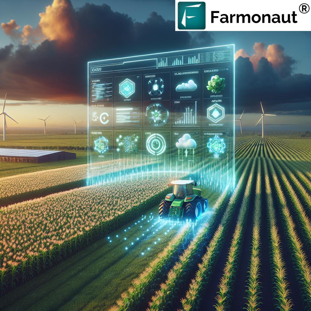
- Remote Sensing and GIS: High-resolution satellite imagery and real-time location data, as provided by specialized companies, support frequent updates and fine-scale mapping.
- Hydrologic & AI Modeling: Integrates weather, historical withdrawal, and quality data to predict future trends.
Aquifer Map Illinois: Benefits for Sectors
Latest aquifer maps enable:
- Farmers: Target irrigation, conserve water, and maximize yield using large scale farm management solutions powered by accurate mapping.
- Urban/Infrastructure Planners: Choose locations and construction methods that protect vital recharge zones and minimize contamination risks.
- Policy Leaders: Set informed extraction limits and craft policies balancing economic, agricultural, and environmental interests.
For those seeking advanced monitoring and scalable, data-driven planning, satellite-based platforms provide actionable insights anytime, anywhere.
Modern Mapping Technologies & Satellite Solutions: The Next Frontier
Advanced technologies are setting a new standard for aquifer mapping in Illinois. By 2025, satellite-based monitoring, AI analytics, and blockchain traceability are increasingly shaping groundwater data collection and decision-making.
Key Technological Advances Driving Sustainable Water Management
- Multispectral Satellite Imagery: Pinpoint changes in soil moisture, vegetation health, and water table levels statewide.
- AI-Powered Modeling: Analyze patterns for climate variability, project recharge shifts, and issue alerts for emerging challenges.
- Blockchain Traceability: Increases supply chain transparency and authenticates agricultural or water sourcing processes. Read more about blockchain-based traceability for agriculture and why it’s critical for food integrity, compliance, and trust.
Many of these advances are being integrated into affordable, app-based dashboards so users—from local farmers to large agribusinesses—can tap into detailed aquifer data for informed management every day.
How Users Can Access Aquifer Maps and Data (2025)
-

Farmonaut’s Satellite Platform: A web and mobile-friendly interface for real-time aquifer, soil, and crop mapping insights. -

Get on Google Play -

Available on iOS
Interested in integrating advanced aquifer and groundwater data directly into your workflow or application? Check out Farmonaut’s Satellite Weather and Monitoring API for developers and businesses.
Read full technical documentation here.
Practical Implications for Agriculture and Infrastructure (2025 & Beyond)
Illinois is a national leader in corn, soybean, and specialty crop production. Over 70% of counties now depend on groundwater sourced from aquifers mapped by ISGS, the USGS, and hi-res satellite data providers. These maps and characteristics have concrete implications for:
1. Optimized Irrigation & Crop Yield
- Utilize real-time groundwater availability data to prioritize fields and deploy precision irrigation systems.
- Minimize over-extraction—protecting both soil health and aquifer sustainability.
- Plant drought-resistant crops in areas with lower recharge or higher demand stress.
2. Infrastructure Planning & Risk Reduction
- Infrastructure for rural water and agricultural supply (pipelines, wells, irrigation canals) is now designed using underlying bedrock and sand/gravel aquifer maps to prevent land subsidence and avoid contamination-prone zones.
- Urban planning integrates recharge zone maps to maintain resilient water access for cities and industry.
Looking to manage vast fields or entire farm clusters? Farmonaut’s platform empowers efficient land use with large-scale farm management tools—crucial for water and resource planning in 2025.
3. Financial, Insurance, and Regulatory Benefits
- Satellite-based verification (see crop loan & insurance solutions) streamlines financing for farms by reducing fraud and supporting accurate, data-backed risk analyses.
- Governments and agencies leverage aquifer and mapping data to set water use quotas, enforce quality standards, and enable responsible growth.
4. Environmental Integrity & Sustainability
- Maintain ecosystem services by identifying recharge zones needing conservation or reforestation.
- Track emissions, nutrient use and carbon footprinting with digital tools—learn more about carbon footprinting for agriculture and how it aligns with aquifer and water stewardship in the era of climate accountability.
Aquifer Sustainability Challenges in Illinois—and the Path Ahead (2025+)
Despite advances in mapping and monitoring, several challenges threaten Illinois’s aquifer sustainability in 2025:
- Climate Variability:
- Altered recharge rates due to more frequent droughts or changing rainfall patterns challenge resource planning, especially for agriculture and rural supply.
- Increasing Extraction Pressure:
- Higher demand from agriculture, cities, and industry outpaces natural recharge, risking long-term depletion, land subsidence, and aquifer compaction.
- Contamination Risks:
- Intensive fertilizer and pesticide use, urban runoff, and industrial discharge raise aquifer contamination and water quality concerns, particularly in shallow sand and gravel systems.
- Complex Data Integration:
- Siloed geological records, drilling data, climate projections, and land use information make it challenging to synthesize actionable insights for policy and planning.
Future Directions: What Will Drive Aquifer Protection in the Coming Decade?
The future of aquifer management rests on:
- Dynamic, integrated groundwater models: Blending historical, real-time, and predictive data for faster, more accurate scenario planning.
- AI & Machine Learning: Automated anomaly/fraud detection, pattern recognition for recharge rates, and contamination alerts.
- Satellite-driven environmental monitoring: Add a landscape-scale perspective to pinpoint at-risk aquifer zones and target restoration efforts.
- Socioeconomic data linkage: Guide resource allocation, ensure equitable water access, and balance agricultural expansion with environmental health.
- Real-time traceability and blockchain: Enhance supply chain authenticity, critical for food safety and regulatory compliance. Review traceability solutions for modern agriculture.
Farmonaut’s Role in Enhancing Aquifer Management & Sustainability
As a leading satellite technology company, we at Farmonaut provide advanced, data-driven solutions for agriculture, infrastructure, and resource management. Our platform leverages satellite imagery, AI analytics, and blockchain traceability—enabling users in Illinois to monitor aquifer health, track recharge rates, detect contamination, and optimize irrigation and land use decisions.
By making these satellite-driven insights accessible on web, Android, and iOS apps, as well as through our robust API, we empower businesses, individual users, and government agencies to manage Illinois’s water and agriculture resources more sustainably.
- Real-time field monitoring: View NDVI, soil conditions, and aquifer proximity, essential for resilience in the face of climate variability and increasing water demand.
- Jeevn AI Advisory System: Personalized, AI-driven irrigation and crop management advice to further optimize water resources and crop yields.
- Blockchain-verified traceability: Secure and authenticate product and resource journeys from farm to market or processor (ideal for audits and environmental certification).
- Fleet and resource management: Optimize logistics and reduce operational costs for large or remote farm holdings.
- Environmental impact monitoring: Detailed, actionable emissions and sustainability metrics to support regulatory compliance and carbon reduction initiatives. Learn more about carbon footprint monitoring.
Our commitment is to make satellite-based aquifer, soil, and environmental monitoring not just accessible, but essential for everyone shaping Illinois’s sustainable future.
Ready to see how advanced mapping and data integration can transform your aquifer management, agricultural success, or infrastructure project? Explore our app and platform suite.
Farmonaut Subscriptions: Scalable Solutions for Every User
Our subscription-based services are designed for flexibility—so individual users, businesses, and government can access just the features they need for aquifer, crop, and resource management.
Customize your monitoring, advisory, and reporting capabilities to suit your agricultural, aquifer, or infrastructure management needs in Illinois and beyond.
Frequently Asked Questions: Aquifer Characteristics, Mapping, and Illinois Water Management
What defines an aquifer, and why are aquifer characteristics important?
Aquifers are underground layers of water-bearing rock or sediment. Aquifer characteristics—like depth, thickness, recharge rate, and water quality—determine their sustainability, productivity, and vulnerability to contamination. In Illinois, understanding these characteristics is crucial for agricultural irrigation, municipal supply, and environmental resilience.
How do aquifer maps benefit agriculture in Illinois?
Aquifer maps help farmers locate the best sites for irrigation, identify water-stressed areas, and plan sustainable cropping strategies based on depth and recharge data. They also help avoid over-extraction and long-term soil health decline.
What are the major differences between Illinois’s shallow sand/gravel aquifers and deep bedrock aquifers?
Shallow sand/gravel aquifers typically have higher recharge rates and are more accessible but are vulnerable to rapid contamination from surface activities. Deep bedrock aquifers store vast water volumes but recharge slowly and may suffer from overdraw and mineralization (salinity, hardness).
How does climate variability affect Illinois aquifers?
Climate variability—especially more extreme droughts and altered rainfall—disrupts the natural recharge rates of aquifers. This makes it harder to predict groundwater availability, thus emphasizing the need for advanced, adaptive management guided by real-time data.
How does technology, such as Farmonaut’s platform, support aquifer management?
Farmonaut’s satellite technology allows users to monitor aquifer zones, water table shifts, soil health, and crop health in near real time. AI advisory tools optimize irrigation, while blockchain ensures traceability and compliance – all supporting informed decision-making and sustainability in 2025.
How can I access Illinois aquifer data and integrate it with my operations?
You can access advanced Illinois aquifer maps and resource monitoring via Farmonaut’s web, Android, or iOS apps, or through our API for developers.
Conclusion: The Significance of Aquifer Characteristics and Mapping in 2025 Illinois
Illinois’s future water security rests on how effectively we understand, map, and manage our aquifer characteristics. As demand intensifies and climate variability increases, detailed aquifer map illinois solutions—powered by satellite, AI, and integrated data platforms—are key to sustainable agriculture, resilient infrastructure, and protected ecosystems.
With advanced mapping, actionable insights, and responsive management tools, we can maintain the state’s economic lifeblood while ensuring sustainability. The right decisions today will shape groundwater health for generations.