The Land Classes Suitable for Field Crop Production: Understanding Land Capability, Suitability, and Sustainable Management
- Introduction: What is Land Capability Classification?
- Why Land Capability Classes Matter in Agriculture
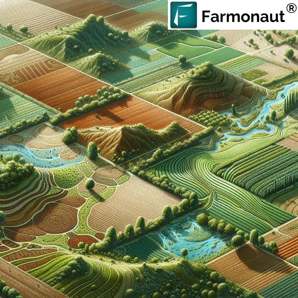
- Overview of Land Capability Classifications
- Land Capability Classes Comparison Table
- Soil Properties for Crop Production
- Topography Effects on Farming: Slope, Drainage, and Erosion
- Climate and Water: Key Factors Influencing Land Use
- Land Classes Considered Suitable for Field Crops
- Lands Reserved for Other Uses
- Conservation Practices in Agriculture for Sustainable Land Management
- Farmonaut Solutions for Sustainable Land Management
- FAQ: Land Capability Classifications and Agriculture
- Conclusion: The Path to Sustainable Field Crop Production
Introduction: What is Land Capability Classification?
Land capability classification is a systematic system used to assess the suitability of land for various agricultural uses, especially field crop production. Today, as we strive for sustainable agriculture and responsible land management, understanding the suitability and limitations of different lands is absolutely essential. We face the ongoing challenge of maximizing crop yields while conserving the environment, maintaining soil health, and ensuring long-term productivity.
The foundation of land suitability for agriculture lies in detailed assessment of soil properties, topography, drainage, and climate. By classifying land according to its capability and limitations, we can determine which lands are best suited (or unsuitable) for various types of cultivation, and implement conservation practices that preserve their value for future generations.
In this blog, we’ll journey into the world of land capability classification, explore its impact on agricultural land classification, and uncover how advanced tools like Farmonaut’s technology are transforming the way we manage land resources and support sustainable crop production.
Why Land Capability Classes Matter in Agriculture
Our planet’s ability to feed a growing population while protecting the environment depends directly on the effective classification and management of land resources. The concept of land capability helps us bridge the gap between potential and sustainability. Here’s why these classes matter:
- Maximizing Crop Yields: Matching crops to the right land class boosts productivity and profitability.
- Conservation and Environmental Protection: Identifying and respecting limitations reduces erosion and land degradation, ensuring land remains viable for generations.
- Resource Efficiency: Targeted management leads to optimal use of water, nutrients, and energy.
- Sustainable Land Management Practices: Aligning farming with the land’s intrinsic characteristics prevents overuse and ecological damage.
Understanding land capability classification is at the core of modern, sustainable agriculture.
Overview of Land Capability Classifications (USDA NRCS)
The United States Department of Agriculture (USDA) Natural Resources Conservation Service (NRCS) defines eight major land capability classes, ranging from Class I (most suitable) to Class VIII (unsuitable for crops). This widely adopted land classification system allows us to systematically group land based on its limitations, guiding us to use our natural resources wisely.
- Class I: Land with essentially no limitations for cultivation.
- Class II: Slight limitations; moderate conservation practices required.
- Class III: Moderate limitations; special conservation practices required.
- Class IV: Severe limitations; very careful management needed.
- Class V: Not prone to erosion, but limited by other factors impractical to remove.
- Class VI: Severe limitations—generally unsuitable for cultivation.
- Class VII: Very severe limitations—unsuitable for cultivation.
- Class VIII: Limitations preclude commercial plant production.
Within the world of field crop production, only Classes I–IV are typically considered suitable, but each class brings its own unique considerations and conservation needs.
Land Capability Classes Comparison Table
| Land Class | Description | Estimated Suitability for Field Crops | Limiting Factors | Recommended Conservation Practices | Impact on Soil Health |
|---|---|---|---|---|---|
| Class I | No limitations for cultivation; deep, well-drained, fertile soils; nearly level topography. | High | None or negligible | Basic crop rotation, minimal intervention | Excellent; minimal degradation, easy to maintain soil health |
| Class II | Slight limitations (e.g., mild slope, moderate erosion risk, minor wetness or climate constraints) | High–Moderate | Minor erosion, drainage, or climate | Moderate conservation: contour farming, grassed waterways | Very good; regular practices preserve soil quality |
| Class III | Moderate limitations (more significant slope, shallower soils, less optimal fertility/drainage) | Moderate | Increased erosion risk, drainage, depth or fertility constraints | Special practices: terracing, cover cropping, drainage management, controlled traffic | Stable with care; at risk of decline without dedicated management |
| Class IV | Severe limitations (steep slopes, shallow soils, high erosion risk, poor drainage) | Low–Marginal | Severe erosion, drainage, shallow or stony soils | Very careful management: permanent cover, minimal tillage, rotational pasture | Protected with dedicated conservation, otherwise declines rapidly |
| Class V | Little/no erosion hazard, but other limiting factors (frequent flooding, stones, etc.) | Very Low | Flooding, stones, impractical to remove limitations | Reserved for pasture, rangeland, wildlife habitat; avoid cultivation | Stable in natural or managed cover; vulnerable if overused |
| Class VI | Severe limitations – not suited to cultivation (steep or very stony, shallow, highly erodible) | None | Slope, shallow, stones, erosion hazard | Forestland, rangeland, wildlife habitat. Implement erosion control. | Risk of degradation without permanent cover |
| Class VII | Very severe limitations; unsuitable for crops; extreme slopes, erosion, or shallow soils | None | Extreme slope, very shallow soil, rocks, very poor fertility | Preserved as forestland or wildlife habitat | Retain natural vegetation to prevent rapid decline |
| Class VIII | Limitations preclude commercial plant production (wetland, desert, barren land) | None | Non-arable: wet, inundated, desert, rock, etc. | Wildlife, recreation, specialty conservation | Extremely limited; retain as-is |
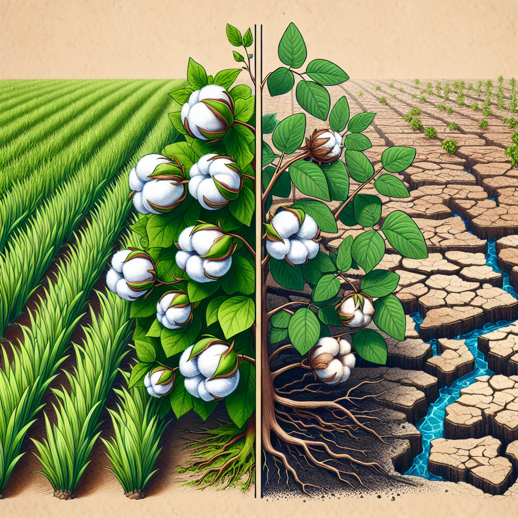
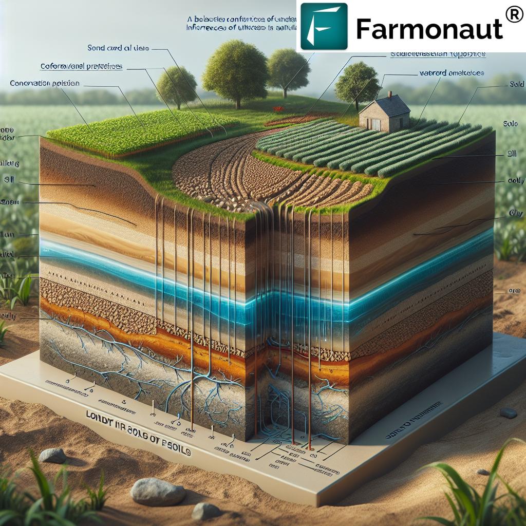
Soil Properties for Crop Production: The Foundation of Land Suitability
When we analyze land suitability for agriculture, we must begin with the soil’s properties. Soil is the living skin of the earth, providing support, water, oxygen, and nutrients required for crop growth. The key factors influencing land use in terms of soil include:
- Texture: Soils are composed of various proportions of sand, silt, and clay. Balanced, loamy soils are often optimal for most field crops due to their structure, nutrient retention, and moisture-holding capacities.
- Depth: Deep soils support extensive root systems and store more nutrients and water. Shallow soils (a limitation in Class IV and above) restrict cultivation options and crop choices.
- Drainage: Well-drained soils are preferable, as waterlogging can damage roots, reduce oxygen, and hinder growth. Poor drainage imposes significant limitations and raises the need for special conservation practices.
- Fertility: The nutrient content of soils—especially nitrogen, phosphorus, and potassium—significantly impacts productivity and the range of crops that can be grown.
- Organic Matter & Structure: High organic content improves soil fertility, supports soil organisms, enhances structure, and enables better water infiltration and retention.
Understanding and managing soil properties is essential for sustainable land management practices and optimizing crop production. Satellite technologies, such as those provided by Farmonaut, enable us to monitor soil health remotely and make informed management decisions.
Topography Effects on Farming: Slope, Drainage and Erosion Control
Topography—the shape and slope of the land—directly affects our management approaches, soil erosion control measures, and actual land suitability for agriculture.
Let’s look at how topography influences land use:
- Slope: Nearly level (0–2%) lands are favorable for cultivation. As slopes become steeper (Classes III, IV and above), the risk of soil erosion increases rapidly.
- Drainage Patterns: Valleys and depressions may accumulate water whereas ridges shed water. Proper management of these features is necessary to prevent waterlogging or drought stress.
- Erosion Risks: Sloped lands require erosion control measures such as contour plowing, strip cropping and terracing. Without these, fertile topsoil is lost, reducing productivity and causing environmental problems downstream.
- Accessibility: Steep, rocky or uneven lands are difficult and more expensive to manage, adding further limitations to their suitability for field crop production.
Identifying topography effects on farming helps us tailor our conservation practices in agriculture to match the landscape, ensuring we control erosion and maintain soil health.
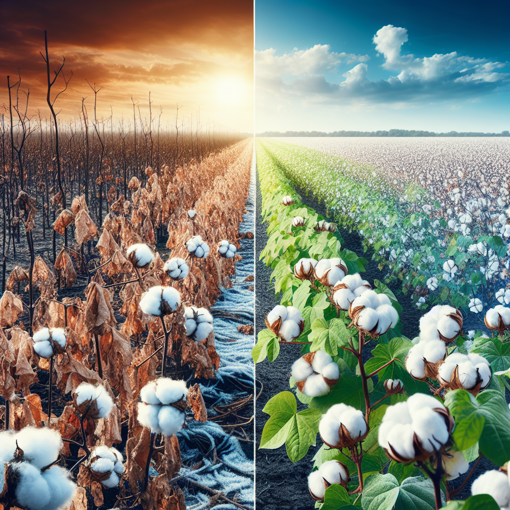
Climate and Water: Key Factors Influencing Land Use and Crop Suitability
The success of field crop production depends not just on soil properties and topography, but also on climate and water resources. Important factors influencing land use include:
- Temperature: Plant growth cycles, germination, flowering, and fruiting all depend on suitable temperature ranges. Some crops require warm, frost-free conditions, while others tolerate cooler climates.
- Precipitation: Reliable and adequate rainfall supports rainfed agriculture. Excessive or insufficient rainfall dictates the need for drainage or irrigation, respectively.
- Sunlight: Crop growth and development are closely linked to sunlight hours and intensity.
- Evapotranspiration: High temperature and wind increase water demand. Regions with high evapotranspiration require careful water management.
Climate, together with soil and topography, determines the suitability of land for crop production. Field crops have specific requirements and adaptation limits—matching them to the land’s environmental context is key to profitable and sustainable agriculture.


Land Classes Considered Suitable for Field Crops: Classes I–IV
Best land for field crops comes from Classes I, II, III, and IV. Each tier offers progressively more limitations, dictating management intensity and required conservation practices:
-
Class I: The Ideal
- Deep, fertile, loamy soils with almost no physical, chemical, or climatic limitations.
- Suitable for nearly any field crop—from grains to vegetables.
- Minimal erosion risk. Basic crop rotation maintains soil health for decades.
-
Class II: Slight Limitations, High Potential
- May have mild slope, minor drainage or fertility issues, slight risk of erosion.
- Requires moderate conservation practices: contour farming, periodic cover cropping, basic drainage improvements.
- Still highly productive with careful management.
-
Class III: Moderate Limitations, Special Measures Needed
- Steeper slopes, shallower or variably-textured soils, more susceptible to wind and water erosion, or moderate climate restraints.
- Special conservation required: terracing, controlled traffic, residue management, enhanced crop rotation to limit depletion.
- Suitability drops if best practices aren’t implemented.
-
Class IV: Severe Limitations, Marginal Cropland
- Narrow bands of land, steep or rough terrain, shallow/stony soils, poorly drained.
- Sustainable cultivation possible only for very select crops—often hay, pasture, or certain grains.
- Very careful management: Reduced tillage, permanent vegetative cover, rotational grazing.
Classes I and II are sought-after for their resilience and yield potential. Classes III and IV require a higher level of responsible management and innovative conservation techniques to protect both productivity and soil health.
Lands Reserved for Pasture, Rangeland, and Conservation: Classes V–VIII
Beyond Class IV, land’s limitations become increasingly unsuited to tilled, annual crop production. Here’s how these classifications are typically used:
- Class V: May not erode, but frequent flooding, stones, or roughness make crop farming impractical. Best for permanent pasture or wildlife habitat.
- Class VI & VII: Steeper slopes, stone outcrops, shallower soils, or extreme topography make these lands appropriate for forestland, rangeland, or wildlife cover only. Any attempt at tillage risks rapid degradation.
- Class VIII: Wetlands, deserts, or barren areas with limitations that preclude commercial plant production.
Using these lands for their appropriate long-term uses—avoiding tillage, encouraging natural or managed permanent cover—is vital for broader ecosystem conservation and resilience.
Conservation Practices in Agriculture for Sustainable Land Management
Harnessing the full potential of land suitability for agriculture requires not just the right classification, but the ongoing application of proper conservation practices. Let’s look at key soil erosion control measures and sustainable practices used in modern agriculture:
-
Contour Plowing and Strip Cropping:
Fitting the tillage and crop rows to the curves of the landscape (topography) reduces runoff, controls erosion, and enhances moisture retention. -
Terracing:
Construction of steps on steep slopes (essential for Classes III, IV and above) prevents soil from washing downhill and maximizes available cropland. -
Cover Cropping and Crop Rotation:
Maintaining a living root cover throughout the year builds soil health, fixes nutrients, and keeps erosion in check. -
Reduced Tillage/No Till Farming:
Maintaining crop residues and minimizing disturbance preserves organic matter and enhances soil structure. -
Buffer Strips and Grassed Waterways:
Vegetation planted along waterways intercepts runoff, reduces sediment loss, filters excess nutrients, and supports wildlife habitat. -
Water Management (Proper Drainage & Irrigation):
Adapting drainage and irrigation to soil properties and class makes land use more resilient to climate extremes, waterlogging, or drought.
Implementing sustainable land management practices ensures ongoing soil productivity, preserves the natural ecosystem, and supports resilient crop production over the long term.
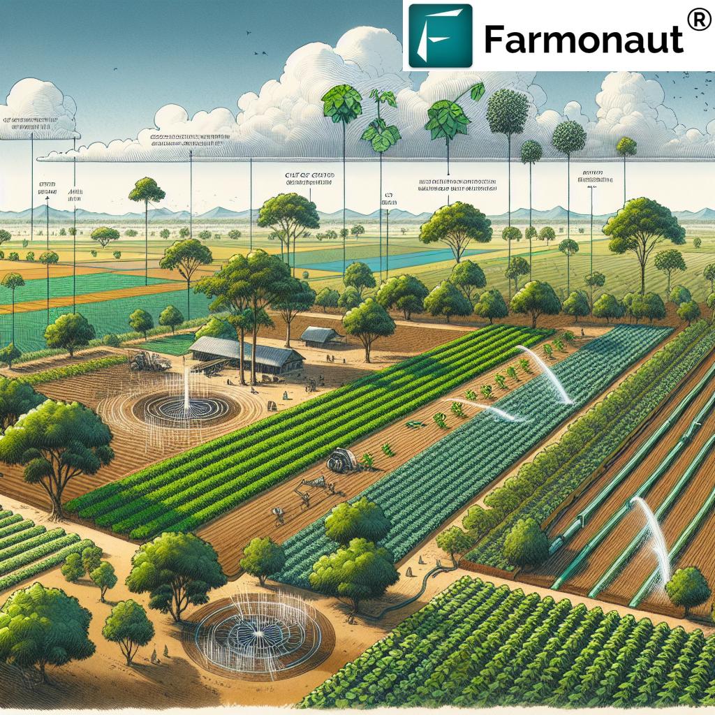
Farmonaut Solutions: Harnessing Technology for Effective Land Capability Classification & Resource Management
At Farmonaut, we believe that precision agriculture and advanced technology are pivotal to unlocking the sustainable potential of agricultural lands. Through our satellite-based crop health monitoring, AI-driven advisory, blockchain traceability, and resource management tools, we empower farmers, agribusinesses, and agencies to make data-driven decisions for better productivity & conservation.
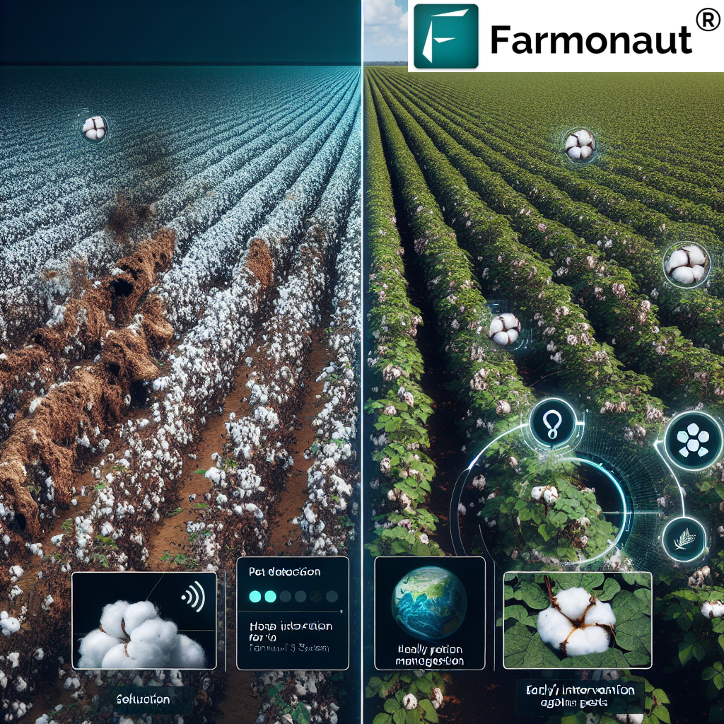
- Satellite-Based Monitoring: Through regular multispectral satellite imagery, our platform tracks soil moisture, vegetation indices (NDVI), crop health, and drainage patterns—enabling proactive land management and soil erosion control measures.
- Jeevn AI Advisory: Our AI-powered system seamlessly integrates satellite and local data to provide real-time weather forecasts, crop health diagnostics, and tailored management recommendations that align with the unique limitations and requirements of each land class.
- Blockchain-based Traceability: Transparency is vital in sustainable agriculture. Farmonaut offers traceability solutions (see more about farm product traceability here), helping you build consumer trust by tracking the origin and journey of agricultural products.
- Carbon Footprinting: With climate change a critical concern, our carbon footprinting suite (learn about carbon footprint management) allows agribusinesses to monitor and reduce emissions, enabling compliance with standards and improving environmental stewardship.
- Fleet and Resource Management: For large-scale operators, our fleet management solution (see more about fleet management) improves logistics, reduces operational costs, and ensures safe, traceable movement of equipment—crucial on vast or diverse land classes.
- Large Scale Farm Management: For plantations and government projects, our web-based platform (see details here) offers comprehensive field mapping, satellite monitoring, and virtual oversight for efficient multi-farm management.
- Pasture, Plantation & Forest Advisory: Farmonaut provides remote sensing and AI tools specifically for lands reserved for pasture, plantation, or forest management—helping you maintain their value and ecological function (Try now).
- Crop Loan & Insurance Support: Our satellite-based verification (details here) enables faster access to agricultural finance and reliable insurance for farmers managing diverse land classes.
Farmonaut stands as your partner for land capability assessment, crop monitoring, and sustainable land management practices. Our goal is to democratize precise, affordable decision support for every farmer and land manager, worldwide.
Farmonaut’s subscription model is designed for flexibility—choose the plan best suited to your land area, frequency requirements, and management goals.
Frequently Asked Questions: Land Capability Classification & Sustainable Agriculture
What is land capability classification and why is it important?
Land capability classification is a system used to assess the suitability and limitations of different lands for various agricultural uses, primarily field crop production. By grouping land according to its physical, chemical, and climatic characteristics, it enables effective, sustainable land management and helps safeguard long-term productivity.
How does soil erosion affect land suitability?
Soil erosion reduces topsoil depth, depletes nutrients, and disrupts soil structure, lowering the capacity of land to sustain crops. Without proper conservation practices, erosion can move land into a lower capability class over time, reducing sustainability.
Can all land be used for crop production?
No. Only classes I–IV are generally considered suitable for field crop production. Other classes have limitations (steep slopes, shallow soils, flooding, etc.) that make them more suitable for pasture, forestry, or conservation.
What are some examples of conservation practices for different land classes?
Class I and II lands require basic crop rotation and cover cropping. Class III–IV lands benefit from special measures such as terracing, minimal tillage, and stricter rotational grazing. Classes V–VIII should remain permanently covered to avoid rapid degradation.
How can technology improve land capability assessment and management?
Technologies like satellite imagery, AI-driven analysis, and remote sensing tools (such as those provided by Farmonaut) enable real-time monitoring of crop health, soil moisture, erosion risk, and drainage, making land evaluation and sustainable management more efficient and accessible.
What options does Farmonaut offer for different types of land?
Farmonaut offers multispectral satellite monitoring for all land types—from prime cropland to pasture and forest management—along with resource management, advisory tools, and blockchain-based traceability so you can match your management style to each land class’s unique needs.
Where can I access the Farmonaut API or developer resources?
You can access our public API, perfect for integrating land capability and crop monitoring data into your own systems, here, and find complete API documentation here.
Conclusion: The Path to Sustainable Field Crop Production
Understanding the land classes suitable for field crop production underpins our ability to nurture the land, maximize yields, and conserve the natural environment. The land capability classification system gives us a framework to identify the best lands for crops, tailor conservation practices for sustainability, and reserve fragile lands for pasture, wildlife, or forest habitat—thereby protecting our most valuable resource for future generations.
With the advance of technology—especially satellite remote sensing and AI-powered insights—we can assess soil properties for crop production, monitor erosion and drainage, and refine our field-by-field management. This not only enhances the effectiveness of current farming practices, but also ensures we meet the highest standards of sustainable land management globally.
Farmonaut is committed to placing affordable, precise agricultural intelligence into the hands of every farmer and agribusiness, making it possible to thrive in a changing climate and an ever-evolving food system.
Explore our web and mobile apps now to take the first step towards resilient and sustainable land management:
For advanced land capability assessment and crop monitoring tools, check out our API and developer documentation.
Let’s work together for a sustainable, productive, and healthy agricultural future.