7 Game-Changing Agricultural GPS Guidance Systems Tips
“Over 70% of large farms now use GPS guidance systems to optimize planting and harvesting accuracy.”
- Introduction
- Understanding Agricultural GPS Guidance Systems
- Key Applications: Precision Farming Technology in Action
- 7 Game-Changing Agricultural GPS Guidance Systems Tips
- Comparative Features Table: GPS Guidance Tips
- Benefits of Agricultural GPS Guidance Systems
- Challenges and Considerations in Implementing GPS Technology
- Future Prospects and Innovations in Agricultural GPS Guidance
- Farmonaut: Making Precision Farming Affordable & Accessible
- Frequently Asked Questions
- Conclusion
Introduction: How GPS Guidance Systems Are Transforming Modern Agriculture
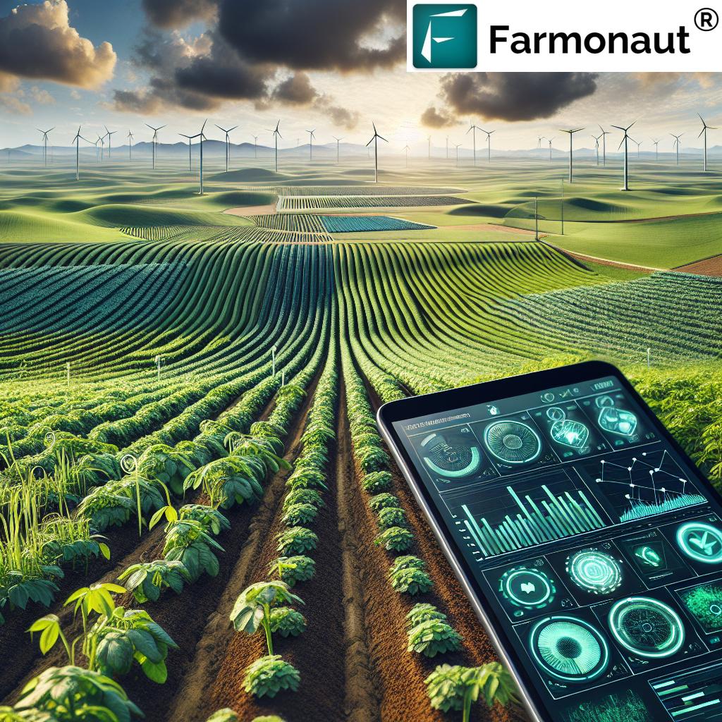
At Farmonaut, we recognize that precision agriculture is no longer just a futuristic concept—it’s the reality shaping modern farming worldwide. Today’s agricultural GPS guidance systems and advanced precision farming technology are revolutionizing the way we manage fields, resources, and yields. With the integration of GNSS solutions for farmers, we’re achieving new heights in yield optimization, operational efficiency, and long-term sustainability.
In this comprehensive guide, we’ll share 7 Game-Changing Agricultural GPS Guidance Systems Tips designed to help you maximize the potential of your farm. This blog covers the critical technologies, the practical applications, and the transformative benefits of adopting these systems—including actionable insights on how you can integrate them into your daily farming processes.


Understanding Agricultural GPS Guidance Systems
To fully appreciate the transformative capabilities of GPS in agriculture, it’s essential to understand how these systems work at their core.
Agricultural GPS guidance systems utilize a combination of satellite-based navigation—including GPS, GLONASS, and Galileo—paired with advanced correction technologies such as Differential GPS (DGPS) and Real-Time Kinematic (RTK) positioning. These solutions enable us to achieve pinpoint accuracy down to the centimeter level, which is critical for guiding modern machinery along precise paths in the field.
The integration of this technology enables automated tractors, planters, and sprayers to follow predetermined paths, ensuring uniformity and reducing overlaps or skips during planting, fertilizing, and harvesting. Not only does this maximize the potential of every square meter, but it also streamlines operations and minimizes resource waste.
- GNSS Technologies: GPS, GLONASS, Galileo
- Correction Techniques: Differential (DGPS) and Real-Time Kinematic (RTK) positioning
- Core Capabilities: High-precision navigation, automated guidance, data-driven farm operations
With a foundation built on these technologies, modern guidance systems have redefined the meaning of precision in agriculture.
Key Applications: Precision Farming Technology in Action
The true power of agricultural GPS guidance systems is realized through their diverse range of applications on the farm. By leveraging data-driven insights and automation, farmers can tackle critical challenges and unlock new opportunities in precision agriculture. Let’s explore these key applications and how they are transforming traditional practices:
-
Precision Planting in Agriculture
GPS-guided seeders ensure seeds are planted at optimal depths and intervals, promoting uniform crop emergence and maximizing yield potential. This removes guesswork and reduces human error. -
Efficient Fertilizer and Pesticide Application
Targeted application of fertilizers and pesticides is possible thanks to precise navigation, reducing input waste and minimizing environmental impact. Inputs are applied only where needed for crop health. -
Automated Harvesting
Autonomous farm machinery such as GPS-equipped harvesters can operate efficiently, reducing labor costs and maximizing harvesting efficiency. -
Field Mapping and Soil Sampling
Integrating GNSS data with GIS enables accurate field mapping and soil sampling, helping us identify specific areas that require tailored treatments. -
Irrigation Management with GPS
We can now optimize irrigation by monitoring soil moisture and water requirements via GPS-guided sensors, promoting sustainability and conserving resources.
7 Game-Changing Agricultural GPS Guidance Systems Tips
Based on our experience and the leading-edge innovations in modern agricultural technology, here are the seven most impactful tips for implementing GPS guidance systems on your farm. These actionable recommendations are aimed at enhancing agricultural efficiency and sustainability, boosting yield, and reducing costs.
1. Invest in the Right Level of GPS Accuracy for Your Crop Operations
Not all GPS solutions offer the same accuracy. When selecting a GPS system, consider the specific requirements for your farm’s scale and crop types:
- Standard GPS (1-3 meter accuracy): Sufficient for general navigation and broadacre tasks.
- Differential GPS (DGPS) (sub-meter accuracy): Suitable for most row-crop farming operations, especially precision planting and spraying.
- RTK (Real-Time Kinematic) GPS (centimeter-level accuracy): Essential for high-value or specialty crops requiring ultra-precise guidance, autonomous equipment, and advanced mapping.
Tip: Match your investment to your operational needs. RTK offers exceptional precision but requires more infrastructure and cost—ideal for operations where every centimeter counts.
For resource-constrained farmers aiming for affordable yet powerful technology, Farmonaut’s real-time satellite monitoring enables field-level decision making, avoiding unnecessary upfront costs.
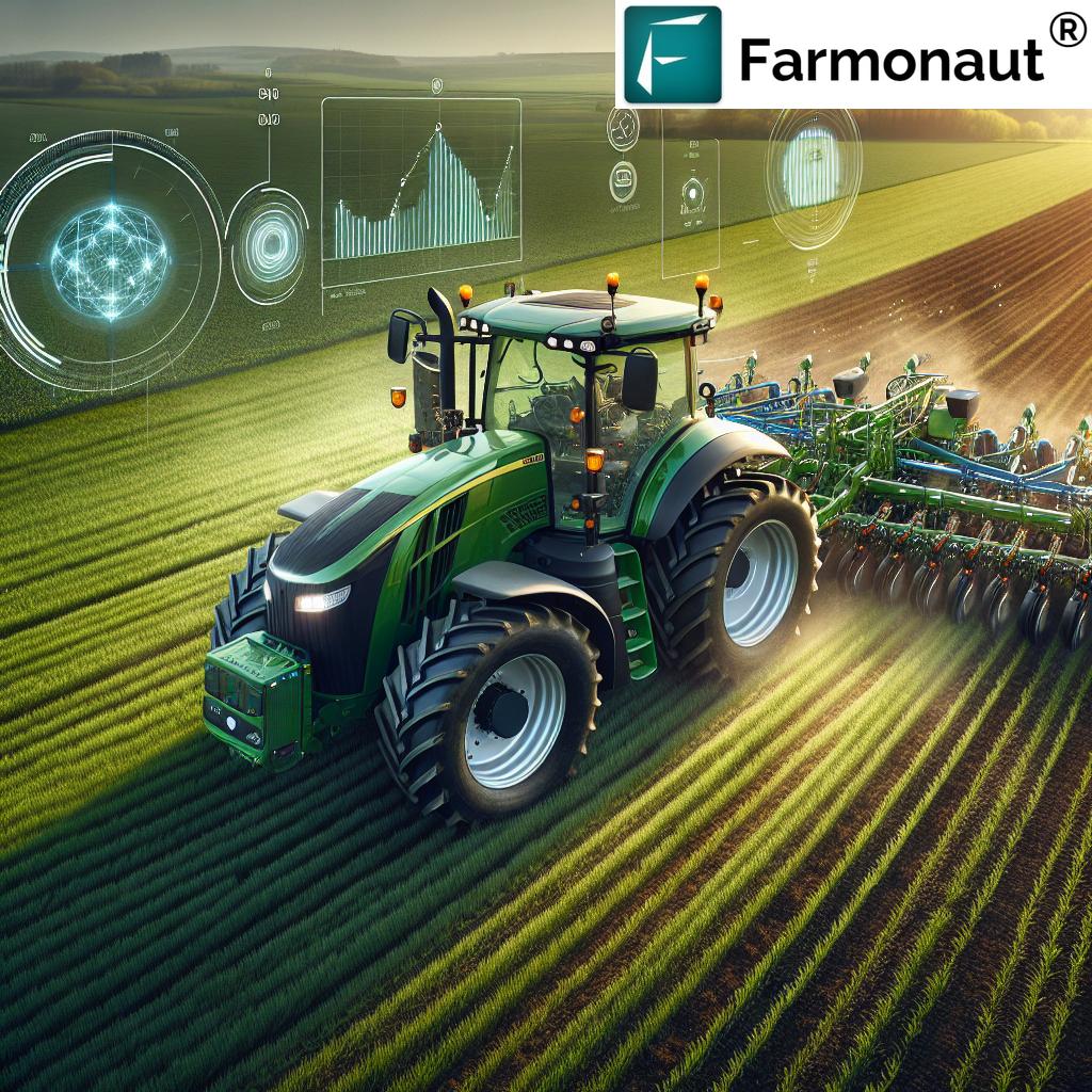
2. Embrace Automated Machinery and Equipment Integration
Automated tractors and implements are increasingly common—leveraging GPS guidance and GNSS solutions to enhance operational efficiency. By integrating GPS technology into your machinery fleet (from planters to sprayers to harvesters), you ensure consistent, error-free operations. Benefits include:
- Labor savings by reducing manual driving and intervention
- Enhanced repeatability—machines can follow precise paths season after season
- Reduced fatigue and human errors, boosting both quality and yield
Farmonaut’s mobile and web platforms help in tracking fleet management (see our Fleet Management page) for smarter deployment of resources across all operations.
3. Prioritize Data Collection and Field Mapping for Informed Decisions
The true strength of modern GPS guidance lies in robust data collection and mapping. With real-time field mapping and soil sampling, you can:
- Identify underperforming areas and target them for improvement
- Track soil health, moisture, and nutrient levels for optimal input allocation
- Build multi-year yield maps to inform long-term crop planning
Farmonaut’s app leverages satellite imagery and AI algorithms for actionable advisory, offering real-time data on vegetation health, soil moisture, and input recommendations.
4. Utilize GPS-Driven Variable Rate Application for Inputs
Variable rate technology (VRT), powered by satellite guidance for farming, lets us apply fertilizer, pesticides, and even seeds at customized rates across different areas of the field. This precision reduces input waste, optimizes plant health, and lowers costs.
- Targeted application for zones needing extra input
- Reduced runoff and environmental contamination
- Improved yield consistency across the field
Farmonaut supports precision input allocation through their AI-based advisory system, enhancing resource optimization for small and large farms alike.
Use Case Highlight: With carbon footprinting tools, you can constantly monitor and reduce the environmental impact of every input, reinforcing both profitability and sustainability.
5. Implement GPS-Assisted Irrigation Management for Water Efficiency
Water is one of our most precious resources, and irrigation management with GPS makes it possible to significantly optimize usage. GPS-enabled sensors and automated irrigation controllers allow us to:
- Identify sections of the field that need more or less water
- Schedule irrigation based on precise crop needs
- Promote sustainability by minimizing waste and runoff
Farmonaut’s platform offers detailed soil moisture and vegetation indices to guide irrigation decisions, making water use smarter and more efficient.
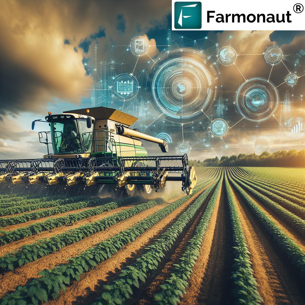
6. Leverage GPS for Automated Harvesting and Post-Harvest Operations
GPS guidance is a game-changer for autonomous harvesting. Machines can operate around the clock, following preset routes and identifying ripe crop areas for targeted harvesting. This minimizes crop losses, reduces labor costs, and accelerates time-to-market.
Key benefits:
- Consistent harvesting patterns, reducing losses
- Maximized use of available labor and machinery
- Seamless integration with blockchain-based traceability solutions for post-harvest transparency
These innovations empower us with complete control over field operations—from planting to post-harvest logistics.
7. Use Data-Driven Insights for Resource Management and Strategic Planning
Collecting field data is just the beginning. The real value comes when we transform this information into actionable strategy:
- Analyze historical productivity trends using yield maps
- Predict and plan crop rotation based on soil health and weather data
- Utilize API access (Farmonaut Satellite Weather API; Developer Docs) to integrate satellite data into custom apps and software for better farm management
- Plan for financial access using satellite-based verification of crops, vital for loan and insurance applications
By embracing these practices, we can reduce risks, improve returns, and ensure long-term sustainability. Farmonaut’s real-time advisory makes all these functions accessible from any device, anywhere.
“Precision farming with GPS can reduce fertilizer use by up to 15%, significantly lowering input costs and environmental impact.”
Comparative Features Table: GPS Guidance Tips
| Tip/System Name | Key Feature/Innovation | Estimated Yield Improvement (%) | Estimated Operational Cost Reduction (%) | Technology Adoption Level |
|---|---|---|---|---|
| 1. GPS Accuracy Optimization | Custom-fit GNSS selection (Standard, DGPS, RTK) | 3–8% | 5–10% | High |
| 2. Automated Machinery Integration | GPS-guided tractors & implements | 7–12% | 10–18% | Medium |
| 3. Field Mapping & Data Collection | Remote sensing, NDVI, soil maps | 5–10% | 6–10% | High |
| 4. Variable Rate Application (VRT) | Zone-based fertilizer/pesticide rates | 8–15% | 12–18% | Medium |
| 5. GPS-Assisted Irrigation Management | Moisture sensors, data-driven scheduling | 6–11% | 10–15% | Low |
| 6. Automated Harvesting Integration | Harvest path planning, yield mapping | 7–13% | 8–14% | Medium |
| 7. Resource Management & Strategic Planning | Historical trend analysis, AI, API integration | 6–12% | 10–16% | Low |
Benefits of Agricultural GPS Guidance Systems
Implementing precision farming technology and agricultural GPS guidance systems brings a multitude of productivity, economic, and sustainability advantages:
- Enhanced Operational Precision: Achieve centimeter-level accuracy in planting, fertilizing, and harvesting, minimizing input errors and overlaps.
- Improved Productivity: Reduce repetitive manual operations, increase field coverage speed, and effectively utilize autonomous machinery.
- Resource Optimization and Cost Savings: Targeted application of seeds, water, and inputs means lower operational costs and greater ROI.
- Data-Driven Decision Making: Actionable insights from ongoing data collection improve both short- and long-term strategies.
- Environmental Sustainability: Efficient input usage reduces environmental footprint; see Farmonaut’s carbon footprinting tools for more information.
- Intelligent Machinery Management: Centralized fleet tracking and management simplify scheduling and maintenance (learn more at our Fleet Management page).
The end result is a win-win: higher productivity, lower costs, and a more sustainable pathway to feeding a growing global population.
Challenges and Considerations in Implementing GPS Technology
Although the adoption of GPS guidance systems in agriculture delivers immense benefits, there are still hurdles that farmers must consider:
- High Costs of Technology: Initial investment in hardware/software can be significant, particularly for small to medium-sized farms.
- Technical Knowledge and Training: Effective use requires training; lack of technical expertise in rural areas is a problem for adoption.
- Signal Interference and Accuracy Issues: GNSS signals may be disrupted by trees, hills, or atmospheric conditions, causing accuracy issues in operations.
- Dependence on Technology: Over-reliance on equipment and data may put operations at risk if a system fails. Contingency plans are essential.
- Data Management Challenges: Large volumes of data can be overwhelming to analyze and integrate meaningfully. User-friendly tools like Farmonaut help mitigate this by translating satellite data into actionable insights.
Farmonaut’s affordable, cloud-based subscription model and intuitive tools are designed to break down these barriers, making precision farming more accessible to all.
Future Prospects and Innovations in Agricultural GPS Guidance
The future of GPS guidance in agriculture is brighter than ever, driven by ongoing innovations:
- Integration with AI and IoT: Artificial Intelligence and IoT devices will automate real-time detection of anomalies, optimize resource allocation, and improve predictive modeling for both crop yields and input needs.
- Expansion of Satellite Systems: The continued growth of satellite constellations such as GPS, GLONASS, and Galileo will enable more reliable coverage and accuracy, even in the remotest fields.
- Advances in Battery Technology: Longer-lasting batteries will ensure uninterrupted operation of guidance systems and on-machine electronics—from sowing to harvesting, regardless of field size.
- Blockchain-Based Product Traceability: Enhancing trust and transparency in agri-value chains, Farmonaut’s Traceability Solution creates secure records for every farm product’s journey, increasing end-user confidence and supply chain security.
By adopting these breakthroughs, we can look forward to further improving yield, efficiency, and environmental stewardship in modern agriculture.
Affordable Access to Precision Farming with Farmonaut
Farmonaut is dedicated to making satellite-powered, precision agriculture solutions affordable for farmers and agribusinesses of every scale. Our subscription-based pricing offers flexible packages—ensuring you only pay for what you need, when you need it.
Farmonaut: Making Precision Agriculture Affordable & Accessible
At Farmonaut, our mission is to break down barriers to precision farming technology for everyone—from smallholder farmers to large-scale agribusinesses and government bodies. With our satellite-based solutions, we empower you to make smarter, more sustainable, and profitable agricultural decisions.
-
Satellite-Based Crop Health Monitoring:
We deliver regular, multispectral satellite imagery and analysis (NDVI, soil moisture), allowing you to identify crop health issues early and act quickly to optimize yield. -
AI-Driven Advisory and Resource Management:
Our Jeevn AI system delivers personalized, real-time insights and management strategies for irrigation, pest control, and fertilizer application—straight from the app. -
Blockchain Traceability (product-traceability):
Trace every product’s journey farm-to-consumer, ensuring supply chain transparency and building trust for your agricultural products. -
Real-Time Fleet & Equipment Management:
Monitor and optimize the deployment of all machinery and resources, enhancing operational efficiency via our fleet management tools. -
Carbon Footprinting:
Track, analyze, and reduce your environmental impact with carbon footprinting solutions – an essential for sustainable agri-business. -
Crop Loan & Insurance Support:
Facilitate easier financial access and minimize fraudulent claims with our satellite-based verification for loans & insurance. -
Scalable Platform:
Whether you manage a few hectares or entire regions, Farmonaut adapts to your needs.
Explore our affordable subscription options above or try our app and rest assured—you’re investing in the future of data-driven, sustainable farming.
Specialized Apps and Tools for Crop Management
- Farmonaut Crop & Forest Plantation Advisory – For expert, location-based AI guidance on managing plantations and forests.
- Large Scale Farm Management Platform – Built for agribusinesses and governments managing thousands of hectares, combining satellite analytics with bulk management tools.
Frequently Asked Questions
These are advanced navigation solutions that use GNSS satellites (like GPS, GLONASS, and Galileo) to guide agricultural machinery and operations with remarkable precision. This makes field tasks like planting, fertilizing, and harvesting more accurate and efficient.
Q2: How do GPS guidance systems benefit smallholder farmers?
Smallholders benefit through optimized input use (seeds, fertilizers, water), reduced labor, minimized costs, and data-driven insights—all leading to improved yield and profitability even on limited land.
Q3: What is the difference between Standard GPS, DGPS, and RTK?
Standard GPS provides meter-level accuracy, sufficient for general use. Differential GPS (DGPS) improves this accuracy to sub-meter (< 1m), while RTK (Real-Time Kinematic) positioning offers centimeter-level precision for the most demanding tasks.
Q4: What is precision planting in agriculture?
Precision planting uses GPS guidance to ensure seeds are placed at optimal depth, spacing, and pattern—resulting in uniform emergence, healthy stands, and maximal yield potential with minimal input waste.
Q5: How does Farmonaut’s platform enhance GPS-enabled agriculture?
We provide field-level, actionable satellite data, AI-driven recommendations, transparent traceability, and affordable access to the latest precision technology, all without the need for expensive on-farm hardware.
Q6: Is the data from Farmonaut’s platform available for API integration?
Yes. We offer robust API access and developer documentation so businesses and researchers can integrate our satellite and weather data into their own systems.
Q7: Can GPS guidance systems help reduce environmental impact?
Absolutely. By ensuring inputs are only used where needed, GPS guidance reduces fertilizer and pesticide runoff, cuts emissions via resource optimization, and supports precision irrigation—promoting agricultural efficiency and sustainability.
Conclusion
Agricultural GPS guidance systems and precision farming technology are at the heart of a paradigm shift in modern agriculture—improving accuracy, efficiency, and sustainability on farms of every size. By leveraging GNSS navigation, data-driven insights, and advanced automation, we’re able to address resource constraints, reduce costs, and achieve remarkable yield improvements.
Farmonaut stands as an industry leader, making these advanced technologies accessible and affordable for every farmer—whether you seek real-time crop monitoring, AI-driven advisory, environmental tracking, or transparent supply chains. By embracing these 7 game-changing tips and equipping your operations with the latest GPS guidance systems, you’re not just modernizing your farm; you’re investing in the future of sustainable agri-business.
Let’s guide the future of agriculture together—one precise field at a time.