Benefits of Drones for Precision Agriculture in 2025: Transforming Crop Yields, Sustainability, and Data-Driven Land Management
“By 2025, over 70% of large farms globally are projected to adopt drones for field monitoring and analysis.”
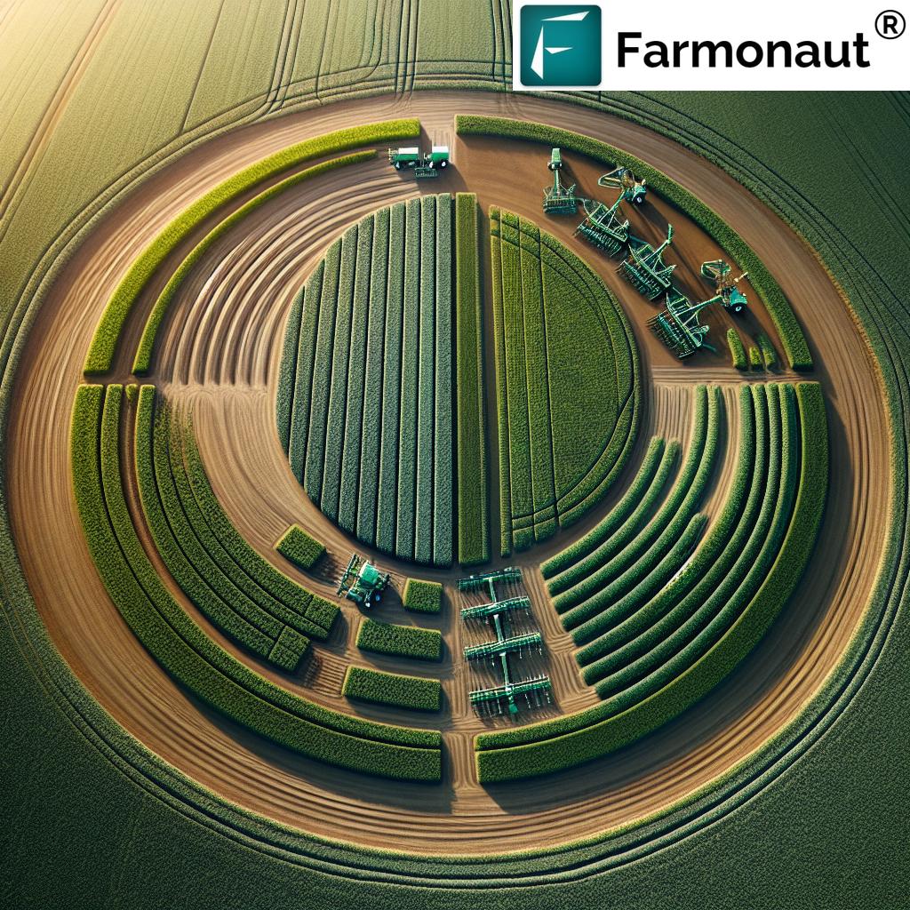
Precision Agriculture 2025: The Revolution in Farming
In 2025, precision agriculture stands as a defining force in farming innovation and sustainable land management worldwide. The use of drones for precision agriculture has become not just an advantage—but a necessity—for forward-thinking farmers aiming to enhance productivity, optimize resource management, and adopt more environmental and sustainable practices. Driven by aerial technology, these advanced tools collect actionable data, delivering unprecedented accuracy and providing a powerful edge to stakeholders seeking to boost crop yields and minimize waste.
As we progress through this transformative decade, various innovative solutions are emerging—from multispectral drone sensors and thermal imaging to AI-driven analytics. Let’s dive deep into the benefits of drones in precision agriculture and discover how their integration is truly revolutionizing farming practices and shaping the future of food production, sustainability, and land use.
How Drones Are Revolutionizing Agriculture: Core Benefits and Technology
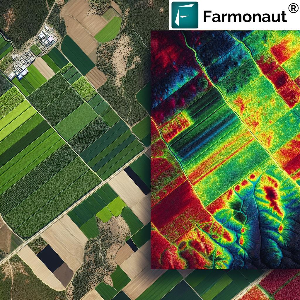
Drones precision agriculture has rapidly evolved over recent years. Today’s modern agricultural drones are equipped with sophisticated sensors, multispectral and thermal cameras, and RGB imaging. These aerial platforms revolutionize how farmers monitor crop health, soil moisture, irrigation coverage, and pest infestations. Such data-driven approaches unlock a new level of decision-making, increasing yields and ensuring sustainable use of resources.
- Higher Efficiency: Drones scan vast tracts of farmland in minutes, providing time-sensitive insights to optimize every aspect from planting to harvest.
- Cost-Efficiency: Targeted spraying and seeding from drones reduces input costs (like fertilizers and pesticides) by applying precisely what’s needed, only where needed.
- Enhanced Data Resolution: Multispectral and RGB cameras capture high-resolution imagery, going far beyond what the naked eye can perceive.
- Sustainability: Reduced chemical usage, minimized runoff, and improved land utilization foster better environmental stewardship.
- Adaptability: Drone-based surveying is invaluable for damage assessment after storms or floods, enabling rapid farm recovery.
- Integration with AI & IoT: Drone data synergizes with AI platforms and IoT sensors to further advance precision agriculture capabilities.


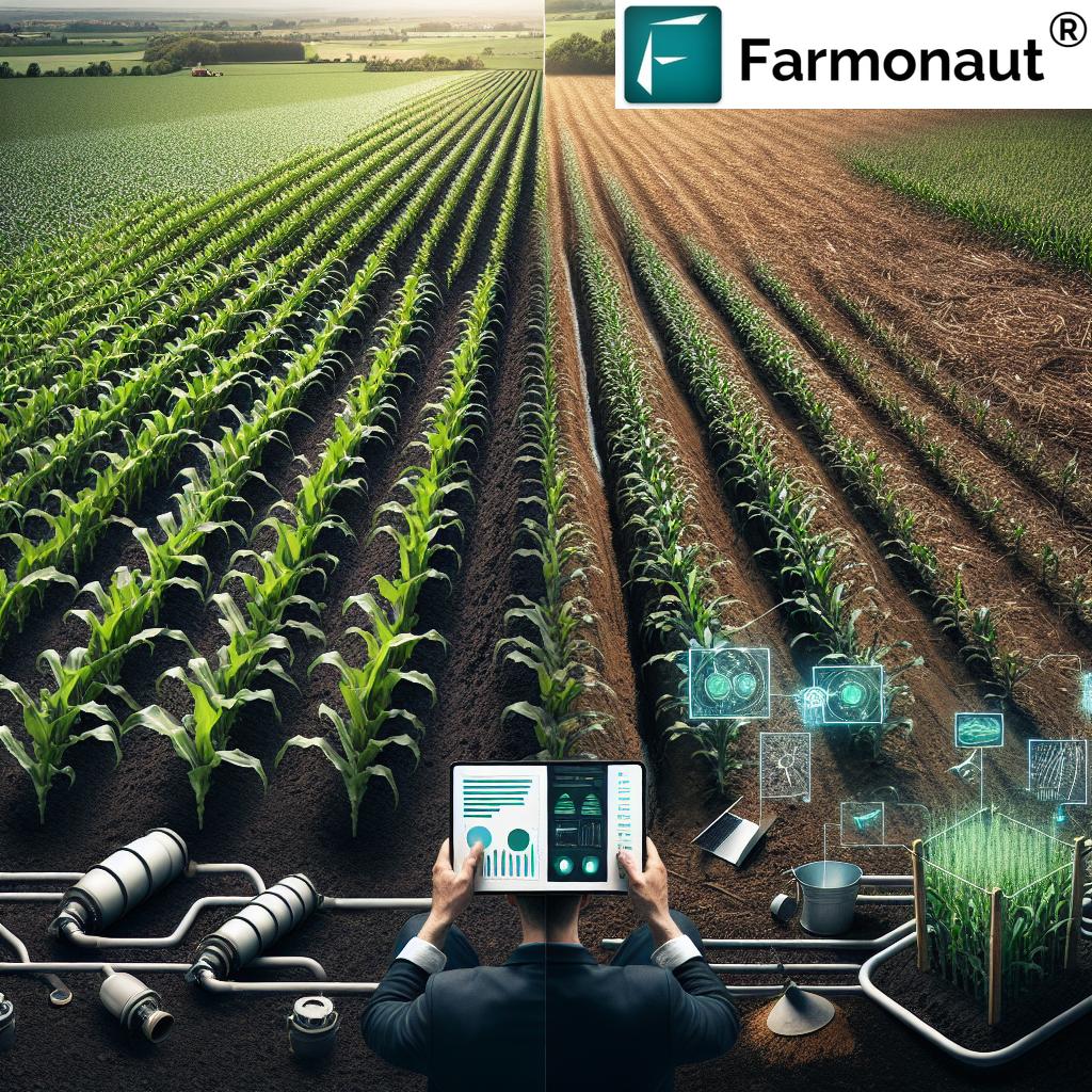
Traditional Farming Methods vs. Drone-Assisted Precision Agriculture (2025): A Comparative Snapshot
Understanding the benefits of drones in precision agriculture is easiest when directly compared to traditional practices. The table below illustrates key differences across crop yield, input usage, labor, operating costs, data collection speed, and environmental impact. These contrasts highlight the clear advantages of drone-assisted precision farming for different agricultural aspects in 2025.
| Farming Aspect | Traditional Methods (2025 Est.) | Drone-Assisted Precision Ag (2025 Est.) | Benefit of Drones |
|---|---|---|---|
| Crop Yield (tons/hectare) | 4.2 | 5.3 | ~26% Yield Boost via targeted inputs and stress mitigation |
| Pesticide Usage (liters/hectare) | 12 | 6.5 | Reduces chemical input by over 45% |
| Labor Hours/Week | 52 | 18 | ~65% Less Manual Labor Required |
| Cost per Acre (USD) | $185 | $120 | Substantial Input and Labor Cost Savings |
| Data Collection Speed (days) | 6–14 days | Within hours | Faster response for timely intervention |
| Sustainability Impact (CO₂ Reduction, %) | 10% | 27% | Nearly 3x reduction in emissions due to optimization |
How Drones Work in Precision Farming: The Technology Behind the Transformation
Drones for precision agriculture leverage aerial multispectral imaging, thermal sensors, high-res RGB cameras, and advanced GPS. These aerial vehicles can map, monitor, and analyze vast farmlands with efficiency that’s unattainable by ground teams. For each application, specialized flight plans are mapped out to survey specific areas with customized frequency and coverage.
The real power lies in combining drone data with analytics platforms and machine learning algorithms (AI). This integration results in actionable recommendations for applying fertilizers, scheduling irrigation, detecting pest infestations, and planning harvests—maximizing both output and sustainability.
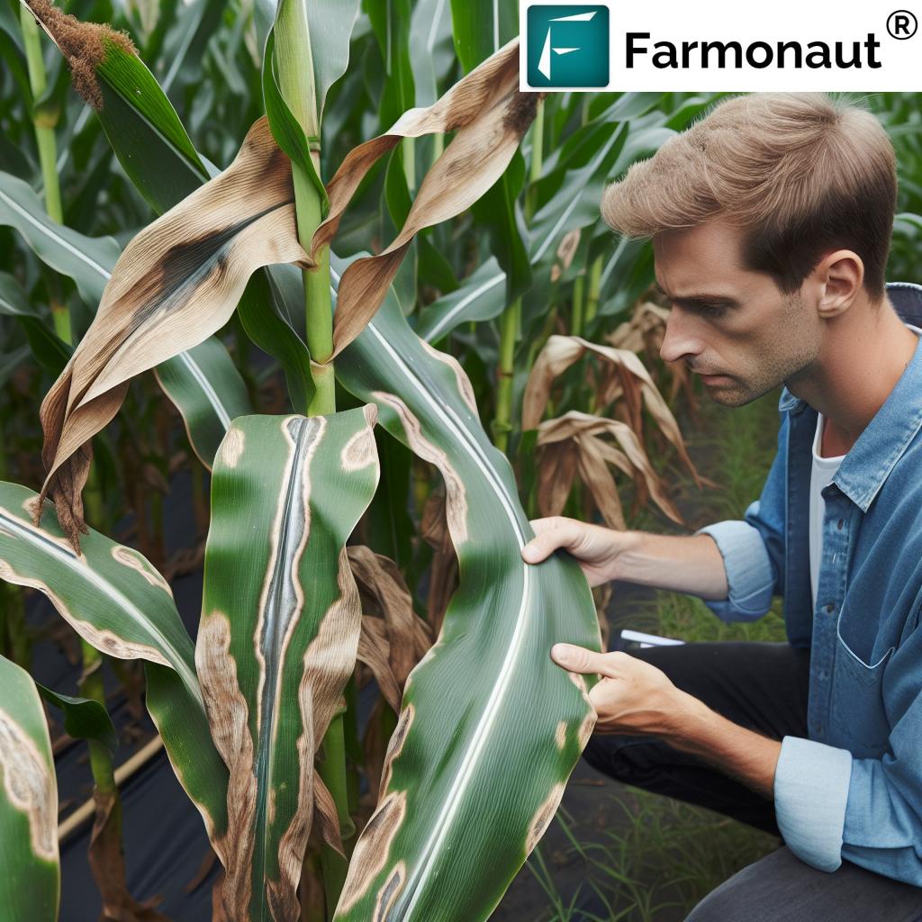
Drones for Crop Monitoring and Health Assessment: Beyond the Naked Eye
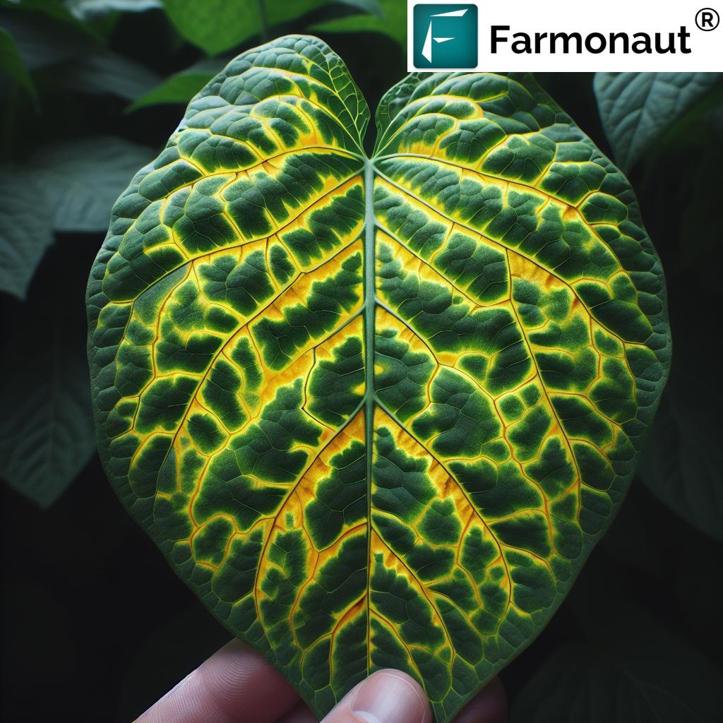
One of the greatest benefits of drones in precision agriculture is their ability to monitor crop health at high frequency and unprecedented accuracy. These multispectral sensors can detect early variations in crop vigor, revealing signs of nutrient deficiencies, disease onset, or water stress before visible symptoms appear.
- Multispectral Sensors: Capture data in near-infrared, red, green, and blue bands, detecting stress or variations that are invisible to the human eye.
- Thermal Imaging: Identify areas of heat stress and assess irrigation effectiveness.
- High-Resolution RGB Cameras: Provide detailed imagery for disease detection and physical damage monitoring.
Through frequent scanning and automated flight scheduling, drones can quickly and repeatedly monitor vast farmland tracts. Farmers are empowered to act on real-time insights and minimize yield loss due to pests, diseases, or suboptimal input usage.
Drones for Irrigation and Water Management: Enabling Smarter Water Use
Water stress and inefficient irrigation are persistent challenges in modern agriculture. Drones for precision agriculture solve this challenge by:
- Mapping Soil Moisture: Detect dry or overwatered areas using thermal imaging, enabling site-specific interventions.
- Monitoring Irrigation Systems: Identifying system malfunctions or leaks in large irrigation networks.
- Supporting Conservation: Reducing overall water usage and protecting freshwater resources.
Over time, this leads to healthier crops, reduced water waste, and cost savings—a win both economically and environmentally.
Targeted Spraying: Smarter Application of Pesticides and Fertilizers
Traditional blanket spraying often results in excess chemical use and higher costs. Drone-based targeted spraying is a game changer:
- Pinpoint Accuracy: Sprays only affected areas, based on real-time data from aerial surveys.
- Environmental Protection: Reduces chemical runoff into surrounding ecosystems and water bodies.
- Lower Input Costs: Cuts fertilizer and pesticide costs dramatically by minimizing unnecessary application.
This approach protects human health, boosts sustainability, and keeps farms compliant with environmental regulations. If you’re interested, explore our Carbon Footprinting tool—which helps measure and reduce the field’s carbon footprint for more sustainable farming.
Drones In Crop Scouting and Damage Assessment: Fast Response, Reduced Losses
When adverse weather or natural disasters like floods, storms, or droughts strike, drones for precision agriculture become indispensable for quick damage assessment:
- Rapid Aerial Surveys: Assess extent of crop damage over vast areas in hours instead of days.
- Tangible Data for Insurance: Provide visual evidence needed for quick insurance claims and compensation.
- Supporting Farm Recovery: Enable farmers to prioritize recovery efforts and minimize economic losses.
This rapid response is a crucial feature in reducing financial risk and improving farm resilience in the face of climate volatility.
For financial support and insurance processing using data, check our Crop Loan and Insurance Verification Services—offering satellite-based evidence for insurance and loan providers.
The Integration of Drones, AI, IoT, and Blockchain: Next-Generation Precision Agricultural Practices
The synergy between drones, AI-powered analytics, IoT-enabled field sensors, and blockchain traceability is transforming global agriculture into a fully connected, data-driven, and transparent ecosystem. Here’s how this powerful integration works:
- AI Analytics: Drones collect aerial data, which AI analyzes to predict pest outbreaks, optimize harvest timings, and plan crop rotations.
- IoT Field Sensors: Real-time connectivity merges on-ground and aerial environmental data, giving a holistic view of crop health and growth conditions.
- Blockchain Traceability: Secure, auditable digital records for every activity—supporting food safety, traceability, and authenticity in agricultural supply chains.
These integrations help create robust, scalable, and sustainable farming systems equipped to face the evolving challenges of 2025 and beyond.
Dive deeper into Farmonaut’s Traceability Solutions—essential for those wanting to assure consumers of responsible and transparent production.
Precision Forestry Drones: Expanding Beyond Traditional Farms
The impact of drones for precision agriculture extends far beyond fields into forestry management and resource conservation. Precision forestry drones play a pivotal role in:
- Assessing Tree Health and Diversity: Multispectral sensors map forest health, track disease, and help conserve biodiversity.
- Biomass Estimation: Accurate, cost-effective monitoring of forest biomass for sustainable logging and carbon credit validation.
- Detecting Illegal Activity: Quick detection of unauthorized logging or land use change to protect forests and support legal compliance.
This represents a natural extension of precision agriculture principles, enabling more effective and sustainable land management across vast, rugged, or difficult terrain.
For plantation and forest advisory resources, see our Crop Plantation & Forest Advisory App—designed to integrate state-of-the-art monitoring even in the most challenging environments.
Supporting Environmental Sustainability and Reducing Input Costs
The environmental impact of drones for precision agriculture is profound. By minimizing chemical inputs, drones facilitate more sustainable practices and help meet evolving regulatory demands:
- Minimized Runoff: Targeted fertilizer and pesticide application significantly reduces waterway contamination.
- Preserved Ecosystems: Reduced chemical exposure protects pollinators, local wildlife, and soil microflora.
- Lower Carbon Footprint: Optimized operations result in substantial CO₂ savings per acre farmed.
- Cost Reductions: Efficient resource management cuts input costs, helping growers stay competitive globally.
These benefits move agriculture towards a more resilient and resource-conscious future—ensuring profitability does not come at the cost of the planet.
To help you track and report sustainability performance, visit our carbon footprint monitoring page.
Adoption, Barriers, and Remaining Challenges for Farmers
While adoption of drones for precision agriculture continues to climb globally, key challenges remain:
- Initial Investment Costs: Upfront costs for drone hardware, sensors, and software can be a barrier, particularly for small-scale farmers.
- Regulatory Hurdles: UAV flight regulations and airspace control may restrict drone use in certain regions.
- Training and Expertise: Effective use of drones requires operator training and data interpretation skills, both of which demand investment in capacity building.
- Data Integration: Seamlessly integrating aerial data with existing farm management systems can be a technical challenge.
Despite these hurdles, falling technology costs, expanded service offerings, and growing demand for sustainable agriculture mean that drone adoption will continue to accelerate in 2025 and beyond.
“Drones can collect up to 1 million data points per acre in a single flight for precision agriculture.”
How We at Farmonaut Empower Agricultural Productivity in 2025
As a satellite technology company, we at Farmonaut are deeply committed to enabling smarter, data-driven, and more sustainable farming for users worldwide. Our platform enhances precision agriculture using the following state-of-the-art features:
- Satellite-Based Monitoring: We provide real-time insights into crop health, soil conditions, and land productivity using multispectral satellite images.
- Jeevn AI Advisory System: Our proprietary AI tool analyzes satellite and weather data to offer tailored recommendations for optimizing operations and supporting better decisions.
- Blockchain Traceability: With blockchain-based auditing, we foster trust and transparency across the agricultural supply chain—vital for modern food systems.
- Fleet and Resource Management: We help businesses streamline logistics, reducing costs and improving efficiency, especially on large-scale farms.
- Environmental Impact Monitoring: Our tools empower sustainable practices by tracking environmental indicators, including carbon emissions and input usage.
Our solutions are accessible via mobile and web apps and even via public APIs for technical integrations—ensuring that every stakeholder, from smallholder farmers to governmental agencies, can benefit from scalable, cost-effective, and actionable satellite insights.
Learn more about our large-scale farm management system here, and access our developer API documentation here for custom integrations.
Build with Farmonaut’s API
Developers and agri-tech solution providers can harness our API to integrate satellite data, environmental monitoring, and AI-powered insights into their own tools, platforms, or research. Visit the API documentation for more information: Farmonaut API Portal
The Future of Drones in Precision Agriculture: 2025 and Beyond
The pace of innovation in drones for precision agriculture shows no signs of slowing. Looking ahead, we can expect continued advances in:
- Sensor Technology: Increased spectral range and sensitivity, improved imaging resolution, and automated post-processing.
- AI-Driven Decision Making: Rapid advances in machine learning will enable fully autonomous farm management cycles.
- Connected Ecosystems: Seamless integration with robotics, IoT field sensors, and blockchain for end-to-end farm automation and data-driven traceability.
- Regulatory Evolution: Evolving UAV regulations are expected to make drone deployment easier and safer for a broader set of users.
- Global Reach: Affordable, accessible drone and satellite services will close the digital divide, empowering farmers in emerging regions to leapfrog into high-efficiency, sustainable farming.
In summary: Drones and aerial technology in precision agriculture are not just trends—they are the new standard for boosting productivity, maximizing sustainability, and building resilient agricultural systems. From crops to forests, data-driven decision making supported by UAVs, AI, and satellite imaging will define the next era of global food security and responsible land management.
Frequently Asked Questions (FAQ) – Drones for Precision Agriculture in 2025
What are drones for precision agriculture?
Drones for precision agriculture are unmanned aerial vehicles (UAVs) equipped with advanced sensors (multispectral, thermal, RGB cameras) that collect high-resolution data over farmland. This data is used to monitor crop health, soil condition, pest outbreaks, irrigation efficiency, and more, enabling farmers to make informed, precise management decisions and boost productivity.
How do drones enhance sustainability in agriculture?
Drones reduce the use of chemical inputs by only applying fertilizers and pesticides where they’re needed, which minimizes environmental contamination, reduces input costs, and preserves ecosystems. Their high-frequency, high-accuracy data collection leads to early detection and swift response to issues, further supporting sustainable and resilient farming practices.
What types of data do drones collect in precision agriculture?
Drones for precision farming collect a range of data:
- Multispectral imagery for plant health and vigor
- Thermal images for irrigation and water stress detection
- RGB images for crop scouting, physical damage, and general monitoring
This data is then analyzed, often with AI, to turn raw images into actionable insights for farmers.
Are drones only relevant for large farms, or can smallholders benefit too?
Both large and smallholders can benefit from drones in precision agriculture. Service providers now offer on-demand drone flights and analytics, making UAV sensing accessible even for small plots. As drone technology becomes more affordable and user-friendly, its adoption by farms of all sizes is rising.
How do drones improve farm management decisions?
By offering frequent, high-resolution insights, drones allow for real-time responses to threats like nutrient deficiencies, irrigation inefficiencies, or pest outbreaks—helping farmers increase yields, reduce costs, and avoid losses.
How can I access precision agriculture insights from Farmonaut?
By using Farmonaut’s apps (Android, iOS, Web) or integrating with our API, users can monitor crop health, soil conditions, and environmental impact from anywhere, gaining satellite-driven insights for decision support. Start here.
What is the role of precision forestry drones?
Precision forestry drones are vital for forest health assessment, biodiversity mapping, and illegal activity detection in forested areas—extending precision agriculture principles to sustainable forestry management.
Farmonaut’s Subscription Options: Accessible Satellite Solutions for Everyone
To make real-time monitoring, AI advisory, resource and fleet management, and traceability solutions accessible and affordable, Farmonaut offers flexible subscription plans tailored for individuals, businesses, and governments globally.
From field-level monitoring to crop traceability and environmental impact tracking, our platform helps you optimize productivity, manage resources, and support sustainable farming—no matter your scale.
Conclusion: Drones for Precision Agriculture—Empowering the Future of Smart Farming in 2025
In conclusion, drones for precision agriculture represent the future of smart, sustainable, and high-yield farming. They empower farmers with unprecedented accuracy, frequency, and actionable insights, making resource management more efficient and environmentally responsible. With further integration of AI, IoT, and blockchain, as well as continued advances in drone hardware and data analytics, the role of drones in global agriculture will only deepen in 2025 and beyond—addressing challenges like food security, labor optimization, and land resilience on a worldwide scale.
As part of this global mission, we at Farmonaut are dedicated to democratizing access to satellite-driven agricultural innovation, fostering productivity, transparency, and sustainability at every level of the food chain.