

3D Mining Animation: 7 Applications, Explained
Reviewed August 2026 against MSHA safety and training data, a NIOSH-affiliated peer-reviewed VR-training study, and USGS/OSMRE mineral-production and reclamation reporting.
Try it: New-Miner Training Hours & Animated-Module Calculator →
A 3D mining animation is a data-built visual model — assembled from drone photogrammetry, LiDAR, drill and seismic data, and satellite spectral imagery — that turns a mine’s geology, equipment, or land-use plan into something a person can walk through instead of read. It is not one product; it is seven distinct jobs wearing the same label: mine design, safety and evacuation drilling, equipment and process training, equipment-performance simulation, environmental and reclamation modeling, stakeholder communication, and ore-body exploration targeting.
Each of those seven jobs uses different source data, produces a different output format, and answers to a different audience — a permitting agency doesn’t watch the same animation as a new hire learning a haul truck. The rest of this page works through all seven, with the regulatory hour requirements, published study results, and funding figures that sit behind each one, plus a calculator so you can size your own training-hours math instead of taking a stock estimate.
Contents
What Actually Goes Into a 3D Mining Animation
Before a model can be animated it has to be geo-referenced, and geo-referencing is where most of the cost and time sits. A mine-planning or ore-body animation typically fuses four data types: drill core and assay logs, ground magnetic or seismic surveys, drone photogrammetry or LiDAR surface capture, and — increasingly — satellite spectral imagery for surface mineralogy and alteration mapping (see Farmonaut’s satellite-based mineral detection approach). Without that fusion step, an animation is a rendering, not a model — it looks convincing but can’t be queried, resized, or trusted for a permit filing.
Drone and LiDAR capture is now standard practice: a September 2025 mining-drones market report from Persistence Market Research put the global mining drones market at $4.8 billion in 2025, projected to $11.0 billion by 2032 at a 12.6% CAGR, and found that 50% of U.S. mining operations had already adopted drone mapping. The same report priced LiDAR-equipped survey drones and autonomous aerial units at $50,000–$200,000 per unit, with maintenance and operator training consuming 15–20% of that initial investment every year — the reason smaller operations still lean on lower-cost photogrammetry rigs instead of full LiDAR fleets.
That capture data feeds two separate downstream products: a static engineering model (used for volumetrics, stope design, haulage routing) and an animated version of the same model (used for training, permitting, and investor communication). The animation doesn’t add new data — it adds a camera path, timing, and narration on top of a model that already had to be accurate.

How the Seven Applications Differ
Because “mining 3D animation” covers seven unrelated jobs, the specifics — what data feeds it, what it produces, who signs off on it — are more useful than any single adoption percentage. This is the table an AI summary can’t hand you in one line:
| Application | Primary Data Inputs | Typical Output Format | Who Signs Off On It |
|---|---|---|---|
| 1. Mine planning & design | CAD, drill data, drone photogrammetry, LiDAR | Fly-through model + cross-sections | Engineering, permitting agency |
| 2. Safety & emergency training | Mine layout, ventilation model, incident data | VR/AR scenario walkthrough | MSHA-certified trainer (Blue Card) |
| 3. Equipment & process training | Equipment CAD, process-flow diagrams | Interactive 3D simulation module | Training/HSE department |
| 4. Equipment simulation & optimization | IoT sensor logs, conveyor/fleet telemetry | Dynamic dashboard overlay | Maintenance & operations engineering |
| 5. Environmental & reclamation modeling | Topographic surveys, hydrology data | Time-lapse animation, closure plan visual | Regulator (e.g., OSMRE, state agency) |
| 6. Stakeholder & community communication | Simplified mine plan, land-use overlay | Narrated flythrough video | Community relations, local officials |
| 7. Ore-body / exploration targeting | Satellite spectral data, geophysics, drill holes | Interactive block model / prospectivity map | Exploration geologist, investors |
The Seven Applications of 3D Mining Animation
Here’s each one worked through in detail — the specific data, the specific regulation or study behind it, and what the finished animation is actually for.
1. Mine Planning & Design Visualization
Before a drill breaks ground, 3D animation is used to test ore-body geometry, haulage routes, and mine ventilation networks against the actual survey data rather than a 2D schematic. This is where most permitting delays get caught early: an animated cross-section that shows a haul road crossing a designed ventilation shaft is a problem regulators can see in the model, before it’s a problem in the ground.
- Underground drifts and access points are modeled from drill and survey data before excavation begins.
- Ventilation pathway animation lets engineers pressure-test airflow scenarios against different mine-plan revisions.
- Regulatory submissions increasingly include an animated walkthrough alongside the static drawings, because reviewers can catch layout conflicts faster in a model than in a stack of plan sheets.
2. Safety and Emergency-Response Training
This is the application with the clearest regulatory floor. Under MSHA’s training programs, a new miner at a surface non-metal operation (sand, gravel, stone, and similar sites under 30 CFR Part 46) must complete 24 hours of training — 4 hours before starting work and 20 hours under close supervision — plus an 8-hour annual refresher. A new miner going underground, or working at a coal, metal, or other Part 48 site, must complete 40 hours of training before working independently. The current hour breakdown by task is in MSHA’s own Part 48 Reference Guide, which is the document to re-check if your program’s hours ever look out of date.
Why animate that training instead of just lecturing it: MSHA’s own hazard data shows why the rehearsal matters more than the paperwork. A 2025 safety alert from MSHA recorded 10 miner fatalities between January 3 and March 5, 2025 — more than three times the fatality count for the same window in 2024 — with powered haulage the leading cause at 4 deaths, followed by machinery (2) and falls of face, rib, side, or highwall (2). Powered haulage and machinery are exactly the scenarios a VR walkthrough can rehearse at zero physical risk, repeatedly, before a shift starts. The full detail is in MSHA’s 2025 Fatalities Focus safety alert.
Try it: use the hour figures above to size your own animated-training budget instead of guessing at savings.
New-Miner Training Hours & Animated-Module Calculator
3. Virtual Equipment and Process Training
Whether VR-style animated training actually beats a classroom depends heavily on who's in the room — and that's the finding of the most directly relevant study on this. A peer-reviewed evaluation of VR safety training in open-cast mining, published January 23, 2025 and covering 40 participants, split results by group: quarry workers aged 36–50 completed the simulation at roughly a 70% completion rate and were strongest at recalling both the number and type of errors they'd made; researchers aged 50+ completed at 70–100%; students aged 20–35 finished fastest — under 10 minutes — but had largely forgotten their errors a week later. The study's conclusion is the useful part: VR training works best layered onto existing mining experience, not as a replacement for it. Full results are in the study, indexed via PubMed Central.
In practice, this means an interactive 3D simulation for crushing circuits, conveyor systems, or a gold plant's cyanidation circuit should be built with two tracks: a faster, lighter walkthrough for experienced operators refreshing a specific procedure, and a slower, more heavily annotated version for new hires who need the context the veterans already have.
- Pre-arrival training: new hires can walk through equipment they haven't physically seen yet.
- Standardized instruction: the same animated module trains every site consistently, instead of instructor-to-instructor variation.
- Lower production interruption: training happens without pulling live equipment offline.
4. Equipment Simulation and Operational Optimization
Modeling equipment and conveyor movement in 3D space, fed by the same IoT sensor streams used for maintenance dashboards, lets operators spot bottlenecks in haulage or material routing before they change anything on the ground. This is a narrower, more technical use of "mining 3D animation" than training or exploration — the audience is maintenance and operations engineering, not the public, and the output is closer to a live dashboard overlay than a rendered video.
- Predictive maintenance: wear patterns on belts and crushers get modeled against real sensor history rather than a fixed replacement schedule.
- Routing tests: conveyor speed or material-routing changes can be simulated before they're physically implemented.

5. Environmental Monitoring and Mine Site Reclamation 3D Animation
"Mine site reclamation 3D animations" model exactly what regulators need to see: post-closure topography, water-table and sediment behavior over time, and revegetation progress from initial closure toward habitat recovery. This is one of the few mining-animation applications with a public federal funding trail attached to it, which makes it possible to show real numbers instead of adjectives.
The U.S. Department of the Interior's Office of Surface Mining Reclamation and Enforcement (OSMRE) announced more than $119 million in fiscal year 2025 abandoned mine land (AML) fee-based grants on June 4, 2025; after a mandatory 5.7% sequestration, $112.9 million was distributed to 24 coal-producing states and two tribal programs. Separately, the Infrastructure Investment and Jobs Act appropriated $11.293 billion for deposit into the federal Abandoned Mine Reclamation Fund — a multi-year pool distinct from the annual fee-based grants. Both funding lines are detailed on OSMRE's grants and funding page, and the FY2025 grant announcement itself is on the Department of the Interior's site.
- Time-lapse hydrology models: water-table shifts, erosion/fill patterns, and revegetation progress plotted from closure onward.
- Biodiversity outreach: how reclaimed land could support flora and fauna after mining ends.
- Permit-ready groundwater modeling: hydrogeological flow visualized in 3D to support water-management filings.
6. Stakeholder and Community Communication
An animated flythrough is how a mine plan gets explained to people who don't read engineering drawings — local officials, landowners, and community groups who need to understand risk and land-use impact in plain terms before a permit hearing. The content is the same underlying model used for planning and reclamation; the difference is simplification: fewer technical annotations, more context on what changes near a property line or a water source.
- Public flythroughs: invite feedback on land-use plans before they're finalized.
- Transparency on commitments: visualized reclamation and environmental plans build the trust that speeds up permitting.
7. Ore Body, Ore Deposit, and Gold Mining 3D Animation for Exploration Targeting
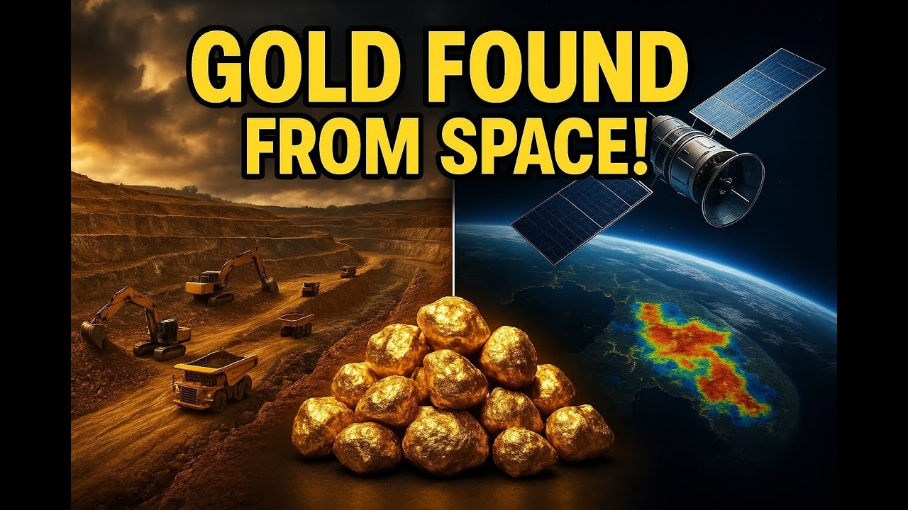
"Ore deposits 3D animations," "ore bodies 3D animations," and "gold mining 3D animations" all point at the same use case: turning subsurface prospectivity data into something a geologist or investor can rotate and query instead of reading off a 2D contour map. This is where satellite spectral data earns its place alongside seismic and drone data — multispectral and hyperspectral imagery maps surface alteration and mineralization signatures over large areas without ground disturbance, which is exactly the input Farmonaut's satellite-based mineral detection service is built around.
For a detailed walkthrough of how that satellite data becomes an actual 3D prospectivity model, see Satellite-Driven 3D Mineral Prospectivity Mapping. The value of getting exploration targeting right is tied directly to the value of what's being found: the U.S. Geological Survey's Mineral Commodity Summaries 2026 — dataset last updated February 6, 2026 per USGS's public dataset listing — reported that the total value of U.S. mineral production rose 5.6% to $112 billion in 2025, with precious-metals prices as the primary driver, and that mineral-dependent industries represented $4.09 trillion in U.S. economic value that year.
- Broader targeting: satellite and geophysical fusion covers large, previously unmapped areas without drilling first.
- Prioritized drilling: resources go to the highest-confidence zones the model flags, not a uniform grid.
- Faster pre-feasibility: a 3D prospectivity model narrows a multi-year field program to specific targets sooner.


Technical Approaches & Tools Powering 3D Mining Animation
The seven applications above share the same technical stack, used in different proportions:
Data Fusion
- Seismic, drill, and magnetic surveys establish underground ore-body geometry.
- Drone photogrammetry and LiDAR capture surface topography and infrastructure at the $50,000–$200,000-per-unit equipment tier cited above.
- Satellite spectral data extends coverage to large areas without ground disturbance.
VR & AR
- VR is used for zero-risk rehearsal of blasting, evacuation, and equipment operation.
- AR overlays block-model data or risk zones onto a worker's live field of view through smart glasses or tablets, distinct from VR's fully digital environment (more on the difference in the FAQ below).
Dynamic Dashboards and Sustainability Storytelling
- Sensor-fusion dashboards combine gas, vibration, and equipment logs into a real-time 3D risk overlay.
- Animated closure narratives turn a reclamation plan into something a regulator or community group can verify visually, rather than take on faith.

Best Practices for 3D Mining Animation Projects
- Start with one decision, not a demo. Tie each animation to a specific technical, commercial, or compliance decision — block geometry, a restoration scenario, a safety protocol — rather than a general "showcase."
- Keep uncertainty visible. Use verified survey, drill, and geochemical data only, and annotate confidence levels so the animation doesn't imply more certainty than the underlying data supports.
- Layer access by audience. A high-level visual summary for executives and regulators; a technical drill-down with annotations for engineers.
- Refresh on a schedule tied to the source data. Re-run the animation whenever the underlying survey, drill, or regulatory data updates — not on a fixed calendar.
Need a starting point for your own site? Contact us for tailored guidance.
Farmonaut's Role: Satellite-Based Intelligence Behind the Model
We don't build the animation — we build the data layer underneath the exploration and prospectivity use case (application 7 above). Using multispectral and hyperspectral satellite data, we identify high-potential mineralization zones without the ground disturbance a traditional survey program requires. That data feeds directly into 3D block models and prospectivity maps, and it's the same satellite-based mineral detection layer referenced throughout this page.
Our Premium+ reports add drilling-intelligence overlays — guidance on drilling angle and geological structure interpretation — built for teams assembling the next generation of block-model animations rather than starting from a blank 3D scene.
Have a site to map? Start here: Map Your Mining Site.


Frequently Asked Questions
What is mining 3D animation, and how does it actually get made?
It's a spatial model — sourced from CAD, LiDAR, drone photogrammetry, satellite imagery, and geological survey data — rendered into a walkthrough or interactive scene. The build order matters: the geo-referenced model comes first (this is the accuracy-critical, time-consuming step), and the animated camera path, narration, and interactivity are layered on afterward.
What makes one 3D mining animation better than another?
Not the render quality — the data fidelity behind it. The animations that hold up under regulatory or investor scrutiny are geo-referenced to survey control, annotated with data sources and confidence levels, and rebuilt when the underlying survey or drill data changes. An animation that looks good but can't be traced back to a specific drill hole or magnetic survey line is a marketing asset, not an engineering one.
How do gold mining 3D animations support planning and permitting specifically?
They visualize ore stockpiles, mineralization patterns, cyanidation circuits, and tailings facilities so engineers, regulators, and community members can review design intent and environmental safeguards before physical construction starts — the same reasoning behind the $112.9 million in FY2025 federal reclamation funding covered above, which exists precisely because closure plans need to be reviewable before a mine opens, not after.
What's the difference between VR and AR in a mining simulation?
VR immerses a trainee in a fully digital mine environment — no physical risk, full scenario control. AR overlays animated data — drill orientation, risk zones, sensor alerts — onto the real, physical mine through smart glasses or a tablet. VR replaces the environment; AR annotates it.
How does satellite-based mineral detection feed into ore-body 3D animation?
Satellite spectral data identifies mineralized zones and structural features (alteration halos, fault lines) over large areas without drilling first. That output becomes one of the input layers for the 3D block model — alongside drill and geophysical data — rather than a replacement for ground-truthing.
Where do I start if I want a 3D animation or prospectivity model for my own site?
Define the decision it needs to support first — planning, training, permitting, or exploration targeting — then gather the survey, drill, and process data behind it. For satellite-driven mineral prospectivity mapping, get a quote here. For anything else, our Contact Us page reaches the same team.
Where can I map my own mining site online?
mining.farmonaut.com is our geospatial portal for mapping a site directly.
Discussion
Questions, corrections or field experience? Share them below. First-time comments are reviewed before they appear, and your email is never published.
No comments yet. Be the first to add a question or your experience.

 Mine4Africa
 Lithspo Minerals Limited
 Tintina Mining Group
 Dalgety Minerals Pty Ltd
 Vortex Minerals Pty Ltd
 Faith At Work (Pty) Ltd
 Geotech Mining Solutions plc
 Vulcan International Limited
 Kidepo Associates
 GKY Mining
 Alkimy SARL
 Double A Trading
 GemSprout Metals Limited
 Qader Group
 Ileys General Trading
 SG Gold Mining LLC
 VRV Global Pte Ltd
 Omsri International FZE
 G.I.T.T.
 Jaunita Erss Ltd
 Almosi SARL
 SRK Consulting
 Berks Gold Limited
 Mwerezi Minerals Company Limited

 Exploration consultancy · South Africa · Gold










