

Farmonaut Inc. · agriculture and mining
About Farmonaut and our work with farms and mines
Some background about Farmonaut: we started in 2018 to make satellite crop monitoring something any farmer could use. Today we monitor farmland in 135 countries, and mining teams in 33 countries use the same satellite data from us to rank mineral Exploration Targets.
A few of the businesses on the platform
- John Deere
- SRK Consulting
- Kubota
- Riverside Resources
- BayWa
- NTS Group
- Elders
- Critica Metals
- CGIAR
- Tintina Mining Group
- Esri North East Africa
- Geotech Mining Solutions
- Unifrutti Gulf
- Vortex Minerals
What we do for farms and for mining teams
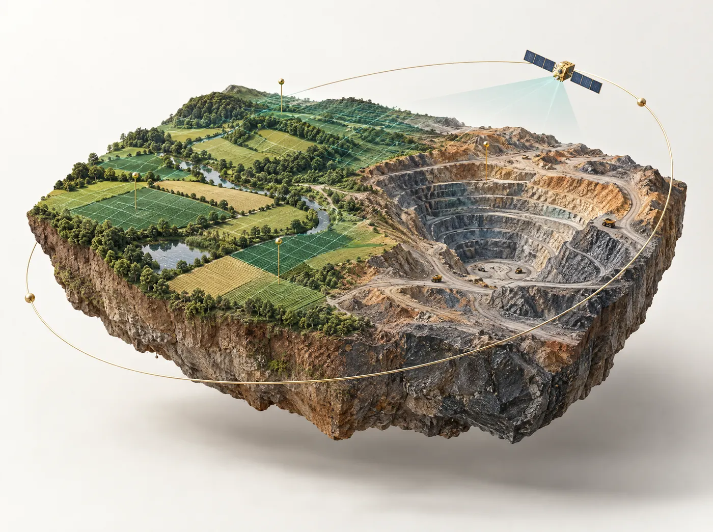
A crop under stress and a patch of altered rock both leave a trace in satellite imagery, and that overlap is why we work in both sectors. Our AI models go through optical, radar, thermal and terrain data for each field or license. Farmers get field advice out of it, and geologists get a ranked target list.
Agriculture
Advice for each field, used by farmers, agronomists, agribusinesses, lenders and insurers on a phone or in a browser.
- Satellite crop monitoring for 166 crops
- AI farm advisory on water, fertilizer and pests
- Crop loan and insurance checks for lenders
- Traceability, carbon and wildfire tools
Mining
License holders, geologists and investors use our ranked Exploration Targets to decide where to sample and drill. They come ahead of a JORC or NI 43-101 resource estimate, not as a replacement for one.
- Satellite mineral detection in under 5 days
- Clients have paid for 23 minerals so far, gold and lithium among them
- Mining Pro software with nine tools
- Exports for Leapfrog, Vulcan, Surpac and Datamine
The numbers so far
Agriculture figures are platform totals. Mining figures cover this and the last financial year.
Agriculture
Mining
Six milestones
How the company has grown since 2018
We started with one crop monitoring tool and added mining in 2025. These were the main steps in between.
- 2018
Farmonaut is founded
Farmonaut starts with one idea: crop monitoring from satellites, with no sensors or drones for the farmer to buy.
- 2019–20
Crop health monitoring goes live
Growers start getting satellite readings of vegetation, soil moisture and crop health, and the platform starts to be used in more countries.
- 2020–21
More crops and new modules
We tune the models for more crops and climates, and add modules for fleet management, product traceability and crop insurance.
- 2023
AI advisory, carbon and wildfire
We launch the JEEVN AI farm advisory, carbon footprinting and wildfire monitoring.
- 2025
Satellite mineral detection
We retune the same satellite and AI methods for geology and launch satellite mineral detection. Exploration teams send a license boundary and get back ranked Exploration Targets.
- 2026
Mining Pro
Mining Pro puts detection results into nine browser tools, from the 3D viewer to the mine plan. Across this and the last financial year we've analyzed 391,956 acres for minerals in 33 countries.
In research and at universities
Independent researchers have studied and cited our work, and 74 universities, colleges and schools in 20 countries have fields on the platform.
Those 74 institutions have their own fields on the platform, with the same satellite views and reports any customer gets. The papers below were written by independent researchers and look at different parts of our work, from farmers in two districts of Uzbekistan adopting the Farmonaut farm information system to blockchain-based ethical sourcing with Farmonaut as the implementation partner, the kind of work our agricultural traceability software is used for. We give the journal, year and topic for anyone who wants to read the papers in full.
Papers that name Farmonaut
- Springer, 2025Applied AI in crop farming
- International Journal of ICT Development & Communication, 2025Adoption of the Farmonaut farm information system in Bo'ka and Chinoz, Uzbekistan
- Circularity Letters, 2025Climate Smart Agriculture Options in Nigeria
- Journal of Enterprise Information Management, 2026Farmonaut as implementation partner for blockchain-enabled ethical sourcing
- Springer, 2026Systems supported by Farmonaut and local NGOs saving up to 50% of water
Universities with fields on the platform
 University of Nebraska–Lincoln
- MIT
- University of Maryland
- Arkansas State University
 University of Sheffield
- University of Aberdeen
 Universidad de Buenos Aires
 Charles University
 Cairo University
We list them because they have fields on the platform. That doesn't mean they endorse us.
Optimised both irrigation and fertiliser use by 30–50%.John Vansickle
Blueberry farmer, Citrus County, Florida. His own estimate, June 2026.How we work
A few things we try to get right
Readings should lead to a decision
A colored map on its own doesn't help much. We want each reading to end in something you can do, like a water amount in millimeters, a fertilizer dose in kilograms or a ranked drill target.
We say what satellites can't do
Satellite data shows you where to look, but a field visit or a drill hole is what confirms what's there. We say that up front, and it's why we call our mining results Exploration Targets.
Saying when nothing is needed
A lot of the savings customers report come from days when the report says "no water today" or marks a zone "skip". That's where water, fertilizer and drilling costs come down.
Usable by any grower
You don't need to buy any equipment. A phone is enough, and the field report is available in 248 languages, so smallholders and lenders work in the same app.
We publish customers' own numbers
The results on our site are customers' own estimates. Before we publish one, we check it against the reports the system actually sent that customer.
Following the whole season
A single day's image can be misleading. We add new readings with every satellite pass, which lets you compare dates and follow a field through the season.
The problem we started with, and why we chose satellites
Farmonaut began in 2018 with a practical problem. Soil sensors, drones and regular agronomist visits all cost money per field, which puts them out of reach for a lot of growers, and even a careful farmer can only walk part of a field in a day. Problems such as water stress or a nutrient shortfall often show up in one corner of a field long before anyone walks past it.
Satellites already pass over every farm on a regular schedule. The European Sentinel-2 mission, for example, images the same spot about every five days with its two satellites and records visible and near-infrared light at 10-meter resolution, which is enough to see differences inside a field. Radar satellites add readings on cloudy days, because radar sees through cloud.
Getting the imagery was the easy part. Most of the effort went into turning a vegetation index into something a grower can act on, such as a water amount in millimeters or a fertilizer dose in kilograms, in a language they read every day. That's still most of the work we do. It's why the field report now comes in 248 languages, runs on a phone, and says "apply nothing" when a field doesn't need any fertilizer at all.
How the same technology serves farms and mines
A crop under stress and a patch of altered rock both change the way the ground reflects and emits light. We first wrote our pipeline for optical, radar, thermal and terrain data to monitor crops, and in 2025 we retuned it for geology. What changes between the two is the model on top and the sensors we lean on.
For farms, we watch the same field again and again through the season, and the value comes from comparing dates: whether a block is drying out faster than the one next to it, or whether the canopy has stopped growing. For mining, we analyze a license in depth, combining eight sensor families that include ASTER shortwave infrared for alteration minerals, radar for faults and lineaments, and EMAG2 magnetics. Multi-season composites help where vegetation hides the rock. The result is a ranked list of Exploration Targets on our satellite mineral detection service, which teams can then explore in Mining Pro.
How we work with customers
On a farm
Most people start in the web app by searching an address, drawing a field or uploading a KML, KMZ or shapefile. Readings arrive after the next satellite pass. From then on, each pass updates 16 satellite views of the field and the AI farm advisory turns them into a report on crop health, water, soil, yield, pests and fertilizer. You can download it as a PDF or share it by link with an agronomist or buyer who doesn't have an account.
For agribusinesses, lenders and software teams
Larger customers usually add many fields at once and want the data inside their own systems. Agronomists keep their clients' fields in one account, field teams get tasks through the Agro Admin app, lenders and insurers use crop loan and insurance checks, and developers pull the same data through the agriculture API. Seven partners run Farmonaut under their own brand.
On a mining license
A mining engagement starts with a boundary sent through the mining quote form. We reply within one working day with the scope, price and timeline, and deliver under 5 days from a usable boundary (larger portfolios are delivered in phases). After delivery, clients take the ranked zones to the field and can keep working with the results in Mining Pro.
How we check our results
On the farming side, the results we publish are customers' own estimates, given through in-app feedback. Before one goes on our site, we compare it with the reports the system actually sent that customer. When John Vansickle, a blueberry farmer in Citrus County, Florida, told us he had cut irrigation and fertilizer use by 30–50%, we could see in his 1,048 reports that in one week the advice was "no water" on 78 of 175 block-days and no fertilizer on 8 of his 25 blocks. You can read that and the other write-ups on the farming case studies page.
In mining, a ranked zone is only confirmed when someone samples or drills it. Clients have taken five engagements to the field or drill so far, and on the engagements where clients tested our ranked zones, 90% were confirmed by ground or drill evidence. On one copper-cobalt license, the client drilled our targets and reported mineralization where the analysis pointed. Five engagements is still a small number, which is one more reason we describe the output as Exploration Targets that come ahead of a JORC or NI 43-101 estimate. Our mining case studies show what clients did next.
What our principles look like in practice
Here is how those principles show up on real accounts.
- A 190-acre farm in El Bayadh, Algeria, received "do not water" on 17 of 28 field-days in one week, with 40 acres off all week, and 3 of its 4 fields needed no fertilizer. The grower estimates 51% less water than watering daily.
- AGROEX Consultancy, working across three countries, received 181 reports in 75 days on 15 fields and 39 warnings above 80% risk. Each pest warning came with its probability, so the team could see which ones to scout first.
- On a gold portfolio in a Zimbabwe greenstone belt, we set aside 83.7% of the area before any fieldwork and narrowed the rest down to seven zones.
- We publish mining figures with the qualifier attached. The 90% confirmation rate always comes with "where clients tested them", and demonstration data in Mining Pro is labeled as conceptual and synthetic.
Where the platform is used
Farmonaut has fields in 135 countries. Apple orchards are monitored in 45 countries, and oil palm plantations account for 116,000+ acres across 35,300+ plots in 11 countries. The mining side has analyzed licenses in 33 countries over this and the last financial year, and Mining Pro has users in 25+ countries.
| Agriculture, by region | Acres monitored | Mining, largest countries | Acres analyzed |
|---|---|---|---|
| Asia | 853,000 |  Ghana | 144,020 |
| Africa & Middle East | 56,800 |  Tanzania | 45,697 |
| Latin America | 27,600 |  Senegal | 38,170 |
| North America | 20,200 |  Mauritania | 34,842 |
| Oceania | 15,600 |  DR Congo | 20,292 |
| Europe | 14,100 |  Mongolia | 17,569 |
 Zambia | 16,969 | ||
| USA | 10,255 |
Agriculture figures are platform totals. Mining figures cover FY2025-26 and FY2026-27 to date.
Questions about Farmonaut
What is Farmonaut?
Farmonaut is a satellite and AI company for agriculture and mining. Farms use it for field-level advice on irrigation, fertilizer and pests. Exploration teams use it to get ranked mineral targets from satellite data.
When was Farmonaut founded?
Farmonaut was founded in 2018. The company's legal name is Farmonaut Inc.
Where is Farmonaut based?
Farmonaut is a US-based company. The platform itself is used by farmers with fields in 135 countries and by mining teams in 33 countries.
Is Farmonaut an agriculture company or a mining company?
Both. We started in agriculture and added satellite mineral detection in 2025, and the two sides run on the same satellite and AI platform. You can see all Farmonaut solutions here.
Is Farmonaut legit?
Yes. Farmonaut has been operating since 2018, 200,000+ farmers and 194 businesses in 47 countries have fields on the platform, and 57 named companies have commissioned mineral exploration work from us. Independent researchers have also published studies that name Farmonaut, and the results on our site are customers' own estimates that we check against the reports we sent them.
Does Farmonaut work with mining companies?
Yes. Across FY2025-26 and FY2026-27 to date we've worked on 189 exploration projects in 33 countries, for 23 minerals including gold, copper and lithium. Clients get ranked Exploration Targets from satellite mineral detection, and 100+ mining businesses use Mining Pro.
Where can I read independent research about Farmonaut?
Search Farmonaut on Google Scholar. Recent papers cover applied AI in crop farming, farmers adopting the Farmonaut farm information system in Uzbekistan, water savings from systems supported by Farmonaut and local NGOs, and Farmonaut as an implementation partner for blockchain-based ethical sourcing.
What is the official Farmonaut website and app?
The company website is farmonaut.com. The farm web app is at sat.farmonaut.com, with apps on Google Play and the App Store, and Mining Pro runs at mining.farmonaut.com.
Can I partner with Farmonaut or resell it?
Yes. Seven partners run Farmonaut under their own brand, developers can use the agriculture data API, and consultants can join the affiliate program for farming or mining referrals.
How can I contact Farmonaut?
For sales and partnerships, use the contact page. If you already use the platform, open a support ticket instead. There are more answers on the FAQ page.
Have a farm to monitor or a license to explore?
Farms and agribusinesses can start in the web app today. For mineral exploration, send us a boundary and we'll reply within one working day with the scope, price and timeline.
More Farmonaut solutions