

 Mining Intelligence Report
Gold Mineral Detection in Ghana: Farmonaut Maps 533.65 km² Across 9 Projects
Ghana has long held its place as Africa’s largest gold producer, yet the precision of gold mineral detection across the country’s sprawling concession landscape has historically lagged behind global benchmarks. That is changing. Farmonaut’s satellite-driven gold mineral detection platform is redefining how exploration companies, junior miners, and geological agencies identify, map, and prioritise gold-bearing zones — without a single drill turning prematurely.
In a landmark engagement across Ghana’s Birimian and Tarkwaian gold belts, Farmonaut completed gold mineral detection surveys covering 533.65 square kilometres across nine distinct exploration projects. This case study examines the methodology, geological context, and strategic value for mining professionals operating in — or evaluating entry into — the Ghanaian gold sector.
Completed
km²
Resolution
Ghana’s Gold Mining Landscape
Ghana ranks among the world’s top ten gold producers, contributing more than 130 tonnes annually. The country’s geology — dominated by the Birimian Supergroup, the Tarkwaian sedimentary system, and a network of auriferous shear zones through the Ashanti, Western, and Brong-Ahafo regions — creates ideal conditions for structurally controlled, high-grade gold deposits.
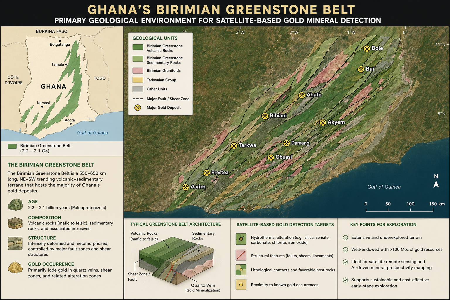
Yet even in this resource-rich environment, conventional gold mineral detection methods — including soil sampling, trenching, and airborne geophysics — remain slow and expensive. Delays run into months; costs spiral before a single meaningful target is confirmed. For companies managing multiple project areas simultaneously, the gap between field reconnaissance and investment-grade geological data has always been a material cost driver.
The Challenge of Gold Mineral Detection
Accurate gold mineral detection in Ghana presents specific geophysical and logistical challenges. Lateritic overburden across the Ashanti Region, dense forest canopy in the Western Region, and restricted access across active artisanal mining zones all obscure subsurface signatures that conventional surveys struggle to resolve.
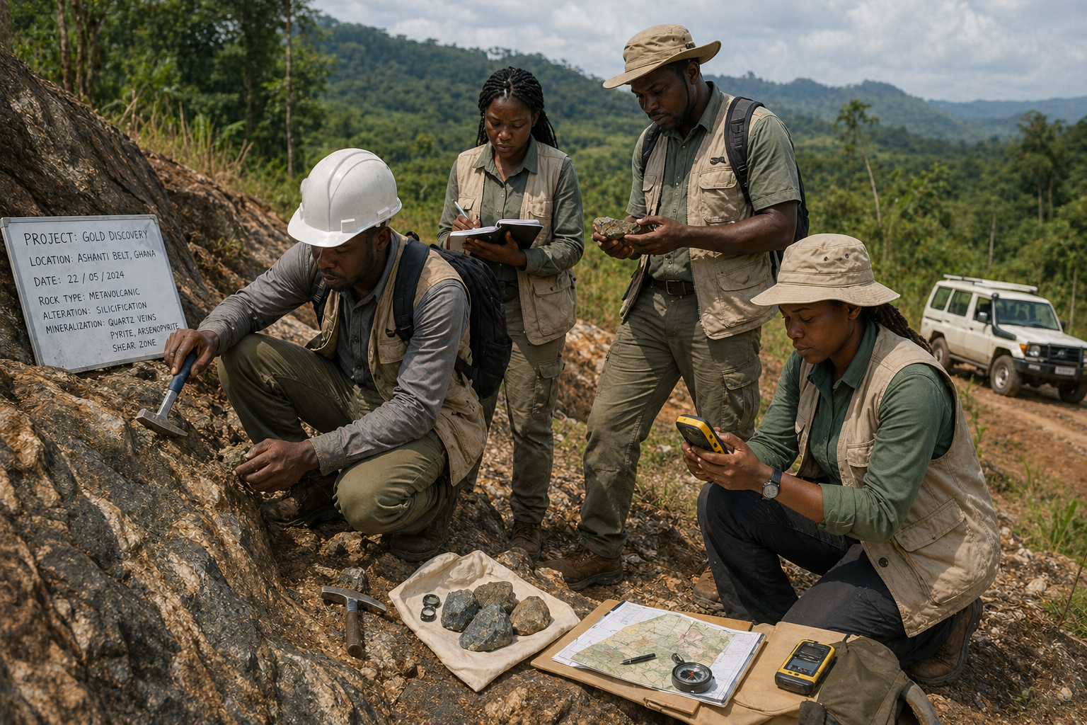
Traditional prospecting workflows are spatially incomplete. Most ground surveys cover selective transects rather than full concession coverage — creating systematic blind spots where genuine gold mineral detection potential is never evaluated, increasing the risk of missing high-priority drill targets.
The most expensive miss in gold exploration is not a dry hole — it is the anomaly that was never tested because it was never seen.
By applying multi-spectral satellite analysis and lithological discrimination at scale, Farmonaut achieves comprehensive gold mineral detection coverage across entire concession footprints — not just accessible corridors. Explore the platform →
Farmonaut’s Satellite-Based Approach
Farmonaut’s gold mineral detection methodology integrates Sentinel-2 multi-spectral imagery, ASTER thermal infrared data, and proprietary spectral decomposition algorithms calibrated against Ghana’s dominant mineralogical assemblages — including arsenopyrite-hosted gold, free-milling Birimian gold, and Tarkwa paleoplacer systems.
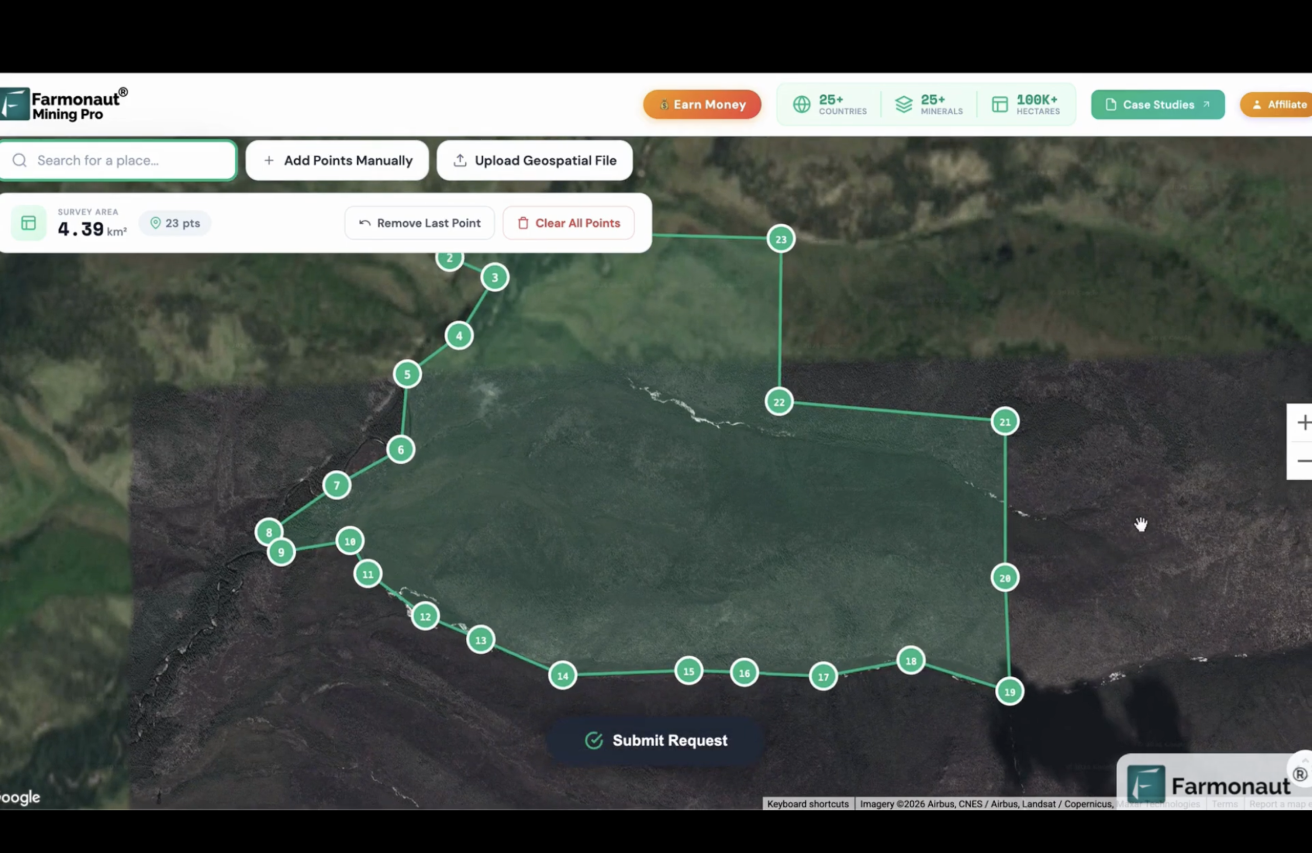
The platform maps iron oxide abundance, clay mineral concentration, ferrous silicate zones, and silicification fronts — all reliable pathfinder indicators for gold mineral detection in the West African geological context. Each project area is processed at resolutions as fine as 10 metres per pixel, enabling geological teams to distinguish structural lineaments, alteration halos, and lithological contacts with fidelity approaching that of low-altitude airborne surveys.
The Ghana Deployment: Nine Projects, 533.65 km²
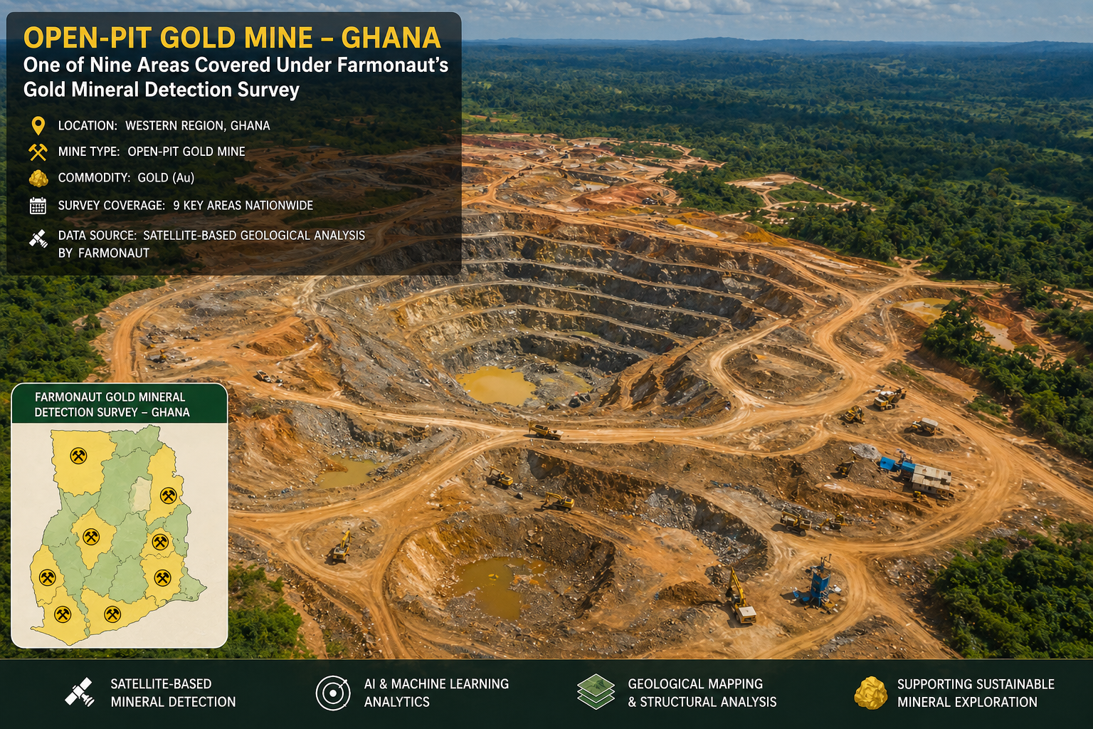
The Ghana deployment represents one of Farmonaut’s most extensive single-country gold mineral detection engagements in Sub-Saharan Africa. Nine separate project areas were surveyed, with total coverage reaching 533.65 square kilometres — equivalent to more than 53,000 standard football pitches of systematically analysed terrain.
Birimian greenstone belt targets across Ashanti and Brong-Ahafo regions — shear-zone-hosted gold mineralisation
Tarkwa-style paleoplacer targets in the Western Region — sediment-hosted Proterozoic reef systems
This dual-setting coverage within a single deployment makes the Ghana dataset one of the most geologically representative in Farmonaut’s West Africa portfolio, providing a methodological cross-section of both principal gold mineral detection environments in the country.
Strategic Value for the Mining Sector
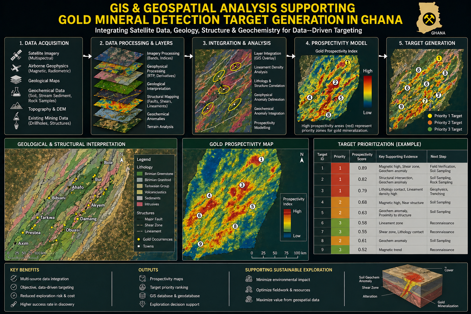
For mining companies evaluating Ghanaian licences, Farmonaut’s gold mineral detection intelligence creates a decisive competitive advantage. Rather than entering a data room with only historical soil survey results and aeromagnetic compilations, technical teams gain access to current, full-coverage spectral analysis stratified by mineralogical confidence — updated on satellite revisit cycles.
The practical implications are direct: reduced time-to-drill-target, more defensible exploration budgets, and a stronger geological narrative for investor presentations. Layering gold mineral detection results against known artisanal mining concentration zones also enables companies to fast-track community engagement planning — a critical factor in Ghana’s regulatory environment, where Environmental and Social Impact Assessments are mandatory and scrutinised by the Minerals Commission and EPA Ghana.

Mining companies and geological consultancies looking to apply Farmonaut’s gold mineral detection platform to their Ghana portfolios can access the full mapping interface at mining.farmonaut.com/mapping. Industry partners and resellers can explore the dedicated mining affiliate programme at farmonaut.com/farmonaut-affiliate-program/mining.
Ghana’s Gold Belt, Seen From Space
Ghana’s gold sector stands at the intersection of geological richness and technological transformation. Farmonaut’s satellite-based gold mineral detection platform is enabling exploration professionals to move faster, spend smarter, and arrive at drill decisions with greater geological confidence than ever before.
With 533.65 square kilometres mapped and nine projects completed, the Ghana engagement demonstrates what is achievable when advanced gold mineral detection technology is deployed at scale — and it represents only the beginning of what Farmonaut’s continental mapping capability can deliver across Africa’s gold belts.
Map Your Ghana Concession
Access Farmonaut’s gold mineral detection platform for your exploration projects — or partner with us across Africa’s gold belts.

 Berks Gold Limited
 Mwerezi Minerals Company Limited
 Congo Mining Solutions
 Mining SARL
 SenGold Invest SAS
 Sania Corporation
 Sean Mining Limited
 NTS Group (Pty) Ltd
 Mine4Africa
 Lithspo Minerals Limited
 Tintina Mining Group
 Dalgety Minerals Pty Ltd
 Vortex Minerals Pty Ltd
 Faith At Work (Pty) Ltd
 Geotech Mining Solutions plc
 Vulcan International Limited
 Kidepo Associates
 GKY Mining
 Alkimy SARL
 Double A Trading
 GemSprout Metals Limited
 Qader Group
 Ileys General Trading
 SG Gold Mining LLC
 VRV Global Pte Ltd
 Omsri International FZE
 G.I.T.T.
 Jaunita Erss Ltd
