

Drones · Price guide
Drone Prices by Type: Hobby, Mapping, Farm and Inspection
Camera drones sold for about $199 to $2,699 in US retail in May 2026. Mapping and inspection kits cost far more: a full-frame mapping camera listed at $7,499 and an inspection platform at $17,302 before batteries. Hiring costs $150 to $700 per hour (Drone U, 2026).
Key takeaways
- Consumer camera drones ranged from about $199 (DJI Neo) to $2,699 (DJI Mavic 4 Pro) in US retail listings in May 2026 (Photography Talk).
- Sensors drive cost: a DJI Zenmuse P1 mapping camera listed at $7,499 at a US dealer in 2026, before the aircraft.
- US drone services cost $150 to $700 per hour and mapping $5 to $20 per acre (Drone U, 2026).
- US spray drone services averaged $13 per acre in 2025, down from $21 in 2024 (American Spray Drone Coalition).
- Since 22 December 2025, new foreign-made drone models cannot get FCC approval for US sale unless exempt; owned drones can still be used (FCC).
In this article
Drone prices by type run from about $200 for a small camera drone to more than $17,000 for an enterprise inspection platform before sensors are added. In US retail listings from May 2026, consumer camera drones sat between $199 and $2,699, while dealer list prices for a heavy-lift inspection drone and a full-frame mapping camera reached $17,302 and $7,499. If you only need the data, hiring a pilot costs $150 to $700 per hour in the US (Drone U, 2026).
This guide sorts drone prices by type into four groups: consumer and hobby drones, mapping and survey drones, inspection drones, and farm drones. For each group it gives dated prices, says whether they are list prices, dealer asks or service rates, and shows what pushes the cost up. A calculator at the end helps you test whether buying or hiring makes more sense for mapping work. For a full look at spray and mapping drones for farms, see our separate guide to agricultural drone prices and models.
Drone prices by type at a glance
The table gives a quick view. Each row is explained in its own section below, with the source behind the number. Prices are US dollars unless stated, and they change often, so treat them as a starting point for your own quotes.
| Drone type | Typical buyer | Example price | Price basis |
|---|---|---|---|
| Beginner camera | Hobby flyers | $199 to $329 | US retail, May 2026 |
| Advanced camera | Photographers, small firms | $999 to $2,699 | US retail, May 2026 |
| Mapping camera | Surveyors | $7,499 for a full-frame payload alone | Dealer list price, 2026 |
| Inspection platform | Utilities, industry | $17,302 list, $11,129 sale, no batteries | Dealer price, discontinued model |
| Hired mapping | Builders, landowners | $5 to $20 per acre | US service rates, 2026 |
| Hired spraying | Farmers | $13 per acre average | US operator survey, 2025 |
What sets the price of a drone
Four things explain most of the gap between a $200 drone and a $20,000 one. The first is the sensor. A small camera is cheap, but a full-frame mapping camera, a thermal camera, a multispectral camera or a LiDAR unit can cost more than the aircraft that carries it. The second is flight time and payload. Larger batteries and stronger motors let a drone carry heavier sensors for longer, and that adds weight and cost.
The third is positioning. Mapping and survey drones often use RTK, a correction system that tightens the position of each photo to a few centimetres. That cuts the need for ground markers but adds cost. The fourth is support: software licences, spare batteries, insurance, training and repairs. Buyers often forget these, yet they can add thousands of dollars a year.
Rules matter too. In the US, any drone flown for work needs a pilot with a Part 107 certificate, which means passing the FAA knowledge test and taking online recurrent training every 24 months, as the FAA guide to becoming a drone pilot explains. Registration is cheap: the FAA registration page lists a fee of $5 per drone for Part 107, valid for three years. Canada has its own system of pilot certificates and registration, set out on the Transport Canada drone safety page. Check local rules before you buy, and get professional advice on insurance and liability.
The US import rule that changes what you can buy
On 22 December 2025 the FCC added drones and drone parts produced in a foreign country to its Covered List. New foreign-made models can no longer get the FCC approval needed for import, marketing or sale in the US. The FCC fact sheet on the drone exemptions says the list does not stop people from using drones they bought legally, and it does not cover models the FCC approved before. A January 2026 FCC public notice exempted drones on the Defense Contract Management Agency’s Blue UAS Cleared List and certain domestic end products. In practice, US buyers should expect fewer new foreign models and should check a model’s status before paying. Get legal advice if you plan to import or resell drones.
▶ How satellites, AI and drones are used together in modern farming. · 13:27
Consumer and hobby drone prices
Consumer drones are the cheapest group. They carry a fixed camera, fly for roughly 18 to 51 minutes, and are made for photos and video rather than measurement. A buying guide on Photography Talk, which compared US prices from B&H and Amazon in May 2026, listed the DJI Neo at about $199, the Potensic Atom 2 at about $329, the DJI Mini 5 Pro at about $999, the DJI Air 3S at about $1,099, the Autel EVO II Pro V3 at about $1,899, and the DJI Mavic 4 Pro at about $2,699. These are retail street prices on that date, not list prices, and bundles with extra batteries cost more.
Chart
US street prices of six camera drones
US dollars, approximate retail price, May 2026, selected models
Weight is a hidden price factor. Drones under 250 grams face lighter rules in several countries, so makers pack a lot of camera into very small aircraft, and that raises their price. A sub-250 gram drone with a large sensor can cost as much as a heavier mid-range model.
- Best for beginners: a drone under $350. Learn to fly before you spend more.
- Best for serious photos: a $1,000 to $2,700 model with a larger sensor and longer flight time.
- Not suited for: survey-grade maps or crop health maps. These drones have no RTK and no multispectral camera.
Mapping and survey drone prices
Mapping drones take hundreds of overlapping photos and turn them into maps and 3D models. The price is driven by the camera and by positioning accuracy. As an example of sensor cost, the drone dealer Dronefly listed the DJI Zenmuse P1 full-frame mapping camera at $7,499 in 2026, before the aircraft that carries it. Software for processing the photos is usually a yearly subscription on top.
Drones can cut survey costs. A peer-reviewed study in Frontiers in Built Environment (2022) compared drone and traditional methods at a quarry stockpile in Malawi. In its literature review it quotes an earlier comparison (Fitzpatrick, 2015) in which a drone volume survey cost $1,316.50 against $2,235.00 for the cross-section method, and took 5 hours instead of 11. At the Malawi site itself, the drone volume error was 2.6% against 1.3% for the tape method, so drones trade a little accuracy for speed. These are single examples, not proof of savings everywhere.
If you only need a few surveys, hiring is often cheaper than buying. A UK firm, Sky Scan Surveys, published 2026 prices for drone topographic surveys that start at £799 for a 3 to 5 acre site and rise to £3,499 to £5,499 for 20 to 50 acres. Its cost per acre falls as the site gets bigger, because travel, setup and drafting cost the same on a small site as on a larger one. In the US, Drone U’s 2026 pricing guide puts drone mapping at $5 to $20 per acre.
Chart
UK drone topographic survey starting prices
Pounds, lowest quoted price by site size, one UK firm, 2026
Inspection drone prices
Inspection drones check roofs, power lines, towers, bridges and solar farms. They need stable flight in wind, a zoom or thermal camera, and often two batteries that can be swapped without shutting down. That makes them some of the most expensive drones sold for civil work.
The DJI Matrice 350 RTK is a common example. A US dealer, Blue Skies Drone Shop, listed it at a regular price of $17,302 and a sale price of $11,129 without batteries or charger, and marked the model discontinued. Add a thermal or zoom camera, batteries and a case, and a full inspection kit costs several thousand dollars more than the aircraft alone. Prices for discontinued models vary a lot between dealers, so ask for written quotes.
Hiring is common here too. Drone U lists roof and building inspections at $200 to $500 per hour and thermal inspections at $300 to $700 per hour in the US in 2026. The extra cost of thermal work comes from the camera, the training needed to read heat images, and the time spent writing reports.
Chart
US drone service rates by job
US dollars per hour, low and high end of typical range, 2026
Farm drone prices
Farm drones come in two kinds. Mapping drones fly over fields with RGB or multispectral cameras to show crop health. Spray drones carry tanks and apply pesticide, fertilizer or seed. Spray drones are the most expensive farm drones, and their prices, models and running costs are covered in our agricultural drone price guide. For a wider look at costs and benefits on the farm, see our page on farming drone price and benefits.
Many farmers hire a spray service instead of buying. The American Spray Drone Coalition 2025 Impact Survey found US spray drones treated more than 16.4 million acres in 2025, up 58.7% on the year before, with 1,710 Part 137 operators. The average price per acre sprayed fell from $21 in 2024 to $13 in 2025. The survey says the fall was likely driven by more competition, particularly from operators without Part 137 certificates. Spraying with a drone needs extra approvals, so check the product label and local rules before any application.
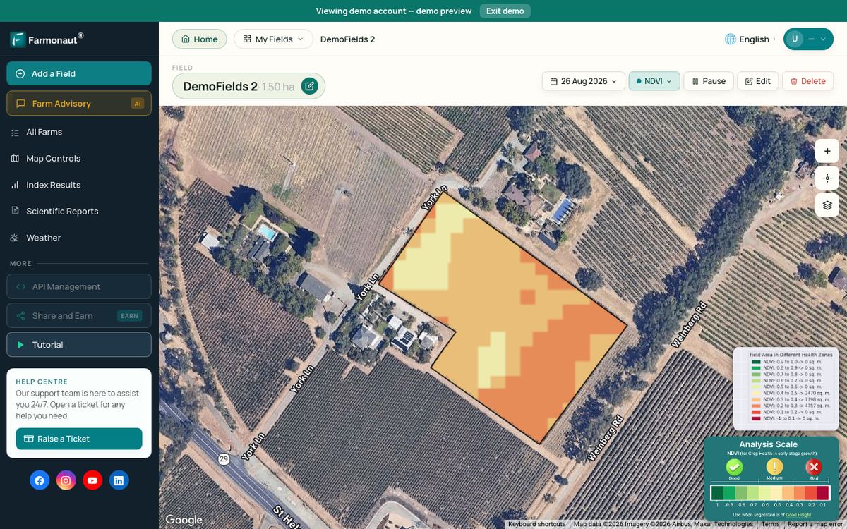
Drones are still a small part of US farming. A USDA Economic Research Service report on precision agriculture (2023) found that the use of drones, aircraft or satellite imagery was far less common than tools such as auto-steer. For crop health maps across many fields, satellite monitoring is another option that needs no aircraft at all. Farmonaut offers satellite crop health maps by subscription, so it can sit alongside or replace a mapping drone for routine checks.
Chart
Average US spray drone price per acre
US dollars per acre sprayed, operator survey
▶ Six plain steps to start precision farming without buying a drone or robot first. · 4:18
Running costs after you buy
The price tag is only the start. Batteries wear out after a few hundred charge cycles, so heavy users replace them every year or two. Processing software for maps is usually sold by subscription. Insurance is another yearly cost, and spray work usually needs higher liability cover than photo work, so get quotes before you buy. Training and recurrent pilot courses take time even when they cost little.
Hidden costs also come from your own time. A pilot who plans flights, travels to sites, flies, processes data and writes reports may spend more hours on the desk than in the air. Drone U’s pricing guide makes a similar point for service firms: add up equipment, software, insurance and time before setting a minimum hourly rate. When you compare drone prices by type, add these costs to the purchase price so that you compare the full cost of owning with the cost of hiring.
Buy or hire: how to choose
The right choice depends on how much you will fly. Use these steps before you compare drone prices by type.
▶ Seven green farming technologies, ranked, from field sensors to precision application. · 2:24
- Write down the job. Photos, maps, inspections and spraying need different drones. A cheap camera drone cannot make survey-grade maps.
- Count the hours or acres. Estimate how many acres you will map, or how many hours you will fly, each year.
- Price the whole kit. Add batteries, sensors, software, insurance and training to the aircraft price.
- Get service quotes. Ask two or three local operators for a price per acre or per hour.
- Compare over the life of the drone. Spread the kit price over the years you expect to use it, then compare it with the cost of hiring.
- Check the rules. Make sure you can get the pilot certificate, registration and approvals you need.
The calculator below runs step 5 for mapping work. Enter your own numbers.
Try the numbers for your own farm below.
Calculator
Is it cheaper to buy a mapping drone or hire one?
Enter your own kit price, running costs, acres and service quote.
- Yearly cost of owning: $3,500
- Yearly cost of hiring: $3,500
- Break-even acres per year: 350 acres
Example values only, not a benchmark or a forecast; they are set close to break-even. Every number is your input. The hire rate default sits inside the $5 to $20 per acre range in Drone U’s 2026 guide. Owning cost = kit price spread evenly over the years of use, plus yearly running costs; it ignores resale value, your own time and financing.
How we checked the numbers
Every price in this guide comes from a named source with a date. Consumer prices are US retail prices from a May 2026 buying guide. Mapping and inspection prices are dealer list or sale prices found in October 2026. Service rates come from a US training firm’s 2026 guide and a UK survey firm’s 2026 price list, and spray prices come from an industry survey of US operators. We did not use market-size forecasts, because published estimates differ by several times. Prices change fast, especially after the FCC rule, so always get a current quote.
Related pages on our site: satellite-based mineral detection, our mining platform, mining enquiry form and contact us.
FAQ
How much does a basic drone cost?
Beginner camera drones started at about $199 to $329 in US retail listings in May 2026. They are good for learning to fly and taking photos, but not for maps or measurement.
What is the price of a mapping drone?
It depends on the camera and positioning. A full-frame mapping camera alone was listed at $7,499 by a US dealer in 2026, before the aircraft and software. Hiring a pilot for mapping costs about $5 to $20 per acre in the US (Drone U, 2026).
Why are inspection drones so expensive?
They need stable flight in wind, zoom or thermal cameras and hot-swap batteries. One common model was listed at $17,302 regular price without batteries by a US dealer.
Can I still buy DJI drones in the US?
Models the FCC approved before the December 2025 Covered List change can still be sold and used, and people can keep using drones they own. New foreign-made models cannot get FCC approval unless they are exempt. Check a model’s status before buying.
Is it cheaper to buy a drone or hire a service?
For a few jobs a year, hiring is usually cheaper. If you map many acres every year, owning can pay off. Use the calculator above with your own quotes.
How much does drone spraying cost per acre?
The average US price was $13 per acre in 2025, down from $21 in 2024, according to the American Spray Drone Coalition. Local prices vary by crop, field size and product.
Farmonaut crop monitoring
Check crop health without a drone
Draw your fields once and Farmonaut shows satellite crop health maps for them through the season, on web, Android or iOS.



Keep reading
Sources
- Photography Talk, Best Drone for Photography 2026: 6 Pro Picks Tested (May 2026): photographytalk.com
- Drone U, Drone Service Pricing Guide (2026): thedroneu.com
- Sky Scan Surveys, Topographic Survey Cost UK (2026): skyscansurveys.co.uk
- Dronefly, DJI Zenmuse P1 product page (2026): dronefly.com
- Blue Skies Drone Shop, DJI Matrice 350 RTK product page (2026): blueskiesdroneshop.com
- American Spray Drone Coalition, 2025 Impact Survey Results (January 2026): americanspraydronecoalition.com
- FAA, Become a Certificated Remote Pilot: faa.gov
- FAA, How to Register Your Drone: faa.gov
- Transport Canada, Drone safety: tc.canada.ca
- FCC, Fact Sheet: FCC Updates Covered List to Exempt Certain Drones (2026): docs.fcc.gov
- FCC, Public Notice DA 26-22 (7 January 2026): docs.fcc.gov
- Matsimbe et al., Comparative utilization of drone technology vs. traditional methods in open pit stockpile volumetric computation, Frontiers in Built Environment (2022): frontiersin.org
- USDA ERS, Precision Agriculture in the Digital Era, EIB-248 (February 2023): ers.usda.gov
- AgDroneDirectory, Agricultural Drone Spraying Statistics 2026 (insurance premium range): agdronedirectory.com
Discussion
Questions, corrections or field experience? Share them below. First-time comments are reviewed before they appear, and your email is never published.
No comments yet. Be the first to add a question or your experience.

 KJBN Labs
 SFX
SFX BACF Africa
 Doodlakine
 Exurbia Geospatial
 FieldZero
 Indico Company
 Kubota
 FFBS
FFBS Jontra
 Tucor
Tucor
 Licence holder · Niger · Gold
 Licence holder · Nigeria · Gold + lithium










