

British Geological Survey · Data guide
BGS Geological Maps: Viewers, Scales and Borehole Data
BGS geological maps cover Great Britain at four scales, from 1:625 000 to 1:10 000. View them in the BGS Geology Viewer or GeoIndex; borehole records, mine plans and geochemistry sit in GeoIndex. Open data uses the Open Government Licence; larger-scale downloads are licensed per km2.
Key takeaways
- BGS describes itself as the world’s oldest national geological survey, founded in 1835; it was the Geological Survey of Great Britain from 1905 and took its present name on 1 January 1984 (BGS, Our history).
- The BGS Geology Viewer is the public app and GeoIndex is the professional viewer; the Geology of Britain viewer was retired on 1 August 2022 (BGS).
- List rates on BGS dataset pages (20 November 2026): GBP 0.007 per km2 at 1:250 000, GBP 0.23 at 1:50 000 and GBP 1.71 at 1:10 000, plus user, licence and preparation fees; the 1:625 000 data is open.
- GeoIndex holds more than 1.8 million borehole records, and drilling deeper than 30 m for minerals must be notified to BGS under the Mining Industry Act 1926, section 23.
- All 662 MEIGA (Mineral Exploration and Investment Grants Act 1972) exploration reports are online through the UK Critical Minerals Intelligence Centre (BGS, May 2024).
In this article
- What the British Geological Survey and the Geological Survey of Great Britain are
- Which BGS map viewer to use
- How to use BGS GeoIndex step by step
- BGS Geology Viewer and the retired Geology of Britain viewer
- BGS geological map scales and what each one is for
- What the map layers show: bedrock, superficial deposits and faults
- How to find BGS borehole records
- Drilling rules and the National Geological Repository
- Mineral, mining and geochemistry data held by BGS
- What BGS data costs and which licence applies
- A desk-study workflow for explorers and consultants
- What to check before you rely on a BGS map
- Frequently asked questions
BGS geological maps are the digital geology maps of Great Britain published by the British Geological Survey (BGS) at four scales: 1:625 000 for the national picture, 1:250 000 for regions, 1:50 000 for local work and 1:10 000 to 1:25 000 for single sites. You can view them in the BGS Geology Viewer (a simple public app) or in BGS GeoIndex (the professional viewer that also holds borehole records, mineral data and mine plans). The 1:625 000 data can be downloaded under the Open Government Licence. Commercial use of the larger-scale data needs a licence priced per square kilometre, with the rates shown below.
This guide explains which viewer to open for which job, what each map scale can and cannot tell you, how to find borehole records, which mineral and geochemistry datasets sit behind the maps, and how an exploration geologist or consultant puts them together in a desk study. Every product description, scale, record count and rate comes from the BGS web pages as they stood on 20 November 2026; BGS changes dataset names and rates from time to time, so check the dataset page before you budget.
What the British Geological Survey and the Geological Survey of Great Britain are
The British Geological Survey calls itself the world’s oldest national geological survey, founded in 1835 (BGS, Our history). It began as the Ordnance Geological Survey under the Board of Ordnance, with Henry de la Beche as its first director. The “Geological Survey of Great Britain” is the same organisation under an earlier name: it took that name on 1 April 1905 when the Irish survey was transferred out, was known as the Geological Survey and Museum when it moved to the Department of Scientific and Industrial Research in 1919, was merged with the Overseas Geological Surveys and renamed the Institute of Geological Sciences in 1966 (after the 1965 Science and Technology Act), and was renamed the British Geological Survey on 1 January 1984.
Today BGS is part of UK Research and Innovation and a research centre under the Natural Environment Research Council (BGS, About BGS). It is the UK’s national provider of geoscience data, and its National Geoscience Data Centre (NGDC) is the long-term store for borehole records, maps and reports. BGS maps Great Britain. For Northern Ireland, the 1:625 000 dataset includes map data, but detailed geochemistry and abandoned-mine plans sit with the Geological Survey of Northern Ireland.
Which BGS map viewer to use
BGS runs several viewers, and the old names still turn up in searches. Pick by the job, not by the name. The table lists what each one does today (BGS map viewer pages, 20 November 2026).
| Viewer | Best for | What it holds | Status |
|---|---|---|---|
| BGS Geology Viewer | A quick look at the rocks under a site | Bedrock and superficial geology of Great Britain, 3D terrain view, satellite base map, GPS location, live legend | Open to all; runs in a web browser and on phones |
| GeoIndex (onshore) | Professional desk studies | Borehole records, 1:50 000 geology with faults, earthquakes, hazard maps, geochemistry samples, rock samples, non-coal mining plans, 3D models of London, Cardiff, Glasgow and Liverpool | Current professional viewer |
| GeoIndex v1.24.0 Beta | Trying the next version | Onshore and offshore data in one app, more base maps, metadata links, search and filters | Beta; BGS advises professional users to keep using the existing apps for now |
| GeoIndex (offshore) | Marine geoscience | Sea-bed and continental shelf data held by NGDC | Current |
| Geology of Britain viewer | Retired | Was the public 2D and 3D viewer | Retired on 1 August 2022 |
| Minerals Information Online | Mineral planning and land-use conflicts | Mineral resources maps, planning permissions (England), environmental designations | Current, on MineralsUK |
| Non-coal mining plans viewer | Old mine workings | More than 70 000 plans of non-coal mines, searchable by area, mineral or mine name | Current |
The short answer for most readers: open the BGS Geology Viewer to see what rock you are standing on, and open GeoIndex (onshore) when you need boreholes, faults, samples or mine plans. BGS describes GeoIndex as the tool for professional users and the Geology Viewer as the lightweight one for the general public (BGS, Geology of Britain viewer page).
How to use BGS GeoIndex step by step
GeoIndex is a map-based index: each layer points to data BGS holds, and clicking a feature opens its record. BGS lists these core functions: go to your area of interest, view and query datasets, produce PDF reports, clip and download data for your area, and send an enquiry about data you have found (BGS, GeoIndex (onshore)). A practical routine for a prospect:
- Search for a place name or enter a grid reference, then zoom until the layer you want appears. Borehole records and the 1:50 000 geology (including faults) only draw once you are zoomed in.
- Open the toolbar option “add data” to see the full layer list. Besides boreholes and geology, it includes rock samples, photographs, data products, hazard maps, geochemistry samples and non-coal mining plans.
- Switch on the geology layer first and read the legend. Click a unit to open its record, then look it up in the BGS Lexicon (see the layers section below).
- Add the borehole layer. Dense clusters mark old shafts, wells, site investigations and exploration drilling; open a record to see the scanned log.
- Add geochemistry samples and mineral-related layers, then export a PDF report or clip the layers for your area, keeping to the licence shown for each dataset.
- Record the layer names, the date you looked and the acknowledgement text with your notes, so the desk study can be repeated.
GeoIndex is also published as web map services. In GIS software such as QGIS, you can add the BGS services as WMS layers and place them under your own licence-area polygon. BGS notes that some older clients cannot connect since its 2022 security changes; Esri ArcMap 10.5.1 and earlier are the example it names (BGS, Web map services). The beta GeoIndex is worth a look for its base maps, which include recent Ordnance Survey maps and high-resolution satellite imagery, but BGS recommends the existing apps for professional work while the beta is evolving.
BGS Geology Viewer and the retired Geology of Britain viewer
Many people still search for the “Geology of Britain viewer”. BGS retired the classic 2D and 3D versions on 1 August 2022, and also retired its iGeology phone app. Its stated reason was that browser and mobile technology had moved on, so it replaced them with one new public viewer and the professional GeoIndex (BGS, Geology of Britain viewer page).
The replacement, the BGS Geology Viewer, shows the bedrock and superficial geology when you tap the map and explains how certain features formed. It can drape the geology over a 3D terrain model, switch base maps (including satellite imagery), follow your GPS position, and update the legend as you pan. Clicking a legend item opens the BGS Lexicon entry for that formation. It needs a browser with WebGL; BGS recommends 8 GB of memory on a desktop and a phone with at least 4 GB of RAM (BGS, BGS Geology Viewer). If you need the 3D cross sections that the old viewer offered, BGS points to its UK3D dataset.
BGS geological map scales and what each one is for
The Digital Geological Map of Great Britain project (formerly called DiGMapGB) prepared the national digital geology at four scales. A map scale of 1:50 000 means 1 mm on the map is 50 m on the ground, so the scale sets how much detail the mapped lines can carry. The calculator below converts a map distance to ground distance for any scale. The scale also tells you the question each dataset can answer; for the mapping methods behind them, see our guide to geological mapping methods and scales.
Calculator
How far on the ground is a distance on the map?
Enter the scale denominator and a distance measured on the map.
- Same distance in kilometres: 1.25 km
- Ground width of the pen line: 25.0 m
Pure arithmetic: ground distance = map distance x scale denominator. Example values only; the 0.5 mm line width is an example input, not a BGS specification.
| Dataset | Scale | Coverage | Access (BGS dataset page) | List rate | Use |
|---|---|---|---|---|---|
| BGS Geology 625K | 1:625 000 | Great Britain and Northern Ireland | Open, under the Open Government Licence; shapefile or GeoPackage | No charge | National overview, teaching |
| BGS Geology 250K | 1:250 000 | Great Britain | Premium licence; bedrock and faults | GBP 0.007 per km2 | Regional targeting |
| BGS Geology 50K | 1:50 000 | Most of Great Britain | Open to view as WMS or in GeoIndex; licence to download for commercial use | GBP 0.23 per km2 | Local prospect work |
| BGS Geology 10-25K | 1:10 000 to 1:25 000 | Partial coverage, including many urban centres and transport routes | Premium licence | GBP 1.71 per km2 | Site level |
Read the table with these points in mind. The 625K data was generalised from the 1:50 000 maps into the 2007 fifth-edition bedrock map, and its superficial layer was digitised from the 1977 first-edition Quaternary map, so it is a good index but a poor guide to a specific boundary (BGS, BGS Geology 625K). The 250K data is bedrock only and comes from maps published between 1977 and 1993 (BGS, BGS Geology 250K). The 50K data is built mainly from 1:50 000 and 1:63 360 (one inch to one mile) maps, with nomenclature updated to current usage (BGS, BGS Geology 50K). The 10K data comes from the highest-resolution survey mapping, but BGS states its coverage is incomplete (BGS, BGS Geology 10K). Each list rate is “subject to number of users, licence fee and data preparation fee”, so treat it as the starting point of a quote.
Chart
BGS Geology list rate by map scale
GBP per km2 (log scale on the horizontal axis: map scale denominator)
What the map layers show: bedrock, superficial deposits and faults
BGS Geology data is supplied as layered themes, and up to five are available depending on scale (BGS, BGS Geology).
- Bedrock geology is the main mass of rock beneath everything else, whether it shows at the surface or lies under cover. It ranges from Proterozoic rocks about 2 500 million years old to Pliocene rocks about 2.6 million years old.
- Superficial deposits are the youngest, mostly unconsolidated sediments (gravel, sand, silt, clay, peat, glacial till) laid down in the Quaternary, the last 2.6 million years or so. They rest on the bedrock and can hide it completely.
- Artificial ground covers made ground, worked ground such as quarries, infilled ground and reshaped ground. BGS warns that it can date quickly because it cannot track every pit and landfill.
- Mass movement shows landslip deposits. BGS cautions that not every landslide has been mapped.
- Faults and other linear features come as a separate line theme.
For exploration, the split between bedrock and superficial deposits matters most. A soil or stream-sediment anomaly sitting on thick glacial till may come from rock some distance up-ice, and satellite imagery only sees the cover. Always read both themes together. Unit names follow the BGS Lexicon of Named Rock Units, which gives each formation’s age, lithology, thickness, boundary definitions, parent unit and type localities. Use the Lexicon code to join map polygons to descriptions in your own database.
GeoIndex also carries interactive 3D models for London, Cardiff, Glasgow and Liverpool. To learn how to read dip and depth from a geological map before using them, see our guide to 3D geologic maps.
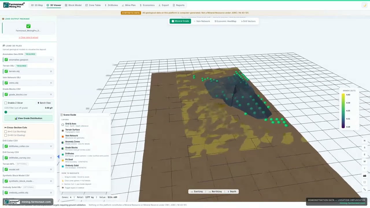
▶ What a 3D geological scene looks like when terrain, depth and grade are draped together (Farmonaut Mining Pro, de-identified demo data). · 5:12
How to find BGS borehole records
A borehole record is a geologist’s or surveyor’s log of what was drilled: location, rock descriptions with depth and thickness, and sometimes water levels, geophysical logs and geochemistry. BGS holds records of boreholes from one metre to several thousand metres deep, and the Single Onshore Borehole Index (SOBI) covers boreholes, shafts and wells dating back to at least 1790, with thousands of records added each year (BGS, Single Onshore Borehole Index). BGS says GeoIndex holds more than 1.8 million borehole records (BGS, mineral borehole drilling obligations), and its borehole records page describes over a million scanned onshore borehole, shaft and well records. The National Well Record Collection, searched with the same viewer, adds more than 130 000 classified records of wells, boreholes and springs in England and Wales (BGS, Borehole records).
To search a “British Geological Survey boreholes map”:
- Open GeoIndex (onshore) and zoom to your site. The borehole layer appears as points once you are close enough.
- Click a point to open its record, with the scanned log where one exists. Individual scans can be opened at no charge.
- Use the log descriptions to check the depth to bedrock, the thickness of superficial cover and any water strikes.
- For the whole index as GIS points, download SOBI under the Open Government Licence, or use its web service. Both are listed on the dataset page.
- If you want a formatted summary, BGS sells GeoReports and GeoRecords as premium products.
SOBI is an index. It tells you that a hole exists and where; the log and any core are separate items. For an exploration company, the useful questions are how deep cover is, whether earlier holes intersected the target rock, and whether core was kept.
Drilling rules and the National Geological Repository
If you drill, BGS is also where your records go. BGS states that anyone sinking a borehole deeper than 30 m to search for or get minerals must notify BGS before drilling and supply the records on completion, an obligation set out in section 23 of the Mining Industry Act 1926. BGS may ask for specimens of the material extracted. BGS prefers machine-readable data (CSV, with a PDF copy of the log) covering geological description, borehole construction and groundwater information, deposited through the NGDC Digital Data Deposit Application (BGS, mineral borehole drilling). BGS gives a separate 15 m threshold for water boreholes (BGS, National Geoscience Data Centre). Confirm the current statute text and your own duties with BGS before you drill.
Physical core and samples are held at the National Geological Repository (NGR) in Nottinghamshire. Its collections include more than 250 km of core, samples and cuttings from over 15 000 onshore boreholes, plus 350 km of core from offshore hydrocarbon wells. As of 7 October 2026, BGS has paused new deposits because the store is near capacity, while access to existing collections continues as normal (BGS, National Geological Repository). Limited sub-sampling is allowed, and the data from any sampling must be lodged with the NGR.
Mineral, mining and geochemistry data held by BGS
For a mineral explorer, the geology map is only the first layer. The datasets below turn it into a prospect screen. Counts and rates are from the BGS pages, 20 November 2026.
Chart
Records and samples behind BGS exploration datasets
Number of records or samples (each is a minimum or maximum as stated by BGS)
| Dataset | What it holds | Access |
|---|---|---|
| Mineral resources | Geological distribution of onshore mineral resources at 1:50 000 for England, Wales and the central belt of Scotland | Premium, GBP 0.14 per km2; sample and viewing in GeoIndex |
| BritPits | Surface and underground mineral workings across Great Britain, Northern Ireland, the Isle of Man and the Channel Islands: operator, commodity, status, planning authority. More than 260 000 entries in total, about 5 200 active, inactive and dormant sites | Index data open as WMS or in GeoIndex; full and active data licensed |
| Mining hazard (not including coal) | National assessment of where past underground non-coal mining may have occurred, built from geology, mine plans, literature and expert knowledge | Premium, GBP 0.35 per km2, subject to user, licence and data preparation fees |
| G-BASE stream sediment | Geochemistry of up to 110 794 sediment samples from small streams, analysed for up to 52 elements | Gridded data under the Open Government Licence; sample points under licence |
| UK topsoil geochemistry | 57 966 topsoil samples collected 1978 to 2014, analysed for 41 elements by XRF | Gridded data under the Open Government Licence |
| HiRes1 airborne geophysics | Magnetic, radiometric and VLF survey data | Viewable as a WMS |
Geochemistry is where the maps meet the target. The stream sediment maps use the less-than-150 micrometre fraction from first- and second-order (small) streams, and the open grids use 500 m cells. In south-west England, where mining history has left metals in river sediments and floodplain soils, BGS reports an average stream-sediment density of about one site per 2.5 km2 (BGS, G-BASE for south-west England). The UK stream sediment atlas gives open grids for 18 elements (BGS, UK stream sediment geochemistry). The topsoil dataset combines G-BASE data (76.4 per cent of samples), TellusNI (13.8 per cent) and a BGS-Rothamsted XRF set (9.8 per cent) (BGS, UK topsoil geochemistry).
Old exploration reports and mine plans
BGS and the UK Critical Minerals Intelligence Centre (CMIC) now publish the results of earlier exploration campaigns, which saves a new company from repeating them. Under the Mineral Exploration and Investment Grants Act 1972 (MEIGA), the government’s Department of Trade and Industry gave grants for exploration for non-ferrous metals, fluorspar, barium minerals and potash, and the projects ran between 1971 and 1984 (CMIC, MEIGA archive reports). All 662 reports are online through CMIC, and they contain geological mapping, soil and stream sediment geochemistry, geophysical surveys, core logs and assay data. The survey areas can be viewed in GeoIndex, and core from the 1970s and 1980s can be booked at the NGR (BGS news, 17 May 2024). CMIC lists the Gairloch copper-zinc-gold, Parys Mountain copper-lead-zinc and Hemerdon tungsten-tin deposits among the discoveries and developments the programme funded (CMIC, MEIGA archive reports). For Welsh gold, our page on the Gwynfynydd gold mine covers one project, and UK gold deposits maps the wider districts.
The Mineral Reconnaissance Programme reports add geological, geochemical, geophysical and mineralogical data for prospective areas (BGS MineralsUK, Exploration and maps).
Mine plans are the other half of a desk study. The non-coal mining plans viewer delivers more than 70 000 plans of sixteen types, including open cast, quarry and cave plans, and in June 2025 BGS added digital scans of over 500 Scottish abandoned-mine plans (BGS news, 24 June 2025). For coal mine plans in England, Scotland and Wales, the enquiry goes to the Mining Remediation Authority, and for Northern Ireland to the Geological Survey of Northern Ireland.
Chart
Where the UK topsoil geochemistry samples come from
Share of the 57 966 samples in the compiled dataset, per cent
What BGS data costs and which licence applies
BGS data comes in two tiers. “Open” data is published under the Open Government Licence (OGL). The OGL lets you copy, adapt and use the information commercially, as long as you acknowledge the source (The National Archives, Open Government Licence v3.0). BGS asks for this wording with reproduced material: “Contains British Geological Survey materials © UKRI [year]”. “Premium” data needs a paid licence from BGS or a reseller, and BGS prices it per square kilometre, subject to the number of users, a licence fee and a data preparation fee.
BGS’s OpenGeoscience service uses several open licences: the OGL for BGS, the BGS Open Licence, the BGS Non-Commercial Use Licence and the BGS Viewer Licence. The terms are shown at the top of each product page, so read them before you reuse material commercially (BGS, OpenGeoscience). A viewing right is not a download right: for example, the 1:50 000 geology can be viewed as a WMS layer or in GeoIndex, but a vector download for commercial use is licensed.
The calculator below turns the per-square-kilometre list rates into an estimate for your licence area. It uses the list rates from the dataset pages above; edit them if BGS has changed them. Results are list-rate estimates, not quotes.
Calculator
What would BGS list rates add up to for your area?
Enter your licence area and the BGS list rates per square kilometre.
- Area: 100.0 km2
- 1:250 000 geology: 0.70 GBP
- 1:10 000 geology (where it exists): 171.00 GBP
- Mineral resources layer: 14.00 GBP
Example values only, not a quote. Rates are the BGS list rates shown on its dataset pages on 20 November 2026 (GBP per km2); BGS adds user, licence and data preparation fees and may change rates. Area in km2 is hectares divided by 100.
A desk-study workflow for explorers and consultants
The order below is the one a geologist would follow when screening British ground before spending on fieldwork. It is a workflow, not a rule.
- Fix the boundary. Load your licence or prospect polygon into GIS and note its area in square kilometres (hectares divided by 100).
- Get the regional picture. Add the 625K and 250K geology to see which rock units and structures cross the area. MineralsUK notes that granite-related mineralisation in south-west England was mined mainly for tin and copper, and base-metal deposits were worked in the Pennines, central Wales and the Southern Uplands, so host rock and age are the first screen.
- Add the local map. Use the 50K geology to see contacts, faults and cover. Join each unit to its Lexicon record.
- Check cover. Compare bedrock and superficial themes and the borehole logs to see where thick cover limits both geochemistry and imagery.
- Add geochemistry. Use the stream-sediment and topsoil grids for elements linked to your commodity and pick out areas that stand out against their neighbours.
- Read the old reports. Check MEIGA and Mineral Reconnaissance Programme coverage. An earlier team may already have sampled, mapped or drilled the area.
- Search boreholes and mine plans. Look for old shafts, adits and drill holes, and the non-coal mining plans, to learn what was worked and at what depth.
- Check workings and hazards. BritPits and the mining hazard dataset show past workings and ground-stability risk near your sites.
- Add a surface screen. Satellite imagery maps surface and near-surface signatures such as iron-oxide, clay and structural patterns; sampling and drilling confirm them. A Farmonaut satellite mineral report is one way to add that screen on top of the BGS geology before you spend on fieldwork. Our guide to how satellite mineral exploration works explains the method.
- Confirm rights. Ownership of minerals and permission to explore are separate from geology. Check with the relevant authority and landowner before you apply or sample.
The same logic applies wherever a national survey publishes open geology. If you want to see another survey’s portal used in practice, the video below shows how to read Western Australia’s geological map, exploration report and mine databases.

▶ How to read a state survey’s map and report databases in practice: GeoVIEW.WA, WAMEX, MINEDEX and Tengraph for Western Australia. · 4:13
What to check before you rely on a BGS map
A geological map is an interpretation drawn at a given time. BGS provides no warranty as to the quality, accuracy or completeness of the open data it publishes. Before you put a line from a BGS map into a decision, check these points.
- Scale. A boundary on a 1:625 000 map can be hundreds of metres off a field contact. Do not use it for site decisions.
- Vintage. The 250K maps date from 1977 to 1993 and the 625K superficial layer from 1977. Names are updated; the observations are older.
- Coverage. The 50K data covers most, not all, of Great Britain, and the 10K data is partial. Coverage maps are on each dataset page.
- Artificial ground and landslides. BGS says maps of both can be out of date or incomplete.
- Licence and acknowledgement. Keep the dataset name, access date, licence and the required acknowledgement text with the desk study.
- Beta tools. If you use the beta GeoIndex, check results against the current app, because BGS says some layers are being reviewed and may look different.

▶ What a satellite map of surface clues shows and how to read it: iron oxide, clay and mica, silica and faults. · 4:18
Frequently asked questions
What are BGS geological maps?
They are the geological maps of Great Britain produced by the British Geological Survey, published on paper and as digital data at 1:625 000, 1:250 000, 1:50 000 and 1:10 000 to 1:25 000 scales. The digital versions can be viewed in the BGS Geology Viewer or GeoIndex and, depending on the dataset, downloaded or licensed.
Is the Geological Survey of Great Britain the same as the British Geological Survey?
Yes. The survey was renamed the Geological Survey of Great Britain in 1905, was known as the Geological Survey and Museum from 1919, became the Institute of Geological Sciences in 1966 and has been called the British Geological Survey since 1 January 1984 (BGS, Our history).
What is the difference between the BGS Geology Viewer and GeoIndex?
The Geology Viewer is a lightweight public app showing bedrock and superficial geology, with 3D terrain and a live legend. GeoIndex is a professional index of BGS data with boreholes, faults, samples, hazard maps, mine plans and options to produce PDF reports and clip data.
Where is the Geology of Britain viewer now?
It was retired on 1 August 2022. BGS says the BGS Geology Viewer and GeoIndex replace it, and that 3D cross-section data is available through the UK3D dataset.
How do I search BGS borehole records?
Open GeoIndex (onshore), zoom in until the borehole layer appears, and click a point to see the record and scan. The borehole records page also gives access to the National Well Record Collection for England and Wales, and the SOBI index can be downloaded as GIS points.
Do I have to tell BGS before I drill?
For a borehole deeper than 30 m to search for or get minerals, BGS says the Mining Industry Act 1926, section 23, requires notice before drilling and records on completion. BGS gives a 15 m threshold for water boreholes. Check the current rules with BGS before you start.
Are BGS maps available at no charge?
Some are. The 1:625 000 geology, SOBI and the geochemistry grids are open under the Open Government Licence. The 1:250 000, 1:50 000 and 1:10 000 downloads for commercial use are licensed, although the 50K geology can be viewed as a WMS layer or in GeoIndex.
Can I use BGS geology in QGIS?
Yes. BGS publishes web map services you can load as WMS layers, and its open datasets come as shapefile or GeoPackage downloads. BGS supplies QGIS style files for the 625K and 50K datasets.
What scale should I use for exploration?
Use 625K and 250K to choose a region and its host rocks, 50K to plan sampling and traverses at licence scale, and 10K to 25K only where it exists for site-level work. Always field-check boundaries.
Where can I find old mine plans in the UK?
Use the BGS non-coal mining plans viewer for non-coal mines in Great Britain, the Mining Remediation Authority for coal plans, and the Geological Survey of Northern Ireland for Northern Ireland.
Does BGS cover Northern Ireland?
The BGS 1:625 000 geology includes Northern Ireland, but BGS 1:50 000 and larger-scale datasets cover Great Britain. Northern Ireland’s detailed data, including its geochemical survey, comes from the Geological Survey of Northern Ireland.
Is BGS data suitable for a mineral resource estimate?
No. Maps, geochemistry and old reports help you pick targets. A resource estimate under a reporting code needs your own sampling, drilling and a competent person. Treat everything on this page as exploration information.
This page is for information only. It is not legal advice. BGS rates, licence terms and drilling obligations change, so confirm them with BGS and the relevant authority before you buy data, drill or apply for rights. Satellite screens and desk studies identify exploration targets, not resources.
Farmonaut mining
Screen your British licence area from space
Add a satellite mineral screen to the BGS desk study before you commit to fieldwork.
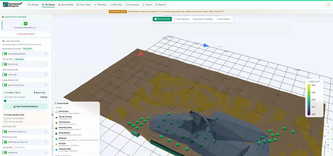
Mining Pro sample view, synthetic data
Sources
- BGS, BGS Geology Viewer: bgs.ac.uk
- BGS, GeoIndex (onshore): bgs.ac.uk
- BGS, Geology of Britain viewer (retired 1 August 2022): bgs.ac.uk
- BGS, BGS Geology (themes and datasets): bgs.ac.uk
- BGS, BGS Geology 625K: bgs.ac.uk
- BGS, BGS Geology 250K: bgs.ac.uk
- BGS, BGS Geology 50K: bgs.ac.uk
- BGS, BGS Geology 10K: bgs.ac.uk
- BGS, Single Onshore Borehole Index (SOBI): bgs.ac.uk
- BGS, Borehole records: bgs.ac.uk
- BGS, Mineral borehole drilling: legal obligations and data deposit: bgs.ac.uk
- BGS, National Geoscience Data Centre: bgs.ac.uk
- BGS, National Geological Repository: bgs.ac.uk
- BGS, Mineral resources dataset: bgs.ac.uk
- BGS, BritPits: bgs.ac.uk
- BGS, Mining hazard (not including coal): bgs.ac.uk
- BGS, G-BASE for south-west England: bgs.ac.uk
- BGS, UK stream sediment geochemistry: bgs.ac.uk
- BGS, UK topsoil geochemistry: bgs.ac.uk
- BGS news, MEIGA reports online (17 May 2024): bgs.ac.uk
- UK Critical Minerals Intelligence Centre, MEIGA archive reports: ukcmic.org
- BGS news, Scottish abandoned-mine plans (24 June 2025): bgs.ac.uk
- BGS, OpenGeoscience: bgs.ac.uk
- BGS, Web map services (WMS): bgs.ac.uk
- BGS, BGS Lexicon of Named Rock Units: bgs.ac.uk
- BGS, Our history: bgs.ac.uk
- BGS, About BGS: bgs.ac.uk
- BGS MineralsUK, Exploration and maps: bgs.ac.uk
- The National Archives, Open Government Licence v3.0: nationalarchives.gov.uk
- GOV.UK, Mining Remediation Authority: gov.uk
Discussion
Questions, corrections or field experience? Share them below. First-time comments are reviewed before they appear, and your email is never published.
No comments yet. Be the first to add a question or your experience.

 Mwerezi Minerals Company Limited
 Congo Mining Solutions
 Mining SARL
 SenGold Invest SAS
 Sania Corporation
 Sean Mining Limited
 NTS Group (Pty) Ltd
 Mine4Africa
 Lithspo Minerals Limited
 Tintina Mining Group
 Dalgety Minerals Pty Ltd
 Faith At Work (Pty) Ltd
 Geotech Mining Solutions plc
 Vulcan International Limited
 Kidepo Associates
 GKY Mining
 Alkimy SARL
 Double A Trading
 GemSprout Metals Limited

 Client · Somalia · Gold
 Client & affiliate partner · Ghana · Gold










