

Where Is Athabasca Basin? 7 Ways Mining Shapes Canada’s Land, Economy & Sustainability
- Athabasca Basin’s Location and Significance
- Geology, Hydrology & Resource Context
- Land Use Comparison Table
- 7 Ways Mining Shapes Canada: The Athabasca Basin Model
- 1. Sustainable Land Use & Planning
- 2. Agriculture, Farming & Soil Sustainability
- 3. Forestry, Watershed & Ecosystem Services
- 4. Modern Mining Operations & Environmental Stewardship
- 5. Infrastructure, Connectivity & Community Resilience
- 6. Technology: Satellite Sensing & Future Prospectivity
- 7. Integrated Land Capability & Adaptive Management
- Key Collaborative & Sustainable Insights
- FAQs about the Athabasca Basin
- Conclusion
Where Is Athabasca Basin? Discovering a Regional Powerhouse in Northern Saskatchewan, Canada
The Athabasca Basin, often phrased as athabasca basin canada in industry circles, is a vast stretch of land situated in the remote expanses of northern Saskatchewan, Canada. Stretching into the northwestern tip of the province and edging into northeastern Alberta, this region covers over 100,000 square kilometers.
Where is Athabasca Basin? The answer grounds us in a landscape far from major urban centers, but pivotal on the world stage due to its breathtaking concentration of high-grade uranium deposits. The nexus of resource extraction, resilient ecosystems, and human communities defines the Athabasca Basin as a crucible where mining, agriculture, and forestry intersect—offering invaluable lessons in land management, sustainability, and environmental stewardship.
Athabasca Basin isn’t solely a uranium hub—its environmental dynamics directly influence agricultural areas, forest resources, groundwater systems, and local community resilience. Effective planning here sets a benchmark for sustainable development around the world.
Geology & Resource Context: The Foundations of Athabasca Basin
The geology of the Athabasca Basin is both ancient and dynamic, defining its role as a global resource powerhouse. It sits atop thick, ancient sandstone formations—a geological setting that has produced the world’s richest uranium ore bodies. These sandstone sequences rest upon even older metamorphic basement rocks, forming a complex structural environment ideal for uranium mineralization.
Hydrology also shapes Athabasca’s fate. The basin’s stable, shallow groundwater systems influence everything from mineral extraction methods to soil moisture regimes in adjacent agricultural lands. Regional water quality—vital for forestry, agriculture, and wildlife—hinges on careful stewardship of these systems.
Mining here isn’t just about drilling for ore. It’s about understanding aquifer sensitivity, drainage patterns, tailings management, and the rehabilitation of disturbed lands. Each of these factors has far-reaching implications for land stability, nearby farming, and forest ecosystem health.

Highlights of the Athabasca Basin’s geology, hydrology, and environmental context:
- ✔ World-leader in uranium ore grade and concentration (over 20% of global supply).
- 📊 Stable, shallow groundwater supports wildlife and adjacent agriculture.
- 🌲 Thick forests, active wetlands, and peatlands sustain ecological diversity.
- 🏞 Altered drainage and tailings management impact both forestry and farming zones.
- ⚠ Crucial to understanding aquifer sensitivity for regional water security and soil health.
When assessing mining potential or environmental impact in the Athabasca Basin, integrate both surface water flow and groundwater systems into modeling and planning efforts. This dual-focus guides sustainable land management and minimizes negative cross-sector impacts.
Land Use Comparison Table: Mining, Agriculture, Forestry in the Athabasca Basin
| Land Use Type | Estimated Area Covered (sq km) | Major Activities | Estimated Direct Employment | Common Environmental Impact | Key Sustainability Measures |
|---|---|---|---|---|---|
| Mining | 1,500+ | Uranium extraction, ore processing, tailings management | 2,000 – 3,500 | Land disturbance, potential water & soil contamination, habitat loss | Containment, tailings treatment, progressive reclamation, environmental monitoring, regulatory oversight |
| Agriculture | 2,000–3,000 | Cropping, livestock, hay & pasture | 1,200 – 1,800 | Soil compaction, nutrient runoff, farm access disruption | Buffer zones, water quality monitoring, crop rotation, soil conservation practices, biodiversity corridors |
| Forestry | 15,000–18,000 | Timber harvest, reforestation, habitat management | 2,000 – 4,000 | Habitat fragmentation, sedimentation of streams, loss of biodiversity | Sustainable harvesting, watershed safeguards, riparian zone protection, habitat restoration, use of traditional knowledge |
Understanding the proportional land use and workforce distribution in the Athabasca Basin helps direct investment where sustainable practices offer both long-term returns and regulatory compliance, particularly in satellite based mineral detection.
7 Ways Mining Shapes Canada: The Athabasca Basin Model of Sustainability, Integration & Environmental Stewardship
1. Sustainable Land Use & Planning in the Athabasca Basin
Smart, responsive land-use planning defines the relationship between mining operations and the broader basin landscape. Given the Athabasca Basin’s fragile hydrology, ancient geology, and intensive resource utilization, land-use frameworks must be robust. Planners employ an ecosystem-wide approach—factoring in the sensitivity of aquifers, surface water interactions, habitat connectivity, and the stability of adjacent lands.
Zones near mining sites often require:
- ✔ Environmental buffer zones to reduce dust, noise, and visual disturbance
- 🌾 Soil health monitoring and protection of organic matter for resilient agriculture
- 🛰 Remote sensing for surface changes, supporting adaptive management
- ⚠ Cautious management of access routes to minimize soil compaction and erosion
- 📊 Reclamation and rehabilitation plans to restore post-mining land capability
For forward-thinking companies exploring new mineral resources, satellite based mineral detection provides a low-impact alternative, identifying target zones while preserving land until physical confirmation is warranted.

Underestimating the influence of basin-wide hydrologic connectivity can lead to inappropriate site selection and regulatory delays.
New tools—like those offered by Farmonaut—help mitigate such oversights by providing a regional context for project planning.
2. Agriculture, Farming & Soil Sustainability: Balancing Benefits & Risks Near Mining
Agriculture in the Athabasca Basin context is shaped by proximity to mining activity, forest zones, and the hydrology of the region. Farms near active mining operations must address not only the direct impact of industrial activities, but also subtle effects on soil, water, and land management:
- ✔ Regular monitoring programs for groundwater and surface water quality
- 🛡 Buffer and transition zones to minimize dust and particulate deposition on crop fields
- ⚙ Careful management of farm access routes to reduce compaction and support harvesting
- 🌱 Adaptive crop selection and rotation strategies that respond to shifts in moisture regimes
- 🌸 Frameworks for preserving soil biodiversity and organic matter, supporting agroecosystem resilience
Crop yields and farm profitability are closely tied to soil health, especially in rugged or rapidly changing landscapes. Robust planning ensures sustainable agricultural value without compromising resource stewardship.
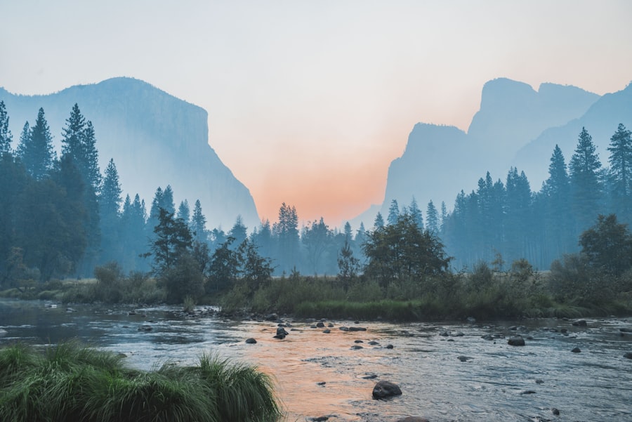
Some of the crucial soil and water management strategies in these agricultural and adjacent mining zones include:
- ✔ Use of soil moisture sensors and remote environmental data to inform irrigation and nutrient management
- 📊 Satellite-driven agricultural monitoring systems such as Farmonaut’s Satellite Services to proactively track crop health, stress, and nutrient changes
- ⚠ Early-warning systems for unforeseen contamination or hydrologic shifts
- 🌱 Collaboration between agronomists, environmental scientists, and mining companies on land rehabilitation plans
- 🔁 Reinstatement of agricultural capability after mining closure via targeted soil restoration and biodiversity practices

3. Forestry, Watershed & Ecosystem Services: Building Resilience in the Athabasca Basin
Forestry remains a vital pillar of both the regional economy and ecosystem stability in the Athabasca Basin. Forest landscapes filter groundwater, sustain surface water quality, and provide habitat for species across the northern Saskatchewan region.
As mining activity waxes and wanes, forest managers employ a range of ecosystem service safeguards:
- 🌲 Watershed integrity protection—reducing sediment loads, preventing stream erosion, ensuring clean surface water reaches downstream farms & communities
- 📊 Riparian zone conservation—buffering habitats, supporting biodiversity, and regulating hydrologic flow across adjacent lands
- 🔁 Reforestation and ecological restoration—repairing disturbed mining leases and enhancing long-term forest resilience
- 🌱 Adoption of both traditional and modern silviculture techniques for sustainable resource management
- 💧 Water quality safeguards built into forest harvest plans

Cross-sector integration—blending forest science, modern remote sensing, and local/Indigenous knowledge—delivers resilient forests that support both wildlife and industry for generations.
4. Modern Mining Operations & Environmental Stewardship in the Athabasca Basin
Uranium mining operations in the Athabasca Basin are renowned worldwide for the sheer richness of their ore—sometimes 10 to 100 times higher than deposits elsewhere. However, modern mining is as much about environmental stewardship as it is about extraction and profit.
Progressive rehabilitation, intensive environmental monitoring, and industry-leading tailings management are non-negotiable features of today’s operations. Closely tracked indicators include:
- 🛡 Groundwater and surface water quality—ensuring no spread of radioactive elements or acid mine drainage
- 📈 Soil health and compaction levels—especially in zones bordering agricultural lands
- 🌱 Vegetation regrowth and biodiversity indices—informing ecosystem recovery post-mining
- ⛏ Tailings containment integrity—avoiding catastrophic leaks or groundwater infiltration
- 📊 Continuous stakeholder engagement (Indigenous communities, farmers, municipal agencies)
Technologies like satellite-based monitoring (learn more here) are increasingly integral, providing near-real-time updates and historical change analysis to guide responsible mining development.
Overlooking the value of early-stage remote sensing data during exploration. Failing to properly assess sensitive zones before fieldwork often increases costs and prolongs regulatory review. Farmonaut helps shift exploration from ground to satellite, minimizing risk.

5. Infrastructure, Connectivity & Community Resilience in Athabasca Basin
Resource-based activity in the Athabasca Basin supports a sprawling network of roads, power lines, transportation links, and community services. Strategic infrastructure planning underpins both economic and social resilience:
- 🏗 Road and rail access—critically important for mineral exports, farm product transport, and forestry supply chains
- ⚡ Energy infrastructure—powering mining operations, local services, and remote communities
- 🏘 Housing and healthcare—supporting labor mobility for mines, mills, and farms alike
- 🌦 Climate-adaptive infrastructure—engineered for harsh winters, flood risk, and wetland preservation
- 📈 Integrated development planning—aligning with long-term land use capability and sustainable management
Collaborative infrastructure development delivers maximum regional benefit—supporting mining, agriculture, forestry, and community health—only when paired with rigorous environmental and climate resilience safeguards.

6. Technology: Satellite Sensing, 3D Mapping & Mineral Prospectivity in the Athabasca Basin
Technology has redefined how companies explore, assess, and manage mineral and resource operations. Satellite based mineral detection and 3D prospectivity mapping are now vital tools in de-risking early-stage exploration and supporting responsible, non-invasive development.
Farmonaut specializes in satellite-driven mineral intelligence, employing Earth observation, AI, and remote sensing to:
- 📡 Rapidly screen vast land areas for high-potential mineral zones with Satellite-Based Mineral Detection
- 🌏 Enable multi-mineral detection (gold, copper, rare earth, uranium) across all continents and geological settings
- 📊 Deliver structured intelligence reports with deposit heatmaps, geological structures, and commercial guidance within days
- ⛏ Power 3D mineral prospectivity mapping—accurate modeling of sub-surface ore trends (see example here)
- ♻ Support ESG-driven exploration, reducing environmental disturbance and emissions
Are you considering new exploration or expansion? Map Your Mining Site Here: mining.farmonaut.com – Satellite analysis delivers rapid results for smarter, safer ground-truthing.

- ✔ Time & Cost Advantage: Farmonaut’s approach reduces mineral screening timelines by up to 85% and eliminates the bulk of early-stage ground disturbance.
- 📊 Data Insight: More than 80,000 hectares and 18+ countries surveyed; applications include gold, copper, uranium, lithium, and rare earth element mapping.
- 💡 Workflow Simplicity: Clients simply define their area of interest and minerals—the rest is handled through advanced analytics, delivering actionable intelligence.
- ⚠ Risk Control: Early, accurate detection avoids unnecessary drilling spend and supports targeted compliance with regional land use frameworks.
- 🏆 Strategic Sustainability: Supports responsible investment & ESG objectives critical for investment and public acceptance.

7. Integrated Land Capability & Adaptive Management: Athabasca’s Blueprint
The Athabasca Basin’s enduring value lies in its adaptable, multifaceted land use—not just in mining riches but in the ongoing capacity of its soil, forests, water, and infrastructure to support diverse industries.
Adaptive management practices—with cross-sector monitoring, science-driven planning, and strong stakeholder engagement—build powerful resilience:
- 🌊 Integrated water management, balancing extraction, farming, and habitat requirements
- 🌳 Diversified land restoration objectives (post-mining land capability for agriculture, forestry, and conservation)
- 📈 Data-driven and satellite-monitored feedback loops
- 🔬 Continuous learning from satellite, drone, and on-ground sensors
- 👥 Community-driven frameworks leveraging both Indigenous and Western science traditions
🌱 Integrated Sustainability Logic
- Basin-wide monitoring (satellite, drone, in-situ)
- Adaptive management—policy and operations respond to real-time feedback
- Seasonal land use adaptation—agriculture, forestry, and mining share ecosystem services
- Restoration-first closure planning—reclaiming land for future use
📊 Resilient Economy Framework
- Diverse employment across mining, agriculture, forestry, and services
- Investment supports infrastructure and climate-adaptive technologies
- Export-driven value chains—minerals, timber, farm products
- Stakeholder engagement secures social license & innovation transfer
🌍 Ecosystem Health Checklist
- Continuous water & soil monitoring
- Maintain habitat corridors for wildlife migration
- Regular biodiversity surveys post-disturbance
- Reforestation and cover crop strategy on reclaimed land
✔ Smart Development Practices
- Satellite-based exploration & monitoring (near zero disturbance)
- Local partnerships with technical experts
- Robust regulatory compliance (federal and provincial)
- Land use zoning—protection for sensitive areas
Looking to identify high-potential mineral zones without causing environmental disturbance?
Map Your Mining Site Here—We use satellite-based analysis and AI-driven methods to provide you with rapid, actionable assessments across the Athabasca Basin and beyond.
Key Collaborative & Sustainable Insights
- ✔ Collaboration between mining operators, agricultural users, and forest managers strengthens environmental safeguards and community resilience
- 📊 Data-driven management leveraging satellite-driven mineral detection and monitoring creates a factual basis for smart, adaptive decisions
- 🌲 Rehabilitation planning before extraction begins ensures post-mining land use supports forest recovery, agriculture, and heritage preservation
- ⚠ Community engagement at all stages—exploration, development, closure—secures social and regulatory license to operate
- 🌍 Integrated planning helps maintain Athabasca Basin’s global leadership in sustainable resource management, not just mineral output
FAQs about the Athabasca Basin, Canada
- Where is Athabasca Basin and why is it so important?
- The Athabasca Basin is located in northern Saskatchewan, Canada, extending slightly into Alberta. It’s globally critical for hosting over 20% of the world’s high-grade uranium, making it essential for global nuclear power and clean energy.
- How does mining in the Athabasca Basin affect agriculture and forestry?
- Mining modifies land, surface water, and sometimes groundwater, which can influence soil moisture, quality, and nearby watershed stability. Robust land use planning, buffer zones, and coordinated monitoring help minimize adverse outcomes and support enduring agroforestry and farming value.
- What sustainability measures are in place for mining operations?
- Environmental safeguards include state-of-the-art containment for tailings, progressive land rehabilitation, regular water/soil/biodiversity monitoring, and stakeholder engagement. Modern satellite-driven approaches (such as those of Farmonaut) enhance non-invasive exploration and ongoing site compliance.
- How does satellite mineral detection improve resource management in the basin?
- Satellite-based mineral detection, as offered by Farmonaut, accelerates exploration by rapidly identifying promising mineral zones with no ground disturbance. This aids in targeted exploration, reduces costs, and optimizes compliance with environmental and land use regulations.
- Where can I get further support for mapping mining sites or sustainable mineral exploration?
- You can use Farmonaut’s platform for rapid, space-based mineral prospectivity analysis: Map Your Mining Site Here. For tailored quotes or support, visit Get Quote or Contact Us.
The Athabasca Basin is at the crossroads of sustainability, economic growth, and strategic resource supply. Smart investors and forward-thinking companies leverage satellite-driven mineral intelligence and robust land use planning to secure both returns and reputation.
Conclusion: The Athabasca Basin’s Future—A Model for Integrated Resource Stewardship
The Athabasca Basin of northern Saskatchewan, Canada, stands as both a resource powerhouse and a global reference point for integrated land management. Spanning over 100,000 square kilometers, it hosts the world’s richest uranium deposits amid thriving forest and agricultural sectors. Its unique juxtaposition of mining, agriculture, and forestry—each demanding careful management of soil, water, and ecological health—demonstrates the necessity of collaborative planning, environmental stewardship, and technological innovation.
New tools such as satellite-based mineral detection and 3D prospectivity mapping provide low-impact, high-confidence intelligence—enabling responsible decision-making and value creation before the first drill is turned or bulldozer deployed.
Ultimately, the real legacy of the Athabasca Basin will not just be the tonnes of ore extracted or the economic cycles driven, but its demonstration that resource extraction, food production, forest management, and ecosystem protection can co-exist through science-driven, adaptive management and a true commitment to environmental resilience.
For any mining company, planner, or investor seeking to engage with sustainable resource operations: Map Your Mining Site Here or Contact Us to join a future where land, water, and community are respected as much as profit.
For more information or a custom exploration quote, visit: Get Quote
Contact Us: farmonaut.com/contact-us
Explore our satellite-based mineral intelligence: Learn More
Discussion
Questions, corrections or field experience? Share them below. First-time comments are reviewed before they appear, and your email is never published.
No comments yet. Be the first to add a question or your experience.

 Almosi SARL
 SRK Consulting
 Berks Gold Limited
 Mwerezi Minerals Company Limited
 Mining SARL
 SenGold Invest SAS
 Sean Mining Limited
 NTS Group (Pty) Ltd
 Mine4Africa
 Lithspo Minerals Limited
 Tintina Mining Group
 Dalgety Minerals Pty Ltd
 Vortex Minerals Pty Ltd
 Faith At Work (Pty) Ltd
 Geotech Mining Solutions plc
 Licence holder · Nigeria · Gold + lithium










