Applications of Drones, GIS, and Potash in Cropping Management: The Revolution of 2025
Introduction: A New Era in Cropping Management
In recent years, advancements in technology have profoundly transformed agricultural practices, leading to more efficient and sustainable farming systems. Among pioneering tools, the applications of drones, GIS in agriculture cropping management, and innovative approaches to the application of potash in plants increases crop productivity, stand out as cornerstones in reshaping the way we manage fields.
As we look toward 2025 and beyond, these technologies promise a revolution in precision, resource conservation, and yield optimization. In this comprehensive guide, we’ll explore the role and synergistic impact of drones, GIS, and potash—illustrating how field data, sensors, spatial analysis, and synthesized inputs enable smarter decisions, minimize environmental impact, and enhance farm sustainability.
Whether you’re a farmer, agronomist, researcher, technology provider, or policymaker, understanding these integrated systems is critical for navigating the future of agriculture and ensuring high-quality, sustainable yields.
Applications of Drones in Agriculture Cropping Management
Modern drones have become indispensable across agricultural landscapes due to their ability to capture aerial imagery rapidly and offer precise, cost-effective data. With drones equipped with multispectral and thermal sensors, we’re able to collect detailed field-level data that provides real-time insights into:
- Crop health monitoring (NDVI, plant vigor, pest/disease detection)
- Soil conditions (fertility, moisture content, compaction)
- Irrigation efficacy (identifying water stress zones)
- Pest infestations and spread
- Mapping yield variability within fields
These inputs empower precision management—whether it’s watering, fertilizing (especially potash), or pesticide application, interventions can be targeted only where needed. This dramatically minimizes waste, reduces input use, and conserves environmental resources.
Key Features of Drones in 2025
- Automated crop scouting: Monitor every hectare several times per week without manual inspection
- Seed planting & localized agrochemical delivery: Support for direct planting and delivering precise doses of nutrients or pesticides
- AI-powered in-flight analysis: Drones can process data on the fly for actionable insights (e.g., identifying and mapping nutrient deficiencies in real time)
- Enabling variable rate applications: Adjust seed, fertilizer, or pesticide rates based on fine-scale field variability
- Data-driven management: Drone-captured data feeds integrated farm management platforms
This level of automation and integration is essential as farms increase in size and complexity—enabling the management of large tracts efficiently and ensuring timely interventions for maximum yield and sustainability.
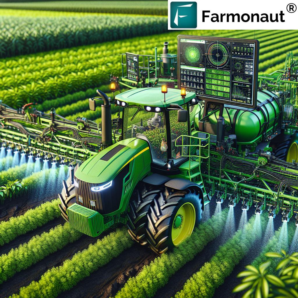
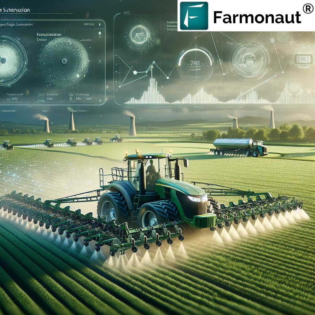
Drone Technology in Action: Precision & Automation
Drones don’t just gather data—they’re now pivotal in implementing decisions. For example, a drone equipped with a sprayer can treat pest hotspots only, or distribute potash fertilizer precisely where soil or crop sensors signal a deficit.
- Automated scouting missions: Drones map and re-map every hectare, offering multi-temporal analysis and reducing labor dependency
- Localized agrochemical application: By delivering doses only where necessary, we dramatically cut down chemical use and environmental impact
- AI integration: Machine learning models enable real-time identification of disease or nutrient stress, making corrective measures instant and data-backed
- Fleet management and logistics: Integrated with platforms for efficient scheduling and deployment of multiple autonomous drones
The impact? Significant boost in resource efficiency, yield improvement, and environmental protection—all tailored to the unique spatial variability of each field.
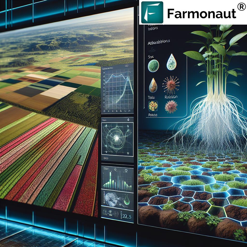
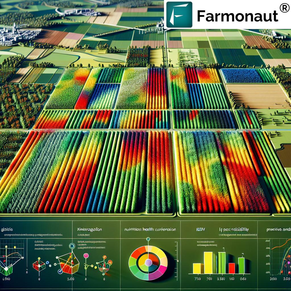
Role and Applications of GIS in Agriculture Cropping Management
Geographic Information Systems (GIS) are powerful technology platforms that allow farmers to view and manage data across spatial and temporal scales. In 2025, the applications of GIS in agriculture cropping management form the digital backbone of every modern farm.
How GIS Transforms Cropping Management
- Aggregrate multi-source data: Combining soil fertility maps, weather, yield histories, and topography for a holistic overview
- Map & model field variability: Site-specific management zones are created to optimize input applications (precision irrigation, variable rate fertilization, pest control)
- Simulate cropping patterns and rotations: Forecast the productivity and environmental outcomes under various scenarios to improve decision making
- Support adaptive management: Integrating climate and historical yield data to forecast risks and advise on resilient cropping systems
- Enable long-term planning: Support for sustainable land management to sustain soil health and productivity for future generations
By 2025, GIS platforms are not just for mapping. They’re about making management decisions smarter, faster, and more sustainable.
Notably, applications of GIS in agriculture cropping management support the transition to AI-driven farm operation—with seamless integration of satellite, drone, and ground-level data for real-time management.
Integrating Data: Drones & GIS for Smarter Farming
When drones and GIS are used together, farms benefit from a synergistic leap in data accuracy, spatial resolution, and actionable insights.
- Drone data feeds into GIS: Real-time aerial imagery, thermal scans, and multispectral images are layered onto GIS platforms for spatial and temporal analysis
- Variable rate application (VRA): GIS guides drone-driven VRA (e.g., only spray potash where needed based on soil and crop health maps)
- Pest and irrigation management: Drones detect infestations and water stress areas, GIS spatially targets interventions
- Spatial-pattern monitoring: Combined drone-GIS insights identify yield-limiting factors, sub-field variability, and support sustainable farm management practices
- Real-time corrective action: Automated detection of stress zones leads to immediate, targeted management decisions
This dual precision technology approach reduces input use, increases yields, and protects environmental assets—all while providing a robust record for compliance and traceability (see Farmonaut’s blockchain-based traceability solutions).
Application of Potash in Plants Increases Crop Productivity
Potash—primarily consisting of potassium-based fertilizers—plays a pivotal role in plant physiology, water regulation, enzyme activation, and disease resilience. Let’s break down why precise potash application is crucial for crop management in 2025:
- Optimal potassium supply: Essential for effective photosynthesis, growth, and grain quality
- Improved drought tolerance: Potassium enhances water uptake, reducing drought impact
- Better disease resistance: Well-nourished plants withstand pest infestations and stresses better
- Nutrient use efficiency: Maximizes uptake of other fertilizers, increasing resource efficiency and reducing runoff
Efficiency in 2025: Precision Potash Management
- GIS-guided soil testing: Identifies fields and sub-zones with potassium deficiencies
- Drone-implemented application: Drones deliver potash exactly where, and when, needed in the crop cycle
- Enhanced efficiency fertilizers (EEF): Use of slow-release and stabilised potash products for sustained nutrition
- Integration with crop health monitoring: Real-time satellite/drone data ensures timely corrective measures
Accurate application of potash in plants increases harvest quality and quantity while improving resilience to future climate and environmental shocks.
Comparative Benefits Table: Drones, GIS, and Potash in Cropping Management
| Technology | Main Functions | Estimated Yield Improvement (%) | Estimated Resource Savings (%) | Environmental Benefit | Cost Implication (Est. % Change) | Sustainability Impact |
|---|---|---|---|---|---|---|
| Drones | Crop scouting, precision input application, aerial mapping, disease & pest monitoring | 15% | 20% | Minimizes chemical & water use; reduces emissions from machinery | -10% (net savings) | Promotes targeted farming, supports precision sustainability goals |
| GIS | Spatial data management, site-specific input planning, zone mapping, resource forecasting | 12% | 15% | Guides optimal input use, supports long-term land & water conservation | -8% (net savings) | Enables adaptive management, resilience against climate variability |
| Potash Application | Nutrient supply, disease resistance, stress mitigation, crop quality improvement | 10% | 12% | Reduces fertilizer waste & leaching, improves soil fertility | -7% (optimized application) | Strengthens plant resilience, boosts long-term soil health |
Synergistic Impact & Future Outlook: Toward 2025 & Beyond
The integration of drones, GIS, and precision potash application produces a multiplier effect—empowering precision agriculture with unmatched accuracy. Here’s how this synergy shapes the future of cropping management:
- Drones capture actionable field data → GIS platforms spatially model nutrient needs and field variability
- Potash application is precisely targeted based on current crop health, soil status, and future weather predictions
- Environmental impacts are minimized—less input overapplication, reduced runoff, lower carbon emissions from machinery
- Sustainability and profitability are balanced through data-driven farming strategies, variable rate applications, and real-time AI advisories
- Long-term resilience against climate risk is reinforced by maintaining soil fertility and crop health
As the world’s food demand grows, and as climate and resource constraints intensify, this integrated approach promises a revolution in how farmers manage their fields and resources.
Learn how Farmonaut’s Carbon Footprinting strengthens sustainable agriculture
How Farmonaut Empowers Next-Gen Cropping Management
At Farmonaut, our mission is to democratize access to advanced, satellite-driven agricultural insights for everyone—from individual farmers to large agribusinesses and governments. Our solutions seamlessly integrate satellite imagery, AI-based advisory, blockchain traceability, and resource management—making precision agriculture not just possible, but practical and affordable.
- Satellite-Based Monitoring: We provide continuous monitoring of crop health, soil conditions, water stress, and pest risks—across every field and every season
- AI Advisory Systems: Our JEEVN AI delivers real-time advice on irrigation, fertilization, and disease prevention to maximize yields and efficiency
- Blockchain-Based Traceability: Secure, transparent tracking for every crop lot and supply chain stage—enhancing market trust
- Environmental Impact Monitoring: Real-time carbon tracking and soil health management tools for sustainable farming
- Multi-Platform Access: Our services are available by Android, iOS, web/browser App, and API—with plug-and-play options for any farm size


- Data Integration: Our API and Developer Docs enable any agritech business or institution to harness Farmonaut data within their systems.
Explore Large Scale Farm Management Solutions from Farmonaut
Want to track machinery use and reduce input waste? Farmonaut’s
Fleet & Resource Management
enables efficient logistics and fleet oversight for large and small farms.
Need verification for crop loans and agricultural insurance? Our
crop loan and insurance verification
leverages real-time satellite data for fast, fraud-resistant claims.
Farmonaut Subscription Plans (Affordable, Scalable, Transparent)
FAQ: Drones, GIS, and Potash in Cropping Management
-
Q: How do drones enhance crop management efficiency in agriculture?
A: Drones offer rapid, high-resolution aerial imagery for real-time crop scouting, disease/pest detection, and input management. This enables precision interventions—reducing waste, labor, and environmental impact while increasing yield. -
Q: What are the main applications of GIS in agriculture cropping management?
A: GIS aggregates and spatially analyzes soil, weather, yield, and topography data. Farmers use this to map management zones, enable variable rate applications, simulate cropping patterns, and forecast resource needs. -
Q: Why is the application of potash in plants critical for productivity?
A: Potash supplies potassium, which is vital for growth, water regulation, stress resilience, and quality/yield improvement. Precision potash management ensures optimal supply—boosting productivity while minimizing environmental impact. -
Q: What is the synergistic benefit of combining drones, GIS, and potash in cropping management?
A: Together, they provide fine-scale, actionable field data (drones), spatially optimize input use (GIS), and enhance crop nutrition and resilience (potash)—synergistically increasing yield, efficiency, and sustainability. -
Q: How does Farmonaut support these technologies in agriculture?
A: Farmonaut offers satellite monitoring, real-time AI-based advice, blockchain traceability, and integrated resource management tools—making advanced crop management accessible, scalable, and cost-effective for all farm sizes. -
Q: Can these solutions be used for large and small farms alike?
A: Yes. Drones and GIS platforms scale from individual fields to large estates. Farmonaut’s web, mobile, and API solutions are designed for flexibility, affordability, and maximum impact, regardless of operation size. -
Q: Is training required to use these systems?
A: Minimal training is needed with platforms like Farmonaut, which emphasize user-friendly interfaces and built-in AI-guided advisories. Users can also access online tutorials and webinars for deeper learning. -
Q: How will future advancements shape cropping management by 2030?
A: Expect greater automation, real-time AI analytics, increased data connectivity, and even more sustainable input use. The drive toward fully autonomous precision agriculture systems will further maximize yields, profitability, and environmental stewardship.
Conclusion: Shaping Agriculture’s Future
The applications of drones, GIS in agriculture cropping management, and precise potash application are not merely trends—they are cornerstones of farming’s technological revolution. As we enter 2025 and beyond, these integrated systems will define how farmers increase yield, optimize efficiency, and conserve resources—all while supporting the planet for future generations.
At Farmonaut, we’re passionate about making data-driven, scalable, and sustainable agricultural technology accessible to all. Reach out or start now by exploring our apps and API integrations—or discover our solutions for blockchain traceability, carbon footprinting, fleet management, and crop insurance.
The future of farming is here—synergistic, intelligent, and sustainable. Will you join the revolution?