

Best Drone Software for Agriculture: Top Drones 2025
Over the recent years, drone technology has revolutionized modern farming practices, marking a significant leap toward precision agriculture and data-driven decision-making. As we move into 2025, the demand for the best drone software for agriculture continues to surge, with technological advancements further enhancing productivity, efficiency, and sustainability in agriculture. From advanced crop analysis to real-time monitoring and AI-driven mapping, the synergy between drones and software is redefining what’s possible for farmers worldwide.
This article delves deeply into the top drones for agriculture in 2025, explores the leading agricultural drone software platforms, and examines agriculture drone software development trends that are set to shape the future of farming.
“Over 70% of top agricultural drones in 2025 feature AI-powered crop analysis for enhanced precision mapping.”
Best Drones for Agriculture in 2025
The modern agriculture drone is now a multi-functional hub, serving critical functions including crop monitoring, real-time soil analysis, fertilizer and pesticide spraying, and even precision mapping for land use optimization. As the agriculture landscape shifts in 2025, the following drone models stand out for their reliability, technical innovation, and user-friendly deployment:
1. DJI Agras T30
The DJI Agras T30 remains a leader in agri-drone innovation. With a heavy payload capacity of up to 30 liters, it is designed to tackle large fields and commercial farm operations. Its efficient spraying system ensures each drop counts, reducing pesticide waste and optimizing chemical usage. This drone uses AI-powered route planning to manage varied terrains with ease, enabling farmers to maximize coverage and yield with minimal input costs.
Key Features:
- 30-liter payload & heavy-duty design
- AI route planning to optimize field coverage
- Efficient and uniform spraying system
- Compatible with multispectral sensors for precise crop analysis
- Ideal for: Large-scale commercial farms
2. Parrot Bluegrass Fields
The Parrot Bluegrass Fields is a top choice for crop scouting and detailed agricultural imaging. It’s well-regarded for its multispectral imaging capabilities, allowing direct and precise detection of crop health, early disease outbreaks, and irrigation needs. Farmers can leverage the actionable data to make rapid, informed decisions and safeguard their fields.
- High-resolution multispectral and RGB sensors
- Lightweight and portable design, perfect for smaller or irregular fields
- Automated image processing and rapid field scanning
- Ideal for: Precision crop health monitoring and disease detection
3. SenseFly eBee X
The SenseFly eBee X excels for those who need to cover large farms quickly. Its extended flight time and interchangeable sensor system (including multispectral and RGB cameras) support comprehensive crop and soil mapping. The eBee X’s design allows data collection for up to 500 hectares on a single flight, making it highly efficient for extensive field coverage and detailed vegetation maps.
- Fixed-wing, long-endurance design
- Wide range of sensors (multispectral, RGB, thermal)
- Actionable, high-resolution vegetation and topographic maps
- Ideal for: Rapid, scalable mapping of large agricultural fields
Why These Models Stand Out
- Integration of AI-powered analytics and planning for smarter input use and reduced environmental impact.
- Support for multiple sensors, including multispectral imaging, giving deeper insights into crop and soil health.
- Reliable hardware design suitable for varied terrains, high payloads, and both large and small farms.
- Seamless compatibility with best-in-class agriculture drone software platforms.
Check out state-of-the-art agriculture drone demonstrations in these videos:

Best Agriculture Drone Software Platforms in 2025
Hardware alone isn’t enough—the software you use with your agricultural drone fleet determines the depth and timeliness of your insights. The best drone software for agriculture in 2025 blends user-friendly interfaces, seamless data processing, AI analytics, and direct integration with other farming management tools. Let’s explore the top software platforms:
DroneDeploy
DroneDeploy is renowned for its comprehensive mapping and real-time analytics. Farmers can use its cloud-based tools to easily generate detailed NDVI vegetation maps, assessing crop health and seeing where intervention is needed. Its collaboration features enable every stakeholder—from field staff to consultants—to access, analyze, and act on data swiftly.
- NDVI & variety of vegetation indices
- Automated, fast flight planning and route optimization
- Sharing & collaboration tools for large teams
- Integration with other platforms and data sources
Pix4Dfields
Designed specifically for agriculture, Pix4Dfields offers fast, field-ready mapping and advanced analytics. With in-the-field processing and instant prescription map generation, it helps farmers make decisions on-the-go, enhancing farming efficiency and reducing both input costs and environmental impact.
- On-site data processing for immediate results
- Variable-rate prescription maps
- AI-powered weed and pest analysis
- Compatible with most commercial drones
Agremo
Agremo specializes in AI analytics and automated data transformation for crop monitoring. It automatically performs tasks like plant counting, weed detection, and pest identification using computer vision. Farmers receive actionable reports that point directly toward which plots need the most urgent intervention—saving both time and resources.
- Cloud-based AI for actionable analysis
- Plant population and emergence mapping
- Pest outbreak alerts and zoning tools
- Customizable analytics for different crop types

Platforms Supporting Integration and APIs
Many agriculture drone software development platforms now offer APIs and data export features. This approach facilitates seamless integration with farm management systems, weather platforms, and third-party analytics. For those looking to build custom workflows or connect drone data into broader agribusiness operations, check out the Farmonaut API and our detailed API Developer Docs.
Comparison Table: Top Agricultural Drone Software & Drones 2025
| Drone/Software Name | Main Features | Estimated Price Range ($) | Compatibility (Platform) | Release Year | Unique Innovation |
|---|---|---|---|---|---|
| DJI Agras T30 | Efficient 30L Spraying, AI Route Planning, Multispectral Imaging Support | $20,000–$27,000 | DJI, Android, iOS, Web | 2023–2025 | Heavy Payload & AI-powered Efficient Coverage |
| Parrot Bluegrass Fields | Multispectral Imaging, Precise Crop Health Detection, Compact Design | $6,000–$7,500 | Parrot, Android, iOS | 2024 | Portable, Multispectral Crop Monitoring |
| SenseFly eBee X | Extended Flight, Multiple Sensors, High-res Mapping | $15,000–$25,000 | SenseFly, Web, Cloud, Local Apps | 2023–2025 | Extreme Field Coverage, Up to 500 Ha/flight |
| DroneDeploy | Comprehensive Crop Mapping, NDVI Analysis, Real-Time Collaboration | $1,200/year (starting) | Web, Android, iOS, Drone APIs | 2025 | Cloud-Based Multi-Stakeholder Platform |
| Pix4Dfields | Instant Prescription Mapping, In-Field Processing, Variable Rate | $3,000/year (starting) | Web, Mac, Windows, iOS | 2025 | On-Site Data Analysis & Prescription Integration |
| Agremo | AI Analytics, Automated Pest/Disease Detection, Custom Reports | $900/year (starting) | Web, Android, iOS, Data Export APIs | 2025 | AI-Based Multi-Crop Analysis Engine |
Satellite Technology & Data Integration: Farmonaut’s Perspective
When examining the best drone software for agriculture, it’s important to understand how satellite-based technologies and drone data can work together to provide farmers and agri-businesses with even more comprehensive, actionable insights.
At Farmonaut, we specialize in satellite-based solutions that complement and extend the value of traditional drone platforms. Our real-time monitoring systems use multispectral satellite imagery to analyze vegetation health (NDVI), soil conditions, and field-level anomalies.
Through our web and mobile apps, as well as the Farmonaut API, users can seamlessly integrate drone-derived data with satellite analysis for a complete, always-up-to-date view of their farms and assets.
- AI-based Advisory: With Jeevn AI, we deliver real-time crop advisories, tailored strategies, and weather updates using satellite-driven insights, enabling more precise, data-led farming decisions.
- Blockchain-Enabled Traceability: Our blockchain-based traceability tools help users track their entire agriculture value chain, reducing fraud and enhancing transparency inside agricultural supply chains.
- Resource & Fleet Management: Using satellite monitoring and advanced analytics, our fleet management solutions help large-scale operations optimize vehicle and equipment usage, reducing operational costs.
- Environmental Impact Tracking: Carbon footprint monitoring for agriculture enables compliance with environmental regulations while supporting sustainability initiatives.
- Access to Financing: Our tools are utilized for satellite-based verification to streamline and support crop loan and insurance applications, bringing greater trust and speed to rural finance.
-
Scalable, cross-platform integration: Easily access our solutions via web, Android, and iOS apps:
-




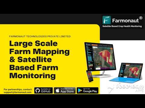
For those managing forests, plantations, or large-scale agricultural lands, our advanced large-scale farm management platform allows admin-level visibility, resource management, and satellite-driven alerts that dovetail perfectly with insights from the best drones for agriculture.
“In 2025, leading drone software can process up to 500 acres of farmland imagery in under 30 minutes.”
Agriculture Drone Software Development: 2025 Trends
The pace of agriculture drone software development is accelerating quickly as technologies become smarter and more accessible. Here’s a closer look at the 2025 trends shaping the evolving landscape of modern farming:
-
AI-Powered Crop Analysis:
Machine learning models analyze multispectral and hyperspectral drone imagery to uncover signs of nutrient deficiencies, pest infestations, and stress in crops, often before they are detectable by scouting alone.

-
Integration With IoT and Sensors:
Forward-thinking farms are connecting soil moisture sensors, weather stations, and satellite feeds directly to their drone software. The result is a comprehensive field monitoring and management platform that offers farmers total operational oversight. -
Automated Flight and Task Management:
Most new agri-drones feature automated flight planning, precise route optimization, and one-click spraying or mapping routines. With minimal human oversight, scalability and safety are improved—especially for larger farms. -
Sustainability and Environmental Focus:
There is growing emphasis on reducing chemical and water inputs through smarter prescription maps, monitoring, and targeted applications. Platforms like Farmonaut’s carbon footprint monitoring tool help assess sustainability and compliance. -
Cloud-Based Collaboration:
Cloud-first platforms enable multiple users—farmers, advisors, agronomists—to access, annotate, and action drone-captured data in real time. -
Custom Integration & API-Focused Development:
Open APIs (see Farmonaut’s API and API documentation linked above) facilitate seamless connections to custom farm management platforms and other agritech software, allowing businesses and developers to build the perfect toolset for every operation. -
Blockchain for Traceability:
Blockchain-backed platforms like Farmonaut traceability can track resource and supply chain movement with full transparency, helping secure agricultural product value chains. -
Support for Remote and Large-Scale Management:
Scalable systems, such as Farmonaut’s large-scale farm management platform, offer admin oversight and actionable satellite-driven intelligence for distributed operations.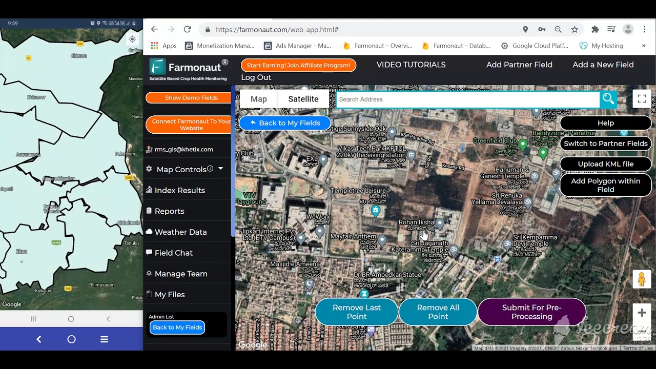
How to Choose the Best Drone Software for Agriculture
When investing in the best drone software for agriculture, it’s crucial to align your selection with your operation’s unique needs:
- Farm Size and Type: Large-scale farms may prefer drones like DJI Agras T30 or SenseFly eBee X for coverage and payload capacity. Smaller, intensive operations may choose compact units with targeted prescription capability.
- Key Use Cases: If crop spraying is your main task, prioritize models with heavy payloads and efficient spraying systems. For monitoring, focus on drones and software that support multispectral imaging, NDVI analysis, and weed/pest detection.
- Data Integration: For holistic farm management, ensure your drone software integrates with satellite platforms and farm management tools like those from Farmonaut.
- Automation and Scalability: Look for platforms with fully automated flight and data processing features—these save operational time and enable scaling your agri-business without heavy manual oversight.
- Cost and ROI: Consider not only the up-front investment, but ongoing software subscription fees and time saved through intelligent automation, actionable analytics, and support for sustainable practices.
- Trial and Support: Many leading platforms offer free demos or trial periods—test before you invest. For managed services and support in crop, forest, and resource advisory, check the Farmonaut crop plantation and forest advisory tools.
FAQs: Best Drone Software for Agriculture
What are the key features of the best drone software for agriculture?
Look for software that offers AI-powered crop analysis, multispectral imaging integration, real-time NDVI mapping, prescription map generation, cloud collaboration, automation, and compatibility with diverse drone models. Seamless data integration and quick processing are essential for precision agriculture in 2025.
Which is the best drone for farming in 2025?
The best drone for farming depends on your operation’s scale and needs. The DJI Agras T30 is highly effective for spraying and large farm coverage. The Parrot Bluegrass Fields excels in crop scouting through multispectral analysis, and the SenseFly eBee X leads in rapid, extensive mapping for big farms.
How does drone data support sustainable farming practices?
Drones equipped with the best agriculture drone software reduce chemical and water inputs by targeting applications to stressed or specific zones, optimizing resource use, and enabling environmental monitoring—all while lowering overall carbon footprints.
How does Farmonaut facilitate integration between drone and satellite data?
At Farmonaut, we offer multispectral satellite analysis, real-time monitoring, and AI-powered advisory tools that can be used alongside drone-captured data. Our API and platform services help unify satellite and drone workflows, enhancing the overall value of agricultural analytics.
What trends are shaping agriculture drone software development in 2025?
Key trends include AI-driven image analysis, IoT and sensor integration, blockchain for traceability, automatic flight planning, a strong focus on sustainability, and API-based ecosystem development.
Can agricultural drones be used for both monitoring and spraying?
Yes, modern agricultural drones like DJI Agras T30 are designed for both monitoring and automated input application (e.g., spraying fertilizers, pesticides, or irrigation), depending on the modules and sensors installed.
Conclusion
The convergence of advanced agricultural drones and powerful drone software platforms is propelling farming into a new era marked by data-driven management, sustainability, and operational excellence. The best drones for agriculture in 2025, such as the DJI Agras T30, Parrot Bluegrass Fields, and SenseFly eBee X, set new benchmarks through their integration of AI, efficient input use, and true precision mapping.
Meanwhile, software solutions like DroneDeploy, Pix4Dfields, and Agremo deliver actionable, collaborative, and fast-processed insights, making precision agriculture accessible for farms of all sizes. As you consider the future, integration of satellite-driven intelligence—as offered by Farmonaut—along with drone data creates a 360° approach for monitoring, analysis, and decision-making.
Choosing the right combination of drone hardware, software, and satellite technology allows farmers to not just keep pace, but to thrive in an evolving, competitive, and sustainable agricultural landscape.

Farmonaut Subscription Plans
Access our satellite-powered agriculture monitoring tools, AI-driven advisory, blockchain traceability, and fleet & resource management via flexible, scalable subscription plans suitable for all farm sizes and agribusinesses. Choose the plan that fits your needs and start leveraging advanced satellite data and real-time crop intelligence for smarter, more sustainable farming.

 SFX
SFX BACF Africa
 Nivia
Nivia Doodlakine
 Exurbia Geospatial
 FieldZero
 Indico Company
 Kubota
 FFBS
FFBS Jontra
 Tucor
Tucor Hayleys Agriculture
