Table of Contents
- Introduction: The Power of Land Surveying in Agriculture
- Quick Trivia: Land Surveying Adoption
- Understanding Land Surveying in Agriculture
- Modern Technologies in Farm Land Mapping
- Land Surveying for Farms: 7 Mapping Hacks for 2024
- Comparative Table: Surveying Technologies for Agriculture
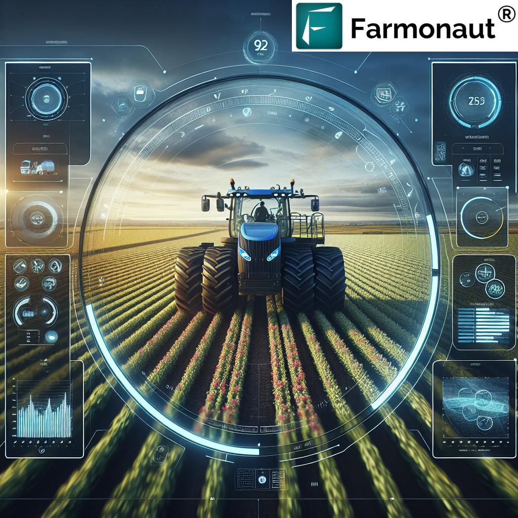
- How Farmonaut Is Powering Precision Farm Land Surveying
- Agricultural Soil Management Trivia
- Implementing Land Surveying in Agricultural Practices
- FAQ: Land Surveying for Farms
- Farmonaut Subscription Plans
- Conclusion: Mapping a Sustainable Agricultural Future
Land Surveying for Farms: 7 Mapping Hacks for 2024
Land surveying in agriculture forms the cornerstone of modern farm planning, management, and sustainability. As we enter 2024, leveraging advanced mapping technologies allows us to unlock new levels of efficiency, precision, and environmental stewardship. In this definitive guide, we’ll explore the latest mapping hacks—from GPS and drone surveys to soil management techniques—empowering farmers with actionable data for better resource allocation, clearer decisions, and improved sustainability.
“Over 80% of large farms now use GPS-based land surveying for precise field mapping and planning in 2024.”
Understanding Land Surveying in Agriculture
Let’s begin by recognizing that land surveying in agriculture means more than just measuring boundaries. It’s about precise mapping and data-driven farm management. With our growing technical toolkit, we can analyze not just property position or size, but also soil characteristics, topography (including streams, rivers, lakes, hills, and valleys), and the placement of vital structures and roads. This data forms the foundation for all resource allocation, crop planning, risk assessment, and environmental actions on the farm.
Types of Land Surveys in Agriculture
- Chain Survey: The simplest and oldest form, using chains or tapes to measure land area and boundaries. Ideal for small plots ([source](https://classhall.com/lesson/farm-surveying/?utm_source=openai)).
- Geodetic / Traverse Survey: Utilizes a prismatic compass to determine area size, shape, and alignment.
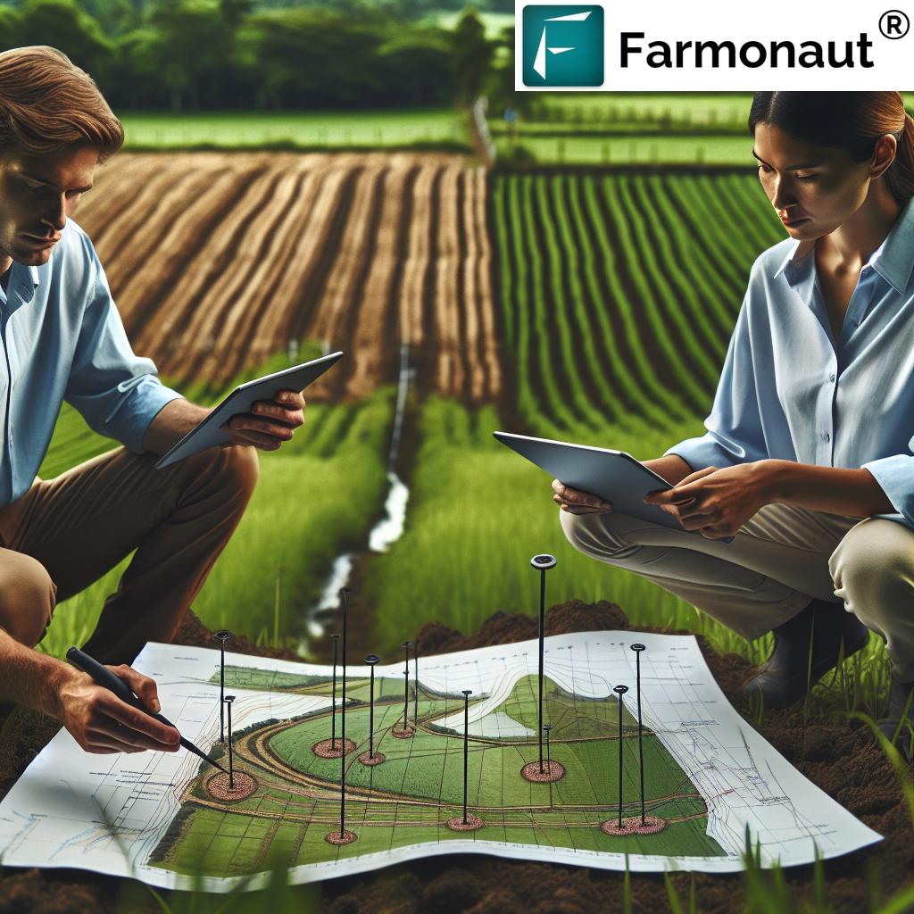
- Soil Survey: Focuses on soil classification and management by examining, mapping, and categorizing soil composition and properties.
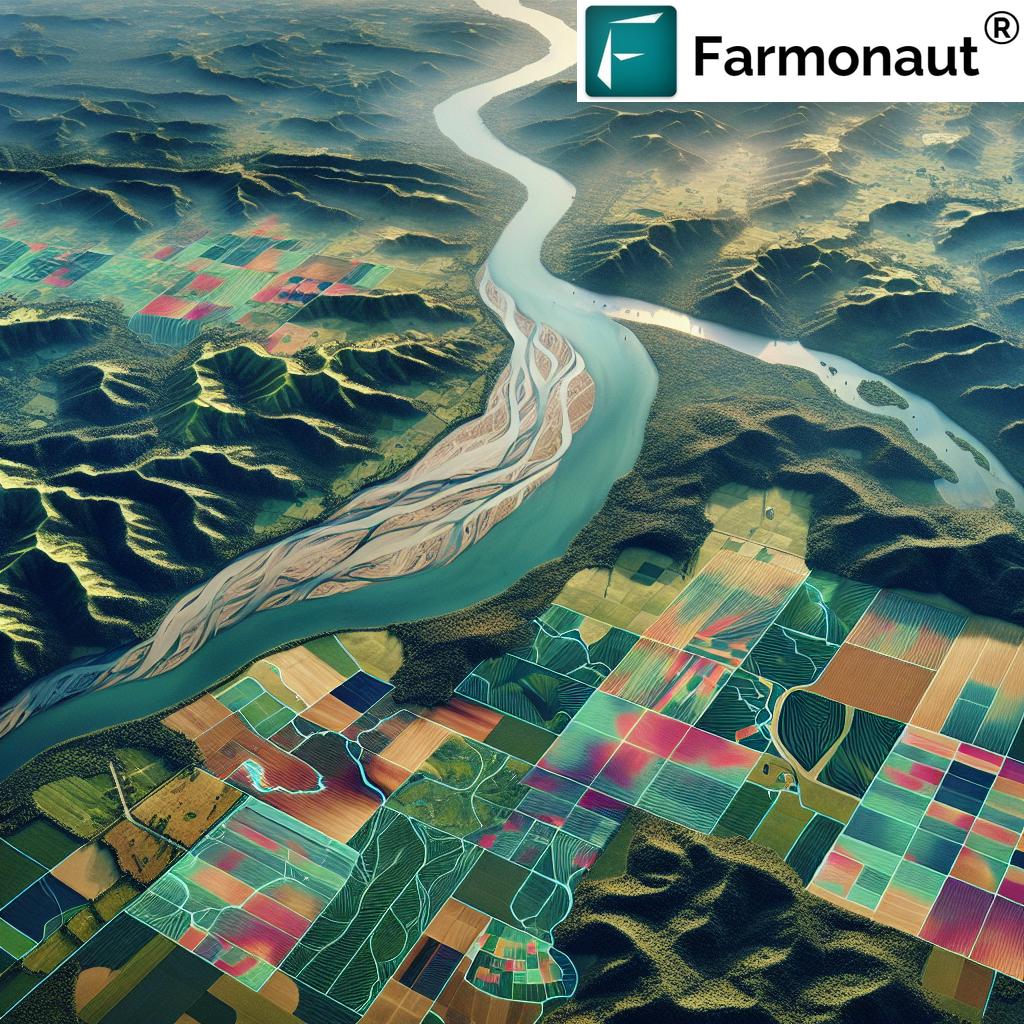
- Topographical Survey: Identifies physical features such as flatness, steepness, valleys, rivers, and hills.
- Aerial Survey: Uses aircraft or drones to observe and map large areas for features like vegetation, lakes, and buildings.
The Importance of Land Surveying for Farms
Farm land mapping is essential not only for determining property boundaries, but also for enhancing farm efficiency in core activities such as:
- Determining Farm Size: Accurate measurements for resource allocation.
- Feasibility Studies: Conducting land suitability assessments for different crops and practices.
- Optimal Land Use: Matching soil and terrain to crop selection and resource management.
- Farmstead Planning: Efficient layout of buildings, access roads, and infrastructure.
- Soil Classification & Management: Generating systematic data for effective soil management, advisory services and sustainable practices.
- Yield Projection: Data-driven projections enable better business planning.
- Property as Collateral: Surveyed land records aid with loans and insurance (see satellite-based loan support).
- Gradient & Erosion: Planning for drainage, erosion control, and water conservation.
- Environmental Conservation: Using high-resolution topographical survey data to protect streams, lakes, and rivers.
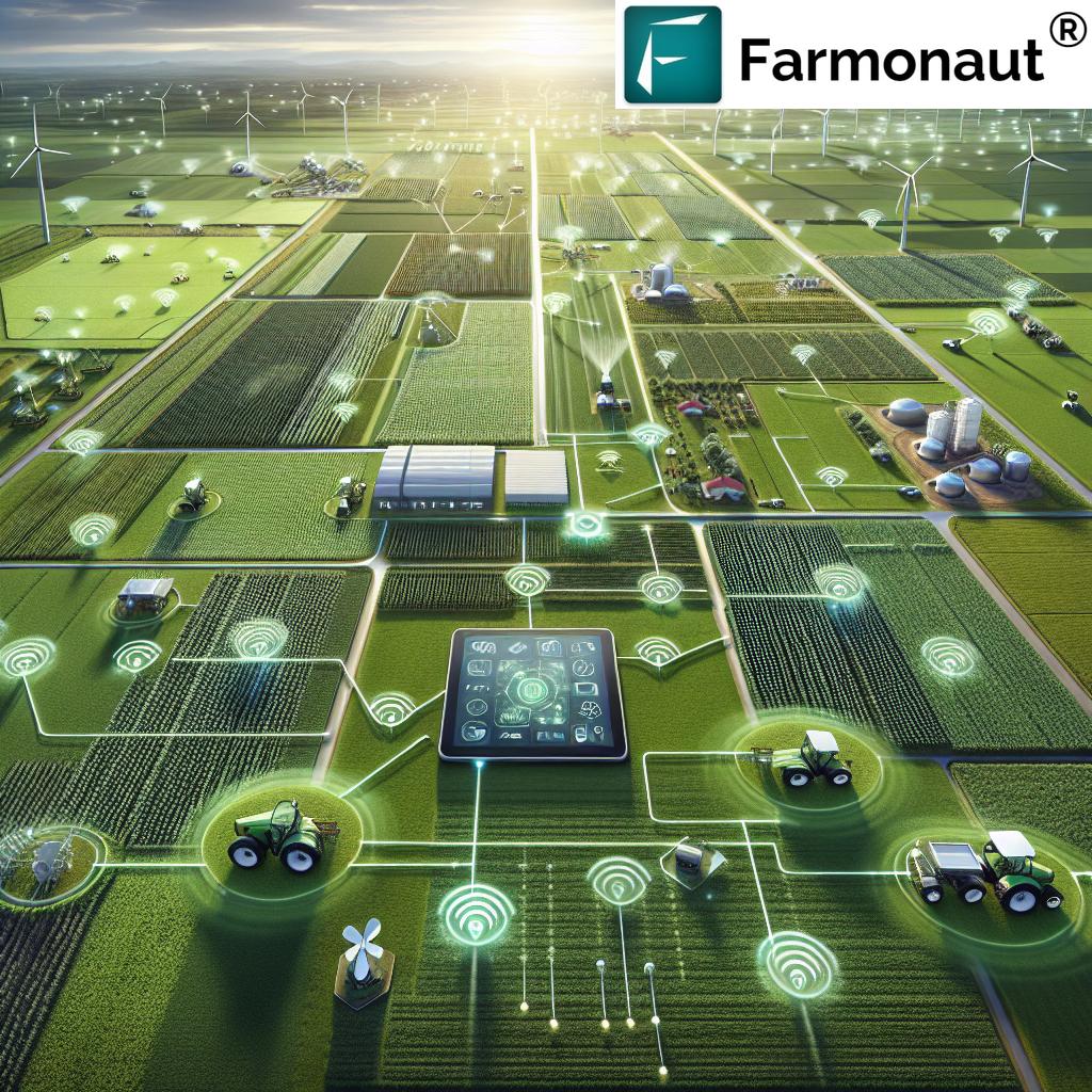
Modern Technologies in Farm Land Mapping & Surveying
Over the past decade, digital technologies have transformed how we collect, analyze, and apply data for agricultural survey techniques. Below we highlight innovations at the forefront of farm mapping, measurement, and planning in 2024:
- Global Positioning System (GPS) / Global Navigation Satellite System (GNSS): Delivers highly accurate positioning for GPS land surveying, boundary marking, and large-scale farm mapping.
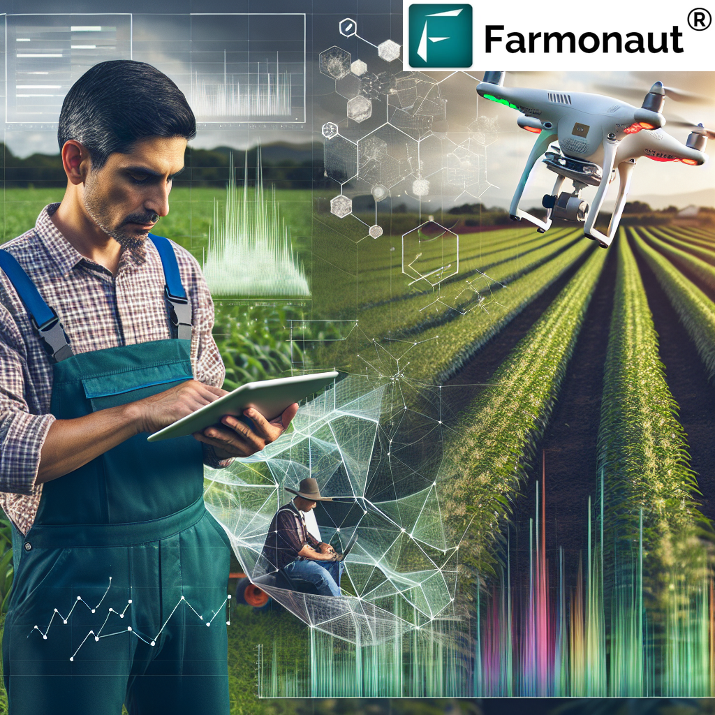
- Satellite Imagery and Remote Sensing: Captures multispectral, high-resolution data for real-time crop health monitoring, soil moisture, and vegetation indices. Farmonaut provides API access for agricultural research and large-scale monitoring.
- Light Detection and Ranging (LiDAR): Uses laser scanning for detailed 3D models of topography and structures—vital for precision farming technologies and drainage planning.
- Drone Surveys for Agriculture: Unmanned Aerial Vehicles (UAVs) produce high-resolution imagery for efficient, scalable, and affordable aerial mapping.
- 3D Scanning & Modeling: Builds digital twins of buildings and landscapes for comprehensive planning.
- Soil Sensors & IoT Devices: Real-time data on soil properties enhances soil classification and management.


Comparative Table: Surveying Technologies for Agriculture
| Survey Method | Estimated Accuracy (%) | Average Time to Survey (acres/hour) |
Cost Range ($/acre) |
Best For | Sustainability Impact (1-5) |
|---|---|---|---|---|---|
| Chain Survey (Manual) | 80-90 | 1-2 | $1-$3 | Small fields, simple boundaries | 2 |
| GPS Land Surveying | 95-99 | 10-20 | $2-$12 | All farms, precision mapping | 4 |
| Drone Surveys for Agriculture | 97-99.5 | 100-200 | $5-$20 | Large/remote areas, quick mapping | 5 |
| LiDAR (Laser Scanning) | 98-99.9 | 50-100 | $10-$50 | Detailed 3D topography, drainage | 5 |
| Topographical Survey | 95-99 | 5-15 | $3-$10 | Terrain analysis, erosion, planning | 4 |
| Soil Sensors & AI Analysis | 90-98 | Real-time | $1-$8 | Precision soil management | 5 |
*Sustainability Impact: 1 = Low, 5 = Very High. Cost and speed estimates may vary by region and context.
Land Surveying for Farms: 7 Mapping Hacks for 2024
To help every farm—from individual landowners to cooperatives and government agencies—harness the full potential of modern agricultural survey techniques, we’ve curated seven of the most impactful and accessible mapping hacks:
-
1. GPS Land Surveying for Accurate Boundaries & Layouts
Using GPS and GNSS technologies, we can map every corner of our fields with centimeter-level accuracy. This means fewer land disputes, simpler resource allocation, and rock-solid records for loans or insurance. With cloud platforms, like Farmonaut’s, data is accessible across web and mobile, making farm management accessible anywhere.
-
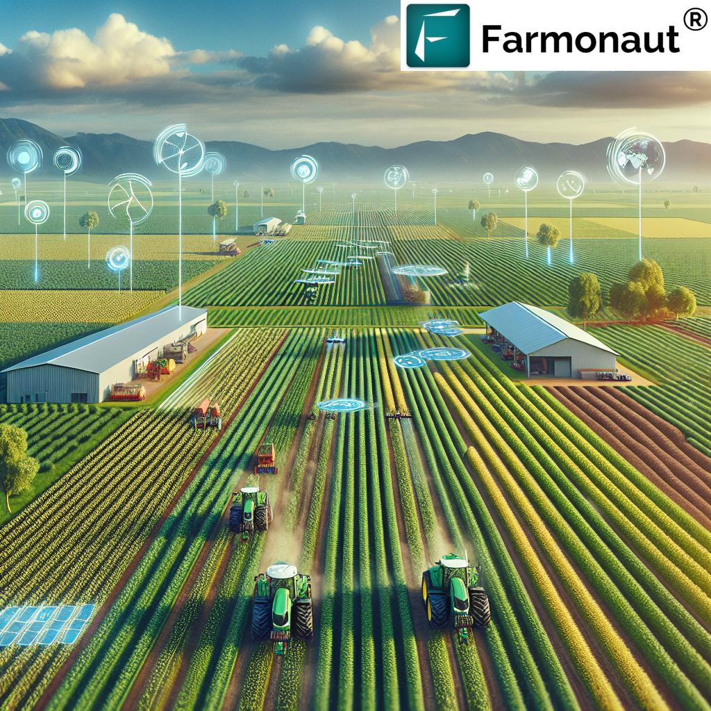
2. Drone Surveys for Agriculture: Fast, Detailed, and Repeatable
Drone-based aerial surveys bring top-level detail at lower cost, especially for larger or more complex landscapes. Drones equipped with RGB and multispectral sensors capture up-to-date maps of topography, soil condition, and even crop health. These rapid surveys support quick decision-making across planting, irrigation, and fertilization cycles.
-
3. Integrate Soil Classification & AI-Based Soil Management
Soil is the farm’s foundation. Soil surveys, enhanced by digital tools and software, allow us to identify zones requiring specific amendments or crop choices. AI systems, like Farmonaut’s Jeevn AI advisory, convert this data into practical recommendations, maximizing yield and minimizing waste for sustainable agriculture (AI-powered advisory & management).
-
4. Use LiDAR & 3D Mapping for Erosion, Drainage, and Sustainability
Laser-based LiDAR scans build dense 3D models of every hill, valley, and waterway. This reveals gradients and critical areas for erosion control or drainage planning, ensuring our sustainability projects are based on accurate elevation data and promoting carbon footprint reduction.
-
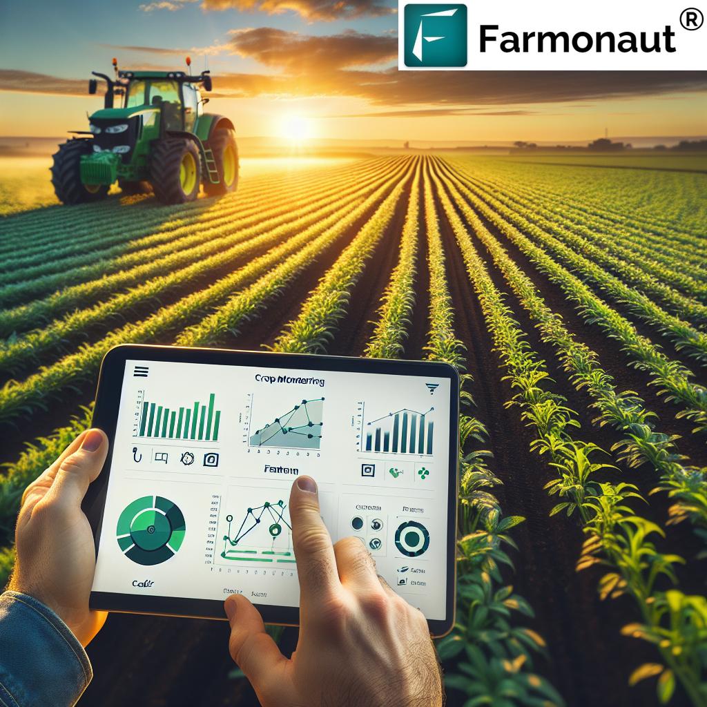
5. Combine Aerial Satellite Survey & Remote Sensing for Crop Monitoring
By tapping into multispectral satellite data (NDVI, soil moisture, etc.), we gain a bird’s-eye view of every field, spotting stress patterns and resource needs weeks ahead of the naked eye. Farmonaut’s platform provides real-time crop health monitoring, weather updates, and traceability for market integrity (traceability & transparency).
-
6. Use Farm Land Mapping Data for Precision Resource Management
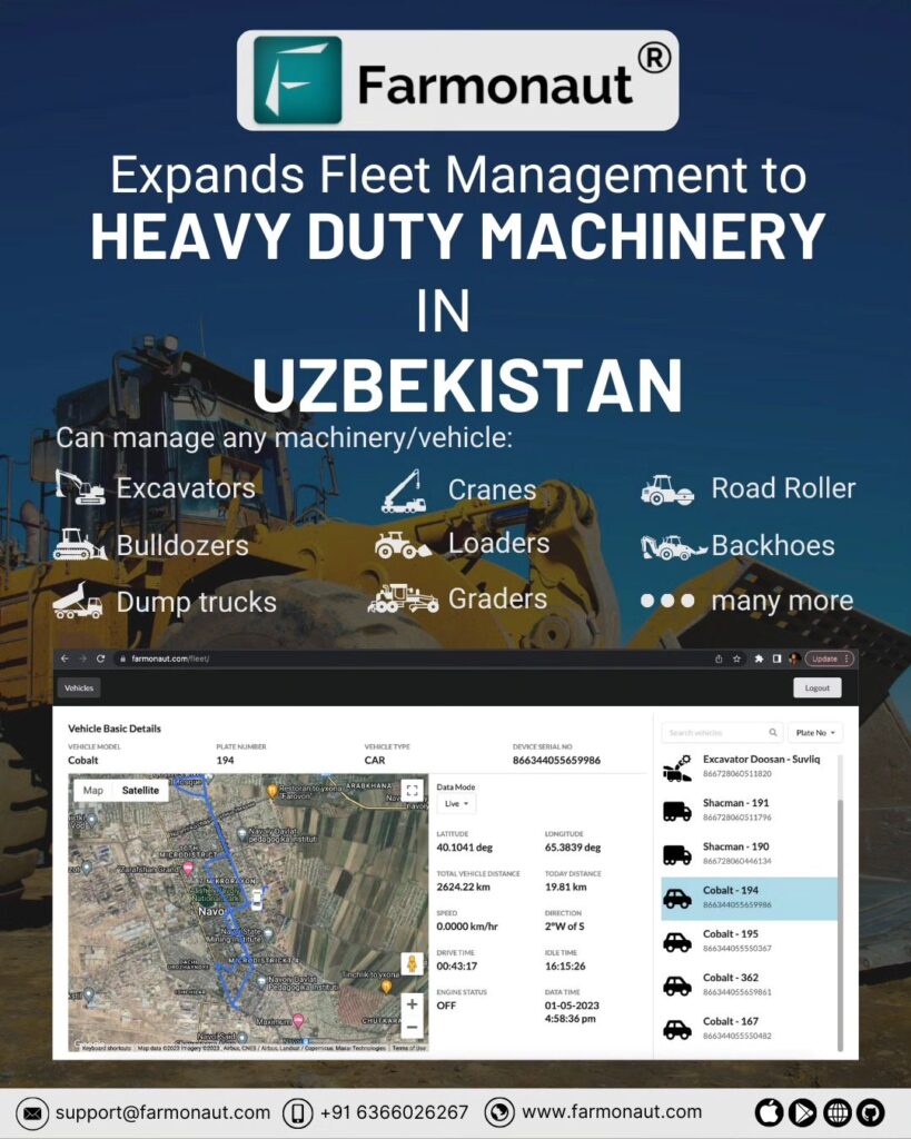
Mapping is essential not only for planning layouts, but for ongoing resource optimization. By overlaying survey data with real-time fleet tracking and input usage, we can optimize cost and sustainability. Farmonaut’s fleet management tools enable large and small operations to improve logistics, reduce fuel use, and automate record-keeping (see fleet management).
-
7. Periodic Topographical Survey: Stay Updated, Stay Compliant
We cannot overstate the importance of regular, detailed surveys. Annual or seasonal topographical surveys allow us to monitor land change, comply with environmental regulations, and spot emerging issues—like new erosion zones, streams or shifting boundaries—before they become costly problems.
How Farmonaut Is Powering Precision Farm Land Surveying
Farmonaut’s mission is making modern land surveying and precision agriculture accessible for every farm. We do this with a platform that combines:
- Satellite-Based Crop Health Monitoring: Multispectral images for high-frequency, large-scale insight into vegetation health, soil moisture, and more.
(Benefit: Plan irrigation, fertilizer, and pest control exactly where needed.) - AI-Driven Jeevn Advisory: Converts survey and satellite data into actions—right from your phone—to improve yields and efficiency.
- Blockchain-Based Traceability: End-to-end traceability that’s verifiable by every stakeholder—from farmer to export market.
- Fleet & Resource Management: Fleet solutions boost logistics efficiency for input application, harvest, or transportation.
- Carbon Footprinting Tools: Real-time metrics for monitoring resource use, reducing emissions, and supporting climate-smart agriculture.
- Crop Loans & Insurance Support: Verified, geo-tagged land records streamline loan disbursal and insurance processing (see: Farmonaut crop loan and insurance).
- Subscription-Based Model: Flexible plans on web and mobile apps, scalable for single farms to national programs. API access for developers/researchers: Farmonaut Satellite & Weather API; docs: Developer Docs.
“Modern soil management mapping can increase crop yield accuracy by up to 25% compared to traditional surveying methods.”
Implementing Land Surveying in Agricultural Practices
Bringing the above mapping hacks and technology into action means adopting a systematized approach to surveying:
-
Engage Professional Surveyors:
Certified professionals using the latest GPS, drones, and LiDAR equipment produce reliable, actionable data. For simple field mapping, start with handheld GPS or digital chain survey tools. -
Adopt Advanced Surveying Equipment:
For medium to large operations, incorporate drones, AI-based analysis, and cloud-based mapping platforms to boost precision and efficiency. -
Integrate Survey Data with Farm Management Systems:
Combine mapping results with platforms like Farmonaut for real-time decision-making and resource optimization, including compliance and traceability. -
Conduct Regular Surveys:
Annual or seasonal follow-ups help us detect changes early—avoiding compliance issues, resource mismatch, or environmental risks. -
Compliance with Regulations:
Stay informed on land use and environmental protection laws, leveraging geospatial records for reporting and verification.
- Farmonaut Carbon Footprinting: Track and reduce your agribusiness environmental impact through real-time data and actionable reports.
- Farmonaut Crop Loan & Insurance: Satellite-based field verification simplifies the loan process, improves access to finance, and deters fraud for both farmers and banks.
- Farmonaut Product Traceability: Ensure produce transparency and authenticity, from farm to shelf, ideal for food and textile industry supply chains.
- Farmonaut Fleet Management: Optimize agricultural machinery, monitor usage, reduce operational costs, and ensure compliance for large-scale logistics.
- Large Scale Farm Management Platform: Comprehensive field, plantation, and staff management for enterprises, cooperatives, or government projects.
FAQ: Land Surveying for Farms
Q1: Why is land surveying important for modern agriculture?
A: Surveying provides precise data for field boundaries, soil types, terrain, and structures. This information is crucial for planning, resource allocation, sustainability, and maximizing farm productivity.
Q2: How does GPS land surveying differ from traditional chain survey?
A: GPS surveying offers much higher accuracy, faster mapping, and the ability to digitally store and share data, making it ideal for large and complex farmlands. Chain surveys are best for small plots and basic measurements.
Q3: How can I use mapping data to improve my farm’s sustainability?
A: By analyzing topographical and soil data, you can plan more efficient irrigation, prevent erosion, conserve water, and optimize crop selection for soil type—supporting environmental sustainability in farming.
Q4: What are the most cost-effective surveying options for small-scale farmers?
A: Start with GPS-based field boundary mapping or mobile apps, and progress to affordable drone surveys as needed for larger or more complex areas. Farmonaut’s mobile and subscription plans support affordable access.
Q5: Can surveys support compliance and certification for loans or organic trade?
A: Yes. Detailed land records, crop monitoring, and satellite verification (such as through Farmonaut’s platform) reduce processing time and demonstrate compliance for finance or certification needs.
Farmonaut Subscription Plans
Choose a Farmonaut subscription to unlock a wide range of tools for satellite crop monitoring, farm mapping, AI advisory, resource management, and more—designed for everyone from smallholder farmers to large agribusinesses.
Conclusion: Mapping a Sustainable Agricultural Future
In 2024, land surveying in agriculture sits at the heart of efficiency, productivity, and long-range sustainability. By combining traditional mapping techniques with cutting-edge digital, GPS, drone, and AI-driven systems, we unlock actionable insights for our fields—no matter their size or location. Embracing practices like aerial surveys, soil classification and management, 3D mapping, and regular farm land mapping doesn’t just benefit crop yields, but strengthens the resilience and value of every agricultural operation.
Platforms like Farmonaut democratize this technology, providing the tools, data, and advisory systems needed for smarter, more sustainable farming—for individual farmers, agribusinesses, governments, and research teams alike.
Whether you’re a seasoned landowner, a cooperative manager, or embracing farming for the first time, the mapping hacks and technologies explored in this blog set the course for a future of data-driven, sustainable agriculture—where every farm can thrive.