Use of Drones in Agriculture: 7 Powerful Ways in 2025
“By 2025, over 60% of large farms worldwide are projected to use drones for crop monitoring and management.”


Satellites API Access
API Developer Docs
Summary: Revolutionizing Modern Farming with Drones in 2025
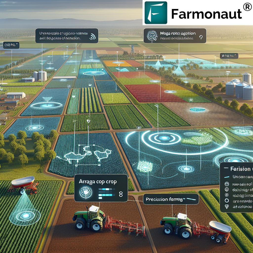
The use of drones in agriculture has undergone a dramatic evolution. Formerly considered niche gadgets, drones have quickly transitioned into being essential tools in the agricultural sector by 2025. Driven by innovations in sensors, AI, drone systems, and satellite integrations, these unmanned aerial vehicles (UAVs) are now at the core of modern farm management. Farmers can monitor crops, assess plant health, apply inputs with precision, and optimize every aspect of their operations using aerial images, data analytics, and targeted intervention strategies.
This article explores the seven most powerful uses of drones in agriculture for 2025, providing up-to-date insights into drone capabilities, technology integrations, and measurable benefits for farms of all sizes. We’ll also detail how solutions like Farmonaut’s platform complement data from drones with satellite-based monitoring and AI-powered advisories to maximize yield, minimize risk, and foster sustainable practices. Whether you’re a grower, agronomist, data scientist, or policymaker, understanding these drone applications will be crucial for advancing productivity, environmental stewardship, and food security in the years ahead.
Why the Use of Drones in Agriculture Is Revolutionizing Farming
Drones use in agriculture is redefining how we approach the challenges of food production, resource management, and environmental sustainability. As we navigate 2025 and beyond, let’s explore the driving forces behind this technological revolution:
- Rapid Evolution of Drone Technology: From simple aerial photos to multi-sensor payloads (multispectral, thermal, LiDAR), today’s drones can perform myriad agricultural tasks—mapping land, spraying fields, assessing crop stress, and much more.
- Democratization of Advanced Imaging: High-resolution aerial imagery is now accessible to both large agricultural enterprises and smallholder farms, allowing widespread monitoring and analysis across the globe.
- Integration with Data Analytics & AI: Drone-captured data feeds directly into predictive models and platforms, enabling smarter decisions, accurate yield forecasts, and timely responses to crop stress, pest infestations, or irrigation issues.
- Precision & Efficiency Gains: Drones enable precision application of inputs (water, fertilizers, pesticides) on a plant-by-plant or zone-by-zone basis, reducing waste, minimizing environmental impact, and supporting sustainable agriculture.
Unlike traditional manual scouting or ground-based machinery, drones for agriculture use provide unprecedented speed, breadth, and detail in data collection and application—leading to significant improvements in productivity, cost savings, and farm management efficiency.
The 7 Powerful Ways Drones Transform Agriculture in 2025
By 2025, seven core areas define the expanded uses of drones in agriculture. Each application leverages the advances in drone hardware, sensors, connectivity, and data-driven farm platforms. Here’s a deep dive into each:
1. Precision Crop Monitoring & Plant Health Assessment
- Focus Keyword Use: By enabling precision crop monitoring, the use of drones in agriculture has become a cornerstone of modern farming.
- How it works: Drones equipped with multispectral, RGB, and thermal cameras capture detailed images of crops. These aerial images expose subtle differences in color, temperature, and reflectance, indicating early signs of disease, pest activity, drought stress, nutrient deficiency, or irrigation problems—often invisible to the naked eye.
- Automated analysis: Data is processed using AI and analytics—flagging trouble spots for immediate intervention and tracking changes over time.
- Benefits: Faster disease and pest detection, improved resource allocation, maximized yield, and lower loss risk.
2. Precision Spraying & Fertilizing
- Automated Input Application: Drones fitted with specialized spraying systems deliver chemicals, nutrients, pesticides, or fertilizers at precise doses to targeted zones or affected plants, dramatically reducing overuse and runoff.
- Speed & Consistency: Drones can cover large areas within minutes, ensuring a uniform, efficient application that outperforms manual labor or traditional ground machinery—especially difficult terrain, wet fields, or sloped land.
- Sustainability: This approach strongly supports carbon footprinting and sustainable practices by minimizing excess input use and environmental runoff.
- Result: Reduced costs, lower labor requirements, minimized environmental impact, and improved crop productivity.
3. High-Resolution Field Mapping & Land Surveying
- Comprehensive Mapping: Drones in agriculture harness GPS, LiDAR, and photogrammetry to construct high-fidelity 2D/3D maps and elevation models quickly across large fields.
- Land Assessment: These maps are essential for understanding soil variability, slope, field boundaries, and crop variation—enabling smart planning for irrigation systems, drainage, and resource allocation.
- Fast Turnaround: What previously took days (or weeks) with surveys now occurs in hours.
- Integration: Fleet and Resource Management platforms can incorporate drone-based field maps, supporting optimized machinery deployment and cost savings.
“Drones can scan up to 1,000 acres per day, providing real-time data for precision agriculture in 2025.”
4. Soil & Water Analysis
- Soil Health Assessment: By analyzing soil color, moisture content, and nutrient distribution with multispectral imaging, drones efficiently pinpoint areas lacking fertility or suffering from compaction.
- Irrigation Monitoring: Drones can spot blockages, leaks, or uneven distribution in irrigation systems, facilitating on-the-spot corrective actions that maximize water use efficiency.
- Environmental Benefits: Reduced overwatering and targeted interventions support both higher yields and sustainability.
5. Early Detection of Pest Infestations & Disease Outbreaks
- Pest, Disease, & Weed Spotting: Drones equipped with advanced cameras scan fields for patterns and colors associated with insect infestations, fungal spreads, or weed outbreaks—detecting issues days to weeks before visual symptoms appear.
- Real-Time Analytics: AI-powered apps flag hotspots as soon as drones relay images, alerting farmers for fast, targeted treatment and loss prevention.
- Crop Insurance Verification: Drones also generate verifiable evidence for crop loan and insurance applications (see Farmonaut’s solution here), streamlining claims and reducing fraud risks.
6. Planting, Crop Counting, & Yield Estimation
- Automated Seeding: Specialty drone systems in 2025 can perform automated planting or targeted reseeding—especially for cover crops, forestry, and challenging terrains. This maximizes labor efficiency and supports large-scale reforestation.
- Crop Stand Analysis & Counting: By systematically photographing fields, drones generate detailed maps showing plant population density, emergence rate, and yield potential across every acre.
- Yield Forecasting: Coupling this data with farm management platforms and AI analytics enables highly accurate yield projections and harvest planning.
7. Environmental Monitoring & Sustainability Reporting
- Sustainability Metrics: Drones empower farms to monitor carbon footprint, emissions, land use, and ecological impact over time—using high-frequency aerial data and smart tracking systems.
- Erosion & Wetland Surveillance: Rapid detection of soil erosion, illegal land clearing, water contamination, or wildlife habitat disturbance is possible using programmed drone flight routes and thermal/multispectral imaging.
- Sustainability Platforms: Drone-collected data feeds directly into solutions like Farmonaut’s carbon footprint tools, linking ground truthing with satellite tracking for compliance, auditing, and market reporting.
Summary Table: Focus Keywords in Drone Applications
- The use of drone in agriculture now extends from plant-level monitoring to sustainability reporting, all enabled by modern advances in drone, sensor, and AI technologies.
- Far from being niche gadgets, drones have become the cornerstone of modern agricultural practices, offering unprecedented productivity, cost savings, and sustainability gains for farmers worldwide in 2025.
Comparative Table: Drones in Agriculture 2025
| Drone Application | Estimated Efficiency Improvement (%) | Estimated Cost Savings (USD per acre) | Implementation Difficulty | Potential Yield Increase (%) |
|---|---|---|---|---|
| Crop Monitoring & Plant Health Assessment | 45–60% | 25–38 | Medium | 8–12% |
| Precision Spraying & Fertilizing | 35–50% | 30–48 | Medium | 7–15% |
| High-Resolution Mapping & Land Surveying | 50–75% | 20–30 | Low | 5–7% |
| Soil & Water Analysis | 35–55% | 18–35 | Medium | 6–10% |
| Pest/Disease Outbreak Detection | 60–80% | 28–45 | Medium | 9–17% |
| Planting & Yield Estimation | 30–50% | 14–28 | High | 6–9% |
| Environmental Monitoring & Sustainability | 40–65% | 20–40 | Medium | 5–8% |
Note: Estimates for 2025 based on reports and projections from international agricultural technology studies. Actual values may vary by region, crop, and operational scale.
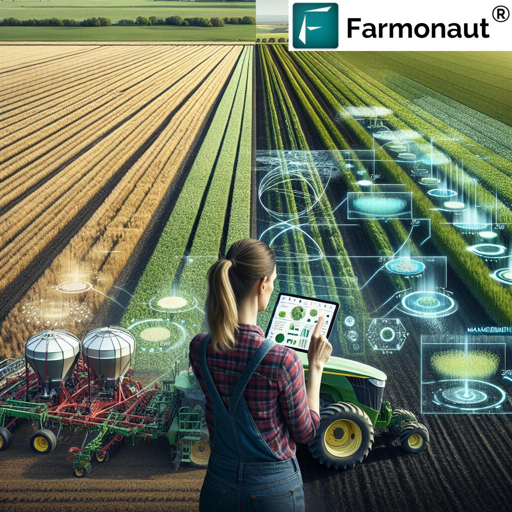
Advancements in Drone Technology & Seamless Integrations
The use of drones in agriculture is supercharged in 2025 through constant breakthroughs in hardware, software, and platform connectivity. Here’s what’s new and impactful:
- Longer Flight Times, Larger Payloads, Swarm Tech: Modern drones cover more acres per battery charge and carry greater input payloads, while advanced swarm algorithms enable multi-drone, coordinated missions over vast farms.
- Real-Time Data Upload: Drones stream high-definition images and sensor readings to central platforms for near-instant analysis, allowing mid-flight task adjustments and truly real-time crop monitoring.
- Integration with Satellite Platforms: Drone and satellite data can be seamlessly blended, combining high-frequency, targeted drone scouting with constant, broad-scale satellite field coverage—delivered in apps such as ours at Farmonaut.
- Cloud & Blockchain Traceability: Blockchain-based agricultural traceability ensures every drone action—spraying, scouting, monitoring—is transparently logged for food safety audits and market credibility.
Aerial Application in Action: Video Demos
Experience drones for agriculture use in action! These top-performing videos showcase how the use of drones is revolutionizing crop monitoring, spraying, mapping, and environmental management at scale in 2025 and beyond:
Overcoming Challenges for Widespread Drone Adoption
While the uses of drones in agriculture are many and the return on investment is significant, several ongoing challenges must be addressed for universal adoption:
- Regulatory Complexity: Drone airspace rules, crop spraying certifications, and flight permissions vary by country and region. Clear frameworks are essential for scalability and safety.
- Initial Capital Outlay & Training: While costs are falling, drones require upfront investment and skilled operators. Accessible service models and simpler interfaces help minimize barriers.
- Data Management: Huge volumes of drone-generated data must be stored, interpreted, and integrated with farm management systems. Secure, user-friendly platforms are crucial.
- Security & Privacy: Protecting farm and personal data, as well as ensuring drones don’t invade neighboring properties, remains important as drone density increases.
- Connectivity: In rural zones with limited 4G/5G/IoT infrastructure, live drone data streaming or cloud uploads can be a bottleneck.
Innovations in connectivity, affordable drone service providers, user training, and integrated data platforms are rapidly mitigating these hurdles, paving the way for mainstream adoption by 2025 and beyond.
Farmonaut: Satellite-Driven Insights for Next-Gen Agriculture
Drones unlock granular, field-level intelligence. However, for large farms, regional operators, and policymakers, pairing drone data with continuous, wide-area satellite monitoring is the key to untapped optimization.
At Farmonaut, our mission is to make advanced, satellite-powered insights affordable and actionable for everyone in agriculture. Here’s what makes our solutions the ideal complement and extension to drone-based farming in 2025:
- Real-Time Crop Monitoring: Our platform provides NDVI, soil moisture, and vegetation health mapping via multispectral satellite imagery for continuous field oversight.
- AI-Based Advisory & Risk Forecasting: Jeevn AI analyzes images and field conditions, delivering actionable advisories for crop schedules, yield forecasting, and input management.
- Blockchain Traceability & Carbon Tracking: We empower farms to trace every product journey and track sustainability metrics (emissions, footprints) in real-time, responding to global compliance needs and consumer trust.
- Fleet & Resource Optimization: With fleet management tools, users can monitor and optimize the movement and deployment of agricultural machinery across mapped land, maximizing cost efficiency and operational safety.
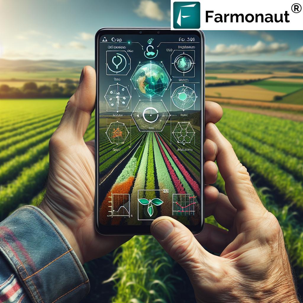
- Seamless Accessibility: Our web, iOS, Android, and API-enabled platform makes satellite intelligence accessible to every farmer, business, and government globally.
FAQ: Use of Drones in Agriculture
What are the main uses of drones in agriculture in 2025?
The primary uses of drones in agriculture are crop health monitoring, precision spraying, field mapping, soil and water analysis, early pest and disease detection, yield estimation, environmental monitoring, and sustainability reporting.
How much can drones improve farm productivity and yields?
Drones can increase productivity by 30–80% depending on the application, with potential yield improvements of 5–17% due to targeted input use, early issue detection, and informed decision-making.
Are drones for agriculture use suitable for small farms?
Yes, with the falling cost of drone hardware and the rise of service providers, farm drone technology is accessible to smallholders as well as large agribusinesses. Many drone solutions now offer pay-per-acre or contract-based monitoring and spraying tailored for small operations.
What is the difference between drone and satellite imagery for farming?
Drones provide ultra-high-resolution, on-demand, local scouting—great for tackling specific field zones, rapid surveys, or applying inputs. Satellites deliver broader, continuous coverage for whole-farm monitoring, historical trend analysis, and compliance. The most effective approach combines both, as with platforms like Farmonaut.
How is privacy and security managed with drones?
Best practices include adhering to local drone regulations, limiting imaging to farm boundaries, encrypting field data, and using blockchain-based traceability for transparency and auditability.
How can I get started with drone and satellite monitoring?
Explore digital farm management platforms such as Farmonaut—which offers integrated satellite crop monitoring and can incorporate drone data via app and API. Training and hardware rental or service providers can also help you launch drone operations tailored to your crops and land needs.
Conclusion: The Future of Smart Farming
The use of drones in agriculture in 2025 marks a fundamental leap forward in how farms of every size are managed, monitored, and optimized. Combining aerial intelligence, precision input application, rapid assessment of plant health, environmental monitoring, and robust data analytics, drones have become essential to maximizing yields, ensuring sustainability, and enabling smarter, data-driven practices across the globe.
As the world’s demand for food, fiber, and sustainable land management increases, the integration of drones, satellite platforms, and AI-driven analytics—like those available from Farmonaut—will be critical for building resilient, productive, and profitable agricultural systems. Whether automating crop monitoring, streamlining field surveys, or tracking environmental impact for farmers or corporate agribusinesses, drones are reshaping the landscape of modern farming for the better.
Ready to begin your next-generation farming journey? Sign up for Farmonaut’s monitoring platform today or contact us to learn how integrating drone and satellite insights can supercharge your yields and sustainability in 2025 and beyond.