

Farm technology · Buyer guide
AI for Agriculture: Apps Compared, With a Cost Calculator
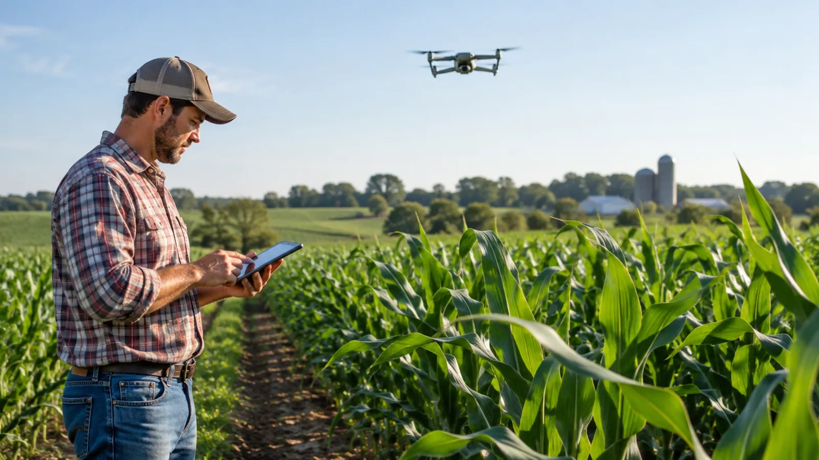
AI turns satellite, drone and sensor data into advice on scouting, irrigation and records. In a June 2026 Purdue survey, 52% of US farmers saw no meaningful benefit, so test one tool on a few fields first.
Key takeaways
- In the Purdue-CME Ag Economy Barometer (June 2026, 400 farmers), 52% saw no meaningful benefit from AI or data-driven tools; 23% named higher production.
- 63% said recommendations from such tools would sometimes be hard to follow and 22% said they often would (Purdue, June 2026).
- Auto-steer reached 58% of US corn acres in 2016, up from 5.3% in 2001 (USDA ERS); newer AI apps have no comparable national survey yet.
- 85% of US farms had internet access and 82% a smart phone in 2025 (USDA NASS), but only 55% had broadband.
- Pick the tool by the job: satellite for whole-farm vegetation checks, drones for leaf-level scouting, probes for irrigation.
In this article
- What an AI agent in agriculture actually is
- What farmers say about AI right now
- Where AI is used on farms
- Best AI apps for agriculture, compared
- How to choose between satellite, drone and sensor tools
- Is an AI app worth the cost?
- Who has adopted precision technology so far
- What you need on the farm before you start
- Limits and risks to weigh
- How to try an AI farm app in six steps
- FAQ
AI for agriculture today means software that turns satellite, drone, sensor and machine data into advice on scouting, irrigation, inputs and records. It is useful, but not yet a sure win: in the Purdue-CME Ag Economy Barometer of June 2026, 52% of US farmers surveyed saw no meaningful benefit from AI or data-driven tools, while 23% named higher production as the main gain.
This guide compares four AI farm apps by what each one does, shows what adoption data says, and gives you a break-even calculator so you can test a subscription against your own numbers. Everything is dated, and vendor claims are marked as the vendor’s own words.
What an AI agent in agriculture actually is
An AI agent in agriculture is software that reads farm data, picks out what matters and suggests, or in some cases takes, an action. The data can come from satellites, drones, soil probes, weather stations and the machines themselves. The output is usually a map, an alert or a recommendation that a person approves.
Most products today sit in the middle of that range. They find the problem and suggest a next step, and the farmer or agronomist decides. Machine guidance is the best-known case where the machine acts on its own. USDA’s Economic Research Service has noted that AI and machine learning have been promoted as productivity tools, yet little evidence exists to date because they had not been deployed at scale when it wrote its February 2023 adoption report.
Three kinds of data feed most tools:
- Satellite images cover whole farms cheaply and show vegetation change over weeks.
- Drone images are sharp enough to count plants and see leaf damage, but someone has to fly them.
- Soil and weather sensors measure one spot very well and need hardware in the field.
What farmers say about AI right now
Surveys give a more careful picture than vendor brochures. In June 2026 the Purdue Center for Commercial Agriculture asked 400 US farmers about AI and data-driven tools. Just over half saw no meaningful benefit. Of those who did, production came first, then labor, then lower risk.
A second question asked whether recommendations from such tools would be hard to follow. About 63% said sometimes and 22% said often. That is a useful test for any app you try: ask what exact action it tells you to take, and whether your crew can do it.
Chart
Main benefit US farmers see in AI and data-driven tools
% of respondents, one answer each, 400 farmers, June 2026
Where AI is used on farms
These are the jobs where AI tools are sold today. Each one needs a person to check the result against the field.
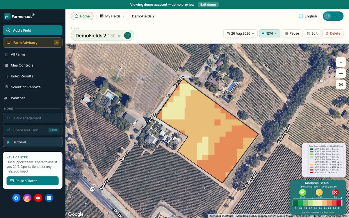
- Crop health monitoring. Vegetation-index maps (NDVI) from satellites flag areas that look different from the rest of the field. They show that something changed, not the cause, so a walk to the spot is still needed.
- Scouting with drone images. Computer vision counts stands and marks weeds, insect damage or disease in drone pictures, as Taranis describes for its service.
- Irrigation timing. Soil moisture probes plus weather data suggest when to water; CropX positions its platform around this job.
- Field records and planning. Platforms such as Climate FieldView collect machine and field data and help with seed prescriptions.
- Machine guidance. Auto-steer is the most widely adopted precision technology on US row crops, per the USDA data below.
- Yield forecasts and market planning. Models use weather, satellite and past yield data. Treat the forecast as a range, not a promise.
Spraying decisions need extra care. An AI alert is not a spray order. Follow the product label and local rules, and ask a licensed adviser before applying any pesticide or fertilizer.
▶ How satellite NDVI maps show crop stress before you can see it from the field edge. · 4:09
Best AI apps for agriculture, compared
The table covers four platforms with different strengths. The last column quotes or paraphrases each company’s own website as seen on 26 October 2026. These are vendor statements, not tests, and none of the four has been ranked against the others. Prices are not listed here because each vendor quotes them on request or by plan.
| Tool | Main job | Data it uses | Vendor’s own wording (site seen 26 Oct 2026) |
|---|---|---|---|
| Climate FieldView | Field data and records | Machine and field data | Says it connects with 60+ partners and works with most equipment types |
| CropX | Irrigation and soil | Soil sensors, weather, satellite | Describes one platform combining soil, weather, crop, satellite and farm operations data |
| Taranis | Scouting for advisers | Drone images | Offers leaf-level insights and a generative AI Ag Assistant; says it is built for advisors |
| Farmonaut | Satellite crop monitoring | Satellite images | Says it offers “crop health monitoring from satellite imagery, down to every 10 metres of your field, with NDVI maps and radar images that see through cloud” |
Read the table by job, not by brand. Climate FieldView is where its own page puts data sharing and equipment compatibility. CropX stresses that its platform joins soil, weather and satellite data for irrigation decisions. Taranis markets leaf-level crop insight for advisors, with drone images. Farmonaut works from satellite images, which suits whole-farm checks more than single-plant counts.
How to choose between satellite, drone and sensor tools
Start with the question you need answered, then pick the data. For a large farm and a weekly look at vegetation change, satellites are the lowest effort. For plant counts or leaf damage, you need drone or ground images. For irrigation, you need soil moisture at root depth, which only a probe measures directly.
Satellite choice matters because pixel size and revisit time differ. The European Space Agency describes Sentinel-2 as four bands at 10 m with a 5-day revisit at the Equator. NASA’s Harmonized Landsat and Sentinel-2 project lists Landsat 8 and 9 at 30 m with a 16-day repeat each, and a peer-reviewed analysis puts the two Landsats together at 8 days. Commercial constellations are sharper: Planet lists 3.7 m PlanetScope images and says its satellites capture the whole land mass every day.
Clouds block optical satellites. Radar sees through them, which our clay-animation explainer below covers in under three minutes.
Chart
Pixel size and revisit time of common farm imagery
Pixel size in metres (log scale) against days between images; Landsat figure is Landsat 8 and 9 combined
Is an AI app worth the cost?
The honest answer is: it depends on the money at stake and on whether you act on the advice. The calculator below puts a subscription against input savings. Change every number to your own. The defaults sit close to break-even on purpose, so you can see how little needs to change the answer.
Try the numbers for your own farm below.
Calculator
Does an AI farm app pay for itself on my farm?
Enter your own acres, input spend, expected saving and costs.
- Input savings: $3,600
- Total yearly cost: $3,500
- Saving needed to break even: 1.17 %
Example values only, not benchmarks or forecasts. The saving percentage is your own estimate of how much the app lets you cut on inputs; no source in this article gives a typical figure. Use today’s prices in US$ and include the subscription, any sensors and your own time.
Who has adopted precision technology so far
US data show that digital tools spread fastest where they save labor and fit existing machines. USDA’s Economic Research Service found that auto-steer was used on 58% of corn acres in 2016, up from 5.3% in 2001, and that yield maps reached 43.7% of corn acres in 2016. Soil maps stayed below 25% of planted acres in every crop surveyed.
Farm size matters. The same ERS report says at least half of relatively large row-crop farms use yield maps, soil maps, variable-rate technology or guidance, while fewer than 25% of the smallest farms do, except in cotton. Adoption of newer AI apps is likely to follow the same pattern, but no survey in this article measures that yet.
Chart
Share of US planted acres using each technology
% of planted acres, first and latest year shown in the report (years in labels)
What you need on the farm before you start
Most AI apps need a phone or computer and a data connection. In its August 2025 report, USDA NASS found 85% of US farms had internet access and 82% had a smart phone. Cellular data reached 74% of farms and broadband 55%. A weak signal in the field is therefore a real limit, so check that an app works offline or syncs later.
Chart
Technology on US farms, 2025
% of farms, national
Limits and risks to weigh
- Cause versus symptom. Images show a change in crop color or density. They do not name the pest, disease or nutrient problem. Confirm on the ground.
- Hard-to-use advice. In the Purdue survey, 85% of respondents (63% sometimes, 22% often) expected recommendations from such tools to be hard to follow.
- Data ownership. Ask who owns the field data, who can see it and how to export or delete it.
- Hardware and training costs. Sensors, drones and staff time add to the subscription price.
- Scale of evidence. Ask any vendor how its yield or savings claims were measured: how many farms, how many seasons, and whether there was a comparison field.
▶ Why cloudy days blind camera satellites and what radar imagery does differently. · 2:37
How to try an AI farm app in six steps
- Write down the one decision you want help with, such as when to irrigate or which fields to scout first.
- Pick the data type that fits it: satellite, drone or sensor.
- Run a trial on two or three fields, and keep one comparison field handled the usual way.
- Record what the app told you and what you did, week by week.
- Check alerts on the ground before spending money on inputs.
- At the end of the season, put the savings and the costs into the calculator and decide whether to renew.
For a plain-language start with no robot needed, the beginner video below walks through the same idea.
▶ Six plain steps to start precision farming without buying a robot. · 4:18
FAQ
What is the best AI for agriculture?
There is no single best one. The right tool depends on the job: satellite apps for whole-farm vegetation checks, drone services for leaf-level scouting, and soil sensors for irrigation. Pick by the decision you need help with, and test it on a few fields first.
Do farmers actually use AI?
Some do, and views are mixed. In the Purdue-CME survey of June 2026, 52% of respondents saw no meaningful benefit from AI or data-driven tools, and 23% named higher production as the main benefit. Machine guidance, by contrast, was already on more than half the acres of corn, soybeans, cotton, rice and sorghum in USDA’s 2016-2019 data.
Is an AI agent different from a normal farm app?
A normal app shows data. An AI agent interprets it and suggests or takes an action. In practice, most farm products sit between the two and leave the final decision to the farmer.
Can small farms benefit from AI apps?
USDA data show smaller farms have adopted precision tools less than large ones. Entry costs differ by tool, and the savings scale with acres, so use the calculator before you commit.
Can AI tell me which pesticide to spray?
It can flag where to look. Choosing and applying a product is a separate step: follow the label, local rules and your adviser’s guidance.
Which satellite images do farm apps use?
Some use public sources such as Sentinel-2 at 10 m and Landsat at 30 m, and some add commercial images with finer pixels. Ask any vendor which satellites it uses and how often images update.
Related pages on our site: AI agents in precision agriculture, AI and big data in farming, fertilizer optimization, carbon footprinting, product traceability, large-scale farm management, fleet management, crop loans and insurance, land use and agriculture, crop and forest advisory, satellite API, API developer docs.
Farmonaut crop monitoring
See your own fields from space
Draw your fields once and view satellite vegetation maps for them through the season, on web, Android or iOS.


Keep reading
Sources
- Purdue University and CME Group, Ag Economy Barometer, June 2026: ag.purdue.edu
- USDA ERS, Precision Agriculture in the Digital Era (EIB-248): ers.usda.gov
- USDA NASS, Technology Use (Farm Computer Usage and Ownership), August 2025: esmis.nal.usda.gov
- ESA/Copernicus SentiWiki, Overview of Sentinel-2 Mission: sentiwiki.copernicus.eu
- Remote Sensing, Global Revisit Interval Analysis of Landsat-8/-9 and Sentinel-2A/-2B: ncbi.nlm.nih.gov
- NASA Earthdata, Harmonized Landsat and Sentinel-2 (HLS): earthdata.nasa.gov
- Planet Labs, Planet imagery product page (seen 26 October 2026): planet.com
- Climate FieldView website (seen 26 October 2026): climate.com
- CropX website (seen 26 October 2026): cropx.com
- Taranis website (seen 26 October 2026): taranis.com
Discussion
Questions, corrections or field experience? Share them below. First-time comments are reviewed before they appear, and your email is never published.
No comments yet. Be the first to add a question or your experience.

 Adgrid
 eKGIS
 Mostas Tech
 Native Seeds
 Andex
 FCF India
 Unifrutti Gulf
 Deluxe Conseil
 TVS Electronics
 BW Pipelines
 WICO
 Chimera Innovation
 SkyHarvest
 Polaris Digitech
 Teledarbas

 Licence holder · Niger · Gold










