7 Uses of Satellite in Agriculture to Boost Yield: Unlocking Efficiency & Sustainability
“Over 80% of global crop monitoring now leverages satellite imagery for real-time yield and health analysis.”
Welcome to the future of farming, where satellite imagery in agriculture is revolutionizing the way we manage fields, crops, and resources. Through remarkable advances in remote sensing, new levels of precision and sustainability are being achieved, empowering farmers, researchers, and agribusinesses. From crop health monitoring to environmental conservation, satellites are now an indispensable part of decision-making in modern agriculture.
Table of Contents
- Introduction: The Revolution of Satellite Imagery in Agriculture
- 1. Crop Monitoring and Management
- 2. Soil Health and Moisture Analysis
- 3. Water Resource Management
- 4. Pest and Disease Detection
- 5. Yield Prediction and Forecasting
- 6. Climate and Weather Monitoring
- 7. Crop Insurance and Risk Management
- Comparative Table: 7 Key Satellite Uses in Agriculture
- Farmonaut’s Technology & Solutions
- Challenges and Future Directions of Satellite Technology in Agriculture
- Frequently Asked Questions (FAQ)
Introduction: The Revolution of Satellite Imagery in Agriculture
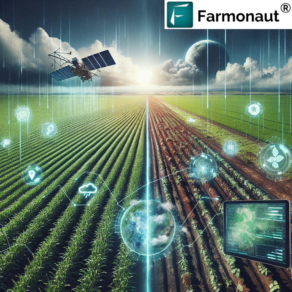
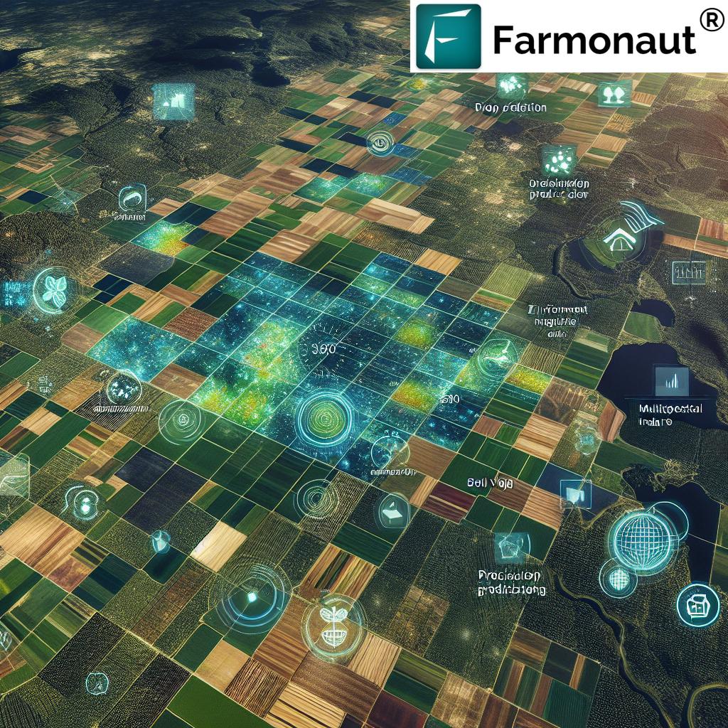
The last decade has seen satellite technology emerge as a game-changer in agriculture. By leveraging remote sensing, multispectral and hyperspectral sensors, and advanced data analysis techniques, we can monitor, evaluate, and optimize nearly every aspect of the farming process. What used to take days or weeks can now be achieved within hours with just a few clicks.
Satellite imagery in agriculture enables real-time monitoring of vast farmlands, soil moisture analysis, climate forecasting, disease detection in crops, and accurate yield prediction and forecasting. These capabilities not only support sustainable agriculture practices but also enhance productivity and resource use efficiency—cornerstones of agricultural success in today’s world.
In this comprehensive guide, we delve deep into the 7 uses of satellite in agriculture that are proven to boost yield and sustainability. Whether you are a grower, agronomist, or policymaker, understanding these cutting-edge applications will transform your approach to farming.
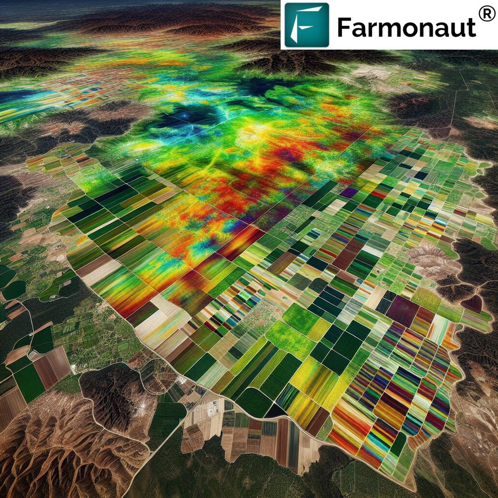
1. Crop Monitoring and Management: Leveraging Satellite Imagery in Agriculture
At the heart of precision agriculture lies the capacity to observe and respond to crop needs in real time. This is where crop monitoring and management with satellites is proving invaluable. Modern satellites, equipped with multispectral and hyperspectral sensors, are capable of capturing detailed images of the earth’s surface, enabling us to evaluate plant vigor, detect diseases, and identify nutrient deficiencies across large fields.
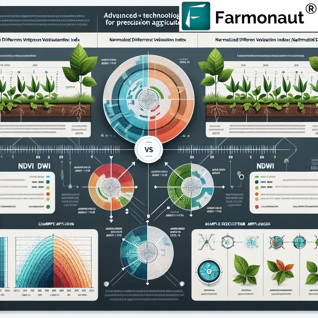
- Remote Sensing for Farmers: Farmers can view up-to-date vegetation indices (e.g., NDVI, SAVI) to assess crop health and identify parcels that need immediate attention.
- Early Detection: By analyzing images captured weekly or even daily, we can proactively detect abnormalities, from fungal attacks to chlorosis, ensuring timely interventions.
- Targeted Actions: Satellite data supports tailored fertilization and precise pesticide application, optimizing resource use and minimizing environmental impact.
- Yield Estimation: Satellite platforms such as the European Space Agency’s Sentinel-2 provide global data for effective crop yield prediction and vegetation monitoring.
With these advancements, large and small farms can benefit from frequent, accurate, and scalable solutions for monitoring and management, ultimately leading to increased crop yield and improved resource utilization.
Try next-generation crop health assessment and monitoring with the Farmonaut App. Experience satellite insights directly from your phone or computer!


Key Takeaway:
- Satellite-based crop monitoring and management empowers farmers with early detection, optimizes interventions, and maximizes yield.
- Platforms like Farmonaut ensure that these cutting-edge tools are accessible and affordable globally.
“Satellite soil moisture analysis can improve irrigation efficiency by up to 30%, boosting sustainable agricultural practices.”

2. Soil Health and Moisture Analysis: Precision Insights for Efficient Irrigation
Understanding soil conditions is foundational to successful agriculture. If soil is too dry, growth ceases; if too wet, roots suffocate and diseases thrive. The advent of satellite-based soil moisture analysis has made it possible to monitor moisture content globally with remarkable precision.
Satellites like NASA’s Soil Moisture Active Passive (SMAP) mission utilize active and passive remote sensing to measure soil moisture levels down to a few centimeters. This data is a game-changer for irrigation scheduling, drought management, and resource conservation.
- Efficient Irrigation: Satellite soil moisture analysis supports precision irrigation technology by aligning watering cycles with real-time need, reducing both water usage and wastage.
- Resource Optimization: By stopping over-irrigation, farmers can save water, reduce pumping costs, and minimize runoff that could contain fertilizers and pesticides.
- Soil Health Monitoring: Satellites can analyze variations in soil types and dryness across entire regions, highlighting areas at risk for erosion, salinity, or nutrient leaching.
According to recent estimates, improvements in irrigation efficiency owing to satellite soil moisture analysis can boost yield by 10–30%, while slashing the use of critical water resources.
- Learn more: Farmonaut’s Carbon Footprinting & Environmental Monitoring Tools offer real-time tracking of field moisture, emissions, and sustainability metrics.
Why Soil Health & Moisture Analysis Matters:
- Provides accurate data for efficient irrigation schedules.
- Enables detection of soils at risk for degradation or erosion.
- Supports sustainable agriculture practices by conserving water and improving crop yield.
3. Water Resource Management: Smart and Sustainable Solutions
In water-scarce regions or during periods of drought, every drop matters. Satellite imagery in agriculture delivers real-time feedback on soil moisture, evapotranspiration rates, and weather patterns, enabling precision irrigation technology and efficient resource management.
Farmers can use these insights to:
- Map water needs: Identify which areas of the field require more or less water.
- Schedule irrigation: Optimize timing and amount of irrigation, reducing both energy and water costs.
- Monitor changes: Track fluctuations in water content due to rainfall, evaporation, or plant use.
For example, almond growers in California have used satellite-guided irrigation to cut water use up to 25% without sacrificing quality.
- Discover advanced management: Farmonaut’s Fleet Management Solution helps agribusinesses track vehicles and optimize irrigation logistics.
Key Benefits:
- Saves valuable water resources.
- Supports regulatory compliance and environmental impact tracking.
- Ensures crops receive adequate hydration for healthy growth and robust yields.
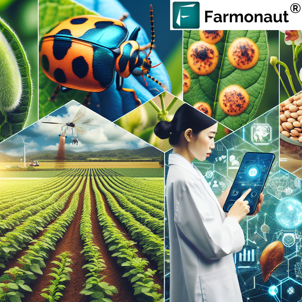
4. Pest and Disease Detection in Crops: Early Intervention for Maximum Yield
Early disease detection in crops is paramount for reducing losses and safeguarding yields. With satellite imagery, it’s possible to detect stress indicators before symptoms are visible to the naked eye.
- Stress Mapping: Satellites capture real-time data on vegetation health, spectral signatures, and color shifts—which can indicate fungal infections, pest attacks, or nutrient deficiencies.
- Precise Pesticide Application: Early alerts mean targeted interventions are possible, reducing chemical use and cropping system’s overall environmental impact.
- Scout Less, Know More: Wide-field satellite images help reduce manual scouting time, especially in large-scale, multi-plot operations or remote regions.
For those engaged in sustainability efforts, Farmonaut’s Plantation & Forest Advisory Tools provide remote detection of crop stress, deforestation risks, and more for holistic management.
How Does Satellite-Aided Pest Detection Work?
- Satellite sensors scan fields at multiple wavelengths detecting changes at the plant tissue level.
- Regular analysis pinpoints the onset and severity of pest or disease outbreaks, enabling swift, effective action.
- AI-based advisory platforms (like Farmonaut’s Jeevn AI) provide personalized action recommendations based on detected threats.
5. Yield Prediction and Forecasting: Data-Driven Food Security
Yield prediction and forecasting are essential for ensuring food security and stabilizing agri-supply chains. Satellite data, combined with machine learning models, leverages years of vegetation growth, weather, and environmental data to predict future harvest outcomes with impressive accuracy.
These predictions inform resource allocation, policy planning, warehouse management, and market strategy.
- Vegetation Analysis: Tracking vegetation indices and growth curves inspects crop performance from emergence to harvest, providing ongoing yield forecasts.
- Environmental Factors: Climate, rainfall, temperature, and soil moisture data are integrated for more robust yield models.
- Data at Scale: Satellites offer the capacity to monitor and predict output for entire regions, countries, or continents, supporting global food security initiatives.
- Integrate with Farmonaut: Access yield prediction data via Farmonaut’s Satellite Data API and API Developer Docs to build custom analytics tools.
Why Accurate Yield Forecasts Matter:
- Empowers farmers with insight for market and input planning.
- Helps governments and NGOs design prompt policy responses to impending shortages or surpluses.
- Supports insurers and banks in conducting risk analysis and loan assessments.
6. Climate and Weather Monitoring: Proactive Farming Decisions
Weather can make or break a crop cycle. With real-time satellite weather monitoring and climate forecasting, we can offer farmers and agribusinesses early warnings and planning capabilities that were unimaginable just a few years ago.
- Disaster Prevention: Advance notice about drought, floods, or storms allows targeted interventions to minimize crop and resource losses.
- Activity Optimization: Schedule key operations like plantings, pesticide application, and irrigation around optimal weather windows.
- Yearly Planning: Analyze long-term climate data to decide which varieties to plant, stagger sowing dates, or adjust business strategies.
Farmonaut’s Jeevn AI system integrates satellite and meteorological data, offering real-time weather alerts and advisory for maximizing farm productivity.
- Maximize large farm efficiency: Farmonaut’s Large Scale Farm Management App delivers comprehensive insight and notification systems for weather risk across multiple sites.
7. Crop Insurance and Risk Management: Protecting Farmers’ Interests
Ensuring resilience in the face of unpredictable weather, pests, or natural disasters is critical. Satellite imagery supports not only crop insurance underwriting, but also real-time verification of damage and objective loss assessment, accelerating compensation to those in need.
- Index-Based Insurance: Leveraging satellite data to trigger payouts based on measurable parameters (e.g., rainfall, soil moisture, biomass loss), this system is highly responsive and transparent.
- Accurate Damage Estimates: Remote sensing detects loss due to severe weather, pests, or diseases across enormous areas, providing instant, unbiased data to insurers and governments.
- Accessibility: Automating insurance workflows with satellite verification reduces fraud and makes insurance viable for smallholder and remote farmers.
- Unlock affordable insurance: Farmonaut’s Satellite-Powered Crop Loan and Insurance Verification ensures quick, evidence-based access to financial support.
Agronomy Application:
- Better risk management, rapid settlements, and extended financial services support the long-term prosperity of global agriculture.
Comparative Table: 7 Key Uses of Satellite in Agriculture—Features & Benefits
| Satellite Application | Description | Estimated Yield Improvement (%) | Technological Advancements Used | Impact on Sustainability |
|---|---|---|---|---|
| Crop Monitoring & Management | Real-time assessment of crop health, vigor, and disease risks across fields | 12–20 | Multispectral/hyperspectral sensors, NDVI/SAVI analysis, AI | Reduces input waste; minimizes chemical use; optimizes productivity |
| Soil Health & Moisture Analysis | Remote measurement of soil moisture, fertility, and structure | 10–30 | Active/passive remote sensing, SMAP mission data, thermal imaging | Increases water-use efficiency, prevents soil degradation |
| Water Resource Management | Real-time mapping of field moisture and optimized irrigation | 15–25 | Evapotranspiration mapping, precision irrigation tech | Conserves water, reduces runoff, ensures crop hydration |
| Pest & Disease Detection | Identification of crop stress, early warning for intervention | 8–15 | Spectral analysis, stress pattern recognition via AI/ML | Reduces chemical use; enables targeted pest and disease control |
| Yield Prediction & Forecasting | Seasonal predictions of harvest quantity and quality | 10–18 | Satellite data, ML/AI models, weather/climate integration | Supports food security planning, reduces post-harvest losses |
| Climate & Weather Monitoring | Real-time weather and extreme event warnings | 7–12 | Satellite meteorology, rapid data delivery, AI alerts | Mitigates disaster losses; aids adaptive farming strategies |
| Crop Insurance & Risk Management | Objective monitoring for insurance, claims, and risk reduction | 5–15 | Satellite validation, index insurance triggers, blockchain traceability | Increases farmer resilience, ensures timely compensation |
Farmonaut’s Technology & Solutions: Making Satellite Agriculture Accessible to All
As a pioneering agricultural technology company, we at Farmonaut strive to break barriers in precision agriculture through a blend of satellite imagery, AI, and blockchain. Our solutions enable farmers worldwide to leverage all the highlighted satellite applications—regardless of their location, farm size, or technical background.
What We Offer:
- Satellite-Based Crop Health Monitoring: Our app delivers up-to-date NDVI, NDRE, SAVI, and other vegetative indices directly to users’ devices, helping farmers recognize plant health changes and optimize practices.
- Jeevn AI Advisory: Our AI-driven, personalized farm advisory system taps into remote sensing data and local climate to recommend the best crop management strategies and yield forecasting.
- Fleet & Resource Management: Track machinery and logistics, improve fuel efficiency, and schedule irrigation using real-time satellite data.
- Blockchain Traceability: Enhance product transparency from farm to fork using our Blockchain Traceability Solution.
- Carbon Footprinting: Accurately measure and manage your farm’s carbon emissions for more sustainable operations.
- Insurance and Financial Access: Our platform supports objective verification for insurance and loans, accelerating approvals and reducing risks.
- Scalable Access: Farmonaut’s web and mobile apps, as well as APIs (API, API Docs), make satellite agriculture globally accessible.
We are committed to democratizing satellite-driven farming through affordable, user-friendly, and innovative solutions—paving the way for a more productive and sustainable agricultural future.
More Applications: Satellite Imagery Beyond Crop Yield
Aiding Forestry and Environmental Monitoring in Farming
- Forestry Management: Satellites like Sentinel-2 deliver high-resolution imagery to monitor forest health, mapping deforestation, and assessing biomass changes, supporting conservation efforts.
- Land Use and Environmental Monitoring: Regularly updated satellite data guides land use planning, soil erosion assessment, and environmental policy.
For forestry professionals and conservationists, Farmonaut’s forestry advisory platform (access here) brings together best-in-class satellite environmental monitoring and risk assessment.
Breeding Better Crops with Remote Sensing
Satellite imagery doesn’t just improve yield on current crops—it’s invaluable for plant breeding programs:
- Monitor physical characteristics: Correlate genotype with observed growth patterns across environmental conditions.
- Accelerate breeding cycles: Select candidates for resilience, productivity, and climate adaptation.
- Support global food security: Enable faster response to shifting climate and population needs.
Empowering Conservation Efforts
- Soil Erosion and Degradation: Monitor ongoing changes to formulate rapid conservation responses.
- Deforestation Tracking: Satellite data enables enforcement of policies and enhances restoration planning.
Farmonaut’s environmental monitoring in farming, available via app or API, provides governments and organizations with actionable data for conservation strategies.
Frequently Asked Questions (FAQ)
-
What is satellite imagery in agriculture?
Satellite imagery in agriculture refers to the use of satellite-captured images and data to monitor, analyze, and manage crops, soil, water, and environmental conditions. This technology enables farmers and agribusinesses to make informed, data-driven decisions for enhanced productivity and sustainability.
-
How does soil moisture analysis from satellites improve irrigation?
Soil moisture analysis uses active and passive remote sensing to estimate water availability in the soil. This information helps farmers to schedule irrigation only when needed, preventing over-irrigation and conserving water, while optimizing crop root health and yield.
-
What are the key benefits of satellite-enabled crop yield prediction and forecasting?
Yield prediction via satellite enables accurate, unbiased estimates of harvest quantity and quality. It powers effective supply chain management, improves food security, reduces loss due to unanticipated events, and drives better policy- and decision-making at all scales.
-
Can satellite imagery help with crop insurance and risk management?
Yes, satellite imagery provides objective and timely evidence of crop losses, supports index-based insurance triggers, and allows faster and more equitable compensation for affected farmers. It reduces fraud and expands access to financial instruments.
-
How does Farmonaut make these advanced tools accessible?
We at Farmonaut deliver real-time satellite imagery, analysis, AI advisory, and resource management solutions via our web, Android, iOS apps, and APIs. By providing a flexible, affordable subscription model, we enable global access to premium satellite farming technology for farmers of all scales, agribusinesses, governments, and researchers.
Challenges and Future Directions: Evolving Toward a Connected Agricultural Ecosystem
While satellite imagery in agriculture has unlocked immense potential, several challenges remain before its benefits are universally realized:
- Data Accessibility: Rural broadband gaps and technological illiteracy can hinder satellite data uptake by smallholder farmers.
- Cost Barriers: Though platforms like Farmonaut have slashed prices, ongoing global scaling is vital to ensure inclusion.
- Technical Expertise: Learning to interpret complex satellite data requires investment in training and extension.
The future promises expanding high-resolution satellite networks, sharper analytics, seamless integration with IoT, and broader education, so every farmer—from Punjab to California—can harness precise, sustainable, and efficient farming for a food-secure world.
Conclusion: Satellite Imagery in Agriculture—A New Era of Yield, Efficiency, and Sustainability
Satellite technology has fundamentally changed our approach to agriculture and forestry. By providing critical data for every key practice—crop monitoring and management, soil moisture analysis, precision irrigation, pest and disease detection, yield prediction and forecasting, weather monitoring, and crop insurance and risk management—it empowers farmers to farm smarter, conserve resources, and build sustainable food systems. As accessibility improves and technology advances, these tools will become even more pivotal in ensuring a resilient, productive, and environmentally responsible future for global agriculture.
Ready to join the future of farming? Experience affordable, advanced remote sensing for farmers everywhere with the Farmonaut app and API tools.