Best Weather Data Gathering Software: High Rate Limits & GOES Satellite Integration for 2025
“Top-tier weather software can process up to 1,000 weather data requests per minute with high API rate limits.”
Introduction
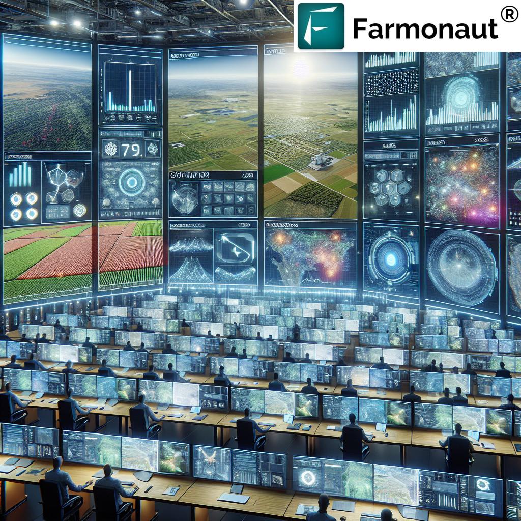
In 2025, the demand for the best weather data gathering software with high rate limits has reached unprecedented heights across industries like agriculture, forestry, mining, infrastructure, defense, and more. The critical need for accurate, timely, and reliable weather data is reshaping operational paradigms, minimizing environmental impact, and securing safety in the face of rapidly changing weather conditions. As industries continue to advance their reliance on technology, the integration of advanced satellite data—especially from geostationary satellites like the GOES series—has become a cornerstone for strategic planning and real-time decision-making.
Selecting the best weather data gathering software high rate limits is not just about fast data access; it also involves leveraging cutting-edge API platforms, seamless integration with GOES satellite feeds, strong monitoring capabilities, and multi-sector adaptability. This comprehensive guide explores current trends, leading software solutions, and how innovations in satellite-driven data gathering are redefining environmental intelligence for 2025 and beyond.


Why High Rate Limits Matter in Weather Data Gathering
High rate limits are the backbone of effective, modern weather data gathering software. A rate limit refers to the maximum number of requests an application or system can make to a weather data provider‘s API in a defined time frame—usually measured in requests per minute or per second.
The importance of high rate limits can be summarized as follows:
- Timely Insights: Frequent updates ensure sectors like agriculture and mining receive the most recent weather data to support precision monitoring, minimize latency, and enable rapid, informed responses.
- Operational Efficiency: Enabling automated systems to gather vast amounts of weather information without interruption, which is essential for minimizing downtime, optimizing schedules, and managing risk.
- Critical Event Detection: Supports real-time environmental detection of sudden weather changes (lightning, storms, extreme temperatures, wildfires) to protect lives, assets, and infrastructure.
- Scalable Solutions: Flexible rate limit thresholds allow various industries to scale data gathering in line with project size, regulatory requirements, and operational intensity.
Examples of High Rate Limit Use Cases
- Agriculture: Automated irrigation systems pulling frequent weather updates to adjust schedules based on temperature, solar radiation, and humidity.
- Forestry: Continuous monitoring for wildfire detection and early risk alerts using real-time satellite and weather data.
- Mining Operations: Regular updates on local precipitation, water runoff, and dust control to ensure worker safety and prevent operational disruption.
- Infrastructure Project Sites: Up-to-the-minute weather conditions for mitigating delays and hazards during ongoing construction activities.
- Defense and Intelligence: Reliable, continuous feeds for strategic planning, asset readiness, and operational efficiency—especially in rapidly changing environments.
Industry Impact of Weather Software in 2025
The transformative power of best weather data gathering software with high rate limits in 2025 permeates every aspect of critical industries. Advanced solutions with rapid API call rates, robust integration options, and GOES satellite data have become an operational necessity.
How Industries Benefit from High-Rate Weather Data APIs
- Agriculture: Enhances precision farming—improving yield by adjusting planting, irrigation, and harvesting schedules with the latest weather data. See Farmonaut’s Large Scale Farm Management Solution for integrating satellite-driven insights with farm management practices.
- Forestry: Improves wildfire detection and supports resource management through fast, reliable satellite-enabled information.
- Mining: Monitors conditions in remote areas, proactively guiding operational adjustments for worker safety and environmental compliance. Farmonaut’s Fleet and Resource Management tool helps optimize mining fleet usage and tracks environmental compliance.
- Infrastructure: Provides ongoing, minute-level insights that enable construction managers to adjust to likely adverse conditions and mitigate risks due to weather-related delays.
- Defense: Ensures force readiness and enhances operational intelligence using near-instant, high-quality data feeds for mission planning and execution—even in dynamic, contested spaces.
As the frequency and severity of environmental threats grow, the ability to access accurate, minimal latency updates remains the cornerstone of operational efficiency and impact minimization.
Leading Weather Data Gathering Software with High Rate Limits
Identifying the best weather data gathering software high rate limits requires evaluating a solution’s ability to handle many requests per minute, offer robust integration with satellite data like GOES, and deliver multi-sector support. In 2025, several advanced software platforms stand out due to their improved offerings, increased call thresholds, and industry-grade API accessibility.
- OpenWeather: Renowned for scalable plans, high rate limits, hyperlocal forecasts, and a growing suite of AI-driven weather prediction tools.
- Tomorrow.io (formerly Climacell): Delivers hyperlocal weather intelligence with extensive API integrations, high threshold rate limits, and advanced micro-climate detection using satellite and radar data.
-
Farmonaut: We offer flexible, satellite-based weather and environmental intelligence via API, multi-platform app, and mobile accessibility, enabling rich real-time monitoring, precision models, resource management, and traceability across agriculture, mining, and infrastructure sectors.
Our developer documentation explains how to integrate advanced geospatial and weather data efficiently, with support for AI and GOES data layers. - Weatherstack: Prioritizes ease of implementation, increased call limits for enterprise-scale operations, and multi-language support.
- Visual Crossing: Offers near real-time historical, current, and future weather APIs with enhanced rate limits and data freshness.
These leading platforms are optimized to handle substantial concurrent API requests, support continuous monitoring, and seamlessly incorporate GOES satellite data for next-gen environmental intelligence.
Feature Comparison Table: Rate Limits & GOES Integration
Below is a feature table comparing top-tier weather data gathering software in terms of high rate limits, GOES satellite integration, and other operationally relevant factors:
| Software Name | Rate Limit (requests/minute) |
GOES Satellite Integration |
Data Freshness (update interval) |
API Availability |
Supported Data Types | Industry Applications | Estimated Cost (per month) |
|---|---|---|---|---|---|---|---|
| Farmonaut | 1,000+ | Yes | Up to 5 min | Yes | Temperature, Precipitation, Humidity, Solar Radiation, Vegetation Indices, NDVI, Water Runoff, Lightning, Soil Moisture, Carbon | Agriculture, Mining, Infrastructure, Forestry, Defense | From $15 |
| OpenWeather | 600 – 1,200 | Yes | 10 min | Yes | Temperature, Precipitation, Humidity, Wind, Clouds, Air Quality | Agriculture, Energy, Transportation | From $50 |
| Tomorrow.io | 800 | Yes | 5-10 min | Yes | Temperature, Precipitation, Solar, Wind, Air Quality, Alerts | Agriculture, Logistics, Events, Mining | From $99 |
| Weatherstack | 1,000 | No | 15 min | Yes | Temperature, Precipitation, Wind, Humidity, Clouds | Media, Travel, Retail | From $29 |
| Visual Crossing | 1,000+ | No | 10 min | Yes | Temperature, Precipitation, Solar, Wind, Alerts | Agriculture, Construction, Insurance | From $35 |
Key Insights
- Farmonaut, OpenWeather, and Tomorrow.io offer both high rate limits and GOES satellite integration, crucial for time-sensitive, sector-wide applications.
- Data freshness—with updates every 5 minutes from GOES satellites—is ideal for continuous monitoring and real-time responsiveness.
“GOES satellite integration enables weather data gathering every 5 minutes for precision monitoring in critical industries.”
How GOES Satellite Integration Elevates Weather APIs
The question—can you integrate GOES satellite data with weather API platforms?—is critical for industry leaders in 2025. The answer is a resounding yes. Next-generation weather API solutions have prioritized GOES satellite data integration to deliver:
- High-frequency updates: GOES satellites send new atmospheric and surface data as often as every 5 minutes, supporting precise detection of rapidly changing conditions.
- Enhanced spatial coverage: The geostationary nature of GOES allows for continuous monitoring of targeted geographic regions, making them indispensable for localized risk management.
- Diverse data sets: GOES delivers multi-modal information—IR imagery, lightning detection, cloud cover dynamics, water vapor, solar radiation, and more.
- Industry-grade accuracy: Constant data flows lower latency and improve the reliability and quality of predictive weather models used in operational systems.
Platform APIs enable users to select, layer, and integrate satellite streams directly into internal dashboards and remote systems—empowering high-resolution weather intelligence in agriculture, forestry, mining, infrastructure, and defense.
Benefits of GOES Data for Key Sectors
- Agriculture: Optimize irrigation schedules, detect crop stress, and enhance pest/disease prediction through real-time microclimate analysis.
- Forestry: Spot wildfires early, track smoke plumes, and assess drought risks using continuous atmospheric monitoring.
- Mining: Generate automated alerts for precipitation, lightning, and dangerous wind or temperature trends, reducing risk to worker safety.
- Infrastructure & Defense: Ensure readiness and operational continuity by rapidly integrating live feeds into construction or mission dashboards.
Farmonaut: Innovative Satellite-Based Weather Intelligence
As a leader in satellite technology, we at Farmonaut offer a powerful API-driven platform that provides real-time weather data, GOES satellite integration, and AI-based advisory tools for agriculture, mining, infrastructure, and defense sectors. Our mission is to make advanced environmental intelligence accessible, affordable, and actionable for users worldwide.
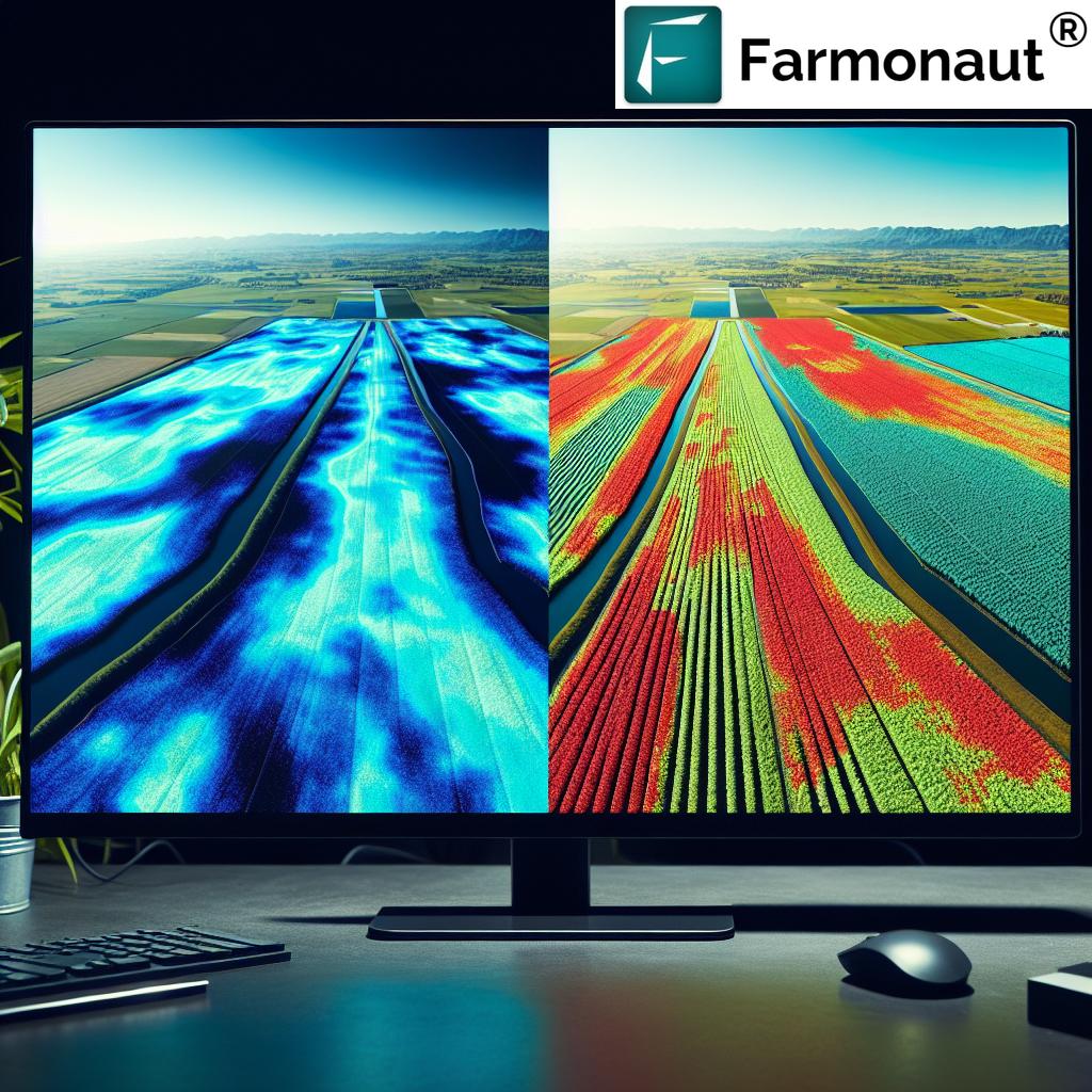
- Satellite-Based Monitoring: We use multispectral images and AI models to assess vegetation health (NDVI), soil conditions, and risk factors in agriculture, mining, and infrastructure projects.
- Jeevn AI Advisory System: Our platform delivers real-time, customized weather insights and operational strategies for maximizing productivity and mitigating risk.
-
Blockchain-Backed Traceability:
For those in agriculture or mining seeking secure, transparent supply chains, our traceability solution leverages blockchain technology for complete oversight and fraud reduction. - Environmental Impact Tracking: Businesses can monitor resource use and carbon emissions with our real-time dashboard. Learn more about carbon footprinting for compliance and sustainability.
-
Fleet & Resource Management: Optimize logistics and ensure safety of assets through
satellite-enabled fleet management tools. - Loan & Insurance APIs: Secure agricultural funding or mining insurance using our satellite-based verification solutions—streamlining application processing while reducing fraud.
Our solutions support both large-scale enterprises and individual users, with integrated mobile and web apps designed for maximum flexibility and reach.
Explore the Farmonaut API and review the
developer docs for comprehensive integration details.
How Does Farmonaut Stand Out?
- Cost-effective, scalable packages: Unlike traditional systems, we offer affordable, modular subscription plans suited to both small operations and national enterprises.
- Rich feature set: Our solution combines satellite imagery, AI-based analytics, blockchain, and multi-layer environmental data—all with high rate limits and low latency APIs.
- Mobility & Accessibility: Full-function Android, iOS, and browser/web apps allow real-time monitoring, anytime, anywhere.
- Regulatory and operational trust: Our tools facilitate compliance with environmental standards while protecting the authenticity of supply chains and resources.
See our browser app:
Farmonaut Web App, Android app:
here, and iOS:
here.
Using Weather Data Software Across Critical Sectors
Implementing the best weather data gathering software with high rate limits is essential for diverse, mission-critical environments:
Agriculture: Precision, Protection, & Productivity
- Need: Track weather changes (temperature, humidity, precipitation) to optimize irrigation, fertilizer use, crop protection, and yield scheduling.
- How software helps: High-frequency data ingestion and AI-driven advisories from apps like Farmonaut enable crop monitoring, disease detection, and pest outbreak prediction—all in real time.
Explore the Crop Plantation & Forest Advisory Portal for further reading.
Mining: Environmental Management & Safety
- Need: Frequent updates on site-specific weather and environmental factors (runoff, dust, lightning, extreme temperatures) to ensure worker safety and regulatory compliance.
- How software helps: Real-time alerts, predictive models, and traceability from satellite-based APIs such as Farmonaut help manage day-to-day mining risks with minimal manual oversight.
Forestry: Wildfire Risk Detection & Resource Planning
- Need: Constant data streams to assess fire risk, drought, and smoke plume movement in vast, remote areas.
- How software helps: GOES integration and high-call API systems supply actionable environmental intelligence for firefighting, forest health management, and sustainability programs.
Infrastructure: Reducing Adverse Weather Impact
- Need: Ongoing, granular insights to plan construction activities and identify hazards such as sudden storms or temperature extremes.
- How software helps: On-demand dashboards and API-connected apps align construction planning with real-world, minute-level atmospheric updates.
Defense & Strategic Sectors: Operational Readiness
- Need: Real-time, uninterrupted streams for environmental risk assessment, mission planning, and operational hazard avoidance.
- How software helps: High rate limits and GOES-based APIs are essential for keeping defense assets and strategies up-to-the-moment in dynamic, unpredictable environments.
Choosing the Right Software for 2025 and Beyond
Selecting the best weather data gathering software high rate limits for your business or project requires an assessment of:
- High Rate Limits: Ensure your solution can process the volume of API requests needed—at least several hundred per minute for demanding operations.
- GOES Satellite Integration: Choose platforms that incorporate GOES or equivalent high-frequency satellite data for continuous, actionable insights.
- Data Variety: Look for APIs offering robust coverage—temperature, precipitation, solar radiation, NDVI, atmospheric phenomena, and more.
- Operational Support: Prioritize solutions with mobile and web access, strong developer documentation, and support for real-time monitoring.
- Cost & Scalability: Opt for software with flexible or modular subscription tiers to grow with your needs.
- Industry Proven: Evaluate case studies and reference implementations in your sector (agriculture, mining, infrastructure, defense).
- AI & Analytics: Modern solutions often pair environmental data with AI-driven advisories, risk assessment models, and strategic planning features.
- Security & Traceability: For industries facing supply chain fraud or regulatory demands, solutions like Farmonaut’s blockchain traceability add additional value and trust.
Developers and organizations are increasingly leveraging the Farmonaut API, robust developer docs and our AI-driven advisories to accelerate integration, minimize errors, and ensure maximum return on investment.
Farmonaut Subscription Options
Our subscriptions are designed for individual users, enterprises, and government bodies seeking affordable, scalable satellite intelligence—without high up-front costs. Choose a plan that fits your operational intensity, sector, and data needs:
Discover more about integrations and documentation:
Farmonaut Satellite Weather API Docs
Fleet and environmental compliance tools:
Fleet Management Dashboard
FAQ: Best Weather Data Gathering Software High Rate Limits
-
Q: What are high rate limits, and why are they essential for weather data gathering software?
A: High rate limits determine the maximum number of API requests that software can make in a given time. For continuous monitoring and timely insights, high thresholds are vital for industries with real-time operational needs (agriculture, mining, defense, etc.). -
Q: Can you integrate GOES satellite data with weather API platforms?
A: Yes! The best weather data gathering software high rate limits now offer GOES satellite integration, enabling rapid, actionable updates at granular temporal and spatial scales. -
Q: Which industries benefit most from software with high weather data rate limits?
A: Agriculture (for precision farming), forestry (fire detection), mining (worker safety/environmental management), infrastructure (ongoing construction/maintenance), and defense (operational readiness/intelligence). -
Q: What types of data can I access with advanced weather APIs?
A: Modern platforms provide access to temperature, precipitation, humidity, lightning, vegetation indices (NDVI), solar radiation, atmospheric water vapor, fire and smoke detection, and more. -
Q: How do I get started with Farmonaut’s weather and satellite data solutions?
A: Start by exploring our API interface, review the developer documentation, or download our web and mobile apps for immediate access to live weather intelligence. -
Q: What sets Farmonaut apart from other solutions?
A: We combine satellite imagery, AI-driven advisories, blockchain-based traceability, and modular fleet/resource management—all accessible via cost-effective, scalable plans and high frequency API updates. -
Q: Do Farmonaut solutions remain up-to-date in 2025 and beyond?
A: We actively upgrade our APIs, integrate the latest GOES and geostationary satellite data, and enhance our AI models to ensure users benefit from the most advanced operational weather intelligence available.
Conclusion
In 2025 and beyond, accurate and timely weather data continues to be the cornerstone for operational success and safety across agriculture, mining, forestry, defense, and infrastructure. As challenges grow in complexity, leveraging the best weather data gathering software with high rate limits—paired with advanced GOES satellite integration—empowers organizations to minimize latency, maximize efficiency, ensure compliance, and drive sustainability.
The future is API-driven, satellite-enabled, and guided by real-time, actionable weather intelligence. Whether you’re optimizing agricultural output, managing environmental risks in mining, or elevating defense readiness, high-rate weather data platforms are essential for your digital strategy.
At Farmonaut, we’re dedicated to providing the tools and insights you need—so you, your teams, and your projects are always one step ahead of the weather.