NDVI, Drone NDVI Mapping: 7 Powerful Advances for 2026
“By 2025, NDVI mapping is projected to analyze over 350 million hectares of global farmland annually.”
Table of Contents
- Harnessing NDVI and Drone Technology for Precision Agriculture in 2025
- What Does NDVI Mean? Understanding the NDVI Index
- Drone NDVI Mapping: The Power of Aerial Perspective
- Comparative Advances Table: 7 Key NDVI & Drone NDVI Mapping Trends for 2026
- Key Applications of NDVI and Drone NDVI in Agriculture
- 7 Most Powerful NDVI & Drone NDVI Advances for 2026
- Our Satellite NDVI Platform: How Farmonaut Empowers 2026 Agriculture
- Integration & The Future: Unlocking Sustainability with Advanced NDVI Mapping
- FAQ: NDVI, Drone NDVI Mapping & Agricultural Innovation
Harnessing NDVI and Drone Technology for Precision Agriculture in 2025
The dynamic landscape of modern agriculture is being fundamentally reshaped by advanced remote sensing technologies and precision resource management solutions. Among all recent advances, the Normalized Difference Vegetation Index (NDVI) has become an indispensable analytical tool in the arsenal of today’s innovative farmers and agronomists.
In recent years, NDVI, drone NDVI mapping, and the synergy between remote sensing and drones have allowed practitioners of smart farming to monitor crop vigor, assess vegetation health, and make yield-boosting decisions earlier and with greater accuracy than ever before. As we approach 2026, these technologies are expected to expand their reach, unlocking new potentials for sustainable, productive, and climate-resilient agriculture.
This comprehensive blog explores what NDVI means, how drone NDVI mapping works, and the 7 most powerful advances in the field expected by 2026 – all tailored to empower farmers, agronomists, and agri-tech users with actionable insights and practical solutions.
What Does NDVI Mean? Understanding the NDVI Index
Unpacking the NDVI Index: Definition and Formula
NDVI, or Normalized Difference Vegetation Index, is a numerical indicator widely used to quantify vegetation health, density, and vigor. The NDVI formula utilizes the strong difference in reflectance properties of healthy vegetation: green, active plant canopies strongly reflect near-infrared (NIR) light while absorbing red visible light.
The NDVI index formula is:
NDVI = (NIR – Red) / (NIR + Red)
- NIR = Reflectance measured in the near-infrared band (wavelength ~700–1100nm)
- Red = Reflectance measured in the red (visible) band (wavelength ~600–700nm)
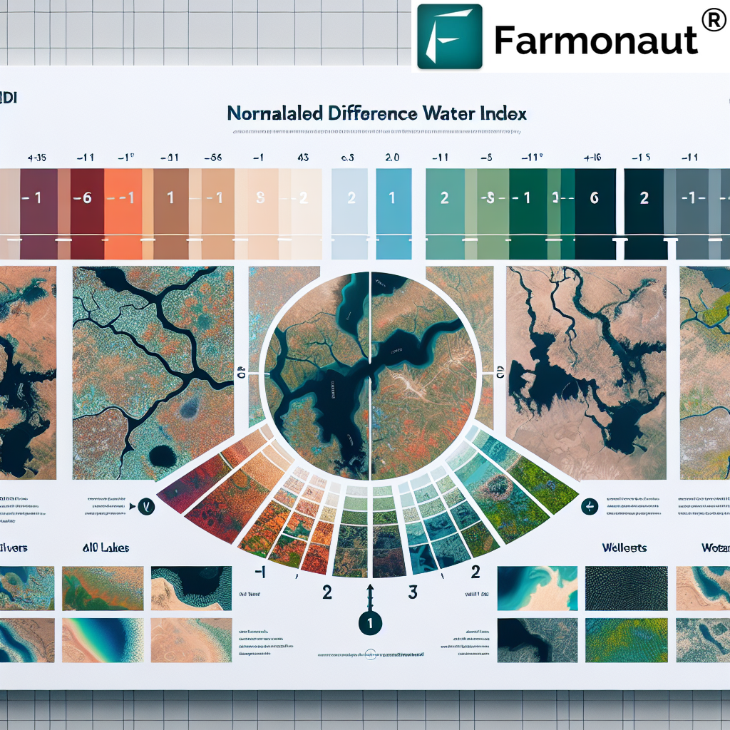
NDVI values range from -1 to +1. Typically:
- High positive values (close to +1): Healthy, dense vegetation
- Moderate values (0 to .3): Sparse or stressed vegetation
- Zero or negative values: Barren land, water bodies, built-up urban areas

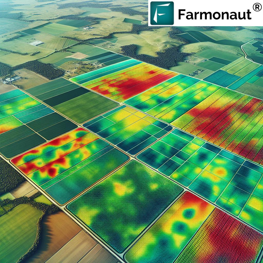
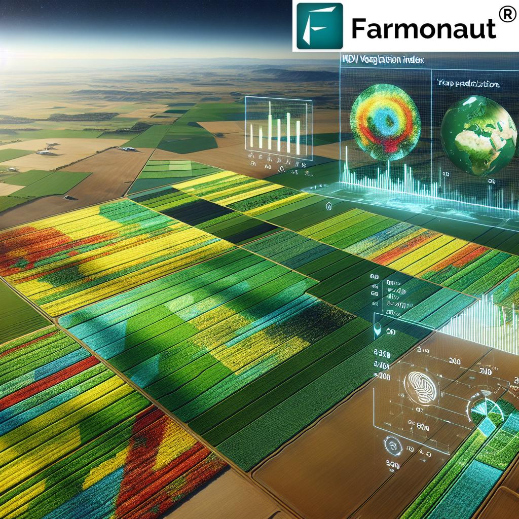
Figure: Example NDVI crop health map showcasing field variability. | ALT Text: NDVI crop health map for precision agriculture NDVI mapping
Why NDVI is Critical for Crop Management
The NDVI index helps agricultural professionals to:
- Identify areas of crop stress (due to water deficiency, pest infestation, or nutrient shortage) early, long before visible symptoms develop.
- Differentiate between healthy and unhealthy plant growth for targeted action.
- Assess overall vegetation condition, density, and spatial variability across their fields easily.
- Optimize input use (water, fertilizer, pesticides) by focusing interventions only where needed, resulting in cost savings and sustainability.
NDVI mapping thus provides an indispensable analytical tool for precision agriculture in 2025 and beyond.
Drone NDVI Mapping: The Power of Aerial Perspective
Drone NDVI mapping marks a profound leap forward for agricultural technology. While satellite imagery traditionally provided large-scale, routine NDVI data, drones equipped with multispectral sensors now empower farmers with never-before-seen spatial resolution and on-demand insights.
Why Drone NDVI Is a Game Changer in Crop Management
- Rapid Data Acquisition: Drones can cover large areas quickly, flying scheduled missions at critical crop growth stages or after adverse events. NDVI maps are available almost in real time.
- Superior Spatial Resolution: Drone NDVI mapping captures subtleties at the meter or even centimeter scale, revealing patterns often invisible in 10m-30m satellite imagery.
- Greater Accessibility and Affordability: Reduced hardware and operational costs make drone NDVI mapping viable for farmers of all farm sizes.
- Customizable Timing: Drones can be dispatched whenever in-field variabilities need assessment – such as during pest outbreaks or irrigation system checks.
- Better Field Validation: Immediate NDVI map delivery allows farmers to validate in-field observations quickly, tying spatial NDVI data to real crop conditions.
How It Works: NDVI Mapping via Drones
Drones carry multispectral sensors that capture reflectance in NIR and Red bands as they fly over crop fields. RAW sensor data is then processed using specialized analytical tools to construct NDVI maps, which visualize spatial variability in vegetation health.
- NDVI mapping pinpoints problem areas – due to water deficiency, pest infestation, or nutrient imbalance – sometimes days or weeks before visual symptoms develop.
- Data-driven management decisions become faster and more accurate, leading to improved resource use and higher yields.
- Cost reduction: Timely detection of stressed areas reduces input costs, minimizes yield losses, and ultimately optimizes agronomic ROI.
“Drone NDVI imaging resolution has improved by 110% since 2020, enabling more precise crop health evaluation.”
Comparative Advances Table: 7 Key NDVI & Drone NDVI Mapping Trends for 2026
| Advance/Technology | Functionality | Estimated Adoption Rate (2026, %) | Potential Yield Increase (%) | Key Benefit |
|---|---|---|---|---|
| High-Resolution NDVI Imaging | Ultra-fine spatial crop health maps from drones & satellites | 62% | 16–22% | Pinpoint sub-field variability & micro-stress |
| Real-Time Drone Data Processing | Instant NDVI map generation & in-field access via apps | 58% | 14–18% | Faster decision cycles & in-season intervention |
| Automated Crop Stress Detection | AI flags irrigation, pest, & nutrient issues auto-alerts | 51% | 16–20% | Reduces scouting time, targets exact field spots |
| Integration with IoT & Weather Data | Combines NDVI, soil, weather, & sensor data | 48% | 13–18% | Holistic precision resource management |
| Predictive Analytics for Yield Forecasting | AI/ML models link NDVI to in-season yield estimates | 66% | 15–21% | Optimizes supply & improves financial planning |
| Blockchain-based Traceability | NDVI data embedded in secure farm-to-fork systems | 43% | 10–12% | Boosts transparency & market premiums |
| Adaptive Drone Flight & Coverage Algorithms | Self-adjusting drone routes for critical crop zones | 39% | 10–14% | Optimizes resource deployment & time |
Key Applications of NDVI and Drone NDVI in Agriculture
NDVI mapping and drone NDVI solutions underpin a host of mission-critical agricultural practices, especially in 2025 and beyond. Their strengths include:
- Crop Health Monitoring: NDVI mapping allows detection of stressed plants (due to drought, pest infestation, nutrient deficiency, or water shortage) for early intervention.
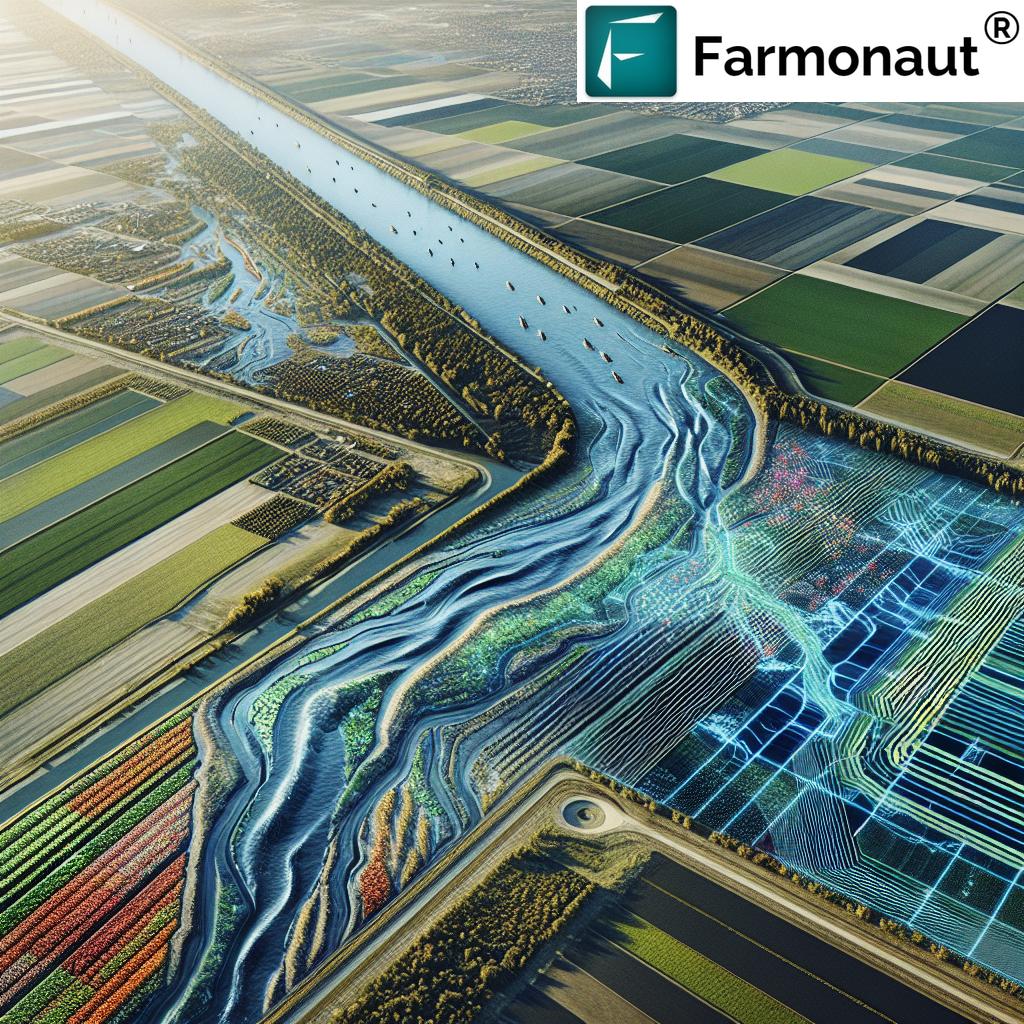
- Irrigation Management: Farmers can identify zones with low moisture and adjust watering plans precisely to avoid waste, reduce costs, and protect the environment.
- Fertilizer Optimization: Pinpoints nutrient-deficient areas for site-specific fertilizer application, reducing overuse and maximizing crop yield and sustainability.
- Pest/Disease Outbreak Tracking: Sudden spatial drops in NDVI values often signal new infestations. Drones help farmers react rapidly to outbreaks, containing spread.
- Yield Estimation & Forecasting: By correlating NDVI patterns with past harvests, yield estimation models improve future planning and supply chain efficiency.
- Land Heterogeneity Analysis: NDVI mapping reveals field variability, enabling smarter variable-rate seeding, crop rotation, and resource management.
- Sustainability and Environmental Compliance: NDVI data helps monitor carbon sequestration, detect erosion, and ensure compliance with environmental standards and carbon footprint reduction protocols.
7 Most Powerful NDVI & Drone NDVI Advances for 2026
1. Ultra High-Resolution Multispectral NDVI Mapping
As sensor technology rapidly evolves, drone NDVI systems in 2026 will routinely deliver maps at sub-10cm spatial resolution – an order of magnitude improvement over early 2020s systems. This allows:
- Pinpointing micro-zones of crop stress undetectable by satellite
- Precision prescription for fertilizer or fungicide application
- In-field integration with smart tractors and automated machinery
2. AI-Powered Real-Time NDVI Data Processing
Machine learning and edge computing on drones now enable NDVI analysis directly after flights, delivering results to farm apps and dashboards on the same day. Benefits include:
- Rapid in-season diagnosis and correction of crop health issues
- Greatly reduced lag between data capture and decision-making
3. Automated, AI-Driven Crop Stress Detection
AI algorithms are now adept at interpreting NDVI spatial patterns, autonomously flagging early signs of stress (drought, pests, or deficiency) and sending direct alerts to farmers. Tools such as Farmonaut’s large scale NDVI monitoring platform include these features, providing:
- Scalable stress detection (across hundreds of fields)
- Integrated recommendations for field-specific action
- Digital guidance to minimize yield losses
4. Integration of NDVI Mapping with IoT, Weather & Soil Sensors
Future resource management is all about data integration. By 2026, NDVI, drone NDVI, IoT soil sensors, and live weather feeds will be natively linked via APIs (see Farmonaut API). This creates a synergistic vision:
- Holistic, field-specific risk analysis (disease, irrigation, input needs)
- Automated task scheduling & fleet optimization (see Farmonaut Fleet Management)
5. Predictive Analytics for Yield Forecasting & Resource Optimization
Machine learning models link historical NDVI data with harvest records to predict yield weeks in advance. This allows farmers to:
- Maximize profits by adjusting harvest plans and logistical operations
- Secure fair insurance (see Farmonaut’s crop loan & insurance solutions)
6. Blockchain-Driven NDVI Traceability
NDVI data is now embedded securely into blockchain traceability systems, documenting crop journeys from field to market. This breakthrough (see Farmonaut Traceability) delivers:
- Food supply transparency, origin verification, and reduced fraud
- Enabling sustainable, climate-friendly agriculture compliance
7. Adaptive Drone Flight & Coverage Algorithms
In 2026, drone algorithms are expected to dynamically alter flight routes – focusing mapping efforts on critical crop management zones identified via previous NDVI data. This enables:
- Resource-efficient mapping, reducing battery usage and time
- Real-time updates as field conditions evolve during the growing season
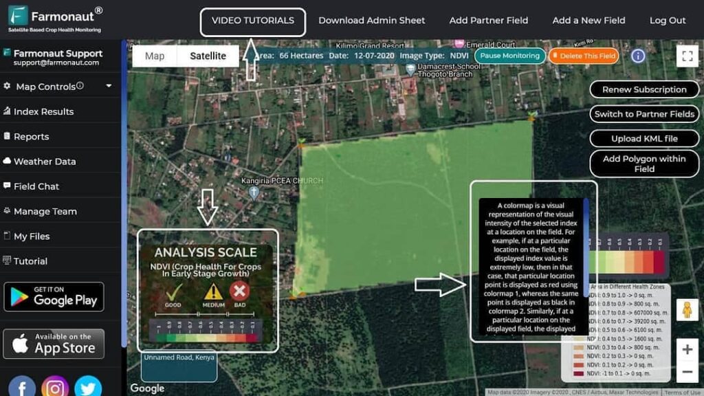
Our Satellite NDVI Platform: How Farmonaut Empowers 2026 Agriculture
At Farmonaut, we believe satellite-based NDVI mapping should be affordable and accessible to all, not just large corporate farms. Our platform solutions integrate multispectral satellite imagery, AI advisory, blockchain traceability, and real-time monitoring to:
- Deliver NDVI and vegetation indices (NDVI, EVI, SAVI, etc.) for crop fields worldwide through easy-to-use Android, iOS, and web applications (see our app here)
- Enable resource management and AI-based field-specific advisories (irrigation, fertilizer, pest countermeasures)
- Track sustainability/ESG compliance with precision carbon footprint monitoring and blockchain-based traceability (learn more)
- Offer scalable solutions for smallholders, large agri-enterprises, and governments with custom API access (API documentation)


Integration & The Future: Unlocking Sustainability with Advanced NDVI Mapping
NDVI Mapping in the Next Agricultural Revolution
As NDVI mapping evolves into a multi-layered, integrated data core for agriculture, 2026 and beyond will witness enormous leaps in productivity, resource efficiency, and sustainability:
- Continuous NDVI & crop monitoring from satellites and drones, feeding into automatic advisories and AI-driven recommendations.
- Farm orchestrations where drones, tractors, irrigation, and workforce are coordinated via live NDVI data.
- Supply chain traceability as a market requirement—farmers and companies who prove crop health and sustainability via NDVI indices command premium prices.
- Environmental compliance made easy – NDVI monitoring as a regulatory and carbon credit standard.
By synergizing these advances, farmers are not just keeping up—they are setting the pace for a new age of smart, climate-wise, and sustainable agriculture.
Discover, Monitor, and Optimize—Join the NDVI Revolution!
- API Integration: Plug in live NDVI, weather, and sensor data to your own systems using our Farmonaut API Documentation.
- Resource Management: Precise fleet and crop management for agri-businesses—see Farmonaut Fleet Management.
- Smart Forest and Plantation Monitoring: Boost compliance and productivity in forest, crop plantation, or advisory projects—see Farmonaut Plantation and Advisory App.
FAQ: NDVI, Drone NDVI Mapping & Agricultural Innovation
Q1: What does NDVI mean and why is it important in agriculture?
NDVI means Normalized Difference Vegetation Index. It’s a numerical indicator derived from multispectral imagery (difference between near-infrared and red bands) to assess crop health, vegetation vigor, and spatial field condition. It’s critical because it provides early detection of crop stress, enabling corrective actions to maximize yields and optimize resource use.
Q2: How do drones improve NDVI mapping compared to satellite-only solutions?
Drones bring higher spatial resolution, rapid on-demand mapping, and custom-timed flights to capture NDVI data exactly when and where needed. They allow farmers to identify intra-field variability at much finer scales than possible with standard satellite imagery, supporting precision field management and timely decision-making.
Q3: Can NDVI mapping help with environmental and sustainability goals?
Absolutely. NDVI mapping not only optimizes on-farm inputs (water, fertilizer) but also supports documentation of carbon sequestration, sustainable crop practices, and regulatory compliance—critical for modern agricultural enterprises, climate programs, and markets demanding verified traceability and low impact.
Q4: Where can I access NDVI data, maps, and advisory tools?
Farmonaut provides accessible, affordable access to NDVI, crop, soil, and resource monitoring solutions via web app, Android app, iOS app, and developer APIs for advanced integrations.
Q5: How can NDVI mapping increase yields and reduce costs?
By identifying problem areas earlier, improving fertilizer and water targeting, and reducing blanket input applications, NDVI mapping minimizes input waste and maximizes productive crop zones—leading to increased yields and cost savings for farmers.
Conclusion: The Future Is Bright for NDVI, Drone NDVI & Precision Agriculture
In summary, NDVI and advanced drone NDVI mapping are at the core of the digital transformation of modern agriculture. Driven by ongoing breakthroughs in multispectral sensors, AI, blockchain, and remote sensing technologies, the agricultural sector is poised to experience unparalleled productivity, resource efficiency, and sustainability by 2026.
The 7 advances outlined above signal a future where farmers and agronomists can:
- Visualize and quantify crop health changes in real time
- Optimize resource allocation to lift yields and reduce environmental impact
- Enable transparent, traceable, and sustainable food value chains
As we continue to harness NDVI and drone NDVI mapping, the promise of a climate-resilient, data-empowered, and sustainable agricultural world is within reach.