“Soil moisture mapping can increase crop yields by up to 20% through precise irrigation management.”
Professional Moisture Mapping Service: 7 Yield Boost Tips
Soil moisture mapping is fundamentally changing the landscape of modern agriculture, farming, and forestry. By providing real-time, actionable data on soil moisture levels across diverse locations, these services empower farmers and foresters to make highly informed, optimized decisions about irrigation management, resource allocation, and overall land stewardship.
Soil moisture mapping unlocks the potential for precision irrigation management, improved crop yield optimization, sustainable farming practices, and streamlined water conservation in agriculture. In this in-depth guide, we will:
- Explain how soil moisture mapping works and explore cutting-edge technologies behind it
- Reveal 7 actionable tips using these services for yield boost
- Highlight which crops/forestry use cases benefit the most
- Present a comparative benefits table demonstrating advantages over traditional methods
- Share expert insights for your next steps in tech-powered moisture management
Let’s dig into how moisture mapping technologies are helping farmers, agribusinesses, and forest managers drive profits, conserve resources, and build a sustainable future!


Understanding Soil Moisture Mapping: A Gamechanger in Irrigation
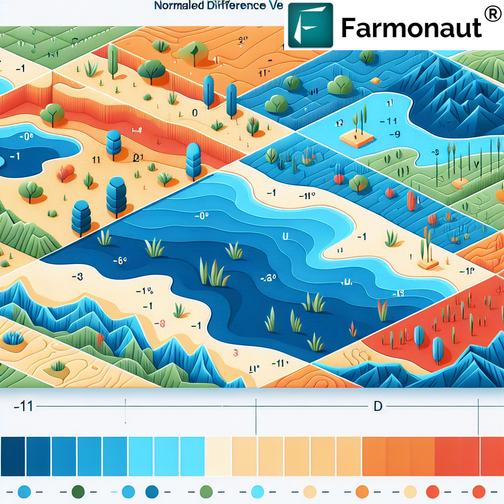
Soil moisture mapping is the process of measuring and visually representing the water content across different soil depths and field locations. This information is crucial for optimizing irrigation scheduling, crop management strategies, and effective resource allocation for both farmers and foresters.
- It relies on technologies like remote sensing, ground-based sensors, and drones for crop monitoring to capture moisture data.
- The resulting moisture maps enable more precise, data-driven decisions.
By transitioning from traditional, often guesswork-based irrigation management to this modern, tech-driven approach, we can ensure that every drop of water and every bit of effort results in increased yield and reduced waste.
Why Soil Moisture Mapping Matters
- Crucial for precision irrigation management: Prevents overwatering and underwatering of crops, reducing input costs.
- Key to crop yield optimization: Ensures crops and trees always have adequate moisture levels for maximal growth and resilience.
- Vital for sustainable resource usage: Saves water by reducing unnecessary irrigation, and supports soil health.
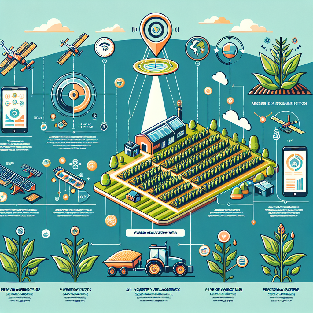
How Soil Moisture Mapping Works
- Capture: Technologies (see below) capture moisture-level signals or readings remotely or on the ground.
- Processing: Moisture data is processed into maps or dashboards, often updated daily with meter-level resolutions.
- Monitoring & Decisions: Farmers use these maps (via mobile/web platforms like Farmonaut or APIs) for scheduling their irrigation, optimizing input timing, and identifying problem zones quickly.
“Remote sensing technologies monitor over 100,000 hectares daily for optimized water use in agriculture and forestry.”
Top Moisture Mapping Technologies Employed
Let’s explore the technologies that make professional soil moisture mapping services effective for agriculture and forestry:
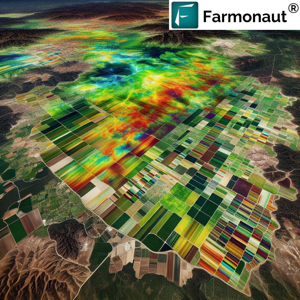
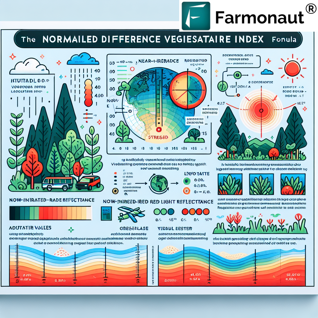
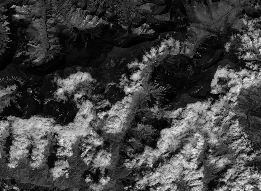
1. Remote Sensing Technologies (Satellites, SMAP, NASA Mission)
- Satellites utilize microwave sensors (e.g. NASA’s Soil Moisture Active Passive – SMAP mission) to capture electromagnetic signals from the earth’s surface. These signals vary with soil moisture levels.
- Advantages: Large-scale, rapid monitoring—several hectares to thousands (ideal for large farm regions, forest locations).
- Output: High-resolution moisture maps, field-level data (down to 10–250 meters), updated daily.
- Learn more about NASA SMAP Mission
- Use in Farmonaut: We leverage satellite-based remote sensing for real-time soil moisture monitoring services—accessible via our intuitive mobile, web, and API platforms for all farmers.
2. Ground-Based Soil Moisture Sensors (TDR, Capacitive Devices)
- TDR (Time-Domain Reflectometry) and capacitive moisture sensors are embedded in the soil at targeted depths for real-time readings.
- Benefits: High local accuracy for precision irrigation management at field/block/micro-zone level. Prevents both overwatering and underwatering.
- Integration: These can be linked with IoT systems (e.g. in forestry for remote, unattended monitoring).
- More on ground-sensor technologies
3. Drones & UAVs for Crop Monitoring
- UAVs (Unmanned Aerial Vehicles) equipped with multispectral and thermal sensors fly over fields, capturing high-res imagery to spot varying moisture zones.
- Detect: Dry patches, overwatered/oversaturated spots, real-time problem mapping.
- Results: Facilitates targeted, rapid irrigation and fast corrective crop management.
- Read about advancements in drone-aided farming
4. Ground-Penetrating Radar (GPR)
- GPR systems emit microwaves into the earth, analyze the returned/reflected signal, and estimate moisture levels at various depths.
- Best suited for: Complex, layered soils, undulating terrains, and mixed-use lands (agri/forestry/plantation).
- Outcome: Gives deep-soil insight unavailable from surface-only measurements.
- Find out GPR’s role in precision irrigation

Professional Moisture Mapping Service: 7 Yield Boost Tips
Using professional soil moisture mapping services transforms how farmers and foresters approach irrigation and management. Here are 7 actionable tips that leverage moisture mapping technologies for significant yield improvement and operational excellence:
-
Implement Precision Irrigation Management
Utilize accurate soil moisture levels data to schedule irrigation precisely—preventing over or under-watering. Farmonaut’s platform enables this via real-time satellite maps and sensor integration. Savings: Up to 40% water usage reduction (source).
-
Identify Dry and Oversaturated Zones for Targeted Action
Drones for crop monitoring and remote sensing for agriculture help you visually identify field patches with abnormal moisture. Target these zones for immediate corrective action—boosting overall field uniformity and minimizing resource waste.
-
Automate Alerts & Monitoring with IoT Systems
By integrating ground sensors and remote dashboards, you can receive automated alerts for out-of-threshold moisture levels. This prevents yield-impacting water stress or saturation events—especially useful for remotely managed forest or large agri lands.
-
Facilitate Optimized Resource Allocation
Leverage real-time moisture maps to allocate water, labor, fertilizer, and pest management where they’re needed most—maximizing ROI and reducing input costs. This intelligent, data-driven approach defines the future of sustainable farming practices.
-
Enhance Crop Yield & Quality Through Moisture Balancing
Scientific studies show certain crops (corn, wheat, cotton) increase yield by 15–20% when irrigation is based on soil moisture data. Balanced moisture also improves fruit size, grain fill, and resilience to drought.
-
Mitigate Flood & Drought Risks with Proactive Decisions
Moisture monitoring services allow you to assess flood risk before rainstorms and implement preventive measures. The same data supports drought stress detection, ensuring better planning and insurance decisions.
For robust crop loan and insurance verification solutions based on satellite data, learn about Farmonaut’s technology here.
-
Support Sustainability & Soil Health Long-Term
Preventing both water logging and soil desiccation, moisture mapping helps maintain structure, microbial life, and nutrient balance—while reducing nitrate leaching and erosion. Effective water conservation in agriculture is a foundation for carbon footprint reduction (see how we support carbon tracking).
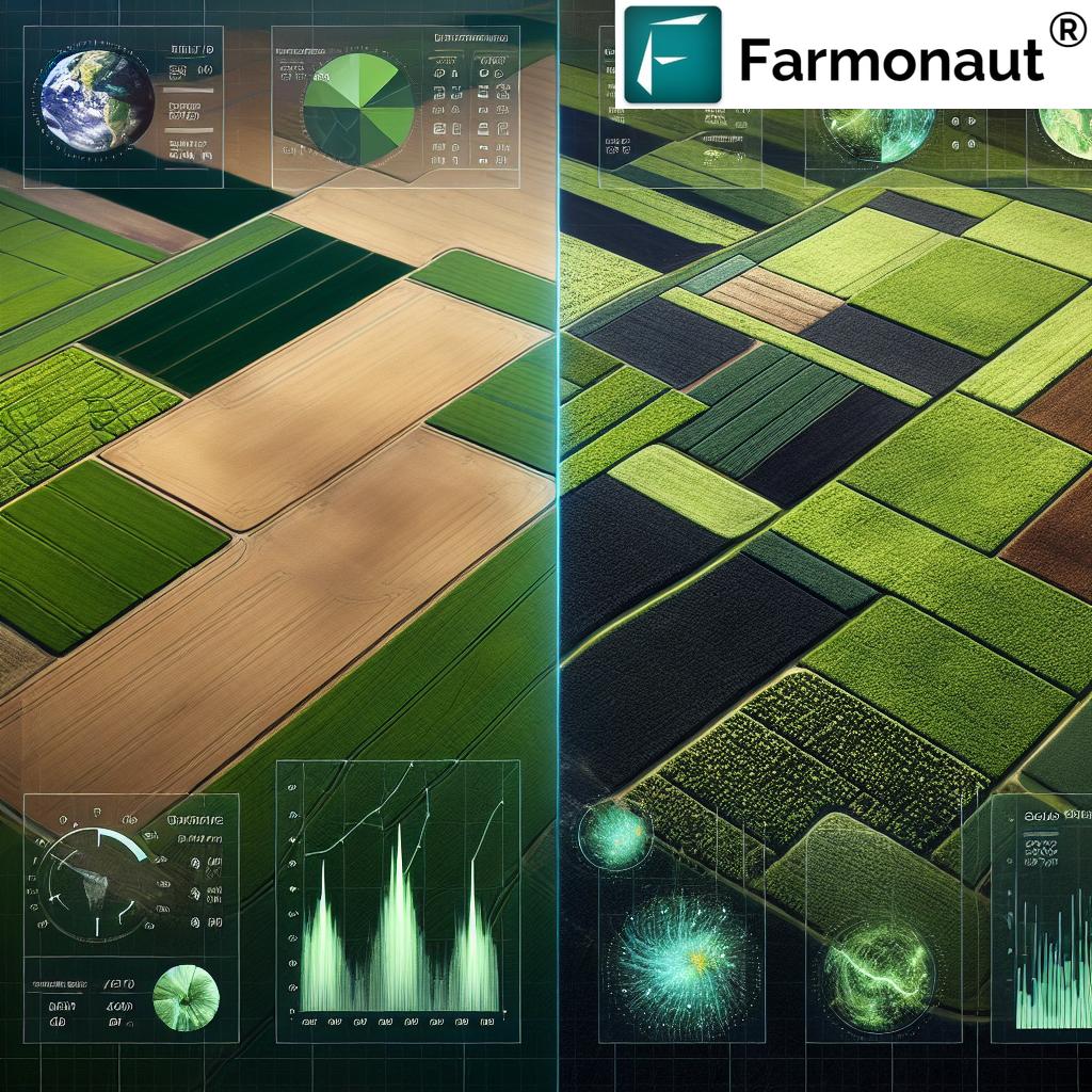
Comparative Table: Moisture Mapping vs Traditional Methods
Below is a detailed comparison between conventional irrigation practices and advanced moisture mapping with remote sensing and sensor integration solutions—illustrating powerful gains in yield, resource savings, and sustainability.
| Feature / Parameter | Traditional Irrigation Methods | Moisture Mapping with Remote Sensing | Estimated Yield / Resource Improvement (%) |
|---|---|---|---|
| Water Usage Reduction | Manual/periodic; risk of over/underwatering | Optimized scheduling; up to 40% less water used | 30-40% |
| Crop Yield Improvement | Unpredictable; uniform irrigation | Targeted, balanced moisture for each crop zone | 15-20% |
| Irrigation Scheduling Accuracy | Low, calendar-based | High, real-time & adaptive | Up to 50% reduction in unnecessary watering |
| Cost Efficiency | Higher water, energy & labor costs | Lower input and operational costs | 30-50% savings |
| Soil Health Monitoring | Rarely measured | Continuous, real-time, multi-depth | Nutrient loss reduced by 20–30% |
| Environmental Impact | Water waste, leaching, carbon footprint | Sustainable, optimized input, reduced environmental harm | Carbon & erosion reduction 20–25% |
Top Benefits of Soil Moisture Mapping Services
Professional soil moisture mapping services are now available through user-friendly apps, web dashboards, and APIs. Here’s how they are transforming agriculture and forestry:
- Precision in Irrigation Management: Irrigate neither too little nor too much—just enough to maximize crop yields and minimize waste.
- Enhanced Yields & Quality: Consistently healthy crops mean higher produce quality, better grain fill, and improved market returns.
- Efficient Water Conservation in Agriculture: By monitoring moisture across time and space, you use only what’s needed, supporting sustainable resource practices.
- Significant Cost Reduction: Reduced water, labor, fertilizer, and energy costs thanks to optimized input and operational decisions.
- Improved Environmental Management & Risk Prediction: Early warnings for potential flood or drought, plus reduced soil/nutrient loss, enable better landscape resilience.
Farmonaut’s moisture mapping technologies make all these benefits accessible on any device globally, so every farmer, from smallholder to plantation manager, can participate in the next revolution in agriculture.
For tech developers and business users: Explore the Farmonaut Satellite Data API | API Developer Docs
Soil Moisture Mapping in Forestry & Conservation
Forestry and forest management practitioners rely on moisture mapping services to assess large, often inaccessible landscapes. Top applications include:
- Forest Health Monitoring: Track drought stress, disease/prone areas, and moisture gradients for timber optimization and forest resilience.
- Wildfire Risk Assessment: Detect and monitor dry zones for proactive fire mitigation, leveraging UAVs and satellites for aerial coverage over thousands of hectares.
- Automated Alert Systems: IoT-empowered moisture mapping tools offer real-time, remote alerts for forest teams, ensuring rapid response to emerging risks.
- Sustainable Timber Harvesting: Identify ideal cutting periods and minimize ecological footprint through moisture-aware activity schedules.
For advisory on plantation, forest, and agroforestry management, see our Farmonaut platform for forest advisory.
Read more: Moisture detection for sustainable forest management
Challenges & Considerations of Moisture Mapping Technologies
- Initial Technology Investment: Satellite and sensor setups may have upfront costs—offset by long-term savings and increased yields.
- Need for Training & Data Interpretation: Effective usage involves understanding maps, data dashboards, and sensor calibration.
- Data Accuracy: Calibration and maintenance of sensors and alignment of satellite data require regular attention for optimal results.
- Integration: Integrating new moisture mapping systems with existing farm management practices is crucial to realize all benefits.
- Connectivity & Coverage: Remote locations may require solutions tailored to limited connectivity (Farmonaut supports both app and offline insights delivery).
Despite these challenges, advancements in agritech—like our satellite-driven maps and AI-powered advisories—lower the barriers to wider adoption of moisture mapping technologies.
About Farmonaut: Satellite Technologies for Data-Driven Agriculture
Farmonaut stands at the forefront of the agricultural technology revolution, delivering advanced, real-time soil moisture mapping, crop health monitoring, and resource optimization tools via Android, iOS, web/browser App, and API.
- Our mission: To make precision agriculture affordable and widely accessible—bridging the technology gap for farmers worldwide.
- Technologies: Hybrid integration of satellite-based multispectral imaging (including SMAP, Sentinel, and other constellations), custom AI algorithms, blockchain for traceability, and API interoperability for any scale of operation.
- Services provided: Real-time crop and soil health monitoring, moisture mapping, precision resource allocation, fleet and logistics management, and blockchain-backed product traceability (see traceability solutions here).
- Flexible access: Subscription packages for small farms, agribusinesses, and government institutions. Scalable integration via API for developers and companies (see comparison table for ROI).
- Sustainability tracking: Carbon footprint analysis tools to enhance compliance and support climate-smart agriculture.
- Fleet and resource efficiency: If you manage agricultural logistics or multiple plots, our fleet management platform helps reduce operational costs.
- Large farm and plantation managers: Discover large-scale farm management tools for optimizing input, tracking operations, and multi-site insights.
Explore Farmonaut’s innovative agritech platform:
Web & Mobile Apps |
Satellite Data APIs for developers
Farmonaut Subscription Plans:
Frequently Asked Questions (FAQ)
What is soil moisture mapping and why is it important?
Soil moisture mapping is the measurement and visualization of water content across field or forest soils. It’s crucial for optimizing irrigation management, maximizing crop yield, and supporting sustainable land practices by providing data for informed decision-making.
How does moisture mapping improve yield?
By revealing exactly how much water each area needs, it prevents both under- and overwatering. This precision ensures crops remain healthy, stress-free, and productive, which studies show can boost yields by 15–20% or more.
What technologies are used in moisture mapping?
Moisture mapping technologies include satellite remote sensing (e.g., SMAP, Sentinel), ground-based sensors (TDR, capacitive, IoT devices), drones/UAVs with thermal and multispectral cameras, and ground-penetrating radar for deep soil insight.
Does my farm need professional moisture mapping?
Most farms and forestry sites benefit from professional mapping, especially those experiencing erratic crop growth, water stress, or inefficiency in irrigation. Tech-driven mapping tools suit every scale, from smallholdings to plantations.
Is moisture mapping expensive?
While there’s often an initial investment, modern satellite-based and IoT sensor networks are cost-effective, especially when spread over seasons. The resource/input reductions and potential yield increases routinely offset these costs.
How can I get started with Farmonaut’s soil moisture monitoring services?
Access Farmonaut through our Android, iOS, and web apps, or via API—no expensive hardware needed. After signup, you’ll receive instant soil moisture maps, crop health analytics, and tailored recommendations for your land’s exact location.
Can I integrate Farmonaut with existing farm management systems?
Yes. We provide open API access (see API details here) so your developers or partners can seamlessly add soil moisture and crop analytics to their platforms.
Conclusion
Professional soil moisture mapping services are a technological leap for agriculture and forestry. By providing real-time, granular data on soil moisture, these services enable optimized irrigation, higher crop yield, reduced input costs, and sustainable resource stewardship.
By embracing moisture mapping technologies, you unlock powerful tools for smarter, eco-conscious farming—and lay a robust foundation for data-driven land management in an era of climate change and resource scarcity.
Ready to join the next generation of farmers and forestry managers reshaping global agriculture? Try Farmonaut’s platform or integrate satellite-backed data via API for instant, actionable soil moisture insights.