

Colorado · Ranked guide
Colorado Gold and Gems: Top 7 Districts by Gold Output
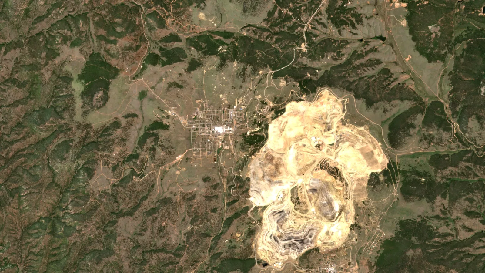
Cripple Creek is Colorado’s top gold district at about 19.1 million troy ounces through 1959 (USGS). This guide ranks the top seven districts, lists the state’s gem localities and explains where you can pan, collect and visit legally.
Key takeaways
- Cripple Creek produced about 19.1 million troy ounces through 1959, second among all U.S. gold districts (USGS Professional Paper 610, 1968).
- Six more districts passed about one million ounces on the same count: Central City, Telluride, Leadville, Sneffels-Red Mountain, Alma and Breckenridge.
- Colorado’s largest gold mine today is the Cripple Creek and Victor open pit, owned by SSR Mining since 28 February 2025, with reserves of 2.7 million ounces at 0.38 g/t (SSR, 31 December 2025).
- Aquamarine is the state gemstone and rhodochrosite the state mineral; much of the aquamarine ground on Mount Antero and the Crystal Peak amazonite area is claimed or private (Colorado Geological Survey).
- Hand panning is casual use on BLM land (43 CFR 3809.5), but Colorado’s DRMS asks you to contact it before any mining operation, and claims and private land still apply.
In this article
- Colorado gold districts, ranked by output
- Why Colorado gold sits in a belt
- The prospectors who opened each district
- Is anyone still mining gold in Colorado?
- Colorado gems: where the best-known stones come from
- Where you can pan, dig and visit legally
- What a day of panning could be worth
- Using satellites before you stake or dig
- Frequently asked questions
Cripple Creek, in Teller County, is Colorado’s biggest gold district by a wide margin. The U.S. Geological Survey records about 19.1 million troy ounces from it through 1959, which made it the second most productive gold district in the United States (USGS Professional Paper 610, 1968). A troy ounce is 31.1 grams, the unit used for precious metals. Six more Colorado districts each passed about one million ounces. Gems come from different ground: the state gemstone, aquamarine, is found high on Mount Antero, and gem-grade rhodochrosite, the state mineral, comes from a mine in the Alma district, according to the Colorado Geological Survey.
This guide ranks the seven top gold districts on one record, names the prospectors who opened them, shows what is still mined, lists the gem localities and explains where an ordinary visitor can pan or collect without breaking the rules. It is written for consultants, licence holders and explorers who need the ground facts first.
Colorado gold districts, ranked by output
A mining district is an area with shared geology and a recorded mining history. The ranking below uses one source for every figure: the district gold totals in USGS Professional Paper 610 (Koschmann and Bergendahl, 1968), counted through 1959. All of these figures are minimums, because early records are patchy. A district qualifies for this list if it passed about one million ounces on that count. Central City and Idaho Springs are ranked as one district, as PP 610 combines them. Silverton, at least 874,000 ounces and possibly over one million, sits just outside the list.
Chart
Gold output of Colorado’s top 7 districts
Million troy ounces through 1959; all figures are minimums
| Rank | District (county) | Gold through 1959 | What the record shows | Where to learn more (DRMS list) |
|---|---|---|---|---|
| 1 | Cripple Creek (Teller) | 19,100,867 oz | Discovered in 1891; peak year 878,167 oz in 1900 | Mollie Kathleen Gold Mine tour, Cripple Creek District Museum |
| 2 | Central City-Idaho Springs (Gilpin and Clear Creek) | about 4,200,000 oz | Almost all lode gold; USGS treats the two camps as one district | Hidee Gold Mine (appointment only), Gilpin County museum |
| 3 | Telluride (San Miguel) | about 3,000,000 oz | Liberty Bell mine alone produced 633,021 oz of gold, 1898 to 1921 | No tour listed for the town; Ouray has mine tours nearby |
| 4 | Leadville (Lake) | about 2,970,000 oz | Gold from placers first, then silver-lead ores | Matchless Mine tour, National Mining Hall of Fame |
| 5 | Sneffels-Red Mountain (Ouray) | about 1,723,000 oz | Camp Bird mine produced at least 1,058,774 oz, 1896 to 1916 | Bachelor Syracuse Mine tour in Ouray |
| 6 | Alma (Park) | about 1,320,000 oz lode gold | Also home to the Sweet Home rhodochrosite mine | No tour listed |
| 7 | Breckenridge (Summit) | about 1,000,000 oz | About 735,000 oz of it from placers | Country Boy Mine tour, public panning at Lomax Gulch |
The Colorado Geological Survey draws the line slightly differently. It names Cripple Creek, Central City, Telluride, Leadville, Sneffels, Silverton and Breckenridge as districts that once produced more than about one million ounces, and it puts Leadville at 3.3 million ounces of gold through 1999 (CGS, Metals). The two sources count different periods and use different district boundaries, so compare districts only within one source. For all of Colorado, USGS gives about 40,776,000 ounces through 1965, second among the states. In all, 44 Colorado districts each produced more than 10,000 ounces.
Cripple Creek: the giant that is still working
Cripple Creek sits outside the main mineral belt, in a volcanic basin, and the gold in its unoxidized ore occurs as telluride minerals. Its output through 1959 is more than four times the next district. It is also the only Colorado district with a large operating mine today, covered below. For a technical read on this style of deposit, see our guide to epithermal gold deposits.
Central City and Idaho Springs
Gold deposits run in an unbroken line from Idaho Springs in Clear Creek County to Central City in Gilpin County. The Gilpin County part produced about 4,207,000 ounces of lode gold and only about 47,900 ounces from placers. Tour mines in Idaho Springs (Argo, Edgar and Phoenix) and Georgetown (Capital Prize and Lebanon) are on the DRMS visitor list.
Telluride and Sneffels-Red Mountain
These two districts share one volcanic basin. Telluride is one of the 25 leading gold districts in the whole United States on the USGS count, and Sneffels-Red Mountain, centred on the Camp Bird mine, adds about 1.7 million ounces. Both are vein deposits in a basin of Tertiary volcanic rock lying over older sedimentary rock.
Leadville and Alma: gold beside silver and gems
Leadville is better known for silver, lead and zinc, yet its gold total is about 2.97 million ounces through 1959 on the USGS count. Alma, east of Leadville on the flank of the Mosquito Range, produced about 1.32 million ounces of lode gold. It is also home to the Sweet Home Mine, located as a silver prospect in 1876 and reopened as a rhodochrosite gem mine in 1991.
Breckenridge: gold you can pan today
Breckenridge sits on the Blue River. About 735,000 of its roughly one million ounces came from placer gravel. The state’s Division of Reclamation, Mining and Safety (DRMS) lists gold panning at Lomax Gulch on its visitor page, along with the Country Boy Mine tour.
Why Colorado gold sits in a belt
Most of the state’s gold lies in a northeast-trending strip called the Colorado Mineral Belt. It runs from the Jamestown district in Boulder County to the La Plata Mountains, and it follows a line of igneous intrusions from the Late Cretaceous and Tertiary (CGS, RS-28 Gold Occurrences of Colorado). Cripple Creek is the main exception, lying east of the belt.
The host rock changes along the belt. In the San Juan Mountains the deposits are in Tertiary volcanic rock, in the Sawatch, Mosquito and Gore-Tenmile ranges they are in Paleozoic sedimentary rock, and in the Front Range they are in older metamorphic and igneous rock (USGS Professional Paper 610). That is why one search method does not fit the whole state: a method tuned to volcanic rock in Ouray County does not carry over to the Front Range. Placer gold is gold freed by weathering and carried into stream gravel; lode gold is still in the rock vein. In Colorado the placers were found first, and lode mining followed.

▶ A plain-language, clay-animation explanation of how gold forms from stars, hot water and earthquakes. · 4:16
The prospectors who opened each district
Every district above traces to a small number of named discoveries, recorded in the USGS paper. In spring 1858 the Russell brothers, placer miners from Georgia and California, led a party that found small amounts of gold along Cherry and Ralston Creeks and the South Platte near Denver. The Colorado Geological Survey dates the first documented find to that summer, in gravel at what is now downtown Denver.
Chart
Colorado’s yearly gold output in selected years
Thousand troy ounces; the years are not evenly spaced
In January 1859 George A. Jackson found the first commercial placers near the mouth of Chicago Creek at Idaho Springs. In May 1859 John Hamilton Gregory found vein outcrops with residual gold in the North Clear Creek basin near Black Hawk, in the area that became the Central City district. In early June, W. G. Russell found placer gold in Russell Gulch near Central City. By the end of 1859 prospectors had reached South Park and the Arkansas River headwaters as far as California Gulch, where Leadville later grew.
The later camps followed the same pattern. Summitville was found in 1873 and Silverton in 1874. Lake City, Ouray and Telluride followed in 1875. Rich lead-silver ore at Leadville was found in 1877, and Cripple Creek and Creede in 1891. State output grew from about 97,500 ounces in 1873 to about 201,000 in 1890, then jumped to roughly 1,393,000 ounces in 1900 as Cripple Creek peaked. It reached a low of 33,605 ounces in 1963.
If you want a plain walk through the old camps and the ore they carried, our guide to gold prospectors of Colorado covers it.
Is anyone still mining gold in Colorado?
Yes, mainly at one site. The Cripple Creek and Victor mine (CC&V) is an open pit in Teller County, and the Colorado Geological Survey calls it the largest gold producer in the state. In 2018 Colorado ranked third among U.S. states for gold, with 360,000 ounces produced from CC&V. Small amounts of placer gold are also recovered from sand and gravel operations on the South Platte, Arkansas and Colorado Rivers and on Clear Creek (CGS).
Chart
Gold from the Cripple Creek and Victor mine
Thousand troy ounces in the year shown; 2025 covers 28 February to 31 December only
SSR Mining completed its purchase of CC&V on 28 February 2025. It reports proven and probable reserves of 2.7 million ounces at an average grade of 0.38 grams per tonne as of 31 December 2025, and a 2025 plan that averages 141,000 ounces a year from 2026 to 2028 (SSR Mining, CC&V). Grade is the amount of gold per tonne of rock. A grade of 0.38 grams per tonne is very low, so the mine depends on moving large volumes and leaching the crushed rock on pads.
Colorado gems: where the best-known stones come from
Colorado has more than thirty gemstone varieties, according to the Colorado Geological Survey. Five stand out, and access is the main question for each.
| Gem | Where | Geology | Access note from the survey |
|---|---|---|---|
| Aquamarine (state gemstone) | Upper slopes of Mount Antero, Chaffee County, around 13,000 ft | Pegmatites in the Mount Antero Granite, with smoky quartz | Much of the outcrop is claimed by private entities and cannot be reached without permission |
| Rhodochrosite (state mineral) | Sweet Home Mine, Buckskin Gulch, Alma district, Park County | Veins and fracture intersections in altered granodiorite | Located as a silver prospect in 1876 and reopened as a rhodochrosite gem mine in 1991, per the survey; ask the owner about access |
| Amazonite | Crystal Peak area, between Woodland Park and Lake George | Pikes Peak granite; lead inclusions colour the feldspar blue | Mostly private land or claimed |
| Diamond | State Line District, near the Wyoming border | About 40 known kimberlite pipes | Kelsey Lake Mine, the first commercial diamond mine in North America, placed in limited production status in 1998 |
| Agate, jasper, petrified wood | Many places; petrified wood in Arapahoe, Douglas, Elbert, Delta, Moffat and El Paso counties | Cryptocrystalline quartz (chalcedony) | Widespread; check who owns the land |
The survey also records a 16.87-carat faceted diamond from Colorado, the largest cut diamond sourced in the United States. Colorado’s first brush with diamonds was a fake: in 1872 the “Great Diamond Hoax” planted rubies and diamonds in a supposed find near the Colorado-Wyoming border, and a federal survey team led by Clarence King exposed it. Other gem-quality minerals found in the state include garnet, tourmaline, lapis lazuli, turquoise, peridot, sapphire and zircon.
Where you can pan, dig and visit legally
Federal land rules draw the line at disturbance. Under the BLM definition, casual use covers collecting specimens with hand tools, hand panning, non-motorized sluicing and metal detectors, and it does not include mechanized earth-moving equipment, chemicals or explosives (43 CFR 3809.5). That is the federal definition used on BLM-managed land. Colorado adds its own layer: the Division of Reclamation, Mining and Safety (DRMS) asks anyone to contact it before any mining operation and provides an “Is it mining?” questionnaire. It issues limited-impact permits for sites under 5 or 10 acres, regular permits above 10 acres, and Notice of Intent permits for prospecting, which do not grant a right of entry (DRMS minerals program).
Before you go, check three things: who owns the surface, whether an active mining claim covers the ground, and whether a closure or special rule applies. Prospecting on private land needs the owner’s consent. A claim gives the claimant rights to the minerals, so panning on someone’s active claim without permission can be a problem even on public land. For tools that fit casual use, see our list of gold hunting supplies in Colorado; for state claim rules, see gold mining in Colorado: claim clocks and permits.
If you only want to try it, the DRMS visitor list is the safest start. It includes gold panning at Lomax Gulch in Breckenridge, and tour mines such as Mollie Kathleen (Cripple Creek), Old Hundred (Silverton), Phoenix and Argo (Idaho Springs), Matchless (Leadville) and Bachelor Syracuse (Ouray). Hours and fees change, so call before you drive. Recover gold with gravity only: panning and sluicing are gravity methods that need no mercury, and mercury has no place in a recreational kit (US EPA).
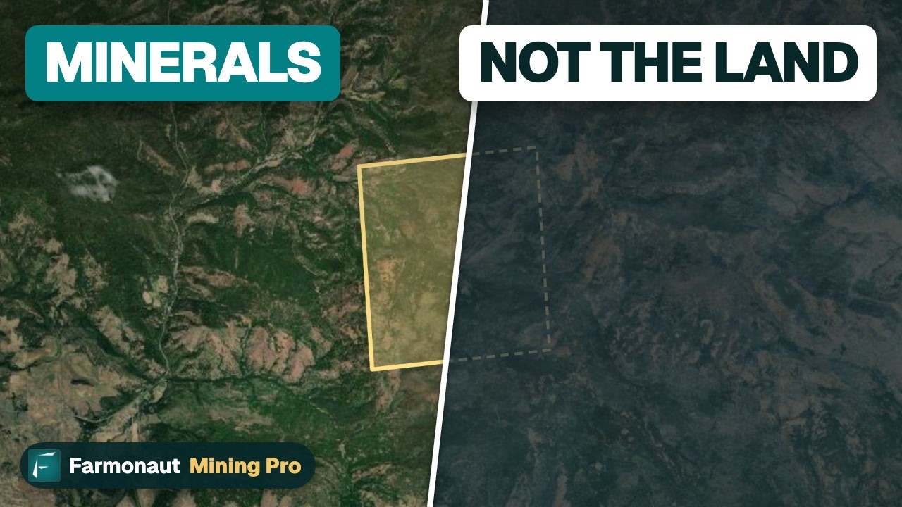
▶ Why owning a gold claim is not owning the land, and how to check the ground first. · 3:19
What a day of panning could be worth
Recreational panning rarely pays for the trip. The calculator below turns the weight of gold you recover into a value at a price you enter, then subtracts your costs so you can see the break-even. The weights are examples, not typical results; your own pans will differ with the creek, the depth and your technique. A milligram is one thousandth of a gram.
Calculator
What is a day of panning worth?
Enter your own pans, gold per pan, costs and price.
- Value of the gold at your price: $21
- Trip costs: $160
- Net result: -$139
- Pans per day to break even: 311 pans
Example values only, not typical results or a forecast. The gold price is an input: example, use today’s price (US$ per troy ounce). One troy ounce is 31.1035 grams. Fees for tours or claims are not included beyond the daily cost you enter.
Using satellites before you stake or dig
A satellite cannot see a gold nugget. It can map the rock around a deposit: iron-stained ground, clay-altered rock and fault lines, which are the clues that hot fluids left behind. For a licence holder or consultant, that is useful for deciding where to spend field time first, on ground you are allowed to explore. Farmonaut’s satellite-based mineral detection platform works from a boundary file (KML, KMZ or a polygon) and reports exploration targets within 5 to 20 business days; it screens ground without disturbing it, and it is a screening step that comes before a resource estimate and before any drilling.
If you hold ground in Colorado or elsewhere and want it screened, request a quote, read how the satellite-based mineral detection reports work, or contact the team. For the wider picture of where U.S. gold sits, see gold deposits in the United States.

▶ How satellites help find gold by mapping the altered rock around it, not the gold itself. · 4:25
Frequently asked questions
Which is the best gold district in Colorado?
By recorded output, Cripple Creek in Teller County: about 19.1 million troy ounces through 1959, according to USGS Professional Paper 610. The next district, Central City, is about 4.2 million ounces.
How much gold has Colorado produced?
About 40,776,000 troy ounces through 1965 (USGS Professional Paper 610), which ranked Colorado second among U.S. states at that date. The Colorado Geological Survey’s RS-28 page says the state total has exceeded 42 million ounces.
Is gold still mined in Colorado?
Yes. The Cripple Creek and Victor open-pit mine, owned by SSR Mining since 28 February 2025, is the main producer. SSR reported 124.6 thousand ounces from 28 February to 31 December 2025.
Can I pan for gold on public land in Colorado?
Hand panning is casual use on BLM land open to mineral entry under 43 CFR 3809.5, but closures, claims and private land still apply, so check the local BLM or Forest Service office for the exact spot.
Do I need a permit to pan or prospect in Colorado?
Hand panning as casual use does not need a federal permit, but DRMS asks you to contact it before any mining operation, and prospecting beyond casual use can need a Notice of Intent. Use the DRMS “Is it mining?” questionnaire when in doubt.
Where can a beginner try gold panning in Colorado?
The DRMS visitor list names gold panning at Lomax Gulch in Breckenridge. Ask each tour mine on that list whether it offers panning, and confirm hours and prices before you go.
What is Colorado’s state gemstone?
Aquamarine, a blue variety of beryl found mostly around the 13,000-foot level on Mount Antero in Chaffee County. The state mineral is rhodochrosite.
Can the public collect aquamarine on Mount Antero?
The Colorado Geological Survey says much of the outcrop that carries aquamarine is claimed by private entities and cannot be reached without permission. Check claim status before you climb.
Does Colorado have diamonds?
Yes, in the State Line District on the Colorado-Wyoming border, where about 40 kimberlite pipes are known. The Kelsey Lake Mine, North America’s first commercial diamond producer, was placed in limited production status in 1998, according to the Colorado Geological Survey.
Where does Colorado rhodochrosite come from?
Gem-quality rhodochrosite is mined at the Sweet Home Mine in Buckskin Gulch, Alma district, Park County. It was located as a silver mine in 1876 and reopened as a rhodochrosite mine in 1991.
Can a satellite find gold in Colorado?
Not gold itself. Satellites map alteration minerals and structures that often sit around gold systems, and the result is an exploration target that must be checked on the ground.
This page is for information only. It is not legal advice or investment advice. Confirm the rules with the BLM, the Forest Service and Colorado DRMS before you prospect. Get the landowner’s permission, check for active claims, and never use mercury to recover gold.
Farmonaut mining
Map your mining site from space
Screen a licence or prospect for alteration and structure targets before field crews go out.
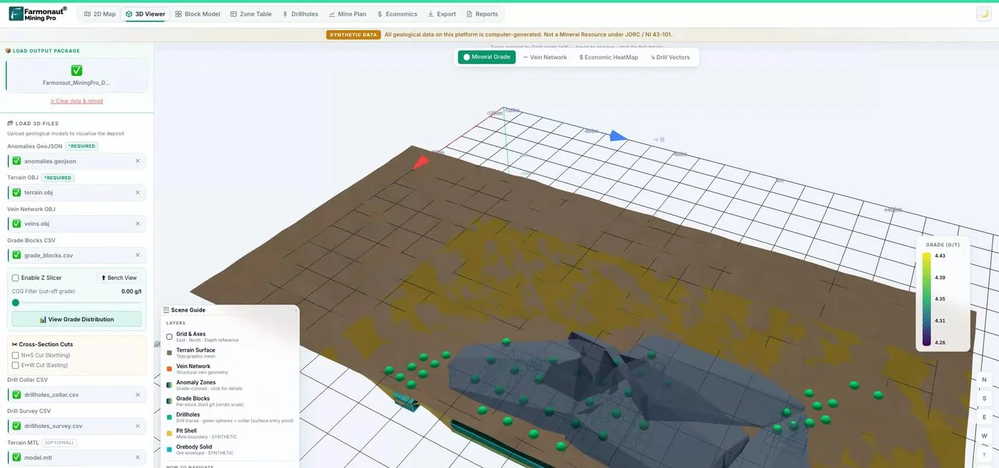
Mining Pro sample view, synthetic data
Keep reading
Sources
- USGS, Principal Gold-Producing Districts of the United States, Professional Paper 610 (1968): pubs.usgs.gov
- USGS, Distribution of Gold, Tellurium, Silver and Mercury in Part of the Cripple Creek District, Circular 543 (1967): pubs.usgs.gov
- Colorado Geological Survey, Metals: coloradogeologicalsurvey.org
- Colorado Geological Survey, Gemstones: coloradogeologicalsurvey.org
- Colorado Geological Survey, RS-28 Gold Occurrences of Colorado: coloradogeologicalsurvey.org
- Colorado DRMS, Minerals Program Information and Mine Permitting Requirements: drms.colorado.gov
- Colorado DRMS, Tourist Mines and Museums: Visit: drms.colorado.gov
- Cornell Legal Information Institute, 43 CFR 3809.5 (definition of casual use): law.cornell.edu
- SSR Mining, Cripple Creek and Victor operation page: ssrmining.com
- SSR Mining, Cripple Creek and Victor site-tour investor presentation: s22.q4cdn.com
- US EPA, Artisanal and Small-Scale Gold Mining Without Mercury: epa.gov
Discussion
Questions, corrections or field experience? Share them below. First-time comments are reviewed before they appear, and your email is never published.
No comments yet. Be the first to add a question or your experience.

 Mining SARL
 SenGold Invest SAS
 Sania Corporation
 Sean Mining Limited
 NTS Group (Pty) Ltd
 Mine4Africa
 Lithspo Minerals Limited
 Tintina Mining Group
 Dalgety Minerals Pty Ltd
 Vortex Minerals Pty Ltd
 Faith At Work (Pty) Ltd
 Geotech Mining Solutions plc
 Vulcan International Limited
 Kidepo Associates
 GKY Mining
 Alkimy SARL
 Double A Trading
 GemSprout Metals Limited
 Qader Group
 Ileys General Trading
 SG Gold Mining LLC
 VRV Global Pte Ltd
 Omsri International FZE
 G.I.T.T.











