

Bingham Canyon Mine Before and After: Location & Changes
Table of Contents
- Where Is the Bingham Canyon Mine Located?
- Bingham Canyon Mine Before and After: A Landscape Transformed
- Environmental Impacts of Surface Mining at Bingham Canyon
- Watershed, Soil, and Water: Core Changes and Sustainable Agricultural Considerations
- Forestry, Habitat Rehabilitation, and Ecological Corridors
- Infrastructure and Regional Planning: Roads, Waterways, and Utilities
- Comparative Impact Table: Bingham Canyon Before & After
- Satellite-Based Mineral Detection & the Modern Mining Era
- Recommended Video Resources
- Key Takeaways and Callouts
- Frequently Asked Questions (FAQ)
Bingham Canyon Mine Location: Where is the Bingham Canyon Mine Located?
The Bingham Canyon Mine, also widely known as the Kennecott Copper Mine and occasionally referred to as the “Brigham Canyon Mine,” is a colossal example of surface mining engineering and environmental transformation. Where is the Bingham Canyon Mine located? It’s situated in the western foothills of the Oquirrh Mountains, southwest of Salt Lake City, in Salt Lake County, Utah, United States—a region historically shaped as much by ranching and agriculture as by its vast mineral resources.
This open-pit mine stretches over four kilometers wide and plunges nearly 1,200 meters deep, ranking it among the world’s most remarkable human-made excavations. Over a century of copper mining operations has fundamentally redefined not only the mine’s immediate landscape but also the surrounding region’s land use, agriculture, hydrology, and ecological functions. Its location at the juncture of foothill pasturelands, agricultural plots, and rugged woodland makes it an instructive case where industrial, environmental, and community considerations must continuously intersect.
Geo-Coordinates & Importance
- Latitude: 40.5231° N
- Longitude: 112.1510° W
The mine’s setting within the Oquirrh foothills means it sits atop highly valuable mineral deposits—notably copper, precious metals, and other base minerals—and its evolving landscape has influenced nearly every local economic sector, from agricultural management to transport infrastructure and land planning.
mining.farmonaut.com
Quickly evaluate and map mining prospects with precise satellite intelligence.
- ✔ Location: Foothills of the Oquirrh Mountains, Utah
- ✔ Also Known As: Kennecott Copper Mine, Brigham Canyon Mine
- ✔ Mining Method: Surface (open-pit) extraction
- ✔ Impact: Drastically reshaped soil, water systems, and local agricultural landscapes
- ✔ Sustainability Focus: Ongoing reclamation efforts for soil and watershed restoration
Bingham Canyon Mine Before and After: A Landscape Transformed
Bingham Canyon Mine before and after mining is a visual testament to how extractive activities reshape not only the land, but also the social, economic, and ecological fabric of a region. To understand this transformation, we need to examine the area’s pre-mining landscape, the onset of industrial surface mining, and the evolving reclamation strategies now employed.
🌱Before Mining: The Original Landscape
- 🌾 Mosaic of Vegetation: Grasses, shrubs, and scattered trees stabilized soil and absorbed runoff
- 🐄 Ranching and Farming: Open spaces hosted grazing and seasonal forage for livestock
- 🌲 Woodlands: Supported small-scale timber management and local biodiversity
- 💧 Healthy Watersheds: Natural drainage supported reliable irrigation and water quality
Alongside ranching and moderate timber harvest, these ecosystems provided arable soil, reliable water flow, and habitat for native plants and wildlife. The site supported nearby communities that depended on these resources for food, fuel, and livelihood.
The Onset of Surface Mining & Landscape Change
Aggressive extraction began in the early 20th century, and the Bingham Canyon Mine rapidly transitioned from mosaic woodland-pasture to an expansive mineral excavation. Layer after layer of overburden material and ore were removed, creating an engineered chasm so vast it became visible from space. The transformation can be summarized as:
- Soil: Structure was disrupted as layers were shifted, exposed, or removed.
- Hydrology: Natural drainage patterns were altered, changing surface runoff and groundwater recharge.
- Vegetation: Native plant cover was lost—destabilizing soil and reducing habitat for wildlife.
- Watershed: Increased sedimentation and potential for contamination affected nearby streams and irrigated agricultural plots.
The result: a stark, stepped terrain where mineral extraction and environmental engineering dictate landform, runoff, and—ultimately—the fate of adjacent lands.

Environmental Impacts of Surface Mining at Bingham Canyon
Bingham Canyon Mine before and after provides a model to study the profound environmental changes triggered by large-scale mineral extraction. The impacts ripple through interconnected themes: soil stability, watershed quality, vegetation cover, agricultural productivity, and habitat integrity for wildlife.
Soil Erosion, Degradation, and Rehabilitation
- ⚠ Soil loss: High rates of erosion once vegetative cover is removed.
- 📊 Organic matter decline: Mining exposes and mixes subsoils low in organic content, undermining fertility.
- 🌱 Rehabilitation measures: Terracing, mulching, and replanting with hardy native species to regain structure and fertility.
Watershed & Water Quality Considerations
- 💧 Runoff & contamination: Intensified surface runoff carries sediment and residual metals downstream, challenging agricultural irrigation and water safety.
- 🛡️ Protection Efforts: Engineering of drainage channels, settling ponds, and buffer zones to intercept contaminants before they reach watercourses or adjacent farmland.
Vegetation, Wildlife, and Ecological Corridors
- 🦌 Wildlife: Loss of forage and cover restricts native populations and breaks migration paths.
- 🌳 Ecological corridors: Replanted buffer zones and rewilded areas help reconnect habitats post-mining.
Agricultural & Regional Function
- 🌽 Productivity dips: Soil and water quality issues lower yield potential in surrounding arable land and pasture.
- 🚜 Ongoing management: Soil stabilization and contaminant monitoring are now part of normal agricultural operations adjacent to the mine.

These challenges underscore why detailed monitoring, progressive reclamation, and sustainable land management practices are vital—not just for mining sites, but in every region where mineral resources are actively developed.
Watershed, Soil, and Water: Core Changes and Sustainable Agricultural Considerations
At Bingham Canyon, the interplay between soil structure, water management, and agricultural viability forms the crux of both environmental impact and restoration. Surface mining stripped away stabilizing vegetation, altered drainage, and required substantial engineering to prevent runoff from overwhelming downstream farms and waterways.
Soil Stability & Erosion Control
- 🌾 Erosion Risk: Lack of ground cover accelerates topsoil loss, reduces arable area, and saps productivity in adjacent plots.
- 🔧 Engineering Interventions: Use of terracing, contour drains, and sediment basins to slow and capture eroded material.
- 🌞 Soil Horizon Restoration: Reapplication of ameliorants (lime, compost), tillage, and gradual reintroduction of organic matter through groundcover plantings.
Watershed Protection: Irrigation and Waterways
- 🌊 Runoff Management: Large-scale ditches and retaining ponds buffer rain events, capturing sediment and pollutants before entering agricultural irrigation ditches and natural watercourses.
- 👨🌾 Water Quality Monitoring: Continuous chemical and biological testing ensure that irrigation water meets regulatory and farming standards.
Farming and Land Reuse Post-Mining
- 🌱 Productive Use: Progressive reclamation efforts slowly turn stabilized mine land back to pasture, forage, and—in some cases—arable fields.
- 🔄 Regeneration Timeline: The full return to productive agricultural use may take generations, but restored soil and water systems are crucial first steps.
Agriculture and Mining—Symbiosis or Conflict?
The bingham canyon mine before and after story offers a potent lesson in soil protection and watershed stewardship. While mining activities can displace and degrade agricultural lands, effective rehabilitation and sustainable management practices can enable coexistence and even the redevelopment of idle or altered landscapes for productive use.

Forestry, Habitat Rehabilitation, and Ecological Corridors
Forestry and land management considerations play a crucial role in the post-mining era at Bingham Canyon. Reclamation and rehabilitation strategies focus heavily on the restoration of native vegetation, slopes stabilization, erosion control, and the re-creation of habitat corridors that benefit both wildlife and adjacent timber operations.
Revegetation—Why Native Species Matter
- 🌲 Native species: Selected for their drought resistance, deep rooting, and compatibility with local ecosystems.
- 🛑 Invasive prevention: Avoiding aggressive non-native plants which can disrupt agricultural and forestry systems.
- 🌿 Forestry Techniques: Mulching, planting in mixed stands, and staged reintroductions mimic natural succession to anchor soil and support young woodland.
Habitat Corridors & Ecological Resilience
- 🐾 Corridors: Strips of reforested or revegetated land connect fragmented habitats and enable animal migration.
- 🍃 Ecological Buffer: Enhanced belts of green help protect adjacent agricultural areas from dust and wind erosion.
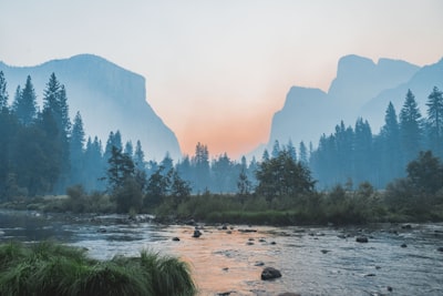
- 🌳 Reclaimed slopes resist landslides and erosion
- 🌱 Vegetation cover recycles nutrients and rebuilds soil
- 🦉 Habitat zones support birds, pollinators, and small mammals

Infrastructure and Regional Planning: Roads, Waterways, and Utilities
The transformation of Bingham Canyon from wildland-pasture to an engineered mining operation required the development of extensive infrastructure. These projects have left lasting footprints—both positive and negative—on the region’s ability to balance industrial, agricultural, and residential land uses.
Mining Infrastructure: Roads and Utilities
- 🚚 Haul roads: Built to move ore and overburden; later become key access routes for land management and reclamation efforts.
- ⚡ Power lines: Serve mining operations but present risk of soil compaction and disruption to farming corridors.
Water Management: Drainage and Sediment Control
- 🌊 Tailings ponds: Engineered to contain and treat mine waste, protecting downstream agricultural irrigation systems.
- 🏞️ Drainage channels: Designed to replicate natural flows and minimize the risk of flooding or water quality degradation.
Regional Planning and Sustainable Use
- 🏗️ Careful routing: Infrastructure is mapped to avoid direct impact on productive agricultural plots and waterways.
- 🛠️ Modern best practices: Involve frequent review of sediment loads, soil compaction, and water table levels to ensure ongoing sustainability of surrounding land uses.

Comparative Impact Table: Bingham Canyon Before & After
| Environmental Factor | Before Mining (Estimated Values) | After Mining (Estimated Values) | Sustainability Measures Taken |
|---|---|---|---|
| Soil Quality (pH, organic matter %) | pH 6.5–7.2; Organic matter 2–4%; good structure, stable surface | pH variable, 5.0–8.2; Organic matter <1% in newly exposed areas; compacted, unstable | Replanting with legumes/cover crops, mulching, organic amendments, lime |
| Watershed Condition (runoff, contamination) | Slow runoff, clear creeks, minimal sediment or heavy metals | Rapid surface runoff, increased sediment, some metal/chemical traces | Drainage channels, settling ponds, regular water quality sampling, buffer strips |
| Landscape Alteration (disturbed area, vegetation %) | High vegetation cover (~65–80%), intact valleys and slopes | Vegetation cover <10% at peak; >4,000 acres disturbed; exposed slopes | Progressive reclamation, contour grading, staged revegetation, native tree plantings |
| Agricultural Viability (arable land/crop yield) | Extensive pasture, diverse crop production, stable yields | Reduced pasture, limited cropping zones, lower yields & soil fertility issues | Soil rebuilding, erosion barriers, waterway protection, selective cropping trials |

Farmonaut’s Satellite-Based Mineral Detection & the Modern Mining Era
In today’s world, minimizing environmental disturbance and maximizing resource discovery efficiency are paramount for sustainable mining. At Farmonaut, we leverage satellite-driven mineral intelligence to help identify mineralized zones, alteration patterns, and key geological structures—before any ground disturbance occurs. Our platform radically reduces exploration time and cost, and removes guesswork from the mineral extraction process.
- 🌍 Global reach: Deploy across diverse geological regions with fast turnaround
- ⏱️ Efficiency: Shorten exploration timelines from years to weeks
- 💼 Cost savings: Reduce exploration expenditure by up to 80–85%
- 🌱 Zero ground disturbance: Non-invasive analysis supports early ESG reporting
- 🧠 Intelligence: Deliverable reporting and GIS outputs for technical & investment teams
Learn more here: Satellite Based Mineral Detection

Our unique workflows utilize multi- and hyperspectral satellite data to identify copper, gold, base metals, battery minerals, and critical rare earth elements. For more advanced prospecting, check out our solution for satellite driven 3D mineral prospectivity mapping.
Ready to transform your exploration? Get Quote here or Contact Us for consultation.

Recommended Video Resources
For visual learners and those wanting deeper insight, explore these hand-picked resources relevant to mineral exploration, mining sustainability, and geospatial innovation:
- ▶️ DRC’s Copper Wealth: Unlocking Africa’s Mineral Potential
- ▶️ Arizona Copper Boom 2025 🚀 AI Drones, Hyperspectral & ESG Tech
- ▶️ Satellite Mineral Exploration 2025 | Copper & Gold in BC
- ▶️ Find Hidden Minerals by Satellite | Farmonaut Detection
- ▶️ How Satellites Find Star Garnets | Idaho, USA
- ▶️ Modern Gold Rush: Inside the Global Race for Gold
- ▶️ Gold Rush Arizona 2025: History & Modern Gold Mining
- ▶️ How Gold is Extracted from Mines | Full Guide
Key Takeaways and Callouts: Bingham Canyon Mine Before and After
Mining reclamation is most successful when native plants, terracing, and sustainable drainage design are planned together from the earliest stages of the operation.
Monitor reclaimed sites with regular satellite data analysis to track erosion risk, soil moisture, and vegetation regrowth at scale.
Neglecting ongoing contamination checks in runoff and sediments can compromise agricultural viability for years after mining ends.
ESG-aligned site management doesn’t just protect the environment—it enhances mining project value, reduces long-term liabilities, and attracts responsible investment.
Integrated land-use planning—accounting for soils, water, vegetation, and infrastructure—offers the best chance for mining and agriculture to thrive side by side.
Top 5 Lessons from Bingham Canyon Mine Before and After:
- 🌎 Massive surface mining reshapes natural landforms, soil regimes, and local climate effects
- 💦 Runoff and watershed risks extend far beyond the mine pit
- 🌱 Ongoing reclamation transforms previously altered land into productive use over decades
- 🚜 Infrastructure design (roads, drainage) influences farming and forestry function regionally
- 🛰️ Remote-sensing and satellite technologies are revolutionizing responsible mineral exploration worldwide
Frequently Asked Questions (FAQ)
-
Where is the Bingham Canyon Mine located?
The mine is in the foothills of the Oquirrh Mountains, west of Salt Lake City, Utah, USA. It sits within a landscape historically dedicated to ranching, farming, and woodlands. -
What is the principal environmental impact of surface mining at Bingham Canyon?
The largest impacts are soil erosion, loss of productive vegetation, watershed disruption, and sedimentation in nearby watercourses, which influence farming and regional hydrology. -
How have reclamation efforts changed the post-mining landscape?
Over 1,200 acres have been restored through terracing, native plantings, and engineered runoff controls—improving soil health, supporting sustainable agriculture, and restoring natural drainage. -
What role does Farmonaut play in sustainable mineral exploration?
Farmonaut uses satellite data and AI to analyze surface and subsurface geology, identifying mineral zones without ground disturbance. This reduces early-stage exploration costs, accelerates decisions, and supports best environmental practices. Learn more here. -
Can surrounding agriculture recover after mining ends?
With progressive reclamation—rebuilding soil, controlling sediment, and restoring water quality—adjacent farms can return to productive use, but recovery may take years and demands constant monitoring. -
How does mining infrastructure affect local land uses?
Mines reshape transport, water management, and utility networks. Poorly routed infrastructure can disrupt farming and forestry for decades, so modern projects plan these routes with ecological and agricultural needs in mind.
mining.farmonaut.com
Transform your mineral exploration with no ground disturbance, reduced ESG risk, and fast results!
The Bingham Canyon Mine before and after journey stands as both a spectacular demonstration of mineral-driven transformation and a lasting educational resource for the mining, agriculture, and geospatial management communities. Leveraging smart restoration, sustainable practices, and modern geospatial intelligence—the future of resource extraction and land stewardship looks not just possible, but brighter.
Discussion
Questions, corrections or field experience? Share them below. First-time comments are reviewed before they appear, and your email is never published.
No comments yet. Be the first to add a question or your experience.

 Omsri International FZE
 G.I.T.T.
 Jaunita Erss Ltd
 Almosi SARL
 SRK Consulting
 Berks Gold Limited
 Mwerezi Minerals Company Limited
 Mining SARL
 SenGold Invest SAS
 Sean Mining Limited
 NTS Group (Pty) Ltd
 Mine4Africa
 Lithspo Minerals Limited
 Tintina Mining Group
 Dalgety Minerals Pty Ltd
