

Farmonaut in Botswana: Satellite Diamond & Kimberlite Detection Across 182 Hectares
Farmonaut’s satellite remote sensing platform characterised Diamond indicator minerals and kimberlite geomorphology across a 182-hectare project in Botswana — the world’s premier diamond-producing nation.

Minerals Identified by Farmonaut
Project Overview: Farmonaut in Botswana
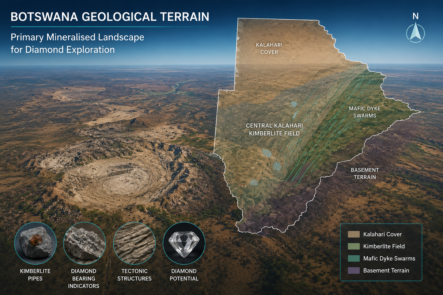
Botswana is the world’s leading diamond producer by value, with its Orapa, Jwaneng, and Letlhakane kimberlite pipe fields together representing the foundation of a diamond mining industry that generates approximately 70–80% of the country’s export earnings and a significant portion of government revenues. The country’s extraordinary diamond endowment is hosted in a series of Cretaceous kimberlite pipes and dykes intruded into the ancient Kaapvaal Craton basement, with the largest pipes hosting enormous diamond resources mined primarily by Debswana (a joint venture between De Beers and the Government of Botswana). Farmonaut’s satellite-based mineral detection project in Botswana covered a single exploration area of 1.82 square kilometres (182 hectares), applying advanced remote sensing methodology to characterise diamond indicator minerals and kimberlite geomorphology in prospective terrain.
Diamond exploration is one of the most technically demanding applications of remote sensing: diamonds themselves are invisible to satellite sensors, but their geological context — kimberlite pipes and dykes, and the indicator minerals (pyrope garnet, chrome diopside, picroilmenite) that are dispersed in soil and stream sediment halos around productive pipes — can be characterised through a combination of spectral, topographic, and morphological satellite analysis. Farmonaut’s Botswana project represented one of the most technically advanced applications of the platform’s mineral detection capability, applying kimberlite-specific spectral mapping alongside DEM-based circular geomorphology analysis to characterise potential kimberlite pipe locations within the 182-hectare project area.
Farmonaut’s Satellite Remote Sensing Technology
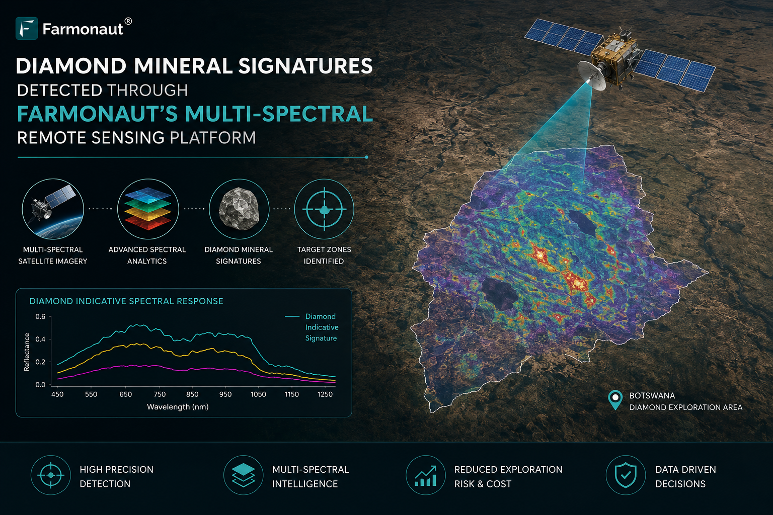
Kimberlite detection from satellite data relies on identifying two principal geological signatures: (1) the spectral response of kimberlite-related minerals (calcite, dolomite, serpentine, phlogopite, and olivine weathering products) that outcrop at or near the surface around kimberlite pipes and dykes, and (2) the characteristic circular to sub-circular topographic depressions (maar craters or low-lying weathered pipe interiors) that are the geomorphological expression of kimberlite pipes in lateritic terrain. Farmonaut deployed Sentinel-2 and WorldView-3 multi-spectral data for spectral kimberlite mineral mapping in Botswana, using carbonate (calcite-dolomite) spectral indices, Mg-silicate (serpentine-forsterite) mapping, and phlogopite detection algorithms to identify the distinctive mineralogy of kimberlite-related surface exposures. SRTM and Copernicus DEM data were used for morphological analysis, identifying circular to elliptical low-relief features consistent with kimberlite pipe geomorphology in Botswana’s flat Kalahari landscape.
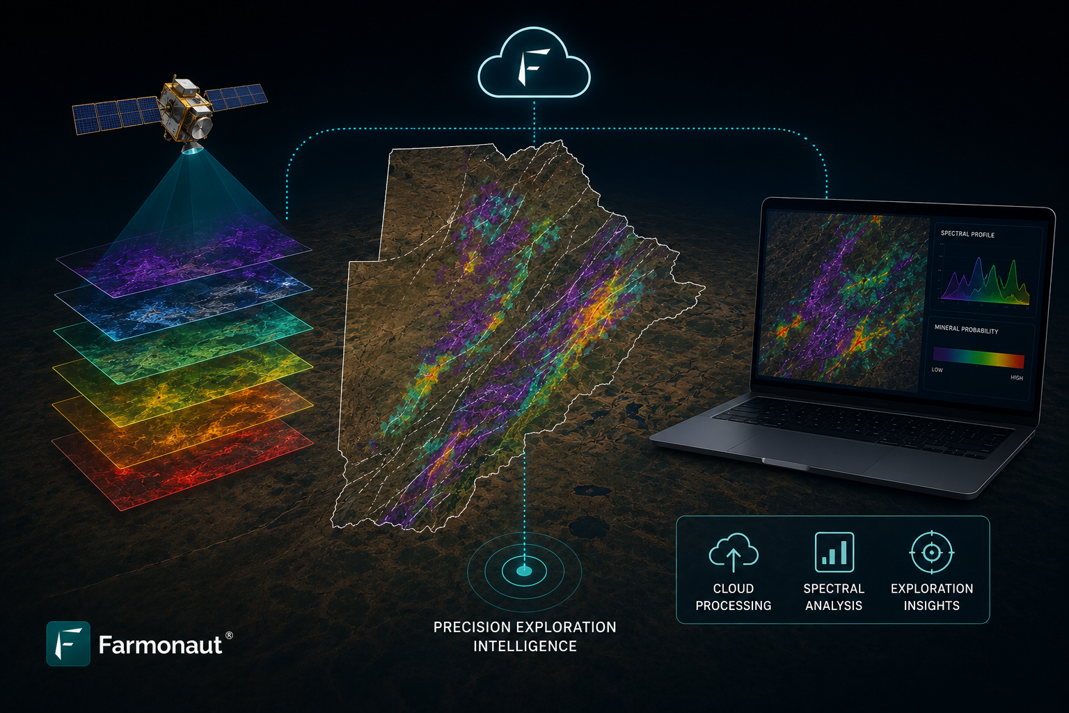
Multi-spectral & hyperspectral satellite imagery · NDVI & mineral index analysis · Machine learning classification · Geological structure mapping · Change detection algorithms · Cloud-penetrating radar integration
Project Scope & Methodology
The Botswana project applied a two-phase kimberlite targeting workflow. Phase 1 (geomorphological screening) used DEM and radar backscatter data to identify circular and sub-circular topographic anomalies within the project area — the geomorphological signature of kimberlite pipes in Botswana’s Kalahari sand-covered basement. Phase 2 (spectral mineral characterisation) focused detailed spectral analysis on the anomalous circular features identified in Phase 1, mapping the spectral expression of kimberlite-related minerals (carbonates, Mg-silicates, phlogopite) in and around the geomorphological anomalies. Features showing both geomorphological (circular depression) and spectral (kimberlite mineralogy) anomalies were classified as highest-priority kimberlite targets, consistent with the dual-anomaly targeting approach recommended by diamond exploration best practice guidelines. The deliverable included a kimberlite target map with priority ranking, spectral mineral maps, and a technical exploration report.
- Satellite data acquisition and preprocessing across all 1 project zones in Botswana
- Spectral band ratio analysis isolating iron oxides, clay minerals, and carbonates
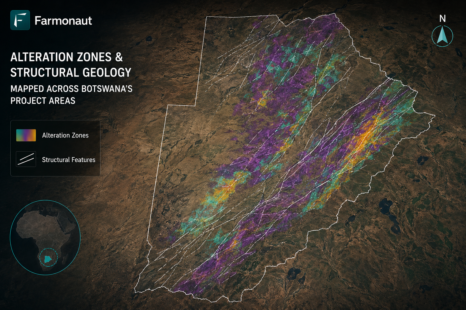
- Structural geology mapping using high-resolution DEMs and radar backscatter
- Mineral anomaly delineation and priority target ranking
- Integration with existing geological maps and ground-truth validation datasets
- Delivery of georeferenced exploration datasets, shapefiles, and technical reports
Minerals Detected: Analysis & Significance
Diamond in Botswana is hosted exclusively in kimberlite pipes and dykes — vertical to sub-vertical cylindrical bodies of kimberlite magma that were explosively emplaced from the mantle through the lithosphere during the Cretaceous (ca. 90–92 Ma). The diamonds themselves crystallised in the mantle at depths of 150–200 km and were carried to surface by the rapidly ascending kimberlite magma during explosive eruptions. Not all kimberlites are diamond-bearing, and the primary exploration challenge is distinguishing diamondiferous kimberlites from barren (non-diamondiferous) kimberlites — a challenge that ultimately requires direct sampling and microdiamond analysis, but which can be informed at the first-pass stage by the spectral and geomorphological mapping of kimberlite pipe extent and composition. Farmonaut’s kimberlite characterisation workflow provides exploration companies with a ranked priority list of kimberlite targets based on the best available remote sensing evidence, guiding cost-efficient ground sampling programs.
Botswana’s Diamond Geology: Kaapvaal Craton Kimberlites and the World’s Greatest Diamond Province
Botswana’s extraordinary diamond endowment is rooted in the geology of the Kaapvaal Craton — one of Earth’s oldest and most stable cratons, formed ca. 3.6–2.7 billion years ago — and in the unique set of mantle and lithospheric conditions that enabled diamond crystallisation and kimberlite emplacement in this part of southern Africa. The Kaapvaal Craton’s thick, stable, cold lithospheric keel (the lithospheric mantle beneath the craton) creates the conditions of high pressure and appropriate temperature at which diamonds are stable — approximately 50–60 kilobars and 1,100–1,300°C, corresponding to depths of 150–200 km. When kimberlitic magmas were generated in the metasomatised lithospheric mantle and rapidly ascended during the Cretaceous, they entrained diamond-bearing mantle xenoliths and xenocrysts, carrying them to surface in explosive eruptions that formed the kimberlite pipes mined today at Orapa, Jwaneng, and Letlhakane.
Farmonaut’s Botswana project targeted kimberlite exploration in an area of Kalahari-covered Kaapvaal Craton basement that is geologically prospective for kimberlite emplacement based on its proximity to known productive pipes and its tectonic position relative to the Kalahari Craton’s structural framework. The Kalahari sand and calcrete cover that blankets much of Botswana’s basement presents the primary challenge for kimberlite exploration: the thin but continuous sand veneer effectively masks bedrock geology from ground-based mapping and limits the ability of conventional geochemical methods to detect kimberlite-derived indicator minerals at surface. Farmonaut’s DEM-based geomorphological mapping addresses this challenge by detecting the characteristic subtle topographic expressions (circular depressions, low-lying areas of preferential moisture retention) that kimberlite pipes create even beneath Kalahari cover.
Botswana’s diamond sector is managed with exemplary governance standards — the Debswana partnership model, in which the government holds a 50% equity stake in all major diamond mining ventures, has been widely cited as a best-practice model for resource nationalism and shared economic benefit. The government’s Diamond Technology Park in Gaborone and its policies promoting local diamond cutting and polishing have maximised the value captured within Botswana from its diamond resources. Farmonaut’s satellite-based kimberlite exploration methodology supports Botswana’s broader diamond sector development by enabling efficient, low-impact characterisation of prospective kimberlite terrain — contributing to the pipeline of new kimberlite discoveries that will sustain Botswana’s diamond sector as existing mines mature and deplete their resources over coming decades.
Key Findings & Project Outcomes
Farmonaut’s Botswana project covered 1.82 sq km (182 ha), delivering a kimberlite target map with ranked priority features based on dual anomaly (geomorphological + spectral) characterisation, spectral kimberlite mineral maps distinguishing carbonate-serpentine-phlogopite mineralogy, and a technical exploration report documenting the kimberlite detection methodology and recommending ground validation steps. The dual-anomaly approach identified priority kimberlite targets combining circular DEM depressions with kimberlite-specific spectral signatures — the highest-confidence remote sensing evidence for kimberlite pipe locations available from satellite-based analysis.
- Total area mapped: 1.82 sq km (182 hectares) across Botswana
- Projects completed: 1 distinct exploration zones characterised
- Minerals confirmed: Diamond identified through spectral analysis
- Structural controls on mineralisation mapped with high spatial precision
- Priority drill targets identified, reducing exploratory drilling risk significantly
- Clients received georeferenced datasets compatible with ArcGIS and QGIS
Environmental & Economic Impact
Botswana’s diamond sector is the foundation of one of Africa’s most successful resource-based development stories, with diamond revenues financing world-class infrastructure, healthcare, and education systems that have made Botswana one of Africa’s wealthiest and best-governed nations. Farmonaut’s satellite-based kimberlite exploration methodology supports the continuation of this development story by enabling efficient identification of new kimberlite targets — sustaining the pipeline of future diamond mine development that will maintain Botswana’s diamond sector beyond the lifetimes of its current operating mines. The platform’s low environmental footprint is consistent with Botswana’s commitment to preserving its pristine natural environment, including the Okavango Delta (a UNESCO World Heritage Site) and the Central Kalahari Game Reserve — ecologically sensitive areas where minimising exploration disturbance is both a legal requirement and an ethical imperative.
- Reduced on-ground exploration footprint through satellite-first targeting
- Minimised unnecessary drilling, lowering carbon emissions and land disturbance
- Delivered cost savings of 40–70% vs conventional geophysical surveys
- Accelerated project timelines from months to weeks for initial target identification
- Enabled sustainable mineral exploration aligned with ESG reporting standards
Why Farmonaut for Mineral Exploration in Botswana?
Botswana’s diamond exploration sector demands technically sophisticated, geologically precise exploration tools capable of identifying kimberlite targets beneath the Kalahari’s deceptively featureless sand cover. Farmonaut’s dual-anomaly kimberlite targeting methodology — combining DEM-based geomorphological analysis with spectral kimberlite mineral mapping — provides diamond exploration companies in Botswana with the most comprehensive satellite-based kimberlite detection approach available. The platform’s proven delivery capability in Botswana’s unique geological and geomorphological setting — demonstrated through the successful 182-hectare project — establishes Farmonaut as a credible provider of satellite-based kimberlite intelligence in the world’s premier diamond-producing nation.
Web App · Android · iOS · API for Developers
Related Farmonaut Resources
Partner with Farmonaut for Your Mineral Exploration Project
Farmonaut has successfully mapped over 133,964 hectares across 102 mineral exploration projects in 25 countries. Whether you are prospecting in Botswana or expanding globally, our satellite-based platform delivers precision, speed, and sustainability.
Request a Project Consultation Explore Our APIDiscussion
Questions, corrections or field experience? Share them below. First-time comments are reviewed before they appear, and your email is never published.
No comments yet. Be the first to add a question or your experience.

 SRK Consulting
 Berks Gold Limited
 Mwerezi Minerals Company Limited
 Mining SARL
 SenGold Invest SAS
 Sania Corporation
 Sean Mining Limited
 NTS Group (Pty) Ltd
 Mine4Africa
 Lithspo Minerals Limited
 Tintina Mining Group
 Dalgety Minerals Pty Ltd
 Vortex Minerals Pty Ltd
 Faith At Work (Pty) Ltd
 Geotech Mining Solutions plc
 Vulcan International Limited
 Licence holder · Nigeria · Gold + lithium










