

Client and partner case study · Gold · Ghana
How Robert Kwasi Atsrim Is Taking Satellite Gold Exploration to Ghana's Mining Institutions
Robert Kwasi Atsrim is a Ghanaian Farmonaut client and Certified Mining Affiliate Partner who commissioned his own satellite gold exploration report in Ghana and calls it “incredibly cost and time saving.” He told us he has since introduced the technology to five Ghanaian mining institutions and proposed a pilot to the Ghana Geological Survey Authority.
Key takeaways
- Robert Kwasi Atsrim, a Ghanaian Farmonaut client and Certified Mining Affiliate Partner, commissioned his own Gold Premium satellite report in June 2026 and calls it “incredibly cost and time saving.”
- By his own estimate, the report saved him more than six months and over US$100,000. These are his estimates, not verified outcomes.
- He plans to drill within three to six months, the step that turns satellite targets into evidence.
- Robert told us he has introduced the technology to five Ghanaian institutions: the GGSA, GoldBod, MIIF, the Ministry of Lands and Natural Resources and GIADEC. None has endorsed, funded or partnered with Farmonaut.
- He proposed a pilot to the Ghana Geological Survey Authority and says it has agreed to pilot with him. The official response is pending.
In this article
- Who Robert Kwasi Atsrim is and why his story matters
- Why satellite gold exploration matters in Ghana
- What Robert told us about his own project
- Taking satellite gold exploration to Ghana's mining institutions
- The pilot proposal to the Ghana Geological Survey Authority
- How satellite gold exploration works
- Planning the next step: from targets to drilling
- What other explorers and partners can learn from Robert's approach
- Satellite gold exploration Ghana: frequently asked questions
Who Robert Kwasi Atsrim is and why his story matters
Robert Kwasi Atsrim is a Ghanaian who wears two hats in his work with us. He is a client: in June 2026 he commissioned a Farmonaut Gold Premium report for his own ground, using our satellite-based mineral detection service. He is also a Farmonaut Certified Mining Affiliate Partner, which means he introduces our technology to people and organisations in his network and earns a commission when a project goes ahead.
That combination is what makes his story worth telling. Most case studies on this site follow one project from a boundary to a set of targets. This one follows a person. Robert used the technology himself first, and then set out to show it to the institutions that shape gold exploration and mining in Ghana.
Robert joined our mining affiliate programme in April 2026. Two months later he paid for a Gold Premium report of his own. In his messages to us, he has described himself as a Certified Mining Affiliate Partner introducing “gold detection technology with satellites and AI” to organisations across the Ghanaian mining sector. Since July 2026 he has been doing exactly that.
Robert gave us that statement on our client feedback form, with permission to publish it and his name. Four words is short, but it goes straight to the two things that decide whether early exploration happens at all: how long it takes and what it costs. We look at the rest of his answers later in this article, and we are clear about which figures are his own estimates.
His affiliate work matters for a different reason. Ghana is Africa’s largest gold producer, and much of the decision-making about where and how gold is explored runs through public institutions. When a Ghanaian brings a new exploration tool to those institutions himself, explains it in his own words and asks for a chance to prove it on Ghanaian ground, that is a story about adoption, not just about one report.

▶ How the Farmonaut mining affiliate programme works, the programme Robert joined in April 2026. · 10:33
Why satellite gold exploration matters in Ghana
Gold is central to Ghana’s economy and its history. The Ghana Chamber of Mines put the country’s 2024 output at about 4.8 million ounces, which keeps Ghana ahead of every other producer in Africa. The US Geological Survey’s Minerals Yearbook for Ghana notes that Ghana became Africa’s leading gold producer in 2019, with production from both large company mines and artisanal and small-scale miners.
The balance between those two kinds of mining has shifted fast. According to figures reported from the Chamber of Mines, gold from artisanal and small-scale mining rose from about 1.1 million ounces in 2023 to about 1.9 million ounces in 2024, while large-scale output held steady at about 2.9 million ounces.
Chart
Small-scale gold output in Ghana jumped in 2024
Artisanal and small-scale gold production, million troy ounces
That growth brings a familiar problem. Small-scale miners and junior explorers often work with very little geological information about their own ground. They may have a licence and a hunch, but no map of where the strongest signs of gold are. In that situation, the usual way to find out is to dig, pit or drill, and that is slow, expensive and hard on the land.
Chart
Where Ghana’s gold came from in 2024
Gold production by type of mining, million troy ounces (rounded)
Satellite analysis offers a different first step. It looks at a whole area at once from data that is already being collected, and it ranks the ground by the strength of the signs that are often found around gold deposits. It does not replace field work. Its job is to tell a team where to start, so that the people, the equipment and the budget go to a small part of the land first.
That is the idea Robert has been explaining to Ghana’s institutions. For a country with millions of ounces produced every year and a fast-growing small-scale sector, better targeting at the start of a project can mean less wasted ground disturbance and less money spent on holes in the wrong place.

▶ How satellite technology is used to look for gold in Ghana. · 15:36
What Robert told us about his own project
Robert commissioned a Farmonaut Gold Premium report in June 2026. The Premium level includes ranked high-potential zones, a prospectivity map, estimated depth and quantity ranges and a geological interpretation, delivered as a PDF with georeferenced GIS files. We do not describe his site or the report’s findings in this article. His project details stay private, and this article is about how he used the technology and what he did next.
What we can share is how Robert himself rated the experience. He completed our client feedback form in November 2026. Here is what the form records, in his own selections:
- Narrowed locations: yes. By his account, the analysis helped narrow down where to look.
- Time: yes, it reduced time. He chose the highest band on the form, more than six months.
- Cost: yes, it reduced cost. He chose the highest band on the form, more than US$100,000.
- Drilling: not yet. He plans to drill within the next three to six months.
- Testimonial: yes, he agreed to share a statement and his name.
Why would a satellite study save that much time and money? Think about what it replaces. Without a map of where to start, a team has to work across the whole area on foot: geological mapping, then soil and rock sampling on a grid, then trenches or pits, and only then drilling. Each of those steps takes skilled people many days, and each one has its own costs for wages, transport and laboratory fees.
A ranked list of targets changes the order of work. Instead of sampling every part of the licence evenly, a team can walk the strongest zones first, sample there, and move to drilling sooner. The calculator below lets you test that idea on your own numbers. It compares the cost of ground work across a whole area with the cost of the same work on a smaller share of it.
Calculator
How much ground work could targeting save?
Enter your own area and costs. All amounts are in US dollars.
- Crew-days to cover the whole area: 50
- Crew-days on targets only: 8
- Crew-days saved: 42
Example values only, not typical rates and not related to Robert’s project. Coverage per crew-day and daily crew cost vary widely with terrain, access and the work done, so use your own figures. The share of land kept is the part you would still cover after targeting.
Robert’s drilling plan is the next step. He told us on the form that he expects to drill within three to six months. That is the right sequence for satellite targets: they are meant to be tested in the field, and drilling and laboratory results are what turn a target into evidence.
Taking satellite gold exploration to Ghana’s mining institutions
Robert’s affiliate work did not start with sales calls to individual prospectors. He went to the institutions. Over four months, by his own account, he introduced the technology to five public bodies that each play a different role in Ghana’s mineral sector. The timeline below is built from what Robert told us in his messages.
Infographic
Robert’s work from April to November 2026, as he described it to us
- 1April: joins the programmeRobert joins our mining affiliate programme as a Certified Mining Affiliate Partner.
- 2June: his own reportHe commissions a Gold Premium satellite report for his own ground.
- 3July: GGSAHe introduces the technology to the Ghana Geological Survey Authority, followed by a virtual technical presentation.
- 4August: GoldBodHe meets the Ghana Gold Board to discuss the technology.
- 5October: more institutionsHe introduces it to MIIF, the Ministry of Lands and Natural Resources and GIADEC, and proposes a pilot to the GGSA.
- 6November: pilot agreed, per RobertHe tells us the GGSA has agreed to pilot with him. The official response is pending.
Each of these institutions has a public mandate that explains why Robert approached it. We describe those mandates from their own public sources. None of them has endorsed, funded or partnered with Farmonaut, and nothing in this article should be read that way.
Ghana Geological Survey Authority (GGSA). The GGSA is Ghana’s national geoscience body. It was set up under the Ghana Geological Survey Authority Act, 2016 (Act 928) to collect and manage geoscientific information, carry out geological mapping and advise on mineral resources. Its geological survey work in Ghana goes back more than 110 years. Robert told us that he introduced our technology to the GGSA in July 2026, and that a virtual technical presentation of the technology to the Authority followed later that month, so that its specialists could ask their own technical questions.
Ghana Gold Board (GoldBod). GoldBod was established under the Gold Board Act, 2025 (Act 1140) to regulate and handle the buying, assaying, refining and export of gold, and it took over the role of the former Precious Minerals Marketing Company. Robert told us he met GoldBod in August 2026 to discuss the technology.
Minerals Income Investment Fund (MIIF). The MIIF was set up under the Minerals Income Investment Fund Act, 2018 (Act 978) to manage Ghana’s equity interests in mining companies and receive a share of mineral royalties for investment. Robert told us he introduced the technology to the MIIF in October 2026.
Ministry of Lands and Natural Resources (MLNR). The Ministry sets policy for Ghana’s land, forest and mineral resources and oversees the agencies that manage them. Robert told us he introduced the technology to the Ministry in October 2026.
Ghana Integrated Aluminium Development Corporation (GIADEC). GIADEC is the state body set up in 2018 to develop an integrated aluminium industry from Ghana’s bauxite. Robert told us he introduced the technology to GIADEC in October 2026, which shows that his outreach reaches beyond gold to Ghana’s wider minerals sector.
The pattern in Robert’s approach is worth noticing. He did not wait for institutions to come to him. He visited offices, followed up each meeting by email and asked for a technical session where people could put their own questions to our team. That is how new tools usually enter a sector: one conversation, one demonstration and one follow-up at a time.
The pilot proposal to the Ghana Geological Survey Authority
The most concrete step in Robert’s work so far is a pilot proposal. In October 2026, he told us, he submitted a proposal to the GGSA for a pilot that would apply our satellite analysis to a concession chosen with the Authority, with Robert covering the cost himself. A pilot of this kind is a test: the satellite study is run first, and the targets it produces are then checked on the ground, so the method can be judged on results rather than on a presentation.
In November 2026, Robert told us that the GGSA has agreed to pilot with him as he proposed, and that the Authority’s official response to his proposal is expected shortly. At the time of writing, that official response is still pending, and we have not received any communication from the GGSA about it.
Why does a pilot matter so much? Because it is the fair way to test any new exploration method. A pilot puts satellite targets next to the evidence that a geological survey already trusts, such as mapping, sampling and drilling. If the targets line up with what is found on the ground, that is useful for everyone who explores in Ghana. If they do not, that is useful to know too.
- A defined area: a pilot works best on a concession with a clear boundary, so the satellite study and the ground checks cover the same land.
- Known geology to compare against: ground with some existing mapping or sampling lets the satellite targets be checked against independent data.
- Field checks: geologists visit the leading targets, map the rock and take samples for the laboratory.
- An honest scorecard: the results are compared zone by zone, including any targets that do not hold up.
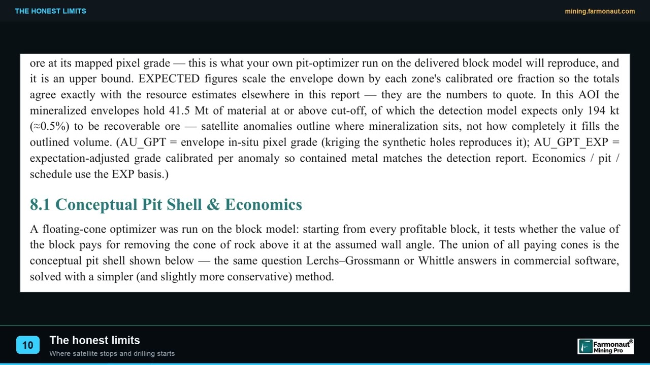
▶ What satellite exploration cannot do, and why ground checks are always part of the plan. · 2:08
How satellite gold exploration works
When Robert presents the technology, he is explaining a method that starts from data rather than from the ground. Here is what that method does, in plain terms.
Different rocks and minerals reflect sunlight in different ways. Satellites such as Sentinel-2 and Landsat 9 measure that reflected light in visible, near-infrared and shortwave-infrared bands. Many of the minerals that form around gold deposits, such as clays, white micas and iron oxides, show up most clearly in those bands.
- Alteration minerals: hot fluids that carry gold also change the rock they pass through, leaving clays, micas and silica that satellites can pick out.
- Iron oxides: rust-coloured minerals can form a cap over weathered sulphide minerals, which are often found with gold.
- Structures: faults and fractures act as pathways for those fluids, and they often show up in terrain and radar data.
- Terrain and drainage: elevation models help explain where weathered material and loose gold may collect.
We combine these signs across years of images, not a single snapshot, so that a lasting rock signal can be told apart from a green season or a cleared field. In a tropical country like Ghana, with thick vegetation and frequent cloud, using many dry-season images and radar data is especially important.
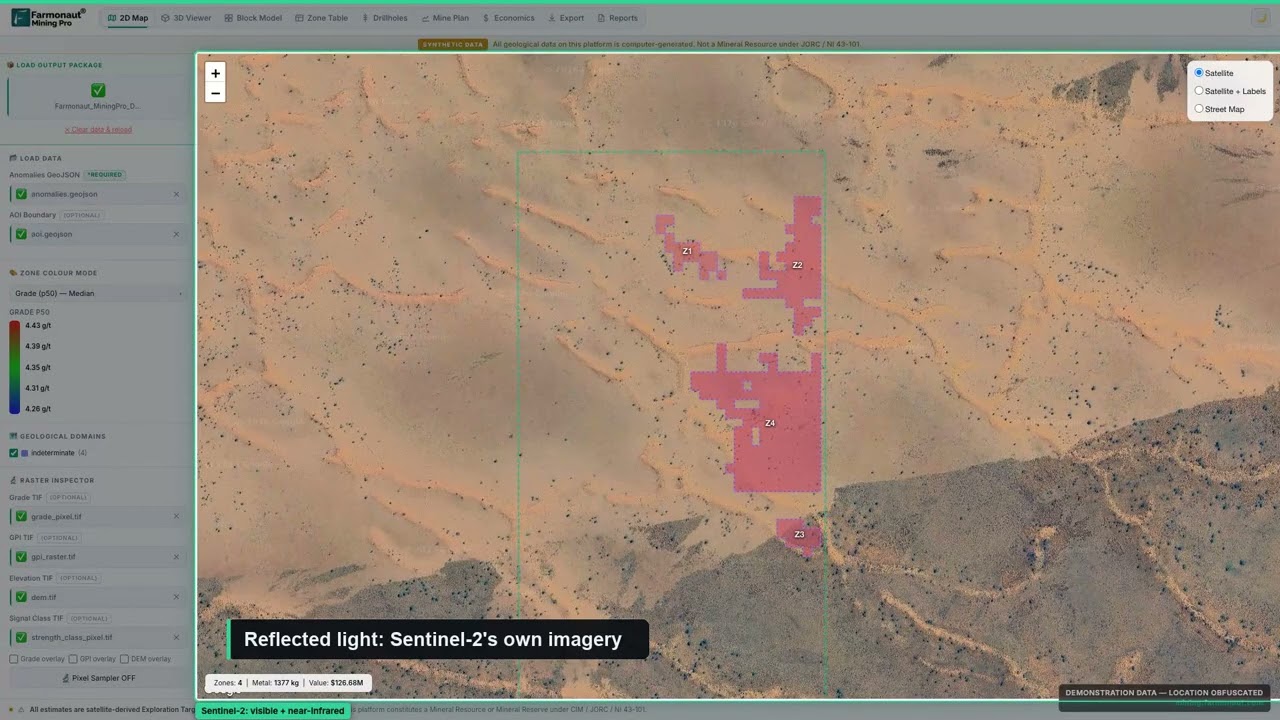
▶ A short explanation of how satellites look for the signs of gold. · 5:44
The result is a ranked set of target zones, each with an estimated depth range and an indicative quantity range, plus a map of the whole area’s potential. A client sends a boundary as coordinates, a KML or KMZ file, or a polygon, names the target mineral, and receives the report, usually within 5 to 20 business days depending on size and mineral. No one has to visit the site for this stage, and no ground is disturbed.
Planning the next step: from targets to drilling
Robert told us he plans to drill within three to six months. That window is typical for a project moving from a desk study to the field: it allows time to walk the leading targets, take samples, get permits in order and book a drilling contractor.
A good drilling plan answers three questions before the rig arrives: which targets come first, how deep each hole needs to go and how many holes the budget can carry. Satellite targets help with the first question directly, and the depth ranges in a report help with the second.
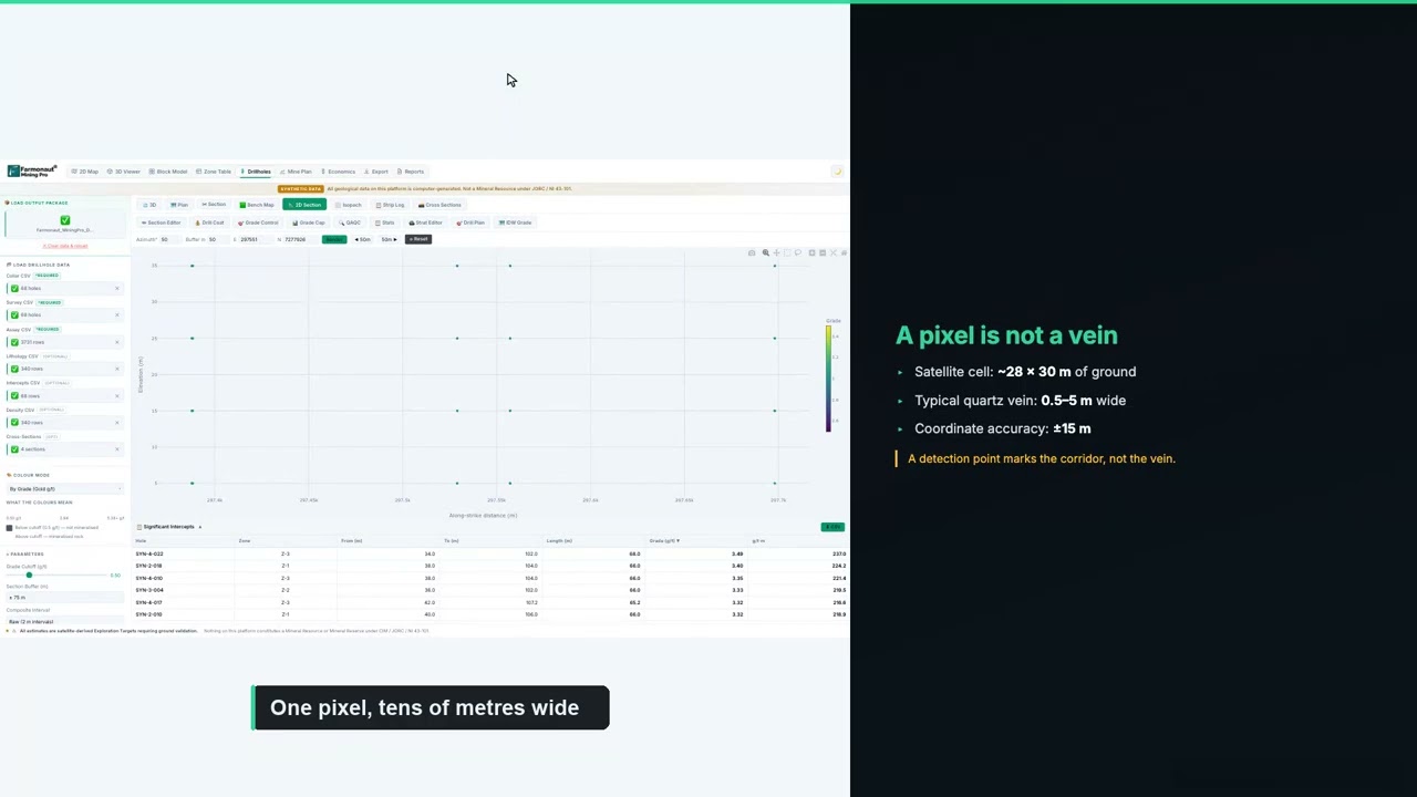
▶ How to plan a drilling programme once you have ranked targets. · 5:49
The third question is about money, and it depends entirely on local quotes. Drilling rates, sampling and assay fees and the cost of moving a rig to site vary from one region to another. The calculator below lets you build a first budget from your own contractor’s numbers.
Calculator
What would a first drill programme cost?
Enter your contractor’s quote. All amounts are in US dollars.
- Total metres: 1,000
- Cost per hole (US$): $12,500
Example values only, not typical prices. Costs vary with location, rock type and rig availability, so use real quotes from your contractor and laboratory.
The order of work matters as much as the budget. Start with the targets the report ranks highest, drill a few holes to test them, and let the first laboratory results decide where the next holes go. That way each round of drilling is guided by what the last one found, and the budget follows the evidence.
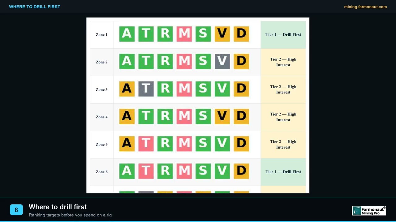
▶ How to decide which target to drill first. · 2:19
What other explorers and partners can learn from Robert’s approach
Robert’s story is still being written, but several parts of his approach would work for other explorers and for anyone introducing new exploration tools in their own country.
- Use the tool yourself first: Robert commissioned his own report before presenting the technology to anyone else, so he could speak from experience.
- Go where decisions are made: he approached the institutions that hold geological data, regulate the gold trade, manage mineral income and set land policy.
- Ask for a technical session: instead of relying on a brochure, he arranged a technical presentation where specialists could ask their own questions.
- Propose a fair test: a pilot on Ghanaian ground, checked against field evidence, is the honest way to judge any new method.
- Keep the sequence: satellite targets first, then field checks, then drilling within a planned window, as Robert intends on his own project.
- Be clear about roles: as an affiliate partner, Robert is open about his role, and that openness is what lets people trust the introduction.
Getting a similar study for your own ground follows the same steps Robert took. Send your boundary as coordinates, a KML or KMZ file, or a polygon, and name your target mineral. You can map your mining site yourself or get a quote from our team. If you would like to introduce the technology in your own country, as Robert does, you can join the mining affiliate programme.
Want to see satellite exploration on other Ghanaian ground? Read our Ghana gold case study on a 422-hectare scan or see how we mapped 53,365 hectares across nine Ghana projects.
Satellite gold exploration Ghana: frequently asked questions
Who is Robert Kwasi Atsrim?
Robert Kwasi Atsrim is a Ghanaian Farmonaut client and Certified Mining Affiliate Partner. He commissioned a Gold Premium satellite report for his own ground in June 2026 and has since introduced the technology to Ghanaian mining institutions. As an affiliate partner, he earns a commission on projects he introduces to us.
What did Robert say about the satellite gold report?
On our client feedback form he wrote that it was “incredibly cost and time saving.” By his own estimate, it saved him more than six months and over US$100,000. These are his estimates and have not been verified by us.
Which Ghanaian institutions has Robert approached?
By his account, Robert has introduced the technology to the Ghana Geological Survey Authority, the Ghana Gold Board, the Minerals Income Investment Fund, the Ministry of Lands and Natural Resources and the Ghana Integrated Aluminium Development Corporation. None of these institutions has endorsed, funded or partnered with Farmonaut.
Is there a pilot with the Ghana Geological Survey Authority?
Robert proposed a pilot to the Authority in October 2026. In November 2026 he told us the Authority has agreed to pilot with him, with its official response still pending. We have not received any communication from the Authority and will update this article if the pilot is formally confirmed.
When does Robert plan to drill?
He told us he expects to drill within three to six months of completing our feedback form in November 2026.
Can a satellite detect gold directly?
No. Satellites detect signs that are linked with gold, such as altered rock, iron oxides and structures. These signs show where to look first. Field mapping, sampling and drilling are needed to confirm gold.
Does satellite exploration work in Ghana’s forests and cloud?
Thick vegetation and cloud make it harder, which is why the analysis combines many dry-season images over several years with radar and terrain data.
How long does a satellite gold report take?
Delivery usually takes 5 to 20 business days, depending on the size of the area and the mineral.
What do I need to send to get a report for my own land?
Send your boundary as coordinates, a KML or KMZ file, or a polygon, along with the country and your target mineral. Our team checks the boundary with you before the work starts.
How can I become a Farmonaut mining affiliate partner?
You can apply through our mining affiliate programme page. Affiliate partners introduce our satellite mineral detection service to clients in their network and earn a commission on projects that go ahead.
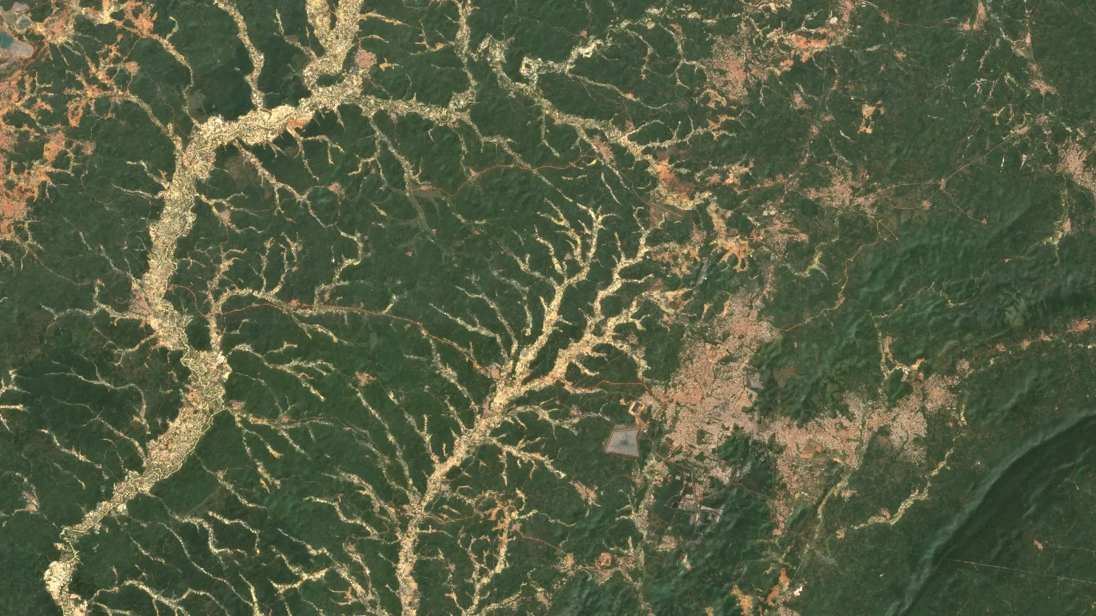
Published with the client’s consent. Robert Kwasi Atsrim is a Farmonaut Certified Mining Affiliate Partner and earns commission on projects he introduces. Time and cost savings are his own estimates, chosen from bands on our feedback form, and have not been verified. His meetings with and introductions to Ghanaian institutions are reported as he described them to us; none of those institutions has endorsed, funded or partnered with Farmonaut, and the GGSA pilot is pending the Authority’s official response. The location and findings of Robert’s own report are not described. The hero image is an illustrative regional view and does not show his site. Nothing here is investment advice.
Farmonaut mineral detection
Map your mining site from space
Send your concession or licence boundary as KML, KMZ or a polygon. Farmonaut returns ranked satellite exploration targets for it, usually in 5 to 20 business days.

Keep reading
Sources
- Adom Online, Ghana still reigns as Africa's gold king with 4.8 million ounces in 2024, Chamber of Mines (2025): adomonline.com
- Norvan Reports, Gold output from artisanal and small-scale mining jumps to 1.9m ounces in 2024 (2025): norvanreports.com
- US Geological Survey, Minerals Yearbook: The Mineral Industry of Ghana (2019): pubs.usgs.gov
- Minerals Commission of Ghana, official website: mincom.gov.gh
- Ministry of Lands and Natural Resources, Ghana, official website: mlnr.gov.gh
- Ghana Geological Survey Authority, official website: gsa.gov.gh
- Ghana Geological Survey Authority Act, 2016 (Act 928), via Judy Legal: judy.legal
- Graphic Online, GGSA launches 110th anniversary celebration: graphiconline.com
- Ghana Gold Board (GoldBod), About us: goldbod.gov.gh
- Mondaq, The Gold Board Act 2025 (Act 1140): key changes to Ghana's gold trading framework (2025): mondaq.com
- Minerals Income Investment Fund, Who we are: miif.gov.gh
- Ministry of Lands and Natural Resources, Ghana Integrated Aluminium Development Corporation: mlnr.gov.gh
- GIADEC, official website: giadec.com
- Copernicus SentiWiki, Sentinel-2 mission: sentiwiki.copernicus.eu
- USGS, Landsat 9 mission: usgs.gov
- JORC, The JORC Code (2012 edition): jorc.org
- Minamata Convention on Mercury: minamataconvention.org
Discussion
Questions, corrections or field experience? Share them below. First-time comments are reviewed before they appear, and your email is never published.
No comments yet. Be the first to add a question or your experience.

 Riverside Resources Limited
 Congo Mining Solutions
 Mining SARL
 SenGold Invest SAS
 Sania Corporation
 Sean Mining Limited
 NTS Group (Pty) Ltd
 Mine4Africa
 Lithspo Minerals Limited
 Tintina Mining Group
 Dalgety Minerals Pty Ltd
 Vortex Minerals Pty Ltd
 Faith At Work (Pty) Ltd
 Geotech Mining Solutions plc
 Vulcan International Limited
 Kidepo Associates
 GKY Mining
 Alkimy SARL
 Double A Trading

 Licence holder · Nigeria · Gold + lithium
 Client · Somalia · Gold
 Client & affiliate partner · Ghana · Gold










