

Agricultural GPS Guide: RTK Accuracy, Receivers & Costs
Reviewed August 2026 against USDA Economic Research Service precision-agriculture adoption data, the GPS.gov Standard Positioning Service accuracy standard, and University of Illinois farmdocdaily machinery-market analysis.
Try it: GPS Guidance Overlap Savings Calculator →
Agricultural GPS spans everything from a $500 lightbar that nudges a driver back onto a pass to a dual-frequency receiver holding a planter within about 2.5 cm of its line, season after season. The difference between those two experiences is entirely the correction signal underneath: plain GPS, free WAAS augmentation, a paid sub-meter subscription, or real-time kinematic (RTK) correction. RTK GPS for farming is the tier row-crop, strip-till, and controlled-traffic operations actually pay for, because it is the only one that repeats the identical line year over year rather than just this pass.

What “Agricultural GPS” Actually Covers
“Agricultural GPS” is an umbrella term for four distinct jobs, and confusing them is the fastest way to overspend or underbuy:
- Guidance/lightbar: a screen shows the driver how far off-line they are; the human still steers.
- Autosteer: the GPS receiver feeds a steering controller (electric wheel motor or hydraulic valve) that drives the line itself, freeing the operator to watch the implement.
- Section and row control: the same position data shuts off individual planter rows or sprayer nozzles over already-covered ground, cutting seed, fertilizer, and chemical overlap.
- Mapping and logging: yield monitors, as-applied maps, and boundary/field-record data tagged to a position, independent of whether autosteer is even installed.
A basic “GPS farm” setup — a receiver and a lightbar — answers the guidance job cheaply. Autosteer, section control, and centimeter-repeatable mapping all depend on the correction signal discussed next, which is where the money and the confusion both live.
Correction Tiers Compared: Why Plain GPS Isn’t Precise Enough
The U.S. government’s own performance commitment for the raw GPS signal, published by GPS.gov, is a daily global average user range error of 2.0 meters (6.6 ft) at 95% probability for the Standard Positioning Service — and GPS.gov notes actual performance is often tighter than the commitment (it cites a global average of 0.643 m, 95% of the time, on April 20, 2021, as one measured example). Either way, an uncorrected signal is wandering by roughly a meter to two meters, which is fine for logging a field boundary and useless for planting 30-inch corn rows without overlap or gaps. Every correction tier above raw GPS exists to shrink that error.
| Correction tier | Typical horizontal accuracy | Repeats the same line next season? | What it costs | Best fit |
|---|---|---|---|---|
| Uncorrected GPS | ~2 m (GPS.gov SPS standard) | No | Free — built into any receiver | Field boundary logging only |
| WAAS / SBAS (free federal augmentation) | Sub-meter; commonly published around 24–36 in static | No — drifts pass to pass | Free signal; receiver must support it | Lightbar guidance, wide-swath spraying |
| Subscription network correction | Single digits of inches | Within a season, not reliably across seasons | Paid annual/monthly subscription through the receiver brand | Row-crop guidance, moderate-precision tillage |
| RTK (own base station or NTRIP network) | ~1–2 cm | Yes — the entire reason growers buy it | Dual-frequency receiver plus a base station or network subscription | Planting, strip-till, controlled traffic, autonomous equipment |
Autosteer built on WAAS alone will still let a tractor drift a few inches within a pass and more between passes, which is why most operators running WAAS still overlap intentionally to avoid skips. RTK closes that gap because the correction comes from a fixed base station (either one the farm owns, or a network reference station reached over cellular data via the NTRIP protocol) that knows its own position precisely and broadcasts a correction to every rover receiver in range. That fixed reference is also what lets RTK repeat a planting line the following season — the same technology under fully autonomous tractors is RTK guidance with no driver at all, which only works because the position hold is centimeter-tight, not meter-tight.

Choosing a Farm GPS Receiver
A farm GPS receiver is the antenna-and-chipset unit that actually pulls in the satellite signal (and the correction stream, if you’re paying for one); the display, the steering controller, and the section-control valves are separate purchases that plug into it. Two things separate receivers: how many satellite frequencies they track, and whether they’re built to accept RTK correction at all.
- Single-frequency receivers: track one GPS frequency band, sufficient for WAAS or subscription-corrected guidance; hardware commonly starts around $500.
- Dual-frequency, RTK-capable receivers: track two frequency bands, which is what lets them resolve the RTK “fixed” solution to centimeter level; this class runs from roughly $3,000 to $15,000 depending on brand and update rate.
- Complete guidance-to-autosteer kits (receiver, screen, and a steering wheel motor or valve): commonly quoted from about $1,500 for basic visual guidance up to $35,000 for a full RTK autosteer package on larger equipment.
The receiver is only half the RTK equation — you still need the correction source. An owned base station is commonly quoted in the $10,000–$18,000 range as a one-time cost covering every receiver on the farm within its radio range, while network RTK (NTRIP) subscriptions are billed per receiver, typically in the tens of dollars per month, with no base station to maintain but an ongoing bill for every rover. That trade-off is exactly what the calculator below is built to run with your own numbers.
GPS Guidance Overlap Savings Calculator
Precision Ag Adoption in the US: Who’s Actually Using GPS Guidance
The USDA Economic Research Service tracks this through the Agricultural Resource Management Survey (ARMS), and the pattern is consistent: adoption tracks farm size, not region. As of 2023, guidance autosteer systems were used on 52% of midsize crop farms and 70% of large-scale crop-producing farms, up from single-digit adoption in the early 2000s, per the ERS report “Precision agriculture use increases with farm size.” Looking crop-by-crop across the four most recent ARMS survey years for each commodity, the same gap shows up every time. The pros and cons sit right next to these adoption figures in GPS accuracy and adoption on farms.
ERS attributes the gap to fixed cost: a receiver, base station or subscription, and steering kit cost roughly the same whether the farm runs 300 acres or 3,000, so the per-acre payback arrives faster on the larger operation. The USDA’s own historical breakdown, in the ERS chart “Largest farms most likely to adopt precision agriculture guidance systems,” also flags terrain, soil variability, and operator age and education as secondary factors behind who adopts and who waits. That fixed cost looks different depending on the system, so it helps to compare tractor guidance costs and accuracy across the main types.
Used Ag Machinery Market Outlook
The used ag machinery market outlook right now is a supply squeeze on quality iron layered onto a multi-year slide in new-unit sales. New tractor sales fell for four straight years after a 2021 peak of 317,944 units: 272,659 in 2022, 250,218 in 2023, 217,279 in 2024, and 195,857 in 2025, according to University of Illinois farmdocdaily’s February 2026 machinery-market review. New combine sales followed the same arc and then fell harder: from 7,349 units in 2023 to 5,556 in 2024 and 3,579 in 2025, a 35.6% single-year drop.
That falling new-unit supply is pushing buyers into the used market, and inventory hasn’t kept pace: used tractor inventories were down 15.5% year-over-year and used combine inventories down 9.5% year-over-year as of December 2025, while used tractor asking prices had still slid 5.85% year-over-year over the same period — a combination farmdocdaily describes as scarce, aging inventory holding prices up even as list prices soften. Dealer-side, farm-equipment inventory value at the manufacturer level fell from $7.23 billion in October 2022 to $5.72 billion in December 2025, a 20.84% decline, and dealers themselves are feeling both sides of the slowdown.
For current-month figures rather than this snapshot, the Association of Equipment Manufacturers publishes a monthly U.S. Ag Tractor and Combine unit retail sales report — as of this review the latest available was the June 2026 edition — which is the primary source both AEM’s members and farmdocdaily build their analysis from.
If you’re specifically looking at used farm equipment for sale in Texas, treat the national figures above as the trend line, not the local price. Texas spans row-crop country on the High Plains and Blacklands, ranching country in the Hill Country and Panhandle, and cotton country in West Texas, and used-equipment supply moves differently across each; cross-reference the national inventory and price direction above against your regional dealer’s current listings, county extension market letters, and auction results before you set a number to offer.

Agricultural Drones and GPS-Guided Scouting
Agri drones fall into two GPS-dependent jobs. Fixed-wing and multirotor mapping drones fly a pre-programmed GPS grid and geotag every image, then stitch the set into an orthomosaic or NDVI map for scouting; heavier spray drones carry the same RTK-class positioning tractors use, because a spray swath has to line up with the boom width just as precisely as a planter row does. Neither job replaces walking a field, but both cut the acres you have to walk to find the problem first. For a season-long, crop-specific scouting framework rather than a drone buying guide, see our corn and soybean scouting guide, built around a pest-management calendar rather than a single flyover.
20 Farm Tools and Their Uses: Quick Reference
| Tool/equipment | Primary use |
|---|---|
| Tractor | Power source (PTO/hydraulics) pulling or mounting most other implements |
| Moldboard/chisel plow | Primary tillage, inverting or fracturing soil ahead of planting |
| Disc harrow | Breaks up clods and residue after plowing |
| Field cultivator | Secondary tillage; final seedbed preparation and weed control |
| Planter/seed drill | Places seed at set depth and spacing |
| Boom sprayer | Applies herbicide, fungicide, or foliar fertilizer across a swath |
| Combine harvester | Cuts, threshes, and cleans grain in one pass |
| Round/square baler | Compresses cut hay or straw into bales for storage/transport |
| Mower-conditioner | Cuts hay and crimps stems for faster field drying |
| Hay rake | Gathers cut hay into windrows for baling |
| Grain cart | Shuttles grain from combine to truck without stopping harvest |
| Auger/conveyor | Moves grain into or out of bins and trucks |
| GPS guidance receiver (autosteer) | Holds equipment on line; enables section/row control |
| Yield monitor | Logs harvested yield by GPS position for mapping |
| Soil probe/sampler | Pulls soil cores for lab testing and variable-rate maps |
| Subsoiler/ripper | Fractures compacted soil below normal tillage depth |
| Rotary tiller | Pulverizes soil in one pass, common in vegetable/specialty beds |
| Front-end loader | Lifts and moves bales, feed, dirt, or manure |
| Utility vehicle/UTV | Fast transport for chores, fencing, and livestock checks |
| Center-pivot irrigation system | Applies water in a rotating circle over row crops |
Putting It Together: Farmonaut’s Satellite Layer on Top of Your GPS
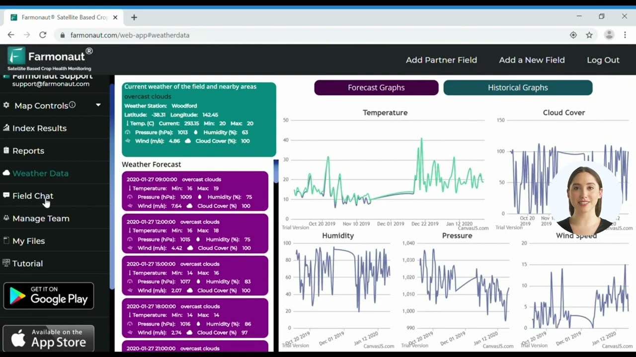
GPS and RTK guidance solve where your equipment is; they don’t tell you what’s happening in the crop between passes. Farmonaut is a satellite-based farming solution that sits on top of whatever GPS tier you already run: our platform reads satellite imagery for crop health, then hands you field-level maps you can carry straight into your existing guidance or section-control system for variable-rate decisions, rather than asking you to replace your GPS setup with anything new.

To try it against your own fields, open the web app or install the mobile app:


Developers building their own tools against the same imagery and field-boundary data can work directly with the Farmonaut API and the API developer docs, both of which cover the same satellite and weather layers described above.

Frequently Asked Questions
Q: What’s the real difference between RTK GPS and regular autosteer?
A: Regular WAAS-based autosteer holds a line to within roughly a foot and drifts between seasons; RTK holds to about 1–2 cm and repeats the identical line the next year, which is what makes controlled traffic farming and strip-till possible. See the correction-tier table above for the full comparison.
Q: Do I need to own an RTK base station, or can I subscribe instead?
A: Both work. An owned base station is a one-time cost, commonly quoted from $10,000–$18,000, covering every receiver within its radio range; a network RTK (NTRIP) subscription bills per receiver monthly with no hardware to maintain. Run both scenarios through the calculator above with your own receiver count.
Q: Where can I check current used farm equipment prices in Texas specifically?
A: Start with the national inventory and pricing trend from farmdocdaily and AEM linked above, then compare it against listings from your regional Texas dealers and county extension market letters, since High Plains row-crop, Hill Country ranching, and West Texas cotton equipment markets don’t move in lockstep.
Q: In Farming Simulator 25, what equipment should I buy first?
A: The same real-world logic applies in-game: a mid-size tractor you can use across multiple jobs, then a basic tillage or seeding implement, before a harvester or any GPS/precision-farming add-on, since those pay off once you already have acreage running through the tractor.
Q: How often is Farmonaut’s satellite data updated?
A: Update frequency depends on cloud cover and which satellite pass is available over your field; check the field view inside the app for the actual date of your most recent clear image rather than assuming a fixed interval.
Q: Is Farmonaut a replacement for my GPS guidance system?
A: No — it’s a satellite crop-monitoring layer meant to sit alongside whatever guidance, autosteer, or RTK setup you already run, feeding field-health data into the same maps your equipment already uses.
Whichever correction tier fits your acreage — WAAS lightbar, subscription guidance, or full RTK autosteer — pair it with a clear read on crop health between passes, and both halves of the investment pull in the same direction.

 Andex
Andex AgroRangers
 FCF India
 Unifrutti Gulf
 Deluxe Conseil
 TVS Electronics
 BW Pipelines
 WICO
WICO Gen Chayat
 Chimera Innovation
 SkyHarvest
 Polaris Digitech
 Teledarbas
 Wild Oak Farm
 SFX
SFX
