

Arizona gold · Starter guide
Gold Prospecting in Arizona: Kit, Rules and Costs
On most open BLM land you can pan, dig with hand tools and use a metal detector without applying first, but not on State Trust Land. This guide lists the kit, the land rules, USGS placer totals by district and a calculator for BLM claim fees.
Key takeaways
- BLM Arizona says it does not process applications for casual use, such as hand panning and metal detecting, and suction dredging is not casual use (BLM guidance, 2011).
- Recreational mining and mineral collecting on Arizona State Trust Land are prohibited (AZGS, accessed October 2026).
- USGS counted at least 564,052 ounces of placer gold from 87 Arizona districts between 1774 and 1968; Weaver (Rich Hill) is largest at an estimated 110,000 ounces (USGS Bulletin 1355).
- A new lode claim costs $274 in BLM fees: $25 processing, $49 location and $200 maintenance; placer claims pay $200 per 20 acres in maintenance (BLM, accessed October 2026).
- More than 55,000 mining claims are recorded on Arizona’s public lands, so check claim records before you dig (BLM Arizona, accessed October 2026).
In this article
- What goes in an Arizona gold prospecting kit
- Which land you can prospect on
- Where Arizona placer gold was found
- Lode districts: where most Arizona gold came from
- What a claim costs to stake and hold
- How to start: seven steps
- Reading the ground with maps and satellite data
- Safety and good manners
- Frequently asked questions
On most open Bureau of Land Management (BLM) land in Arizona you can pan, dig with hand tools and swing a metal detector without telling the BLM first. The agency calls this “casual use” and says it does not process applications for it (BLM Arizona guidance, 2011). BLM Arizona says suction dredging cannot be done at the casual-use level there (although the federal definition says small portable dredges may be casual use), and State Trust Land is closed to recreational mining (AZGS, accessed October 2026). That is the whole starter-kit decision: carry hand tools, check who owns the ground, and leave the engine-driven gear at home until you hold a claim or a permit.
This guide is written for people who want to work out what to carry, where the rules allow it and what it costs, and for consultants who brief clients before a site visit. It lists the kit by job rather than by brand, shows where Arizona’s placer gold was recovered according to a USGS survey, and gives the current BLM fees to stake and hold a claim, with a calculator.
What goes in an Arizona gold prospecting kit
A kit has one purpose: to move gravel, separate the heavy fraction and show you whether any gold is there. Most of Arizona’s placer gold came from small-scale work with pans, rockers, sluices and dry concentrators (USGS Bulletin 1355, 1972), so the basic kit has not changed much. The table groups the items by job and says where the rules touch each one.
| Item | Job | Rule to check |
|---|---|---|
| Gold pan and classifier screen | Screens out the coarse stones, then washes light material away so heavy grains stay in the pan | Hand panning is listed as casual use in the federal rule (43 CFR 3809.5) |
| Shovel, pick and crevice tool | Digs gravel from bedrock cracks, where the Weaver district’s early gold was found | Hand tools are casual use; leave no large holes |
| Snuffer bottle and vials | Lifts small grains out of the pan and stores them | None |
| Metal detector | Finds nuggets in dry ground that no pan can reach | The federal rule lists metal detectors as casual use; State Trust Land is closed to recreational mining and the Forest Service sets its own rules |
| Hand-fed dry washer | Separates gold from dry gravel using air and vibration where there is no water | BLM Arizona says dry washers with engines under 10 brake horsepower are allowed as casual use if fed with hand tools only |
| Sluice box (non-motorised) | Catches gold from running water | Non-motorised sluicing is casual use on BLM land; check water rules and any Forest Service limits |
| Map, GPS and land-status layer | Shows whether you are on BLM, Forest Service, State Trust, tribal or private land | Ownership decides every other rule |
| Water, first-aid kit and a plan left with someone | Keeps a day in the desert safe | Not a rule, but the AZGS asks prospectors to tell others where they are going and when they will return |
Leave out: suction dredges, explosives, chemicals and mercury. The federal casual-use definition excludes explosives, chemicals and mechanised earth-moving equipment (43 CFR 3809.5), and BLM Arizona states that dredging needs a formal notice or plan (BLM, 2011). Using mercury to catch fine gold is also a health hazard, so use a pan or sluice instead.
The BLM Arizona guidance adds a camping limit: do not occupy public land within a 25-mile radius for more than 14 days in a 90-day period (BLM, 2011). BLM Arizona still lists this 2011 guidance on its Arizona mining page (checked 16 October 2026).
Which land you can prospect on
Ownership matters more than equipment. The table sets out the rule for each land type. It is a summary, not legal advice.
| Land type | What the sources say | Source |
|---|---|---|
| BLM public land, no claim on it | Casual use (hand tools, panning, detectors, hand-fed small dry washers) needs no BLM application; dredging is excluded; camping limits apply | BLM Arizona guidance (2011); 43 CFR 3809.5 |
| BLM land with someone else’s claim | The claimant holds the right to the minerals, so check the claim record before you dig | BLM Mineral and Land Records System |
| Arizona State Trust Land | Recreational mining and mineral collecting are prohibited; mineral rights are by exploration permit or lease | AZGS, Mineral Rights page |
| National Forest | Managed by the Forest Service, not the BLM; ask the ranger district what applies where you want to work | District office |
| Private land | You need the owner’s permission | County records |
The AZGS says a mining claim on federal land cannot be used as a residence, and that a moratorium on patenting means no title to the surface can be obtained through a claim (AZGS, accessed October 2026). In plain terms, a claim gives you a right to the minerals, not ownership of the land. The Arizona State Land Department’s parcel viewer shows State Trust ownership and the BLM publishes land status through its map viewers, both listed on the AZGS page.
More than 55,000 mining claims are recorded on Arizona’s public lands (BLM Arizona, accessed October 2026), so a good-looking creek may already belong to someone. Our guide to Arizona gold prospecting laws, locations and regulations goes deeper into the rules by land type.
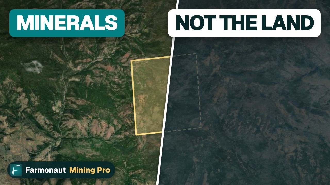
▶ Explains that owning a gold claim gives mineral rights, not ownership of the land. · 3:19
Where Arizona placer gold was found
A placer is gold that has weathered out of its rock and been moved and concentrated by water or gravity. Johnson’s 1972 USGS survey counts 87 placer districts in Arizona with a minimum of 564,052 ounces of placer gold recovered between 1774 and 1968. Six districts produced more than 25,000 ounces each: Lynx Creek, Big Bug and Weaver (Rich Hill) in Yavapai County, Gila City and La Paz in Yuma County, and Greaterville in Pima County (USGS Bulletin 1355, 1972). The chart shows each district’s estimated total including pre-1900 output.
Chart
Largest Arizona placer districts by estimated total gold
Troy ounces, estimated total including pre-1900 output; La Paz and Gila City are shown at the minimum figures USGS gives
These totals are history. Most of that gold left the ground decades ago, and a district’s name tells you nothing about who owns or may work the ground today. Use the list to learn what geology to look for, then check ownership.
- Weaver (Rich Hill): about 40 square miles on the south flank of the Weaver Mountains, with a USGS estimate of 110,000 ounces. Gold was found under boulders and in crevices in granite bedrock on top of Rich Hill, and later mined mostly with dry washers, pans, rockers and sluices.
- La Paz (Dome Rock Mountains): placers about 10 miles west of Quartzsite beside the highway, famous for nuggets, some weighing 26 to 47 ounces in 19th-century accounts. Part of the area has at times been inside the Colorado River tribal reservation, so check tribal boundaries first.
- Lynx Creek: described as the most productive gold-bearing stream in Arizona, near Prescott, with gold in thin gravels on narrow benches in the upper reaches and thicker gravels downstream, where some of the largest dredges worked.
- Big Bug Creek, Greaterville and Gila City: smaller placers. At Gila City, gravels more than 15 feet above bedrock were not profitable to work.
The bulletin also notes that the major lode-gold districts, except the Bradshaw Mountains in Yavapai County, produced very little placer gold. That is a useful screen: placers are not found below every mine.
If you want a map-based view of the same question, see where gold occurs in Arizona.
Lode districts: where most Arizona gold came from
Placer gold is the small part of the story. The same USGS bulletin lists 27 lode districts that each produced more than 25,000 ounces of gold. The six largest, from the Koschmann and Bergendahl 1968 compilation quoted there, are shown below in thousand ounces. These are old mining camps, many of them now closed or on private or claimed ground.
Chart
Largest Arizona lode-gold districts by recorded gold
Thousand troy ounces, districts above 25,000 ounces; figures to the late 1960s
Lode gold sits inside the rock in veins, so you cannot pan it directly. Casual-use tools can sample surface rock, and the next step for a serious target is a claim and professional sampling. The Arizona Geological Survey hosts more than 20,000 unpublished mine files and 6,800 geologic and mine maps in its AZGS Mining Data site (AZGS, accessed October 2026), which is the first place a consultant should look before a site visit.
What a claim costs to stake and hold
If a hand-tool session turns up gold, the next question is whether to stake a claim. The BLM’s fee schedule for new claims is a $25 processing fee, a $49 location fee and a $200 maintenance fee, a total of $274 per lode claim. For a placer claim, the maintenance fee is $200 for each 20 acres or part of 20 acres (BLM, Mining Claim Fees page, accessed October 2026). Notices of location must be filed with the BLM within 90 days of staking. The BLM raised the location fee from $40 to $49 and the maintenance fee from $165 to $200 in a 2024 rule, on a five-year inflation adjustment (BLM, 28 June 2024).
Chart
BLM mining claim fees before and after the 2024 adjustment
US$ per lode claim
After the first year, owners of 10 or fewer claims nationwide can file a maintenance fee waiver by 1 September if they will do $100 of assessment work that year, then file an affidavit of assessment work by 30 December with a $15 processing fee per claim (BLM, accessed October 2026). The current BLM total for a new lode claim is $274, before any county recorder charges. The BLM 2027 mining season notice gave 1 September 2026 as the fee or waiver deadline for the 2027 assessment year, which has now passed. The affidavit is due by 30 December 2026.
The calculator shows what holding claims costs over a number of years using the BLM schedule. It does not include county recorder fees, surveying or the cost of the assessment work.
Calculator
What would your claims cost to hold?
Enter your own claim counts and years. Fee inputs follow the BLM schedule checked on 16 October 2026.
- First-year fees: $822
- Each later year (maintenance fees): $600
- Later years if waiver route is used (affidavit fees): $180
Example values only, not a quote. Fee inputs are the BLM schedule (processing $25, location $49, maintenance $200 per lode claim or per 20 acres of placer), checked 16 October 2026. Money is in US$. County recorder fees, surveys and assessment work are not included. The waiver line applies only if you and related parties hold 10 or fewer claims nationwide. Not included: a claim located before 1 September but filed after it owes maintenance fees for two assessment years (BLM bridge-claim rule), and the first-year maintenance fee cannot be waived; the small-miner waiver also needs $100 of assessment work per claim each year.
How to start: seven steps
- Pick a target from the geology, not the brand name. Start with the USGS and AZGS district descriptions above and ask whether the ground is a gravel-filled wash, a bedrock crack or a vein.
- Check ownership. Look up the land status (BLM, Forest Service, State Trust, tribal, private) and search the BLM’s records for claims on the same section.
- Read the casual-use rules for that land. If a Forest Service district or tribal government manages it, ask them directly.
- Pack hand tools and water. A pan, classifier, shovel and a way to carry out your trash cover most of the work.
- Sample first, then dig. Pan a few scoops from different spots in the wash before moving gravel in bulk.
- Record where gold showed up. A GPS point and a note on the gravel type is worth more than the gold itself.
- Decide whether to stake. Use the fee calculator, then take the claim paperwork to the BLM and the county recorder, and consider a legal check before spending money.
Reading the ground with maps and satellite data
Desk work narrows a day-trip into a short list. Old mine files, geologic maps and claim records show where gold has been found and who has rights to it. Satellites cannot see gold itself; they map the rock around it, such as iron staining, clay minerals and faults, and that pattern can help a consultant rank areas before a field visit. Farmonaut offers a satellite mineral detection service that takes a polygon or KML/KMZ boundary and returns mapped target zones in 5 to 20 business days, as an exploration target and not a resource estimate. Our note on separating gold from ore explains what happens after gold is found.
If you hold a licence or claim block and want a site screened, you can send a quote request, or use the contact page to ask a question first.

▶ Shows how satellites map alteration minerals and faults around gold systems instead of seeing gold itself. · 4:25
Safety and good manners
- Stay out of abandoned mines and shafts. Panning gravel is never a reason to enter a mine opening.
- Carry more water than you think you need and tell someone your route and return time, as the AZGS advises.
- Keep to the land type you are allowed on. Do not cross onto claims, private ranches or State Trust parcels to follow a streambed.
- Fill holes, carry out trash, and respect any historic artefacts you find.
- Do not use mercury. It is a health hazard to you and to the stream.
If this topic matters to you, read Gold and Diamond Prospecting in Western Australia: Rules next.
Frequently asked questions
Do I need a permit to pan for gold in Arizona?
Not for casual use on BLM land. The BLM says it does not process applications for casual-use activities and you do not have to contact it first (BLM Arizona guidance, 2011). State Trust Land prohibits recreational mining, and National Forest and tribal land have their own rules, so ask the manager of the specific parcel.
Can I use a metal detector for gold in Arizona?
On BLM land, the federal casual-use rule lists metal detectors and other battery-operated mineral-sensing devices as generally allowed (43 CFR 3809.5), and BLM Arizona gives metal detecting while camping as a typical example. State Trust Land is closed to recreational mining, and the Forest Service sets its own rules, so confirm before you go.
Can I use a suction dredge in Arizona?
Not as casual use on BLM land in Arizona. The federal rule (43 CFR 3809.5) says casual use may include small portable suction dredges, but BLM Arizona’s guidance says you cannot suction dredge at the casual-use level there. BLM Arizona says dredging can only be done under a Notice or Plan of Operations filed under 43 CFR 3809 (BLM, 2011). The BLM Arizona Mining Permitting Guide (2017) explains that anything beyond casual use needs a notice or plan, and the route involves a financial guarantee for reclamation.
Can I use a dry washer?
BLM Arizona says dry washers with engines of less than 10 brake horsepower are allowed as casual use if they are fed with hand tools only (BLM, 2011). The BLM Arizona guidance does not clear larger or mechanically fed machines as casual use, so ask the field office before using one.
Where was the most placer gold found in Arizona?
Among the districts listed in USGS Bulletin 1355, the Weaver (Rich Hill) district has the highest estimated total at 110,000 ounces, followed by La Paz at more than 100,000 and Lynx Creek at 80,000. These are historic totals, not today’s yields.
How much does it cost to stake a claim in Arizona?
The BLM’s fee for a new lode claim is $274: $25 processing, $49 location and $200 maintenance. A placer claim pays $200 maintenance for each 20 acres or part (BLM, accessed October 2026). County recorder fees and surveying are extra.
Can I live on a mining claim?
No. The AZGS states that mining claims cannot be used as a residence or home site (AZGS, accessed October 2026).
What counts as casual use?
The federal rule defines it as activities that cause no or negligible disturbance, such as collecting specimens with hand tools, hand panning, non-motorised sluicing, metal detectors and hand or battery-operated dry washers. It excludes mechanised earth-moving equipment, chemicals, explosives and occupancy (43 CFR 3809.5).
How long can I camp near where I prospect?
BLM Arizona guidance says not to occupy public land within a 25-mile radius for more than 14 days in a 90-day period (BLM, 2011). Check the field office for any change.
Can a satellite show me where to find gold in Arizona?
A satellite cannot see gold, but it can map alteration minerals, faults and iron staining that often sit around gold systems. That narrows the search; it does not replace sampling.
This guide is for information only. It is not legal advice, and rules change, so confirm them with the BLM, Forest Service or State Land Department.
This page is for information only. It is not legal advice. Confirm the rules with the BLM, the Forest Service or the Arizona State Land Department before you prospect or stake a claim. Get permission for any land that is not open public land, stay out of abandoned mines and do not use mercury.
Farmonaut mining
Map your mining site from space
Consultants can screen a licence or claim area for exploration targets from satellite data before a field visit.
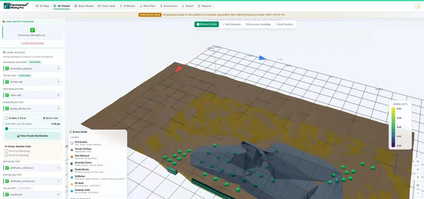
Mining Pro sample view, synthetic data
Keep reading
Sources
- BLM Arizona, Attachment 3 to IM AZ-2011-029: Operator information for casual use, notice and plan level operations (2011): blm.gov
- 43 CFR 3809.5, definitions including casual use (Legal Information Institute): law.cornell.edu
- USGS Bulletin 1355, Placer Gold Deposits of Arizona (Johnson, 1972): pubs.usgs.gov
- Arizona Geological Survey, Mineral Rights: azgs.arizona.edu
- Arizona Geological Survey, Gold Prospecting in Arizona: azgs.arizona.edu
- BLM, Mining Claim Fees: blm.gov
- BLM, announcement of adjusted location and maintenance fees (28 June 2024): blm.gov
- BLM, Arizona Mining and Minerals: blm.gov
- BLM Arizona Mining Permitting Guide (2017): blm.gov
- BLM, 2027 mining season fee notice: blm.gov
Discussion
Questions, corrections or field experience? Share them below. First-time comments are reviewed before they appear, and your email is never published.
No comments yet. Be the first to add a question or your experience.

 Ramani Investments Ltd
 Congo Mining Solutions
 Mining SARL
 SenGold Invest SAS
 Sania Corporation
 Sean Mining Limited
 NTS Group (Pty) Ltd
 Mine4Africa
 Lithspo Minerals Limited
 Tintina Mining Group
 Dalgety Minerals Pty Ltd
 Vortex Minerals Pty Ltd
 Faith At Work (Pty) Ltd
 Geotech Mining Solutions plc
 Vulcan International Limited
 Kidepo Associates
 GKY Mining
 Alkimy SARL
 Double A Trading
 GemSprout Metals Limited











