
Queensland fossicking · Site guide
Fossicking Near Me: 17 Queensland Gold and Gem Sites
Queensland lists its legal fossicking sites by region, from Gympie gold to western opal. Compare 17 of them by mineral, access and camping, then check licence fees, digging limits and trip costs.
Key takeaways
- A licence is required across Queensland; an individual month cost A$9.97 on 5 November 2026 (Queensland Government).
- Digging is limited to 2 m on land and 0.5 m in streams, with hand tools only; some sites set 0.5 m everywhere.
- Around Rubyvale much sapphire wash lies deeper than the limit, so Big Bessie or Glenalva may suit better.
- Palmer River and Charters Towers have no page in the state’s fossicking guide, so access needs your own tenure checks.
- At Emerald, June and July average about 23.5°C highs, against about 35°C in December and January (BoM, records to 1992).
In this article
- 17 fossicking sites in Queensland compared
- Which regions have the most listed sites
- Gold fossicking near me: the Queensland options
- Gemstone fossicking near me: sapphire, topaz and agate
- Opal fossicking in western Queensland
- Fossicking licence cost in Queensland
- What your fossicking trip might cost
- Where you can legally fossick without asking first
- Fossicking rules: tools, depth and what you can keep
- Equipment for gold and gem fossicking
- Best time to go fossicking in Queensland
- A fossicking plan in 6 steps
- If you hold or plan to buy a mining tenement
- Frequently asked questions
Looking for fossicking near me in Queensland? Start with the state’s official list of specified fossicking land, then pick by what you want to find: gold around Gympie, Warwick, Clermont and Mount Morgan; sapphires around Anakie, Sapphire and Rubyvale; topaz near Stanthorpe and Mount Surprise; opal in the far west. You need a licence, and an individual one costs A$9.97 for a month on the fee table we read on 5 November 2026.
Fossicking means searching for and collecting gemstones, ornamental stones, mineral specimens and alluvial gold by hand, for recreation, tourism or education. It is not small-scale mining, and it comes with no promise of a find. The table below compares 17 sites by mineral, access and camping, so you can narrow the choice to the part of the state you can actually reach.
17 fossicking sites in Queensland compared
How we chose: every site below appears in the Queensland Government’s guide to fossicking areas, and each row comes from that site’s own page. The order runs from south-east to the far west. It is not a ranking, because no public data compares how much people find at each site. The guide also lists other sites not shown here, including Talgai State Forest, Mount Gibson, Young’s Block, Bar-Barrum and Moonstone Hill, plus further central gemfield areas.
| Site | Nearest base | Look for | Camping on site | Main thing to know |
|---|---|---|---|---|
| Deep Creek | Gympie | Gold | No | Pans only, in the creek bed, not the bank |
| Thanes Creek | Warwick (about 40 km) | Gold | No | Water can be scarce in dry times |
| Durikai State Forest | Warwick (27 km) | Gold | No | Carry all water; holes limited to 0.5 m deep |
| Swipers Gully | Stanthorpe (about 13 km) | Topaz, quartz varieties | No | No facilities; bring water for wet sieving |
| Greenswamp and Lallalindi | Chinchilla | Petrified wood | No | Landowner entry fee at the visitor centre; licence still required |
| Mount Morgan No 7 Dam | Mount Morgan | Gold | No | No sluices or dry blowers; carry the map and conditions |
| Clermont general permission areas | Clermont | Gold | No | Twelve areas; water may be too scarce to pan |
| Big Bessie | Sapphire (about 2 km) | Sapphire | Yes, with permit | Shallow wash, under 500 mm, but heavily worked |
| Glenalva | Anakie (20 km) | Sapphire | Yes, with permit | Carry water; try gully tops after rain |
| Willows | Willows Gemfields | Sapphire, mostly green and yellow | Caravan areas in town only | Shop, fuel and water in the township |
| Sapphire, Rubyvale and neighbours | Sapphire, Rubyvale | Sapphire | Yes, with permit, over 1.5 km from town centres | Much wash is deep and held under mining tenure |
| Agate Creek | Forsayth (about 70 km) | Agate, thunder eggs | Nearby, outside the area | Gravel road may close in the wet season |
| O’Briens Creek | Mount Surprise | Topaz, quartz, aquamarine | Private campground nearby | Creeks are dry; black soil roads turn bad when wet |
| Lava Plains | Between Mount Garnet and Greenvale | Sapphire | Wyandotte only | Carry water and gear in on foot |
| Yowah | Yowah (about 160 km from Cunnamulla) | Opal in ironstone nuts | No | Eastern side suits surface searching |
| Toompine (Duck Creek, Sheep Station Creek) | Quilpie | Opal | Yes, with permit | Remote, no facilities; old spoil dumps are the best chance |
| Opalton | Winton (about 124 km) | Opal | Yes, with permit | Mostly unsealed road; private bush park next door |
Source for all rows: Queensland Government, Fossicking areas in Queensland. Page dates vary, so check the site’s own page and map before you leave.
Which regions have the most listed sites
The guide groups its sites into six regions. Central Queensland holds the largest share, because the Clermont gold district and the sapphire gemfields sit there. The chart counts entries named on each regional page. It measures how many listings exist, not how much land they cover or how likely a find is.
Chart
Listed fossicking entries by region
entries named on each regional page of the state guide; not land area
Gold fossicking near me: the Queensland options
Fossickers may collect alluvial gold, including nuggets. Alluvial gold is gold that water has moved out of its source rock into creek and gully sediment. Queensland’s gold sites differ more in their rules than in their gear, so read each one before packing.
Deep Creek, Gympie
A gold find in a gully near the Mary River in 1867 started Queensland’s first major gold rush and founded Gympie. Deep Creek sits at the town’s southern entrance, and yellow posts mark its limits. The early diggers worked it hard, so any gold today is likely to be reconcentrated or in missed pockets, most likely on the inside of creek bends. Only pans are allowed, and digging into the bank is banned.
Thanes Creek and Durikai, near Warwick
Thanes Creek lies about 40 km west of Warwick, reached by highway and a formed gravel road. Colours of gold (very fine visible specks) can come from stream sediment, low-bank gravel and rock-bar crevices. Durikai State Forest, 27 km west of Warwick, has three access routes and no permanent water beyond stock dams, which you may not draw from. It is a general permission area, meaning access depends on written special conditions, and holes there may not exceed 2 m by 1 m by 0.5 m deep.
Clermont, central Queensland
A find south of Clermont in 1861 triggered one of the state’s major rushes. Twelve general permission areas surround the town, most of them north-west via Laglan Road. Deep leads, which are buried ancient stream gravels, produced the most gold historically, but modern fossickers mainly work young alluvium and eluvial soil, where gold has moved only a short way from its source. Water can be too scarce for panning in dry periods, so the government page notes dry blowing as an alternative. Camping is not allowed in these areas.
Mount Morgan No 7 Dam
The Mount Morgan mine ran from 1882 to 1981 and produced 250 t of gold from over 50 Mt of ore, according to the Queensland Government. The reserve around the No 7 Dam has sealed access, toilets and picnic areas at the carpark. Its conditions are among the most detailed in the guide: exclusion zones around tracks, roads, the dam and its wall, no sluices, educator dredges or dry blowers, and a printed map and conditions on you. For the wider geology, see our guide to gold deposits in Queensland.
What about Palmer River and Charters Towers?
Both are famous goldfields, yet neither has a page in the government’s guide to specified fossicking land. That does not make them closed by itself. It means there is no ready-made access arrangement in that guide, so you must work out tenure and gain consent yourself, as described in the access section below.

▶ How gold forms and gathers in veins, explained in clay animation · 4:16
Gemstone fossicking near me: sapphire, topaz and agate
The Central Queensland gemfields have five fossicking areas and six designated fossicking lands set aside for visitors. The government says world-class sapphires, rubies and zircon have been found there. Sapphire is the usual target at the sites below; the pages we read describe no ruby-specific locality.
Chart
Sapphire wash depth against the 2 m digging limit
metres below surface, shallowest to deepest described by the state guide
How deep the sapphire wash lies
Wash is the gem-bearing gravel layer. Its depth matters because you may not dig below 2 m from the natural surface, or below 0.5 m in streams. Around Rubyvale and Scrub Lead much of it sits deeper than that, and the government sees few openings for fossickers there. Rubyvale’s fame is a poor guide to its hand-digging prospects, and shallower ground elsewhere often suits a first visit better.
- Big Bessie: wash generally within 500 mm of the surface and close to Sapphire township, though Little Bessie has very little untouched ground left.
- Glenalva: wash rarely exceeds 500 mm; stones are mostly green, blue-green and yellow, with rare blues. Gully tops suit specking (searching the surface by eye) after rain.
- Willows: greens and yellows dominate and blues are rare. The Duffer’s wash runs from 500 mm to 2 m, and the township has fuel, water and a shop.
- Divide and Reward: the west side of the ridge past Divide has the best shallow ground, and Washpool is the popular digging at Reward. Reward is remote, so visitors must be self-sufficient.
At Sapphire and Rubyvale, some miners do not object to fossickers working their dumps if asked, and some underground tourist mines are open to the public. The licence page says tourist mines and sites charging an entry fee need no fossicking licence, but Chinchilla’s fee sites still require one, so check the site page first.
Topaz, agate and north Queensland sapphire
Swipers Gully, about 13 km north-west of Stanthorpe, yields mostly colourless topaz, with pale blue and yellow also recorded, from shallow gravels. O’Briens Creek near Mount Surprise is known for gem-quality topaz in gravel up to 2 m deep, usually worked by hand digging and dry sieving. Agate Creek, south of Forsayth, has banded agates averaging about 50 mm, and the Robertson River crossing is about 100 m of soft sand. Lava Plains offers sapphire in ground generally up to 1 m deep, but the stones may be small and everything must be carried in on foot.
Petrified wood at Chinchilla
Chinchilla, about 300 km west-northwest of Brisbane, has two landowner sites, Greenswamp and Lallalindi, with entry fees payable at the visitor centre. Both still require a fossicking licence. You can also pick up specimens from the bare surface of road reserves, but digging there is not allowed.
Opal fossicking in western Queensland
The western opal fields run about 1,000 km from the New South Wales border at Hungerford to Kynuna. The government advises April to September and warns against summer heat and rain that can close roads. It also warns never to enter old shafts, because of unstable ground, bad air, snakes and spiders.
- Yowah: the home of Yowah Nuts, ironstone nodules from 5 mm to 200 mm across that sometimes hold a kernel of precious opal. The eastern part of the area has loose rubble to about 600 mm, and the town has shops, fuel and a caravan park.
- Toompine: much opal lies beyond a fossicker’s reach, so old spoil dumps give the best chance. Carry food, water and fuel, and stay off current mining tenures.
- Opalton: about 124 km south-west of Winton, mostly on unsealed road. Visitors speck or noodle (sort through loose material) on the surface and old spoil dumps.
For a commercial view of the same ground, see our guide to opal mining leases for sale.
Fossicking licence cost in Queensland
Everyone needs a licence, except at tourist mines and fee-charging sites. Site conditions can override this: Chinchilla’s fee sites still require one. Metal detecting for lost items such as jewellery and coins also needs none, although council rules may apply. The table shows the fee list served on the government’s licence page on 5 November 2026, in Australian dollars. Fees change, so confirm them when you buy.
Chart
One-year licence fees compared
A$, fee list served on 5 November 2026
| Licence type | 1 month | 6 months | 1 year |
|---|---|---|---|
| Individual | A$9.97 | A$37.84 | A$63.73 |
| Family | A$14.28 | A$48.55 | A$85.14 |
| Club | Not offered | Not offered | A$106.67 |
| Educational organisation | A$42.26 | Not offered | A$85.14 |
| Commercial tour operator | A$74.61 | Not offered | A$642.41 |
A family licence covers the holder, a spouse, and children or students under 23 living at home. Buy online through MyMinesOnline, from a Mines Assessment Hub, or from an authorised agent such as the Cooloola Information Centre at Gympie or the Warwick and Chinchilla visitor centres. A licence works on paper or on your phone, but you must carry it.
A fossicking camping permit is separate. For an individual or family it costs A$4.76 a night or A$30.02 a week, with a three-month limit in any one area. It does not authorise fossicking.
What your fossicking trip might cost
The licence is often the smallest part of the bill, because the sites are spread across a very large state. Enter your own distance and prices below to compare a day trip with a week at the gemfields. Equipment, food and landowner entry fees are not included.
Calculator
What will your fossicking trip cost?
Enter your own distance, nights and prices.
- Licence and camping (A$): $24
- Fuel (A$): $120
Example values only, not a benchmark. Defaults are the Queensland one-month individual licence and the individual or family nightly camping fee, as listed on 5 November 2026; confirm before buying. Fuel price is an input: example, use today’s price.
Where you can legally fossick without asking first
This is the question behind most searches for fossicking areas near me. The Queensland access rules divide land like this:
- Specified fossicking land: general permission areas, designated fossicking lands and fossicking areas. You do not need to seek the landowner’s permission separately, but all listed conditions and fees apply.
- National parks, conservation parks and wildlife reserves: not permitted.
- State forests and timber reserves: not permitted unless a general permission area covers the spot.
- Road reserves: surface collecting only, with no digging.
- Watercourses on public land: no permission needed to enter. Contact owners first where the stream is on freehold or leased land.
- Unoccupied state land: generally no permission, unless exclusive native title exists or the land is vested in another agency.
- Any other land: written consent from the landholder.
- Mining claims and leases: keep out without the holder’s permission. Posts mark the tenures on the gemfields.
To check a spot, open the state’s GeoResGlobe map and add the cadastre, native title and administrative boundary layers. A title search then gives the landholder’s name. No phone app replaces this step, and a search result that says “near me” tells you nothing about tenure. The rules also differ by state: see our New South Wales licence guide if you live close to the border, since Glen Innes and its sapphire country are in that state, not Queensland. For broader questions on who owns a find, read if you find gold, can you keep it.
Fossicking rules: tools, depth and what you can keep
These state-wide rules sit under the Fossicking Act 1994. Breaches can bring an on-the-spot fine, prosecution or loss of the licence.
- Tools allowed: picks, shovels, hammers, sieves, shakers, hand sluices and metal detectors, unless a site’s conditions say otherwise.
- Tools banned: machinery, including sluices with electric pumps and dredges of any kind.
- Digging: no deeper than 2 m on land or 0.5 m in streams, and no tunnels or overhangs. Some sites are stricter: Durikai, Swipers Gully and Mount Morgan limit holes to 0.5 m deep.
- In watercourses: no digging within 40 m of a bridge or weir unless signs allow it, or within 3 m of the top or toe of a bank where this may collapse it.
- Do not collect: meteorites or fossils of vertebrate animals.
- On leaving: refill holes, remove rubbish and bury human waste at least 20 cm deep and 20 m from a watercourse’s high bank.
- Selling: an occasional lucky find, or sales to hobbyists and at fairs, is allowed. Selling through shops or to make a living counts as commercial and needs tenure under the Mineral Resources Act 1989. The government page says royalties apply above A$100,000 from fossicked material.
Never use mercury to recover gold. It is toxic, it pollutes water, and pollution of any watercourse is banned under these rules.
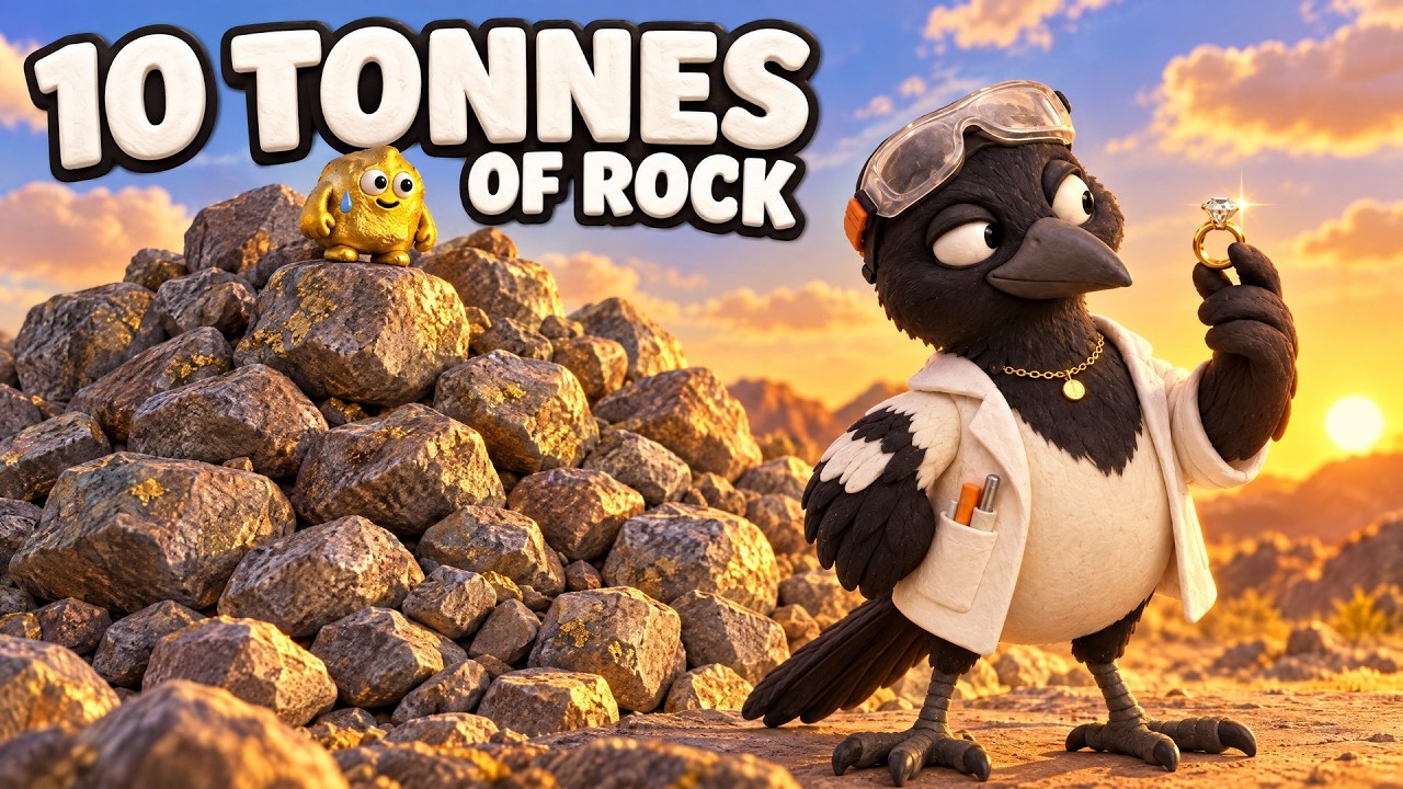
▶ How commercial gold mining differs: a nugget’s path from rock to refined metal · 5:27
Equipment for gold and gem fossicking
Match the kit to the site, because the rules narrow it. Deep Creek needs only a pan. Sapphire wash usually needs a pick, shovel, nested sieves and a tub, plus water at dry sites. Clermont suits a metal detector, and a pan only when water allows. Opal specking needs little more than good eyes, gloves and a small bag.
- Gold: pan, small shovel, classifier sieve, snuffer bottle and a detector where allowed.
- Gems: pick, shovel, sieve set, a tub or shaker and tweezers.
- Safety: the state’s safety list names a hat, sturdy footwear, sun protection, gloves, safety glasses for breaking rock and a stocked first-aid kit.
- Backcountry: water, fuel, spares and a phone or other means of contact. Tell someone when you expect to return, and avoid going alone.
Stay well clear of open shafts, loose mine dumps and large boulders while digging, and watch for parthenium, a weed that can cause serious allergic reactions. In an emergency, dial 000, or 112 from a mobile.
Best time to go fossicking in Queensland
Go in the cooler, drier months. At Emerald, the Bureau of Meteorology’s averages show, in records ending 1992, highs near 35°C and 80 mm or more of rain in December and January, against about 23.5°C and under 30 mm in June and July. The opal field advice of April to September fits the same pattern. Wet months can also close gravel roads in the north, as the O’Briens Creek and Agate Creek pages warn. Dry months have their own problem: creeks may hold no water for panning or washing gravel, so plan to carry it or to work dry. Check bushfire, road and park alerts before you leave.
Chart
Rainfall through the year at Emerald
mean monthly rainfall in mm, central Queensland; records ended 1992
A fossicking plan in 6 steps
Use this order to go from a general idea to a legal day in the field.
Infographic
From idea to a legal day in the field
- 1Pick a mineralChoose gold, sapphire, topaz, agate or opal.
- 2Pick a siteRead its page and download its map.
- 3Check the rulesNote tools, depth and special conditions.
- 4Buy permitsGet the licence, plus a camping permit if needed.
- 5PrepareCheck roads, fire alerts, water and fuel.
- 6Leave it safeRefill holes and take your rubbish out.
If you hold or plan to buy a mining tenement
Fossicking and commercial mining overlap on the map, and that matters to licence holders, consultants and investors. The government states that commercial mining authorities are allowed in designated fossicking lands but not in fossicking areas. So a designated land can contain active tenures, but a fossicking area cannot. Check that distinction on GeoResGlobe before you budget for a parcel in the gemfields.
Hobby finds also do not establish a mineral resource. Moving beyond hand tools requires the proper tenure and sampling work. At that stage, satellite-based mineral detection can help screen a licence area for exploration targets ahead of ground sampling; the results are not a resource estimate. For commercial questions, use our mining quote form or contact the team. Recreational visitors do not need any of this. For a look at where gold occurs nationally, see Australian gold deposits by state.

▶ How satellites map the rocks around gold rather than the gold itself · 4:25
Frequently asked questions
Where can I go fossicking near me in Queensland?
Start with the state’s fossicking guide, organised into six regions. South-east Queensland has gold near Gympie and Warwick, topaz near Stanthorpe and petrified wood near Chinchilla. Central Queensland has Clermont gold and the sapphire gemfields.
Do you need a licence to fossick in Queensland?
Yes, on all land, whether or not the site is specified fossicking land. The exceptions are tourist mines and sites that charge an entry fee, and searching for lost items with a metal detector.
How much is a fossicking licence in Queensland?
The fee table on 5 November 2026 showed A$9.97 for one month for an individual and A$14.28 for a family. One-year licences were A$63.73 and A$85.14. Check the government page before you buy.
Where can I go gold fossicking near Brisbane?
Gympie’s Deep Creek and the Warwick sites at Thanes Creek and Durikai are the usual options in the south-east. Compare your own driving time, and note that none of them allows camping.
Where is the best gem fossicking in Queensland for beginners?
No official ranking exists. Big Bessie and Glenalva have shallow sapphire wash, and Willows has town services. Tourist mines can be simpler for a first attempt and need no licence. Fee-charging sites usually need none either, but Chinchilla’s do, so check the site page.
Can you find sapphires at Rubyvale without a mine?
Sometimes, but the government notes few opportunities because wash is deep and many tenures apply. Ask miners about their dumps, or try a tourist mine or shallower ground nearby.
Can I use a metal detector when fossicking in Queensland?
Yes, a metal detector is a permitted tool, with a licence, on most fossicking land. Check the site, because Deep Creek allows pans only.
Where can I fossick for opal in Queensland?
The guide lists Yowah, the Toompine lands and Opalton. All are remote, and April to September is the advised season.
Can I fossick in national parks or state forests?
Not in national parks, conservation parks or wildlife reserves. State forests and timber reserves are closed unless covered by a general permission area, as at Durikai and parts of Clermont.
Can I sell gold or gems I find while fossicking?
You can sell an occasional find, or trade with hobbyists and at fairs. Selling through shops or as a living is commercial activity and requires tenure.
Can I camp while fossicking?
Only where the site allows. Several gemfield and opal lands allow it with a permit, up to three months in one area. Gold sites such as Deep Creek, Thanes Creek, Durikai, Clermont and Mount Morgan do not.
Is there a fossicking map for Queensland?
Yes. Each site page in the government guide links a PDF map of its boundaries, and GeoResGlobe shows land tenure across the state.
This page is for information only. It is not legal advice. Confirm the rules with the regulator. Get permission where required, fossick safely and never use mercury.
Farmonaut mining
Assessing a commercial licence?
Request a quote to screen a mining licence area for exploration targets before planning ground sampling.
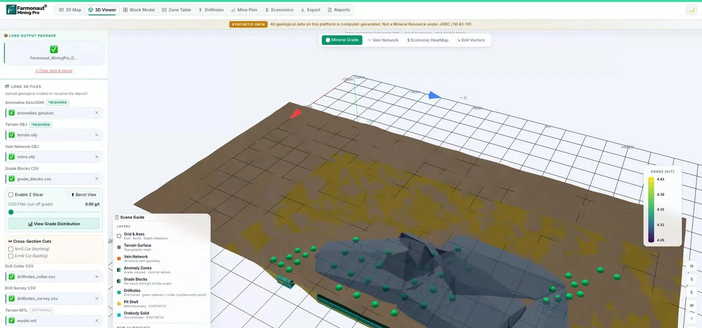
Mining Pro sample view, synthetic data
Keep reading
Sources
- Queensland Government, Licences for fossicking: qld.gov.au
- Queensland Government, Fossicking areas in Queensland: qld.gov.au
- Queensland Government, Where you can fossick: qld.gov.au
- Queensland Government, Rules for fossicking: qld.gov.au
- Queensland Government, Keeping safe while fossicking: qld.gov.au
- Queensland Government, Camping while fossicking: qld.gov.au
- Queensland Government, Deep Creek fossicking area: qld.gov.au
- Queensland Government, Thanes Creek fossicking area: qld.gov.au
- Queensland Government, Durikai State Forest: qld.gov.au
- Queensland Government, Swipers Gully: qld.gov.au
- Queensland Government, Chinchilla petrified wood: qld.gov.au
- Queensland Government, Central gold district: qld.gov.au
- Queensland Government, Capricorn region: qld.gov.au
- Queensland Government, Central Queensland gemfields: qld.gov.au
- Queensland Government, Sapphire/Rubyvale designated fossicking land: qld.gov.au
- Queensland Government, Big Bessie: qld.gov.au
- Queensland Government, Glenalva: qld.gov.au
- Queensland Government, Willows: qld.gov.au
- Queensland Government, Agate Creek: qld.gov.au
- Queensland Government, O’Briens Creek: qld.gov.au
- Queensland Government, Lava Plains: qld.gov.au
- Queensland Government, Western opal fields: qld.gov.au
- Queensland Government, Yowah: qld.gov.au
- Queensland Government, Toompine: qld.gov.au
- Queensland Government, Opalton: qld.gov.au
- Australian Business Licence and Information Service, Fossicking licence – Queensland: ablis.business.gov.au
- Bureau of Meteorology, Climate statistics, station 035264: bom.gov.au
Discussion
Questions, corrections or field experience? Share them below. First-time comments are reviewed before they appear, and your email is never published.
No comments yet. Be the first to add a question or your experience.

 Lithspo Minerals Limited
 Tintina Mining Group
 Dalgety Minerals Pty Ltd
 Vortex Minerals Pty Ltd
 Faith At Work (Pty) Ltd
 Geotech Mining Solutions plc
 Vulcan International Limited
 Kidepo Associates
 GKY Mining
 Alkimy SARL
 Double A Trading
 GemSprout Metals Limited
 Qader Group
 Ileys General Trading
 SG Gold Mining LLC
 VRV Global Pte Ltd
 Omsri International FZE
 G.I.T.T.
 Jaunita Erss Ltd
 Almosi SARL
 SRK Consulting
 Berks Gold Limited
 Mwerezi Minerals Company Limited
 Exploration consultancy · South Africa · Gold